SlideShare uma empresa Scribd logo
1 de 1
Baixar para ler offline
178440                                     181560                           178440                         181560
333760                                             333760                   333760                                 333760
                                                         40%          70%
             ordinary kriging


                                                                                                                            A Practical Guide to Geostatistical Mapping
                                                      7.51                           universal kriging


                                                       4.72


                                                                                                                                                                             A Practical Guide to
                                                                                                                                                                          Geostatistical Mapping
329600                                             329600                   329640                                 329640
    178440                                     181560                           178440                         181560


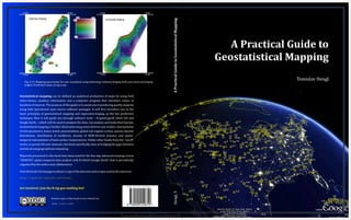
      Fig. 5.19. Mapping uncertainty for zinc visualized using whitening: ordinary kriging (left) and universal kriging
                                                                                                                                                                                          Tomislav Hengl
      (right). Predicted values in log-scale.


Geostatistical mapping can be defined as analytical production of maps by using field
observations, auxiliary information and a computer program that calculates values at
locations of interest. The purpose of this guide is to assist you in producing quality maps by
using fully-operational open source software packages. It will first introduce you to the
basic principles of geostatistical mapping and regression-kriging, as the key prediction
technique, then it will guide you through software tools – R+gstat/geoR, SAGA GIS and
Google Earth – which will be used to prepare the data, run analysis and make final layouts.
Geostatistical mapping is further illustrated using seven diverse case studies: interpolation
of soil parameters, heavy metal concentrations, global soil organic carbon, species density
distribution, distribution of landforms, density of DEM-derived streams, and spatio-
temporal interpolation of land surface temperatures. Unlike other books from the “use R”
series, or purely GIS user manuals, this book specifically aims at bridging the gaps between
statistical and geographical computing.

Materials presented in this book have been used for the five-day advanced training course
“GEOSTAT: spatio-temporal data analysis with R+SAGA+Google Earth”, that is periodically
organized by the author and collaborators.

Visit the book's homepage to obtain a copy of the data sets and scripts used in the exercises:

http://spatial-analyst.net/book/


Get involved: join the R-sig-geo mailing list!
                                                                                                                            Hengl, T.


                                Printed copies of this book can be ordered via

                                www.lulu.com

Mais conteúdo relacionado

Destaque

Geomorphology and its application to hydrogeology
Geomorphology and its application to hydrogeologyGeomorphology and its application to hydrogeology
Geomorphology and its application to hydrogeologysuchi4
 
Geomorphology applications
Geomorphology applicationsGeomorphology applications
Geomorphology applicationsvyshalik
 
Settlement Characteristics
Settlement CharacteristicsSettlement Characteristics
Settlement Characteristicswhiskeyhj
 
Map Skills Revision
Map Skills RevisionMap Skills Revision
Map Skills Revisionwhiskeyhj
 
Morphometric analysis of a vrishabhavathi sub watershed upstream side of gali...
Morphometric analysis of a vrishabhavathi sub watershed upstream side of gali...Morphometric analysis of a vrishabhavathi sub watershed upstream side of gali...
Morphometric analysis of a vrishabhavathi sub watershed upstream side of gali...eSAT Publishing House
 
Settlement Patterns
Settlement PatternsSettlement Patterns
Settlement PatternsJiexin Zhang
 

Destaque (8)

2 hydro-geomorphology
2  hydro-geomorphology2  hydro-geomorphology
2 hydro-geomorphology
 
Geomorphology and its application to hydrogeology
Geomorphology and its application to hydrogeologyGeomorphology and its application to hydrogeology
Geomorphology and its application to hydrogeology
 
Geomorphology applications
Geomorphology applicationsGeomorphology applications
Geomorphology applications
 
Settlement Characteristics
Settlement CharacteristicsSettlement Characteristics
Settlement Characteristics
 
What Is GIS?
What Is GIS?What Is GIS?
What Is GIS?
 
Map Skills Revision
Map Skills RevisionMap Skills Revision
Map Skills Revision
 
Morphometric analysis of a vrishabhavathi sub watershed upstream side of gali...
Morphometric analysis of a vrishabhavathi sub watershed upstream side of gali...Morphometric analysis of a vrishabhavathi sub watershed upstream side of gali...
Morphometric analysis of a vrishabhavathi sub watershed upstream side of gali...
 
Settlement Patterns
Settlement PatternsSettlement Patterns
Settlement Patterns
 

Mais de Tomislav Hengl

Introducing GSIF (seminar at Lamont campus)
Introducing GSIF (seminar at Lamont campus)Introducing GSIF (seminar at Lamont campus)
Introducing GSIF (seminar at Lamont campus)Tomislav Hengl
 
Poster "Global Soil Information Facilities"
Poster "Global Soil Information Facilities"Poster "Global Soil Information Facilities"
Poster "Global Soil Information Facilities"Tomislav Hengl
 
A statistical assessment of GDEM using LiDAR data
A statistical assessment of GDEM using LiDAR dataA statistical assessment of GDEM using LiDAR data
A statistical assessment of GDEM using LiDAR dataTomislav Hengl
 
Open Soil Profiles - testbed data portal for storing soil profile data
Open Soil Profiles - testbed data portal for storing soil profile dataOpen Soil Profiles - testbed data portal for storing soil profile data
Open Soil Profiles - testbed data portal for storing soil profile dataTomislav Hengl
 
Worldgrids.org: building global covariates for automated mapping
Worldgrids.org: building global covariates for automated mappingWorldgrids.org: building global covariates for automated mapping
Worldgrids.org: building global covariates for automated mappingTomislav Hengl
 
Space-time data workshop at IfGI
Space-time data workshop at IfGISpace-time data workshop at IfGI
Space-time data workshop at IfGITomislav Hengl
 
Global soilmap at_afsis_hengl
Global soilmap at_afsis_henglGlobal soilmap at_afsis_hengl
Global soilmap at_afsis_henglTomislav Hengl
 
Spatial interpolation comparison
Spatial interpolation comparisonSpatial interpolation comparison
Spatial interpolation comparisonTomislav Hengl
 
DSM training - preparing auxiliary data
DSM training - preparing auxiliary dataDSM training - preparing auxiliary data
DSM training - preparing auxiliary dataTomislav Hengl
 

Mais de Tomislav Hengl (14)

Introducing GSIF (seminar at Lamont campus)
Introducing GSIF (seminar at Lamont campus)Introducing GSIF (seminar at Lamont campus)
Introducing GSIF (seminar at Lamont campus)
 
Poster "Global Soil Information Facilities"
Poster "Global Soil Information Facilities"Poster "Global Soil Information Facilities"
Poster "Global Soil Information Facilities"
 
A statistical assessment of GDEM using LiDAR data
A statistical assessment of GDEM using LiDAR dataA statistical assessment of GDEM using LiDAR data
A statistical assessment of GDEM using LiDAR data
 
SAGA GIS 2.0.7
SAGA GIS 2.0.7SAGA GIS 2.0.7
SAGA GIS 2.0.7
 
GSIF utilities
GSIF utilitiesGSIF utilities
GSIF utilities
 
Open Soil Profiles - testbed data portal for storing soil profile data
Open Soil Profiles - testbed data portal for storing soil profile dataOpen Soil Profiles - testbed data portal for storing soil profile data
Open Soil Profiles - testbed data portal for storing soil profile data
 
Drupal course hengl
Drupal course henglDrupal course hengl
Drupal course hengl
 
Worldgrids.org: building global covariates for automated mapping
Worldgrids.org: building global covariates for automated mappingWorldgrids.org: building global covariates for automated mapping
Worldgrids.org: building global covariates for automated mapping
 
Space-time data workshop at IfGI
Space-time data workshop at IfGISpace-time data workshop at IfGI
Space-time data workshop at IfGI
 
Global soilmap at_afsis_hengl
Global soilmap at_afsis_henglGlobal soilmap at_afsis_hengl
Global soilmap at_afsis_hengl
 
Spatial interpolation comparison
Spatial interpolation comparisonSpatial interpolation comparison
Spatial interpolation comparison
 
DSM training - preparing auxiliary data
DSM training - preparing auxiliary dataDSM training - preparing auxiliary data
DSM training - preparing auxiliary data
 
R crash course
R crash courseR crash course
R crash course
 
Latex crash course
Latex crash courseLatex crash course
Latex crash course
 

Último

Gardella_PRCampaignConclusion Pitch Letter
Gardella_PRCampaignConclusion Pitch LetterGardella_PRCampaignConclusion Pitch Letter
Gardella_PRCampaignConclusion Pitch LetterMateoGardella
 
Gardella_Mateo_IntellectualProperty.pdf.
Gardella_Mateo_IntellectualProperty.pdf.Gardella_Mateo_IntellectualProperty.pdf.
Gardella_Mateo_IntellectualProperty.pdf.MateoGardella
 
Introduction to Nonprofit Accounting: The Basics
Introduction to Nonprofit Accounting: The BasicsIntroduction to Nonprofit Accounting: The Basics
Introduction to Nonprofit Accounting: The BasicsTechSoup
 
How to Give a Domain for a Field in Odoo 17
How to Give a Domain for a Field in Odoo 17How to Give a Domain for a Field in Odoo 17
How to Give a Domain for a Field in Odoo 17Celine George
 
Nutritional Needs Presentation - HLTH 104
Nutritional Needs Presentation - HLTH 104Nutritional Needs Presentation - HLTH 104
Nutritional Needs Presentation - HLTH 104misteraugie
 
Seal of Good Local Governance (SGLG) 2024Final.pptx
Seal of Good Local Governance (SGLG) 2024Final.pptxSeal of Good Local Governance (SGLG) 2024Final.pptx
Seal of Good Local Governance (SGLG) 2024Final.pptxnegromaestrong
 
Presentation by Andreas Schleicher Tackling the School Absenteeism Crisis 30 ...
Presentation by Andreas Schleicher Tackling the School Absenteeism Crisis 30 ...Presentation by Andreas Schleicher Tackling the School Absenteeism Crisis 30 ...
Presentation by Andreas Schleicher Tackling the School Absenteeism Crisis 30 ...EduSkills OECD
 
Unit-IV- Pharma. Marketing Channels.pptx
Unit-IV- Pharma. Marketing Channels.pptxUnit-IV- Pharma. Marketing Channels.pptx
Unit-IV- Pharma. Marketing Channels.pptxVishalSingh1417
 
Beyond the EU: DORA and NIS 2 Directive's Global Impact
Beyond the EU: DORA and NIS 2 Directive's Global ImpactBeyond the EU: DORA and NIS 2 Directive's Global Impact
Beyond the EU: DORA and NIS 2 Directive's Global ImpactPECB
 
SECOND SEMESTER TOPIC COVERAGE SY 2023-2024 Trends, Networks, and Critical Th...
SECOND SEMESTER TOPIC COVERAGE SY 2023-2024 Trends, Networks, and Critical Th...SECOND SEMESTER TOPIC COVERAGE SY 2023-2024 Trends, Networks, and Critical Th...
SECOND SEMESTER TOPIC COVERAGE SY 2023-2024 Trends, Networks, and Critical Th...KokoStevan
 
Paris 2024 Olympic Geographies - an activity
Paris 2024 Olympic Geographies - an activityParis 2024 Olympic Geographies - an activity
Paris 2024 Olympic Geographies - an activityGeoBlogs
 
Grant Readiness 101 TechSoup and Remy Consulting
Grant Readiness 101 TechSoup and Remy ConsultingGrant Readiness 101 TechSoup and Remy Consulting
Grant Readiness 101 TechSoup and Remy ConsultingTechSoup
 
ICT Role in 21st Century Education & its Challenges.pptx
ICT Role in 21st Century Education & its Challenges.pptxICT Role in 21st Century Education & its Challenges.pptx
ICT Role in 21st Century Education & its Challenges.pptxAreebaZafar22
 
Measures of Central Tendency: Mean, Median and Mode
Measures of Central Tendency: Mean, Median and ModeMeasures of Central Tendency: Mean, Median and Mode
Measures of Central Tendency: Mean, Median and ModeThiyagu K
 
PROCESS RECORDING FORMAT.docx
PROCESS      RECORDING        FORMAT.docxPROCESS      RECORDING        FORMAT.docx
PROCESS RECORDING FORMAT.docxPoojaSen20
 
Advanced Views - Calendar View in Odoo 17
Advanced Views - Calendar View in Odoo 17Advanced Views - Calendar View in Odoo 17
Advanced Views - Calendar View in Odoo 17Celine George
 

Último (20)

Gardella_PRCampaignConclusion Pitch Letter
Gardella_PRCampaignConclusion Pitch LetterGardella_PRCampaignConclusion Pitch Letter
Gardella_PRCampaignConclusion Pitch Letter
 
Gardella_Mateo_IntellectualProperty.pdf.
Gardella_Mateo_IntellectualProperty.pdf.Gardella_Mateo_IntellectualProperty.pdf.
Gardella_Mateo_IntellectualProperty.pdf.
 
Introduction to Nonprofit Accounting: The Basics
Introduction to Nonprofit Accounting: The BasicsIntroduction to Nonprofit Accounting: The Basics
Introduction to Nonprofit Accounting: The Basics
 
How to Give a Domain for a Field in Odoo 17
How to Give a Domain for a Field in Odoo 17How to Give a Domain for a Field in Odoo 17
How to Give a Domain for a Field in Odoo 17
 
Advance Mobile Application Development class 07
Advance Mobile Application Development class 07Advance Mobile Application Development class 07
Advance Mobile Application Development class 07
 
Nutritional Needs Presentation - HLTH 104
Nutritional Needs Presentation - HLTH 104Nutritional Needs Presentation - HLTH 104
Nutritional Needs Presentation - HLTH 104
 
Seal of Good Local Governance (SGLG) 2024Final.pptx
Seal of Good Local Governance (SGLG) 2024Final.pptxSeal of Good Local Governance (SGLG) 2024Final.pptx
Seal of Good Local Governance (SGLG) 2024Final.pptx
 
Presentation by Andreas Schleicher Tackling the School Absenteeism Crisis 30 ...
Presentation by Andreas Schleicher Tackling the School Absenteeism Crisis 30 ...Presentation by Andreas Schleicher Tackling the School Absenteeism Crisis 30 ...
Presentation by Andreas Schleicher Tackling the School Absenteeism Crisis 30 ...
 
Código Creativo y Arte de Software | Unidad 1
Código Creativo y Arte de Software | Unidad 1Código Creativo y Arte de Software | Unidad 1
Código Creativo y Arte de Software | Unidad 1
 
Mehran University Newsletter Vol-X, Issue-I, 2024
Mehran University Newsletter Vol-X, Issue-I, 2024Mehran University Newsletter Vol-X, Issue-I, 2024
Mehran University Newsletter Vol-X, Issue-I, 2024
 
Unit-IV- Pharma. Marketing Channels.pptx
Unit-IV- Pharma. Marketing Channels.pptxUnit-IV- Pharma. Marketing Channels.pptx
Unit-IV- Pharma. Marketing Channels.pptx
 
Mattingly "AI & Prompt Design: Structured Data, Assistants, & RAG"
Mattingly "AI & Prompt Design: Structured Data, Assistants, & RAG"Mattingly "AI & Prompt Design: Structured Data, Assistants, & RAG"
Mattingly "AI & Prompt Design: Structured Data, Assistants, & RAG"
 
Beyond the EU: DORA and NIS 2 Directive's Global Impact
Beyond the EU: DORA and NIS 2 Directive's Global ImpactBeyond the EU: DORA and NIS 2 Directive's Global Impact
Beyond the EU: DORA and NIS 2 Directive's Global Impact
 
SECOND SEMESTER TOPIC COVERAGE SY 2023-2024 Trends, Networks, and Critical Th...
SECOND SEMESTER TOPIC COVERAGE SY 2023-2024 Trends, Networks, and Critical Th...SECOND SEMESTER TOPIC COVERAGE SY 2023-2024 Trends, Networks, and Critical Th...
SECOND SEMESTER TOPIC COVERAGE SY 2023-2024 Trends, Networks, and Critical Th...
 
Paris 2024 Olympic Geographies - an activity
Paris 2024 Olympic Geographies - an activityParis 2024 Olympic Geographies - an activity
Paris 2024 Olympic Geographies - an activity
 
Grant Readiness 101 TechSoup and Remy Consulting
Grant Readiness 101 TechSoup and Remy ConsultingGrant Readiness 101 TechSoup and Remy Consulting
Grant Readiness 101 TechSoup and Remy Consulting
 
ICT Role in 21st Century Education & its Challenges.pptx
ICT Role in 21st Century Education & its Challenges.pptxICT Role in 21st Century Education & its Challenges.pptx
ICT Role in 21st Century Education & its Challenges.pptx
 
Measures of Central Tendency: Mean, Median and Mode
Measures of Central Tendency: Mean, Median and ModeMeasures of Central Tendency: Mean, Median and Mode
Measures of Central Tendency: Mean, Median and Mode
 
PROCESS RECORDING FORMAT.docx
PROCESS      RECORDING        FORMAT.docxPROCESS      RECORDING        FORMAT.docx
PROCESS RECORDING FORMAT.docx
 
Advanced Views - Calendar View in Odoo 17
Advanced Views - Calendar View in Odoo 17Advanced Views - Calendar View in Odoo 17
Advanced Views - Calendar View in Odoo 17
 

A practical guide to geostatistical mapping

  • 1. 178440 181560 178440 181560 333760 333760 333760 333760 40% 70% ordinary kriging A Practical Guide to Geostatistical Mapping 7.51 universal kriging 4.72 A Practical Guide to Geostatistical Mapping 329600 329600 329640 329640 178440 181560 178440 181560 Fig. 5.19. Mapping uncertainty for zinc visualized using whitening: ordinary kriging (left) and universal kriging Tomislav Hengl (right). Predicted values in log-scale. Geostatistical mapping can be defined as analytical production of maps by using field observations, auxiliary information and a computer program that calculates values at locations of interest. The purpose of this guide is to assist you in producing quality maps by using fully-operational open source software packages. It will first introduce you to the basic principles of geostatistical mapping and regression-kriging, as the key prediction technique, then it will guide you through software tools – R+gstat/geoR, SAGA GIS and Google Earth – which will be used to prepare the data, run analysis and make final layouts. Geostatistical mapping is further illustrated using seven diverse case studies: interpolation of soil parameters, heavy metal concentrations, global soil organic carbon, species density distribution, distribution of landforms, density of DEM-derived streams, and spatio- temporal interpolation of land surface temperatures. Unlike other books from the “use R” series, or purely GIS user manuals, this book specifically aims at bridging the gaps between statistical and geographical computing. Materials presented in this book have been used for the five-day advanced training course “GEOSTAT: spatio-temporal data analysis with R+SAGA+Google Earth”, that is periodically organized by the author and collaborators. Visit the book's homepage to obtain a copy of the data sets and scripts used in the exercises: http://spatial-analyst.net/book/ Get involved: join the R-sig-geo mailing list! Hengl, T. Printed copies of this book can be ordered via www.lulu.com