SlideShare a Scribd company logo
1 of 7
Download to read offline
Uplift Report 2012
Sean O’Connor, Freesolo Collective

Front & Back Cover Images:

Table of Contents

All Images Sean O’Connor,
Freesolo Collective; Except for
Bottom Center, Hanmi Meyer

Salmon Calculator........................................................................................................................................................4
Shade-a-lator.................................................................................................................................................................5
Water Temperature Tracking Tool ...............................................................................................................................6
Nutrient Tracking Tool.................................................................................................................................................. 7

Quantifying Ecological Uplift: Why it is Important

Case Study: Rudio Creek .............................................................................................................................................8

T

he Freshwater Trust is a non-profit organization with a mission to preserve and restore
freshwater ecosystems. With nearly 30 years of on-the-ground experience, we have always
looked for innovative ways to fix imperiled rivers and streams.

Hanmi Meyer

What do we mean by ecological uplift? Simply put, “uplift”
refers to the environmental gain of a project — the quantifiable
environmental benefit of the restoration actions we take.
For example, when we plant trees next to a stream, we can
now model the solar radiation that will be blocked by mature
trees and calculate kilocalories per day of solar load avoided.
How do we reflect that in our analysis and reporting of our
projects? First, let’s look at how we might have reported a tree
planting project in the past:

Healthy and functioning
habitat is critical to improving
wild fish populations.

Example from the past: planting project without uplift metricS
Acres
10

Trees planted Total cost
5,000

$50,000

Tracking the number of trees planted does not measure or
report the impact of trees on habitat function.

Example using new science & tools: planting project with uplift metrics
Acres
10

Trees planted Total cost
5,000

Healthy streamside
vegetation is critical to improving
habitat for aquatic species.
The Freshwater Trust

2 — The Freshwater Trust Uplift Report 2012

$50,000

Kilocalories/day
of solar load
avoided

Pounds/year
of phosphorus
reduced

Weighted linear
feet of salmon
habitat restored

50,000,000

50

100

Map of 2012 Projects ..................................................................................................................................................11

Quantifying the benefits of restoration
projects in this way can provide a
more robust picture of a project’s
value. In fact, we are now doing
these calculations on projects before
implementation to determine potential
ecological uplift prior to committing
significant resources to a project. We are
doing this to ensure we apply resources
to project sites and restoration actions
that achieve the most benefit.

Measuring the width
of a stream is an important
factor in determining baseline
habitat conditions.

In the future, this new ability to quantify
project benefits can aid conservation groups and funders in better directing grant dollars and other
environmental investments. Traditionally, grant seekers ­ like The Freshwater Trust — submit
—
project proposals to grant makers that describe the actions to be taken, the cost to implement and
a general rationale for why the project is needed. This method makes it challenging to distinguish
between similar projects in a competitive environment where the need is great and the funding is
limited. Using the scientific tools described in this report, we imagine that conservationists will be
able to estimate ecological uplift for projects and improve rationales for project location and design.

Sean O’Connor, Freesolo Collective

Like all groups in this field, The Freshwater Trust has traditionally evaluated and reported
on projects in terms of dollars spent, trees planted, gallons of water restored instream or acres
of floodplain reconnected, etc. In 2012, our approach is evolving, just like the science we use to
measure ecological benefit. Using recently developed — and
in some cases, still developing — tools for calculating the
ecological uplift of restoration projects, we are advancing a
new system for communicating the value of our work.

Uplift from 2012 Projects...........................................................................................................................................10

We have quantified most of our work in 2012 with regard to ecological uplift. We are committed to
doing this every year so that we may begin to understand and evaluate the actual effectiveness of
our actions and their benefits to our rivers and streams.
The Freshwater Trust measured and quantified the ecological uplift of its projects
with powerful tools, built using the best thinking and data available to the various developers and
partners. That said, the underlying science and modeling methods remain iterative. Over time,
as The Freshwater Trust and others use these tools to evaluate project benefits, the monitoring
of ongoing project performance will provide an essential feedback loop for refining the formulas,
calculation methodologies and modeling logic used by the tools. In this way, not only will uplift
calculation continue to improve, but so will restoration practices, project design and our general
understanding of aquatic ecosystem functions.
The following tools are discussed in this report:
Salmon Calculator	
Shade-a-lator		

Water Temperature Transaction Tool (W3T)
Nutrient Tracking Tool (NTT)

The Freshwater Trust Uplift Report 2012 —

3
Mary Edwards Photography

Freshwaters Illustrated

Salmon Calculator
MODEL INPUTS
Distribution & abundance of
aquatic & riparian native &
nonnative vegetation
Stream width & depth
Substrate characteristics
Flow & depth characteristics

Shade-a-lator

Quantifying increased salmon habitat through stream restoration

Quantifying avoided solar load through riparian restoration

T

he Salmon Calculator is designed to quantify ecological changes that directly impact
salmon habitat. The Salmon Calculator helps us model, on average, how well a given
stream reach supports salmon. Put a different way, the Salmon Calculator uses data
from a given reach of stream (say 1,000 feet long), and weights the number of feet that
demonstrate ideal habitat function. If 10% of a 1,000 foot reach is optimal, then that reach receives
a score of 100 weighted linear feet. Change is calculated as the difference between pre-project
conditions (baseline) and modeled conditions 20 years after project work.

Aquatic features such as
log jams, pools, riffles,
glides, alcoves, gravel bars &
cascades

Inputs into the Salmon Calculator are physical characteristics of the stream and terrestrial
areas (see sidebar for model inputs). Based on the inputs, the Salmon Calculator measures the
ecological functions of a stream with regard to its ability to create and maintain salmon habitat. The
Salmon Calculator then consolidates those ecological functions into one salmon habitat score.
The score is a percentage of functional habitat per linear foot of stream, which is recorded as
weighted linear feet.

Floodplain connectivity
Barriers to fish movement
Land use
Floodplain slope, width
& soil type
Amount of large wood
Historical frequency &
duration of flooding

The Salmon Calculator was developed as part of Counting
on the Environment, a Natural Resources Conservation
Service grant project managed by Willamette Partnership.
The development of the Salmon Calculator began as part
of the Oregon Department of Transportation bridges project
and was further refined by Parametrix, Inc.

Large instream wood
structures help develop pools
and create cool water refugia
for rearing wild fish.

EXAMPLE: HOW IT WORKS

Counting on the Environment
Natural Resources
Conservation Service
Oregon Department of
Transportation
Parametrix, Inc.
Willamette Partnership

AFTER
Restoration

TOOL DEVELOPERS

BEFORE
Restoration

Uplift for Salmon Habitat
1,000 feet stream reach

Uplift = Change in weighted linear feet of salmon habitat (

Shade-a-lator has been
in use and improving for
more than a decade. With
The Freshwater Trust’s
projects, its refinement
will continue.

WLF)

Uplift for Avoided solar Load
BEFORE
Restoration

Before (baseline)

Uplift

AFTER
Restoration
Projections
based
on tree
maturity

Salmon Habitat Restored

After (post-project)

4 — The Freshwater Trust Uplift Report 2012

Shade-a-lator is a module of Heat Source, a stream assessment tool used by Oregon Department
of Environmental Quality (ODEQ). It was developed in 1996 as a Master’s Thesis at Oregon
State University in
the Departments of
Bioresource Engineering
and Civil Engineering.
ODEQ currently
maintains the Heat
Source methodology
and computer
programming.

Uplift Gained through Restoration

Units of measure = Weighted linear feet (WLF)

400 WLF (40%)
of functional habitat

Using pre-project data (see sidebar for model inputs), Shade-a-lator calculates the current
amount of solar radiation hitting the surface area of a stream. Once vegetation is planted,
Shade-a-lator models the amount of solar radiation hitting the stream based on the new vegetation’s
maturity. The difference represents that project’s uplift in terms of solar radiation blocked or avoided
by streamside shade. Shade-a-lator expresses this uplift in energy units of kilocalories per day.

Upstream & downstream
boundaries of the stream reach
Aspect ratio to the sun
Wetted width of the stream
Bank slope
Extent of existing riparian
trees & plants
Modeling time period,
including the time of year the
model is run & the number of
days the model is run
Surrounding topography

A Solar PathfinderTM (left)
measures the amount of sun
hitting the stream in a given
location at a given time on a
given day. A densiometer (right)
measures the canopy cover
over a stream. Both instruments
are used to determine the solar
impact on a stream.

EXAMPLE: HOW IT WORKS

Measured in weighted linear feet (WLF) of functional habitat for
aquatic species

100 WLF (10%)
of functional habitat

1,000 feet stream reach

R

iparian shade, provided by streamside trees, blocks the sun’s rays from hitting the surface
of the water, reducing the amount of energy entering the river. In effect, this shade prevents
the water from heating up. Anadromous fish, such as salmon and steelhead, are extremely
sensitive to water temperature. Healthy riparian buffers help ensure healthy fish habitat.

Left: Sean O’Connor,
Freesolo Collective
Right: The Freshwater Trust

Sean O’Connor, Freesolo Collective

While robust, the Salmon Calculator remains a work
in progress. Willamette Partnership is also working on a
more comprehensive functional stream assessment tool
that may further improve our ability to calculate stream
function for salmon. In the meantime, we are using the
Salmon Calculator and gaining valuable data that will
help inform the next generation of scientific tools.

MODEL INPUTS

Restoration actions

• Construct instream
engineered log jams
400 • Plant streamside vegetation
• Reconnect floodplains
300 • Increase pools & riffles
100

Measured in kilocalories per day (kcal/day), which is a
measurement of energy

Uplift = Change in kilocalories (

kcal) of avoided solar load

Uplift Gained through Restoration
Solar Load Avoided
Units of measure =
kilocalories per day (kcal/day)
Before (baseline)

10,000,000 • Plant streamside
vegetation

After (post-project)
Solar Load

Blocked Solar Load

Restoration actions

4,500,000

Uplift

5,500,000

TOOL DEVELOPERS
Oregon Department of
Environmental Quality
Oregon State University,
Departments of
Bioresource Engineering &
Civil Engineering

The Freshwater Trust Uplift Report 2012 —

5
Sean O’Connor, Freesolo Collective

Sean O’Connor, Freesolo Collective

Water Temperature Transaction Tool (W3T)
Quantifying decreased water temperature through streamflow restoration

Quantifying reduced nitrogen, phosphorus and sediments from
riparian improvements and agricultural practices

ncreasing flow can buffer water temperature and increase velocity through a stream reach.
This can limit the water’s exposure to the local temperature to keep the water from warming.
Additional temperature benefits can be achieved if the increased flow is cooler than water in
the existing stream reach.

Stream bed roughness
Topographical & vegetation
features: surrounding zones
of vegetation that provide
shade & inhibit solar radiation
Inflow water temperatures

The Water Temperature Transaction Tool (W3T) uses river and landscape characteristics to
estimate hourly solar radiation and overall heat loss or gain from the water. W3T also incorporates
tributary inputs and meteorological information. From these inputs, W3T calculates temperature
changes in a river reach.

Flow volumes
Atmospheric heat exchange,
air-water interface & bedwater interface
Tributary inputs

W3T is based on a steady flow approach requiring baseline data (see sidebar for model inputs); W3T
models water temperature based on energy transfer to and from the water across the air-water
interface and bed-water interface. It
also accounts for transport of heat
energy in the downstream direction.

River velocity
Cross sectional area

A river’s length, width
and depth are important
inputs entered into the Water
Temperature Transaction Tool.
Sean O’Connor, Freesolo Collective

Water temperature reduction from
increased flow can be determined
by comparing baseline conditions
with modeled conditions after flow
has been restored. The difference in
water temperature represents the
temperature uplift from restoring
flow to that reach.
National Fish and Wildlife
Foundation contracted with
Watercourse Engineering to
develop the W3T calculator.

EXAMPLE: HOW IT WORKS

TOOL DEVELOPERS
National Fish &
Wildlife Foundation
Watercourse Engineering

AFTER
Restoration

BEFORE
Restoration

Uplift for Temperature through FLOW
1,000 feet stream reach

Measured in degrees Celsius.

Uplift = Change in temperature (

o

C) through flow, measured in cubic

Uplift Gained through Restoration

20 C
(stream temperature)
o

Water Temperature Decreased (Daily Max)
Restoration actions

Units of measure = cfs / oC
1,000 feet stream reach

1.5 CFS
(cubic feet
per second)

6 — The Freshwater Trust Uplift Report 2012

18o C
(stream temperature)

Before (baseline)

1.0

After (post-project)

+ 0.5 cfs

Large sediment loads that carry these nutrients can also harm aquatic systems. They can settle
into streambeds and fill in the spaces between the rocks and gravel — spaces that are essential for
salmonid spawning. Sediment-filled streambeds also cut streams off from groundwater, a valuable
source of cold water essential to creating refugia for many fish species.
Nationwide, farming and ranching operations represent large inputs of nitrogen and phosphorus.
The Freshwater Trust is working to measure the benefit of conservation actions that limit these
inputs while maintaining productive agricultural lands.

MODEL INPUTS
Crop type & livestock type
Crop rotations
Fertilizer application rates
Irrigation practices
Livestock access to streams
Pesticide application rates
Tillage practices
Field size & slope
Geographic location
Local weather data
Soil type
Soil phosphorus concentration

Calculating Runoff
Surface Runoff =

The Nutrient Tracking Tool (NTT) is a sophisticated modeling tool that allows the user to create a
detailed scenario of on-field agricultural practices (see sidebar for model inputs). NTT models the
agricultural practices and then estimates the annual nutrient and sediment loads that occur as a
result of these actions. NTT can model a wide assortment of conservation actions ­ from riparian
—
restoration actions to changed practices on farms.

( Rd

–

0.2 s ) 2

Rd

+

0.8 s

Rd 	 = 	 daily rainfall
s 	 =	 retention parameter
The retention parameter (s)
is variable and is dependent
on a number of site-specific
physical characteristics,
including: soil type, land use,
management practices, slope
and soil water content.

NTT calculates uplift in terms of nitrogen, phosphorus and
sediment load reductions by comparing baseline conditions of
a field to modeled conditions after restoration. The difference
represents the uplift from conservation actions.
The Nutrient Tracking Tool was designed and developed by
the United States Department of Agriculture (USDA) Natural
Resources Conservation Service, the USDA Agricultural Research
Service and Texas Institute for Applied Environmental Research. 

Rotational grazing is a
best management practice
that can reduce nutrient and
sediment load to a stream.
Freshwaters Illustrated

EXAMPLE: HOW IT WORKS

feet per second (cfs)
1.0 CFS
(cubic feet
per second)

major water quality concern across the country is the abundance of nutrients like nitrogen
and phosphorus in our freshwater systems. Too much nitrogen and phosphorus promotes
excessive plant and algae growth, choking out other aquatic species.

1.5

Uplift

0.5

• Introduce cooler water
• Increase stream velocity
18 oC • Deepen channel

20 oC

2 oC

Uplift for NUTRIENTS & SEDIMENTS
BEFORE
Restoration

River length, width & depth

AFTER
Restoration

MODEL INPUTS

Nutrient Tracking Tool (NTT)

Runoff drains into stream

Measured in pounds per year of nutrients and
sediments reduced through restoration

Uplift = Change in pounds per year (

pounds/year)

Uplift Gained through Restoration
Nutrient & Sediment Reduction
Units of measure = pounds per year

Vegetation filters runoff

Phosphorus

Nitrogen

10.0

100.0

After (post-project)

5.0

25.0

Uplift

5.0

75.0

Before (baseline)

Sediments

TOOL DEVELOPERS
Restoration actions

2,000.0 • Plant streamside
vegetation
100.0 • Implement cover
crops, livestock
1,900.0
exclusion fencing, etc.

United States Department of
Agriculture Natural Resources
Conservation Service
USDA Agricultural
Research Service
Texas Institute for Applied
Environmental Research

The Freshwater Trust Uplift Report 2012 —

7
Sean O’Connor, Freesolo Collective

Case Study: Rudio Creek

Uplift from 2012 Project

n ecologically significant tributary of the North Fork John Day River, Rudio Creek provides
important habitat for federally-listed summer steelhead and spring Chinook. During the
early and mid-1900s, a portion of Rudio Creek that runs through a ranch was straightened
and channelized, draining wet meadow floodplain habitat to create livestock pasture. This
channelization, coupled with agricultural development of the floodplain throughout the mid-1900s,
led to the loss of riparian vegetation and beaver dam complexes. This resulted in a faster flowing
stream system with reduced habitat diversity and reduced cold-water storage capabilities.

Sean O’Connor, Freesolo Collective

Collecting thorough
baseline data allows scientists
to more precisely design a
restoration project.

The Freshwater Trust has restored Rudio Creek to mimic historic conditions to the greatest extent
possible. The illustration below details how habitat restoration actions were implemented on a
section of the Rudio Creek project.

1 Reconstruct historic channel: Reactivation of flow to the historic

channel provides habitat diversity and floodplain connectivity
and reverses the effects of straightening and channelizing the stream.
Restoring the stream to near-historic conditions increases its length
and offers greater potential habitat complexity. Creating bends and
wood structures allows for varying water velocities and for different
sizes of gravel and cobble — important for native fish — to be naturally
sorted and deposited.

2 Increase floodplain connectivity: Reconnecting the stream to its

floodplain allows water to spill over and facilitate the growth and
diversity of streamside vegetation. A connected floodplain also reduces
the stream’s speed during a flood event, preventing banks from eroding and creating opportunities
for secondary side channels to form.

Units of measure

Salmon Habitat
Restored

Solar Load
Avoided

Water Temperature
Decreased (Daily Max)

Phosphorus
Reduced

Nitrogen
Reduced

Sediments
Reduced

Weighted
linear feet (WLF)

Kilocalories
per day (kcals)

Degrees Celsius (oC)

Pounds per
year

Pounds per
year

Pounds per
year

Before (baseline)

Rudio Creek

4,641

50,061,190

26.5

4.6

26.7

111.3

After (post-project)

6,419

8,534,474

25.5

0.1

9.4

107.6

1,777

41,526,716

1.0

4.5

17.2

3.7

Uplift
Restoration actions

3,250 feet of historic channel reconnected
6,588 feet of channel constructed and floodplain reconnected
70 pool-glide habitat complexes created

70 large wood structures built
13,000 native shrubs, hardwoods and
plugs planted

4 Construct large wood structures: In undisturbed systems, dead wood naturally accumulates

in rivers and streams, adding to habitat complexity. During high flow periods, water carves
around and beneath these pieces of wood, creating deep pools where water stays cool. Structures
are constructed where they would be expected to occur under natural conditions and are designed
to be self-sustaining.

5 Restore native riparian vegetation: Native vegetation is planted along the banks of the creek,

providing channel stability, shade for the river, food for insects and fish, and materials for beavers,
birds and other animals to build shelter. While beavers are present in the system, their numbers and
influence on the river and floodplain have been greatly reduced. It is anticipated that this project and
its restored habitat conditions will support a larger beaver population and perennial dam complexes.
To restore Rudio Creek holistically, The Freshwater Trust also worked with private landowners
upstream and downstream of its on-the-ground project site to address instream flow issues.
An upstream water leasing agreement and a change to a downstream point of diversion restored
2.0 cubic feet per second (1.3 million gallons per day) of streamflow to Rudio Creek, increasing water
quality, lowering temperature in Rudio Creek and contributing cold water to the North Fork John Day.

3 Increase pool/pool-glide habitat: Pools provide slow water habitat,
spawning sized gravels and shelter for both adults and juvenile fish.

Historic channel
realignment (top and bottom
left) reverses the effects of
straightening and channelizing
the stream.
Establishing cross section
locations (right) helps assess
existing channel conditions.

DESIGN PLAN KEY

2
3

Channel plug

Restored Channel (Historic)

Flow

Floodplain connectivity
Pool/pool-glide enhancement

4

Large wood structure

5

Riparian vegetation plantings

8 — The Freshwater Trust Uplift Report 2012

Existing Channel (Before Restoration)

All Images to the Left:

Channel construction

Sean O’Connor, Freesolo Collective

1

Existing channel centerline
Project channel centerline

The Freshwater Trust Uplift Report 2012 —

9
Sean O’Connor, Freesolo Collective

Uplift from 2012 Projects
Salmon Habitat
Restored
Tool used
Units of measure

Solar Load
Avoided

Water Temperature
Decreased (Daily Max)

Salmon
Calculator

Shade-a-lator

Water Temperature
Transaction Tool
(W3T)

Weighted
linear feet (WLF)

Kilocalories
per day (kcals)

Degrees Celsius
(oC)

Phosphorus
Reduced

Nitrogen
Reduced

Sediments
Reduced

Pounds per year

Pounds per year

Pounds per year

—

64,677, 1 3 1

—

1.0

66.0

1,649.0

After (post-project)

—

50,875,236

—

0.0

1.0

86.0

—

13,801,895

—

1.0

65.0

1,563.0

Uplift
Restoration actions

Salmon
River Side
Channel 3a
Salmon
River Side
Channel 4

6,120 native shrubs, hardwoods and plugs were planted

Before (baseline)

297

—

—

—

—

—

After (post-project)

331

—

—

—

—

—

35

—

—

—

—

—

Uplift
Restoration actions

654 feet side channel habitat restored; 1 large wood habitat structure at inlet

Before (baseline)

0

—

—

—

—

—

After (post-project)

430

—

—

—

—

—

Uplift

430

—

—

—

—

—

Restoration actions

670 feet side channel habitat restored; 1 large wood habitat structure; 50 pieces large wood placed in side channel

Before (baseline)

Salmon
River Side
Channel 5

Salmon
River Side
Channel 18
Salmon
River Side
Channel
23a

0

Restoration actions

—

—

—

—

—

—

—

—

2,606

Uplift

—

2,606

After (post-project)

—

—

—

—

—

—

250 pieces large wood placed in side channel; 2 large wood habitat structures;
3,760 feet side channel habitat restored

Before (baseline)

40

—

—

—

—

—

After (post-project)

2,012

—

—

—

—

—

Uplift

1,972

—

—

—

—

—

Restoration actions

2,685 feet side channel habitat restored; 2 culverts replaced; 40 pieces large wood placed in side channel

Before (baseline)

456

—

—

—

—

After (post-project)

806

—

—

—

—

—

Uplift

350

—

—

—

—

Habitat Restoration Projects

—

—

Restoration actions

Flow Restoration Projects

1,148 feet side channel habitat restored; 1 large wood habitat structure at inlet

Before (baseline)

4,641

50,061,190

26.5

4.6

26.7

111.3

After (post-project)

Rudio Creek

6,419

8,534,474

25.5

0.1

9.4

107.6

Uplift

1,777

41,526,716

1.0

*4.5

*17.2

*3.7

Restoration actions

3,250 feet of historic channel reconnected
6,588 feet of channel constructed and floodplain reconnected
70 pool-glide habitat complexes created

70 large wood structures built
13,000 native shrubs, hardwoods and
plugs planted

Before (baseline)

Rogue River

In addition to quantified project work detailed in this Uplift Report, The Freshwater Trust
also completed major habitat restoration work on Still Creek, a tributary of the Salmon River,
and protected 13.65 billion gallons of water
per day instream across the state.

Nutrient Tracking Tool (NTT)

Before (baseline)

Little Butte
Creek

Map of 2012 Projects

—

44,250,538

—

After (post-project)

—

19,156,327

—

0.0

1.4

3.9

Uplift

—

**25,094,211

—

**0.0

**0.4

**12.6

5.5 pounds
(reduced
phosphorus)

82.6 pounds
(reduced
nitrogen)

1,579.3 pounds
(reduced
sediments)

Restoration actions

Total Uplift for 2012 Projects
(for which uplift calculation is possible)

0.0

1.8

10 — The Freshwater Trust Uplift Report 2012

1.0 oC
(reduced max daily
water temperature)

Counting on the Environment

The Freshwater Trust would like to thank
the following partners who developed
the tools & calculators to measure the
ecological uplift in this report.

Environmental Research

16.5

2,450 native shrubs, hardwoods and plugs were planted
7,170 WLF 80,422,822 kcals
(restored
(avoided
salmon habitat)
solar load)

Acknowledgements

National Fish & Wildlife
Foundation
Natural Resources
Conservation Service

Oregon Department of
Environmental Quality

Texas Institute for Applied
Environmental Research

Oregon Department of
Transportation

United States Department
of Agriculture

Oregon State University

Watercourse Engineering

Parametrix, Inc.

Willamette Partnership

NOTES
* Soil data are not available for the project area in Grant County, therefore, a nearby proxy was used to calculate the uplift, making them rough estimates,
not exact numbers. The uplift is a result of the removal of grazing livestock from a single field in the project area. The modeled area is 2.3 acres.
** These numbers are from the Phase 1 planting of Rogue River. Additional planting will occur in the spring which will change the estimated uplift. The

uplift is a result of planting riparian vegetation. The modeled area is 1.3 acres.

The Freshwater Trust Uplift Report 2012 —

11
65 SW Yamhill Street, Suite 200
Portland, OR 97204

ADDRESS SERVICE REQUESTED

NON-PROFIT
ORGANIZATION
U.S. POSTAGE
PAID
PORTLAND, OR
PERMIT No. 4313

More Related Content

Similar to 2012 Uplift Report: Quantifying Ecological Benefit

GreenWater Stakeholders Package
GreenWater Stakeholders PackageGreenWater Stakeholders Package
GreenWater Stakeholders PackageJeff Lemon
 
Water+stewardship++03212014+final+issued+guidance+update+cm+6 8-15+ej+6-15-15...
Water+stewardship++03212014+final+issued+guidance+update+cm+6 8-15+ej+6-15-15...Water+stewardship++03212014+final+issued+guidance+update+cm+6 8-15+ej+6-15-15...
Water+stewardship++03212014+final+issued+guidance+update+cm+6 8-15+ej+6-15-15...Huu Thien
 
Guidelines for Modelling Water Sharing Rules in eWater Source
Guidelines for Modelling Water Sharing Rules in eWater SourceGuidelines for Modelling Water Sharing Rules in eWater Source
Guidelines for Modelling Water Sharing Rules in eWater SourceeWater
 
Review of Groundwater Surfacewater Interaction Modelling Sofware Approaches ...
 Review of Groundwater Surfacewater Interaction Modelling Sofware Approaches ... Review of Groundwater Surfacewater Interaction Modelling Sofware Approaches ...
Review of Groundwater Surfacewater Interaction Modelling Sofware Approaches ...eWater
 
Risk, Vulnerability and Resilience in the Limpopo River Basin - A Synthesis_0
Risk, Vulnerability and Resilience in the Limpopo River Basin - A Synthesis_0Risk, Vulnerability and Resilience in the Limpopo River Basin - A Synthesis_0
Risk, Vulnerability and Resilience in the Limpopo River Basin - A Synthesis_0Amelia Midgley
 
AECOM natural capital and ecosystem services April 2016
AECOM natural capital and ecosystem services April 2016AECOM natural capital and ecosystem services April 2016
AECOM natural capital and ecosystem services April 2016Robert Spencer
 
Aqua Ball Project Report
Aqua Ball Project ReportAqua Ball Project Report
Aqua Ball Project ReportAbhishek Dhar
 
# (Steven f. hayward) 2011 almanac of environmental trends
# (Steven f. hayward) 2011 almanac of environmental trends# (Steven f. hayward) 2011 almanac of environmental trends
# (Steven f. hayward) 2011 almanac of environmental trendsEddy Effendi
 
Epaswmm5 user manual
Epaswmm5 user manualEpaswmm5 user manual
Epaswmm5 user manualhoussem1
 
ASSESSMENT OF FLOOD MITIGATION STRATEGIES FOR THE CITY OF KALONA, IA
ASSESSMENT OF FLOOD MITIGATION STRATEGIES FOR THE CITY OF KALONA, IAASSESSMENT OF FLOOD MITIGATION STRATEGIES FOR THE CITY OF KALONA, IA
ASSESSMENT OF FLOOD MITIGATION STRATEGIES FOR THE CITY OF KALONA, IADavid Koser
 

Similar to 2012 Uplift Report: Quantifying Ecological Benefit (20)

GreenWater Stakeholders Package
GreenWater Stakeholders PackageGreenWater Stakeholders Package
GreenWater Stakeholders Package
 
Water+stewardship++03212014+final+issued+guidance+update+cm+6 8-15+ej+6-15-15...
Water+stewardship++03212014+final+issued+guidance+update+cm+6 8-15+ej+6-15-15...Water+stewardship++03212014+final+issued+guidance+update+cm+6 8-15+ej+6-15-15...
Water+stewardship++03212014+final+issued+guidance+update+cm+6 8-15+ej+6-15-15...
 
modelos_sitterson.PDF
modelos_sitterson.PDFmodelos_sitterson.PDF
modelos_sitterson.PDF
 
QUOVADIS_NUM3_OND_2010
QUOVADIS_NUM3_OND_2010QUOVADIS_NUM3_OND_2010
QUOVADIS_NUM3_OND_2010
 
rti_2014_sustainability
rti_2014_sustainabilityrti_2014_sustainability
rti_2014_sustainability
 
QUOVADIS_NUM10_JAS_2012
QUOVADIS_NUM10_JAS_2012 QUOVADIS_NUM10_JAS_2012
QUOVADIS_NUM10_JAS_2012
 
Guidelines for Modelling Water Sharing Rules in eWater Source
Guidelines for Modelling Water Sharing Rules in eWater SourceGuidelines for Modelling Water Sharing Rules in eWater Source
Guidelines for Modelling Water Sharing Rules in eWater Source
 
QUOVADIS_num13_AMJ_2013
QUOVADIS_num13_AMJ_2013QUOVADIS_num13_AMJ_2013
QUOVADIS_num13_AMJ_2013
 
Review of Groundwater Surfacewater Interaction Modelling Sofware Approaches ...
 Review of Groundwater Surfacewater Interaction Modelling Sofware Approaches ... Review of Groundwater Surfacewater Interaction Modelling Sofware Approaches ...
Review of Groundwater Surfacewater Interaction Modelling Sofware Approaches ...
 
Risk, Vulnerability and Resilience in the Limpopo River Basin - A Synthesis_0
Risk, Vulnerability and Resilience in the Limpopo River Basin - A Synthesis_0Risk, Vulnerability and Resilience in the Limpopo River Basin - A Synthesis_0
Risk, Vulnerability and Resilience in the Limpopo River Basin - A Synthesis_0
 
AECOM natural capital and ecosystem services April 2016
AECOM natural capital and ecosystem services April 2016AECOM natural capital and ecosystem services April 2016
AECOM natural capital and ecosystem services April 2016
 
Aqua Ball Project Report
Aqua Ball Project ReportAqua Ball Project Report
Aqua Ball Project Report
 
WIPAC Monthly - April 2022.pdf
WIPAC Monthly - April 2022.pdfWIPAC Monthly - April 2022.pdf
WIPAC Monthly - April 2022.pdf
 
Ports Australia
Ports Australia Ports Australia
Ports Australia
 
QUOVADIS_NUM_18_JAS_2014
QUOVADIS_NUM_18_JAS_2014QUOVADIS_NUM_18_JAS_2014
QUOVADIS_NUM_18_JAS_2014
 
ClimateChangeAdaptation
ClimateChangeAdaptationClimateChangeAdaptation
ClimateChangeAdaptation
 
# (Steven f. hayward) 2011 almanac of environmental trends
# (Steven f. hayward) 2011 almanac of environmental trends# (Steven f. hayward) 2011 almanac of environmental trends
# (Steven f. hayward) 2011 almanac of environmental trends
 
Epaswmm5 user manual
Epaswmm5 user manualEpaswmm5 user manual
Epaswmm5 user manual
 
UOSA_CAFR2014_Final
UOSA_CAFR2014_FinalUOSA_CAFR2014_Final
UOSA_CAFR2014_Final
 
ASSESSMENT OF FLOOD MITIGATION STRATEGIES FOR THE CITY OF KALONA, IA
ASSESSMENT OF FLOOD MITIGATION STRATEGIES FOR THE CITY OF KALONA, IAASSESSMENT OF FLOOD MITIGATION STRATEGIES FOR THE CITY OF KALONA, IA
ASSESSMENT OF FLOOD MITIGATION STRATEGIES FOR THE CITY OF KALONA, IA
 

Recently uploaded

Designing IA for AI - Information Architecture Conference 2024
Designing IA for AI - Information Architecture Conference 2024Designing IA for AI - Information Architecture Conference 2024
Designing IA for AI - Information Architecture Conference 2024Enterprise Knowledge
 
Nell’iperspazio con Rocket: il Framework Web di Rust!
Nell’iperspazio con Rocket: il Framework Web di Rust!Nell’iperspazio con Rocket: il Framework Web di Rust!
Nell’iperspazio con Rocket: il Framework Web di Rust!Commit University
 
Leverage Zilliz Serverless - Up to 50X Saving for Your Vector Storage Cost
Leverage Zilliz Serverless - Up to 50X Saving for Your Vector Storage CostLeverage Zilliz Serverless - Up to 50X Saving for Your Vector Storage Cost
Leverage Zilliz Serverless - Up to 50X Saving for Your Vector Storage CostZilliz
 
SAP Build Work Zone - Overview L2-L3.pptx
SAP Build Work Zone - Overview L2-L3.pptxSAP Build Work Zone - Overview L2-L3.pptx
SAP Build Work Zone - Overview L2-L3.pptxNavinnSomaal
 
Dev Dives: Streamline document processing with UiPath Studio Web
Dev Dives: Streamline document processing with UiPath Studio WebDev Dives: Streamline document processing with UiPath Studio Web
Dev Dives: Streamline document processing with UiPath Studio WebUiPathCommunity
 
Vertex AI Gemini Prompt Engineering Tips
Vertex AI Gemini Prompt Engineering TipsVertex AI Gemini Prompt Engineering Tips
Vertex AI Gemini Prompt Engineering TipsMiki Katsuragi
 
"ML in Production",Oleksandr Bagan
"ML in Production",Oleksandr Bagan"ML in Production",Oleksandr Bagan
"ML in Production",Oleksandr BaganFwdays
 
Tampa BSides - Chef's Tour of Microsoft Security Adoption Framework (SAF)
Tampa BSides - Chef's Tour of Microsoft Security Adoption Framework (SAF)Tampa BSides - Chef's Tour of Microsoft Security Adoption Framework (SAF)
Tampa BSides - Chef's Tour of Microsoft Security Adoption Framework (SAF)Mark Simos
 
Unraveling Multimodality with Large Language Models.pdf
Unraveling Multimodality with Large Language Models.pdfUnraveling Multimodality with Large Language Models.pdf
Unraveling Multimodality with Large Language Models.pdfAlex Barbosa Coqueiro
 
Training state-of-the-art general text embedding
Training state-of-the-art general text embeddingTraining state-of-the-art general text embedding
Training state-of-the-art general text embeddingZilliz
 
What's New in Teams Calling, Meetings and Devices March 2024
What's New in Teams Calling, Meetings and Devices March 2024What's New in Teams Calling, Meetings and Devices March 2024
What's New in Teams Calling, Meetings and Devices March 2024Stephanie Beckett
 
Install Stable Diffusion in windows machine
Install Stable Diffusion in windows machineInstall Stable Diffusion in windows machine
Install Stable Diffusion in windows machinePadma Pradeep
 
Scanning the Internet for External Cloud Exposures via SSL Certs
Scanning the Internet for External Cloud Exposures via SSL CertsScanning the Internet for External Cloud Exposures via SSL Certs
Scanning the Internet for External Cloud Exposures via SSL CertsRizwan Syed
 
Gen AI in Business - Global Trends Report 2024.pdf
Gen AI in Business - Global Trends Report 2024.pdfGen AI in Business - Global Trends Report 2024.pdf
Gen AI in Business - Global Trends Report 2024.pdfAddepto
 
Ensuring Technical Readiness For Copilot in Microsoft 365
Ensuring Technical Readiness For Copilot in Microsoft 365Ensuring Technical Readiness For Copilot in Microsoft 365
Ensuring Technical Readiness For Copilot in Microsoft 3652toLead Limited
 
WordPress Websites for Engineers: Elevate Your Brand
WordPress Websites for Engineers: Elevate Your BrandWordPress Websites for Engineers: Elevate Your Brand
WordPress Websites for Engineers: Elevate Your Brandgvaughan
 
CloudStudio User manual (basic edition):
CloudStudio User manual (basic edition):CloudStudio User manual (basic edition):
CloudStudio User manual (basic edition):comworks
 
Transcript: New from BookNet Canada for 2024: BNC CataList - Tech Forum 2024
Transcript: New from BookNet Canada for 2024: BNC CataList - Tech Forum 2024Transcript: New from BookNet Canada for 2024: BNC CataList - Tech Forum 2024
Transcript: New from BookNet Canada for 2024: BNC CataList - Tech Forum 2024BookNet Canada
 
Kotlin Multiplatform & Compose Multiplatform - Starter kit for pragmatics
Kotlin Multiplatform & Compose Multiplatform - Starter kit for pragmaticsKotlin Multiplatform & Compose Multiplatform - Starter kit for pragmatics
Kotlin Multiplatform & Compose Multiplatform - Starter kit for pragmaticscarlostorres15106
 

Recently uploaded (20)

Designing IA for AI - Information Architecture Conference 2024
Designing IA for AI - Information Architecture Conference 2024Designing IA for AI - Information Architecture Conference 2024
Designing IA for AI - Information Architecture Conference 2024
 
Nell’iperspazio con Rocket: il Framework Web di Rust!
Nell’iperspazio con Rocket: il Framework Web di Rust!Nell’iperspazio con Rocket: il Framework Web di Rust!
Nell’iperspazio con Rocket: il Framework Web di Rust!
 
E-Vehicle_Hacking_by_Parul Sharma_null_owasp.pptx
E-Vehicle_Hacking_by_Parul Sharma_null_owasp.pptxE-Vehicle_Hacking_by_Parul Sharma_null_owasp.pptx
E-Vehicle_Hacking_by_Parul Sharma_null_owasp.pptx
 
Leverage Zilliz Serverless - Up to 50X Saving for Your Vector Storage Cost
Leverage Zilliz Serverless - Up to 50X Saving for Your Vector Storage CostLeverage Zilliz Serverless - Up to 50X Saving for Your Vector Storage Cost
Leverage Zilliz Serverless - Up to 50X Saving for Your Vector Storage Cost
 
SAP Build Work Zone - Overview L2-L3.pptx
SAP Build Work Zone - Overview L2-L3.pptxSAP Build Work Zone - Overview L2-L3.pptx
SAP Build Work Zone - Overview L2-L3.pptx
 
Dev Dives: Streamline document processing with UiPath Studio Web
Dev Dives: Streamline document processing with UiPath Studio WebDev Dives: Streamline document processing with UiPath Studio Web
Dev Dives: Streamline document processing with UiPath Studio Web
 
Vertex AI Gemini Prompt Engineering Tips
Vertex AI Gemini Prompt Engineering TipsVertex AI Gemini Prompt Engineering Tips
Vertex AI Gemini Prompt Engineering Tips
 
"ML in Production",Oleksandr Bagan
"ML in Production",Oleksandr Bagan"ML in Production",Oleksandr Bagan
"ML in Production",Oleksandr Bagan
 
Tampa BSides - Chef's Tour of Microsoft Security Adoption Framework (SAF)
Tampa BSides - Chef's Tour of Microsoft Security Adoption Framework (SAF)Tampa BSides - Chef's Tour of Microsoft Security Adoption Framework (SAF)
Tampa BSides - Chef's Tour of Microsoft Security Adoption Framework (SAF)
 
Unraveling Multimodality with Large Language Models.pdf
Unraveling Multimodality with Large Language Models.pdfUnraveling Multimodality with Large Language Models.pdf
Unraveling Multimodality with Large Language Models.pdf
 
Training state-of-the-art general text embedding
Training state-of-the-art general text embeddingTraining state-of-the-art general text embedding
Training state-of-the-art general text embedding
 
What's New in Teams Calling, Meetings and Devices March 2024
What's New in Teams Calling, Meetings and Devices March 2024What's New in Teams Calling, Meetings and Devices March 2024
What's New in Teams Calling, Meetings and Devices March 2024
 
Install Stable Diffusion in windows machine
Install Stable Diffusion in windows machineInstall Stable Diffusion in windows machine
Install Stable Diffusion in windows machine
 
Scanning the Internet for External Cloud Exposures via SSL Certs
Scanning the Internet for External Cloud Exposures via SSL CertsScanning the Internet for External Cloud Exposures via SSL Certs
Scanning the Internet for External Cloud Exposures via SSL Certs
 
Gen AI in Business - Global Trends Report 2024.pdf
Gen AI in Business - Global Trends Report 2024.pdfGen AI in Business - Global Trends Report 2024.pdf
Gen AI in Business - Global Trends Report 2024.pdf
 
Ensuring Technical Readiness For Copilot in Microsoft 365
Ensuring Technical Readiness For Copilot in Microsoft 365Ensuring Technical Readiness For Copilot in Microsoft 365
Ensuring Technical Readiness For Copilot in Microsoft 365
 
WordPress Websites for Engineers: Elevate Your Brand
WordPress Websites for Engineers: Elevate Your BrandWordPress Websites for Engineers: Elevate Your Brand
WordPress Websites for Engineers: Elevate Your Brand
 
CloudStudio User manual (basic edition):
CloudStudio User manual (basic edition):CloudStudio User manual (basic edition):
CloudStudio User manual (basic edition):
 
Transcript: New from BookNet Canada for 2024: BNC CataList - Tech Forum 2024
Transcript: New from BookNet Canada for 2024: BNC CataList - Tech Forum 2024Transcript: New from BookNet Canada for 2024: BNC CataList - Tech Forum 2024
Transcript: New from BookNet Canada for 2024: BNC CataList - Tech Forum 2024
 
Kotlin Multiplatform & Compose Multiplatform - Starter kit for pragmatics
Kotlin Multiplatform & Compose Multiplatform - Starter kit for pragmaticsKotlin Multiplatform & Compose Multiplatform - Starter kit for pragmatics
Kotlin Multiplatform & Compose Multiplatform - Starter kit for pragmatics
 

2012 Uplift Report: Quantifying Ecological Benefit

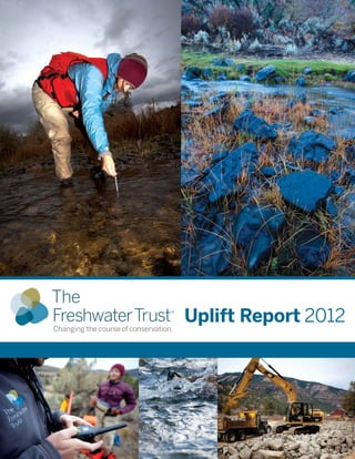
  • 2. Sean O’Connor, Freesolo Collective Front & Back Cover Images: Table of Contents All Images Sean O’Connor, Freesolo Collective; Except for Bottom Center, Hanmi Meyer Salmon Calculator........................................................................................................................................................4 Shade-a-lator.................................................................................................................................................................5 Water Temperature Tracking Tool ...............................................................................................................................6 Nutrient Tracking Tool.................................................................................................................................................. 7 Quantifying Ecological Uplift: Why it is Important Case Study: Rudio Creek .............................................................................................................................................8 T he Freshwater Trust is a non-profit organization with a mission to preserve and restore freshwater ecosystems. With nearly 30 years of on-the-ground experience, we have always looked for innovative ways to fix imperiled rivers and streams. Hanmi Meyer What do we mean by ecological uplift? Simply put, “uplift” refers to the environmental gain of a project — the quantifiable environmental benefit of the restoration actions we take. For example, when we plant trees next to a stream, we can now model the solar radiation that will be blocked by mature trees and calculate kilocalories per day of solar load avoided. How do we reflect that in our analysis and reporting of our projects? First, let’s look at how we might have reported a tree planting project in the past: Healthy and functioning habitat is critical to improving wild fish populations. Example from the past: planting project without uplift metricS Acres 10 Trees planted Total cost 5,000 $50,000 Tracking the number of trees planted does not measure or report the impact of trees on habitat function. Example using new science & tools: planting project with uplift metrics Acres 10 Trees planted Total cost 5,000 Healthy streamside vegetation is critical to improving habitat for aquatic species. The Freshwater Trust 2 — The Freshwater Trust Uplift Report 2012 $50,000 Kilocalories/day of solar load avoided Pounds/year of phosphorus reduced Weighted linear feet of salmon habitat restored 50,000,000 50 100 Map of 2012 Projects ..................................................................................................................................................11 Quantifying the benefits of restoration projects in this way can provide a more robust picture of a project’s value. In fact, we are now doing these calculations on projects before implementation to determine potential ecological uplift prior to committing significant resources to a project. We are doing this to ensure we apply resources to project sites and restoration actions that achieve the most benefit. Measuring the width of a stream is an important factor in determining baseline habitat conditions. In the future, this new ability to quantify project benefits can aid conservation groups and funders in better directing grant dollars and other environmental investments. Traditionally, grant seekers ­ like The Freshwater Trust — submit — project proposals to grant makers that describe the actions to be taken, the cost to implement and a general rationale for why the project is needed. This method makes it challenging to distinguish between similar projects in a competitive environment where the need is great and the funding is limited. Using the scientific tools described in this report, we imagine that conservationists will be able to estimate ecological uplift for projects and improve rationales for project location and design. Sean O’Connor, Freesolo Collective Like all groups in this field, The Freshwater Trust has traditionally evaluated and reported on projects in terms of dollars spent, trees planted, gallons of water restored instream or acres of floodplain reconnected, etc. In 2012, our approach is evolving, just like the science we use to measure ecological benefit. Using recently developed — and in some cases, still developing — tools for calculating the ecological uplift of restoration projects, we are advancing a new system for communicating the value of our work. Uplift from 2012 Projects...........................................................................................................................................10 We have quantified most of our work in 2012 with regard to ecological uplift. We are committed to doing this every year so that we may begin to understand and evaluate the actual effectiveness of our actions and their benefits to our rivers and streams. The Freshwater Trust measured and quantified the ecological uplift of its projects with powerful tools, built using the best thinking and data available to the various developers and partners. That said, the underlying science and modeling methods remain iterative. Over time, as The Freshwater Trust and others use these tools to evaluate project benefits, the monitoring of ongoing project performance will provide an essential feedback loop for refining the formulas, calculation methodologies and modeling logic used by the tools. In this way, not only will uplift calculation continue to improve, but so will restoration practices, project design and our general understanding of aquatic ecosystem functions. The following tools are discussed in this report: Salmon Calculator Shade-a-lator Water Temperature Transaction Tool (W3T) Nutrient Tracking Tool (NTT) The Freshwater Trust Uplift Report 2012 — 3
  • 3. Mary Edwards Photography Freshwaters Illustrated Salmon Calculator MODEL INPUTS Distribution & abundance of aquatic & riparian native & nonnative vegetation Stream width & depth Substrate characteristics Flow & depth characteristics Shade-a-lator Quantifying increased salmon habitat through stream restoration Quantifying avoided solar load through riparian restoration T he Salmon Calculator is designed to quantify ecological changes that directly impact salmon habitat. The Salmon Calculator helps us model, on average, how well a given stream reach supports salmon. Put a different way, the Salmon Calculator uses data from a given reach of stream (say 1,000 feet long), and weights the number of feet that demonstrate ideal habitat function. If 10% of a 1,000 foot reach is optimal, then that reach receives a score of 100 weighted linear feet. Change is calculated as the difference between pre-project conditions (baseline) and modeled conditions 20 years after project work. Aquatic features such as log jams, pools, riffles, glides, alcoves, gravel bars & cascades Inputs into the Salmon Calculator are physical characteristics of the stream and terrestrial areas (see sidebar for model inputs). Based on the inputs, the Salmon Calculator measures the ecological functions of a stream with regard to its ability to create and maintain salmon habitat. The Salmon Calculator then consolidates those ecological functions into one salmon habitat score. The score is a percentage of functional habitat per linear foot of stream, which is recorded as weighted linear feet. Floodplain connectivity Barriers to fish movement Land use Floodplain slope, width & soil type Amount of large wood Historical frequency & duration of flooding The Salmon Calculator was developed as part of Counting on the Environment, a Natural Resources Conservation Service grant project managed by Willamette Partnership. The development of the Salmon Calculator began as part of the Oregon Department of Transportation bridges project and was further refined by Parametrix, Inc. Large instream wood structures help develop pools and create cool water refugia for rearing wild fish. EXAMPLE: HOW IT WORKS Counting on the Environment Natural Resources Conservation Service Oregon Department of Transportation Parametrix, Inc. Willamette Partnership AFTER Restoration TOOL DEVELOPERS BEFORE Restoration Uplift for Salmon Habitat 1,000 feet stream reach Uplift = Change in weighted linear feet of salmon habitat ( Shade-a-lator has been in use and improving for more than a decade. With The Freshwater Trust’s projects, its refinement will continue. WLF) Uplift for Avoided solar Load BEFORE Restoration Before (baseline) Uplift AFTER Restoration Projections based on tree maturity Salmon Habitat Restored After (post-project) 4 — The Freshwater Trust Uplift Report 2012 Shade-a-lator is a module of Heat Source, a stream assessment tool used by Oregon Department of Environmental Quality (ODEQ). It was developed in 1996 as a Master’s Thesis at Oregon State University in the Departments of Bioresource Engineering and Civil Engineering. ODEQ currently maintains the Heat Source methodology and computer programming. Uplift Gained through Restoration Units of measure = Weighted linear feet (WLF) 400 WLF (40%) of functional habitat Using pre-project data (see sidebar for model inputs), Shade-a-lator calculates the current amount of solar radiation hitting the surface area of a stream. Once vegetation is planted, Shade-a-lator models the amount of solar radiation hitting the stream based on the new vegetation’s maturity. The difference represents that project’s uplift in terms of solar radiation blocked or avoided by streamside shade. Shade-a-lator expresses this uplift in energy units of kilocalories per day. Upstream & downstream boundaries of the stream reach Aspect ratio to the sun Wetted width of the stream Bank slope Extent of existing riparian trees & plants Modeling time period, including the time of year the model is run & the number of days the model is run Surrounding topography A Solar PathfinderTM (left) measures the amount of sun hitting the stream in a given location at a given time on a given day. A densiometer (right) measures the canopy cover over a stream. Both instruments are used to determine the solar impact on a stream. EXAMPLE: HOW IT WORKS Measured in weighted linear feet (WLF) of functional habitat for aquatic species 100 WLF (10%) of functional habitat 1,000 feet stream reach R iparian shade, provided by streamside trees, blocks the sun’s rays from hitting the surface of the water, reducing the amount of energy entering the river. In effect, this shade prevents the water from heating up. Anadromous fish, such as salmon and steelhead, are extremely sensitive to water temperature. Healthy riparian buffers help ensure healthy fish habitat. Left: Sean O’Connor, Freesolo Collective Right: The Freshwater Trust Sean O’Connor, Freesolo Collective While robust, the Salmon Calculator remains a work in progress. Willamette Partnership is also working on a more comprehensive functional stream assessment tool that may further improve our ability to calculate stream function for salmon. In the meantime, we are using the Salmon Calculator and gaining valuable data that will help inform the next generation of scientific tools. MODEL INPUTS Restoration actions • Construct instream engineered log jams 400 • Plant streamside vegetation • Reconnect floodplains 300 • Increase pools & riffles 100 Measured in kilocalories per day (kcal/day), which is a measurement of energy Uplift = Change in kilocalories ( kcal) of avoided solar load Uplift Gained through Restoration Solar Load Avoided Units of measure = kilocalories per day (kcal/day) Before (baseline) 10,000,000 • Plant streamside vegetation After (post-project) Solar Load Blocked Solar Load Restoration actions 4,500,000 Uplift 5,500,000 TOOL DEVELOPERS Oregon Department of Environmental Quality Oregon State University, Departments of Bioresource Engineering & Civil Engineering The Freshwater Trust Uplift Report 2012 — 5
  • 4. Sean O’Connor, Freesolo Collective Sean O’Connor, Freesolo Collective Water Temperature Transaction Tool (W3T) Quantifying decreased water temperature through streamflow restoration Quantifying reduced nitrogen, phosphorus and sediments from riparian improvements and agricultural practices ncreasing flow can buffer water temperature and increase velocity through a stream reach. This can limit the water’s exposure to the local temperature to keep the water from warming. Additional temperature benefits can be achieved if the increased flow is cooler than water in the existing stream reach. Stream bed roughness Topographical & vegetation features: surrounding zones of vegetation that provide shade & inhibit solar radiation Inflow water temperatures The Water Temperature Transaction Tool (W3T) uses river and landscape characteristics to estimate hourly solar radiation and overall heat loss or gain from the water. W3T also incorporates tributary inputs and meteorological information. From these inputs, W3T calculates temperature changes in a river reach. Flow volumes Atmospheric heat exchange, air-water interface & bedwater interface Tributary inputs W3T is based on a steady flow approach requiring baseline data (see sidebar for model inputs); W3T models water temperature based on energy transfer to and from the water across the air-water interface and bed-water interface. It also accounts for transport of heat energy in the downstream direction. River velocity Cross sectional area A river’s length, width and depth are important inputs entered into the Water Temperature Transaction Tool. Sean O’Connor, Freesolo Collective Water temperature reduction from increased flow can be determined by comparing baseline conditions with modeled conditions after flow has been restored. The difference in water temperature represents the temperature uplift from restoring flow to that reach. National Fish and Wildlife Foundation contracted with Watercourse Engineering to develop the W3T calculator. EXAMPLE: HOW IT WORKS TOOL DEVELOPERS National Fish & Wildlife Foundation Watercourse Engineering AFTER Restoration BEFORE Restoration Uplift for Temperature through FLOW 1,000 feet stream reach Measured in degrees Celsius. Uplift = Change in temperature ( o C) through flow, measured in cubic Uplift Gained through Restoration 20 C (stream temperature) o Water Temperature Decreased (Daily Max) Restoration actions Units of measure = cfs / oC 1,000 feet stream reach 1.5 CFS (cubic feet per second) 6 — The Freshwater Trust Uplift Report 2012 18o C (stream temperature) Before (baseline) 1.0 After (post-project) + 0.5 cfs Large sediment loads that carry these nutrients can also harm aquatic systems. They can settle into streambeds and fill in the spaces between the rocks and gravel — spaces that are essential for salmonid spawning. Sediment-filled streambeds also cut streams off from groundwater, a valuable source of cold water essential to creating refugia for many fish species. Nationwide, farming and ranching operations represent large inputs of nitrogen and phosphorus. The Freshwater Trust is working to measure the benefit of conservation actions that limit these inputs while maintaining productive agricultural lands. MODEL INPUTS Crop type & livestock type Crop rotations Fertilizer application rates Irrigation practices Livestock access to streams Pesticide application rates Tillage practices Field size & slope Geographic location Local weather data Soil type Soil phosphorus concentration Calculating Runoff Surface Runoff = The Nutrient Tracking Tool (NTT) is a sophisticated modeling tool that allows the user to create a detailed scenario of on-field agricultural practices (see sidebar for model inputs). NTT models the agricultural practices and then estimates the annual nutrient and sediment loads that occur as a result of these actions. NTT can model a wide assortment of conservation actions ­ from riparian — restoration actions to changed practices on farms. ( Rd – 0.2 s ) 2 Rd + 0.8 s Rd = daily rainfall s = retention parameter The retention parameter (s) is variable and is dependent on a number of site-specific physical characteristics, including: soil type, land use, management practices, slope and soil water content. NTT calculates uplift in terms of nitrogen, phosphorus and sediment load reductions by comparing baseline conditions of a field to modeled conditions after restoration. The difference represents the uplift from conservation actions. The Nutrient Tracking Tool was designed and developed by the United States Department of Agriculture (USDA) Natural Resources Conservation Service, the USDA Agricultural Research Service and Texas Institute for Applied Environmental Research.  Rotational grazing is a best management practice that can reduce nutrient and sediment load to a stream. Freshwaters Illustrated EXAMPLE: HOW IT WORKS feet per second (cfs) 1.0 CFS (cubic feet per second) major water quality concern across the country is the abundance of nutrients like nitrogen and phosphorus in our freshwater systems. Too much nitrogen and phosphorus promotes excessive plant and algae growth, choking out other aquatic species. 1.5 Uplift 0.5 • Introduce cooler water • Increase stream velocity 18 oC • Deepen channel 20 oC 2 oC Uplift for NUTRIENTS & SEDIMENTS BEFORE Restoration River length, width & depth AFTER Restoration MODEL INPUTS Nutrient Tracking Tool (NTT) Runoff drains into stream Measured in pounds per year of nutrients and sediments reduced through restoration Uplift = Change in pounds per year ( pounds/year) Uplift Gained through Restoration Nutrient & Sediment Reduction Units of measure = pounds per year Vegetation filters runoff Phosphorus Nitrogen 10.0 100.0 After (post-project) 5.0 25.0 Uplift 5.0 75.0 Before (baseline) Sediments TOOL DEVELOPERS Restoration actions 2,000.0 • Plant streamside vegetation 100.0 • Implement cover crops, livestock 1,900.0 exclusion fencing, etc. United States Department of Agriculture Natural Resources Conservation Service USDA Agricultural Research Service Texas Institute for Applied Environmental Research The Freshwater Trust Uplift Report 2012 — 7
  • 5. Sean O’Connor, Freesolo Collective Case Study: Rudio Creek Uplift from 2012 Project n ecologically significant tributary of the North Fork John Day River, Rudio Creek provides important habitat for federally-listed summer steelhead and spring Chinook. During the early and mid-1900s, a portion of Rudio Creek that runs through a ranch was straightened and channelized, draining wet meadow floodplain habitat to create livestock pasture. This channelization, coupled with agricultural development of the floodplain throughout the mid-1900s, led to the loss of riparian vegetation and beaver dam complexes. This resulted in a faster flowing stream system with reduced habitat diversity and reduced cold-water storage capabilities. Sean O’Connor, Freesolo Collective Collecting thorough baseline data allows scientists to more precisely design a restoration project. The Freshwater Trust has restored Rudio Creek to mimic historic conditions to the greatest extent possible. The illustration below details how habitat restoration actions were implemented on a section of the Rudio Creek project. 1 Reconstruct historic channel: Reactivation of flow to the historic channel provides habitat diversity and floodplain connectivity and reverses the effects of straightening and channelizing the stream. Restoring the stream to near-historic conditions increases its length and offers greater potential habitat complexity. Creating bends and wood structures allows for varying water velocities and for different sizes of gravel and cobble — important for native fish — to be naturally sorted and deposited. 2 Increase floodplain connectivity: Reconnecting the stream to its floodplain allows water to spill over and facilitate the growth and diversity of streamside vegetation. A connected floodplain also reduces the stream’s speed during a flood event, preventing banks from eroding and creating opportunities for secondary side channels to form. Units of measure Salmon Habitat Restored Solar Load Avoided Water Temperature Decreased (Daily Max) Phosphorus Reduced Nitrogen Reduced Sediments Reduced Weighted linear feet (WLF) Kilocalories per day (kcals) Degrees Celsius (oC) Pounds per year Pounds per year Pounds per year Before (baseline) Rudio Creek 4,641 50,061,190 26.5 4.6 26.7 111.3 After (post-project) 6,419 8,534,474 25.5 0.1 9.4 107.6 1,777 41,526,716 1.0 4.5 17.2 3.7 Uplift Restoration actions 3,250 feet of historic channel reconnected 6,588 feet of channel constructed and floodplain reconnected 70 pool-glide habitat complexes created 70 large wood structures built 13,000 native shrubs, hardwoods and plugs planted 4 Construct large wood structures: In undisturbed systems, dead wood naturally accumulates in rivers and streams, adding to habitat complexity. During high flow periods, water carves around and beneath these pieces of wood, creating deep pools where water stays cool. Structures are constructed where they would be expected to occur under natural conditions and are designed to be self-sustaining. 5 Restore native riparian vegetation: Native vegetation is planted along the banks of the creek, providing channel stability, shade for the river, food for insects and fish, and materials for beavers, birds and other animals to build shelter. While beavers are present in the system, their numbers and influence on the river and floodplain have been greatly reduced. It is anticipated that this project and its restored habitat conditions will support a larger beaver population and perennial dam complexes. To restore Rudio Creek holistically, The Freshwater Trust also worked with private landowners upstream and downstream of its on-the-ground project site to address instream flow issues. An upstream water leasing agreement and a change to a downstream point of diversion restored 2.0 cubic feet per second (1.3 million gallons per day) of streamflow to Rudio Creek, increasing water quality, lowering temperature in Rudio Creek and contributing cold water to the North Fork John Day. 3 Increase pool/pool-glide habitat: Pools provide slow water habitat, spawning sized gravels and shelter for both adults and juvenile fish. Historic channel realignment (top and bottom left) reverses the effects of straightening and channelizing the stream. Establishing cross section locations (right) helps assess existing channel conditions. DESIGN PLAN KEY 2 3 Channel plug Restored Channel (Historic) Flow Floodplain connectivity Pool/pool-glide enhancement 4 Large wood structure 5 Riparian vegetation plantings 8 — The Freshwater Trust Uplift Report 2012 Existing Channel (Before Restoration) All Images to the Left: Channel construction Sean O’Connor, Freesolo Collective 1 Existing channel centerline Project channel centerline The Freshwater Trust Uplift Report 2012 — 9
  • 6. Sean O’Connor, Freesolo Collective Uplift from 2012 Projects Salmon Habitat Restored Tool used Units of measure Solar Load Avoided Water Temperature Decreased (Daily Max) Salmon Calculator Shade-a-lator Water Temperature Transaction Tool (W3T) Weighted linear feet (WLF) Kilocalories per day (kcals) Degrees Celsius (oC) Phosphorus Reduced Nitrogen Reduced Sediments Reduced Pounds per year Pounds per year Pounds per year — 64,677, 1 3 1 — 1.0 66.0 1,649.0 After (post-project) — 50,875,236 — 0.0 1.0 86.0 — 13,801,895 — 1.0 65.0 1,563.0 Uplift Restoration actions Salmon River Side Channel 3a Salmon River Side Channel 4 6,120 native shrubs, hardwoods and plugs were planted Before (baseline) 297 — — — — — After (post-project) 331 — — — — — 35 — — — — — Uplift Restoration actions 654 feet side channel habitat restored; 1 large wood habitat structure at inlet Before (baseline) 0 — — — — — After (post-project) 430 — — — — — Uplift 430 — — — — — Restoration actions 670 feet side channel habitat restored; 1 large wood habitat structure; 50 pieces large wood placed in side channel Before (baseline) Salmon River Side Channel 5 Salmon River Side Channel 18 Salmon River Side Channel 23a 0 Restoration actions — — — — — — — — 2,606 Uplift — 2,606 After (post-project) — — — — — — 250 pieces large wood placed in side channel; 2 large wood habitat structures; 3,760 feet side channel habitat restored Before (baseline) 40 — — — — — After (post-project) 2,012 — — — — — Uplift 1,972 — — — — — Restoration actions 2,685 feet side channel habitat restored; 2 culverts replaced; 40 pieces large wood placed in side channel Before (baseline) 456 — — — — After (post-project) 806 — — — — — Uplift 350 — — — — Habitat Restoration Projects — — Restoration actions Flow Restoration Projects 1,148 feet side channel habitat restored; 1 large wood habitat structure at inlet Before (baseline) 4,641 50,061,190 26.5 4.6 26.7 111.3 After (post-project) Rudio Creek 6,419 8,534,474 25.5 0.1 9.4 107.6 Uplift 1,777 41,526,716 1.0 *4.5 *17.2 *3.7 Restoration actions 3,250 feet of historic channel reconnected 6,588 feet of channel constructed and floodplain reconnected 70 pool-glide habitat complexes created 70 large wood structures built 13,000 native shrubs, hardwoods and plugs planted Before (baseline) Rogue River In addition to quantified project work detailed in this Uplift Report, The Freshwater Trust also completed major habitat restoration work on Still Creek, a tributary of the Salmon River, and protected 13.65 billion gallons of water per day instream across the state. Nutrient Tracking Tool (NTT) Before (baseline) Little Butte Creek Map of 2012 Projects — 44,250,538 — After (post-project) — 19,156,327 — 0.0 1.4 3.9 Uplift — **25,094,211 — **0.0 **0.4 **12.6 5.5 pounds (reduced phosphorus) 82.6 pounds (reduced nitrogen) 1,579.3 pounds (reduced sediments) Restoration actions Total Uplift for 2012 Projects (for which uplift calculation is possible) 0.0 1.8 10 — The Freshwater Trust Uplift Report 2012 1.0 oC (reduced max daily water temperature) Counting on the Environment The Freshwater Trust would like to thank the following partners who developed the tools & calculators to measure the ecological uplift in this report. Environmental Research 16.5 2,450 native shrubs, hardwoods and plugs were planted 7,170 WLF 80,422,822 kcals (restored (avoided salmon habitat) solar load) Acknowledgements National Fish & Wildlife Foundation Natural Resources Conservation Service Oregon Department of Environmental Quality Texas Institute for Applied Environmental Research Oregon Department of Transportation United States Department of Agriculture Oregon State University Watercourse Engineering Parametrix, Inc. Willamette Partnership NOTES * Soil data are not available for the project area in Grant County, therefore, a nearby proxy was used to calculate the uplift, making them rough estimates, not exact numbers. The uplift is a result of the removal of grazing livestock from a single field in the project area. The modeled area is 2.3 acres. ** These numbers are from the Phase 1 planting of Rogue River. Additional planting will occur in the spring which will change the estimated uplift. The uplift is a result of planting riparian vegetation. The modeled area is 1.3 acres. The Freshwater Trust Uplift Report 2012 — 11
  • 7. 65 SW Yamhill Street, Suite 200 Portland, OR 97204 ADDRESS SERVICE REQUESTED NON-PROFIT ORGANIZATION U.S. POSTAGE PAID PORTLAND, OR PERMIT No. 4313