GEO 2.0 - geography in (ter) action
•Transferir como PPT, PDF•
2 gostaram•469 visualizações

GEO 2.0 definition and examples of this emerging trend where web2.0 world meets GPS, cartography and mobile technologies; experience driven presentation presented at gisotopolis

Recomendados
Mais conteúdo relacionado
Semelhante a GEO 2.0 - geography in (ter) action
Semelhante a GEO 2.0 - geography in (ter) action (20)
Último
Último (20)
GEO 2.0 - geography in (ter) action
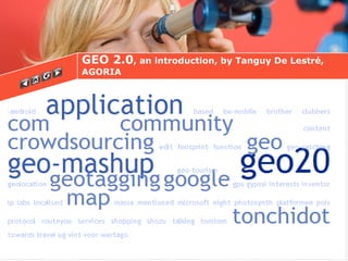
- 1. GEO 2.0 , an introduction, by Tanguy De Lestré, AGORIA
- 2. GEO 2.0 = WEB 2.0 within Geographic Information Systems (GIS) Enables visualisations of cartographic data, withouth prior technological know-how
- 3. Key concept 1: Geotagging Process of adding geographical identification to various media such images and is a form of geospatial metadata (source wikipedia)
- 4. Geotagging example : Google maps- user generated control included
- 5. Key concept 2 :Geo-mashup “ A mashup is a webpage or a webapplication where data can be combined of different sources” (source: Wikipedia) GEO mashup combines maps with underlaying data.
- 6. Geo-mashup example : San-Francisco lowest Price Gas finder http://207.45.186.82/~mdelfs/iphone/sanfrangas/index/index.html
- 8. Example Platform : create workout jogging route on mobile, webshare and export easily the GPS tracks ( http://sportstracker.nokia.com)
- 9. Key concept 4: Crowdsourcing or concept of ‘outsourcing’ innovation to a large ‘crowd’:users participate in making changes to geografic spatial data.
- 12. Localised user generated travel 'city' guides Social networks that use localisation aspects and geotagging Price shopping and combine on and offline shops GPS track
- 13. Insert routeyouprintscreen GPS tracks to share and export; Example: Routeyou.be
- 14. Social mobile community networks Example : one click or no click upload of own pictures and GPS coordinates from mobile phone (N79, iphone,…) to Shozu, Gypsii, Pelago, Loopt,…
- 15. Price shopping that combine on and offline shop(s) and reviews Example: Pongr, Shopsavvy
- 16. Localised User Generated travel 'city' guides ; Example WERTAGO (nightlife), Urbanspoon (transport, food,…)
- 18. And the future… [email_address] Augmented user generated reality
- 19. Expo 58 memories Average visitor rating ** I slept here Tania 7/8/8 Agoria reception 2006 Thank you