SlideShare uma empresa Scribd logo
1 de 14
All About Maps
Grade 3 Geography
      Ms. R’s class
What is a map?
 • A map is a flat drawing of a
   specific location, country,
   or the world.

 • A map looks as if it were
   drawn from the view of
   someone sitting in an
   airplane.

What is a globe?
       • A globe is a small model
         of the Earth.
How do maps help us?
   • Maps help us find our way from one
     place to another.

   • A map shows where things or places
     are located.

   • Maps can be used to show
     how far one place is from another.
Map Components

           Title
         Compass
          Scale
     Map Key or Legend
           Grid
• The title tells what the map is
  about.


          What is the title of this map?
• A compass rose tells the directions (which
  way) on a map.
• It normally shows the four cardinal
  directions. They are:
        * North is at the top of a map.
           * South is at the bottom of
                    a map.
           * West is on the left side of
                    a map.
          * East is on the right side of
                    a map.
Scale
  • A scale shows the relationship
    between the actual size of a location
    and the map size.
     For example, each
     inch on the map
     represents one mile
     on Earth. So, a map of
     a town would show a
     mile-long strip of fast
     food joints and auto
     dealers in one inch.
Map Key or Legend
 • The map key or legend shows the
   symbols or colors on a map and
   gives their meaning.
Grid
 The latitude and longitude are imaginary
  lines to help us find the exact point of a
                   location.
Kinds of Map


          POLITICAL
          PHYSICAL
               AND

          THEMATIC
Political Map
 • A political map shows the borders and
   boundaries of a country, state, region or city.

 • They usually
   include important
   bodies of water.

      • A political map
        often change
        because of wars
        or conflict.
Physical Map
   • A physical map shows natural
     landforms, bodies of water, and
     features of a country, region, or the
     world.
Thematic Map
   • A thematic map is designed to show a
     specific information or data.
• Examples of
  information can be
  about:
  •   Population
  •   Religion
  •   Weather
  •   Food
  •   Natural Resources
END

Mais conteúdo relacionado

Mais procurados (20)

Reading a map
Reading a mapReading a map
Reading a map
 
Maps and location
Maps and locationMaps and location
Maps and location
 
MAPS AND GLOBES PRESENTATION FOR SCHOOL STUDENTS
MAPS AND GLOBES PRESENTATION FOR SCHOOL STUDENTSMAPS AND GLOBES PRESENTATION FOR SCHOOL STUDENTS
MAPS AND GLOBES PRESENTATION FOR SCHOOL STUDENTS
 
Types of maps
Types of mapsTypes of maps
Types of maps
 
Types of map
Types of mapTypes of map
Types of map
 
Different Types of Maps
Different Types of MapsDifferent Types of Maps
Different Types of Maps
 
Types of maps
Types of mapsTypes of maps
Types of maps
 
Directions
DirectionsDirections
Directions
 
Mapping space around us
Mapping space around usMapping space around us
Mapping space around us
 
Unit 5 Orientation and Maps
Unit 5 Orientation and MapsUnit 5 Orientation and Maps
Unit 5 Orientation and Maps
 
Grade - 6 - Social Science, Geography Chapter 4. Map Reading
Grade - 6 - Social Science, Geography Chapter 4. Map ReadingGrade - 6 - Social Science, Geography Chapter 4. Map Reading
Grade - 6 - Social Science, Geography Chapter 4. Map Reading
 
Different kindsofmaps
Different kindsofmapsDifferent kindsofmaps
Different kindsofmaps
 
Graphics aids 6 maps A Lecture By Allah Dad Khan VP AUP
Graphics aids 6 maps  A Lecture By Allah Dad Khan VP AUPGraphics aids 6 maps  A Lecture By Allah Dad Khan VP AUP
Graphics aids 6 maps A Lecture By Allah Dad Khan VP AUP
 
Geotest1review
Geotest1reviewGeotest1review
Geotest1review
 
Geotest1review slides
Geotest1review slidesGeotest1review slides
Geotest1review slides
 
Graphic representation of the earth . maps and globe
Graphic representation of the earth . maps and globeGraphic representation of the earth . maps and globe
Graphic representation of the earth . maps and globe
 
CONTINENTS AND OCEANS
CONTINENTS AND OCEANSCONTINENTS AND OCEANS
CONTINENTS AND OCEANS
 
Maps
MapsMaps
Maps
 
Final Project
Final ProjectFinal Project
Final Project
 
Maps & TODALS
Maps & TODALSMaps & TODALS
Maps & TODALS
 

Destaque

Classroom Policies
Classroom PoliciesClassroom Policies
Classroom Policiesriaferuiz
 
Classroom policies updated
Classroom policies updatedClassroom policies updated
Classroom policies updatedriaferuiz
 
Candy And Cavities Final Draft
Candy And Cavities Final DraftCandy And Cavities Final Draft
Candy And Cavities Final Draftguest9dd9c9
 
Food presentation
Food presentationFood presentation
Food presentation17kimn
 
Candy PowerPoint
Candy PowerPointCandy PowerPoint
Candy PowerPointemurfield
 

Destaque (6)

Classroom Policies
Classroom PoliciesClassroom Policies
Classroom Policies
 
Classroom policies updated
Classroom policies updatedClassroom policies updated
Classroom policies updated
 
Candy And Cavities Final Draft
Candy And Cavities Final DraftCandy And Cavities Final Draft
Candy And Cavities Final Draft
 
Food presentation
Food presentationFood presentation
Food presentation
 
Candy
CandyCandy
Candy
 
Candy PowerPoint
Candy PowerPointCandy PowerPoint
Candy PowerPoint
 

Semelhante a Maps

Interpreting maps
Interpreting mapsInterpreting maps
Interpreting mapsrrodri37
 
Interpreting maps
Interpreting mapsInterpreting maps
Interpreting mapsrrodri37
 
Geography_Map Skills .pptx
 Geography_Map Skills .pptx Geography_Map Skills .pptx
Geography_Map Skills .pptxNataliaBurgess
 
Earth science unit 1 introduction to mapping
Earth science unit 1   introduction to mappingEarth science unit 1   introduction to mapping
Earth science unit 1 introduction to mappingTim Corner
 
Unit 1, part 3 the study of geography, cartographers' tools
Unit 1, part 3 the study of geography, cartographers' toolsUnit 1, part 3 the study of geography, cartographers' tools
Unit 1, part 3 the study of geography, cartographers' toolsmontathomas
 
GEOGRAPHY YEAR 9 SKILLS - MAPS
GEOGRAPHY YEAR 9 SKILLS - MAPSGEOGRAPHY YEAR 9 SKILLS - MAPS
GEOGRAPHY YEAR 9 SKILLS - MAPSGeorge Dumitrache
 
Introduction to geological maps and geomorpholgy
Introduction to geological maps and geomorpholgyIntroduction to geological maps and geomorpholgy
Introduction to geological maps and geomorpholgyfadhilkj1
 
Cartography – plotting the world
Cartography – plotting the worldCartography – plotting the world
Cartography – plotting the worldNishant Sinha
 
Exploring our geographic world by tessie calimag bb.
Exploring our geographic world by tessie calimag bb.Exploring our geographic world by tessie calimag bb.
Exploring our geographic world by tessie calimag bb.Tessie Calimag
 
map_projections_powerpoint3.ppt
map_projections_powerpoint3.pptmap_projections_powerpoint3.ppt
map_projections_powerpoint3.pptDeshDeepak68
 
Ss3 m1 u01_presentation
Ss3 m1 u01_presentationSs3 m1 u01_presentation
Ss3 m1 u01_presentationdfr4591
 
SOCIAL SCIENCE WORLD
SOCIAL SCIENCE WORLDSOCIAL SCIENCE WORLD
SOCIAL SCIENCE WORLDLuciaAbalos
 
Exploring our geographic world by tessie calimag bb.
Exploring our geographic world by tessie calimag bb.Exploring our geographic world by tessie calimag bb.
Exploring our geographic world by tessie calimag bb.Tessie Calimag
 

Semelhante a Maps (20)

Interpreting maps
Interpreting mapsInterpreting maps
Interpreting maps
 
Interpreting maps
Interpreting mapsInterpreting maps
Interpreting maps
 
Geography_Map Skills .pptx
 Geography_Map Skills .pptx Geography_Map Skills .pptx
Geography_Map Skills .pptx
 
class1b (3).ppt
class1b (3).pptclass1b (3).ppt
class1b (3).ppt
 
GEOGRAPHY IGCSE: MAP SKILLS
GEOGRAPHY IGCSE: MAP SKILLSGEOGRAPHY IGCSE: MAP SKILLS
GEOGRAPHY IGCSE: MAP SKILLS
 
Earth science unit 1 introduction to mapping
Earth science unit 1   introduction to mappingEarth science unit 1   introduction to mapping
Earth science unit 1 introduction to mapping
 
Unit 1, part 3 the study of geography, cartographers' tools
Unit 1, part 3 the study of geography, cartographers' toolsUnit 1, part 3 the study of geography, cartographers' tools
Unit 1, part 3 the study of geography, cartographers' tools
 
GEOGRAPHY YEAR 9 SKILLS - MAPS
GEOGRAPHY YEAR 9 SKILLS - MAPSGEOGRAPHY YEAR 9 SKILLS - MAPS
GEOGRAPHY YEAR 9 SKILLS - MAPS
 
Exploring geographic world
Exploring geographic worldExploring geographic world
Exploring geographic world
 
Introduction to geological maps and geomorpholgy
Introduction to geological maps and geomorpholgyIntroduction to geological maps and geomorpholgy
Introduction to geological maps and geomorpholgy
 
Cartography – plotting the world
Cartography – plotting the worldCartography – plotting the world
Cartography – plotting the world
 
Exploring our geographic world by tessie calimag bb.
Exploring our geographic world by tessie calimag bb.Exploring our geographic world by tessie calimag bb.
Exploring our geographic world by tessie calimag bb.
 
map_projections_powerpoint3.ppt
map_projections_powerpoint3.pptmap_projections_powerpoint3.ppt
map_projections_powerpoint3.ppt
 
map projections.ppt
map projections.pptmap projections.ppt
map projections.ppt
 
Ss3 m1 u01_presentation
Ss3 m1 u01_presentationSs3 m1 u01_presentation
Ss3 m1 u01_presentation
 
SOCIAL SCIENCE WORLD
SOCIAL SCIENCE WORLDSOCIAL SCIENCE WORLD
SOCIAL SCIENCE WORLD
 
Unit 1 geography
Unit 1 geographyUnit 1 geography
Unit 1 geography
 
Unit 1 geography
Unit 1 geographyUnit 1 geography
Unit 1 geography
 
Exploring our geographic world by tessie calimag bb.
Exploring our geographic world by tessie calimag bb.Exploring our geographic world by tessie calimag bb.
Exploring our geographic world by tessie calimag bb.
 
Maps and globes
Maps and globesMaps and globes
Maps and globes
 

Mais de riaferuiz

Sy 14 15 1st semester after-school activities
Sy 14 15 1st semester after-school activitiesSy 14 15 1st semester after-school activities
Sy 14 15 1st semester after-school activitiesriaferuiz
 
Classroom Policies
Classroom PoliciesClassroom Policies
Classroom Policiesriaferuiz
 
Welcome Letter
Welcome LetterWelcome Letter
Welcome Letterriaferuiz
 
Welcome Back!
Welcome Back!Welcome Back!
Welcome Back!riaferuiz
 
Economics[1]
Economics[1]Economics[1]
Economics[1]riaferuiz
 
The Earth in Space
The Earth in SpaceThe Earth in Space
The Earth in Spaceriaferuiz
 
Career Opportunities
Career OpportunitiesCareer Opportunities
Career Opportunitiesriaferuiz
 
Career Opportunities
Career OpportunitiesCareer Opportunities
Career Opportunitiesriaferuiz
 
Grade 3 Lab Report Guide
Grade 3 Lab Report GuideGrade 3 Lab Report Guide
Grade 3 Lab Report Guideriaferuiz
 
United Nations Day Celebration
United Nations Day CelebrationUnited Nations Day Celebration
United Nations Day Celebrationriaferuiz
 

Mais de riaferuiz (12)

Sy 14 15 1st semester after-school activities
Sy 14 15 1st semester after-school activitiesSy 14 15 1st semester after-school activities
Sy 14 15 1st semester after-school activities
 
Classroom Policies
Classroom PoliciesClassroom Policies
Classroom Policies
 
Welcome Letter
Welcome LetterWelcome Letter
Welcome Letter
 
Welcome Back!
Welcome Back!Welcome Back!
Welcome Back!
 
Matter
MatterMatter
Matter
 
Economics[1]
Economics[1]Economics[1]
Economics[1]
 
The Earth in Space
The Earth in SpaceThe Earth in Space
The Earth in Space
 
Career Opportunities
Career OpportunitiesCareer Opportunities
Career Opportunities
 
Career Opportunities
Career OpportunitiesCareer Opportunities
Career Opportunities
 
Grade 3 Lab Report Guide
Grade 3 Lab Report GuideGrade 3 Lab Report Guide
Grade 3 Lab Report Guide
 
Lab report
Lab reportLab report
Lab report
 
United Nations Day Celebration
United Nations Day CelebrationUnited Nations Day Celebration
United Nations Day Celebration
 

Maps

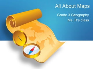
  • 1. All About Maps Grade 3 Geography Ms. R’s class
  • 2. What is a map? • A map is a flat drawing of a specific location, country, or the world. • A map looks as if it were drawn from the view of someone sitting in an airplane. What is a globe? • A globe is a small model of the Earth.
  • 3. How do maps help us? • Maps help us find our way from one place to another. • A map shows where things or places are located. • Maps can be used to show how far one place is from another.
  • 4. Map Components Title Compass Scale Map Key or Legend Grid
  • 5. • The title tells what the map is about. What is the title of this map?
  • 6. • A compass rose tells the directions (which way) on a map. • It normally shows the four cardinal directions. They are: * North is at the top of a map. * South is at the bottom of a map. * West is on the left side of a map. * East is on the right side of a map.
  • 7. Scale • A scale shows the relationship between the actual size of a location and the map size. For example, each inch on the map represents one mile on Earth. So, a map of a town would show a mile-long strip of fast food joints and auto dealers in one inch.
  • 8. Map Key or Legend • The map key or legend shows the symbols or colors on a map and gives their meaning.
  • 9. Grid The latitude and longitude are imaginary lines to help us find the exact point of a location.
  • 10. Kinds of Map POLITICAL PHYSICAL AND THEMATIC
  • 11. Political Map • A political map shows the borders and boundaries of a country, state, region or city. • They usually include important bodies of water. • A political map often change because of wars or conflict.
  • 12. Physical Map • A physical map shows natural landforms, bodies of water, and features of a country, region, or the world.
  • 13. Thematic Map • A thematic map is designed to show a specific information or data. • Examples of information can be about: • Population • Religion • Weather • Food • Natural Resources
  • 14. END