SlideShare uma empresa Scribd logo
1 de 79
Baixar para ler offline
Planet Earth


IES « Fray Pedro de Urbina »
Rafael Agúndez Blanco
1. THE UNIVERSE
   1.1. The Big-bang


Le Big Bang was an event which led to the
formation of the universe 14 000 millions
years ago. The universe, originally in an
extremely hot and dense state, has since
cooled by expanding.
1. THE UNIVERSE
   1.2. The celestial bodies


A star is a very large ball of burning gas
that releases energy.
1. THE UNIVERSE
   1.2. The celestial bodies


                                              Elliptic galaxy


             Spiral galaxy


A galaxy is a very large group of stars.
Each galaxy contains thousands of stars.
                                           Bared-spiral galaxy
1. THE UNIVERSE
   1.2. The celestial bodies


                                          The Sun


The Milky Way Galaxy eis the galaxy in
which the Solar System is located..
1. THE UNIVERSE
   1.2. The celestial bodies


A supernova is a stellar explosion.
1. THE UNIVERSE
   1.2. The celestial bodies


A black hole is a region of universe so
dense that absorbs even the light.
1. THE UNIVERSE
   1.3. The dimensions of the universe


A light year is the distance that light
travels in a year.
The light-year is used to measure
distances to stars and other
distances on a galactic scale.
The speed of light is 300 000 km/s,
so a light year is equal to 9 trillion
kilometres.
1. THE UNIVERSE
   1.3. The dimensions of the universe


The scale of the distances between
the celestial bodies that is
represented in books is not real.

If the Sun was a beach ball of 1 m in diameter,
Earth would be a marble at a distance of 108 m;
and Pluto, a pea at 4,7 km.
1. THE UNIVERSE
   1.3. The dimensions of the universe


The size of celestial bodies is often misrepresented too.

                    Earth
                                                            Venus


                  Mars                Mercury          The moon
1. THE UNIVERSE
   1.3. The dimensions of the universe


   Jupiter
                                         Saturn


              Uranus
                                         Neptune
1. THE UNIVERSE
   1.3. The dimensions of the universe


               The Sun


              Jupiter
1. THE UNIVERSE
   1.3. The dimensions of the universe


       The Sun


       Earth is not visible on
       this scale
1. THE UNIVERSE
   1.3. The dimensions of the universe
2. SOLAR SYSTEM


   The Sun              Terrestrial                       Gas
                         planets                         giants


             Mercury   Venus   Earth   Mars   Jupiter    Saturn   Uranus   Neptune


The Solar System is the planetary system formed by the Sun, the eight planets,
theirs natural satellites (moons) and other small bodies (asteroids, comets,
meteorites, etc.).
2. SOLAR SYSTEM


   The Sun               Terrestrial                       Gas
                          planets                         giants


              Mercury   Venus   Earth   Mars   Jupiter     Saturn   Uranus   Neptune


The inner planets, also called the terrestrial planets, are composed of rocks;
the outer planets or gas giants are composed of gases.
2. SOLAR SYSTEM
   2.1. Mercury

Mercury is the innermost and
smallest planet in the Solar System,
orbiting the Sun once every 88 Earth
days.
It keeps the same face directed
towards the Sun, so the surface
temperature ranges from 427 ºC in
one hemisphere to -183 ºC in the
other.
2. SOLAR SYSTEM
   2.2. Venus


                  Venus is the hottest planet of the
                  Solar System because of its
                  greenhouse effect. The surface
                  temperature is over 460 ºC.
                  After the Moon, it is the brightest
                  natural object in the night sky,
2. SOLAR SYSTEM
   2.3. Earth


Earth is currently the only place
in the universe where life is
known to exist.
The abundance of water on
Earth's surface is a unique
feature that distinguishes the
"Blue Planet" from others in the
Solar System.
2. SOLAR SYSTEM
   2.4. The Moon


Earth formed as a result of a
giant impact: a planet hit the
Earth, blasting material into orbit,
which accreted to form the
Moon.
2. SOLAR SYSTEM
   2.4. The Moon


The Moon is Earth's only natural
satellite.
The Earth-Moon distance is
about 400 000 km, which is
about 30 times the diameter of
the Earth.
The Moon is the only celestial
body on which humans have
made a manned landing.
2. SOLAR SYSTEM
   2.5. Mars


Mars is called the “Red Planet”. The average
temperature is about -63 ºC.
Mars has two permanent polar ice caps, which
are two km thick.
2. SOLAR SYSTEM
   2.5. Mars


Mars has a very rugged topography: Olympus
Mons is the highest known mountain within the
Solar System, and Valles Marineris, the largest
canyon (4 000 km long and up to 7 km deep).


        27 000 m


                                                  Olympus
                                                   Mons


          8 000 m
                                                            Everest
2. SOLAR SYSTEM
   2.6. Jupiter


Jupiter is the largest`planet within the
Solar System.
2. SOLAR SYSTEM
   2.6. Jupiter


Jupiter consists of a rocky core
and a surrounding layer of
gases.
2. SOLAR SYSTEM
   2.6. Jupiter


The Great Red Spot is a
persistent storm that is larger
than Earth.
Winds around the edge of the
spot peak at about 700 km/h (a
hurricane in the Earth is 200
km/h)
Jupiter has 63 named natural
2. SOLAR SYSTEM                        satellites. The four largest moons
   2.6. Jupiter                        are known as the "Galilean
                                       moons".
                                       Most scientists believe that a layer
                                       of liquid water exists beneath
                              Io
                                       Europa's surface, which could allow
                                       extraterrestrial life.

                             Europa


                                      Ganymede


                  Callisto
2. SOLAR SYSTEM
   2.7. Saturn


Saturn is probably best known
for its system of planetary
rings, which are composed of
water ice.
2. SOLAR SYSTEM
   2.8. Uranus


Uranus moves around the Sun with its
rotation axis nearly horizontal.
2. SOLAR SYSTEM
   2.9. Neptune


Neptune completes an orbit every 165 years.
Wind speeds can reach 2 000 km/h.
2. SOLAR SYSTEM
   2.10. Pluto


Pluto is considered a dwarf planet because of
its size.
3. THE EARTH’S MOVEMENTS
   3.1. Earth’s rotation


 Earth’s rotation is the motion of Earth
 around its own axis. It takes the Earth about
 24 hours to finish one complete rotation.
3. THE EARTH’S MOVEMENTS
   3.2. Earth’s orbit

Earth’s rotation is the
motion of Earth around the
Sun. It takes the Earth
about 365 days to finish
one complete orbit.
3. THE EARTH’S MOVEMENTS
   3.2. Earth’s orbit


                                                     The Sun


                                         Ecliptic
Erath orbits the Sun in a counterclockwise direction. The plane of the ecliptic
is the plane of the Earth’s orbit around the Sun.
This orbit seems a circle, but it is slightly elliptical.
3. THE EARTH’S MOVEMENTS
   3.2. Earth’s orbit


   July 4                                                                January 4

                     Aphelion                             Perihelion

                                                The Sun


The Sun is not in the center of the orbit.
The closest point to the Sun in a planet’s orbit is called perihelion. The furthest
point is called aphelion.
3. THE EARTH’S MOVEMENTS
   3.3. Axial tilt


                                                             23º


              Ecliptic


The rotation axis is not perpendicular to the ecliptic plane: the Earth has an
axial tilt of 23º.
3. THE EARTH’S MOVEMENTS
   3.3. Axial tilt


The axial tilt was probably caused by
an asteroid impact.
3. THE EARTH’S MOVEMENTS
   3.3. Axial tilt


                                 Rays of sunshine


                                                                 December 21


The axial til is the cause of the seasons: on december 21 the southern
hemisphere receives more energy than the northern hemisphere.
3. THE EARTH’S MOVEMENTS
   3.3. Axial tilt


                                Rays of sunshine


          June 21


On the other hand, June 21 the northern hemisphere receives more energy
than the northern hemisphere.
3. THE EARTH’S MOVEMENTS
   3.3. Axial tilt
                           Vernal equinox
                             (Mars 21)


                                                                    Winter solstice
                                                                    (December 21)


    Summer solstice
      (June 21)


                                              Autumn equinox
                                              (September 22)


A solstice occurs twice a year, when the center of the Sun reaches its
northernmost or southernmost extremes.
3. THE EARTH’S MOVEMENTS
   3.3. Axial tilt
                          Vernal equinox
                            (Mars 21)


                                                                  Winter solstice
                                                                  (December 21)


    Summer solstice
      (June 21)


                                             Autumn equinox
                                             (September 22)


An equinox occurs twice a year, when the center of the Sun is in the same
plane as the Earth’s equator.
3. THE EARTH’S MOVEMENTS
   3.3. Axial tilt


                                      Juin 21
 The axial tilt is the cause of the
 differences between the daytime
 and the night-time.
 On the equator, every daytime
 has a length of 12 hours, but the
 differences increase with the
 latitude.
 For example, on June 21, at the
 Arctic Circle, the daytime has a
 length of 24 hours; on the other
 hand, at the Antarctic Circle, the
 daytime has a length of 0 hours.
3. THE EARTH’S MOVEMENTS
   3.3. Axial tilt


The polar day or midnight sun is a natural phenomenon occurring inside the
Polar Circles, where the sun remains visible at the local midnight.
3. THE EARTH’S MOVEMENTS
   3.3. Axial tilt
                                        Spitzbergen


 The number of days per year with
 potential midnight sun increases the
 farther poleward one goes.


                                            Alaska
3. THE EARTH’S MOVEMENTS
   3.3. Axial tilt


                           Midnight Sun in Norway
3. THE EARTH’S MOVEMENTS
   3.3. Axial tilt


Locations that are south of
the Arctic Circle or north of
the Antarctic Circle
experience midnight twilight.
The sun is only 6º below the
horizon, so that daytime
activities, such as reading,
are still possible without
artificial light.
3. THE EARTH’S MOVEMENTS
   3.3. Axial tilt
The Polar Night in Norway


The polar night is a natural phenomenon occurring inside the Polar Circles,
where the night lasts for more than 24 hours.
3. THE EARTH’S MOVEMENTS
   3.4. The moon as seen from Earth


The lunar phases vary cyclically as the
Moon orbits the Earth.
3. THE EARTH’S MOVEMENTS
   3.4. The moon as seen from Earth


     New moon     First quarter moon   Full moon   Last quarter moon
3. THE EARTH’S MOVEMENTS
   3.4. The moon as seen from Earth


Eclipses can only occur when the Sun, Earth and Moon are all in a
straight line.
3. THE EARTH’S MOVEMENTS
   3.4. The moon as seen from Earth


Lunar eclipses occur near a full moon, when the
Earth is between the Sun and Moon.
3. THE EARTH’S MOVEMENTS
   3.4. The moon as seen from Earth


Solar eclipses occur near a new Moon, when
the moon is between the Sun and Earth.
3. THE EARTH’S MOVEMENTS
   3.4. The moon as seen from Earth


There are four types of solar eclipses:


  Partial eclipse              Annular eclipse   Total eclipse
3. THE EARTH’S MOVEMENTS
   3.4. The moon as seen from Earth


Total solar eclipses are rare events.
Although they occur somewhere on
Earth every 18 months on average,
they recur at ay given place only once
every 370 years, on average.
4. LA RÉPRÉSENTATION DE LA TERRE
   4.1. Les mesures de la Terre


Ératosthène était un astronome, géographe, philosophe
et mathématicien grec du IIIe siècle av. J.-C.
Il dirigeait la bibliothèque d’Alexandrie.
4. LA RÉPRÉSENTATION DE LA TERRE
   4.1. Les mesures de la Terre                                Alexandrie

Il a déduit que la Terre était ronde : le 21 juin, il a
remarqué qu'il n'y avait aucune ombre dans un
obélisque à Syène ; néanmoins, le même jour à
la même heure, un autre obélisque situé à
Alexandrie formait une ombre.                                     Syène

       Syène                                      Alexandrie
4. LA RÉPRÉSENTATION DE LA TERRE
   4.1. Les mesures de la Terre

Pour déduire la circonférence de la
Terre, il a mesuré l’angle formé par
l’obélisque et l’ombre (7º); et la
distance entre Alexandrie
et Syene (780 km).
                                       7º
Pourriez-vous calculer le              Alexandrie


résultat ?


                                            Syène
4. LA RÉPRÉSENTATION DE LA TERRE
   4.1. Les mesures de la Terre

Pour déduire la circonférence de la
Terre, il a mesuré l’angle formé par
l’obélisque et l’ombre (7º); et la
distance entre Alexandrie
et Syène (780 km).
                                            7º
Pourriez-vous calculer le                   Alexandrie


résultat ?
Voilà une piste.
                                       7º
                                                 Syène


7   _______ 780
360 _______ x
(360 x 780)/7 = 40 114 km
4. LA RÉPRÉSENTATION DE LA TERRE
   4.1. Les mesures de la Terre

Le mètre est la dix millionième
partie du quart terrestre ; alors
la circonférence de la Terre
est 40 000 km.
4. LA RÉPRÉSENTATION DE LA TERRE
   4.2. Les coordonnées géographiques

Pour localiser un point de la Terre
on utilise le système de
coordonnées géographiques, qui
détermine la longitude et la latitude
de ce point.
4. LA RÉPRÉSENTATION DE LA TERRE
   4.2. Les coordonnées géographiques

                                                                       90º N
La latitude est la distance                                    80º N

angulaire d’un point à                             60º N

l’équateur.
                                          40º N

Pour mesurer la longitude on
utilise les parallèles, lignes
imaginaires tracées autour de    20º N

la Terre.
                                                                               40º
                                                           Équateur
                                 0º


                                 20º S


                                         40º S


                                                  60º S

                                                            80º S
                                                                       90º S
4. LA RÉPRÉSENTATION DE LA TERRE
   4.2. Les coordonnées géographiques

L'équateur est leparallèle qui
                                              66º N
marque la séparation entre                              Cercle Arctique
l'hémisphère nord et
l'hémisphère sud.
Les tropiques sont les            23º N

parallèles qui correspondent                     Tropique du Cancer
au passage du Soleil à chacun
des solstices.
                                                           Équateur
                                 0º
Les cercles polaires sont les
parallèles qui marquent la
limite du jour polaire.
                                                Tropique du Capricorne
                                      23º S


                                                      Cercle Antarctique
                                              66º S
4. LA RÉPRÉSENTATION DE LA TERRE
    4.2. Les coordonnées géographiques

 La longitude est la distance
 angulaire d’un point au méridien
 d’origine (méridien de Greenwich).
 Pour mesurer la longitude on
 utilise les méridiens, lignes
 imaginaires qui relient le pôles
 géographiques.


                                                      Méridien de Grenwich
                  90º E


                                                                             90º E
                                              90º O
        135º E
                                45º E


                          45º
180º                                     0º


                                 45º O
       135º O


                 90º O
4. LA RÉPRÉSENTATION DE LA TERRE
   4.2. Les coordonnées géographiques


On utilise les méridiens pour      Un fuseau horaire est une zone de la
déterminer les fuseaux horaires.   surface terrestre où l'heure adoptée
                                   doit être identique en tout lieu.
4. LA RÉPRÉSENTATION DE LA TERRE
   4.3. Les points cardinaux

Un point cardinal est l'une des
quatre principales directions d'une
boussole sur un plan : nord, est, sud
et ouest.
En plus des quatre points cardinaux, il
est possible de construire des points
intermédiaires (ou points inter
cardinaux) : nord-est, sud-est, sud-
ouest et nord-ouest.
Les points cardinaux sont représentés
sur les cartes géographiques par une
rose des vents.
4. LA RÉPRÉSENTATION DE LA TERRE
   4.3. Les points cardinaux

À midi, dans l’hémisphère nord notre
ombre indique le nord.
4. LA RÉPRÉSENTATION DE LA TERRE
   4.3. Les points cardinaux

Une autre manière de trouver le
nord est utiliser la montre :
d’abord, on met la montre à
l'heure du soleil (tu la recules
                                            11
                                                 12
                                                      1
                                                                  S
d'une heure) ;
après, on pointe le 12 vers le      10                    2
soleil ;
la bissectrice entre la petite      9                         3
aiguille et le 12 indique le sud.
                                        8                 4

                                            7         5
                                                 6
4. LA RÉPRÉSENTATION DE LA TERRE
   4.4. La projection cartographique

La projection cartographique est un
ensemble de techniques qui
permettent de représenter la surface
de la Terre sur la surface plane d'une
carte.


       Projection                  Projection   Projection
       cylindrique                  conique     azimutale
4. LA RÉPRÉSENTATION DE LA TERRE
   4.4. La projection cartographique


La projection de
Mercator est une
projection cylindrique.
Il s'agit d'une projection
conforme, c’est-à-dire
qu'elle conserve les
angles et les formes des
continents; ceci la rend
particulièrement utile aux
marins
4. LA RÉPRÉSENTATION DE LA TERRE
   4.4. La projection cartographique


  La projection de Peters est une   C’est une projection équivalente
  autre projection cylindrique.     (maintient la taille réelle des continents).
4. LA RÉPRÉSENTATION DE LA TERRE
   4.4. La projection cartographique


  Comparaison de la projection de
  Mercator et celle de Peters.
4. LA RÉPRÉSENTATION DE LA TERRE
   4.4. La projection cartographique


  Exemples de projection conique.
4. LA RÉPRÉSENTATION DE LA TERRE
   4.4. La projection cartographique


Exemple de projection
azimutale
4. LA RÉPRÉSENTATION DE LA TERRE
   4.4. La projection cartographique


Un autre type de projection
4. LA RÉPRÉSENTATION DE LA TERRE
   4.4. La projection cartographique


L’élection du type de carte dépend
souvent de motivations politiques.
4. LA RÉPRÉSENTATION DE LA TERRE
   4.5. L’échelle cartographique


                           Échelle numérique    1 : 100 000
                           Échelle graphique 
                                                  0   1     2    3    4     5
                                                 km


L’échelle est le rapport qui existe
entre une longueur et sa
représentation sur la carte.
L’échelle numérique est une fraction             L’échelle graphique est une ligne
qui indique le rapport qui existe entre          graduée, divisée en parties égales,
une longueur et sa représentation sur            qui indique le rapport qui existe entre
la carte ; par exemple, à l'échelle de           une longueur et sa représentation
1 : 100 000, 1 cm représente 1 km.               sur la carte.
4. LA RÉPRÉSENTATION DE LA TERRE
   4.5. L’échelle cartographique


Un plan est une carte à grande
échelle ; le dénominateur de l’échelle
est égal ou inférieur à 10 000.

Mais conteúdo relacionado

Mais procurados

Mais procurados (20)

Solar system
Solar systemSolar system
Solar system
 
Touring our solar system (astronomy)
Touring  our solar system (astronomy)Touring  our solar system (astronomy)
Touring our solar system (astronomy)
 
Uranus powerpoint
Uranus powerpointUranus powerpoint
Uranus powerpoint
 
Our solar system
Our solar systemOur solar system
Our solar system
 
The nine planets
The nine planetsThe nine planets
The nine planets
 
Solar system & constellation(g 4)
Solar system & constellation(g 4)Solar system & constellation(g 4)
Solar system & constellation(g 4)
 
Unit 1. Planet Earth
Unit 1. Planet EarthUnit 1. Planet Earth
Unit 1. Planet Earth
 
Solar System Planets
Solar System PlanetsSolar System Planets
Solar System Planets
 
Solar system power point
Solar system power pointSolar system power point
Solar system power point
 
Lumino Presentation : Dark Color Version
Lumino Presentation : Dark Color VersionLumino Presentation : Dark Color Version
Lumino Presentation : Dark Color Version
 
Lumino Presentation : Light Color Version
Lumino Presentation : Light Color VersionLumino Presentation : Light Color Version
Lumino Presentation : Light Color Version
 
Astronamy in quran.ppt saleel@hira
Astronamy in quran.ppt saleel@hiraAstronamy in quran.ppt saleel@hira
Astronamy in quran.ppt saleel@hira
 
Chapter 5 part one.
Chapter 5 part one.Chapter 5 part one.
Chapter 5 part one.
 
Jupiter
JupiterJupiter
Jupiter
 
The planet earth
The planet earthThe planet earth
The planet earth
 
Student multimedia presentation
Student multimedia presentationStudent multimedia presentation
Student multimedia presentation
 
Solar System
Solar SystemSolar System
Solar System
 
Introduction of Solar System
Introduction of Solar SystemIntroduction of Solar System
Introduction of Solar System
 
Solar System Formation
Solar System FormationSolar System Formation
Solar System Formation
 
Solar system
Solar systemSolar system
Solar system
 

Destaque

L’île de la cité
L’île de la citéL’île de la cité
L’île de la citécoinculture
 
L'Afrique Francophone- Le senegal
L'Afrique Francophone- Le senegalL'Afrique Francophone- Le senegal
L'Afrique Francophone- Le senegalcoinculture
 
Coin culture martinique
Coin culture martiniqueCoin culture martinique
Coin culture martiniquecoinculture
 
Communique-codendi-lutece-d-or
Communique-codendi-lutece-d-orCommunique-codendi-lutece-d-or
Communique-codendi-lutece-d-orCodendi
 
Coin culture strasbourg
Coin culture strasbourgCoin culture strasbourg
Coin culture strasbourgcoinculture
 
Le Parc des Virunga
Le Parc des VirungaLe Parc des Virunga
Le Parc des Virungacoinculture
 
Coin culture 1: Mia Wohl
Coin culture 1: Mia WohlCoin culture 1: Mia Wohl
Coin culture 1: Mia Wohlcoinculture
 

Destaque (8)

L’île de la cité
L’île de la citéL’île de la cité
L’île de la cité
 
L'Afrique Francophone- Le senegal
L'Afrique Francophone- Le senegalL'Afrique Francophone- Le senegal
L'Afrique Francophone- Le senegal
 
Coin culture martinique
Coin culture martiniqueCoin culture martinique
Coin culture martinique
 
Communique-codendi-lutece-d-or
Communique-codendi-lutece-d-orCommunique-codendi-lutece-d-or
Communique-codendi-lutece-d-or
 
Coin culture strasbourg
Coin culture strasbourgCoin culture strasbourg
Coin culture strasbourg
 
Le Parc des Virunga
Le Parc des VirungaLe Parc des Virunga
Le Parc des Virunga
 
Bruxelles
BruxellesBruxelles
Bruxelles
 
Coin culture 1: Mia Wohl
Coin culture 1: Mia WohlCoin culture 1: Mia Wohl
Coin culture 1: Mia Wohl
 

Semelhante a Planet Earth

The Solar System
The Solar SystemThe Solar System
The Solar Systemsegrey
 
Ch. 1 Earth, Moon, and Sun
Ch. 1 Earth, Moon, and SunCh. 1 Earth, Moon, and Sun
Ch. 1 Earth, Moon, and SunHamdy Karim
 
Ch 23
Ch 23Ch 23
Ch 23llaub
 
Solar system presentation
Solar system presentationSolar system presentation
Solar system presentationMason Easley
 
Universe .
Universe .Universe .
Universe .ehrika
 
Origins of our solar system
Origins of our solar systemOrigins of our solar system
Origins of our solar systembrenzac15
 
Thesolarsystem
Thesolarsystem Thesolarsystem
Thesolarsystem Foo Ling
 
Red faction powerpoint
Red faction powerpointRed faction powerpoint
Red faction powerpointMrNoakes
 
Earth and-earthquakes
Earth and-earthquakesEarth and-earthquakes
Earth and-earthquakesnymufti
 
Presentation on solar system
Presentation on solar systemPresentation on solar system
Presentation on solar systemShiv Pratap Singh
 
The universe.pptx [Autosaved]
The universe.pptx [Autosaved]The universe.pptx [Autosaved]
The universe.pptx [Autosaved]manjunath
 
Solar System Assignment
Solar System AssignmentSolar System Assignment
Solar System AssignmentIsrar Ahmad
 
solar system
solar systemsolar system
solar systemuas
 
The Sun The Earth The Moon
The Sun The Earth The MoonThe Sun The Earth The Moon
The Sun The Earth The Moonredcedarmedia
 
Astronomy- Motion, eclipses, tides, moon
Astronomy- Motion, eclipses, tides, moonAstronomy- Motion, eclipses, tides, moon
Astronomy- Motion, eclipses, tides, moonbarresee
 
Final Project ( Journey to Space) - Basel Ahmed - 8a (2).pptx
Final Project ( Journey to Space) - Basel Ahmed - 8a (2).pptxFinal Project ( Journey to Space) - Basel Ahmed - 8a (2).pptx
Final Project ( Journey to Space) - Basel Ahmed - 8a (2).pptxIsmailOmran4
 

Semelhante a Planet Earth (20)

The Solar System
The Solar SystemThe Solar System
The Solar System
 
Ch. 1 Earth, Moon, and Sun
Ch. 1 Earth, Moon, and SunCh. 1 Earth, Moon, and Sun
Ch. 1 Earth, Moon, and Sun
 
Ch 23
Ch 23Ch 23
Ch 23
 
Solar system presentation
Solar system presentationSolar system presentation
Solar system presentation
 
Solar system
Solar systemSolar system
Solar system
 
Universe .
Universe .Universe .
Universe .
 
Origins of our solar system
Origins of our solar systemOrigins of our solar system
Origins of our solar system
 
Thesolarsystem
Thesolarsystem Thesolarsystem
Thesolarsystem
 
Astronomy
AstronomyAstronomy
Astronomy
 
Red faction powerpoint
Red faction powerpointRed faction powerpoint
Red faction powerpoint
 
Earth and-earthquakes
Earth and-earthquakesEarth and-earthquakes
Earth and-earthquakes
 
Presentation on solar system
Presentation on solar systemPresentation on solar system
Presentation on solar system
 
The universe.pptx [Autosaved]
The universe.pptx [Autosaved]The universe.pptx [Autosaved]
The universe.pptx [Autosaved]
 
Solar System Assignment
Solar System AssignmentSolar System Assignment
Solar System Assignment
 
solar system
solar systemsolar system
solar system
 
The Sun The Earth The Moon
The Sun The Earth The MoonThe Sun The Earth The Moon
The Sun The Earth The Moon
 
Astronomy- Motion, eclipses, tides, moon
Astronomy- Motion, eclipses, tides, moonAstronomy- Motion, eclipses, tides, moon
Astronomy- Motion, eclipses, tides, moon
 
Final Project ( Journey to Space) - Basel Ahmed - 8a (2).pptx
Final Project ( Journey to Space) - Basel Ahmed - 8a (2).pptxFinal Project ( Journey to Space) - Basel Ahmed - 8a (2).pptx
Final Project ( Journey to Space) - Basel Ahmed - 8a (2).pptx
 
Astronomy Basics
Astronomy BasicsAstronomy Basics
Astronomy Basics
 
The solar system
The solar systemThe solar system
The solar system
 

Mais de rafa5979

Le temple grec
Le temple grecLe temple grec
Le temple grecrafa5979
 
Le panthéon grec
Le panthéon grecLe panthéon grec
Le panthéon grecrafa5979
 
Le panthéon grec
Le panthéon grecLe panthéon grec
Le panthéon grecrafa5979
 
Les polis grecques
Les polis grecquesLes polis grecques
Les polis grecquesrafa5979
 
Les temps modernes
Les temps modernesLes temps modernes
Les temps modernesrafa5979
 
Les sources d'énergie
Les sources d'énergieLes sources d'énergie
Les sources d'énergierafa5979
 
Fôret slerophylle
Fôret slerophylleFôret slerophylle
Fôret slerophyllerafa5979
 
Unité préhistoire
Unité   préhistoireUnité   préhistoire
Unité préhistoirerafa5979
 
Les biomes
Les biomesLes biomes
Les biomesrafa5979
 
Le bas moyen âge
Le bas moyen âgeLe bas moyen âge
Le bas moyen âgerafa5979
 
La population
La populationLa population
La populationrafa5979
 
03 L Europe FéOdale
03   L Europe FéOdale03   L Europe FéOdale
03 L Europe FéOdalerafa5979
 

Mais de rafa5979 (20)

Energy
EnergyEnergy
Energy
 
Biomes
BiomesBiomes
Biomes
 
Biomes
BiomesBiomes
Biomes
 
Relief
ReliefRelief
Relief
 
Le temple grec
Le temple grecLe temple grec
Le temple grec
 
Le panthéon grec
Le panthéon grecLe panthéon grec
Le panthéon grec
 
Le panthéon grec
Le panthéon grecLe panthéon grec
Le panthéon grec
 
Les polis grecques
Les polis grecquesLes polis grecques
Les polis grecques
 
Égypte
ÉgypteÉgypte
Égypte
 
Rome
RomeRome
Rome
 
Les temps modernes
Les temps modernesLes temps modernes
Les temps modernes
 
Les sources d'énergie
Les sources d'énergieLes sources d'énergie
Les sources d'énergie
 
Fôret slerophylle
Fôret slerophylleFôret slerophylle
Fôret slerophylle
 
Mangrove
MangroveMangrove
Mangrove
 
Toundra
ToundraToundra
Toundra
 
Unité préhistoire
Unité   préhistoireUnité   préhistoire
Unité préhistoire
 
Les biomes
Les biomesLes biomes
Les biomes
 
Le bas moyen âge
Le bas moyen âgeLe bas moyen âge
Le bas moyen âge
 
La population
La populationLa population
La population
 
03 L Europe FéOdale
03   L Europe FéOdale03   L Europe FéOdale
03 L Europe FéOdale
 

Planet Earth

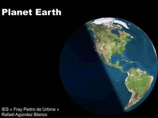
  • 1. Planet Earth IES « Fray Pedro de Urbina » Rafael Agúndez Blanco
  • 2. 1. THE UNIVERSE 1.1. The Big-bang Le Big Bang was an event which led to the formation of the universe 14 000 millions years ago. The universe, originally in an extremely hot and dense state, has since cooled by expanding.
  • 3. 1. THE UNIVERSE 1.2. The celestial bodies A star is a very large ball of burning gas that releases energy.
  • 4. 1. THE UNIVERSE 1.2. The celestial bodies Elliptic galaxy Spiral galaxy A galaxy is a very large group of stars. Each galaxy contains thousands of stars. Bared-spiral galaxy
  • 5. 1. THE UNIVERSE 1.2. The celestial bodies  The Sun The Milky Way Galaxy eis the galaxy in which the Solar System is located..
  • 6. 1. THE UNIVERSE 1.2. The celestial bodies A supernova is a stellar explosion.
  • 7. 1. THE UNIVERSE 1.2. The celestial bodies A black hole is a region of universe so dense that absorbs even the light.
  • 8. 1. THE UNIVERSE 1.3. The dimensions of the universe A light year is the distance that light travels in a year. The light-year is used to measure distances to stars and other distances on a galactic scale. The speed of light is 300 000 km/s, so a light year is equal to 9 trillion kilometres.
  • 9. 1. THE UNIVERSE 1.3. The dimensions of the universe The scale of the distances between the celestial bodies that is represented in books is not real. If the Sun was a beach ball of 1 m in diameter, Earth would be a marble at a distance of 108 m; and Pluto, a pea at 4,7 km.
  • 10. 1. THE UNIVERSE 1.3. The dimensions of the universe The size of celestial bodies is often misrepresented too. Earth Venus Mars Mercury The moon
  • 11. 1. THE UNIVERSE 1.3. The dimensions of the universe Jupiter Saturn Uranus Neptune
  • 12. 1. THE UNIVERSE 1.3. The dimensions of the universe The Sun Jupiter
  • 13. 1. THE UNIVERSE 1.3. The dimensions of the universe The Sun Earth is not visible on this scale
  • 14. 1. THE UNIVERSE 1.3. The dimensions of the universe
  • 15. 2. SOLAR SYSTEM The Sun Terrestrial Gas planets giants Mercury Venus Earth Mars Jupiter Saturn Uranus Neptune The Solar System is the planetary system formed by the Sun, the eight planets, theirs natural satellites (moons) and other small bodies (asteroids, comets, meteorites, etc.).
  • 16. 2. SOLAR SYSTEM The Sun Terrestrial Gas planets giants Mercury Venus Earth Mars Jupiter Saturn Uranus Neptune The inner planets, also called the terrestrial planets, are composed of rocks; the outer planets or gas giants are composed of gases.
  • 17. 2. SOLAR SYSTEM 2.1. Mercury Mercury is the innermost and smallest planet in the Solar System, orbiting the Sun once every 88 Earth days. It keeps the same face directed towards the Sun, so the surface temperature ranges from 427 ºC in one hemisphere to -183 ºC in the other.
  • 18. 2. SOLAR SYSTEM 2.2. Venus Venus is the hottest planet of the Solar System because of its greenhouse effect. The surface temperature is over 460 ºC. After the Moon, it is the brightest natural object in the night sky,
  • 19. 2. SOLAR SYSTEM 2.3. Earth Earth is currently the only place in the universe where life is known to exist. The abundance of water on Earth's surface is a unique feature that distinguishes the "Blue Planet" from others in the Solar System.
  • 20. 2. SOLAR SYSTEM 2.4. The Moon Earth formed as a result of a giant impact: a planet hit the Earth, blasting material into orbit, which accreted to form the Moon.
  • 21. 2. SOLAR SYSTEM 2.4. The Moon The Moon is Earth's only natural satellite. The Earth-Moon distance is about 400 000 km, which is about 30 times the diameter of the Earth. The Moon is the only celestial body on which humans have made a manned landing.
  • 22. 2. SOLAR SYSTEM 2.5. Mars Mars is called the “Red Planet”. The average temperature is about -63 ºC. Mars has two permanent polar ice caps, which are two km thick.
  • 23. 2. SOLAR SYSTEM 2.5. Mars Mars has a very rugged topography: Olympus Mons is the highest known mountain within the Solar System, and Valles Marineris, the largest canyon (4 000 km long and up to 7 km deep). 27 000 m Olympus Mons 8 000 m Everest
  • 24. 2. SOLAR SYSTEM 2.6. Jupiter Jupiter is the largest`planet within the Solar System.
  • 25. 2. SOLAR SYSTEM 2.6. Jupiter Jupiter consists of a rocky core and a surrounding layer of gases.
  • 26. 2. SOLAR SYSTEM 2.6. Jupiter The Great Red Spot is a persistent storm that is larger than Earth. Winds around the edge of the spot peak at about 700 km/h (a hurricane in the Earth is 200 km/h)
  • 27. Jupiter has 63 named natural 2. SOLAR SYSTEM satellites. The four largest moons 2.6. Jupiter are known as the "Galilean moons". Most scientists believe that a layer of liquid water exists beneath Io Europa's surface, which could allow extraterrestrial life. Europa Ganymede Callisto
  • 28. 2. SOLAR SYSTEM 2.7. Saturn Saturn is probably best known for its system of planetary rings, which are composed of water ice.
  • 29. 2. SOLAR SYSTEM 2.8. Uranus Uranus moves around the Sun with its rotation axis nearly horizontal.
  • 30. 2. SOLAR SYSTEM 2.9. Neptune Neptune completes an orbit every 165 years. Wind speeds can reach 2 000 km/h.
  • 31. 2. SOLAR SYSTEM 2.10. Pluto Pluto is considered a dwarf planet because of its size.
  • 32. 3. THE EARTH’S MOVEMENTS 3.1. Earth’s rotation Earth’s rotation is the motion of Earth around its own axis. It takes the Earth about 24 hours to finish one complete rotation.
  • 33. 3. THE EARTH’S MOVEMENTS 3.2. Earth’s orbit Earth’s rotation is the motion of Earth around the Sun. It takes the Earth about 365 days to finish one complete orbit.
  • 34. 3. THE EARTH’S MOVEMENTS 3.2. Earth’s orbit The Sun Ecliptic Erath orbits the Sun in a counterclockwise direction. The plane of the ecliptic is the plane of the Earth’s orbit around the Sun. This orbit seems a circle, but it is slightly elliptical.
  • 35. 3. THE EARTH’S MOVEMENTS 3.2. Earth’s orbit July 4 January 4 Aphelion Perihelion The Sun The Sun is not in the center of the orbit. The closest point to the Sun in a planet’s orbit is called perihelion. The furthest point is called aphelion.
  • 36. 3. THE EARTH’S MOVEMENTS 3.3. Axial tilt 23º Ecliptic The rotation axis is not perpendicular to the ecliptic plane: the Earth has an axial tilt of 23º.
  • 37. 3. THE EARTH’S MOVEMENTS 3.3. Axial tilt The axial tilt was probably caused by an asteroid impact.
  • 38. 3. THE EARTH’S MOVEMENTS 3.3. Axial tilt Rays of sunshine December 21 The axial til is the cause of the seasons: on december 21 the southern hemisphere receives more energy than the northern hemisphere.
  • 39. 3. THE EARTH’S MOVEMENTS 3.3. Axial tilt Rays of sunshine June 21 On the other hand, June 21 the northern hemisphere receives more energy than the northern hemisphere.
  • 40. 3. THE EARTH’S MOVEMENTS 3.3. Axial tilt Vernal equinox (Mars 21) Winter solstice (December 21) Summer solstice (June 21) Autumn equinox (September 22) A solstice occurs twice a year, when the center of the Sun reaches its northernmost or southernmost extremes.
  • 41. 3. THE EARTH’S MOVEMENTS 3.3. Axial tilt Vernal equinox (Mars 21) Winter solstice (December 21) Summer solstice (June 21) Autumn equinox (September 22) An equinox occurs twice a year, when the center of the Sun is in the same plane as the Earth’s equator.
  • 42. 3. THE EARTH’S MOVEMENTS 3.3. Axial tilt Juin 21 The axial tilt is the cause of the differences between the daytime and the night-time. On the equator, every daytime has a length of 12 hours, but the differences increase with the latitude. For example, on June 21, at the Arctic Circle, the daytime has a length of 24 hours; on the other hand, at the Antarctic Circle, the daytime has a length of 0 hours.
  • 43. 3. THE EARTH’S MOVEMENTS 3.3. Axial tilt The polar day or midnight sun is a natural phenomenon occurring inside the Polar Circles, where the sun remains visible at the local midnight.
  • 44. 3. THE EARTH’S MOVEMENTS 3.3. Axial tilt Spitzbergen The number of days per year with potential midnight sun increases the farther poleward one goes. Alaska
  • 45. 3. THE EARTH’S MOVEMENTS 3.3. Axial tilt Midnight Sun in Norway
  • 46. 3. THE EARTH’S MOVEMENTS 3.3. Axial tilt Locations that are south of the Arctic Circle or north of the Antarctic Circle experience midnight twilight. The sun is only 6º below the horizon, so that daytime activities, such as reading, are still possible without artificial light.
  • 47. 3. THE EARTH’S MOVEMENTS 3.3. Axial tilt The Polar Night in Norway The polar night is a natural phenomenon occurring inside the Polar Circles, where the night lasts for more than 24 hours.
  • 48. 3. THE EARTH’S MOVEMENTS 3.4. The moon as seen from Earth The lunar phases vary cyclically as the Moon orbits the Earth.
  • 49. 3. THE EARTH’S MOVEMENTS 3.4. The moon as seen from Earth New moon First quarter moon Full moon Last quarter moon
  • 50. 3. THE EARTH’S MOVEMENTS 3.4. The moon as seen from Earth Eclipses can only occur when the Sun, Earth and Moon are all in a straight line.
  • 51. 3. THE EARTH’S MOVEMENTS 3.4. The moon as seen from Earth Lunar eclipses occur near a full moon, when the Earth is between the Sun and Moon.
  • 52. 3. THE EARTH’S MOVEMENTS 3.4. The moon as seen from Earth Solar eclipses occur near a new Moon, when the moon is between the Sun and Earth.
  • 53. 3. THE EARTH’S MOVEMENTS 3.4. The moon as seen from Earth There are four types of solar eclipses: Partial eclipse Annular eclipse Total eclipse
  • 54. 3. THE EARTH’S MOVEMENTS 3.4. The moon as seen from Earth Total solar eclipses are rare events. Although they occur somewhere on Earth every 18 months on average, they recur at ay given place only once every 370 years, on average.
  • 55. 4. LA RÉPRÉSENTATION DE LA TERRE 4.1. Les mesures de la Terre Ératosthène était un astronome, géographe, philosophe et mathématicien grec du IIIe siècle av. J.-C. Il dirigeait la bibliothèque d’Alexandrie.
  • 56. 4. LA RÉPRÉSENTATION DE LA TERRE 4.1. Les mesures de la Terre Alexandrie Il a déduit que la Terre était ronde : le 21 juin, il a remarqué qu'il n'y avait aucune ombre dans un obélisque à Syène ; néanmoins, le même jour à la même heure, un autre obélisque situé à Alexandrie formait une ombre. Syène Syène Alexandrie
  • 57. 4. LA RÉPRÉSENTATION DE LA TERRE 4.1. Les mesures de la Terre Pour déduire la circonférence de la Terre, il a mesuré l’angle formé par l’obélisque et l’ombre (7º); et la distance entre Alexandrie et Syene (780 km). 7º Pourriez-vous calculer le Alexandrie résultat ? Syène
  • 58. 4. LA RÉPRÉSENTATION DE LA TERRE 4.1. Les mesures de la Terre Pour déduire la circonférence de la Terre, il a mesuré l’angle formé par l’obélisque et l’ombre (7º); et la distance entre Alexandrie et Syène (780 km). 7º Pourriez-vous calculer le Alexandrie résultat ? Voilà une piste. 7º Syène
  • 59. 4. LA RÉPRÉSENTATION DE LA TERRE 4.1. Les mesures de la Terre Pour déduire la circonférence de la Terre, il a mesuré l’angle formé par l’obélisque et l’ombre (7º); et la distance entre Alexandrie et Syène (780 km). 7º Pourriez-vous calculer le Alexandrie résultat ? Voilà une piste. 7º Syène 7 _______ 780 360 _______ x
  • 60. 4. LA RÉPRÉSENTATION DE LA TERRE 4.1. Les mesures de la Terre Pour déduire la circonférence de la Terre, il a mesuré l’angle formé par l’obélisque et l’ombre (7º); et la distance entre Alexandrie et Syène (780 km). 7º Pourriez-vous calculer le Alexandrie résultat ? Voilà une piste. 7º Syène 7 _______ 780 360 _______ x (360 x 780)/7 = 40 114 km
  • 61. 4. LA RÉPRÉSENTATION DE LA TERRE 4.1. Les mesures de la Terre Le mètre est la dix millionième partie du quart terrestre ; alors la circonférence de la Terre est 40 000 km.
  • 62. 4. LA RÉPRÉSENTATION DE LA TERRE 4.2. Les coordonnées géographiques Pour localiser un point de la Terre on utilise le système de coordonnées géographiques, qui détermine la longitude et la latitude de ce point.
  • 63. 4. LA RÉPRÉSENTATION DE LA TERRE 4.2. Les coordonnées géographiques 90º N La latitude est la distance 80º N angulaire d’un point à 60º N l’équateur. 40º N Pour mesurer la longitude on utilise les parallèles, lignes imaginaires tracées autour de 20º N la Terre. 40º Équateur 0º 20º S 40º S 60º S 80º S 90º S
  • 64. 4. LA RÉPRÉSENTATION DE LA TERRE 4.2. Les coordonnées géographiques L'équateur est leparallèle qui 66º N marque la séparation entre Cercle Arctique l'hémisphère nord et l'hémisphère sud. Les tropiques sont les 23º N parallèles qui correspondent Tropique du Cancer au passage du Soleil à chacun des solstices. Équateur 0º Les cercles polaires sont les parallèles qui marquent la limite du jour polaire. Tropique du Capricorne 23º S Cercle Antarctique 66º S
  • 65. 4. LA RÉPRÉSENTATION DE LA TERRE 4.2. Les coordonnées géographiques La longitude est la distance angulaire d’un point au méridien d’origine (méridien de Greenwich). Pour mesurer la longitude on utilise les méridiens, lignes imaginaires qui relient le pôles géographiques. Méridien de Grenwich 90º E 90º E 90º O 135º E 45º E 45º 180º 0º 45º O 135º O 90º O
  • 66. 4. LA RÉPRÉSENTATION DE LA TERRE 4.2. Les coordonnées géographiques On utilise les méridiens pour Un fuseau horaire est une zone de la déterminer les fuseaux horaires. surface terrestre où l'heure adoptée doit être identique en tout lieu.
  • 67. 4. LA RÉPRÉSENTATION DE LA TERRE 4.3. Les points cardinaux Un point cardinal est l'une des quatre principales directions d'une boussole sur un plan : nord, est, sud et ouest. En plus des quatre points cardinaux, il est possible de construire des points intermédiaires (ou points inter cardinaux) : nord-est, sud-est, sud- ouest et nord-ouest. Les points cardinaux sont représentés sur les cartes géographiques par une rose des vents.
  • 68. 4. LA RÉPRÉSENTATION DE LA TERRE 4.3. Les points cardinaux À midi, dans l’hémisphère nord notre ombre indique le nord.
  • 69. 4. LA RÉPRÉSENTATION DE LA TERRE 4.3. Les points cardinaux Une autre manière de trouver le nord est utiliser la montre : d’abord, on met la montre à l'heure du soleil (tu la recules 11 12 1 S d'une heure) ; après, on pointe le 12 vers le 10 2 soleil ; la bissectrice entre la petite 9 3 aiguille et le 12 indique le sud. 8 4 7 5 6
  • 70. 4. LA RÉPRÉSENTATION DE LA TERRE 4.4. La projection cartographique La projection cartographique est un ensemble de techniques qui permettent de représenter la surface de la Terre sur la surface plane d'une carte. Projection Projection Projection cylindrique conique azimutale
  • 71. 4. LA RÉPRÉSENTATION DE LA TERRE 4.4. La projection cartographique La projection de Mercator est une projection cylindrique. Il s'agit d'une projection conforme, c’est-à-dire qu'elle conserve les angles et les formes des continents; ceci la rend particulièrement utile aux marins
  • 72. 4. LA RÉPRÉSENTATION DE LA TERRE 4.4. La projection cartographique La projection de Peters est une C’est une projection équivalente autre projection cylindrique. (maintient la taille réelle des continents).
  • 73. 4. LA RÉPRÉSENTATION DE LA TERRE 4.4. La projection cartographique Comparaison de la projection de Mercator et celle de Peters.
  • 74. 4. LA RÉPRÉSENTATION DE LA TERRE 4.4. La projection cartographique Exemples de projection conique.
  • 75. 4. LA RÉPRÉSENTATION DE LA TERRE 4.4. La projection cartographique Exemple de projection azimutale
  • 76. 4. LA RÉPRÉSENTATION DE LA TERRE 4.4. La projection cartographique Un autre type de projection
  • 77. 4. LA RÉPRÉSENTATION DE LA TERRE 4.4. La projection cartographique L’élection du type de carte dépend souvent de motivations politiques.
  • 78. 4. LA RÉPRÉSENTATION DE LA TERRE 4.5. L’échelle cartographique Échelle numérique  1 : 100 000 Échelle graphique  0 1 2 3 4 5 km L’échelle est le rapport qui existe entre une longueur et sa représentation sur la carte. L’échelle numérique est une fraction L’échelle graphique est une ligne qui indique le rapport qui existe entre graduée, divisée en parties égales, une longueur et sa représentation sur qui indique le rapport qui existe entre la carte ; par exemple, à l'échelle de une longueur et sa représentation 1 : 100 000, 1 cm représente 1 km. sur la carte.
  • 79. 4. LA RÉPRÉSENTATION DE LA TERRE 4.5. L’échelle cartographique Un plan est une carte à grande échelle ; le dénominateur de l’échelle est égal ou inférieur à 10 000.