
Recomendados
Recomendados
Mais conteúdo relacionado
Mais de preservationcombination
Mais de preservationcombination (20)
Evaluating Historic Roadway Improvements
- 2. Project overview Evaluation of the roadway corridor and limits Challenges of having a historic road corridor within the proposed project Public involvement
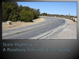
- 7. Current Construction Limits Previous Construction Limits WPA Project Number 16344
- 8. Culverts
- 9. Culverts
- 10. Widened culverts
- 12. Rock wall on Kimberlin Mountain
- 13. Rock wall on Kimberlin Mountain
- 14. Significance under Criterion A and Criterion C Character-defining features ◦ Alignment ◦ Masonry workmanship ◦ Pavement (?) NRHP-eligible boundaries
- 15. WPA Project Number 16344
- 16. Widened culverts
- 19. Environmental constraints and other constraints Working with multiple consulting parties and government agencies Engineering reassessment of project scope and activities Mitigation development (on-going)
- 20. Historic Resources Brazos River Nature Trail
- 21. Golden-cheeked Warbler and Brazos River – Potential Black-capped Vireo Habitat Interior Least Tern Habitat, Mussel Sanctuary, and Riparian Vegetation
- 22. Consulting Parties ◦ Preservation Texas, Inc. ◦ Affected property owner ◦ Palo Pinto County Historical Commission (Includes County Judge) Agencies ◦ Texas Parks and Wildlife ◦ U.S. Fish and Wildlife ◦ Brazos River Authority ◦ County Commissioners ◦ Texas State Historic Preservation Office
- 26. Existing SH 16 on Kimberlin Mountain
- 27. QUESTIONS?
Notas do Editor
- As Kara noted, I work for Blanton & Associates, an environmental consulting firm in Austin, Texas. We were hired by the Texas Department of Transportation (also known as TxDOT) to complete a survey of a road in North central Texas called State Highway 16, which is the focus of this presentation.
- This presentation will outline: an overview of the area and some project history how the roadway was evaluated for the National Register how the limits of the road were determined implications of our work on the overall project development, such as completing a Section 4(f) evaluation for the road corridorAND public involvement that was completed for the project
- So this is the project. …It’s a safety improvement project to widen/add shoulders and avoid a curve by building a new alignment section HERE at a location called Kimberlin Mountain. And, originally, the project called for replacing the Brazos River bridge HERE>The construction limits are where the project activities will occur and the project limits reflect our study limits (based on NEPA requirements).Now the main thing all of us knew going into this project was that the road had been determined NRHP-eligible in the 1990s as part of a statewide survey of Depression-era resources. However, We knew we were going to have to re-evaluate the road We weren’t sure what the integrity of the road and its associated resourcesWe knew that we were going to have to assess the roadway limits again.
- Before I give you a run-down of the project, I want to give you some understanding of this area and the issues facing the project planners, this photograph is a great depiction of what the area looks like.Point out:Brazos River - one of the major rivers in central Texas that extends from north central Texas to the Gulf of Mexico Hilly terrain – this photo was taken atop a sheer cliff that was 350 feet above the river. (Eagle survey vantage point.) Road/BridgePossum Kingdom Dam – Built by the WPA in the early 1940s. Behind the dam is Possum Kingdom Lake – NOTE THE RECREATION IN THE AREA Possum Kingdom State Fish hatchery – Constructed between 1947 and 1950One of seven fresh water fish hatcheries in the state run by Texas Parks and Wildlife Dept.Water treatment plantRanch landOil and Natural gas wells and pipelines throughout the area.Endangered bird habitatKimberlin Mountain (135 feet above valley floor) – HERE
- So this is Kimberlin Mountain – don’t laugh – which is the focus of the project. The combination of a steep grade of the road (7%) and sharp curve (turning radius of 245 feet – doesn’t meet design criteria, which needs to be 275 feet)have resulted in a disproportionate number of accidents on Kimberlin Mountain. To give you some idea - since 1992, there have been 115 recorded accidents within the construction limits, which is 6 miles long. Nearly 40 percent of all accidents have occurred within the one-mile segment where Kimberlin Mountain is located and almost half of injury accidents recorded on the road have occurred on Kimberlin Mountain. NEXT SLIDE.
- When you’re on the road, this is what the Kimberlin Mountain section of the road looks like. It has a steep hill and a sharp, blind curve.This is a 60 mph road and this section of road has a cautionary speed limit of 25 mph, which catches many drivers off guard. There has been a fatality here in this curve in the last several years and according to the accident data gathered for this project, it appears that this is the most difficult portion of the road for drivers to navigate.What’s happens quite often is the large vehicles that use the road can’t stay within their lane. Note the 18-wheeler truck with its front wheels on the center line and its back wheels off the pavement. On this road, we have:Recreational vehiclesTractor trailers Oil/Natural Gas trucksBRA trucks (only access to downstream side of the dam is from SH 16).
- So we know the road within our construction limits was built by the WPA. So when we were tasked with re-evaluating the road, we had to look at the full extent of the WPA project. The entire WPA project was 27.75 miles long and was built in the early 1940s. As you’ll see here’s the Possum Kingdom dam I showed you earlier. The road was constructed from the Brazos River near the dam to Salesville (the nearest railhead) to bring construction materials to the dam. 1997 Statewide Depression-era Survey undertaken by Texas Historical Commission (where the SHPO is housed) in cooperation with TxDOT. That statewide survey established registration requirements for Depression-era road corridors and structures in consultation with the NPS.Had to be a documented WPA projectHad to illustrate make-work/labor-intensive projectsNo widening allowedThe study inventoried extant depression-era resources and conducted research of primary sources (WPA records) to determine NRHP eligibility for individual resources and historic districts. The study found a section of the highlighted road was determined to be one of 13 depression-era corridors in the stateExact boundaries of the NRHP eligible road were unclear.10 culverts, 1 bridge (Brazos River Bridge) HERE>, and the rockwall on Kimberlin Mountain HERE> were determined eligible as a historic district, which extended into our current project.The Brazos River Bridge determined individually eligible, which was also located in our project.In 2002, an upgrade of a section of SH 16 immediately south of our current construction limits was proposed and included several of the resources determined eligible by the 1997 survey located HERE> the 2002 Project called for widening road to have 8-foot shoulders.To avoid widening the culverts, engineers built 4-foot shoulders instead.So B&A surveyed the road resources in the project limits, which included resources south of the construction limits HERE in this section.
- We found a number of masonry culverts, such as this one. We took GPS data points to make sure they were mapped in exactly the correct locations since there were some discrepancies with previous surveys of these types of resources.
- We also found several small culverts that were not identified in the 1997 and 2002 surveys. We did this in cooperation with a biologist who could identify where stream or drainage crossings were likely to be. NEXT SLIDE
- We also found several culverts that had been widened along the road. Here is one within the project area. These culverts within the project area had been widened by local maintenance forces with street signs that were used to form the concrete. Work like this makes Section 110 obligations very challenging for the agency.
- Here’s a photograph of the Brazos River Bridge. GIVE STATS ON BRIDGE>>>The bridge is an 18-span masonry arch bridge with earthen-filled spandrels and a concrete deck. It has 11-foot travel lanes and no shoulders.The bridge is a landmark in the area and public involvement revealed that the local and state officials were interested in saving the bridge – as a result, replacing the bridge was taken out of consideration for the project.
- While there are some smaller rock walls that were built throughout the area, the longest one is located on Kimberlin Mountain. This wall acts as a guardrail, although it doesn’t work very well. Note the leaning masonry in the foreground, which appears to have been hit and this one which was been replaced.NEXT SLIDE
- Here’s another view of the wall. Note the steep drop off on the left. NEXT SLIDE
- So, after our survey work we began to look at NRHP eligibility for the road, which was really a four-part process which began with reviewing the 1997 determination of eligibility and seeing if we agreed with that determination, determining a period of significance, the character-defining features, and the NRHP-eligible boundaries.SIGNIFICANCEWe found that based on the 1997 statewide Depression-era Survey, the research completed for that survey was accurate and we found no new information to refute the determination. Furthermore, we supported the significance finding of the 1997 survey and we recommended to TxDOT that the road (and the Bridge individually) was still eligible for Criterion A (Events) and Criterion C (Engineering). Under Criterion A, the road and bridge are both documented WPA projects that employed hundred of workers and provided work relief for skilled and unskilled laborers.Also under Criterion A, the roadway and bridge provided the main north/south access to the dam, which was and is a major infrastructure facility in the area. As such, the road and the bridge played a critical role in the construction of the dam and in the development of the area. Under Criterion C, the roadway features and the bridge are true representations of masonry construction that was typical of WPA work relief projects.The culverts, bridge, and masonry guard wall exhibit the use of hand-labor workmanship and exhibit a harmonious blending of the transportation resources with the surroundings. It should be noted that the 1997 survey determined the roadway and bridge eligible at the state level of significance and rather than forming an argument for local significance when the road was already eligible, we maintained the state level significance call. CHARACTER-DEFINING FEATURESIn determining the character-defining features of the road, we determined that the Alignment and the Masonry Workmanship were the character-defining features. Alignment – WPA records regarding the construction of the road indicate that the roadway alignment was determined by the location for the movement of people and goods. The realignment of the road denotes integrity of location, setting, design, workmanship, and feeling.Masonry workmanship – the masonry structures were representative of the WPA make-work program and the hand-labor required for the construction of the structures was important and integral to the design of the road according to the WPA records. They used locally quarried rock and used the materials that were readily available at the project site. Some of the larger culverts and the work on the masonry arch bridge illustrates superior masonry techniques that aren’t seen in other areas of the state or in the region. The masonry features help the roadway to retain integrity of setting, design, materials, workmanship, and feeling. We considered if pavement material would be a character-defining feature, but determined that there was no special pavement material noted in the WPA records for the road and TxDOT records showed that the agency had resurfaced and repaved the roadway with asphalt several times from the 1950s through the 1990s. Regardless, the pavement material wouldn’t have been able to convey any potential significance if we had no indication that it was different from any other roadway type.NEXT SLIDE
- So, when it came to determining the limits of the NRHP-eligible roadway, we followed the southern limits were easy as they were the southern limits of the WPA project. There were still intact, unwidened masonry culverts directly adjacent to the southern terminus of the WPA project. The northern limits were more difficult. Research showed that the SH 16, which turns northwest HERE was not built by the WPA. Since there were several WPA projects in this county, we checked every culvert for several miles on SH 16 outside limits of WPA project number 16344 just to be sure. What we found was that the blue highlighted line really did represent the only WPA-built road in the area so we focused our efforts on finding the northern limits of the roadway along SH 16 and SH 254 HERE. NEXT SLIDE
- We stopped at every single culvert for several miles outside the project limits, we found every masonry culvert had been widened, such as the one shown here. As you can imagine, this was a time-consuming effort, but it was worth the time so we could be sure we had the correct NRHP eligible boundaries. Also, we discovered through research that several portions of the roadway north of the project limits had been realigned.
- So, once we determined that the only intact concentration of depression era resources, we stopped the NRHP-eligible roadway HERE at the SH 16/SH 254 intersection. NEXT SLIDE
- Here’s another perspective, note north is to the right. Here are the limits again showing the contributing resources in red and non-contributing resources in yellow. POINT OUT CULVERTS, BRIDGE, ROCK WALLCLICKSo, the main area of interest with project is Kimberlin Mountain because this is where all of the adverse effects are occurring. To create a gradual vertical curve, they are placing fill HERE at the base of Kimberlin Mountain, which will bury this culvert , realign this section of road, and cut off access to the rock wall HERE. As an aside, the engineers figured out that they could widen/add shoulders without widening any of the culverts.
- While project engineers also had to consider the historic resources, they also had some other environmental issues to contend with ... They had another Section 4(f) Resource on the north side of the Brazos River within the project area – a publicly owned recreational facility.
- The area is also surrounded by potential habitat for two endangered song birds – Golden Cheeked Warbler and Black-capped vireo. There is also potential interior least tern habitat in the Brazos River. These endangered species are protected by the Endangered Species Act and are under the jurisdiction of the U.S. Fish and Wildlife Service.
- Talk about why these guys are all involved and their diverging interests.Talk about many meetings with them…including the December 2011 meeting.
- No bridge to be replaced. Note why
- We originally had 13 alternatives, then refined it to 5. 3 of the 5 alternatives called for replacing the bridge so the engineers re-evaluated the need to replace the bridge and decided they didn’t have to.Then we got down to 3 alternatives.
- Narrower road than originally conceived.
- Talk about the discussions regarding ownership… property owner wants one thing, county wants another. Balancing desires hard, but almost done with mitigation agreements. We are continuing to work with the consulting parties to find a solution that everyone is comfortable with.THIS IS THE LAST SLIDE