FULL ENJOY Call Girls In Majnu Ka Tilla, Delhi Contact Us 8377877756
Approach and landing procedures 2013
1. 03/06/2013
1
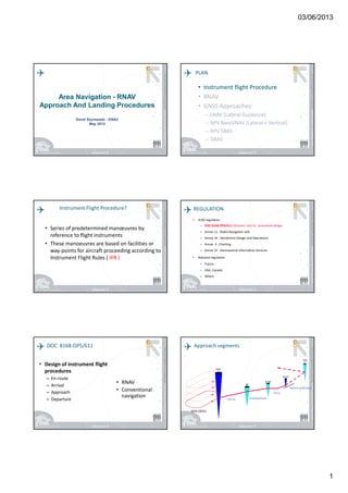
Area Navigation - RNAV
Approach And Landing Procedures
David Szymanski - ENAC
May 2013
PLAN
• Instrument flight Procedure
• RNAV
• GNSS Approaches:
– LNAV (Lateral Guidance)
– APV BaroVNAV (Lateral + Vertical)
– APV SBAS
– GBAS
• Instrument flight Procedure
• RNAV
• GNSS Approaches:
– LNAV (Lateral Guidance)
– APV BaroVNAV (Lateral + Vertical)
– APV SBAS
– GBAS
Instrument Flight Procedure?
• Series of predetermined manœuvres by
reference to flight instruments
• These manoeuvres are based on facilities or
way-points for aircraft proceeding according to
Instrument Flight Rules ( IFR )
REGULATION
• ICAO regulation
– DOC 8168-OPS/611 (Volume I and II) : procedure design
– Annex 11 : Radio Navigation aids
– Annex 14 : Aerodrome Design and Operations
– Annex 4 : Charting
– Annex 15 : Aeronautical Information Services
• National regulation
– France
– USA, Canada
– Others
DOC 8168-OPS/611
• Design of instrument flight
procedures
– En-route
– Arrival
– Approach
– Departure
• RNAV
• Conventional
navigation
IAF
IF
FAF
MAPT
TP
HOLDING
INITIAL INTERMEDIATE
FINAL
MISSED APPROACH
Approach segments
2. 03/06/2013
2
Fixes and Segments
Straight Radioguided segment
Curve radioguided segment
Dead-reckoning segment
AIRCRAFT CATEGORY
• Five categories : From A to E (H) :
– Max and Min Speed (IAS) known by pilots and designers
(regulation tables)
• Possible speed limitation
– Obstructions
– ATC constraints
– Environmental contraints
– MUST be displayed on the chart
INITIAL
APPROACH
FINAL
APPROACH
CIRCLING MISSED APPROACH
Maximum speedCat.
Vat
Min Max Min Max Max Initial and
Intermediate
Final
A <<<< 91 90 150 (110*) 70 100 100 100 100
B 91 / 120 120 180 (140*) 85 130 135 130 150
C 121 / 140 160 240 115 160 180 160 240
D 141 / 165 185 250 130 185 205 185 265
E 166 / 210 185 250 155 230 240 230 275
SPEEDS TABLE : IAS
unit kt
PROTECTION AREA
• Protection area data
– Nominal trajectory
– Flight technical tolerances (FTT)
– Fix tolerance
– Wind effect
• Segment protected by a protection area
Fix 1
Fix 2
Fix 3
FTT : Reaction delay
Bank delay
Consecutive segments PLAN
• Instrument flight Procedure
• RNAV
• GNSS Approaches:
– LNAV (Lateral Guidance)
– APV BaroVNAV (Lateral + Vertical)
– APV SBAS
– GBAS
• Instrument flight Procedure
• RNAV
• GNSS Approaches:
– LNAV (Lateral Guidance)
– APV BaroVNAV (Lateral + Vertical)
– APV SBAS
– GBAS
3. 03/06/2013
3
A B
C
D
E
F
RNAV: AREA NAVIGATION
Shorter Routes ….
More Routes Possible ...
RNAV approach trajectory
RNAV POSITIONING METHOD
• The RNAV system
– identifies the next waypoint,
– selects the most appropriate source of
navigation to determine its position
– provides information to the auto-pilot to fly
to the next waypoint.
• An RNAV route can be flown manually
WAYPOINT
• Waypoints expressed in WGS84 coordinates
– IAF, IF, FAF, MAPt, MAHF
– Arrival or departure waypoint
Fly-over waypoint
Fly-by waypoint
WP1 : FLY-OVER WP2 : FLY-BY
Stabilization distances are necessary
ALL RNAV TRAJECTORIES ARE CODED
INTO THE DATABASE
On board database
••Aerodrome dataAerodrome data
••Available navaidsAvailable navaids
•Flight paths to follow
(charts)
5. 03/06/2013
5
DF Protection Semi Area Width for RNAV
RNAV 5 EnRoute 5.77 Nm
RNAV 1 / RNAV 2
More than 30 Nm 5 Nm
Less than 30 Nm 2.5 Nm
RNPAPCH
Initial/ Intermediate 2.5Nm
Final 0.95Nm
Missed Approach 2 Nm
Type of waypoint
PATH Terminator
Coding influence
Nominal trajectory
Protection Area
PLAN
• Instrument flight Procedure
• RNAV
• GNSS Approaches:
– LNAV (Lateral Guidance)
– APV BaroVNAV (Lateral + Vertical)
– APV SBAS
– GBAS
• Instrument flight Procedure
• RNAV
• GNSS Approaches:
– LNAV (Lateral Guidance)
– APV BaroVNAV (Lateral + Vertical)
– APV SBAS
– GBAS
GNSS integrity monitoring
• GNSS integrity monitoring techniques aim at monitoring GNSS
positioning
• Large variety of techniques:
– In an autonomous manner (ABAS) :
• Using only redundancy of GNSS measurements (RAIM)
• Using additional information from other sensors (AAIM)
– Using a ground station (GBAS)
– Using a network of ground stations (SBAS)
ICAO GNSS CONCEPT
GLOBAL NAVIGATION SATELLITE SYSTEM
AUGMENTATION
SATELLITE
BASED
(SBAS)
GEOSTATIONARY
EGNOS
WAAS
MTSAS
GROUND
BASED
(GBAS)
ON BOARD
ABAS)
A.A.I.M
R.A.I.M
GAGAN
6. 03/06/2013
6
Approche GNSS : RNP APPROACH
• RNP APCH = Sensor used GNSS with Augmentation
• RNP 1 (1 NM of Accuracy) for initial, intermediate and missed
approach segments
• RNP 0.3 for final
• No vertical guidance :
– LNAV
• vertical guidance :
–– Baro VNAV, SBAS, GBASBaro VNAV, SBAS, GBAS
WHICH AUGMENTATION FOR WHICH KIND
OF APPROACH ?
ABAS Non Precision Approach NPA
+ VNAV: APproach with Vertical Guidance
APV baroVNAV
SBAS APproach with Vertical Guidance
APV I and II
GBAS Precision Approach
PLAN
• Instrument flight Procedure
• RNAV
• GNSS Approaches:
– LNAV (Lateral Guidance)
– APV BaroVNAV (Lateral + Vertical)
– APV SBAS
– GBAS
• Instrument flight Procedure
• RNAV
• GNSS Approaches:
– LNAV (Lateral Guidance)
– APV BaroVNAV (Lateral + Vertical)
– APV SBAS
– GBAS
Non Precision Approach : LNAV
LNAV Protection Areas LNAV : OCH Computation
• Assessment of Obstacles in Protection
Area : Hobst
• Add MOC (Minimum obstacle Clearance)
– Same whatever the Aircraft Category
• OCH = Hobst + MOC
• Minima Box Line : LNAV
7. 03/06/2013
7
RNAV NPA :
LNAV Approaches
• 2D RNAV = LNAV
• RNAV system provides
lateral guidance in final
segment
– ABAS as minimum
HOW TO FLY VERTICALLY NPA ?
• Two different ways to FLY vertically :
– ‘Dive and Drive’
– ‘Stabilized approach’
• NO CONSEQUENCE on PROCEDURE
DESIGN
DIVE AND DRIVE
• Descend immediately to not below minimum step-
down fix altitude or MDA/H as appropriate.
• Descent gradient < 15%
• Missed approach initiated at, or before MAPt.
STABILIZED APPROACH
(CDFA)
• Continuous descent gradient to
– a point 50 ft above the threshold
– taking regard of minimum crossing altitude at FAF
and step-down fixes.
• Missed approach initiated :
– Visual reference not achieved approaching MDA/H
– Not permitted below MDA/H at any time
– Not permitted after MAPt
CDFA
50 FT
MOC
MDA
MAPt
DIVE and DRIVE
CDFA : A specific METHOD OF FLYING the FINAL approach segment of NPA on
pre-determined approach slope with continous descent to DA (H)
CDFA : Continuous Descent Final
Approach
3°°°°
FAF
Dive and
Drive mode
Stabilized
approach
8. 03/06/2013
8
APV : Approach with Vertical Guidance
APPROACH PROCEDURE WITH VERTICAL
GUIDANCE
• APV Approach Procedure with Vertical guidance:
An instrument procedure which utilizes lateral and vertical
guidance but DOES NOT MEET the requirements established
for PRECISION APPROACH and landing operations
• LATERAL and VERTICAL GUIDANCE in the FINAL segment
• 2 Types
– APV SBAS
• SBAS receiver on-board
– APV BaroVnav
• ABAS + VNAV capability
RNAV APV : SBAS
APV SBAS Protection Area (1)
APV SBAS Protection Area (2) APV SBAS (LPV) : OCH Computation
• Based on ILS methodology
• Obstacle Assessment Surfaces (W, W*, X, Y, Z)
• Height Loss (HL) instead of MOC (Vertical Guidance)
– Different Value for each Aircraft Category
• When penetration of obstacle
OCH = Hobst + HL
• Minima Box Line : LPV
– Different value per Aircraft Category
9. 03/06/2013
9
APV SBAS integrity
• Final Approach segment
integrity through a FAS
Data Block (including CRC)
• FAS Data Block in the SBAS
System
• Publication of FAS Data
block in AIP
APV SBAS :
LPV Approaches
• APV SBAS = LPV
• RNAV system
provides lateral and
vertical guidance in
final segment
– SBAS
RNAV APV : Baro VNAV
APV Baro VNAV : Protection Area
APV Baro VNAV OCH Computation
• Temperature dependant
• Obstacle Assessment Surfaces (FAS, Horizontal
Plane, Z)
• When penetration of obstacle
OCH = Hobst + MOC
• Minima Box Line : LNAV / VNAV
10. 03/06/2013
10
APV Baro VNAV :
LNAV / VNAV
• APV Baro VNAV = LNAV /
VNAV
• RNAV system provides
lateral and guidance in final
segment
• Vertical guidance through
Barometric altimeter
• RNAV System:
– ABAS + VNAV system
APV Baro VNAV : On going criteria
• On going criteria for Baro VNAV :
– Consistency with all vertical guidance (ILS,
MLS, SBAS, GBAS)
– Use of HL instead of MOC
– Different Position of surfaces regarding
existing criteria
RNAV Precision Approach : GBAS
APV GBAS (LPV) : OCH Computation
• Same principle as SBAS
• Obstacle Assessment Surfaces (W, X, Y, Z)
• Height Loss (HL) instead of MOC (Vertical
Guidance)
• When penetration of obstacle
OCH = Hobst + HL
RNAV GBAS : PRECISION
APPROACH
• LATERAL and VERTICAL
GUIDANCE in the FINAL
segment
– Only with GBAS
augmentation
• FAS Data Block send by
ground station to Aircraft
↸↸↸↸
PRECISION
APPROACH
•Horizontal guidance
•Vertical guidance
FAFMAPt
OCH
MOC
HL
OCH
FAP
DHDH
MDHMDH
NON PRECISION
APPROACH
•Horizontal guidance
APPROACH with
vertical guidance
11. 03/06/2013
11
SUMMING UP
Type of approach
Type of
guidance
MDA or DA Minima line
NPA lateral MDA LNAV
APV baroVNAV
Lateral
Vertical
DA LNAV/VNAV
APV SBAS
Lateral
Vertical
DA LPV
PA
Lateral
Vertical
DA
Title of procedure :
GLS
• Approaches are based on GNSS
– In PBN vocabulary : RNP APCH
– In AIS document : RNAV (GNSS)
• All different vertical guidance in one chart
(same Final + missed approach)
Publication
Capture
region
Capture Région
IAF
IAF
IAF
IF
FAF
MAPt
70°
INITIAL
SEGMENT
INTERMEDIATE
SEGMENT
FINAL
SEGMENT
Capture
region
TF coding
Y BAR DESIGN CONCEPT
•Flight time reduction
•Aligned on runway centerline
•Improve visualization of
markings and lightings
•Easy use ( piloting ,no
misunderstanding )
Y BAR Concept KEY POINT
• Standardization
• Easy design
• All GNSS receivers NPA certified could
proceed T or Y procedure
12. 03/06/2013
12
• Provide a vertical guidance
– ILS , APV BARO-VNAV, APV SBAS
• Provide a constant descent in final
approach
For CFIT PREVENTIVE MEASURE
KEY POINT CONCLUSIONS
• Different GNSS Approaches
• Only RNP APPROACH (NO RNAV)
• GNSS approaches : NPA, APV and PA
– Using augmentation:
» NPA : LNAV (ABAS)
» APV : - SBAS = LPV
- BaroVNAV = LNAV / VNAV
» PA : GBAS
• Obstacle assessment based on surfaces when
vertical guidance is provided (AV and PA)
GNSS
+
VNAV
+
ABAS receiver
BARO VNAV
WASS / EGNOS
+
SBAS Receiver
APV SBAS
Computed vertical
guidance and
barodependant
Geometric vertical
guidance based on
satellite information
Navigation Sensors associated with MDA
and DA
MDH higher than 300ft
NPA : GPS
HAL : 556m
HAL : 40m
VAL : 50m300ft< DH < 250ft
APV1 : SBAS
HAL : 40m
VAL : 35m300ft< DH < 200ft
LPV200 : SBAS
EGNOS, Galileo
HAL : 40m
VAL : 15 to 10m200ft = DH
GBAS catI
HAL : Horizontal Alarm Limit
VAL : Vertical Alarm Limit