Using VGI to create child suitable maps
•Download as PPTX, PDF•
0 likes•499 views

This is a presentation about how and why i intent to use the VGI of OpenStreetMap to create a digital map suitable for kids.

Recommended
Recommended
More Related Content
Similar to Using VGI to create child suitable maps
Similar to Using VGI to create child suitable maps (20)
Recently uploaded
Recently uploaded (20)
Using VGI to create child suitable maps
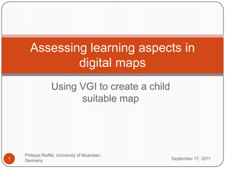
- 1. Using VGI tocreate a childsuitablemap September 16, 2011 Philippe Rieffel, University ofMuenster, Germany 1 Assessing learning aspects in digital maps
- 2. Who am I? September 16, 2011 Philippe Rieffel, University of Muenster, Germany 2 Philippe Rieffel, student of Geoinformatics from Muenster, Germany Student assistant with GI@School (www.gi-at-school.de) Our Mission: Introduce new concepts of Geoinformatics to teachers, pupils and parents
- 3. What do I do with OSM? September 16, 2011 Philippe Rieffel, University ofMuenster, Germany 3 Hobby Mapper Worked on some OSM (related) projectsduringmystudies Work with kids/students Introduction to OpenStreetMap/ VGI Actually go out, trace, edit and upload data to OpenStreetMap High levels of motivation amongst the kids
- 4. September 16, 2011 Philippe Rieffel, University of Muenster, Germany 4
- 5. September 16, 2011 Philippe Rieffel, University of Muenster, Germany 5
- 6. The actualtopicofthistalk September 16, 2011 Philippe Rieffel, University of Muenster, Germany 6 (Digital) Maps are undoubtly important for the process of spatial learning of kids, starting at very young ages We worked with several software products lately, even created some, that support spatial learning processes
- 7. September 16, 2011 Philippe Rieffel, University of Muenster, Germany 7
- 8. The actualtopicofthistalk September 16, 2011 Philippe Rieffel, University of Muenster, Germany 8 (Digital) Maps are undoubtly important for the process of spatial learning of kids, starting at very young ages We worked with several software products lately, even created some, that support spatial learning processes All lack the same problem NO basemap especially suitable for kids!
- 9. Motivation September 16, 2011 Philippe Rieffel, University of Muenster, Germany 9 Whyisthatstreetyellow on thismap? I seethatisgrey
- 10. September 16, 2011 Philippe Rieffel, University of Muenster, Germany 10
- 11. Kids need „easier“ maps! September 16, 2011 Philippe Rieffel, University of Muenster, Germany 11
- 12. First thoughts September 16, 2011 Philippe Rieffel, University of Muenster, Germany 12 Howshould a mapforkidslooklike? Remove unnecessaryfeatures off themap Usemore uniform signatures Useclearfontsand easy symbols
- 13. First thoughts September 16, 2011 Philippe Rieffel, University of Muenster, Germany 13 OSM offers a world-coveringdatabaseofgeodatawith a open licensingmodel Ifdataqualityisbad, everybodyisinvitedtocorrectthis Relatingtothekid´smotivation Technical setuptorender a self-styledmapforthewholeworldisrather easy to do (Not talkingaboutperformanceatthis time!!) Styling rulesallow easy creationofmaps
- 14. Structureofthe Project September 16, 2011 Philippe Rieffel, University of Muenster, Germany 14 Theoreticalanalysis How do kidsperceivetheirenvironment? Howisthatperception „stored“ in theirimagination? Howcanthatperceptionbetransferedinto a cartographicrepresentation?
- 15. Fundamental Spatial Concepts September 16, 2011 Philippe Rieffel, University of Muenster, Germany 15
- 16. Fundamental Spatial Concepts September 16, 2011 Philippe Rieffel, University of Muenster, Germany 16 Approach to formalize spatial information
- 17. Fundamental Spatial Concepts September 16, 2011 Philippe Rieffel, University of Muenster, Germany 17
- 18. September 16, 2011 Philippe Rieffel, University of Muenster, Germany 18 Scale Resolution Extent Feature Density Variability Map Scale Coverage
- 21. September 16, 2011 Philippe Rieffel, University of Muenster, Germany 21
- 22. September 16, 2011 Philippe Rieffel, University of Muenster, Germany 22
- 23. September 16, 2011 Philippe Rieffel, University of Muenster, Germany 23
- 24. Structureofthe Project September 16, 2011 Philippe Rieffel, University of Muenster, Germany 24 Practicalimplementation Usethemapnikrendererwith a custom style toaccomodatethefindingsfromthetheoreticalpart
- 25. Work so far September 16, 2011 Philippe Rieffel, University of Muenster, Germany 25 Survey at 3 Brazilianprimaryschoolsregardingsymbologyofmapsandmapunderstanding Literature on spatiallearningofkidssuggeststhatkidsorientalongcertainlandmarksandfeatures(Roads, Rivers, (local) centers, Institutions / POI´s) Symbologyused/understoodbykidsmightbequite different fromwhat „we“ use
- 26. Maporientation September 16, 2011 Philippe Rieffel, University of Muenster, Germany 26 Can youidentifytheareaofyourschoolandofyourhome?
- 27. Symbology I September 16, 2011 Philippe Rieffel, University ofMuenster, Germany 27
- 28. Symbology II September 16, 2011 28 Philippe Rieffel, University ofMuenster, Germany
- 29. Survey results September 16, 2011 Philippe Rieffel, University ofMuenster, Germany 29 Not in yet, since i just returnedfromBrazil last week Same survey will beconducted in Germany Results will beused in thestylingrules
- 30. Still tocome September 16, 2011 Philippe Rieffel, University of Muenster, Germany 30 Conductsurvey in Germany (andmaybe Afrika) Analyzethesurveyresults Setup therenderer Publishthemap on somekindofportal Introducethe final resulttothe OSM comunityandeverybodyelsewhomightbeinterested FEEDBACK!
- 31. Contact September 16, 2011 Philippe Rieffel, University of Muenster, Germany 31 Philippe Rieffel p.rieffel@uni-muenster.de @p.rieffel Progress blog: http://52north.org/GeospatialLearning/