Multiple Benefits: Regional Visioning to Local Engagement
•Transferir como PPTX, PDF•
2 gostaram•553 visualizações

2014 Park Pride Parks and Greenspace Conference Presenter is Will Allen

Recomendados
Recomendados
Mais conteúdo relacionado
Mais procurados
Mais procurados (20)
Semelhante a Multiple Benefits: Regional Visioning to Local Engagement
Semelhante a Multiple Benefits: Regional Visioning to Local Engagement (20)
Mais de Park Pride
Mais de Park Pride (20)
Último
Último (20)
Multiple Benefits: Regional Visioning to Local Engagement
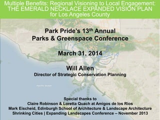
- 1. Multiple Benefits: Regional Visioning to Local Engagement: THE EMERALD NECKLACE EXPANDED VISION PLAN for Los Angeles County Park Pride’s 13th Annual Parks & Greenspace Conference March 31, 2014 Will Allen Director of Strategic Conservation Planning Special thanks to Claire Robinson & Loretta Quach at Amigos de los Rios Mark Eischeid, Edinburgh School of Architecture & Landscape Architecture Shrinking Cities | Expanding Landscapes Conference – November 2013
- 2. 2Wordle™
- 4. Regional Green Infrastructure Vision PROTECT RESTORE CONNECT MULTIPLE BENEFITS Green Infrastructure – Linking Megaregions & Large Landscapes
- 5. 5 A strategically planned and managed network of natural lands, working landscapes, and other open spaces that conserves ecosystem values and functions and provides associated benefits to human Green Infrastructure – Linking Megaregions & Large Landscapes
- 6. 6 GI Network: Protect | Restore | Connect Cores: • Contain fully functional natural ecosystems • Provide high-quality habitat for native plants and animals Hubs: • Slightly fragmented aggregations of core areas, plus contiguous natural cover Corridors: • Link core areas together • Allow animal movement and seed and pollen transfer between core areas Sites: • Important microhabitats not captured by network Functional Connectivity
- 7. 7 Ecological Capital Human well-being Material needs, health, security, social relations, “quality of life” Regulating Services Cultural experiences Supporting Products (Natural processes that maintain other ecosystem services) EcosystemServices Adapted from 2010 Ecological Footprint Atlas GI Network: Mapping Nature’s Benefits
- 8. 8 • Cities and their regions as ecosystems • Common vision • Coalitions shape priority green infrastructure investments • Collaboration and collective action
- 9. 9 Other Metropolitan Greenspace Initiatives Columbia MO | Lufkin TX | Central Indiana Milwaukee WI | Nashville TN
- 10. 10 Site Scale Green Infrastructure Implementation: Philadelphia http://www.phillywatersheds.org/what_were_doing/documents_and_data/ cso_long_term_control_plan
- 11. Green Infrastructure on Vacant/Underutilized Lands 11 New York City 596 Acres Philadelphia Possible City Grounded in Philly New Orleans Living Lots
- 12. Urban Green | Active Living | Local Food | Flood Control National Agenda for Metropolitan Greenspaces Health | Livability | Economic Vitality | Resiliency
- 13. 13 Los Angeles County: From the Mountains to the Sea, Forest to Ocean Catalina Island San Gabriel Mountains Whittier Narrows Angeles National Forest
- 14. 14Commissioned by Citizens’ Committee on Parks, Playgrounds and “Throughout a century and a half of urban growth, LA and the surrounding region have exhibited a love-hate relationship with nature.” Planning Los Angeles Los Angeles County: From the Mountains to the Sea, Forest to Ocean
- 15. 15 Historic Aerial Photo of Rio Hondo River Floodplain Olmstead Plan Key Points • “…chronically lacking in parks, playgrounds and public beaches for a city of its size and ambition…” • Lack of open space for play grounds at schools…“Positively reprehensible” • Proposed regional park agency Olmstead Plan Priorities for Park Development • Public access to beaches • Regional athletic fields • Large parks/reservations (mountains, canyons, islands) • Interconnected network of Parkways linking all of the above park assets together Los Angeles County: From the Mountains to the Sea, Forest to Ocean
- 16. 16 Los Angeles County: From the Mountains to the Sea, Forest to Ocean Modern Day Los Angeles County • Dominated by gray infrastructure - freeways, utility rights-of-way, water conveyances… • …but still framed by Mountains/forest and beaches/ocean • Opportunities to implement the Olmstead vision within the modern realities of the landscape
- 17. 17 Los Angeles County: From the Mountains to the Sea, Forest to Ocean Water Supply / Spreading Basins Utilities / Water Conveyances Wildlife Crossing Cultural Heritage
- 18. 18 Operating environment in Los Angeles County • Focus on private spaces – neglect of public spaces • Disadvantaged urban population in eastern Los Angeles County and elsewhere in City of LA and 80+ municipalities • Historic neglect by environmental community – focus on west side City of LA. coastal areas, and Santa Monica Mountains • Government agency department silos / competition for resources with City of LA / fragmented leadership • Major social inequity and public health crisis: education Los Angeles County: From the Mountains to the Sea, Forest to Ocean
- 19. 19 Linkages between historic L.A. and modern L.A. Los Angeles County: From the Mountains to the Sea, Forest to Ocean
- 20. 20 Opportunities in Los Angeles County • Diverse human populations and rare ecosystems • Increased emphasis on transit, auto alternatives • The need to be resourceful – with $$$ and water • A surprising amount of synergy on what needs to be done Los Angeles County: From the Mountains to the Sea, Forest to Ocean
- 21. 21 Los Angeles County: From the Mountains to the Sea, Forest to Ocean Aspirational Los Angeles County: The Emerald Necklace Expanded Vision Plan – Towards a Common Vision • Green infrastructure, access to nature, river corridors with natural vegetation, non-vehicular transportation
- 22. 22 Catalina Island Angeles National Forest Amigos de los Rios Initial Case Study Area The Emerald Necklace is a vision for a 17-mile loop of parks and greenways connecting 16 cities and over 500,000 residents along the Río Hondo and San Gabriel Rivers and their tributaries. El Monte South El Monte Baldwin Park Rosemea d Temple City Avocado Heights
- 23. 23 Alhambra Wash Rubio Wash Eaton Wash Santa Anita Wash Arcadia Wash SAN GABRIEL RIVER RIO HONDO RIVER Walnut Creek San Jose Creek Connection Trail TIER ONE: E: 5 acres and greater TIER TWO: 3-5 acres TIER Three: 2 acres and less “Pocket Parks – Entrances” TIER FOUR: Connector Trails Park Hierarchy Forest Gateway POTENTIAL NATIONAL RECREATION AREA WITH NPS Amigos de los Rios Initial Case Study Area
- 24. 24 Amigos de los Rios Initial Case Study Area Green Infrastructure • Urban biodiversity • Native habitat restoration • Groundwater infiltration • Climate change / urban heat island mitigation • Community forestry Public Health • Active living / recreation • Alternative transportation corridors • Access to nature & outdoor classrooms • Youth job training • Natural & cultural heritage • Way finding & interpretive signage
- 25. 25 Amigos de los Rios Initial Case Study Area
- 26. 26
- 27. 27 Amigos de los Rios Initial Case Study Area
- 28. 28
- 29. 29
- 30. 30
- 31. 31
- 32. 32
- 33. 33
- 34. 34
- 35. 35 *Congressional Appropriation- Congresswoman, Hilda Solis partial funding City of El Monte DURFEE / THOMPSON SCHOOL • State-of-the- art sports fields and perimeter nature trail • Outdoor interpretive area / Reconnect to nature
- 36. 36 Coalition Member Cities Unincorporated Areas • Charro Equestrian Joint Council • Park El Monte Improvement Association State & County Agencies • Hacienda Heights Homeowners’ Association • Workman Mill Road Homeowners’ Association • Rivers & Mountains Conservancy • Los Angeles County Board of Supervisors Emerald Necklace Coalition / Accord Member Agencies Emerald Necklace Region Local Cities • City of Azusa • City of Bell • City of Downey • City of Duarte • City of Irwindale • City of Baldwin Park • City of El Monte • City of South El Monte • City of San Gabriel • City of South Gate • City of Whittier • City of Monrovia • City of Montebello • City of La Puente • Gateway Authority: – 20 Cities Community Based Organizations School Districts •El Rancho Unified - Pico Rivera •El Monte Union •El Monte City •Rosemead •Mountain View
- 37. 37 Expanded Emerald Necklace - Total Distance A) Alhambra Wash to Eaton Wash B) Eaton Wash to South Edge of Peck Park C) Peck Road Water Conservation Park to San Gabriel River D) Ramona Blvd. to Whittier Narrows E) Whittier Narrows SGR to Seal Beach F) Whittier Narrows LA River to Long Beach 2.0 3.0 2.5 8.0 20.0 20.0 Distance MilesSegments Grand Total 88.4 Total length of River Corridor 57.4 A B C D E F G G) City of Bell to River Confluence 4 Peck Park to Mountains + (Wash) – 5.0 Peck Park to Mountains + (SGR) – 6.5 Expanded Vision Plan Area
- 38. 38 Expanded Vision Plan Area
- 39. 39 Expanded Vision Plan Approach • Define Regional Goals and Collaborative Priorities • Convene Focus Group Meetings (8/2012, 2/2013) • Synthesize Existing/Adopted Plans (60+) • Identify Regional Scale Spatial Priorities in Vision Plan • Analyze Priorities from Olmstead 1930 Plan • Collect, Organize, and Assess Current GIS Mapping Layers and Supporting Resources (100+) • Common Vision Plan Strategies • Implement Existing Plan Recommendations • Promote Best Practices in Design for All
- 40. 40 Expanded Vision Plan - Regional Goals 1. Promote Active Transportation – Walking, Biking, and Alternative Commute Options 2. Create Functional and Multi-Purpose Natural (Green) and Built (Grey) Environment Networks 3. Improve Public Health by Expanding Access to Nature and Outdoor Recreation 4. Treat Water as a Multi-Benefit Amenity 5. Design and Build Communities Resilient to the Current and Projected Impacts of Climate Change 6. Enhance Regional Anchors for People and Wildlife 7. Support Environmental Awareness and Civic Engagement through Education, Outreach, and Cultural Heritage 8. Foster a Green Economy that Creates Jobs and Spurs Investment in
- 41. Will Allen Director of Strategic Conservation Planning 919-967-2248 wallen@conservationfund.org http://www.conservationfund.org/strategic- conservation Wordle™ Multiple Benefits: Regional Visioning to Local Engagement: THE EMERALD NECKLACE EXPANDED VISION PLAN for Los Angeles County
Notas do Editor
- Which lands to conserve? Where to permit development? Where to build roads and utilities? Where & how to select mitigation projects?Proactivenot reactive; Systematicnot haphazard;Multi-functional not Single Purpose; Multiple Scales not Single Scale, and Scientifically defensible, transparent decision-making process
- GI and ecosystem services relationship
- Site Scale GI implementation in PHL, stormwater focused but potential for multiple benefits
- http://grist.org/cities/pretty-vacants-urban-communities-fill-empty-lots-with-gardens-skate-parks-and-creative-possibility/Site scale, grassroots implementation of GI
- Themes for a national agenda