SlideShare uma empresa Scribd logo
1 de 35
An analysis of Walkability in a late 20 th  Century Master Planned suburb on Australia’s Gold Coast   Nigel Cartlidge Nigel Cartlidge Second Gold Coast Urban Design Conference 2009
An analysis of Walkability in a late 20 th  Century Master Planned suburb on Australia’s Gold Coast  The study area of Robina/Robina Woods The factors affecting connectivity Mapping pedestrian mobility The Route Deviation Index (RDI) Nigel Cartlidge Second Gold Coast Urban Design Conference 2009 Contents
Nigel Cartlidge ,[object Object],[object Object],[object Object],[object Object],An analysis of Walkability in a late 20 th  Century Master Planned suburb on Australia’s Gold Coast   Second Gold Coast Urban Design Conference 2009
Nigel Cartlidge Second Gold Coast Urban Design Conference 2009 Robina/Varsity Lakes Study Area Google Earth™ image ,[object Object],[object Object],[object Object],[object Object]
Nigel Cartlidge Second Gold Coast Urban Design Conference 2009 Robina/Varsity Lakes Study Area Google Earth™ image ,[object Object],[object Object],[object Object],[object Object],[object Object]
Nigel Cartlidge Second Gold Coast Urban Design Conference 2009 Robina/Varsity Lakes Study Area Google Earth™ image The edge city spatial  layout of  Robina Town Centre
Nigel Cartlidge Second Gold Coast Urban Design Conference 2009 Robina/Varsity Lakes Study Area Google Earth™ image Pacific Motorway
Nigel Cartlidge Second Gold Coast Urban Design Conference 2009 Robina/Varsity Lakes Study Area Google Earth™ image Rail Line to  Brisbane Pacific Motorway
Nigel Cartlidge Second Gold Coast Urban Design Conference 2009 Robina/Varsity Lakes Study Area Google Earth™ image Rail Line to  Brisbane Pacific Motorway Robina Town Centre Layered barriers to pedestrian access
Nigel Cartlidge Robina Woods Study Area Second Gold Coast Urban Design Conference 2009 ,[object Object],[object Object]
Nigel Cartlidge Robina Woods Study Area Second Gold Coast Urban Design Conference 2009 The four lane median strip highways and the golf course constrain and define the suburb
Nigel Cartlidge The Layered Barriers to Pedestrian Connectivity Factors affecting connectivity Second Gold Coast Urban Design Conference 2009
Nigel Cartlidge An analysis of Walkability in a late 20 th  Century Master Planned suburb on Australia’s Gold Coast  ,[object Object],[object Object],[object Object],[object Object],[object Object],Second Gold Coast Urban Design Conference 2009
Nigel Cartlidge An analysis of Walkability in a late 20 th  Century Master Planned suburb on Australia’s Gold Coast  ,[object Object],[object Object],[object Object],[object Object],Second Gold Coast Urban Design Conference 2009
Nigel Cartlidge Second Gold Coast Urban Design Conference 2009 Town centre aligned to the motorway and heavy rail line A residential core separated from needs Amenities and facilities on the edges of the development Truncated routes Un-walkable distances Land uses and routes Spatial & Physical Barriers
Nigel Cartlidge Second Gold Coast Urban Design Conference 2009 Google Earth™ images Spatial & Physical Barriers
Nigel Cartlidge Second Gold Coast Urban Design Conference 2009 Google Earth™ images Wide Roads & Fences Spatial & Physical Barriers
Nigel Cartlidge Second Gold Coast Urban Design Conference 2009 Google Earth™ images Wide Roads & Fences Roundabouts as crossings Spatial & Physical Barriers
Nigel Cartlidge Second Gold Coast Urban Design Conference 2009 Google Earth™ images Wide Roads & Fences Roundabouts as crossings Open Space  & Car Parks Spatial & Physical Barriers
Nigel Cartlidge Second Gold Coast Urban Design Conference 2009 Google Earth™ images Wide Roads & Fences Roundabouts as crossings Open Space  & Car Parks Loops & Lollipops Spatial & Physical Barriers
Nigel Cartlidge The car focused design limits pedestrian mobility Arterial Roads Second Gold Coast Urban Design Conference 2009
Nigel Cartlidge The car focused design limits pedestrian mobility Arterial Roads Collector Roads Second Gold Coast Urban Design Conference 2009
Nigel Cartlidge The car focused design limits pedestrian mobility Arterial Roads Collector Roads Second Gold Coast Urban Design Conference 2009 Crossings
Nigel Cartlidge The location of private open space The inappropriate location, size and shape of Golf Courses or other private open spaces is an unacceptable long term land use especially if it forms barriers to all forms of mobility. Second Gold Coast Urban Design Conference 2009
Nigel Cartlidge Mapping Pedestrian   Mobility The study adopted a walking speed of 4.5km/h, giving a walking distance of 375m in five minutes. Based on a study of older pedestrian speeds  (US Roads 2008). The study rejected the common practice of drawing pedshed circles on maps and sought to establish actual route times through mapping. “ Design for the young and you exclude the old: design for the old and you include the young”  Dr Bernard Isaacs quoted in “Healthy Spaces and Places”. The metric: The distance someone can walk in five minutes Second Gold Coast Urban Design Conference 2009
Nigel Cartlidge Compared to the reality  for  residence 6 in actual permeability Proximity of origins to destinations determines walkability  Traditional 400 & 800m pedsheds centered on the Primary School Second Gold Coast Urban Design Conference 2009
Nigel Cartlidge Proximity of origins to destinations determines walkability  Physical barriers to pedestrian mobility include limited route choice Second Gold Coast Urban Design Conference 2009 Residence 10: 550m in a straight line from Varsity College (H) is 2410m by road separated by 22m of golf course buggy track Residence 6: 660m in a straight line from Robina Town Centre (A) is 4080m by road. Blocked by the golf course and Robina Parkway
Nigel Cartlidge Route structure is a shared problem for all forms of mobility Impermeable barriers are formed by the spatial layout Second Gold Coast Urban Design Conference 2009
The Route Deviation Index (RDI) The Route Deviation Index is the variation between the straight line distance and the actual travel distance as a percentage of the straight line distance. The route deviation maps sought to measure the distortion caused by the route structure and the impermeable barriers. These maps were used to produce a mean average and range of RDI for each destination A benchmark RDI was established by analysing the RDI of a grid road system in a suburb of Vancouver Canada Second Gold Coast Urban Design Conference 2009
Nigel Cartlidge The spatial layout of the arterial road system used in Robina Woods was compared to the grid system employed in a suburb of Vancouver. Suburb of Vancouver RDI 135 to 140 Second Gold Coast Urban Design Conference 2009
Nigel Cartlidge The spatial layout of the arterial road system used in Robina Woods was compared to the grid system employed in a suburb of Vancouver. Suburb of Vancouver RDI 135 to 140 Robina Woods RDI 108 to 1045 The relative scale, disconnect, lack of amenity, permeability and route choice in Robina Woods is shown in these two images Second Gold Coast Urban Design Conference 2009
The Route Deviation Index (RDI) The mean RDI for the selected ten residences to Robina Town Centre is 239 with a RDI range of 117 for residence 2, to 618 for residence 6 Robina Town Centre RDI map Varsity College RDI map The mean RDI for the selected ten residences to Varsity College is 220 with a RDI range of 147 for residence 2, to 438 for residence 6 The Town Centre The Local State School Second Gold Coast Urban Design Conference 2009
Nigel Cartlidge ,[object Object],[object Object],[object Object],[object Object],[object Object],The spatial layout and the arterial road system imposes costs on people and the environment Second Gold Coast Urban Design Conference 2009
Nigel Cartlidge Conclusions The residents of Robina Woods have little or no option but to travel by car to the amenities, facilities and employment they need within or outside of their residential suburb. There is a lack of destinations within the suburb to meet residents needs locally. There are layers of barriers to pedestrian mobility in the car focused urban design utilised in the development of Robina. Walking speed and achievable distances should be reduced to promote equity in planning and pedestrian mapping needs to replace the 400m circle. The Route Deviation Index (RDI) could be adopted to as a measurement tool to analyse and improve urban layouts. Second Gold Coast Urban Design Conference 2009
Nigel Cartlidge An analysis of Walkability in a late 20 th  Century Master Planned suburb on Australia’s Gold Coast  “ Sprawl is bad aesthetics, it is bad economics. Five acres being made to do the work of one, and to do it very poorly." William Whyte, January 1958. Second Gold Coast Urban Design Conference 2009

Mais conteúdo relacionado

Destaque

Presentation on cox's bazar
Presentation on cox's bazarPresentation on cox's bazar
Presentation on cox's bazarUmme Absari
 
History & Town Planning of Delhi
History & Town Planning of DelhiHistory & Town Planning of Delhi
History & Town Planning of DelhiShruti Bhatia
 
Theories and Concepts of town planning
Theories and Concepts of town planningTheories and Concepts of town planning
Theories and Concepts of town planningSrishti Mehta
 
Land use planning
Land use planningLand use planning
Land use planningTin Lagman
 
Urban Planning theories and models
Urban Planning theories and modelsUrban Planning theories and models
Urban Planning theories and modelsGeofrey Yator
 
Chapter 6 Urban Land Rent - Urban Economics 6th Edition
Chapter 6 Urban Land Rent - Urban Economics 6th EditionChapter 6 Urban Land Rent - Urban Economics 6th Edition
Chapter 6 Urban Land Rent - Urban Economics 6th EditionParamita E.
 

Destaque (6)

Presentation on cox's bazar
Presentation on cox's bazarPresentation on cox's bazar
Presentation on cox's bazar
 
History & Town Planning of Delhi
History & Town Planning of DelhiHistory & Town Planning of Delhi
History & Town Planning of Delhi
 
Theories and Concepts of town planning
Theories and Concepts of town planningTheories and Concepts of town planning
Theories and Concepts of town planning
 
Land use planning
Land use planningLand use planning
Land use planning
 
Urban Planning theories and models
Urban Planning theories and modelsUrban Planning theories and models
Urban Planning theories and models
 
Chapter 6 Urban Land Rent - Urban Economics 6th Edition
Chapter 6 Urban Land Rent - Urban Economics 6th EditionChapter 6 Urban Land Rent - Urban Economics 6th Edition
Chapter 6 Urban Land Rent - Urban Economics 6th Edition
 

Semelhante a The Robina Residential Archipelago

KYOVA US 52 Safety Plan Stakeholder Meeting
KYOVA US 52 Safety Plan Stakeholder MeetingKYOVA US 52 Safety Plan Stakeholder Meeting
KYOVA US 52 Safety Plan Stakeholder Meetingpyoungkyova
 
Leed nd and local governments 031213_Includes Aurora and Arvada
Leed nd and local governments 031213_Includes Aurora and ArvadaLeed nd and local governments 031213_Includes Aurora and Arvada
Leed nd and local governments 031213_Includes Aurora and ArvadaConor Merrigan
 
Brisbane Innovation Series Apr10 Cate Collins
Brisbane Innovation Series  Apr10 Cate CollinsBrisbane Innovation Series  Apr10 Cate Collins
Brisbane Innovation Series Apr10 Cate CollinsThe Innovation Series
 
NACTO Urban Street Design Guide
NACTO Urban Street Design GuideNACTO Urban Street Design Guide
NACTO Urban Street Design GuideJesse Budlong
 
Highway and railway geometric design-Revised.pptx
Highway and railway geometric design-Revised.pptxHighway and railway geometric design-Revised.pptx
Highway and railway geometric design-Revised.pptxkiranmaqsood5
 
Moving Beyond Cost: Evaluating LRT & BRT options in Australian & NZ cities
Moving Beyond Cost: Evaluating LRT & BRT options in Australian & NZ citiesMoving Beyond Cost: Evaluating LRT & BRT options in Australian & NZ cities
Moving Beyond Cost: Evaluating LRT & BRT options in Australian & NZ citiesScott Martin, CMILT
 
Gardiner short briefing package
Gardiner   short briefing packageGardiner   short briefing package
Gardiner short briefing packageWaterfrontTO
 
North Kings Highway (VA 241) Intersection Improvements Study
North Kings Highway (VA 241) Intersection Improvements StudyNorth Kings Highway (VA 241) Intersection Improvements Study
North Kings Highway (VA 241) Intersection Improvements StudyFairfax County
 
CIVITAS Outcomes Presentation 2009
CIVITAS Outcomes Presentation 2009 CIVITAS Outcomes Presentation 2009
CIVITAS Outcomes Presentation 2009 Richard Clarke
 
RCSS Capabilities
RCSS CapabilitiesRCSS Capabilities
RCSS Capabilitiesstevefinnie
 
Mcm demo glasgow - august 11
Mcm demo   glasgow - august 11Mcm demo   glasgow - august 11
Mcm demo glasgow - august 11Cycling Scotland
 
The Value of Place: Planning for Walkability in the Tigard Triangle
The Value of Place: Planning for Walkability in the Tigard TriangleThe Value of Place: Planning for Walkability in the Tigard Triangle
The Value of Place: Planning for Walkability in the Tigard TriangleRay Atkinson
 
Question G from Hector Guerrero
Question G from Hector GuerreroQuestion G from Hector Guerrero
Question G from Hector GuerreroHectorGuerrero55
 
Рикардо Марини - Какой город хотите вы
Рикардо Марини - Какой город хотите выРикардо Марини - Какой город хотите вы
Рикардо Марини - Какой город хотите выAnna Odintsova
 
Coastway Capability Statement
Coastway Capability StatementCoastway Capability Statement
Coastway Capability Statementmarkhudson
 
dot-hwy_Roundabout_Planning_and_Design_Guide_Mar2022.pdf
dot-hwy_Roundabout_Planning_and_Design_Guide_Mar2022.pdfdot-hwy_Roundabout_Planning_and_Design_Guide_Mar2022.pdf
dot-hwy_Roundabout_Planning_and_Design_Guide_Mar2022.pdfdoaagame00
 

Semelhante a The Robina Residential Archipelago (20)

KYOVA US 52 Safety Plan Stakeholder Meeting
KYOVA US 52 Safety Plan Stakeholder MeetingKYOVA US 52 Safety Plan Stakeholder Meeting
KYOVA US 52 Safety Plan Stakeholder Meeting
 
Leed nd and local governments 031213_Includes Aurora and Arvada
Leed nd and local governments 031213_Includes Aurora and ArvadaLeed nd and local governments 031213_Includes Aurora and Arvada
Leed nd and local governments 031213_Includes Aurora and Arvada
 
A Systematic Approach to Bicycle Parking Planning for Cities
A Systematic Approach to Bicycle Parking Planning for CitiesA Systematic Approach to Bicycle Parking Planning for Cities
A Systematic Approach to Bicycle Parking Planning for Cities
 
Brett Maynard
Brett MaynardBrett Maynard
Brett Maynard
 
Brisbane Innovation Series Apr10 Cate Collins
Brisbane Innovation Series  Apr10 Cate CollinsBrisbane Innovation Series  Apr10 Cate Collins
Brisbane Innovation Series Apr10 Cate Collins
 
NACTO Urban Street Design Guide
NACTO Urban Street Design GuideNACTO Urban Street Design Guide
NACTO Urban Street Design Guide
 
Highway and railway geometric design-Revised.pptx
Highway and railway geometric design-Revised.pptxHighway and railway geometric design-Revised.pptx
Highway and railway geometric design-Revised.pptx
 
Moving Beyond Cost: Evaluating LRT & BRT options in Australian & NZ cities
Moving Beyond Cost: Evaluating LRT & BRT options in Australian & NZ citiesMoving Beyond Cost: Evaluating LRT & BRT options in Australian & NZ cities
Moving Beyond Cost: Evaluating LRT & BRT options in Australian & NZ cities
 
Sasaki associates
Sasaki associatesSasaki associates
Sasaki associates
 
Gardiner short briefing package
Gardiner   short briefing packageGardiner   short briefing package
Gardiner short briefing package
 
North Kings Highway (VA 241) Intersection Improvements Study
North Kings Highway (VA 241) Intersection Improvements StudyNorth Kings Highway (VA 241) Intersection Improvements Study
North Kings Highway (VA 241) Intersection Improvements Study
 
CIVITAS Outcomes Presentation 2009
CIVITAS Outcomes Presentation 2009 CIVITAS Outcomes Presentation 2009
CIVITAS Outcomes Presentation 2009
 
RCSS Capabilities
RCSS CapabilitiesRCSS Capabilities
RCSS Capabilities
 
Mcm demo glasgow - august 11
Mcm demo   glasgow - august 11Mcm demo   glasgow - august 11
Mcm demo glasgow - august 11
 
PORTFOLIO_AntonioPeriago_2015
PORTFOLIO_AntonioPeriago_2015PORTFOLIO_AntonioPeriago_2015
PORTFOLIO_AntonioPeriago_2015
 
The Value of Place: Planning for Walkability in the Tigard Triangle
The Value of Place: Planning for Walkability in the Tigard TriangleThe Value of Place: Planning for Walkability in the Tigard Triangle
The Value of Place: Planning for Walkability in the Tigard Triangle
 
Question G from Hector Guerrero
Question G from Hector GuerreroQuestion G from Hector Guerrero
Question G from Hector Guerrero
 
Рикардо Марини - Какой город хотите вы
Рикардо Марини - Какой город хотите выРикардо Марини - Какой город хотите вы
Рикардо Марини - Какой город хотите вы
 
Coastway Capability Statement
Coastway Capability StatementCoastway Capability Statement
Coastway Capability Statement
 
dot-hwy_Roundabout_Planning_and_Design_Guide_Mar2022.pdf
dot-hwy_Roundabout_Planning_and_Design_Guide_Mar2022.pdfdot-hwy_Roundabout_Planning_and_Design_Guide_Mar2022.pdf
dot-hwy_Roundabout_Planning_and_Design_Guide_Mar2022.pdf
 

The Robina Residential Archipelago

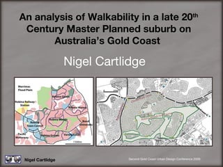
  • 1. An analysis of Walkability in a late 20 th Century Master Planned suburb on Australia’s Gold Coast Nigel Cartlidge Nigel Cartlidge Second Gold Coast Urban Design Conference 2009
  • 2. An analysis of Walkability in a late 20 th Century Master Planned suburb on Australia’s Gold Coast The study area of Robina/Robina Woods The factors affecting connectivity Mapping pedestrian mobility The Route Deviation Index (RDI) Nigel Cartlidge Second Gold Coast Urban Design Conference 2009 Contents
  • 3.
  • 4.
  • 5.
  • 6. Nigel Cartlidge Second Gold Coast Urban Design Conference 2009 Robina/Varsity Lakes Study Area Google Earth™ image The edge city spatial layout of Robina Town Centre
  • 7. Nigel Cartlidge Second Gold Coast Urban Design Conference 2009 Robina/Varsity Lakes Study Area Google Earth™ image Pacific Motorway
  • 8. Nigel Cartlidge Second Gold Coast Urban Design Conference 2009 Robina/Varsity Lakes Study Area Google Earth™ image Rail Line to Brisbane Pacific Motorway
  • 9. Nigel Cartlidge Second Gold Coast Urban Design Conference 2009 Robina/Varsity Lakes Study Area Google Earth™ image Rail Line to Brisbane Pacific Motorway Robina Town Centre Layered barriers to pedestrian access
  • 10.
  • 11. Nigel Cartlidge Robina Woods Study Area Second Gold Coast Urban Design Conference 2009 The four lane median strip highways and the golf course constrain and define the suburb
  • 12. Nigel Cartlidge The Layered Barriers to Pedestrian Connectivity Factors affecting connectivity Second Gold Coast Urban Design Conference 2009
  • 13.
  • 14.
  • 15. Nigel Cartlidge Second Gold Coast Urban Design Conference 2009 Town centre aligned to the motorway and heavy rail line A residential core separated from needs Amenities and facilities on the edges of the development Truncated routes Un-walkable distances Land uses and routes Spatial & Physical Barriers
  • 16. Nigel Cartlidge Second Gold Coast Urban Design Conference 2009 Google Earth™ images Spatial & Physical Barriers
  • 17. Nigel Cartlidge Second Gold Coast Urban Design Conference 2009 Google Earth™ images Wide Roads & Fences Spatial & Physical Barriers
  • 18. Nigel Cartlidge Second Gold Coast Urban Design Conference 2009 Google Earth™ images Wide Roads & Fences Roundabouts as crossings Spatial & Physical Barriers
  • 19. Nigel Cartlidge Second Gold Coast Urban Design Conference 2009 Google Earth™ images Wide Roads & Fences Roundabouts as crossings Open Space & Car Parks Spatial & Physical Barriers
  • 20. Nigel Cartlidge Second Gold Coast Urban Design Conference 2009 Google Earth™ images Wide Roads & Fences Roundabouts as crossings Open Space & Car Parks Loops & Lollipops Spatial & Physical Barriers
  • 21. Nigel Cartlidge The car focused design limits pedestrian mobility Arterial Roads Second Gold Coast Urban Design Conference 2009
  • 22. Nigel Cartlidge The car focused design limits pedestrian mobility Arterial Roads Collector Roads Second Gold Coast Urban Design Conference 2009
  • 23. Nigel Cartlidge The car focused design limits pedestrian mobility Arterial Roads Collector Roads Second Gold Coast Urban Design Conference 2009 Crossings
  • 24. Nigel Cartlidge The location of private open space The inappropriate location, size and shape of Golf Courses or other private open spaces is an unacceptable long term land use especially if it forms barriers to all forms of mobility. Second Gold Coast Urban Design Conference 2009
  • 25. Nigel Cartlidge Mapping Pedestrian Mobility The study adopted a walking speed of 4.5km/h, giving a walking distance of 375m in five minutes. Based on a study of older pedestrian speeds (US Roads 2008). The study rejected the common practice of drawing pedshed circles on maps and sought to establish actual route times through mapping. “ Design for the young and you exclude the old: design for the old and you include the young” Dr Bernard Isaacs quoted in “Healthy Spaces and Places”. The metric: The distance someone can walk in five minutes Second Gold Coast Urban Design Conference 2009
  • 26. Nigel Cartlidge Compared to the reality for residence 6 in actual permeability Proximity of origins to destinations determines walkability Traditional 400 & 800m pedsheds centered on the Primary School Second Gold Coast Urban Design Conference 2009
  • 27. Nigel Cartlidge Proximity of origins to destinations determines walkability Physical barriers to pedestrian mobility include limited route choice Second Gold Coast Urban Design Conference 2009 Residence 10: 550m in a straight line from Varsity College (H) is 2410m by road separated by 22m of golf course buggy track Residence 6: 660m in a straight line from Robina Town Centre (A) is 4080m by road. Blocked by the golf course and Robina Parkway
  • 28. Nigel Cartlidge Route structure is a shared problem for all forms of mobility Impermeable barriers are formed by the spatial layout Second Gold Coast Urban Design Conference 2009
  • 29. The Route Deviation Index (RDI) The Route Deviation Index is the variation between the straight line distance and the actual travel distance as a percentage of the straight line distance. The route deviation maps sought to measure the distortion caused by the route structure and the impermeable barriers. These maps were used to produce a mean average and range of RDI for each destination A benchmark RDI was established by analysing the RDI of a grid road system in a suburb of Vancouver Canada Second Gold Coast Urban Design Conference 2009
  • 30. Nigel Cartlidge The spatial layout of the arterial road system used in Robina Woods was compared to the grid system employed in a suburb of Vancouver. Suburb of Vancouver RDI 135 to 140 Second Gold Coast Urban Design Conference 2009
  • 31. Nigel Cartlidge The spatial layout of the arterial road system used in Robina Woods was compared to the grid system employed in a suburb of Vancouver. Suburb of Vancouver RDI 135 to 140 Robina Woods RDI 108 to 1045 The relative scale, disconnect, lack of amenity, permeability and route choice in Robina Woods is shown in these two images Second Gold Coast Urban Design Conference 2009
  • 32. The Route Deviation Index (RDI) The mean RDI for the selected ten residences to Robina Town Centre is 239 with a RDI range of 117 for residence 2, to 618 for residence 6 Robina Town Centre RDI map Varsity College RDI map The mean RDI for the selected ten residences to Varsity College is 220 with a RDI range of 147 for residence 2, to 438 for residence 6 The Town Centre The Local State School Second Gold Coast Urban Design Conference 2009
  • 33.
  • 34. Nigel Cartlidge Conclusions The residents of Robina Woods have little or no option but to travel by car to the amenities, facilities and employment they need within or outside of their residential suburb. There is a lack of destinations within the suburb to meet residents needs locally. There are layers of barriers to pedestrian mobility in the car focused urban design utilised in the development of Robina. Walking speed and achievable distances should be reduced to promote equity in planning and pedestrian mapping needs to replace the 400m circle. The Route Deviation Index (RDI) could be adopted to as a measurement tool to analyse and improve urban layouts. Second Gold Coast Urban Design Conference 2009
  • 35. Nigel Cartlidge An analysis of Walkability in a late 20 th Century Master Planned suburb on Australia’s Gold Coast “ Sprawl is bad aesthetics, it is bad economics. Five acres being made to do the work of one, and to do it very poorly." William Whyte, January 1958. Second Gold Coast Urban Design Conference 2009