SlideShare uma empresa Scribd logo
1 de 1
Baixar para ler offline
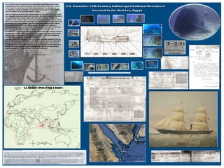
SHA Poster2012

Mais conteúdo relacionado

Destaque

Gisday2012 pgd cyklodoprava_liberec_1
Gisday2012 pgd cyklodoprava_liberec_1Gisday2012 pgd cyklodoprava_liberec_1
Gisday2012 pgd cyklodoprava_liberec_1Jiří Šmída
 
FOSS in GIS: Overview Part-2
FOSS in GIS: Overview Part-2FOSS in GIS: Overview Part-2
FOSS in GIS: Overview Part-2Hardeep Rai
 
GIS and Open Source
GIS and Open SourceGIS and Open Source
GIS and Open SourceHardeep Rai
 
Beyond Google: mapping a new world of open data and open access
Beyond Google: mapping a new world of open data and open accessBeyond Google: mapping a new world of open data and open access
Beyond Google: mapping a new world of open data and open accessBritish Cartographic Society
 
Cartography and Geospatial Intelligence (GEOINT): Actionable Knowledge for Hu...
Cartography and Geospatial Intelligence (GEOINT): Actionable Knowledge for Hu...Cartography and Geospatial Intelligence (GEOINT): Actionable Knowledge for Hu...
Cartography and Geospatial Intelligence (GEOINT): Actionable Knowledge for Hu...British Cartographic Society
 
Active Transportation Consulting Portfolio
Active Transportation Consulting PortfolioActive Transportation Consulting Portfolio
Active Transportation Consulting PortfolioAnthony Smith
 
Digital cartography and natural disaster management
Digital cartography and natural disaster managementDigital cartography and natural disaster management
Digital cartography and natural disaster managementGCUF
 
Stuart Miller - GIS Output and the Role of Cartography
Stuart Miller - GIS Output and the Role of CartographyStuart Miller - GIS Output and the Role of Cartography
Stuart Miller - GIS Output and the Role of CartographyBritish Cartographic Society
 
Building a Geodatabase
Building a GeodatabaseBuilding a Geodatabase
Building a GeodatabasePeter McCready
 

Destaque (19)

Gisday2012 pgd cyklodoprava_liberec_1
Gisday2012 pgd cyklodoprava_liberec_1Gisday2012 pgd cyklodoprava_liberec_1
Gisday2012 pgd cyklodoprava_liberec_1
 
FOSS in GIS: Overview Part-2
FOSS in GIS: Overview Part-2FOSS in GIS: Overview Part-2
FOSS in GIS: Overview Part-2
 
3 d visualisation of information
3 d visualisation of information3 d visualisation of information
3 d visualisation of information
 
GIS and Open Source
GIS and Open SourceGIS and Open Source
GIS and Open Source
 
Foss4g 2016 How to make a 3D web geoportal
Foss4g 2016 How to make a 3D web geoportal Foss4g 2016 How to make a 3D web geoportal
Foss4g 2016 How to make a 3D web geoportal
 
Model de la Base topogràfica 1:5.000. Productes derivats
Model de la Base topogràfica 1:5.000. Productes derivatsModel de la Base topogràfica 1:5.000. Productes derivats
Model de la Base topogràfica 1:5.000. Productes derivats
 
Beyond Google: mapping a new world of open data and open access
Beyond Google: mapping a new world of open data and open accessBeyond Google: mapping a new world of open data and open access
Beyond Google: mapping a new world of open data and open access
 
Geo database
Geo databaseGeo database
Geo database
 
Pioneros en la preservación de datos geográficos
Pioneros en la preservación de datos geográficosPioneros en la preservación de datos geográficos
Pioneros en la preservación de datos geográficos
 
Cartography and Geospatial Intelligence (GEOINT): Actionable Knowledge for Hu...
Cartography and Geospatial Intelligence (GEOINT): Actionable Knowledge for Hu...Cartography and Geospatial Intelligence (GEOINT): Actionable Knowledge for Hu...
Cartography and Geospatial Intelligence (GEOINT): Actionable Knowledge for Hu...
 
Gis 3 databaze_2012
Gis 3 databaze_2012Gis 3 databaze_2012
Gis 3 databaze_2012
 
Active Transportation Consulting Portfolio
Active Transportation Consulting PortfolioActive Transportation Consulting Portfolio
Active Transportation Consulting Portfolio
 
Model de la Base topogràfica 1:5.000
Model de la Base topogràfica 1:5.000Model de la Base topogràfica 1:5.000
Model de la Base topogràfica 1:5.000
 
Distribució de productes ICC en ETRS89
Distribució de productes ICC en ETRS89Distribució de productes ICC en ETRS89
Distribució de productes ICC en ETRS89
 
Digital cartography and natural disaster management
Digital cartography and natural disaster managementDigital cartography and natural disaster management
Digital cartography and natural disaster management
 
Digital Mapping
Digital MappingDigital Mapping
Digital Mapping
 
3D Modeling by GIS
3D Modeling by GIS3D Modeling by GIS
3D Modeling by GIS
 
Stuart Miller - GIS Output and the Role of Cartography
Stuart Miller - GIS Output and the Role of CartographyStuart Miller - GIS Output and the Role of Cartography
Stuart Miller - GIS Output and the Role of Cartography
 
Building a Geodatabase
Building a GeodatabaseBuilding a Geodatabase
Building a Geodatabase
 

Mais de Janelle Harrison (20)

SCA conference2014
SCA conference2014SCA conference2014
SCA conference2014
 
Dor Field School 2007prt 2
Dor Field School 2007prt 2Dor Field School 2007prt 2
Dor Field School 2007prt 2
 
Dor Field School 2007 prt 1
Dor Field School 2007 prt 1Dor Field School 2007 prt 1
Dor Field School 2007 prt 1
 
United Irishmen
United IrishmenUnited Irishmen
United Irishmen
 
Nps1
Nps1Nps1
Nps1
 
Nps2
Nps2Nps2
Nps2
 
Vvc Ref 1995
Vvc Ref 1995Vvc Ref 1995
Vvc Ref 1995
 
Rpa
RpaRpa
Rpa
 
Jharrison09
Jharrison09Jharrison09
Jharrison09
 
Harrision Lor Student
Harrision Lor StudentHarrision Lor Student
Harrision Lor Student
 
Mtn High
Mtn HighMtn High
Mtn High
 
Jnewland letter of recommendation
Jnewland letter of recommendationJnewland letter of recommendation
Jnewland letter of recommendation
 
Janelle Harrison Letter Of Recommendation2011
Janelle Harrison Letter Of Recommendation2011Janelle Harrison Letter Of Recommendation2011
Janelle Harrison Letter Of Recommendation2011
 
Experimental Archaeology
Experimental ArchaeologyExperimental Archaeology
Experimental Archaeology
 
Dichotomy
DichotomyDichotomy
Dichotomy
 
Janelle Harrison GISG 112 Project Map
Janelle Harrison GISG 112 Project MapJanelle Harrison GISG 112 Project Map
Janelle Harrison GISG 112 Project Map
 
GISG 114 Geodatabase Project
GISG 114 Geodatabase ProjectGISG 114 Geodatabase Project
GISG 114 Geodatabase Project
 
Annual Report Cover
Annual Report CoverAnnual Report Cover
Annual Report Cover
 
My Mauna Loa Hike
My Mauna Loa HikeMy Mauna Loa Hike
My Mauna Loa Hike
 
Bonnie Clare Quads Ref
Bonnie Clare Quads RefBonnie Clare Quads Ref
Bonnie Clare Quads Ref