
Recomendados
Mais conteúdo relacionado
Semelhante a Blatchford Development
Semelhante a Blatchford Development (20)
Último
Último (20)
Blatchford Development
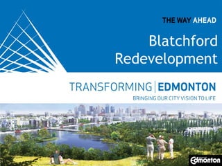
- 1. Blatchford Redevelopment Replace with appropriate image in View > Master.
- 2. The vision… Transform an airport… 217 hectares of land in the heart of the city
- 3. The Blatchford community •Mixed use Development •Transitoriented development •Reduced ecological footprint
- 4. Planning principles • • • • • • • Planning & design Ecological footprint Infrastructure Family housing Green space Technology History
- 6. Town Centre • Adjacent to southern LRT stop • Retail, office, residential • Potential health care “cluster” • Central plaza community core
- 7. East district • Medium-high density residential area • LRT with transitoriented development • Integrates with NAIT’s post-secondary campus
- 8. West district • Focus on homes for families • Lower density • Transit to provide quick access to LRT • Urban agriculture
- 9. The park • Amenities for all seasons • Destination for all Edmontonians • Easily accessed by LRT and pedestrian/ bicycle multi-use trail network
- 10. West district • Bush Pilot Main road Runway Secondary roads Furrow/community garden • see DFP School site Parks and greenways Stormwater ponds Central plaza Secondary roads
- 12. West district destinations Community destinations Active street design
- 14. Trails and cycling routes Traffic calming Active routes Major cycling route Cycling routes Connection to multi-use trail Existing multi-use train
- 15. Transit and LRT Northwest LRT line LRT station Public transit route Potential transit stop
- 16. West district land use
- 17. Environmentally innovative • Green building designs – minimize water, heat, power use • Renewable energy sources for heat and power • Reuse water from stormwater ponds
- 18. Environmentally innovative • Promoting active transportation – walking, cycling, • Designing convenient transit access • Recycling construction and demolition waste – Runways turned into aggregate for future roads • Designing the plan so we can adopt new technologies
- 19. Timing • Current: engineering/pre-construction work • 2014: Zoning, Stage 1 engineering completed, construction will begin • 2016/17: People living/working on site
Notas do Editor
- Thank you for having me here to share with you what’s being planned for the Blatchford Redevelopment. Blatchford is an exciting project for Edmonton that will demonstrate in a real way, how to plan and build a sustainable, cutting edge, urban environment.
- This is what the site looks like today. The vision for the Blatchford Redevelopment is to take this land that’s near NAIT, the Royal Alexandra Hospital, Kingsway Mall and businesses and transform it into (change slide)
- Into Blatchford, a world leading sustainable development. Vision: Mixed use development Transit-oriented Reduced ecological footprint a socially and economically sustainable community Council wanted to raise the bar it was clear to our team that this was not to be a “business as usual” development.
- The Master Plan Principles define the vision and establish the goals for the redevelopment – as approved by Council (go through planning principles) Area Redevelopment Plan, based on these principles, was approved May 2012
- Blatchford will have 4 distinct areas Two residential – West and East Middle is the park – accessible to all Town Centre – majority of retail/office Place for everyone – all ages, families, students, seniors, affordable housing Integrated – easy access within the site, connected to area communities
- Destination point for the community Shops, offices, dining + homes a vibrant core for those who want to live in the middle of it all Central square for community events Up to 1M sq ft of retail and office Up to 3000 dwelling units
- LRT line services this area Nearly everyone here lives within a 5 minute walk of an LRT station LRT proximity facilitates higher density approx 4,000 dwelling units (per Wayne pro-forma) NAIT’s Master Plan proposes to approximately double NAIT’s size by expanding into the Blatchford area; including the potential for student housing
- Lower density residential area – townhouses, row housing, 4 to 6 storey apartments Focus on homes designed for families – play areas, front doors open to the street, Approx 6,000 dwelling units Transit, walking or cycling access to LRT Urban agriculture – community green-spaces
- Natural area in the middle – approx 40 ha (100 acres) not counting the SWMF Lakeside boardwalk amenity on the east edge of the park Natural landscaping, constructed wetlands, drought resistant trees and plants Four season recreational use Only park accessible by LRT Lakes a natural filtration system for stormwater, will be used to irrigate the park
- The Agrihood is where the first Stage of development will be, and so let’s focus on it a little more. The staging of development will roughly follow the four outlined precincts, with the first stage being at the south end, closest the Town Centre. (Mark with laser points them out) Each precinct will be developed to have its own unique character and community feel. The planning of the West community began with the basic elements of: the key access routes for the movement of people through the community awareness of where the community gathering places will be year round… like the parks, urban agriculture areas, central Plaza, schools, etc. The major access road sits on the alignment of one of the main runways from the airport.
- Community destination are vibrant people places, with distinctive architecture and design of the public realm.
- In fine tuning the plan community activity and destinations were placed at the intersections of the major and minor roads. These nodes will be : centres of activity and gathering places in the precincts Streets will be designed to active places where you can shop or grab a coffee
- These are some images of a people first design. Dedicated bike lanes, safe pedestrian crossings, traffic calming like the curb bump out in the bottom left picture.
- The Blatchford goal of a community with a people first philosophy was key in establishing the hierarchy of pedestrian, bicycling, transit then private vehicle movement on site is a basic component of this plan. To this end multi-use trails, pedestrian / cycling connections within Blatchford and beyond, dedicated cycling routes and traffic calming will all be employed. These could either be on roads or within green areas. Additionally within the Regional Park there will be a number of paths, trails, and recreation facilities for pedestrians, cyclists, skateboarders, roller bladders, cross country skiers, skating and other opportunities.
- The dotted red line shows the Agrihood district within the overall Blatchford plan. The LRT is a major feature of Blatchford and the transit linkages to it from the Agrihood will be easily accessible. From Blatchford the LRT is only 2 stops from downtown Edmonton Bike parking at the two on site LRT transit stations Cars still accommodated, but daily life could be car free
- The land uses flow out from our identified nodes and axes. In brief the higher density residential and mixed use residential will be located along the major axis The mid level residential density is primarily along those roads that cross the regional park. The lowest residential density fills in the balance of the site. The remaining land uses are for the schools, the furrows / linear park areas, and the existing commercial uses that will remain on site.
- Council’s vision is of a world leading environmentally sustainable community Begin with high performance buildings (energy efficient, water conservation, etc) Energy impacts begin with the reducing how much we use Still need energy –focusing on the use of renewable energy on site (solar, district energy to produce green power/heat on site) This helps us meet our goal of significantly reducing Green House Gas emissions Will reuse water from stormwater ponds Exploring different options to bring Smart City technologies such as fibre to the home, and
- Site design for walking, cycling or use transit for daily needs reducing private vehicle use and thereby emissions. Waste management will include all building construction waste and all waste produced by the community. This includes recycling of the concrete in the runways and buildings to be demolished. Any existing environmental concerns within the land or buildings will be properly and safely addressed. Blatchford will be built over approximately 20 years allowing us to take advantage and integrate new technologies as they come available.
- The airport closes on November 30, 2013. Work will then begin on doing geotechnical testing, further environmental testing, and demolition, including recycling the runways to create aggregate for future roads Preliminary engineering is nearing completion with detailed design of Stage 1 in the Agrihood and the southern regional park and its associated storm water lakes beginning in early 2014. We expect shovels in the ground in fall 2014, and anticipate having people living and working on the site in 2016/17.