SlideShare uma empresa Scribd logo
1 de 3
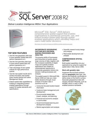
Microsoft® SQL Server® 2008 delivers comprehensive spatial support that enables organizations to seamlessly consume, use, and extend location-based data through spatial-enabled applications which ultimately helps end users make better decisions.<br />http://www.microsoft.com/sqlserver/2008/en/us/data-warehousing.aspx<br />TOP NEW FEATURES<br />Use the new geography data type to store geodetic spatial data and perform operations on it<br />Use the new geometry data type to store planar spatial data and perform operations on it<br />Take advantage of new spatial indexes for high performance queries<br />Use the new spatial results tab to quickly and easily view spatial query results directly from within Management Studio<br />Extend spatial data capabilities by building or integrating location-enabled applications through support for spatial standards and specifications <br />INCORPORATE GEOGRAPHIC FACTORS INTO DECISION MAKING PROCESSES AND ANALYSIS <br />The growing ability of businesses and consumers to quickly absorb large volumes of data, together with the increased availability of digital maps and spatially-enabled applications has created an unprecedented opportunity to incorporate geographic factors into decision making processes and analysis. <br />The spatial support in Microsoft SQL Server 2008 can help you make better decisions through visual analysis of location data in scenarios such as:<br />Consumer-focused location-based information <br />Customer-base management and development<br />Environmental-related data impact, analysis, and planning <br />Financial and economic analysis in communities<br />Government-based planning and development analysis<br />Market segmentation and analysis<br />Scientific research study design and analysis<br />Real-estate development and analysis<br />COMPREHENSIVE SPATIAL SUPPORT<br />Build spatial capabilities into your applications by using the support for spatial data in SQL Server 2008.<br />Work with geodetic data<br />Implement Round Earth solutions with the geography data type. Use latitude and longitude coordinates to define areas on the Earth’s surface. Associate geographical data with industry standard ellipsoids, such as WGS84, which is used in GPS-enabled solutions worldwide. <br />Geodetic model<br />Work with planar data<br />Implement Flat Earth solutions with the geometry data type. Store polygons, points, and lines that are associated with projected planar surfaces and naturally planar data, such as interior spaces.<br />Planar model<br />Build on industry standards<br />Import and export spatial data in industry-standard formats, such as Well Known Text, Well Known Binary, and Geographic Markup Language (GML).Take advantage of geometry data type compatibility with Open Geospatial Consortium (OGC) standards for geometric data types. <br />Perform spatial operations<br />Use the methods provided by SQL Server 2008 spatial data types to write Transact-SQL code that performs operations on spatial data, such as finding intersections between geospatial objects and distances between locations. <br />HIGH PERFORMANCE SPATIAL DATA CAPABILITIES <br />Achieve high performance spatial capabilities with SQL Server 2008.<br />Store large and complex spatial objects<br />Use the spatial types in SQL Server 2008 to accommodate spatial objects, regardless of whether the objects are simple or very complex. <br />Build high-performance solutions with spatial data indexing<br />Enhance query performance by using indexes for spatial data that are integrated into the SQL Server database engine. Take advantage of accurate query optimizer cost assessment for spatial queries that can determine the optimal query plan and identify appropriate index selection.<br />View results directly from within Management Studio<br />Use the new spatial results tab to easily view spatial query results directly from within SQL Server Management Studio. This tab offers simple projection and zoom/pan capabilities for quick investigation.  <br />Spatial Results Tab<br />Consolidate relational and spatial data in business applications<br />Use the native support for spatial data types in SQL Server 2008 to seamlessly incorporate spatial data into line-of-business applications. Avoid the performance and manageability issues associated with a dedicated spatial data store.<br />GEOSPATIAL APPLICATION EXTENSIBILITY<br />Extend spatial support by integrating spatial data in SQL Server 2008 with location-enabled applications and services.  <br />Build spatial solutions of any scale<br />Take advantage of spatial support in multiple editions of SQL Server 2008, from SQL Server Express to SQL Server Enterprise Edition. <br />Use spatial standards support to integrate applications<br />Leverage a .NET-based geometry library that supports OGC standards. Build applications that consume and manipulate spatial data. Integrate with geospatial services, such as Microsoft Virtual Earth™, to build comprehensive location-enabled solutions that render your spatial data for display.<br />Virtual Earth SDK<br />Benefit from spatial community support<br />Take advantage of spatial products and services offered by Microsoft partners that integrate with SQL Server 2008. Microsoft maintains partnerships with the leading GIS application providers and a range of spatial community organizations, integrators, and ISVs.<br />
Sql server 2008 r2 spatial data   datasheet

Mais conteúdo relacionado

Mais de Klaudiia Jacome

Aoutsourcing para capitulo 7
Aoutsourcing para capitulo 7Aoutsourcing para capitulo 7
Aoutsourcing para capitulo 7Klaudiia Jacome
 
Applicationandmulti instances
Applicationandmulti instancesApplicationandmulti instances
Applicationandmulti instancesKlaudiia Jacome
 
Sql server2008 r2_mds_datasheet
Sql server2008 r2_mds_datasheetSql server2008 r2_mds_datasheet
Sql server2008 r2_mds_datasheetKlaudiia Jacome
 
Microsoft sql server 2008 r2 business intelligence
Microsoft sql server 2008 r2 business intelligenceMicrosoft sql server 2008 r2 business intelligence
Microsoft sql server 2008 r2 business intelligenceKlaudiia Jacome
 
Introduction to master data services
Introduction to master data servicesIntroduction to master data services
Introduction to master data servicesKlaudiia Jacome
 
Sql server2008 r2_bi_datasheet_final
Sql server2008 r2_bi_datasheet_finalSql server2008 r2_bi_datasheet_final
Sql server2008 r2_bi_datasheet_finalKlaudiia Jacome
 
Sql server 2008 business intelligence tdm deck
Sql server 2008 business intelligence tdm deckSql server 2008 business intelligence tdm deck
Sql server 2008 business intelligence tdm deckKlaudiia Jacome
 
Microsoft sql server 2008 r2 business intelligence
Microsoft sql server 2008 r2 business intelligenceMicrosoft sql server 2008 r2 business intelligence
Microsoft sql server 2008 r2 business intelligenceKlaudiia Jacome
 
Sql server2008 r2_reporting_services_datasheet
Sql server2008 r2_reporting_services_datasheetSql server2008 r2_reporting_services_datasheet
Sql server2008 r2_reporting_services_datasheetKlaudiia Jacome
 

Mais de Klaudiia Jacome (20)

Aoutsourcing para capitulo 7
Aoutsourcing para capitulo 7Aoutsourcing para capitulo 7
Aoutsourcing para capitulo 7
 
Si las cosas van mal
Si las cosas van malSi las cosas van mal
Si las cosas van mal
 
Analysis services
Analysis  servicesAnalysis  services
Analysis services
 
Enterprise security
Enterprise securityEnterprise security
Enterprise security
 
Performance
PerformancePerformance
Performance
 
Performance
PerformancePerformance
Performance
 
Enterprise security
Enterprise securityEnterprise security
Enterprise security
 
Data warehouse
Data warehouseData warehouse
Data warehouse
 
Managemen tools
Managemen toolsManagemen tools
Managemen tools
 
Managemen tolos
Managemen tolosManagemen tolos
Managemen tolos
 
Data warehouse
Data warehouseData warehouse
Data warehouse
 
Avances analticos
Avances analticosAvances analticos
Avances analticos
 
Applicationandmulti instances
Applicationandmulti instancesApplicationandmulti instances
Applicationandmulti instances
 
Sql server2008 r2_mds_datasheet
Sql server2008 r2_mds_datasheetSql server2008 r2_mds_datasheet
Sql server2008 r2_mds_datasheet
 
Microsoft sql server 2008 r2 business intelligence
Microsoft sql server 2008 r2 business intelligenceMicrosoft sql server 2008 r2 business intelligence
Microsoft sql server 2008 r2 business intelligence
 
Introduction to master data services
Introduction to master data servicesIntroduction to master data services
Introduction to master data services
 
Sql server2008 r2_bi_datasheet_final
Sql server2008 r2_bi_datasheet_finalSql server2008 r2_bi_datasheet_final
Sql server2008 r2_bi_datasheet_final
 
Sql server 2008 business intelligence tdm deck
Sql server 2008 business intelligence tdm deckSql server 2008 business intelligence tdm deck
Sql server 2008 business intelligence tdm deck
 
Microsoft sql server 2008 r2 business intelligence
Microsoft sql server 2008 r2 business intelligenceMicrosoft sql server 2008 r2 business intelligence
Microsoft sql server 2008 r2 business intelligence
 
Sql server2008 r2_reporting_services_datasheet
Sql server2008 r2_reporting_services_datasheetSql server2008 r2_reporting_services_datasheet
Sql server2008 r2_reporting_services_datasheet
 

Último

Vector Search -An Introduction in Oracle Database 23ai.pptx
Vector Search -An Introduction in Oracle Database 23ai.pptxVector Search -An Introduction in Oracle Database 23ai.pptx
Vector Search -An Introduction in Oracle Database 23ai.pptxRemote DBA Services
 
Apidays New York 2024 - Passkeys: Developing APIs to enable passwordless auth...
Apidays New York 2024 - Passkeys: Developing APIs to enable passwordless auth...Apidays New York 2024 - Passkeys: Developing APIs to enable passwordless auth...
Apidays New York 2024 - Passkeys: Developing APIs to enable passwordless auth...apidays
 
[BuildWithAI] Introduction to Gemini.pdf
[BuildWithAI] Introduction to Gemini.pdf[BuildWithAI] Introduction to Gemini.pdf
[BuildWithAI] Introduction to Gemini.pdfSandro Moreira
 
Strategies for Landing an Oracle DBA Job as a Fresher
Strategies for Landing an Oracle DBA Job as a FresherStrategies for Landing an Oracle DBA Job as a Fresher
Strategies for Landing an Oracle DBA Job as a FresherRemote DBA Services
 
Strategize a Smooth Tenant-to-tenant Migration and Copilot Takeoff
Strategize a Smooth Tenant-to-tenant Migration and Copilot TakeoffStrategize a Smooth Tenant-to-tenant Migration and Copilot Takeoff
Strategize a Smooth Tenant-to-tenant Migration and Copilot Takeoffsammart93
 
Why Teams call analytics are critical to your entire business
Why Teams call analytics are critical to your entire businessWhy Teams call analytics are critical to your entire business
Why Teams call analytics are critical to your entire businesspanagenda
 
Cloud Frontiers: A Deep Dive into Serverless Spatial Data and FME
Cloud Frontiers:  A Deep Dive into Serverless Spatial Data and FMECloud Frontiers:  A Deep Dive into Serverless Spatial Data and FME
Cloud Frontiers: A Deep Dive into Serverless Spatial Data and FMESafe Software
 
Web Form Automation for Bonterra Impact Management (fka Social Solutions Apri...
Web Form Automation for Bonterra Impact Management (fka Social Solutions Apri...Web Form Automation for Bonterra Impact Management (fka Social Solutions Apri...
Web Form Automation for Bonterra Impact Management (fka Social Solutions Apri...Jeffrey Haguewood
 
EMPOWERMENT TECHNOLOGY GRADE 11 QUARTER 2 REVIEWER
EMPOWERMENT TECHNOLOGY GRADE 11 QUARTER 2 REVIEWEREMPOWERMENT TECHNOLOGY GRADE 11 QUARTER 2 REVIEWER
EMPOWERMENT TECHNOLOGY GRADE 11 QUARTER 2 REVIEWERMadyBayot
 
Finding Java's Hidden Performance Traps @ DevoxxUK 2024
Finding Java's Hidden Performance Traps @ DevoxxUK 2024Finding Java's Hidden Performance Traps @ DevoxxUK 2024
Finding Java's Hidden Performance Traps @ DevoxxUK 2024Victor Rentea
 
Elevate Developer Efficiency & build GenAI Application with Amazon Q​
Elevate Developer Efficiency & build GenAI Application with Amazon Q​Elevate Developer Efficiency & build GenAI Application with Amazon Q​
Elevate Developer Efficiency & build GenAI Application with Amazon Q​Bhuvaneswari Subramani
 
Architecting Cloud Native Applications
Architecting Cloud Native ApplicationsArchitecting Cloud Native Applications
Architecting Cloud Native ApplicationsWSO2
 
ICT role in 21st century education and its challenges
ICT role in 21st century education and its challengesICT role in 21st century education and its challenges
ICT role in 21st century education and its challengesrafiqahmad00786416
 
Artificial Intelligence Chap.5 : Uncertainty
Artificial Intelligence Chap.5 : UncertaintyArtificial Intelligence Chap.5 : Uncertainty
Artificial Intelligence Chap.5 : UncertaintyKhushali Kathiriya
 
Navigating the Deluge_ Dubai Floods and the Resilience of Dubai International...
Navigating the Deluge_ Dubai Floods and the Resilience of Dubai International...Navigating the Deluge_ Dubai Floods and the Resilience of Dubai International...
Navigating the Deluge_ Dubai Floods and the Resilience of Dubai International...Orbitshub
 
Modular Monolith - a Practical Alternative to Microservices @ Devoxx UK 2024
Modular Monolith - a Practical Alternative to Microservices @ Devoxx UK 2024Modular Monolith - a Practical Alternative to Microservices @ Devoxx UK 2024
Modular Monolith - a Practical Alternative to Microservices @ Devoxx UK 2024Victor Rentea
 
How to Troubleshoot Apps for the Modern Connected Worker
How to Troubleshoot Apps for the Modern Connected WorkerHow to Troubleshoot Apps for the Modern Connected Worker
How to Troubleshoot Apps for the Modern Connected WorkerThousandEyes
 
Repurposing LNG terminals for Hydrogen Ammonia: Feasibility and Cost Saving
Repurposing LNG terminals for Hydrogen Ammonia: Feasibility and Cost SavingRepurposing LNG terminals for Hydrogen Ammonia: Feasibility and Cost Saving
Repurposing LNG terminals for Hydrogen Ammonia: Feasibility and Cost SavingEdi Saputra
 
Corporate and higher education May webinar.pptx
Corporate and higher education May webinar.pptxCorporate and higher education May webinar.pptx
Corporate and higher education May webinar.pptxRustici Software
 
Introduction to Multilingual Retrieval Augmented Generation (RAG)
Introduction to Multilingual Retrieval Augmented Generation (RAG)Introduction to Multilingual Retrieval Augmented Generation (RAG)
Introduction to Multilingual Retrieval Augmented Generation (RAG)Zilliz
 

Último (20)

Vector Search -An Introduction in Oracle Database 23ai.pptx
Vector Search -An Introduction in Oracle Database 23ai.pptxVector Search -An Introduction in Oracle Database 23ai.pptx
Vector Search -An Introduction in Oracle Database 23ai.pptx
 
Apidays New York 2024 - Passkeys: Developing APIs to enable passwordless auth...
Apidays New York 2024 - Passkeys: Developing APIs to enable passwordless auth...Apidays New York 2024 - Passkeys: Developing APIs to enable passwordless auth...
Apidays New York 2024 - Passkeys: Developing APIs to enable passwordless auth...
 
[BuildWithAI] Introduction to Gemini.pdf
[BuildWithAI] Introduction to Gemini.pdf[BuildWithAI] Introduction to Gemini.pdf
[BuildWithAI] Introduction to Gemini.pdf
 
Strategies for Landing an Oracle DBA Job as a Fresher
Strategies for Landing an Oracle DBA Job as a FresherStrategies for Landing an Oracle DBA Job as a Fresher
Strategies for Landing an Oracle DBA Job as a Fresher
 
Strategize a Smooth Tenant-to-tenant Migration and Copilot Takeoff
Strategize a Smooth Tenant-to-tenant Migration and Copilot TakeoffStrategize a Smooth Tenant-to-tenant Migration and Copilot Takeoff
Strategize a Smooth Tenant-to-tenant Migration and Copilot Takeoff
 
Why Teams call analytics are critical to your entire business
Why Teams call analytics are critical to your entire businessWhy Teams call analytics are critical to your entire business
Why Teams call analytics are critical to your entire business
 
Cloud Frontiers: A Deep Dive into Serverless Spatial Data and FME
Cloud Frontiers:  A Deep Dive into Serverless Spatial Data and FMECloud Frontiers:  A Deep Dive into Serverless Spatial Data and FME
Cloud Frontiers: A Deep Dive into Serverless Spatial Data and FME
 
Web Form Automation for Bonterra Impact Management (fka Social Solutions Apri...
Web Form Automation for Bonterra Impact Management (fka Social Solutions Apri...Web Form Automation for Bonterra Impact Management (fka Social Solutions Apri...
Web Form Automation for Bonterra Impact Management (fka Social Solutions Apri...
 
EMPOWERMENT TECHNOLOGY GRADE 11 QUARTER 2 REVIEWER
EMPOWERMENT TECHNOLOGY GRADE 11 QUARTER 2 REVIEWEREMPOWERMENT TECHNOLOGY GRADE 11 QUARTER 2 REVIEWER
EMPOWERMENT TECHNOLOGY GRADE 11 QUARTER 2 REVIEWER
 
Finding Java's Hidden Performance Traps @ DevoxxUK 2024
Finding Java's Hidden Performance Traps @ DevoxxUK 2024Finding Java's Hidden Performance Traps @ DevoxxUK 2024
Finding Java's Hidden Performance Traps @ DevoxxUK 2024
 
Elevate Developer Efficiency & build GenAI Application with Amazon Q​
Elevate Developer Efficiency & build GenAI Application with Amazon Q​Elevate Developer Efficiency & build GenAI Application with Amazon Q​
Elevate Developer Efficiency & build GenAI Application with Amazon Q​
 
Architecting Cloud Native Applications
Architecting Cloud Native ApplicationsArchitecting Cloud Native Applications
Architecting Cloud Native Applications
 
ICT role in 21st century education and its challenges
ICT role in 21st century education and its challengesICT role in 21st century education and its challenges
ICT role in 21st century education and its challenges
 
Artificial Intelligence Chap.5 : Uncertainty
Artificial Intelligence Chap.5 : UncertaintyArtificial Intelligence Chap.5 : Uncertainty
Artificial Intelligence Chap.5 : Uncertainty
 
Navigating the Deluge_ Dubai Floods and the Resilience of Dubai International...
Navigating the Deluge_ Dubai Floods and the Resilience of Dubai International...Navigating the Deluge_ Dubai Floods and the Resilience of Dubai International...
Navigating the Deluge_ Dubai Floods and the Resilience of Dubai International...
 
Modular Monolith - a Practical Alternative to Microservices @ Devoxx UK 2024
Modular Monolith - a Practical Alternative to Microservices @ Devoxx UK 2024Modular Monolith - a Practical Alternative to Microservices @ Devoxx UK 2024
Modular Monolith - a Practical Alternative to Microservices @ Devoxx UK 2024
 
How to Troubleshoot Apps for the Modern Connected Worker
How to Troubleshoot Apps for the Modern Connected WorkerHow to Troubleshoot Apps for the Modern Connected Worker
How to Troubleshoot Apps for the Modern Connected Worker
 
Repurposing LNG terminals for Hydrogen Ammonia: Feasibility and Cost Saving
Repurposing LNG terminals for Hydrogen Ammonia: Feasibility and Cost SavingRepurposing LNG terminals for Hydrogen Ammonia: Feasibility and Cost Saving
Repurposing LNG terminals for Hydrogen Ammonia: Feasibility and Cost Saving
 
Corporate and higher education May webinar.pptx
Corporate and higher education May webinar.pptxCorporate and higher education May webinar.pptx
Corporate and higher education May webinar.pptx
 
Introduction to Multilingual Retrieval Augmented Generation (RAG)
Introduction to Multilingual Retrieval Augmented Generation (RAG)Introduction to Multilingual Retrieval Augmented Generation (RAG)
Introduction to Multilingual Retrieval Augmented Generation (RAG)
 

Sql server 2008 r2 spatial data datasheet

  • 1. Microsoft® SQL Server® 2008 delivers comprehensive spatial support that enables organizations to seamlessly consume, use, and extend location-based data through spatial-enabled applications which ultimately helps end users make better decisions.<br />http://www.microsoft.com/sqlserver/2008/en/us/data-warehousing.aspx<br />TOP NEW FEATURES<br />Use the new geography data type to store geodetic spatial data and perform operations on it<br />Use the new geometry data type to store planar spatial data and perform operations on it<br />Take advantage of new spatial indexes for high performance queries<br />Use the new spatial results tab to quickly and easily view spatial query results directly from within Management Studio<br />Extend spatial data capabilities by building or integrating location-enabled applications through support for spatial standards and specifications <br />INCORPORATE GEOGRAPHIC FACTORS INTO DECISION MAKING PROCESSES AND ANALYSIS <br />The growing ability of businesses and consumers to quickly absorb large volumes of data, together with the increased availability of digital maps and spatially-enabled applications has created an unprecedented opportunity to incorporate geographic factors into decision making processes and analysis. <br />The spatial support in Microsoft SQL Server 2008 can help you make better decisions through visual analysis of location data in scenarios such as:<br />Consumer-focused location-based information <br />Customer-base management and development<br />Environmental-related data impact, analysis, and planning <br />Financial and economic analysis in communities<br />Government-based planning and development analysis<br />Market segmentation and analysis<br />Scientific research study design and analysis<br />Real-estate development and analysis<br />COMPREHENSIVE SPATIAL SUPPORT<br />Build spatial capabilities into your applications by using the support for spatial data in SQL Server 2008.<br />Work with geodetic data<br />Implement Round Earth solutions with the geography data type. Use latitude and longitude coordinates to define areas on the Earth’s surface. Associate geographical data with industry standard ellipsoids, such as WGS84, which is used in GPS-enabled solutions worldwide. <br />Geodetic model<br />Work with planar data<br />Implement Flat Earth solutions with the geometry data type. Store polygons, points, and lines that are associated with projected planar surfaces and naturally planar data, such as interior spaces.<br />Planar model<br />Build on industry standards<br />Import and export spatial data in industry-standard formats, such as Well Known Text, Well Known Binary, and Geographic Markup Language (GML).Take advantage of geometry data type compatibility with Open Geospatial Consortium (OGC) standards for geometric data types. <br />Perform spatial operations<br />Use the methods provided by SQL Server 2008 spatial data types to write Transact-SQL code that performs operations on spatial data, such as finding intersections between geospatial objects and distances between locations. <br />HIGH PERFORMANCE SPATIAL DATA CAPABILITIES <br />Achieve high performance spatial capabilities with SQL Server 2008.<br />Store large and complex spatial objects<br />Use the spatial types in SQL Server 2008 to accommodate spatial objects, regardless of whether the objects are simple or very complex. <br />Build high-performance solutions with spatial data indexing<br />Enhance query performance by using indexes for spatial data that are integrated into the SQL Server database engine. Take advantage of accurate query optimizer cost assessment for spatial queries that can determine the optimal query plan and identify appropriate index selection.<br />View results directly from within Management Studio<br />Use the new spatial results tab to easily view spatial query results directly from within SQL Server Management Studio. This tab offers simple projection and zoom/pan capabilities for quick investigation. <br />Spatial Results Tab<br />Consolidate relational and spatial data in business applications<br />Use the native support for spatial data types in SQL Server 2008 to seamlessly incorporate spatial data into line-of-business applications. Avoid the performance and manageability issues associated with a dedicated spatial data store.<br />GEOSPATIAL APPLICATION EXTENSIBILITY<br />Extend spatial support by integrating spatial data in SQL Server 2008 with location-enabled applications and services. <br />Build spatial solutions of any scale<br />Take advantage of spatial support in multiple editions of SQL Server 2008, from SQL Server Express to SQL Server Enterprise Edition. <br />Use spatial standards support to integrate applications<br />Leverage a .NET-based geometry library that supports OGC standards. Build applications that consume and manipulate spatial data. Integrate with geospatial services, such as Microsoft Virtual Earth™, to build comprehensive location-enabled solutions that render your spatial data for display.<br />Virtual Earth SDK<br />Benefit from spatial community support<br />Take advantage of spatial products and services offered by Microsoft partners that integrate with SQL Server 2008. Microsoft maintains partnerships with the leading GIS application providers and a range of spatial community organizations, integrators, and ISVs.<br />