
Recomendados
Mais conteúdo relacionado
Semelhante a Mexico's Top Natural and Cultural Sites
Semelhante a Mexico's Top Natural and Cultural Sites (20)
Mais de joseluiscaro
Mais de joseluiscaro (20)
Último
Último (20)
Mexico's Top Natural and Cultural Sites
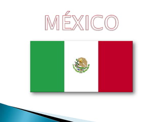
- 1. MÉXICO
- 2. La Barranca del Cobre is a group of canyons consisting of 6different locations in the Sierra Tarahumara in the north western Mexican state of Chihuahua in Mexico. The canyon system is largerand deeper than the Grand Canyon in the United States of America.
- 3. The Lagunas de Montebello National Park has 6 022 hectares. It was created on December 16, 1959, to conserve soil, forests and lakes of this place and create a tourist center. Comprised of avariety of fauna and flora in the forests and several lakes, whose waters impressive color from green to turquoise blue.
- 4. Thevolcano Popocatepetl. Popocatepetl is an active volcano located in centralMexico, within the territorial limits of the states of Morelos, Pueblaand Mexico. It is located about 55 km southeast of Mexico City.Popocatepetl volcano is a symmetrical cone-shaped, is attached to the north with the Iztaccíhuatl through a mountain pass known asPaso de Cortes. The perennial ice volcano is near the mouth of the cone at the tip of the mountain. It is the second highest volcano in Mexico, with a maximum height of 5500 meters above sea level, only after the Pico de Orizaba to 5610 meters.
- 5. Playa del Carmen is the head of the municipality of Solidaridad, Quintana Roo, located southeast of Mexico, south of Cancun.Is within what has been called the Riviera Maya. The city (located at coordinates 20.62 degrees north and 87.07 degrees west) is washed by the Caribbean Sea and its main economic activity is tourism. This comes from the hand that also generate a lot of work in the construction industry, this is the second largest industry in the municipality.
- 6. Guadalajara is a Mexican city, capital of Jalisco state and municipality in the main urban area called Zona Metropolitana de Guadalajara. It is located in western Mexico, central Jalisco, in the geographical area known as Valle de Atemajac. It is the second largest city in the country.
- 7. Cabo San Lucas Mexico is a city located on the southern tip of Baja California and Baja California Sur. Its coasts unite the waters of the Gulf of California and the Pacific Ocean. Its geographical location is22.88 degrees north latitude and 109.90 degrees west longitude.
- 8. El Palacio Postal in Mexico or the Fifth House Post Office is one of the most emblematic buildings and a symbol of the historic center of Mexico City. This impressive work of eclectic architecture was built in the early twentieth century as a symbol of Porfirio Diaz (on the presidency of Porfirio Díaz showing the development and progress of Mexicans who had reached at that time.
- 9. The Independence Monument, also known as ¨ independence fairy ¨ and popularly as the Angel or the Angel of Independence monuments located in Mexico City, at the roundabout at the junction of Paseo de la Reforma , Tiber River and Florence. Established in 1910 to commemorate the centenary of the independence of Mexico by President Porfirio Diaz in 1923 it was adapted to house there mains of different characters from the War of Independence, currently used as a cultural icon of Mexico City and place of national festivals.
- 10. The Church of Santo Domingo is a Baroque church of the eighteenth century and is all that remains of what was the important monastery of the Order of Santo Domingo in Mexico City. Located in the historic city center, Plaza May 23, and facing the north side of the Plaza de Santo Domingo, very near the cathedral.
- 11. Noelia Castro Calderón PepiAlmanza Martín 3 .° B Madeby: