
Recomendados
Recomendados
Mais conteúdo relacionado
Último
Último (20)
Destaque
Destaque (20)
Presentation in ENTRO - Eastern Nile hydrological Work
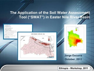
- 1. The Application of the Soil Water Assessment Tool (“SWAT”) in Easter Nile River Basin Jorge Escurra October, 2011 Ethiopia - Workshop, 2011 LOGO
- 2. ENPM seeks to encourage use of public- domain modeling tools especially using available public-domain global and local datasets Soil and Water Assessment Tool (SWAT) is a popular tool for water modeling – especially water balance assessments LOGO Ethiopia - Workshop, 2011
- 3. Models and Databases “Models are feed by databases” LOGO Ethiopia - Workshop, 2011
- 4. Solving a Problem Disaster happened : DC - Irene Hurricane (2011) Webpage Models GPS - Pictures/Photos Or - Coordinates Lat and Long Cell phones - Physical characteristics such as,,,, - “Unique code” Database “Update” – autonomous way LOGO Ethiopia - Workshop, 2011
- 5. SWAT Soil water Assessment Tool is a long term continuous watershed simulation model. It was developed by Jeff Arnold for the USDA Agriculture Research Service (ARS) in 1998. SWAT was developed to predict the impact of land management practices on water, sediment, climate change, and agriculture chemicals yields. Daily time steps. Physically based (hydrology, plant growth, nutrients, pesticides and land management) LOGO Ethiopia - Workshop, 2011
- 6. SWAT LOGO
- 7. LOGO Ethiopia - Workshop, 2011
- 8. How to Use SWAT SWAT model allows users to: • Use a GIS interface. • Consider the topographical characteristics. • Use Hydrological Response Units. • Download and use open source code. • Access SWAT2009.mdb SWAT model uses the following equations (SWAT Manual and J Schuol, 2005): LOGO Ethiopia - Workshop, 2011
- 9. SWAT Process - Bolivia INPUT Digital Elevation Model Basin delineation Climate data Soil types Land use Kc SWAT Infrastructure dams and irrigation schemes Crop calendar and agriculture practices OUTPUT Precipitation Evapotranspiration Sediments Water yield Soil water moisture LOGO Ethiopia - Workshop, 2011
- 10. Model accuracy Divide available time series… Flow (m 3/s) Set up Calibration Validation LOGO Ethiopia - Workshop, 2011
- 11. Validation/Calibration indicators LOGO Ethiopia - Workshop, 2011
- 12. Beni Basin Indicador Valor Calificación RRSME 0.48 muy bueno NSE 0.54 Satisfactorio R2 0.6 PBIAS 1.5 muy bueno Indicador Valor Calificación RRSME 0.44 muy bueno NSE 0.65 bueno R2 0.82LOGO PBIAS 28 insatisfactorio
- 13. Ganges: Basic Model Results LOGO Emerging Talent Water Series, 2011
- 14. Climate Change LOGO Ethiopia - Workshop, 2011
- 15. LOGO Ethiopia - Workshop, 2011
- 16. LOGO
- 17. Runoff will change… but in which direction? Mid-Century Monthly Flow Scenarios at Farakka Flo Rate in Farakka - Ganges Basin 100000 90,000 1969 1970 80,000 90000 1971 1972 1973 70,000 80000 1974 1975 1976 60,000 1977 70000 1978 Flow rate (m3/s) 1979 50,000 1980 60000 1981 1982 Flow rate (cms) 40,000 1983 50000 1984 30,000 1985 1986 1987 40000 1988 20,000 1989 1990 10,000 30000 1991 1992 1993 0 1994 20000 Jan Feb Mar Apr May Jun Jul Aug Sep Oct Nov Dec 1995 1996 BCM - 2050 UKMO - 2050 CMA - 2050 IPSL - 2050 1997 10000 1998 CNRM - 2050 CSIRO_MK3 - 2050 GFDL_CM2_0 - 2050 GFDL_CM2_1 - 2050 1999 GISS - 2050 INMCM3 - 2050 MIROC3 - 2050 MIUB_ECHO - 2050 2000 MPI_ECHAM - 2050 MRI_CGCM2 - 2050 NCAR_CCSM3 - 2050 NCAR_PSM1 - 2050 0 2001 Baseline (1969 - 2001) Baseline Jan Feb Mar Apr May Jun Jul Aug Sep Oct Nov Dec Model Historical data 1970-2000 predictions 2050 LOGO Ethiopia - Workshop, 2011
- 18. Hydropower Sensitivity to Climate Change Models (2050 A2 Scenarios) Tamur-1 Lower Arun 100% Sun Kosi-2 Arun III Andhi Khola 50% Sapt kosi Kali Gandaki-1 0% %HP Change BCM %HP Change CMA Kulekhani-1 -50% Kali Gandaki-2 %HP Change GFDL_CM2 %HP Change GISS %HP Change MIU_ECHO -100% %HP Change CSIRO Kamala Seti-1 (Central) %HP Change CNRM %HP Change UKMO %HP Change MIROC Pancheswor Marsyandi %HP Change NCARPM1 Seti-6 (West) Burhi Gandaki Karnali-1B Sapta Gandaki Chisapani Trisuli LOGO Ethiopia - Workshop, 2011
- 19. What we can do in the Nile Basin? Land use Weather Soil Types LOGO Ethiopia - Workshop, 2011
- 20. LOGO Emerging Talent Water Series, 2011