SlideShare uma empresa Scribd logo
1 de 17
Baixar para ler offline
natural power


ZephIR® laser anemometer

lidar wind profiler for
reliable, accurate, bankable wind data
up to 200m from ground level


           clever                        ™
deployed with:
                        measure wind with                              ZephIR®
                        We PIoNeeRed the use of LIdAR IN the WINd INdustRy some eIght yeARs
                        Ago. WIth moRe thAN 200 ZephIR dePLoymeNts gLobALLy We RemAIN the
                        mARket LeAdeR.


                        ZephIR has successfully operated through Canadian winters and Australian summers. Customers
                        have financed projects using ZephIR data. Banks’ Engineers recommend ZephIR onshore and
                        offshore to both complement and replace traditional masts. This is how we do it:


                                 •	 10m to 200m wind profile - speed, direction, turbulence
                                 •	 speed accuracy* < 0.5%
                                 •	 direction accuracy* < 0.5°
Natural Power ZephIR


                                                                                                                                                                                                                            Natural Power ZephIR
                                 •	 50 data points per second
                                 •	 - 25°C to + 40°C operation (extendable operating range)
                                 •	 100W average power draw**
                                 •	 + 5 years experience in the field
                                 •	 Industry approved validation
                                 •	 Accepted by banks’ engineers
                                 •	 one-man portable pods


                        So what can we do to reduce your project risk and uncertainty?


                       measure the wind up to
                                                                           200 m
                                                                                etres                                                                                                                      c        e
                                                                                      from                                                                                                             ten
                                                                                                               groun                                                                            s   en
                                                                                                                     d                                                                      s
                                                                                                                         level
                                                                                                                                 .. . . . . . . .                                rea d t hi
                                                                                                                                                    in t h e t ime it takes to
                        * as measured against a calibrated moving target
                        ** in standard dry climates (-13°C to +25°C)
Natural Power ZephIR


                                                             Natural Power ZephIR
                        ZephIR has been used on more than
                       200 deployments and has operated in
                             23 countries worldwide
“ZephIR is approved to be added to the ReRL
                                                                                                                            suite of wind speed measurement devices“

                       ZephIR APPLICAtIoNs                                                                                            - University of Massachusetts (UMASS)
                       IN the WINd INdustRy

                                                                                                                            “during the offshore assessment campaign
                       the ACCuRAte PRedICtIoN of eNeRgy yIeLds Is fuNdAmeNtAL to the                                       ZephIR came up with a remarkable data
                       suCCess of WINd fARm PRojeCts. yIeLd PRedICtIoN ACCuRACy INCReAses                                   availability, clearly being better than the
                       by CoLLeCtINg hIgh quALIty WINd dAtA fRom NumeRous PoINts                                            demanded 95%... ZephIR should now be
                       thRoughout A WINd fARm ANd At APPRoPRIAte heIghts INCLudINg the                                      thought of as a powerful tool to aid in the
                       fuLL RotoR sWeeP. thIs deNsIty of dAtA CoLLeCtIoN Is dIffICuLt ANd                                   understanding of flow conditions on sites
                       exPeNsIve to AChIeve WIth tRAdItIoNAL ANemometRy mAsts ALoNe.                                        being investigated“

                                                                                                                                            - Germanischer Lloyd WINDTEST
                       Based at ground level, ZephIR provides complete wind resource measurement including horizontal
Natural Power ZephIR


                                                                                                                                                                              Natural Power ZephIR
                       and vertical wind speed, wind direction and turbulence at any height up to 200 metres without
                       the need for a mast. ZephIR requires no planning permits and removes the need to work at height,     “the ZephIR technology has provided Naikun
                       mitigating associated health & safety issues.                                                        with continual wind resource measurement
                                                                                                                            in a very challenging offshore environment.
                       The portability of ZephIR and ease of deployment makes high density data collection a reality with   Its reliability and performance has been close
                       50 measurements per height per second, both horizontally and vertically across the extent of your    to 100 per cent and is a valuable asset in the
                       site. ZephIR is used in four phases of a project:                                                    development of the Naikun offshore wind
                                                                                                                            project in hecate strait near haida gwaii (the
                          •	   site prospecting, assessment and turbine micro-siting                                        queen Charlotte Islands)”
                          •	   Wind flow model verification
                          •	   Power curve assessment                                                                                       - NaiKun Wind Development Inc.
                          •	   Permanent wind farm anemometry and operational wind farm analysis


                       ZephIR has been independently tested and validated by respected parties in the wind industry.        “We evaluated ZephIR’s performance next
                                                                                                                            to a 100m mast in complex terrain and
                                                                                                                            witnessed extremely high correlations against
                                                                                                                            traditional meteorology, at all heights”

                                                                                                                               - Center for Renewable Energy Sources (CRES)
the PRINCIPLes of LIdAR

                                                                                                                                                  200 metres (656 feet) allowing
                       dR mIChAeL hARRIs, seNIoR sCIeNtIst At NAtuRAL PoWeR,                                                                      measurements across the full wind
                       hAs sPeNt oveR A deCAde WoRkINg IN the fIeLd of LIdAR                                                                      turbine rotor diameter including hub
                                                                                                                                                  height and tip height measurements.
                       ReseARCh ANd desIgN. mIChAeL WAs fuNdAmeNtAL IN the
                       desIgN CoNCePt of ZephIR At oNe of euRoPe’s LeAdINg
                       ReseARCh ANd deveLoPmeNt INstItutes. beLoW, he
                       outLINes the PRINCIPLes of LIdAR.


                       “An eye-safe infrared beam illuminates natural aerosols in the atmosphere
                       (such as dust, pollen and water droplets) and a small fraction of the light is
Natural Power ZephIR


                                                                                                                                                                                         Natural Power ZephIR
                       back scattered into a receiver. Motion of the target particles along the beam direction leads to a                         5 user defined heights configured
                                                                                                                                                  using the simple ZephIR Waltz™
                       change in the light’s frequency through Doppler shift which is then accurately measured.                                   software supplied with every system.


                       A conical scan pattern is used to move the
                       beam and intercept the wind at different angles,
                       building up a series of measurements around a
                       disc of air from which the wind speed vector is
                       obtained.


                       ZephIR obtains each measurement in just 20                                                             25 minutes set-up   10 metres (33 feet) allowing
                                                                                                                                                  for correlations to short masts
                       milliseconds and one second of data can be                                                                                 or historic wind data. Low
                       used to derive the horizontal and vertical wind speed components and wind direction. This can                              measurements are particularly
                                                                                                                                                  important offshore when the
                       then be repeated from 10 metres up to a height of 200 metres, at five or more user-defined                                 system is on a raised platform or
                       heights by focussing the transmitted beam.”                                                                                when an accurate onshore shear
                                                                                                                                                  measurement is required.

                       Michael is invited to present lidar papers and tuition sessions within a wide range of organisations
                       across Europe and North America. He has conducted fundamental optics research at JILA
                                                                                                                                                  2 metres (6 foot 6 inches) ground
                       (Boulder, Colorado) and the University of Essex.                                                                           level wind measurements plus
                                                                                                                                                  temperature, barometric pressure
                                                                                                                                                  and humidity.
ZephIR evaluated at Risø’s høvsøre test, 2009
                                                                                                                                           ZephIR is compared to the fixed anemometry at Risø’s Høvsøre 116m met mast during a test campaign over Winter 2009.


                                                                                                                                                                                            ZephIR vs. cup @ 100m                                                                                       ZephIR vs. cup @ 80m
                                                                                                                                                                               20                                                                                                      18


                                                                                                                                                                               18
                                                                                                                                                                                                                                                                                       16


                                                                                                                                                                               16


                       INdePeNdeNt CoRReLAtIoNs
                                                                                                                                                                                                                                                                                       14


                                                                                                                                                                               14
                                                                                                                                                                                                                                                                                       12


                                                                                                                                                                                                                                                         ZephIR Wind Speed 78m (m/s)
                                                                                                                                             ZephIR Wind Speed 98m
                                                                                                                                                                               12

                                                                                                                                                                                                                                                                                       10

                                                                                                                                                                               10

                                                                                                                                                                                                                                                                                        8
                                                                                                                                                                                8


                                                                                                                                                                                6                                                     y = 0.999x                                        6
                                                                                                                                                                                                                                                                                                                                                               y = 1.000x
                                                                                                                                                                                                                                      R² = 0.986                                                                                                               R² = 0.988
                       Risø evaluation of ZephIR at høvsøre, 2008                                                                                                               4                                                                                                       4


                       ZephIR is compared to the fixed anemometry at Risø’s Høvsøre 1   16m met mast. Ten minute average wind speeds are                                        2                                                                                                       2


                       collected over a 10 week period at 4 heights. This recent study took place during the Spring of 2008.                                                    0
                                                                                                                                                                                    0   2   4    6       8              10       12     14     16   18
                                                                                                                                                                                                                                                                                        0
                                                                                                                                                                                                                                                                                            0   2       4       6           8               10           12         14        16    18
                                                                                                                                                                                                      Mast Wind Speed 100m
                                                                                                                                                                                                                                                                                                                        Mast Wind Speed 80m (m/s)


                                                                                                                                                                                            ZephIR vs. cup @ 60m                                                                                        ZephIR vs. cup @ 40m
                                                                                                                                                                                                                                                                                       18
                                                                                                                                                                               18


                                                                                                                                                                                                                                                                                       16
                                                                                                                                                                               16


                                                                                                                                                                                                                                                                                       14
                                                                                                                                                                               14


                                                                                                                                                                                                                                                                                       12
                                                                                                                                                                               12


                                                                                                                                                                                                                                                         ZephIR Wind Speed 38m (m/s)
                                                                                                                                                 ZephIR Wind Speed 58m (m/s)
Natural Power ZephIR


                                                                                                                                                                                                                                                                                                                                                                                         Natural Power ZephIR
                                                                                                                                                                                                                                                                                       10
                                                                                                                                                                               10


                                                                                                                                                                                                                                                                                        8
                                                                                                                                                                                8


                                                                                                                                                                                6
                                                                                                                                                                                                                                      y = 0.999x
                                                                                                                                                                                                                                                                                        6
                                                                                                                                                                                                                                                                                                                                                              y = 0.999x
                                                                                                                                                                                                                                      R² = 0.992                                        4
                                                                                                                                                                                                                                                                                                                                                              R² = 0.986
                                                                                                                                                                                4


                                                                                                                                                                                                                                                                                        2
                                                                                                                                                                                2


                                                                                                                                                                                                                                                                                        0
                                                                                                                                                                                0
                                                                                                                                                                                                                                                                                            0       2       4       6              8                10         12        14        16
                                                                                                                                                                                    0   2   4    6       8              10       12     14     16   18
                                                                                                                                                                                                                                                                                                                        Mast Wind Speed 40m (m/s)
                                                                                                                                                                                                     Mast Wind Speed 60m (m/s)


                       germanischer Lloyd WINdtest evaluation of ZephIR offshore at fINo1 research platform, 2006
                       ZephIR is compared to the fixed anemometry over a six month period.
                                                                                                                                           The correlation graphs show the relationship between the wind speed readings from a cup and the corresponding wind
                                                                                                                                           speed readings from the ZephIR. Data are plotted against each other and a line of best fit drawn. By forcing this line
                                                                                                                                           of best fit through the origin its gradient, y, indicates the mean difference between the two readings. For example, a
                                                                                                                                           gradient of 1.01 would indicate a difference of 1%. The R 2 value gives an assessment of how well correlated the two
                                                                                                                                           sets of values are. If the cup and the ZephIR always read identically then the R 2 value will be 1, i.e. they are perfectly
                                                                                                                                           correlated. At the other extreme, an R 2 value of zero would indicate that the values bear no relationship to each other
                                                                                                                                           whatsoever.


                                                                                                                                           evaluation of ZephIR at a tall mast in North America, 2009
                                                                                                                                           The identical ZephIR system tested above is also compared to the fixed anemometry at a 193m met mast during a test
                                                                                                                                           campaign in Spring, 2009.


                       For the above campaign, the availability was recorded as:


                         •	 100% for the overall system availability
                         •	 99.6% for the overall data availability
beNefIts of
                       ZephIR LIdAR                                                                                                                                      CLoud ReCogNItIoN ANd RemovAL


                       Not ALL LIdARs ARe the sAme. ZephIR Is desIgNed ARouNd veRy sImPLe,                                       CLouds CAN be hIghLy sCAtteRINg objeCts WhICh PRovIde A sIgNAL thAt
                       Rugged ANd ReLIAbLe oPtICs, the heARt of WhICh Is A CoNtINuous WAve                                       Is meAsuRed by LIdARs. INCLusIoN of these sIgNALs IN PRoCessed dAtA
                       (CW) LIdAR WhICh PRovIdes CLeAR AdvANtAges oveR otheR LIdAR systems                                       CouLd LeAd to AN oveRALL INCReAse IN the uNCeRtAINty of the WINd
                                                                                                                                 sPeed meAsuRed.


                       Sensitivity                                                                                               ZephIR is able to recognise and remove this cloud signal using a patented cloud removal algorithm. This has been
                                                                                                                                 extensively tested in a number of locations, and its effectiveness demonstrated by correlation analysis against calibrated
                       ZephIR’s sensitivity remains constant at all heights ensuring high data availability in all conditions.
                                                                                                                                 tall masts.
                       The emitted laser beam is focussed at each user configured height - the laser power does not
Natural Power ZephIR


                                                                                                                                                                                                                                                              Natural Power ZephIR
                       change at each height or with range and so the sensitivity does not degrade.                              During the wind profile scan, background measurements are taken to quantify the specific cloud return and the cloud
                                                                                                                                 effect is then removed from the processed data. In general, Lidars of various types of design will all have difficulty
                                                                                                                                 measuring in very low cloud and fog scenarios; the light emitted from the Lidar simply doesn’t reach the height of
                       Sample rate
                                                                                                                                 interest due to the density of the atmosphere. Whilst this atmospheric condition mostly occurs during low wind speed
                       ZephIR measures 50 data points every second across a full 360 degree scan providing the high              periods, it is essential that these periods be identified. With ZephIR these particular conditions can be ‘seen’ and
                       sample rate advantageous in complex and fast changing air flows.                                          automatically detected and filtered.


                                                                                                                                 ZephIR can be configured so that the data output is automatically filtered for such conditions of reduced certainty, ready
                       Accurate measurements                                                                                     to use wind data simply presented to you over the averaging period of your choice.
                       ZephIR provides highly accurate measurements from 200 metres down to just 10 metres from
                       ground level where wind shear typically changes more rapidly with height.                                                                                                                 totAL dAtA               dAtA PoINts
                                                                                                                                        heIght            y (mean difference)          R2 (correlation)
                                                                                                                                                                                                                   PoINts                 WIth CLoud
                                                                                                                                         1
                                                                                                                                         16m                      0.990                     0.986                    2604                      1098
                       As height increases and wind shear changes less rapidly, ZephIR still provides highly accurate
                                                                                                                                         100m                     0.999                     0.986                    2603                      1098
                       measurements with a probe length of less than 8 metres @ 100 metres height. Similarly, the                         80m                     1.000                     0.988                    2601                      1094
                       optics are designed such that at 200 metres, ZephIR delivers excellent results as demonstrated on                  60m                     0.999                      0.992                    2597                     1093

                       the previous page.                                                                                                 40m                     0.999                     0.986                     2740                     1 92
                                                                                                                                                                                                                                               1


                       ZephIR’s optical design ensures that at these crucial low heights, probe length (effective sample         In order to demonstrate the accurate performance of ZephIR with cloud conditions the above results have been
                                                                                                                                 measured. The data set below was taken during periods of both clear (~ 60%) and cloudy (~40%) skies. The number
                       length) can be as small as just 7 cm.
                                                                                                                                 of data points taken during cloud has been indicated (cloud was measured using a Ceilometer), demonstrating excellent
                                                                                                                                 accuracy in extreme cloud conditions.
INdustRy ACCePted                                                                                                                                                                                  sAfety & eNvIRoNmeNtAL
                       vALIdAtIoN                                                                                                                                                                                                   CeRtIfICAtIoNs


                       ALL LIdAR systems Need to be suCCessfuLLy vALIdAted to AN INdustRy                                                                 LIdAR systems IN the WINd INdustRy must oPeRAte sAfeLy. ZephIR
                       ACCePted stANdARd befoRe CustomeRs CommeNCe dePLoymeNt.                                                                            hAs uNdeRgoNe RIgoRous sAfety testINg eNsuRINg ANy useR CAN
                       bANks’ eNgINeeR gARRAd hAssAN hAve WoRked WIth us IN defININg                                                                      effeCtIveLy oPeRAte the system WIth mINImAL tRAININg ANd No sPeCIfIC
                       the PRINCIPLes of ouR vALIdAtIoN PRoCess foR ALL NeW systems.                                                                      quALIfICAtIoNs oR CeRtIfICAtIoN IN LAseRs. We hAve suCCessfuLLy
                       thIs PRovIdes the tRACeAbILIty WhICh Is A key eLemeNt of foRmAL                                                                    AdheRed to euRoPeAN sAfety LAWs ANd kePt WIthIN the LoWest LeveL
                       eNeRgy PRedICtIoN RePoRts used by the fINANCIAL CommuNIty. befoRe                                                                  of LAseR CLAssIfICAtIoN. As A Ce-mARked, CeRtIfIed CLAss 1 LAseR
                       shIPPINg, eACh ZephIR uNdeRgoes seveRAL stAges of RIgoRous CheCks.                                                                 system, ZephIR CAN be dePLoyed sAfeLy ANyWheRe, by ANy AbLe body.
                       these PRoCesses ARe RePeAted As PARt of the RoutINe mAINteNANCe
                       WheNeveR A uNIt RetuRNs to NAtuRAL PoWeR.                                                                                          Conformité Européenne - the CE mark                              ZephIR is IP65 rated for resistance to particle and water
Natural Power ZephIR


                                                                                                                                                                                                                                                                                            Natural Power ZephIR
                                                                                                                                                          The CE marking is a mandatory conformity mark on many            penetration. Deployments on offshore platforms have
                                                                                              The reference system is compared below to the fixed         products placed on the single market in the European             demonstrated the systems ability to withstand offshore
                       Velocity and Directional Accuracy
                                                                                           anemometry at the test site showing strong correlation and a   Economic Area (EEA). The CE marking certifies that a product     conditions such as sea spray and salt corrosion for prolonged
                       The velocity and directional accuracy are checked in the
                                                                                                               gradient close to 1:                       has met EU consumer safety, health and environmental             periods of time.
                       laboratory against a calibrated moving target, to an accuracy
                                                                                                                                                          requirements.
                       of better than 0.5%. The velocity calibration depends only on
                                                                                                                                                                                                                           The tall, round design of ZephIR ensures snow does not build
                       laser wavelength and scanner cone angle, so there is no risk
                                                                                                                                                          ZephIR is Ce compliant, certified by an independent              up during severe weather conditions. The top pod has a very
                       of drift even over an extended period of operation.
                                                                                                                                                          compliance company who are fully ukAs accredited.                small surface area and is angled to reduce the risk of snow
                                                                                                                                                                                                                           gathering and prevent the laser beam being emitted.
                       Velocity resolution of ZephIR is very high and its accuracy is
                                                                                                                                                          ZephIR achieved full safety compliance for electrical
                       measured to be 0.003m/s against a calibrated moving belt
                                                                                                                                                          equipment and measurement, standard eN61010-                     Laser safety
                       target.
                                                                                                                                                          1:2001.                                                          The operator of a laser system outdoors must comply with
                                                                                                                                                                                                                           the international legislation on laser safety (IEC 60825-1) to
                       Focussing at Height
                                                                                                                                                          ZephIR has achieved eN61326:1997 for emC emissions               ensure protection of workers and the general public. Higher
                       ZephIR focus is calibrated at the factory and its range is set by
                                                                                                                                                          and susceptibility.                                              class lasers (Class 3R, Class 3B, Class 4) are potentially
                       a closed loop positioning system.
                                                                                                                                                                                                                           hazardous and their use outdoors places a responsibility on
                                                                                                                                                          Environmental performance                                        the user to minimise any risks.
                       Calibrated Reference Unit
                                                                                              A typical new ZephIR system is compared below to the        Wind projects are often sited in challenging conditions where
                       Each ZephIR undergoes an outdoor test to measure wind
                                                                                            reference system and again shows strong correlation and a     equipment is exposed to the elements for extended periods        ZephIR has been independently certified as Class 1, the
                       speed side-by-side against a Reference Unit. The Reference
                                                                                                               gradient close to 1:                       of time.                                                         lowest laser category into which everyday devices such as CD
                       Unit has been checked against a tall mast such as at Risø’s
                                                                                                                                                                                                                           players are placed and poses no hazard to operators.
                       Høvsøre test site; this provides traceability to measurements.
                                                                                                                                                          ZephIR is constructed using a twin-skin Glass Reinforced
                       Risø are the National Laboratory for Sustainable Energy at the
                                                                                                                                                          Plastic (Polyvitro infusion composite) with a layer of           The international standard defines Class 1 as:
                       Technical University of Denmark - DTU.
                                                                                                                                                          Xtratherm Polysio (PIR) Foam. This method of fabrication         “lasers that are safe under reasonably foreseeable conditions
                                                                                                                                                          has proved highly successful across the full and extensive       of operation, including the use of optical instruments for
                                                                                                                                                          operating temperature range which has been tested both in        intrabeam viewing”.
                                                                                                                                                          an environmental chamber and in the field during customer
                                                                                                                                                          deployments.
system softWARe
                       ZephIR Waltz™ & ZephIR tempo™                                                                                                                                                                                         dAtA doWNLoAd


                       ZephIR Is suPPLIed WIth PRoPRIety softWARe - WALtZ™ ANd temPo™ - thAt                                                            oNCe dAtA hAs beeN doWNLoAded to youR ComPuteR It Is A sImPLe CLICk
                       PRovIdes A useR-fRIeNdLy INteRfACe to youR ZephIR vIA A PC.                                                                      to exPoRt It ALL IN to A .Csv fILe foRmAt foR ANALysIs, oR ImPoRt It
                                                                                                                                                        dIReCtLy IN to A PRogRAm suCh As WINdogRAPheR. dAtA Is PReseNted
                                                                                                                                                        IN A foRmAt CoNsIsteNt WIth tRAdItIoNAL ANemometRy, keePINg the
                                                                                                                                                        PRoCess sImPLe foR WINd eNgINeeRs.

                       ZephIR Waltz                                                                                                                     Header Descriptions
                       Waltz allows the user to access ZephIR remotely in realtime to   The screen shot below is a view of the operational screen and   Reference; Each one second measurement has a reference            max gust (m/s); Maximum one second wind speed
                       configure heights, play data live and access system updates.     highlights the data collected by ZephIR.                        associated with it. The reference starts at zero and increments   measured by the ZephIR in the ten minute average.
                       The screen shot below shows just how simple it is to configure                                                                   with each reading.
Natural Power ZephIR


                                                                                                                                                                                                                                                                                     Natural Power ZephIR
                       the five different heights between 10m and 200m from                                                                                                                                               ZephIR bearing (degrees); Compass bearing of ZephIR
                       ground level.                                                                                                                    timestamp; The time and date of the reading as a                  North arrow.
                                                                                                                                                        numerical format in seconds.
                                                                                                                                                                                                                          met. speed; Horizontal wind speed as measured by the
                                                                                                                                                        height (m); Current ZephIR measurement height.                    met. station.

                                                                                                                                                        horizontal velocity (m/s); Mean horizontal wind speed as          Wind vane Reading (degrees); Wind direction as read by
                                                                                                                                                        measured by the ZephIR at the given height.                       ZephIR met. mast

                                                                                                                                                        vertical velocity (m/s); Mean vertical wind speed as              temperature (C); Ambient temperature measured by the
                                                                                                                                                        measured by the ZephIR at the given height.                       MET station.

                                                                                                                                                        Wind direction (degrees); Wind direction as measured by           Pressure (hPa); Ambient pressure measured by the met.
                                                                                                                                                        the ZephIR at the given height.                                   station.

                                                                                                                                                        turbulence Intensity; Mean variation of individual point          humidity; Ambient humidity measured by the met. station.
                                                                                                                                                        measurements from the mean wind speed. This is normalised
                                                                                                                                                        by the horizontal wind speed.                                     status flags; Internal ZephIR status [Red/Amber/Green].

                                                                                                                                                        min gust (m/s); Minimum one second wind speed measured            gPs data; GPS location data as set in the configuration.
                                                                                                                                                        by the ZephIR in the ten minute average.
                       ZephIR Tempo                                                                                                                                                                                       battery status (v); External supply voltage if present,
                       Tempo allows for automated, scheduled data download                                                                                                                                                otherwise internal battery voltage.
                       at a set period. Customers with multiple units are able to
                       automatically, quickly and consistently dial in to units and
                       download all data since the last scheduled download.
PoWeR soLutIoNs                                                                                                                                                                                        CommuNICAtIoN oPtIoNs


                       ZephIR RequIRes A CoNstANt 100 WAtt suPPLy duRINg NoRmAL oPeRAtINg                                                                  Remote seNsINg devICes ARe dePLoyed WoRLdWIde ANd RequIRe fLexIbLe
                       CoNdItIoNs. WhILst mANAgINg A fLeet of ReNtAL systems We hAve                                                                       CommuNICAtIoNs to seCuReLy ACCess dAtA dIReCtLy fRom youR desk
                       gAINed muCh exPeRIeNCe IN PRovIdINg Remote PoWeR.                                                                                   ACRoss A vARIety of NetWoRks.


                       ZephIR standard power requirements                                  in practice over several winter and summer seasons that         Ethernet                                                           Communications Service Package
                       To ensure ZephIR only draws the power it needs during               operation is possible down to -40°C when an insulation          Ethernet is a global networking standard supporting high           Natural Power are happy to offer a fully managed service
                       varying operating temperatures, the system is designed to           jacket is used and up to +50°C at the other extreme. If         speed communications locally, or over distance. The ZephIR         package for your communications requirements. Please get
                       automatically control heaters and fans as necessary. Details of     ZephIR is exposed to temperatures below -10 degrees             Ethernet port can be connected directly to a laptop or             in touch to find out more.
                       the power requirements varying conditions are shown below.          regularly it is recommended to use an insulating jacket. This   into Wifi, the Internet or a corporate network for direct
Natural Power ZephIR


                                                                                                                                                                                                                                                                                              Natural Power ZephIR
                       ZephIR is specified to operate between -25°C and +40°C .            reduces power draw and provides some protection from the        communications with your office.                                   Data Storage
                       ZephIR has been laboratory tested within these ranges but           elements.                                                                                                                          ZephIR writes all data to an integral, removable flash memory
                       operation outside of this range is possible. We have seen                                                                           GSM                                                                card. Customers are able to store 1 months of 3 second
                                                                                                                                                                                                                                                                  2
                                                                                                                                                           The most widely supported mobile phone protocol is GSM.            wind data on one card. This onboard storage offers a back-
                                                                                                                                                           It is used by over 3 billion people across more than 2 2
                                                                                                                                                                                                                 1            up should the regional communications network have any
                                                          standard Climate                     Cold Climate                       hot Climate
                                                          (-13°C to +25°C)                   (-25°C to -13°C)                  (+25°C to +40°C)            countries and territories. Each ZephIR comes with a built in       failures during the deployment.
                                                                                                                                                           GSM modem. This allows communication with the ZephIR
                        Standard draw                            100W                              1
                                                                                                   10W*                                100W
                                                                                                                                                           through the telephone network using a modem. GPRS is               Natural Power anemometry services
                        Heaters                                     -                              76W                                   -                 also supported, allowing direct access from internet enabled       We are able to provide a fully managed anemometry service
                        Fans                                        -                                 -                                18W                 machines and support for networks where GSM is not                 for your ZephIR deployments ensuring all wind data is
                        totAL                                    100W                              186W                                118W                available.                                                         downloaded, stored and delivered to you. Our wind engineers
                                                                                                                                                                                                                              currently manage a portfolio of anemometry devices globally
                       * in cold weather the standard draw increases from 100W to 110W due to heaters in the MET station drawing 10W                       Iridium                                                            for project developers and utilities.
                                                                                                                                                           For ultimate flexibility, the Iridium satellite network provides
                       During extreme cold conditions where the batteries have been completely discharged higher power draw will occur. During wiper
                       activation an additional 10W is required periodically. ZephIR has 12 - 24 hours reserve power provided by internal batteries.       truly global communications for your ZephIR. Simply connect
                                                                                                                                                           the optional Iridium modem to get direct access to your
                       INPUT VOLTAGE RANGE: 27.75v +/- 0.5v
                                                                                                                                                           device, pole to pole.

                                                                                                                                                           Satellite Internet
                                                                                                                                                           Where standard mobile infrastructure fails, satellite internet
                                                                                                                                                           can be deployed. This method provides a high speed,
                                                                                                                                                           dedicated link between the ZephIR and the internet using a
                                                                                                                                                           satellite dish and can be used in locations with line-of-site to
                                                                                                                                                           geo-synchronous satellites over the equator.
NAtuRAL PoWeR’s methodoLogy
                       IN ComPLex teRRAIN                                                                                                                                          meAsuRINg tuRbuLeNCe


                                                                                                                                                            tuRbuLeNCe CAN mANIfest ItseLf As gusts, eddIes, ANd fLuCtuAtIoNs
                                                                                                                                                            IN WINd sPeed. It Is ImPoRtANt IN WINd eNeRgy APPLICAtIoNs to
                                                                                                                                                            ChARACteRIse the LeveLs of tuRbuLeNCe eNCouNteRed At A sPeCIfIC
                                                                                                                                                            sIte LoCAtIoN. A CommoNLy-used bAsIC meAsuRe of tuRbuLeNCe Is
                                                                                                                                                            tuRbuLeNCe INteNsIty (tI). ZePhIR AutomAtICALLy CALCuLAtes ANd Logs
                       the stAte of the ARt IN the APPLICAtIoN of Remote seNsINg ANd Cfd                                                                    the vALues of tI foR eACh 10-mINute meAsuRemeNt PeRIod.

                       Complex wind farm sites present various challenges which          The Natural Power methodology uses a combination of high-          ZephIR calculates the turbulence intensity (TI) that a          The plot below shows a comparison of standard deviation
                       can often limit the applicability of conventional wind resource   density measurement campaigns alongside an advanced CFD            conventional cup would have obtained at the same                for 10-minute averaged horizontal wind speeds obtained by
Natural Power ZephIR


                                                                                                                                                                                                                                                                                             Natural Power ZephIR
                       and energy yield measurement assessment methods, due to           flow model (VENTOS®). VENTOS® has been specifically and            measurement height by analysing the variation in individual     ZephIR and calibrated cup anemometer mounted on 80m
                       the complexity of the flow physics at play and the spatial and    intensively validated for application on complex terrain and       wind speed values during a 10-minute averaging period.          meteorological mast. All sectors are included and no filtering
                       temporal variations in the flow conditions.                       forested sites.                                                    This value of TI is automatically logged in the output data.    has been performed. ZephIR was deployed 62m from the
                                                                                                                                                            The calculation takes into account the difference between       mast in flat terrain; the agreement between individual points
                       The effects of this are varied; the typically steep slopes        A map is produced showing the area of highest flow                 point measurements obtained from a cup anemometer, and          is affected by the separation and differing probe volumes,
                       encountered on complex terrain sites often violate the            complexity in terms of turbulence, shear, inflow angle, veer       spatially-averaged lidar data where a volume is interrogated.   an overall assessment of the site turbulance shows good
                       assumptions on which linearised flow models are based,            and deviation from conventional flow modelling results. This       ZephIR’s measurements of turbulence have been investigated      agreement.
                       notably the assumption that topography is a perturbation          identifies areas where flow modelling uncertainty is highest       in a number of independent studies against calibrated met
                       to the horizontal flow, rather than a true 3-D effect. An         and informs where further measurement campaigns are                masts in flat, offshore and complex terrain, and at different   * “Investigation of turbulence measurements with a
                       off-horizontal flow can result in measurement errors with         best performed in order to deliver an optimised reduction in       heights above ground*.                                          continuous wave, conically scanning lidar”, R Wagner, T
                       anemometry. Additionally, forestry cannot be accurately           prediction uncertainty. Measurements are then performed at                                                                         Mikkelsen, M Courtney, Risø-R-1 682(EN), March 2009
                       modelled using simple methods for a number of reasons.            as many locations as deemed necessary, using a combination
                       Regions with significant veer can complicate wake loss            of conventional anemometry and ZephIR (a lidar wind
                       and wind prediction calculations. Finally, strong wind speed      profiler) as required to obtain an optimum balance between
                       gradients make the energy yield very sensitive to the precise     measurement density and increased certainty in the results.
                       location of the measurement systems used.
                                                                                         These measured and modelled data sets are then fed into
                       Measuring and predicting wind flows in complex terrain            an overall analysis model, with the output of the process
                       requires a methodology that addresses the above challenges.       being a set of maps which describe the full set of flow
                                                                                         variables across the site, validated by measurements. These
                       Natural Power has developed a best-practice methodology           variables include; inflow angle, veer, shear profile across the
                       which combines several leading technologies to reduce             rotor disk, mean horizontal velocity and turbulence intensity.
                       and quantify wind resource and energy yield prediction            These variables not only serve as turbine micro-siting
                       uncertainties.                                                    constraints and to provide an estimate of mean annual wind
                                                                                         resource and energy production, but serve as an input to site
                                                                                         classification and wind quality analyses, which are increasingly
                                                                                         required for engaging with prospective turbine technology
                                                                                         suppliers on complex terrain sites.
Image courtesy and copyright of CENER
                                                                                                                                                                             ZephIR - an integrated tool at CeNeR’s
                       CAse study 1 : spain                                                                                                                                 experimental test site in complex terrain
                       National Renewable energy Centre (CeNeR)


                       the PuRPose of the CeNeR WINd eNeRgy dePARtmeNt Is to deveLoP
                       APPLIed ReseARCh ACtIvItIes ANd gIve teChNICAL AdvICe IN the fIeLd of
                       WINd eNeRgy, PRovIdINg A seRvICe foR ALL the seCtoR PLAyeRs, suCh
                       As deveLoPeRs, mANufACtuReRs, CeRtIfICAtIoN AuthoRItIes, fINANCIAL
                       INstItutIoNs, useRs, AssoCIAtIoNs ANd AdmINIstRAtIve bodIes, both
                       At home ANd AbRoAd. the AIm, IN shoRt, Is to ImPRove the effICIeNCy
                       ANd theRefoRe the ComPetItIveNess of AN evoLvINg seCtoR. IN thIs
                       seNse, the CeNeR WINd eNeRgy dePARtmeNt Is WoRkINg oN dIffeReNt
                       ReseARCh PRojeCts, oN Its oWN INItIAtIve ANd IN CooPeRAtIoN WIth
Natural Power ZephIR


                                                                                                                                                                                                                        Natural Power ZephIR
                       teChNoLogICAL CeNtRes, INstItutIoNs ANd ComPANIes.

                       “During 2009 and 2010 the Wind energy Department of CENER is             measurement according to IEC 61400-1 and in parallel used the
                                                                                                                                    2-1,
                       developing an experimental test site in complex terrain in the north     ZephIR lidar data to provide wind profile information, in order to obtain
                       of Spain, for the testing of multi-megawatt wind turbines, up to 120m    a better understanding of the wind conditions across the rotor area,
                       hub height.                                                              and study its effect on power production.


                       ZephIR is an integrated tool of this facility, which complements the     At the moment, we are using ZephIR to keep on with lidar-related
                       measurements provided by the meteorological masts. In particular,        research activities. In particular, within the SafeWind Project (EU
                       ZephIR allows measuring the wind conditions up to heights greater        7th Framework Program), which focuses on extreme events,
                       than hub height. Moreover, the option for mobility that the lidar        we are working on the creation of a long-term database of lidar
                       provides, allow us to measure upwind or downwind conditions              measurements in complex terrain. One of CENER’s tasks in this
                       when required. ZephIR has been integrated in the experimental            project is to investigate the benefits of new measurement techniques
                       site calibration, in order to allow for future use of the lidar as a     (remote sensing) for resource assessment and forecasting purposes.”
                       complement to standard-compliant tests and research activities.


                       CENER’s previous experience with ZephIR lidar includes various
                       measurement campaigns, mainly in complex terrain. Most of our
                       activities have been carried out under the framework of the UpWind
                       project (EU 6th Framework Program). The aim of our work has been
                       to contribute to enhance the knowledge on the performance of this
                       technology in complex terrain.


                       Particular cases of study have been the installation of a ZephIR lidar
                       in the proximity of a wind turbine and IEC-compliant meteorological
                       masts, in order to analyse the wind vector at various heights, wind
                       shear and turbulence. During 2009 we carried out a power curve
“ZephIR has achieved 95% data availability

                       CAse study 2 : North America                                                                                                                     for the past 9 months demonstrating its reliability
                       Naikun Wind development Inc                                                                                                                        and suitability in such challenging conditions.”


                       IN 2006 NAIkuN begAN WoRkINg WIth NAtuRAL PoWeR oN A NoveL
                       APPRoACh to gAtheRINg WINd dAtA offshoRe foR the heCAte stRAIt
                       WINd fARm PRojeCt off the CoAst of NoRth West bRItIsh CoLumbIA. Not
                       WIshINg to ComPRomIse dAtA ACCuRACy by ReduCINg mAst INstALLAtIoN
                       Costs, NAIkuN Looked At Remote seNsINg teChNoLogIes As A WAy
                       foRWARd.


                       Over the following months NaiKun developed a world-class marine           than 50% of all certifications. GL WINDTEST has been providing
Natural Power ZephIR


                                                                                                                                                                                                                              Natural Power ZephIR
                       meteorological station equipped with ZephIR as the sole on-site           NaiKun with operational support, data collection from the ZephIR via
                       resource assessment tool to provide a bankable wind regime across         SatComms, system integrity checks and the ongoing data analysis in
                       the site, plus a number of other high-tech devices for measuring sea      the Hecate Strait wind farm project.
                       current velocities and wave heights, periods and direction. All data is
                       transmitted in real-time to their wind resource managers in Germany,      Commenting on the success of the project, Detlef Kindler, Senior
                       and met-ocean managers in Victoria, BC. The data collected will           Offshore Project Manager for GL WINDTEST highlighted that “one
                       play an important role in pre-engineering the project and identifying     critical performance indicator of such remote solutions
                       optimal siting of wind turbine locations.                                 described here is availability and ensuring continuous data
                                                                                                 collection. ZephIR has achieved 95% data availability for the
                       “Natural Power’s ZephIR will improve our ability to profile               past 9 months demonstrating it’s reliability and suitability in
                       the resource by providing wind measurements within the                    such challenging conditions.” Kindler also commented that “with
                       entire area of a turbine blade rotation; from base to hub                 more than 3 years of operating ZephIR’s the system can now
                       height within seconds. traditional anemometers provide                    be seen not as an emerging technology but as a product and
                       data, but only at one height and cannot capture other wind                tool that wind engineers should call upon for wind resource
                       characteristics like this particular LidAR system does,” noted            assessment. the Naikun project has clearly demonstrated
                       Peter Hunter, Vice President for Design & Planning at NaiKun              that ZephIR can assist developers not only onshore but now
                       Wind Development. “the difference in technology is dramatic,              offshore also.”
                       not unlike that between an x-Ray and Ct scan. Instead of a
                       snapshot of the resource, using ZephIR we can gain a multi-
                       dimensional understanding of the wind resource and several
                       characteristics at the project site. the data collected will be
                       used to optimise project design and layout of the wind farm.”


                       ZephIR has now successfully been gathering data on the station for
                       the past 1 months, acting as the sole on-site resource assessment
                                 2
                       tool. The platform has been managed by GL WINDTEST - the world’s
                       leading certification body in the wind energy field.


                       GL WINDTEST has extensive experience in certifying onshore and
                       offshore wind energy products and projects, responsible for more
“ZephIR gives us better confidence than ever before

                       CAse study 3 : New Zealand                                                                                                        that conditions at potential wind farm sites
                       meridian energy Ltd                                                                                                                            are acceptable.”


                       meRIdIAN eNeRgy geNeRAtes eLeCtRICIty fRom 100% ReNeWAbLe
                       ResouRCes WIth A PoRtfoLIo of hydRo ANd WINd geNeRAtIoN. IN
                       deveLoPINg WINd PRojeCts suCh As West WINd IN WeLLINgtoN ANd
                       te uku NeAR hAmILtoN It WAs CRuCIAL to obtAIN WINd dAtA quICkLy ANd
                       IN dIffICuLt teRRAIN - eReCtINg hub heIght meteoRoLogICAL mAsts WAs
                       Not feAsIbLe IN ALL LoCAtIoNs thAt WeRe IdeNtIfIed As RequIRINg WINd
                       meAsuRemeNts so they begAN LookINg foR A NeW methodoLogy.
Natural Power ZephIR


                                                                                                                                                                                                           Natural Power ZephIR
                       Meridian purchased one of the first production ZephIR          Dougal McQueen, Research Associate at Meridian, has much
                       systems back in 2005 and followed this by purchasing a         field deployment experience having operated ZephIR’s for the
                       further second system in 2008.                                 past four years. “It takes me less than an hour to install
                                                                                      our ZephIR and begin measurements at height. the
                       Paul Botha, Wind Technical Consultant at Meridian, explains    reliability of the units themselves has been good and
                       how ZephIR is used across sites in New Zealand. “our           the casing’s composite plastic structure is extremely
                       ZephIR’s are extremely valuable in measuring from              tough and well suited to the environment and rugged
                       short masts at around 30m upto hub height at around            terrain here in NZ. ZephIR gives us better confidence
                       90m. short tilt-up masts are cheap to install and              than ever before that conditions at potential wind farm
                       ZephIR can be placed next to the mast for periods              sites are acceptable.”
                       of approximately 6 weeks to obtain good hub height
                       measurements. We can also use ZephIR for micro-siting
                       around a large site, returning to the mast as a reference
                       point.”

                       In addition, Meridian are able to assess wind flow with
                       ZephIR where access is difficult and terrain conditions mean
                       a guyed mast may not be able to be installed. Botha notes
                       “We measure wind shear across the entire rotor disk
                       notably up to 130m, and can understand other wind
                       characteristics such as inflow angle at turbine locations
                       in complex terrain. We have also used ZephIR to
                       provide a qualitative turbulence intensity assessment,
                       measuring fluctuations in wind direction and eddies.”
Image courtesy and copyright of Risø DTU
                                                                                                                                                      “since the very first ZephIR unit trialled, the product

                             CAse study 4 : denmark                                                                                                    combines revolutionary ideas with high accuracy.”
                             Risø dtu


                       the dANIsh WINd tuRbINe INdustRy hAs A 40% shARe of the gLobAL
                       mARket ANd emPLoys moRe thAN 20,000 PeoPLe, mAkINg It the WoRLd
                       LeAdeR IN WINd PoWeR. some 20% of deNmARk’s domestIC eLeCtRICIty
                       PRoduCtIoN Comes fRom WINd. the deveLoPmeNt of WINd PoWeR IN
                       deNmARk Is ChARACteRIsed by A CLose CoLLAboRAtIoN betWeeN PubLICLy
                       fINANCed ReseARCh ANd INdustRy IN key AReAs suCh As ReseARCh
                       ANd deveLoPmeNt, CeRtIfICAtIoN, testINg, ANd the PRePARAtIoN of
                       stANdARds. RIsø dtu PLAy A PIvotAL RoLe IN PRovIdINg thIs R&d to
                       deNmARk’s gRoWINg WINd INdustRy.
Natural Power ZephIR


                                                                                                                                                                                                                Natural Power ZephIR
                       In January 2004, Risø DTU took delivery of the first ZephIR       “We have been working with Natural Power ever since
                       prototype, and shortly afterwards used it to perform the first    the very first ZephIR unit was trialled; from the start
                       lidar comparisons against their tall mast at Høvsøre. Since       the product combined revolutionary ideas with high
                       then, Risø have tested over a dozen ZephIR systems for the        accuracy, and we have seen this further improved over
                       purposes of:                                                      the following years. the ZephIR team at Natural Power
                                                                                         has always been open to developing the product,
                          •	 Independent	correlations	for	customers	using	ZephIR	        both in improving its performance and also its use in
                             as the sole source of anemometry on projects                novel applications, for example the turbine mounted
                          •	 Ongoing	ZephIR	research	&	development                       application and ‘Windscanner’. [Windscanner is a system
                          •	 Development	of	new	products	and	algorithms                  combining three steerable ZephIR lidars providing 3-D wind
                          •	 Traceable	calibration	for	Natural	Power’s	ZephIR	           and turbulence measurements - see www.windscanner.dk for
                             reference system                                            more information].

                       Torben Mikkelsen, Professor in the Wind Energy Division at        We very much see lidar as an essential tool for the
                       Risø DTU, commented in 2004 that “Lidar nowadays gives            future of both the wind energy research community
                       rapid, reliable and accurate measurements. Notably,               and the wind industry.”
                       the technology permits wind yields to be determined
                       at heights significantly above the furthest reach of the                              - WINd eNeRgy dIvIsIoN, Risø dtu
                       highest wind turbines and offers great deployment
                       flexibility”.

                       The relationship between Risø DTU and Natural Power
                       has flourished with much ongoing work involving the use
                       of ZephIR. One such example is the recent world’s first
                       installation of a lidar in the spinner of a wind turbine - this
                       particular development is detailed on the next pages under
                       ControlZephIR.
ControlZephIR™ - WoRLd fIRsts                                                                                                                                 teChNICAL sPeCIfICAtIoN


                       the INCoRPoRAtIoN of AdvANCed WINd dAtA fRom ZephIR INto tuRbINe                                 PeRfoRmANCe                         ZephIR
                       CoNtRoL systems offeRs oWNeR / oPeRAtoRs the PossIbILIty of ImPRoved                             Range (min.)                        10 metres
                                                                                                                        Range (max.)                        200 metres
                       eNeRgy yIeLd ANd LoAd ReduCtIoN by ComPeNsAtINg the effeCts of yAW
                                                                                                                        Probe length @ 10 m                 0.07 metres
                       eRRoRs, gusts ANd stRoNg WINd sheAR. ZephIR WAs the fIRst LIdAR to                               Probe length @ 100 m                7.70 metres
                       be INstALLed oN AN oPeRAtIoNAL tuRbINe bACk IN 2003. NoW, NAtuRAL                                Heights measured                    5 (user configurable)
                       PoWeR hAve WoRked WIth RIsø dtu to AChIeve the WoRLd’s fIRst LIdAR                               Sampling rate                       50Hz
                                                                                                                        Averaging period                    1s upwards (user configurable)
                       meAsuRemeNts fRom A RotAtINg tuRbINe sPINNeR / hub.
                                                                                                                        Scanning cone angle                 30° (other angles available)

                       In September 2009 Risø DTU reported their latest results                                         Speed accuracy*                     < 0.5%
Natural Power ZephIR


                                                                                                                                                                                                               Natural Power ZephIR
                       from a fast data acquisition continuous wave (cw) wind                                           Speed range                         1 m/s to 70 m/s
                       lidar - ZephIR - which has been installed and operated in
                                                                                                                        Direction accuracy*                 < 0.5°
                       the rotating spinner of a large 80 m diameter, 59 m hub
                       height Vestas NM80 wind turbine located at Tjæreborg Enge
                       in western Denmark. To the best of Risø knowledge this                                           oPeRAtIoNs                          ZephIR
                       achieved a “World first” successful operation of a forward
                                                                                                                        Temp range (min.)                   -25°C
                       looking wind lidar integrated in the spinner of an operating
                                                                                                                        Temp range (max.)                   +40°C
                       wind turbine. This new measurement concept has allowed
                                                                                                                                                            Extendable range achievable
                       an unimpeded view of the approaching wind field, which
                       has been interrogated using several different scan patterns.                                     Power consumption                   100 Watts**
                       Information on wind speed, shear and direction has been                                          Power input                         28 V
                       extracted and compared to the output from an adjacent met                                        Weight including 1 - 24h
                                                                                                                                          2                 1 kg
                                                                                                                                                             34
                       mast.                                                                                            battery back-up
                                                                                      ControlZephIR installed - 2009
                       Torben Mikkelsen, Professor at Risø DTU, reported “our
                       results encourage development and integration of                                                 dAtA                                ZephIR
                       continuous wave wind lidar technologies in the area                                              10 minute averaging                 80K / day
                       of active turbine control and improvement of wind                                                3 second data                       3MB / day
                       turbine performance. during the test period ZephIR
                       has shown excellent reliability and data availability
                       was very high throughout the 4 month measurement                                                 sAfety                              ZephIR
                       period.”                                                                                         Laser classification                Class 1
                                                                                                                        Eye safety standard                 IEC 60825-1
                                                                                                                        IP Rating                           IP65
                                                                                                                        Compliance                          Full CE accrediation

                                                                                                                       ZephIR has integral batteries providing 1 - 24 hours back-up power.
                                                                                                                                                                2
                                                                                                                       * as measured against a calibrated moving target
                                                                                      ControlZephIR installed - 2003
                                                                                                                       ** in normal operating conditions (-13°C to +25°C)
Natural Power Zeph Ir Brochure Ecopy

Mais conteúdo relacionado

Destaque

PEPSICO Presentation to CAGNY Conference Feb 2024
PEPSICO Presentation to CAGNY Conference Feb 2024PEPSICO Presentation to CAGNY Conference Feb 2024
PEPSICO Presentation to CAGNY Conference Feb 2024Neil Kimberley
 
Content Methodology: A Best Practices Report (Webinar)
Content Methodology: A Best Practices Report (Webinar)Content Methodology: A Best Practices Report (Webinar)
Content Methodology: A Best Practices Report (Webinar)contently
 
How to Prepare For a Successful Job Search for 2024
How to Prepare For a Successful Job Search for 2024How to Prepare For a Successful Job Search for 2024
How to Prepare For a Successful Job Search for 2024Albert Qian
 
Social Media Marketing Trends 2024 // The Global Indie Insights
Social Media Marketing Trends 2024 // The Global Indie InsightsSocial Media Marketing Trends 2024 // The Global Indie Insights
Social Media Marketing Trends 2024 // The Global Indie InsightsKurio // The Social Media Age(ncy)
 
Trends In Paid Search: Navigating The Digital Landscape In 2024
Trends In Paid Search: Navigating The Digital Landscape In 2024Trends In Paid Search: Navigating The Digital Landscape In 2024
Trends In Paid Search: Navigating The Digital Landscape In 2024Search Engine Journal
 
5 Public speaking tips from TED - Visualized summary
5 Public speaking tips from TED - Visualized summary5 Public speaking tips from TED - Visualized summary
5 Public speaking tips from TED - Visualized summarySpeakerHub
 
ChatGPT and the Future of Work - Clark Boyd
ChatGPT and the Future of Work - Clark Boyd ChatGPT and the Future of Work - Clark Boyd
ChatGPT and the Future of Work - Clark Boyd Clark Boyd
 
Getting into the tech field. what next
Getting into the tech field. what next Getting into the tech field. what next
Getting into the tech field. what next Tessa Mero
 
Google's Just Not That Into You: Understanding Core Updates & Search Intent
Google's Just Not That Into You: Understanding Core Updates & Search IntentGoogle's Just Not That Into You: Understanding Core Updates & Search Intent
Google's Just Not That Into You: Understanding Core Updates & Search IntentLily Ray
 
Time Management & Productivity - Best Practices
Time Management & Productivity -  Best PracticesTime Management & Productivity -  Best Practices
Time Management & Productivity - Best PracticesVit Horky
 
The six step guide to practical project management
The six step guide to practical project managementThe six step guide to practical project management
The six step guide to practical project managementMindGenius
 
Beginners Guide to TikTok for Search - Rachel Pearson - We are Tilt __ Bright...
Beginners Guide to TikTok for Search - Rachel Pearson - We are Tilt __ Bright...Beginners Guide to TikTok for Search - Rachel Pearson - We are Tilt __ Bright...
Beginners Guide to TikTok for Search - Rachel Pearson - We are Tilt __ Bright...RachelPearson36
 
Unlocking the Power of ChatGPT and AI in Testing - A Real-World Look, present...
Unlocking the Power of ChatGPT and AI in Testing - A Real-World Look, present...Unlocking the Power of ChatGPT and AI in Testing - A Real-World Look, present...
Unlocking the Power of ChatGPT and AI in Testing - A Real-World Look, present...Applitools
 
12 Ways to Increase Your Influence at Work
12 Ways to Increase Your Influence at Work12 Ways to Increase Your Influence at Work
12 Ways to Increase Your Influence at WorkGetSmarter
 
Ride the Storm: Navigating Through Unstable Periods / Katerina Rudko (Belka G...
Ride the Storm: Navigating Through Unstable Periods / Katerina Rudko (Belka G...Ride the Storm: Navigating Through Unstable Periods / Katerina Rudko (Belka G...
Ride the Storm: Navigating Through Unstable Periods / Katerina Rudko (Belka G...DevGAMM Conference
 

Destaque (20)

Skeleton Culture Code
Skeleton Culture CodeSkeleton Culture Code
Skeleton Culture Code
 
PEPSICO Presentation to CAGNY Conference Feb 2024
PEPSICO Presentation to CAGNY Conference Feb 2024PEPSICO Presentation to CAGNY Conference Feb 2024
PEPSICO Presentation to CAGNY Conference Feb 2024
 
Content Methodology: A Best Practices Report (Webinar)
Content Methodology: A Best Practices Report (Webinar)Content Methodology: A Best Practices Report (Webinar)
Content Methodology: A Best Practices Report (Webinar)
 
How to Prepare For a Successful Job Search for 2024
How to Prepare For a Successful Job Search for 2024How to Prepare For a Successful Job Search for 2024
How to Prepare For a Successful Job Search for 2024
 
Social Media Marketing Trends 2024 // The Global Indie Insights
Social Media Marketing Trends 2024 // The Global Indie InsightsSocial Media Marketing Trends 2024 // The Global Indie Insights
Social Media Marketing Trends 2024 // The Global Indie Insights
 
Trends In Paid Search: Navigating The Digital Landscape In 2024
Trends In Paid Search: Navigating The Digital Landscape In 2024Trends In Paid Search: Navigating The Digital Landscape In 2024
Trends In Paid Search: Navigating The Digital Landscape In 2024
 
5 Public speaking tips from TED - Visualized summary
5 Public speaking tips from TED - Visualized summary5 Public speaking tips from TED - Visualized summary
5 Public speaking tips from TED - Visualized summary
 
ChatGPT and the Future of Work - Clark Boyd
ChatGPT and the Future of Work - Clark Boyd ChatGPT and the Future of Work - Clark Boyd
ChatGPT and the Future of Work - Clark Boyd
 
Getting into the tech field. what next
Getting into the tech field. what next Getting into the tech field. what next
Getting into the tech field. what next
 
Google's Just Not That Into You: Understanding Core Updates & Search Intent
Google's Just Not That Into You: Understanding Core Updates & Search IntentGoogle's Just Not That Into You: Understanding Core Updates & Search Intent
Google's Just Not That Into You: Understanding Core Updates & Search Intent
 
How to have difficult conversations
How to have difficult conversations How to have difficult conversations
How to have difficult conversations
 
Introduction to Data Science
Introduction to Data ScienceIntroduction to Data Science
Introduction to Data Science
 
Time Management & Productivity - Best Practices
Time Management & Productivity -  Best PracticesTime Management & Productivity -  Best Practices
Time Management & Productivity - Best Practices
 
The six step guide to practical project management
The six step guide to practical project managementThe six step guide to practical project management
The six step guide to practical project management
 
Beginners Guide to TikTok for Search - Rachel Pearson - We are Tilt __ Bright...
Beginners Guide to TikTok for Search - Rachel Pearson - We are Tilt __ Bright...Beginners Guide to TikTok for Search - Rachel Pearson - We are Tilt __ Bright...
Beginners Guide to TikTok for Search - Rachel Pearson - We are Tilt __ Bright...
 
Unlocking the Power of ChatGPT and AI in Testing - A Real-World Look, present...
Unlocking the Power of ChatGPT and AI in Testing - A Real-World Look, present...Unlocking the Power of ChatGPT and AI in Testing - A Real-World Look, present...
Unlocking the Power of ChatGPT and AI in Testing - A Real-World Look, present...
 
12 Ways to Increase Your Influence at Work
12 Ways to Increase Your Influence at Work12 Ways to Increase Your Influence at Work
12 Ways to Increase Your Influence at Work
 
ChatGPT webinar slides
ChatGPT webinar slidesChatGPT webinar slides
ChatGPT webinar slides
 
More than Just Lines on a Map: Best Practices for U.S Bike Routes
More than Just Lines on a Map: Best Practices for U.S Bike RoutesMore than Just Lines on a Map: Best Practices for U.S Bike Routes
More than Just Lines on a Map: Best Practices for U.S Bike Routes
 
Ride the Storm: Navigating Through Unstable Periods / Katerina Rudko (Belka G...
Ride the Storm: Navigating Through Unstable Periods / Katerina Rudko (Belka G...Ride the Storm: Navigating Through Unstable Periods / Katerina Rudko (Belka G...
Ride the Storm: Navigating Through Unstable Periods / Katerina Rudko (Belka G...
 

Natural Power Zeph Ir Brochure Ecopy

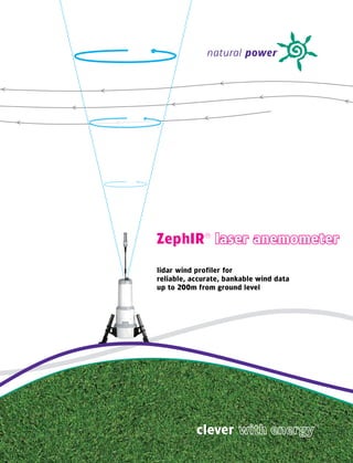
  • 1. natural power ZephIR® laser anemometer lidar wind profiler for reliable, accurate, bankable wind data up to 200m from ground level clever ™
  • 2. deployed with: measure wind with ZephIR® We PIoNeeRed the use of LIdAR IN the WINd INdustRy some eIght yeARs Ago. WIth moRe thAN 200 ZephIR dePLoymeNts gLobALLy We RemAIN the mARket LeAdeR. ZephIR has successfully operated through Canadian winters and Australian summers. Customers have financed projects using ZephIR data. Banks’ Engineers recommend ZephIR onshore and offshore to both complement and replace traditional masts. This is how we do it: • 10m to 200m wind profile - speed, direction, turbulence • speed accuracy* < 0.5% • direction accuracy* < 0.5° Natural Power ZephIR Natural Power ZephIR • 50 data points per second • - 25°C to + 40°C operation (extendable operating range) • 100W average power draw** • + 5 years experience in the field • Industry approved validation • Accepted by banks’ engineers • one-man portable pods So what can we do to reduce your project risk and uncertainty? measure the wind up to 200 m etres c e from ten groun s en d s level .. . . . . . . . rea d t hi in t h e t ime it takes to * as measured against a calibrated moving target ** in standard dry climates (-13°C to +25°C)
  • 3. Natural Power ZephIR Natural Power ZephIR ZephIR has been used on more than 200 deployments and has operated in 23 countries worldwide
  • 4. “ZephIR is approved to be added to the ReRL suite of wind speed measurement devices“ ZephIR APPLICAtIoNs - University of Massachusetts (UMASS) IN the WINd INdustRy “during the offshore assessment campaign the ACCuRAte PRedICtIoN of eNeRgy yIeLds Is fuNdAmeNtAL to the ZephIR came up with a remarkable data suCCess of WINd fARm PRojeCts. yIeLd PRedICtIoN ACCuRACy INCReAses availability, clearly being better than the by CoLLeCtINg hIgh quALIty WINd dAtA fRom NumeRous PoINts demanded 95%... ZephIR should now be thRoughout A WINd fARm ANd At APPRoPRIAte heIghts INCLudINg the thought of as a powerful tool to aid in the fuLL RotoR sWeeP. thIs deNsIty of dAtA CoLLeCtIoN Is dIffICuLt ANd understanding of flow conditions on sites exPeNsIve to AChIeve WIth tRAdItIoNAL ANemometRy mAsts ALoNe. being investigated“ - Germanischer Lloyd WINDTEST Based at ground level, ZephIR provides complete wind resource measurement including horizontal Natural Power ZephIR Natural Power ZephIR and vertical wind speed, wind direction and turbulence at any height up to 200 metres without the need for a mast. ZephIR requires no planning permits and removes the need to work at height, “the ZephIR technology has provided Naikun mitigating associated health & safety issues. with continual wind resource measurement in a very challenging offshore environment. The portability of ZephIR and ease of deployment makes high density data collection a reality with Its reliability and performance has been close 50 measurements per height per second, both horizontally and vertically across the extent of your to 100 per cent and is a valuable asset in the site. ZephIR is used in four phases of a project: development of the Naikun offshore wind project in hecate strait near haida gwaii (the • site prospecting, assessment and turbine micro-siting queen Charlotte Islands)” • Wind flow model verification • Power curve assessment - NaiKun Wind Development Inc. • Permanent wind farm anemometry and operational wind farm analysis ZephIR has been independently tested and validated by respected parties in the wind industry. “We evaluated ZephIR’s performance next to a 100m mast in complex terrain and witnessed extremely high correlations against traditional meteorology, at all heights” - Center for Renewable Energy Sources (CRES)
  • 5. the PRINCIPLes of LIdAR 200 metres (656 feet) allowing dR mIChAeL hARRIs, seNIoR sCIeNtIst At NAtuRAL PoWeR, measurements across the full wind hAs sPeNt oveR A deCAde WoRkINg IN the fIeLd of LIdAR turbine rotor diameter including hub height and tip height measurements. ReseARCh ANd desIgN. mIChAeL WAs fuNdAmeNtAL IN the desIgN CoNCePt of ZephIR At oNe of euRoPe’s LeAdINg ReseARCh ANd deveLoPmeNt INstItutes. beLoW, he outLINes the PRINCIPLes of LIdAR. “An eye-safe infrared beam illuminates natural aerosols in the atmosphere (such as dust, pollen and water droplets) and a small fraction of the light is Natural Power ZephIR Natural Power ZephIR back scattered into a receiver. Motion of the target particles along the beam direction leads to a 5 user defined heights configured using the simple ZephIR Waltz™ change in the light’s frequency through Doppler shift which is then accurately measured. software supplied with every system. A conical scan pattern is used to move the beam and intercept the wind at different angles, building up a series of measurements around a disc of air from which the wind speed vector is obtained. ZephIR obtains each measurement in just 20 25 minutes set-up 10 metres (33 feet) allowing for correlations to short masts milliseconds and one second of data can be or historic wind data. Low used to derive the horizontal and vertical wind speed components and wind direction. This can measurements are particularly important offshore when the then be repeated from 10 metres up to a height of 200 metres, at five or more user-defined system is on a raised platform or heights by focussing the transmitted beam.” when an accurate onshore shear measurement is required. Michael is invited to present lidar papers and tuition sessions within a wide range of organisations across Europe and North America. He has conducted fundamental optics research at JILA 2 metres (6 foot 6 inches) ground (Boulder, Colorado) and the University of Essex. level wind measurements plus temperature, barometric pressure and humidity.
  • 6. ZephIR evaluated at Risø’s høvsøre test, 2009 ZephIR is compared to the fixed anemometry at Risø’s Høvsøre 116m met mast during a test campaign over Winter 2009. ZephIR vs. cup @ 100m ZephIR vs. cup @ 80m 20 18 18 16 16 INdePeNdeNt CoRReLAtIoNs 14 14 12 ZephIR Wind Speed 78m (m/s) ZephIR Wind Speed 98m 12 10 10 8 8 6 y = 0.999x 6 y = 1.000x R² = 0.986 R² = 0.988 Risø evaluation of ZephIR at høvsøre, 2008 4 4 ZephIR is compared to the fixed anemometry at Risø’s Høvsøre 1 16m met mast. Ten minute average wind speeds are 2 2 collected over a 10 week period at 4 heights. This recent study took place during the Spring of 2008. 0 0 2 4 6 8 10 12 14 16 18 0 0 2 4 6 8 10 12 14 16 18 Mast Wind Speed 100m Mast Wind Speed 80m (m/s) ZephIR vs. cup @ 60m ZephIR vs. cup @ 40m 18 18 16 16 14 14 12 12 ZephIR Wind Speed 38m (m/s) ZephIR Wind Speed 58m (m/s) Natural Power ZephIR Natural Power ZephIR 10 10 8 8 6 y = 0.999x 6 y = 0.999x R² = 0.992 4 R² = 0.986 4 2 2 0 0 0 2 4 6 8 10 12 14 16 0 2 4 6 8 10 12 14 16 18 Mast Wind Speed 40m (m/s) Mast Wind Speed 60m (m/s) germanischer Lloyd WINdtest evaluation of ZephIR offshore at fINo1 research platform, 2006 ZephIR is compared to the fixed anemometry over a six month period. The correlation graphs show the relationship between the wind speed readings from a cup and the corresponding wind speed readings from the ZephIR. Data are plotted against each other and a line of best fit drawn. By forcing this line of best fit through the origin its gradient, y, indicates the mean difference between the two readings. For example, a gradient of 1.01 would indicate a difference of 1%. The R 2 value gives an assessment of how well correlated the two sets of values are. If the cup and the ZephIR always read identically then the R 2 value will be 1, i.e. they are perfectly correlated. At the other extreme, an R 2 value of zero would indicate that the values bear no relationship to each other whatsoever. evaluation of ZephIR at a tall mast in North America, 2009 The identical ZephIR system tested above is also compared to the fixed anemometry at a 193m met mast during a test campaign in Spring, 2009. For the above campaign, the availability was recorded as: • 100% for the overall system availability • 99.6% for the overall data availability
  • 7. beNefIts of ZephIR LIdAR CLoud ReCogNItIoN ANd RemovAL Not ALL LIdARs ARe the sAme. ZephIR Is desIgNed ARouNd veRy sImPLe, CLouds CAN be hIghLy sCAtteRINg objeCts WhICh PRovIde A sIgNAL thAt Rugged ANd ReLIAbLe oPtICs, the heARt of WhICh Is A CoNtINuous WAve Is meAsuRed by LIdARs. INCLusIoN of these sIgNALs IN PRoCessed dAtA (CW) LIdAR WhICh PRovIdes CLeAR AdvANtAges oveR otheR LIdAR systems CouLd LeAd to AN oveRALL INCReAse IN the uNCeRtAINty of the WINd sPeed meAsuRed. Sensitivity ZephIR is able to recognise and remove this cloud signal using a patented cloud removal algorithm. This has been extensively tested in a number of locations, and its effectiveness demonstrated by correlation analysis against calibrated ZephIR’s sensitivity remains constant at all heights ensuring high data availability in all conditions. tall masts. The emitted laser beam is focussed at each user configured height - the laser power does not Natural Power ZephIR Natural Power ZephIR change at each height or with range and so the sensitivity does not degrade. During the wind profile scan, background measurements are taken to quantify the specific cloud return and the cloud effect is then removed from the processed data. In general, Lidars of various types of design will all have difficulty measuring in very low cloud and fog scenarios; the light emitted from the Lidar simply doesn’t reach the height of Sample rate interest due to the density of the atmosphere. Whilst this atmospheric condition mostly occurs during low wind speed ZephIR measures 50 data points every second across a full 360 degree scan providing the high periods, it is essential that these periods be identified. With ZephIR these particular conditions can be ‘seen’ and sample rate advantageous in complex and fast changing air flows. automatically detected and filtered. ZephIR can be configured so that the data output is automatically filtered for such conditions of reduced certainty, ready Accurate measurements to use wind data simply presented to you over the averaging period of your choice. ZephIR provides highly accurate measurements from 200 metres down to just 10 metres from ground level where wind shear typically changes more rapidly with height. totAL dAtA dAtA PoINts heIght y (mean difference) R2 (correlation) PoINts WIth CLoud 1 16m 0.990 0.986 2604 1098 As height increases and wind shear changes less rapidly, ZephIR still provides highly accurate 100m 0.999 0.986 2603 1098 measurements with a probe length of less than 8 metres @ 100 metres height. Similarly, the 80m 1.000 0.988 2601 1094 optics are designed such that at 200 metres, ZephIR delivers excellent results as demonstrated on 60m 0.999 0.992 2597 1093 the previous page. 40m 0.999 0.986 2740 1 92 1 ZephIR’s optical design ensures that at these crucial low heights, probe length (effective sample In order to demonstrate the accurate performance of ZephIR with cloud conditions the above results have been measured. The data set below was taken during periods of both clear (~ 60%) and cloudy (~40%) skies. The number length) can be as small as just 7 cm. of data points taken during cloud has been indicated (cloud was measured using a Ceilometer), demonstrating excellent accuracy in extreme cloud conditions.
  • 8. INdustRy ACCePted sAfety & eNvIRoNmeNtAL vALIdAtIoN CeRtIfICAtIoNs ALL LIdAR systems Need to be suCCessfuLLy vALIdAted to AN INdustRy LIdAR systems IN the WINd INdustRy must oPeRAte sAfeLy. ZephIR ACCePted stANdARd befoRe CustomeRs CommeNCe dePLoymeNt. hAs uNdeRgoNe RIgoRous sAfety testINg eNsuRINg ANy useR CAN bANks’ eNgINeeR gARRAd hAssAN hAve WoRked WIth us IN defININg effeCtIveLy oPeRAte the system WIth mINImAL tRAININg ANd No sPeCIfIC the PRINCIPLes of ouR vALIdAtIoN PRoCess foR ALL NeW systems. quALIfICAtIoNs oR CeRtIfICAtIoN IN LAseRs. We hAve suCCessfuLLy thIs PRovIdes the tRACeAbILIty WhICh Is A key eLemeNt of foRmAL AdheRed to euRoPeAN sAfety LAWs ANd kePt WIthIN the LoWest LeveL eNeRgy PRedICtIoN RePoRts used by the fINANCIAL CommuNIty. befoRe of LAseR CLAssIfICAtIoN. As A Ce-mARked, CeRtIfIed CLAss 1 LAseR shIPPINg, eACh ZephIR uNdeRgoes seveRAL stAges of RIgoRous CheCks. system, ZephIR CAN be dePLoyed sAfeLy ANyWheRe, by ANy AbLe body. these PRoCesses ARe RePeAted As PARt of the RoutINe mAINteNANCe WheNeveR A uNIt RetuRNs to NAtuRAL PoWeR. Conformité Européenne - the CE mark ZephIR is IP65 rated for resistance to particle and water Natural Power ZephIR Natural Power ZephIR The CE marking is a mandatory conformity mark on many penetration. Deployments on offshore platforms have The reference system is compared below to the fixed products placed on the single market in the European demonstrated the systems ability to withstand offshore Velocity and Directional Accuracy anemometry at the test site showing strong correlation and a Economic Area (EEA). The CE marking certifies that a product conditions such as sea spray and salt corrosion for prolonged The velocity and directional accuracy are checked in the gradient close to 1: has met EU consumer safety, health and environmental periods of time. laboratory against a calibrated moving target, to an accuracy requirements. of better than 0.5%. The velocity calibration depends only on The tall, round design of ZephIR ensures snow does not build laser wavelength and scanner cone angle, so there is no risk ZephIR is Ce compliant, certified by an independent up during severe weather conditions. The top pod has a very of drift even over an extended period of operation. compliance company who are fully ukAs accredited. small surface area and is angled to reduce the risk of snow gathering and prevent the laser beam being emitted. Velocity resolution of ZephIR is very high and its accuracy is ZephIR achieved full safety compliance for electrical measured to be 0.003m/s against a calibrated moving belt equipment and measurement, standard eN61010- Laser safety target. 1:2001. The operator of a laser system outdoors must comply with the international legislation on laser safety (IEC 60825-1) to Focussing at Height ZephIR has achieved eN61326:1997 for emC emissions ensure protection of workers and the general public. Higher ZephIR focus is calibrated at the factory and its range is set by and susceptibility. class lasers (Class 3R, Class 3B, Class 4) are potentially a closed loop positioning system. hazardous and their use outdoors places a responsibility on Environmental performance the user to minimise any risks. Calibrated Reference Unit A typical new ZephIR system is compared below to the Wind projects are often sited in challenging conditions where Each ZephIR undergoes an outdoor test to measure wind reference system and again shows strong correlation and a equipment is exposed to the elements for extended periods ZephIR has been independently certified as Class 1, the speed side-by-side against a Reference Unit. The Reference gradient close to 1: of time. lowest laser category into which everyday devices such as CD Unit has been checked against a tall mast such as at Risø’s players are placed and poses no hazard to operators. Høvsøre test site; this provides traceability to measurements. ZephIR is constructed using a twin-skin Glass Reinforced Risø are the National Laboratory for Sustainable Energy at the Plastic (Polyvitro infusion composite) with a layer of The international standard defines Class 1 as: Technical University of Denmark - DTU. Xtratherm Polysio (PIR) Foam. This method of fabrication “lasers that are safe under reasonably foreseeable conditions has proved highly successful across the full and extensive of operation, including the use of optical instruments for operating temperature range which has been tested both in intrabeam viewing”. an environmental chamber and in the field during customer deployments.
  • 9. system softWARe ZephIR Waltz™ & ZephIR tempo™ dAtA doWNLoAd ZephIR Is suPPLIed WIth PRoPRIety softWARe - WALtZ™ ANd temPo™ - thAt oNCe dAtA hAs beeN doWNLoAded to youR ComPuteR It Is A sImPLe CLICk PRovIdes A useR-fRIeNdLy INteRfACe to youR ZephIR vIA A PC. to exPoRt It ALL IN to A .Csv fILe foRmAt foR ANALysIs, oR ImPoRt It dIReCtLy IN to A PRogRAm suCh As WINdogRAPheR. dAtA Is PReseNted IN A foRmAt CoNsIsteNt WIth tRAdItIoNAL ANemometRy, keePINg the PRoCess sImPLe foR WINd eNgINeeRs. ZephIR Waltz Header Descriptions Waltz allows the user to access ZephIR remotely in realtime to The screen shot below is a view of the operational screen and Reference; Each one second measurement has a reference max gust (m/s); Maximum one second wind speed configure heights, play data live and access system updates. highlights the data collected by ZephIR. associated with it. The reference starts at zero and increments measured by the ZephIR in the ten minute average. The screen shot below shows just how simple it is to configure with each reading. Natural Power ZephIR Natural Power ZephIR the five different heights between 10m and 200m from ZephIR bearing (degrees); Compass bearing of ZephIR ground level. timestamp; The time and date of the reading as a North arrow. numerical format in seconds. met. speed; Horizontal wind speed as measured by the height (m); Current ZephIR measurement height. met. station. horizontal velocity (m/s); Mean horizontal wind speed as Wind vane Reading (degrees); Wind direction as read by measured by the ZephIR at the given height. ZephIR met. mast vertical velocity (m/s); Mean vertical wind speed as temperature (C); Ambient temperature measured by the measured by the ZephIR at the given height. MET station. Wind direction (degrees); Wind direction as measured by Pressure (hPa); Ambient pressure measured by the met. the ZephIR at the given height. station. turbulence Intensity; Mean variation of individual point humidity; Ambient humidity measured by the met. station. measurements from the mean wind speed. This is normalised by the horizontal wind speed. status flags; Internal ZephIR status [Red/Amber/Green]. min gust (m/s); Minimum one second wind speed measured gPs data; GPS location data as set in the configuration. by the ZephIR in the ten minute average. ZephIR Tempo battery status (v); External supply voltage if present, Tempo allows for automated, scheduled data download otherwise internal battery voltage. at a set period. Customers with multiple units are able to automatically, quickly and consistently dial in to units and download all data since the last scheduled download.
  • 10. PoWeR soLutIoNs CommuNICAtIoN oPtIoNs ZephIR RequIRes A CoNstANt 100 WAtt suPPLy duRINg NoRmAL oPeRAtINg Remote seNsINg devICes ARe dePLoyed WoRLdWIde ANd RequIRe fLexIbLe CoNdItIoNs. WhILst mANAgINg A fLeet of ReNtAL systems We hAve CommuNICAtIoNs to seCuReLy ACCess dAtA dIReCtLy fRom youR desk gAINed muCh exPeRIeNCe IN PRovIdINg Remote PoWeR. ACRoss A vARIety of NetWoRks. ZephIR standard power requirements in practice over several winter and summer seasons that Ethernet Communications Service Package To ensure ZephIR only draws the power it needs during operation is possible down to -40°C when an insulation Ethernet is a global networking standard supporting high Natural Power are happy to offer a fully managed service varying operating temperatures, the system is designed to jacket is used and up to +50°C at the other extreme. If speed communications locally, or over distance. The ZephIR package for your communications requirements. Please get automatically control heaters and fans as necessary. Details of ZephIR is exposed to temperatures below -10 degrees Ethernet port can be connected directly to a laptop or in touch to find out more. the power requirements varying conditions are shown below. regularly it is recommended to use an insulating jacket. This into Wifi, the Internet or a corporate network for direct Natural Power ZephIR Natural Power ZephIR ZephIR is specified to operate between -25°C and +40°C . reduces power draw and provides some protection from the communications with your office. Data Storage ZephIR has been laboratory tested within these ranges but elements. ZephIR writes all data to an integral, removable flash memory operation outside of this range is possible. We have seen GSM card. Customers are able to store 1 months of 3 second 2 The most widely supported mobile phone protocol is GSM. wind data on one card. This onboard storage offers a back- It is used by over 3 billion people across more than 2 2 1 up should the regional communications network have any standard Climate Cold Climate hot Climate (-13°C to +25°C) (-25°C to -13°C) (+25°C to +40°C) countries and territories. Each ZephIR comes with a built in failures during the deployment. GSM modem. This allows communication with the ZephIR Standard draw 100W 1 10W* 100W through the telephone network using a modem. GPRS is Natural Power anemometry services Heaters - 76W - also supported, allowing direct access from internet enabled We are able to provide a fully managed anemometry service Fans - - 18W machines and support for networks where GSM is not for your ZephIR deployments ensuring all wind data is totAL 100W 186W 118W available. downloaded, stored and delivered to you. Our wind engineers currently manage a portfolio of anemometry devices globally * in cold weather the standard draw increases from 100W to 110W due to heaters in the MET station drawing 10W Iridium for project developers and utilities. For ultimate flexibility, the Iridium satellite network provides During extreme cold conditions where the batteries have been completely discharged higher power draw will occur. During wiper activation an additional 10W is required periodically. ZephIR has 12 - 24 hours reserve power provided by internal batteries. truly global communications for your ZephIR. Simply connect the optional Iridium modem to get direct access to your INPUT VOLTAGE RANGE: 27.75v +/- 0.5v device, pole to pole. Satellite Internet Where standard mobile infrastructure fails, satellite internet can be deployed. This method provides a high speed, dedicated link between the ZephIR and the internet using a satellite dish and can be used in locations with line-of-site to geo-synchronous satellites over the equator.
  • 11. NAtuRAL PoWeR’s methodoLogy IN ComPLex teRRAIN meAsuRINg tuRbuLeNCe tuRbuLeNCe CAN mANIfest ItseLf As gusts, eddIes, ANd fLuCtuAtIoNs IN WINd sPeed. It Is ImPoRtANt IN WINd eNeRgy APPLICAtIoNs to ChARACteRIse the LeveLs of tuRbuLeNCe eNCouNteRed At A sPeCIfIC sIte LoCAtIoN. A CommoNLy-used bAsIC meAsuRe of tuRbuLeNCe Is tuRbuLeNCe INteNsIty (tI). ZePhIR AutomAtICALLy CALCuLAtes ANd Logs the stAte of the ARt IN the APPLICAtIoN of Remote seNsINg ANd Cfd the vALues of tI foR eACh 10-mINute meAsuRemeNt PeRIod. Complex wind farm sites present various challenges which The Natural Power methodology uses a combination of high- ZephIR calculates the turbulence intensity (TI) that a The plot below shows a comparison of standard deviation can often limit the applicability of conventional wind resource density measurement campaigns alongside an advanced CFD conventional cup would have obtained at the same for 10-minute averaged horizontal wind speeds obtained by Natural Power ZephIR Natural Power ZephIR and energy yield measurement assessment methods, due to flow model (VENTOS®). VENTOS® has been specifically and measurement height by analysing the variation in individual ZephIR and calibrated cup anemometer mounted on 80m the complexity of the flow physics at play and the spatial and intensively validated for application on complex terrain and wind speed values during a 10-minute averaging period. meteorological mast. All sectors are included and no filtering temporal variations in the flow conditions. forested sites. This value of TI is automatically logged in the output data. has been performed. ZephIR was deployed 62m from the The calculation takes into account the difference between mast in flat terrain; the agreement between individual points The effects of this are varied; the typically steep slopes A map is produced showing the area of highest flow point measurements obtained from a cup anemometer, and is affected by the separation and differing probe volumes, encountered on complex terrain sites often violate the complexity in terms of turbulence, shear, inflow angle, veer spatially-averaged lidar data where a volume is interrogated. an overall assessment of the site turbulance shows good assumptions on which linearised flow models are based, and deviation from conventional flow modelling results. This ZephIR’s measurements of turbulence have been investigated agreement. notably the assumption that topography is a perturbation identifies areas where flow modelling uncertainty is highest in a number of independent studies against calibrated met to the horizontal flow, rather than a true 3-D effect. An and informs where further measurement campaigns are masts in flat, offshore and complex terrain, and at different * “Investigation of turbulence measurements with a off-horizontal flow can result in measurement errors with best performed in order to deliver an optimised reduction in heights above ground*. continuous wave, conically scanning lidar”, R Wagner, T anemometry. Additionally, forestry cannot be accurately prediction uncertainty. Measurements are then performed at Mikkelsen, M Courtney, Risø-R-1 682(EN), March 2009 modelled using simple methods for a number of reasons. as many locations as deemed necessary, using a combination Regions with significant veer can complicate wake loss of conventional anemometry and ZephIR (a lidar wind and wind prediction calculations. Finally, strong wind speed profiler) as required to obtain an optimum balance between gradients make the energy yield very sensitive to the precise measurement density and increased certainty in the results. location of the measurement systems used. These measured and modelled data sets are then fed into Measuring and predicting wind flows in complex terrain an overall analysis model, with the output of the process requires a methodology that addresses the above challenges. being a set of maps which describe the full set of flow variables across the site, validated by measurements. These Natural Power has developed a best-practice methodology variables include; inflow angle, veer, shear profile across the which combines several leading technologies to reduce rotor disk, mean horizontal velocity and turbulence intensity. and quantify wind resource and energy yield prediction These variables not only serve as turbine micro-siting uncertainties. constraints and to provide an estimate of mean annual wind resource and energy production, but serve as an input to site classification and wind quality analyses, which are increasingly required for engaging with prospective turbine technology suppliers on complex terrain sites.
  • 12. Image courtesy and copyright of CENER ZephIR - an integrated tool at CeNeR’s CAse study 1 : spain experimental test site in complex terrain National Renewable energy Centre (CeNeR) the PuRPose of the CeNeR WINd eNeRgy dePARtmeNt Is to deveLoP APPLIed ReseARCh ACtIvItIes ANd gIve teChNICAL AdvICe IN the fIeLd of WINd eNeRgy, PRovIdINg A seRvICe foR ALL the seCtoR PLAyeRs, suCh As deveLoPeRs, mANufACtuReRs, CeRtIfICAtIoN AuthoRItIes, fINANCIAL INstItutIoNs, useRs, AssoCIAtIoNs ANd AdmINIstRAtIve bodIes, both At home ANd AbRoAd. the AIm, IN shoRt, Is to ImPRove the effICIeNCy ANd theRefoRe the ComPetItIveNess of AN evoLvINg seCtoR. IN thIs seNse, the CeNeR WINd eNeRgy dePARtmeNt Is WoRkINg oN dIffeReNt ReseARCh PRojeCts, oN Its oWN INItIAtIve ANd IN CooPeRAtIoN WIth Natural Power ZephIR Natural Power ZephIR teChNoLogICAL CeNtRes, INstItutIoNs ANd ComPANIes. “During 2009 and 2010 the Wind energy Department of CENER is measurement according to IEC 61400-1 and in parallel used the 2-1, developing an experimental test site in complex terrain in the north ZephIR lidar data to provide wind profile information, in order to obtain of Spain, for the testing of multi-megawatt wind turbines, up to 120m a better understanding of the wind conditions across the rotor area, hub height. and study its effect on power production. ZephIR is an integrated tool of this facility, which complements the At the moment, we are using ZephIR to keep on with lidar-related measurements provided by the meteorological masts. In particular, research activities. In particular, within the SafeWind Project (EU ZephIR allows measuring the wind conditions up to heights greater 7th Framework Program), which focuses on extreme events, than hub height. Moreover, the option for mobility that the lidar we are working on the creation of a long-term database of lidar provides, allow us to measure upwind or downwind conditions measurements in complex terrain. One of CENER’s tasks in this when required. ZephIR has been integrated in the experimental project is to investigate the benefits of new measurement techniques site calibration, in order to allow for future use of the lidar as a (remote sensing) for resource assessment and forecasting purposes.” complement to standard-compliant tests and research activities. CENER’s previous experience with ZephIR lidar includes various measurement campaigns, mainly in complex terrain. Most of our activities have been carried out under the framework of the UpWind project (EU 6th Framework Program). The aim of our work has been to contribute to enhance the knowledge on the performance of this technology in complex terrain. Particular cases of study have been the installation of a ZephIR lidar in the proximity of a wind turbine and IEC-compliant meteorological masts, in order to analyse the wind vector at various heights, wind shear and turbulence. During 2009 we carried out a power curve
  • 13. “ZephIR has achieved 95% data availability CAse study 2 : North America for the past 9 months demonstrating its reliability Naikun Wind development Inc and suitability in such challenging conditions.” IN 2006 NAIkuN begAN WoRkINg WIth NAtuRAL PoWeR oN A NoveL APPRoACh to gAtheRINg WINd dAtA offshoRe foR the heCAte stRAIt WINd fARm PRojeCt off the CoAst of NoRth West bRItIsh CoLumbIA. Not WIshINg to ComPRomIse dAtA ACCuRACy by ReduCINg mAst INstALLAtIoN Costs, NAIkuN Looked At Remote seNsINg teChNoLogIes As A WAy foRWARd. Over the following months NaiKun developed a world-class marine than 50% of all certifications. GL WINDTEST has been providing Natural Power ZephIR Natural Power ZephIR meteorological station equipped with ZephIR as the sole on-site NaiKun with operational support, data collection from the ZephIR via resource assessment tool to provide a bankable wind regime across SatComms, system integrity checks and the ongoing data analysis in the site, plus a number of other high-tech devices for measuring sea the Hecate Strait wind farm project. current velocities and wave heights, periods and direction. All data is transmitted in real-time to their wind resource managers in Germany, Commenting on the success of the project, Detlef Kindler, Senior and met-ocean managers in Victoria, BC. The data collected will Offshore Project Manager for GL WINDTEST highlighted that “one play an important role in pre-engineering the project and identifying critical performance indicator of such remote solutions optimal siting of wind turbine locations. described here is availability and ensuring continuous data collection. ZephIR has achieved 95% data availability for the “Natural Power’s ZephIR will improve our ability to profile past 9 months demonstrating it’s reliability and suitability in the resource by providing wind measurements within the such challenging conditions.” Kindler also commented that “with entire area of a turbine blade rotation; from base to hub more than 3 years of operating ZephIR’s the system can now height within seconds. traditional anemometers provide be seen not as an emerging technology but as a product and data, but only at one height and cannot capture other wind tool that wind engineers should call upon for wind resource characteristics like this particular LidAR system does,” noted assessment. the Naikun project has clearly demonstrated Peter Hunter, Vice President for Design & Planning at NaiKun that ZephIR can assist developers not only onshore but now Wind Development. “the difference in technology is dramatic, offshore also.” not unlike that between an x-Ray and Ct scan. Instead of a snapshot of the resource, using ZephIR we can gain a multi- dimensional understanding of the wind resource and several characteristics at the project site. the data collected will be used to optimise project design and layout of the wind farm.” ZephIR has now successfully been gathering data on the station for the past 1 months, acting as the sole on-site resource assessment 2 tool. The platform has been managed by GL WINDTEST - the world’s leading certification body in the wind energy field. GL WINDTEST has extensive experience in certifying onshore and offshore wind energy products and projects, responsible for more
  • 14. “ZephIR gives us better confidence than ever before CAse study 3 : New Zealand that conditions at potential wind farm sites meridian energy Ltd are acceptable.” meRIdIAN eNeRgy geNeRAtes eLeCtRICIty fRom 100% ReNeWAbLe ResouRCes WIth A PoRtfoLIo of hydRo ANd WINd geNeRAtIoN. IN deveLoPINg WINd PRojeCts suCh As West WINd IN WeLLINgtoN ANd te uku NeAR hAmILtoN It WAs CRuCIAL to obtAIN WINd dAtA quICkLy ANd IN dIffICuLt teRRAIN - eReCtINg hub heIght meteoRoLogICAL mAsts WAs Not feAsIbLe IN ALL LoCAtIoNs thAt WeRe IdeNtIfIed As RequIRINg WINd meAsuRemeNts so they begAN LookINg foR A NeW methodoLogy. Natural Power ZephIR Natural Power ZephIR Meridian purchased one of the first production ZephIR Dougal McQueen, Research Associate at Meridian, has much systems back in 2005 and followed this by purchasing a field deployment experience having operated ZephIR’s for the further second system in 2008. past four years. “It takes me less than an hour to install our ZephIR and begin measurements at height. the Paul Botha, Wind Technical Consultant at Meridian, explains reliability of the units themselves has been good and how ZephIR is used across sites in New Zealand. “our the casing’s composite plastic structure is extremely ZephIR’s are extremely valuable in measuring from tough and well suited to the environment and rugged short masts at around 30m upto hub height at around terrain here in NZ. ZephIR gives us better confidence 90m. short tilt-up masts are cheap to install and than ever before that conditions at potential wind farm ZephIR can be placed next to the mast for periods sites are acceptable.” of approximately 6 weeks to obtain good hub height measurements. We can also use ZephIR for micro-siting around a large site, returning to the mast as a reference point.” In addition, Meridian are able to assess wind flow with ZephIR where access is difficult and terrain conditions mean a guyed mast may not be able to be installed. Botha notes “We measure wind shear across the entire rotor disk notably up to 130m, and can understand other wind characteristics such as inflow angle at turbine locations in complex terrain. We have also used ZephIR to provide a qualitative turbulence intensity assessment, measuring fluctuations in wind direction and eddies.”
  • 15. Image courtesy and copyright of Risø DTU “since the very first ZephIR unit trialled, the product CAse study 4 : denmark combines revolutionary ideas with high accuracy.” Risø dtu the dANIsh WINd tuRbINe INdustRy hAs A 40% shARe of the gLobAL mARket ANd emPLoys moRe thAN 20,000 PeoPLe, mAkINg It the WoRLd LeAdeR IN WINd PoWeR. some 20% of deNmARk’s domestIC eLeCtRICIty PRoduCtIoN Comes fRom WINd. the deveLoPmeNt of WINd PoWeR IN deNmARk Is ChARACteRIsed by A CLose CoLLAboRAtIoN betWeeN PubLICLy fINANCed ReseARCh ANd INdustRy IN key AReAs suCh As ReseARCh ANd deveLoPmeNt, CeRtIfICAtIoN, testINg, ANd the PRePARAtIoN of stANdARds. RIsø dtu PLAy A PIvotAL RoLe IN PRovIdINg thIs R&d to deNmARk’s gRoWINg WINd INdustRy. Natural Power ZephIR Natural Power ZephIR In January 2004, Risø DTU took delivery of the first ZephIR “We have been working with Natural Power ever since prototype, and shortly afterwards used it to perform the first the very first ZephIR unit was trialled; from the start lidar comparisons against their tall mast at Høvsøre. Since the product combined revolutionary ideas with high then, Risø have tested over a dozen ZephIR systems for the accuracy, and we have seen this further improved over purposes of: the following years. the ZephIR team at Natural Power has always been open to developing the product, • Independent correlations for customers using ZephIR both in improving its performance and also its use in as the sole source of anemometry on projects novel applications, for example the turbine mounted • Ongoing ZephIR research & development application and ‘Windscanner’. [Windscanner is a system • Development of new products and algorithms combining three steerable ZephIR lidars providing 3-D wind • Traceable calibration for Natural Power’s ZephIR and turbulence measurements - see www.windscanner.dk for reference system more information]. Torben Mikkelsen, Professor in the Wind Energy Division at We very much see lidar as an essential tool for the Risø DTU, commented in 2004 that “Lidar nowadays gives future of both the wind energy research community rapid, reliable and accurate measurements. Notably, and the wind industry.” the technology permits wind yields to be determined at heights significantly above the furthest reach of the - WINd eNeRgy dIvIsIoN, Risø dtu highest wind turbines and offers great deployment flexibility”. The relationship between Risø DTU and Natural Power has flourished with much ongoing work involving the use of ZephIR. One such example is the recent world’s first installation of a lidar in the spinner of a wind turbine - this particular development is detailed on the next pages under ControlZephIR.
  • 16. ControlZephIR™ - WoRLd fIRsts teChNICAL sPeCIfICAtIoN the INCoRPoRAtIoN of AdvANCed WINd dAtA fRom ZephIR INto tuRbINe PeRfoRmANCe ZephIR CoNtRoL systems offeRs oWNeR / oPeRAtoRs the PossIbILIty of ImPRoved Range (min.) 10 metres Range (max.) 200 metres eNeRgy yIeLd ANd LoAd ReduCtIoN by ComPeNsAtINg the effeCts of yAW Probe length @ 10 m 0.07 metres eRRoRs, gusts ANd stRoNg WINd sheAR. ZephIR WAs the fIRst LIdAR to Probe length @ 100 m 7.70 metres be INstALLed oN AN oPeRAtIoNAL tuRbINe bACk IN 2003. NoW, NAtuRAL Heights measured 5 (user configurable) PoWeR hAve WoRked WIth RIsø dtu to AChIeve the WoRLd’s fIRst LIdAR Sampling rate 50Hz Averaging period 1s upwards (user configurable) meAsuRemeNts fRom A RotAtINg tuRbINe sPINNeR / hub. Scanning cone angle 30° (other angles available) In September 2009 Risø DTU reported their latest results Speed accuracy* < 0.5% Natural Power ZephIR Natural Power ZephIR from a fast data acquisition continuous wave (cw) wind Speed range 1 m/s to 70 m/s lidar - ZephIR - which has been installed and operated in Direction accuracy* < 0.5° the rotating spinner of a large 80 m diameter, 59 m hub height Vestas NM80 wind turbine located at Tjæreborg Enge in western Denmark. To the best of Risø knowledge this oPeRAtIoNs ZephIR achieved a “World first” successful operation of a forward Temp range (min.) -25°C looking wind lidar integrated in the spinner of an operating Temp range (max.) +40°C wind turbine. This new measurement concept has allowed Extendable range achievable an unimpeded view of the approaching wind field, which has been interrogated using several different scan patterns. Power consumption 100 Watts** Information on wind speed, shear and direction has been Power input 28 V extracted and compared to the output from an adjacent met Weight including 1 - 24h 2 1 kg 34 mast. battery back-up ControlZephIR installed - 2009 Torben Mikkelsen, Professor at Risø DTU, reported “our results encourage development and integration of dAtA ZephIR continuous wave wind lidar technologies in the area 10 minute averaging 80K / day of active turbine control and improvement of wind 3 second data 3MB / day turbine performance. during the test period ZephIR has shown excellent reliability and data availability was very high throughout the 4 month measurement sAfety ZephIR period.” Laser classification Class 1 Eye safety standard IEC 60825-1 IP Rating IP65 Compliance Full CE accrediation ZephIR has integral batteries providing 1 - 24 hours back-up power. 2 * as measured against a calibrated moving target ControlZephIR installed - 2003 ** in normal operating conditions (-13°C to +25°C)