
Recomendados
Mais conteúdo relacionado
Mais procurados
Mais procurados (20)
Semelhante a Grand entry virtualmuseumtemplate4
Semelhante a Grand entry virtualmuseumtemplate4 (20)
Mais de Janelle Wilson
Mais de Janelle Wilson (20)
Último
Último (20)
Grand entry virtualmuseumtemplate4
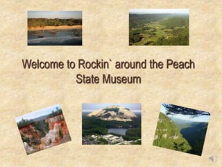
- 1. Welcome to Rockin` around the Peach State Museum
- 2. Museum Entrance AppalachianPlateau Valley&Ridge BlueRidge Coastal Plains Rockin` around the Peach State Museum Piedmont
- 3. Room 1 s Return to Entry Appalachian Plateau Artifact 2 Types of Rocks/Minerals and Fossils Appalachian Plateau Geological Changes Tourist Attractions
- 4. http://edumanual.pbworks.com/w/page/58006589/Home?utm_ campaign=wiki-link The Appalachian Plateau located in the northwest region of Georgia is a series of plateaus dissected into deep, narrow valleys and steep, rugged mountain sides. Maximum elevations are over 4000 feet. Return to Exhibit Appalachian Plateau
- 5. Room 1 s Return to Entry Appalachian Plateau Artifact 2 Types of Rocks/Minerals and Fossils Appalachian Plateau Geological Changes Tourist Attractions
- 6. Main types of rocks: Sedimentary rocks of similar age and type to those found in the southeast. Igneous rocks are also found there. Examples of these rocks are limestone, sandstone and black shale. How the rock formed: Sediment from nearby eroding hills flowed into a basin called the Ocoee. Over millions of years, sediments deposited and transported by water compressed into the high-calcium limestone, dolomite and silica bedrock of the southern Appalachians. The igneous rocks were formed from the molten lava. Rock and the mineral resources for this region: Sedimentary rocks contain minerals such as pyrite and metallic copper. Igneous rocks contain minerals like pegmatite, alaskite, mica and feldspar. Also found are iron ore, coal fuel. Fossils: The fossils found belong to the Paleozoic era and were deposited in shallow seas between the Cambrian and Pennsylvanian periods (540-300 million years ago). The rocks of the Appalachian Valley contain a variety of shark fossils that include tertiary shark teeth, goblin shark, mackerel, tiger shark and sand shark as well as the Carcharodon megalodon shark can be found in the southern regions of the Appalachian Mountains. Return to Exhibit Types of rocks/minerals and fossils
- 7. Room 1 s Return to Entry Appalachian Plateau Artifact 2 Types of Rocks/Minerals and Fossils Appalachian Plateau Geological Changes Tourist Attractions
- 8. During the middle Ordovician Period (about 440 - 480 million years ago), the tectonic plate carrying this area collided with another plate, leading to the creation of a new seduction zone and the beginning of the Appalachians As a result of this and later progenies, alternating beds of hard and soft Paleozoic sedimentary rocks were folded, looking much like the wrinkles one would find in a kicked floor rug. Return to Exhibit How the environment of the region has changed through geological time
- 9. Room 1 s Return to Entry Appalachian Plateau Artifact 2 Types of Rocks/Minerals and Fossils Appalachian Plateau Geological Changes Tourist Attractions
- 10. shltrip.com Pigeon Mountain is a popular climbing attraction. Cloudland Canyon State Park is a popular hiking spot where tourists can hike down to the bottom of the canyon. Lookout Mountain lies on the Georgia-Tennessee border and offers a spectacular view of both states. Return to Exhibit Tourist Attractions Lookout Mountain At Pigeon Mountain, Lafayette sandstones Cloudland Canyon State Park
- 11. Room 1 s Return to Entry Appalachian Plateau Artifact 2 Types of Rocks/Minerals and Fossils Appalachian Plateau Geological Changes Tourist Attractions
- 12. Museum Entrance AppalachianPlateau Valley&Ridge BlueRidge Coastal Plains Rockin` around the Peach State Museum Why these Regions Exist Piedmont
- 13. Room 2 Return to Entry Artifact 6 Valley and Ridge Artifact 7 Geological Changes Tourist Attractions Types of Rock/Minerals and Fossils Valley and Ridge
- 14. The Valley and Ridge are located in the northwest region of Georgia and are bordered by the Appalachian Plateau, Blue Ridge and Piedmont regions. Return to Exhibit Valley and Ridge
- 15. Room 2 Return to Entry Artifact 6 Valley and Ridge Artifact 7 Geological Changes Tourist Attractions Types of Rock/Minerals and Fossils Valley and Ridge
- 16. Main types of rocks: Sedimentary rocks in these areas occur as layers (also called strata) and consist mainly of sandstones, shale, limestone, and dolostone. The major ridges are formed by prominent sandstone. The valleys and lower flanks of major ridges are underlain by shale and limestone. Explain how the rock formed: The Sedimentary rocks originally were deposited in horizontal layers, but in the Valley and Ridge area these layers have been folded and faulted, squeezed and deformed by the continental collision event. As a result, the layers are no longer horizontal but are bent into great folds. As these bent and folded layers of rock gradually weather and erode, they form the long winding ridges and valleys from which the region takes its name. Rock and the mineral resources for this region: Ridges are developed on resistant layers of sandstone. Valleys are underlain by shale or limestone. Limestone and Dolostone contain the minerals calcite and dolomite. Fossils: Many of these rocks contain many marine fossils like Brachiopods (clams and mollusks) and Trilobites. Return to Exhibit Types of rocks/minerals and fossils
- 17. Room 2 Return to Entry Artifact 6 Valley and Ridge Artifact 7 Geological Changes Tourist Attractions Types of Rock/Minerals and Fossils Valley and Ridge
- 18. When North America and Africa collided to make the Pangaean supercontinent, the compression where they met shoved sheets of sedimentary rock over each other to make the Valley and Ridge. The Paleozoic Sedimentary rocks of the Valley and Ridge formed under a vast, shallow, inland sea that covered the area. Return to Exhibit How the environment of the region has changed through geological time
- 19. Room 2 Return to Entry Artifact 6 Valley and Ridge Artifact 7 Geological Changes Tourist Attractions Types of Rock/Minerals and Fossils Valley and Ridge
- 20. These rock strata may be seen exposed at Cloudland Canyon State Park, just east of Trenton. At the Carters Dam Fault the Western Blue Ridge sedimentary rocks meet the metamorphic rocks of the Great Valley. Return to Exhibit Tourist Attractions Cloudland Canyon State Park Carters Dam Fault – separates the piedmont region from the valley and ridge.
- 21. Room 2 Return to Entry Artifact 6 Valley and Ridge Artifact 7 Geological Changes Tourist Attractions Types of Rock/Minerals and Fossils Valley and Ridge
- 22. Museum Entrance AppalachianPlateau Valley&Ridge BlueRidge Coastal Plains Rockin` around the Peach State Museum Why these Regions Exist Piedmont
- 23. Room 5 Return to Entry Piedmont Types of Rocks/Minerals and Fossils Geological Changes Tourist Attractions Piedmont
- 24. The Piedmont is located in the central part of Georgia. It is flat and hilly along with some prairies. The capital Atlanta is located here along with other major cities in Georgia. This makes it a very popular tourist attraction. Return to Exhibit Piedmont
- 25. Room 5 Return to Entry Piedmont Types of Rocks/Minerals and Fossils Geological Changes Tourist Attractions Piedmont
- 26. Main types of rocks: The rocks of the Piedmont are igneous and metamorphic that include granite, gneiss, schist, slate. Explain how the rock formed: Several periods of volcanism have occurred, and the sedimentary rocks have been intruded by magma from deeper layers of the Earth, forming the granitic rocks. The metamorphic rocks were formed by the heat and pressure from the other rocks. Rock and the mineral resources for this region: Rocks typical of the region include Gneiss (Feldspar, quartz and mica), schist (contains talc, chlorite, quartz, and feldspar), amphibolite, migmatite, and granite (Feldspar, quartz and mica). Fossil types: The rocks of the Piedmont are largely metamorphic and igneous, though many of them were initially sedimentary and may have contained fossils from Paleozoic continental seas. Some still contain fossils, but the fossils have been deformed by stress and strain on the rocks. The most common fossils are those of fishes, plants, and footprints, though remains of large reptiles like phytosaurus and rauisuchians are also known. Return to Exhibit Types of rocks/minerals and fossils
- 27. Room 5 Return to Entry Piedmont Types of Rocks/Minerals and Fossils Geological Changes Tourist Attractions Piedmont
- 28. The Piedmont geological region is composed of igneous and metamorphic rocks resulting from ancient (300 to 600 million year old) sediments that were subjected to high temperatures and pressures and re- exposed about 250 to 300 million years ago. Return to Exhibit How the environment of the region has changed through geological time
- 29. Room 5 Return to Entry Piedmont Types of Rocks/Minerals and Fossils Geological Changes Tourist Attractions Piedmont
- 30. Tourist attractions: Atlanta is the largest city and capital of Georgia. FD Roosevelt Park is the largest state park in Georgia. Stone Mountain is the largest exposed mass of granite in the world. Return to Exhibit Tourist Attractions FD Roosevelt Park Stone Mountain
- 31. Room 5 Return to Entry Piedmont Types of Rocks/Minerals and Fossils Geological Changes Tourist Attractions Piedmont
- 32. Museum Entrance AppalachianPlateau Valley&Ridge BlueRidge Coastal Plains Rockin` around the Peach State Museum Why these Regions Exist Piedmont
- 33. Room 3 Return to Entry Coastal Plains Geological ChangesTypes of Rocks/Minerals and Fossils Tourist Attractions Coastal Plains
- 34. The Coastal Plains are located in the Southern part of Georgia. It is split into the Upper Coastal Plain (agricultural part) and Lower Coastal Plain (Atlantic Ocean and swamps). Return to Exhibit Coastal Plains
- 35. Room 3 Return to Entry Coastal Plains Geological ChangesTypes of Rocks/Minerals and Fossils Tourist Attractions Coastal Plains
- 36. en.wikipedia.org Main types of rocks: The Coastal Plain is composed of sedimentary rock layers. Sand, gravel, clay, and peat are found here. Explain how the rock formed: Formed from rock sediments. The fall line marks the beginning of the Coastal Plains. It has waterfalls and rapids that formed where streams flow off the hard, erosion-resistant rocks of the Piedmont onto the softer, easily eroded sediments of the Coastal Plain. Rock and the mineral resources for this region: The central and eastern Coastal Plain has important kaolin clay deposits. These deposits derived from the intense weathering of Piedmont rocks like granite and gneiss were formed during the Paleocene period. These rocks contain the mineral feldspar, the chemical weathering of which produces kaolin clay. Also found are Bauxite, sand, limestone. Main mineral resource is Kaolin. Fossils: Further south, Coastal Plain strata contain fossil- bearing sediments that formed in the shallow offshore waters of the continental shelf. Clams, snails, cephalopods, corals, sea urchins, and sand dollars are common, as are shark’s teeth, including those of the giant shark megalodon. Return to Exhibit Types of rocks/minerals and fossils
- 37. Room 3 Return to Entry Coastal Plains Geological ChangesTypes of Rocks/Minerals and Fossils Tourist Attractions Coastal Plains
- 38. Sedimentary deposits formed during the Pleistocene epoch, or Ice Ages and were deposited by ancient seas and river deltas that periodically dominated the landmass over the last 120 million years. Their history involves the rising and falling of sea level due to the advance and retreat of the giant continental glaciers. Return to Exhibit How the environment of the region has changed through geological time
- 39. Room 3 Return to Entry Coastal Plains Geological ChangesTypes of Rocks/Minerals and Fossils Tourist Attractions Coastal Plains
- 40. The Okefenokee Swamp has 402,000 acres of marshes, lakes, islands and forests. Tybee Island is located on the coast of Savannah. It has ports, museums, and a lighthouse. Providence Canyon is known as Georgia’s “Little Grand Canyon.” Return to Exhibit Tourist Attractions Tybee Island Providence Canyon
- 41. Room 3 Return to Entry Coastal Plains Geological ChangesTypes of Rocks/Minerals and Fossils Tourist Attractions Coastal Plains
- 42. Museum Entrance AppalachianPlateau Valley&Ridge BlueRidge Coastal Plains Rockin` around the Peach State Museum Why these Regions Exist Piedmont
- 43. Room 4 Return to Entry Blue Ridge Types of Rocks/Minerals and Fossils Geological Changes Blue Ridge Tourist Attractions
- 44. georgiaregions.webs.com The Blue Ridge Mountains in northeast Georgia make up the state's highest mountain range. The range of rugged ridges and rounded, weathered peaks varies in elevation from 1,600 to 4,700 feet and harbors spectacular mountain scenery, as well as some of the world's richest biological diversity. In addition, the range contains Georgia's wettest areas, with higher elevations getting more than eighty inches of rain annually on average. Return to Exhibit Blue Ridge
- 45. Room 4 Return to Entry Blue Ridge Types of Rocks/Minerals and Fossils Geological Changes Blue Ridge Tourist Attractions
- 46. activerain.com Main types of rocks: The rocks in the Blue Ridge province are dominantly metamorphic and consist of greenstone (metabasalt), schist, and slate. Granite and other igneous rocks also are found throughout the area. Explain how the rock formed: The processes include rock folding, faulting, upward thrusting, and a great collision that took place about 300 million years ago between the North American and African continents in a process called plate tectonics. The collision buckled the Earth's surface and pushed huge masses of rocks westward, causing them to pile up. Rock and the mineral resources for this region: The rocks of the Blue Ridge Mountains, have a crystalline foundation. The layered gneiss contains various amounts of biotite, muscovite, quartz and feldspar. They also contain small amounts of mica schist and larger amounts of hornblende. The non- layered gneiss is mostly quartz monzonite and granodiorite whose chief minerals are biotite, epidote and magnetite. Marble and talc are also found here. Fossils: The most common fossils are fishes, plant remains and footprints. Return to Exhibit Types of rocks/minerals and fossils
- 47. Room 4 Return to Entry Blue Ridge Types of Rocks/Minerals and Fossils Geological Changes Blue Ridge Tourist Attractions
- 48. http://geo.ua.edu/field-trips/field-trips/toxaway-gneiss/ Most of the rocks of the Blue Ridge, which are of earlier Precambrian age formed more than a billion years ago. For the past 100 million years, erosion has carved away much of Georgia's mountains, leaving only their cores standing. Erosion continues today and is constantly altering the landscape of the Blue Ridge Mountains. Return to Exhibit How the environment of the region has changed through geological time
- 49. Room 4 Return to Entry Blue Ridge Types of Rocks/Minerals and Fossils Geological Changes Blue Ridge Tourist Attractions
- 50. In 1828 the first gold rush took place in Auraria (city near Dahlonega). Ruby Falls is the highest underground waterfall. People can tour the underground cavern. Brass town Bald is the highest point in Georgia (4784ft). Return to Exhibit Tourist Attractions Ruby Falls Brass town bald – highest point in GA
- 51. Room 4 Return to Entry Blue Ridge Types of Rocks/Minerals and Fossils Geological Changes Blue Ridge Tourist Attractions
- 52. Citations • Note: Virtual museums were first introduced by educators at Keith Valley Middle School in Horsham, Pennsylvania. This template was designed by Dr. Christy Keeler. View the Educational Virtual Museums website for more information on this instructional technique. • © 2001, 2013, Radford University, All Rights Reserved. http://www.radford.edu/jtso/GeolVAHome.html • http://en.wikipedia.org • http://www.georgiaencyclopedia.org/articles/science-medicine/valley-and-ridge-geologic-province • http://georgiageosciences.tripod.com/carter's_dam_fault.htm
- 53. Thank You for watching our Virtual Museum tour!