
Recomendados
Mais conteúdo relacionado
Mais procurados
Mais procurados (20)
Destaque
Destaque (18)
Semelhante a Using 3-D Seismic Attributes in Reservoir Characterization
Semelhante a Using 3-D Seismic Attributes in Reservoir Characterization (20)
Último
Último (20)
Using 3-D Seismic Attributes in Reservoir Characterization
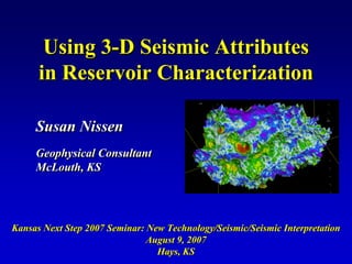
- 1. Using 3-D Seismic Attributes in Reservoir Characterization Susan Nissen Geophysical Consultant McLouth, KS Kansas Next Step 2007 Seminar: New Technology/Seismic/Seismic Interpretation August 9, 2007 Hays, KS
- 2. Outline • Brief overview of some reflection seismology basics • What are seismic attributes and what physical information can they provide? • Methods of interpreting attributes from 3-D seismic volumes • Reservoir Characterization Examples – Fault interpretation – Porosity – Bed thickness estimation – Fracture delineation • Conclusions
- 3. The Seismic Reflection Method Source Receiver ρ1V1 CMP ρ2V2 Figure Courtesy of Industrial Vehicles Vibrator truck (source) Geophone (receiver) Moveout, stack, migrate CMP gather 3-D seismic data volume
- 4. Seismic Reflection Interpretation Usually horizon-based 0.4 Horizon - the surface 0.5 Travel time (seconds) separating two different rock layers; also, the 0.6 reflection from this surface. 0.7 0.8 ρ1V1 Horizon 1 ρ2V2 Depth Horizon 2 ρ3V3 Horizon 3 ρ4V4
- 5. Seismic Applications in Petroleum Exploration Structural analysis (1920s onward) • study of reflector geometry • used to identify faults and locally high parts of formations Seismic sequence stratigraphy (1970s onward) • study of reflection sequences • used to locate stratigraphic traps and define the facies framework of structural traps deBruin et al. (2007) Seismic attribute analysis (1970s onward) • study of seismic attributes • provides information related to structure, stratigraphy, and reservoir properties
- 6. What are Seismic Attributes? Any measurement derived from the seismic data is a seismic attribute. Seismic attributes typically provide information relating to the amplitude, shape, and/or position of the seismic waveform. Seismic attributes reveal features, relationships, and patterns in the seismic data that otherwise might not be noticed.
- 7. General classes of attributes 1-D attributes - operate on a single stacked seismic trace 2-D and 3-D attributes - calculated using information from adjacent traces
- 8. Families of Seismic Attributes Time Attributes (1930s) – related to the vertical position of the waveform in the seismic section (e.g., horizon time picks, isochrons) Complex Trace Attributes q(t) (1970s) – The seismic data is treated as an analytic trace, A(t) θ(t) which contains both real and r(t) imaginary parts. Various amplitude, phase, and frequency attributes can be Taner et al. (1989) calculated. Envelope: A(t) = [q2(t)+r2(t)]1/2 Instantaneous Phase: θ(t) = tan-1[q(t)/r(t)] Instantaneous Frequency: ω(t)=dθ(t)/dt
- 9. Families of Seismic Attributes Window Attributes (1980s) – attributes which summarize information from a vertical window of data. Fourier Attributes (1990s) – frequency domain attributes obtained through Fourier analysis (e.g., spectral decomposition) Multi-trace Attributes (1990s) - attributes calculated using more than one input seismic trace, which provide quantitative information about lateral variations in the seismic data (e.g., coherence, dip/azimuth, volumetric curvature)
- 11. Instantaneous Attributes q(t) A(t) θ(t) r(t) Taner et al. (1989) Envelope: A(t) = [q2(t)+r2(t)]1/2 Instantaneous Phase: θ(t) = tan-1[q(t)/r(t)] Instantaneous Frequency: ω(t)=dθ(t)/dt
- 12. Spectral Decomposition Uses the Fourier transform to 3D Seismic Volume calculate the amplitude } analysis spectrum of a short time window window covering the zone of interest Single All traces trace F1 The amplitude spectrum is tuned by the geologic units within the analysis window, F2 so that units with different rock properties and/or thickness will exhibit different amplitude responses. black = low amplitude white = high amplitude
- 13. Seismic Coherence A measure of the trace-to-trace similarity of the seismic waveform within a small analysis window 3D Seismic Volume fault = low coherence For each point in a 3D seismic volume, compare the waveform of adjacent traces (e.g., red trace compared to blue traces) over a short vertical window fault = low coherence Coherence Cube black = low coherence white = high coherence
- 14. Volumetric Curvature Curvature describes how bent a surface is at a particular point and is closely related to the second derivative of the curve defining the surface. May be computed 2-D 3-D at any azimuth Positive about a point Curvature Cu Zer Zero rv o Generally atu Curvature re computed normal Negative to tangent plane Curvature Anticline Di Principal p Pl pin X Flat Curvatures (kmax R an g e and kmin) can be combined to Syncline define other Z Curvature (k)=1/R curvature After Roberts, 2001 attributes Sigismondi and Soldo, 2003 Volumetric curvature is computed for every point within a 3-D seismic volume.
- 15. What physical information is provided by seismic attributes? Envelope- presence of gas (bright spots), thin-bed tuning effects, lithology changes Phase – lateral continuity of reflectors, bedding configurations Frequency – bed thickness, presence of hydrocarbons, fracture zones Spectral Decomposition – bed thickness Coherence, Volumetric Curvature – faults, fractures, lateral stratigraphic discontinuities
- 16. Methods of interpreting attributes from 3-D seismic volumes Identify spatial patterns/trends in attribute data – Cross-sectional view – Map view (attributes extracted along horizon or from zone of interest) – 3D visualization Tie attributes to well control using statistical methods (e.g., crossplots) Automatically analyze multiple attributes (with or without well control) – Geostatistics – Principal component analysis – Cluster analysis – Texture analysis
- 17. Reservoir Characterization Examples
- 18. Fault Interpretation – Offshore Trinidad Seismic Time Slice Coherence Slice Complex Coherence faulting shows difficult to lateral detect on continuity seismic of faults Gersztenkorn et al., 1999
- 19. Limits of Porous Reservoir -- Mississippian Dolomite Reservoir Judica Field Ness and Gove Counties, KS
- 20. Judica Field Stratigraphy System Penn. LS Top Miss Spergen GR DOLOMITE ? Judica Warsaw Mississippian pay zone Meramecian Series LS 20% O/W -1938 Base Warsaw LS Nt Phi Guard Res Osagian Series After Dubois et al., 2003
- 21. Judica 3-D seismic survey Top Mississippian structure Dry holes on structural high due to low porosity A within reservoir interval A' A A' 0.80 s Bhattacharya et al., 2004 Top Miss Base Warsaw LS 0.85 s
- 22. 5 4.5 4 3.5 phi-h (porosity-ft) 3 2.5 Base Warsaw LS amplitude map 2 1.5 1 0.5 0 -18000 -16000 -14000 -12000 -10000 -8000 -6000 -4000 seismic amplitude - Base Warsaw LS horizon Bhattacharya et al., 2004
- 23. Modeled variation in amplitude of Base Warsaw LS horizon due to increase in porosity of reservoir zone Velocity model Synthetic seismic section -0.15 Base Warsaw LS Amplitude -0.2 -0.25 -0.3 Approximate porosity of reservoir interval: 5% 25%
- 24. Top Mississippian Structure Map Base Warsaw LS Amplitude Map Bhattacharya et al., 2004 Reservoir compartment mapped from 3-D seismic structure and amplitudes
- 25. Judica 3-D attribute analysis results Seismic amplitude of the base of Warsaw LS correlates with porosity-thickness of the Judica pay zone, providing a method for discriminating between dry and productive wells A combination of seismic structure and amplitude analysis allows us to better delineate reservoir compartment boundaries
- 26. quot;Thin bedquot; thickness estimation -- Upper Cretaceous “D” Sand Sooner Unit, Colorado
- 27. “D” Sand Reservoir Upper Cretaceous Incised valley fill Fluvial and estuarine sediments Cannon, 1998
- 28. quot;Dquot; sand thickness from wells Objective Determine “D” sand thickness between well control points.
- 29. Sooner 3-D seismic survey “D” sand isochron map 10 ms 7 ms
- 30. Unfortunately…. Over most of the 3-D survey 2.0 25 Maximum area, the “D” sand is below thickness seismic resolution (a “thin of “D” Sand Maximum absolute amplitude Two-way apparent thickness 20 bed”). of composite wavelet Below seismic resolution, E 15 UD reflections from the top and T 1.0 bottom of the sand maintain a PLI S AM constant temporal separation, ES 10 N K which is unrelated to the true b/2 IC TR TH sand thickness. Amplitude, 5 however, decreases with decreasing bed thickness. 0 0 b/2 10 5 0 15 20 25 Two-way true thickness (ms) Therefore…. Envelope and spectral For our model wavelet (Ormsby 12/16-80/100): decomposition, both related to b/2 = tuning thickness = 7.9 ms (~ 53 ft) amplitude, are likely to be TR = temporal resolution = 7.2 ms (~49 ft) better potential predictors of “D” sand thickness
- 31. Envelope - extracted along top “D” sand horizon 12000 0 “D” sand thickness contours from wells
- 32. Discrete Fourier component thin bed tuning analysis 40 Hz Maximum thickness of quot;Dquot; sand 30 Hz envelope amplitude 20 Hz 10 Hz 5 0 10 15 20 25 temporal thickness (ms) After Partyka, 2001
- 33. Spectral Decomposition - 50 ms window centered on “D” sand 20 Hz 30 Hz 40 Hz 0.8 Amplitude 50 Hz 60 Hz 70 Hz 0
- 34. Spectral Decomposition – 29 Hz - 50 ms window centered on “D” sand 0.8 0 “D” sand thickness contours from wells
- 35. Crossplots of attribute versus “D” sand thickness Isochron Envelope Spectral Decomposition – 29 Hz
- 36. Fracture Delineation -- Mississippian Reservoir Dickman Field Ness County, Kansas
- 37. Dickman Mississippian Reservoir Subjacent to regional pre- Pennsylvanian unconformity and karst surface Composed of multi-layered shallow shelf carbonates Production strongly influenced by solution- enhanced natural fractures Supported by strong bottom water drive High water-cut production C.I. = 10 ft 0.5 mile (>94%) Seismic depth map of top Mississippian (pre-Penn unconformity surface)
- 38. Shale-filled fractures intersected by horizontal well Ness County, KS Karst-controlled Karst-controlled 10-100 ft interval 10-100 ft interval Provide a barrier to Provide a barrier to fluid flow fluid flow Carr et al., 2000
- 39. Seismic Attributes for Delineating Faults and Fractures Horizon Curvature Volumetric Curvature Coherence Calculated from Calculated directly interpreted horizon from seismic volume Extracted along interpreted horizon
- 40. Volumetric Curvature – Gilmore City Horizon Frequency-Azimuth Rose Diagram fault Length-Azimuth Rose Diagram 0.5 mile
- 41. Interpreted shale- and debris-filled solution-enlarged fracture coincides with NE-trending curvature lineament NE-trending lineament
- 42. Thickness of karst zone in well versus distance to nearest NW and NE lineaments Thicker karst zone No relationship closer to lineaments
- 43. Oil production versus distance to nearest NW and NE lineaments A B Increased oil production farther from lineaments C No relationship 0.5 mile
- 44. Water production versus distance to nearest NW and NE lineaments B A No relationship C Increased water production near lineaments 0.5 mile
- 45. Dickman 3-D attribute analysis results NE-trending curvature lineaments appear to be barriers to fluid flow, and may represent shale-filled fractures. NW-trending curvature lineaments appear to represent open fractures, which serve as conduits into the underlying aquifer. Understanding the orientations of open and filled fractures is an important pre-requisite for effective reservoir management.
- 46. General conclusions about attributes Attributes reveal information which is not readily apparent in the raw seismic data Dozens of seismic attributes can be calculated, some of which are more useful than others Attributes may be interpreted singly or using multi-attribute analysis tools Different attributes reflect different physical properties of the underlying rock system Attributes can aid in improving our understanding of the reservoir The specific attributes to use in a reservoir characterization study will vary, depending on the type of reservoir and the problem being addressed
- 47. Acknowledgments Tim Carr, Marty Dubois, and Saibal Bhattacharya, Kansas Geological Survey Kurt Marfurt and Chuck Blumentritt, University of Houston Mull Drilling Company, Inc. Grand Mesa Operating Company Seismic Micro-Technology, Inc. IHS, Inc. U. S. Department of Energy