SlideShare uma empresa Scribd logo
1 de 16
Spatial and Temporal Mapping of Soil Moisture Content  with Polarimetric RADARSAT2 SAR Imagery  in the Alpine Area Luca Pasolli1,2 Claudia Notarnicola2 Lorenzo Bruzzone1 Giacomo Bertoldi3 Georg Niedriest3 Ulrike Tappeiner3 Marc Zebisch2 Fabio Del Frate4 Gaia Vaglio Laurin4 E-mail: 	luca.pasolli@disi.unitn.it 	luca.pasolli@eurac.edu Web: 	http://rslab.disi.unitn.it 	http://www.eurac.edu
2 Outline Introduction 1 Aim of the Work 2 Study Area and Dataset 3 Estimation System Description 4 Analysis of Results 5 Conclusion 6 IEEE International Geoscience and Remote Sensing Symposium IGARSS 2011    Vancouver, Canada – 24-29 July, 2011
Introduction 3 SOFIA: SOil and Forest Information retrieval by using RADARSAT2 images ,[object Object]
Supported in the framework of the IRKIS project (Civil Protection Department, Province of Bolzano)Main Innovative Aspects: ,[object Object]
Mountain landscape (Alpine area)
Advanced estimation methodsObjectives: ,[object Object]
Estimation of vegetation biomass (forest)
Investigation on the influence of soil and vegetation parameters in connection to natural hazard in Alpine regions.
Estimation of soil moisture content on bare and vegetated areas (alpine meadows and pastures) IEEE International Geoscience and Remote Sensing Symposium IGARSS 2011    Vancouver, Canada – 24-29 July, 2011
Introduction 4 Soil moisture estimation supports various application domains: ,[object Object]
flood and landslide prediction
climate change analysisChallenges:  ,[object Object]
sensitivityof microwave signals on different target properties (moisture content, roughness, vegetation, land use)
influence of topography on the microwave signal acquired by the sensorIn a previous study (Pasolli et al., 2010) RADARSAT2 SAR images have shown to be promising for the retrieval of soil moisture in Alpine areas: ,[object Object]
by exploiting an advanced retrieval algorithm based on the Support Vector Regression (SVR) methodL. Pasolli, C. Notarnicola, L. Bruzzone, G. Bertoldi, S. Della Chiesa, V. Hell, G. Niedrist, U. Tappeiner, M. Zebisch, F. Del Frate, G.V. Laurin, “EstimagionofSoilMoisture in an Alpine catchmentwith RADARSAT2 images”, Applied and EnvironmentalSoil Science, in press IEEE International Geoscience and Remote Sensing Symposium IGARSS 2011    Vancouver, Canada – 24-29 July, 2011
5 Aimof the Work ToFurther Investigate the RetrievalofSoilMoisture from RADARSAT2 SAR Images in Alpine Areas Byexploiting the fully-polarimetriccapabilityof RADARSAT2 in combinationwith standard and advancedfeatureextraction/selectionmethods Byextending the analysisin time and spacewith the availableimages IEEE International Geoscience and Remote Sensing Symposium IGARSS 2011    Vancouver, Canada – 24-29 July, 2011

Mais conteúdo relacionado

Mais procurados

Multi sensor data fusion for change detection
Multi sensor data fusion for change detectionMulti sensor data fusion for change detection
Multi sensor data fusion for change detectionsanu sharma
 
A Review of Change Detection Techniques of LandCover Using Remote Sensing Data
A Review of Change Detection Techniques of LandCover Using Remote Sensing DataA Review of Change Detection Techniques of LandCover Using Remote Sensing Data
A Review of Change Detection Techniques of LandCover Using Remote Sensing Dataiosrjce
 
2021_Article_.pdf
2021_Article_.pdf2021_Article_.pdf
2021_Article_.pdfgautam3392
 
Application of Ground Penetrating Radar (GPR) In Detecting Target of Interest
Application of Ground Penetrating Radar (GPR) In Detecting Target of InterestApplication of Ground Penetrating Radar (GPR) In Detecting Target of Interest
Application of Ground Penetrating Radar (GPR) In Detecting Target of InterestIRJET Journal
 
Polar Use Case - ExtremeEarth Open Workshop
Polar Use Case  - ExtremeEarth Open WorkshopPolar Use Case  - ExtremeEarth Open Workshop
Polar Use Case - ExtremeEarth Open WorkshopExtremeEarth
 
IGARSS11_takaku_dsm_report.ppt
IGARSS11_takaku_dsm_report.pptIGARSS11_takaku_dsm_report.ppt
IGARSS11_takaku_dsm_report.pptgrssieee
 
IRJET - Prediction of Ground Water Level based on Machine Learning
IRJET - Prediction of Ground Water Level based on Machine LearningIRJET - Prediction of Ground Water Level based on Machine Learning
IRJET - Prediction of Ground Water Level based on Machine LearningIRJET Journal
 
Supervised machine learning based dynamic estimation
Supervised machine learning based dynamic estimationSupervised machine learning based dynamic estimation
Supervised machine learning based dynamic estimationeSAT Publishing House
 
Supervised machine learning based dynamic estimation of bulk soil moisture us...
Supervised machine learning based dynamic estimation of bulk soil moisture us...Supervised machine learning based dynamic estimation of bulk soil moisture us...
Supervised machine learning based dynamic estimation of bulk soil moisture us...eSAT Journals
 
Water level monitoring using the interference pattern GNSS-R.ppt
Water level monitoring using the interference pattern GNSS-R.pptWater level monitoring using the interference pattern GNSS-R.ppt
Water level monitoring using the interference pattern GNSS-R.pptgrssieee
 
Imaging the dust_sublimation_front_of_a_circumbinary_disk
Imaging the dust_sublimation_front_of_a_circumbinary_diskImaging the dust_sublimation_front_of_a_circumbinary_disk
Imaging the dust_sublimation_front_of_a_circumbinary_diskSérgio Sacani
 
HPC Use for Earthquake Research
HPC Use for Earthquake ResearchHPC Use for Earthquake Research
HPC Use for Earthquake Researchinside-BigData.com
 
An Automated Approach of Shoreline Detection Applied to Digital Videos using ...
An Automated Approach of Shoreline Detection Applied to Digital Videos using ...An Automated Approach of Shoreline Detection Applied to Digital Videos using ...
An Automated Approach of Shoreline Detection Applied to Digital Videos using ...Dwi Putra Asana
 
A Model for Correction Factors in GPS Signals
A Model for Correction Factors in GPS SignalsA Model for Correction Factors in GPS Signals
A Model for Correction Factors in GPS Signalsijiert bestjournal
 
3178_IGARSS11.ppt
3178_IGARSS11.ppt3178_IGARSS11.ppt
3178_IGARSS11.pptgrssieee
 

Mais procurados (19)

Multi sensor data fusion for change detection
Multi sensor data fusion for change detectionMulti sensor data fusion for change detection
Multi sensor data fusion for change detection
 
A Review of Change Detection Techniques of LandCover Using Remote Sensing Data
A Review of Change Detection Techniques of LandCover Using Remote Sensing DataA Review of Change Detection Techniques of LandCover Using Remote Sensing Data
A Review of Change Detection Techniques of LandCover Using Remote Sensing Data
 
2021_Article_.pdf
2021_Article_.pdf2021_Article_.pdf
2021_Article_.pdf
 
Application of Ground Penetrating Radar (GPR) In Detecting Target of Interest
Application of Ground Penetrating Radar (GPR) In Detecting Target of InterestApplication of Ground Penetrating Radar (GPR) In Detecting Target of Interest
Application of Ground Penetrating Radar (GPR) In Detecting Target of Interest
 
Polar Use Case - ExtremeEarth Open Workshop
Polar Use Case  - ExtremeEarth Open WorkshopPolar Use Case  - ExtremeEarth Open Workshop
Polar Use Case - ExtremeEarth Open Workshop
 
IGARSS11_takaku_dsm_report.ppt
IGARSS11_takaku_dsm_report.pptIGARSS11_takaku_dsm_report.ppt
IGARSS11_takaku_dsm_report.ppt
 
IRJET - Prediction of Ground Water Level based on Machine Learning
IRJET - Prediction of Ground Water Level based on Machine LearningIRJET - Prediction of Ground Water Level based on Machine Learning
IRJET - Prediction of Ground Water Level based on Machine Learning
 
Mercator Ocean newsletter 47
Mercator Ocean newsletter 47Mercator Ocean newsletter 47
Mercator Ocean newsletter 47
 
Supervised machine learning based dynamic estimation
Supervised machine learning based dynamic estimationSupervised machine learning based dynamic estimation
Supervised machine learning based dynamic estimation
 
Supervised machine learning based dynamic estimation of bulk soil moisture us...
Supervised machine learning based dynamic estimation of bulk soil moisture us...Supervised machine learning based dynamic estimation of bulk soil moisture us...
Supervised machine learning based dynamic estimation of bulk soil moisture us...
 
Water level monitoring using the interference pattern GNSS-R.ppt
Water level monitoring using the interference pattern GNSS-R.pptWater level monitoring using the interference pattern GNSS-R.ppt
Water level monitoring using the interference pattern GNSS-R.ppt
 
Imaging the dust_sublimation_front_of_a_circumbinary_disk
Imaging the dust_sublimation_front_of_a_circumbinary_diskImaging the dust_sublimation_front_of_a_circumbinary_disk
Imaging the dust_sublimation_front_of_a_circumbinary_disk
 
The LEISA Atmospheric Corrector (LAC) on Earth Observer 1 (EO1)
The LEISA Atmospheric Corrector (LAC) on Earth Observer 1 (EO1)The LEISA Atmospheric Corrector (LAC) on Earth Observer 1 (EO1)
The LEISA Atmospheric Corrector (LAC) on Earth Observer 1 (EO1)
 
HPC Use for Earthquake Research
HPC Use for Earthquake ResearchHPC Use for Earthquake Research
HPC Use for Earthquake Research
 
An Automated Approach of Shoreline Detection Applied to Digital Videos using ...
An Automated Approach of Shoreline Detection Applied to Digital Videos using ...An Automated Approach of Shoreline Detection Applied to Digital Videos using ...
An Automated Approach of Shoreline Detection Applied to Digital Videos using ...
 
A Model for Correction Factors in GPS Signals
A Model for Correction Factors in GPS SignalsA Model for Correction Factors in GPS Signals
A Model for Correction Factors in GPS Signals
 
AAS National Conference 2008: Gary Davis
AAS National Conference 2008: Gary DavisAAS National Conference 2008: Gary Davis
AAS National Conference 2008: Gary Davis
 
3178_IGARSS11.ppt
3178_IGARSS11.ppt3178_IGARSS11.ppt
3178_IGARSS11.ppt
 
Near real time automatic modis fire information
Near real time automatic modis fire informationNear real time automatic modis fire information
Near real time automatic modis fire information
 

Destaque

Destaque (9)

temporal_analysis_forest_cover_using_hmm.ppt
temporal_analysis_forest_cover_using_hmm.ppttemporal_analysis_forest_cover_using_hmm.ppt
temporal_analysis_forest_cover_using_hmm.ppt
 
gao.ppt
gao.pptgao.ppt
gao.ppt
 
FV_IGARSS11.ppt
FV_IGARSS11.pptFV_IGARSS11.ppt
FV_IGARSS11.ppt
 
WE1.TO9.2.pdf
WE1.TO9.2.pdfWE1.TO9.2.pdf
WE1.TO9.2.pdf
 
Haiti Earthquake.ppt
Haiti Earthquake.pptHaiti Earthquake.ppt
Haiti Earthquake.ppt
 
3_Igarss2011RFI.ppt
3_Igarss2011RFI.ppt3_Igarss2011RFI.ppt
3_Igarss2011RFI.ppt
 
Implementing HDF5 in MATLAB
Implementing HDF5 in MATLABImplementing HDF5 in MATLAB
Implementing HDF5 in MATLAB
 
Multitexture_TE_V3.pdf
Multitexture_TE_V3.pdfMultitexture_TE_V3.pdf
Multitexture_TE_V3.pdf
 
HDF & HDF-EOS Data & Support at NSIDC
HDF & HDF-EOS Data & Support at NSIDCHDF & HDF-EOS Data & Support at NSIDC
HDF & HDF-EOS Data & Support at NSIDC
 

Semelhante a Pasolli_TU1_TO3.4.pptx

TU3.L09 - SPACEBORNE FULLY POLARIMETRIC TIME-SERIES DATASETS FOR LAND COVER A...
TU3.L09 - SPACEBORNE FULLY POLARIMETRIC TIME-SERIES DATASETS FOR LAND COVER A...TU3.L09 - SPACEBORNE FULLY POLARIMETRIC TIME-SERIES DATASETS FOR LAND COVER A...
TU3.L09 - SPACEBORNE FULLY POLARIMETRIC TIME-SERIES DATASETS FOR LAND COVER A...grssieee
 
Collection and Interpretation of Remote Sensing Data, Kasper Johansen, Univer...
Collection and Interpretation of Remote Sensing Data, Kasper Johansen, Univer...Collection and Interpretation of Remote Sensing Data, Kasper Johansen, Univer...
Collection and Interpretation of Remote Sensing Data, Kasper Johansen, Univer...becnicholas
 
Advances in Agricultural remote sensings
Advances in Agricultural remote sensingsAdvances in Agricultural remote sensings
Advances in Agricultural remote sensingsAyanDas644783
 
01 gabriel vasile_igarss_2018
01 gabriel vasile_igarss_201801 gabriel vasile_igarss_2018
01 gabriel vasile_igarss_2018Gabriel VASILE
 
Using Remote Sensing Techniques For Monitoring Ecological Changes In Lakes: C...
Using Remote Sensing Techniques For Monitoring Ecological Changes In Lakes: C...Using Remote Sensing Techniques For Monitoring Ecological Changes In Lakes: C...
Using Remote Sensing Techniques For Monitoring Ecological Changes In Lakes: C...IJERA Editor
 
A PHYSICAL METHOD TO COMPUTE SURFACE RADIATION FROM GEOSTATIONARY SATELLITES
A PHYSICAL METHOD TO COMPUTE SURFACE RADIATION FROM GEOSTATIONARY SATELLITES  A PHYSICAL METHOD TO COMPUTE SURFACE RADIATION FROM GEOSTATIONARY SATELLITES
A PHYSICAL METHOD TO COMPUTE SURFACE RADIATION FROM GEOSTATIONARY SATELLITES Roberto Valer
 
tech-uk-02-RSS simple explications.pdf
tech-uk-02-RSS simple explications.pdftech-uk-02-RSS simple explications.pdf
tech-uk-02-RSS simple explications.pdfmichellouisfriedman
 
The Emerging Cyberinfrastructure for Earth and Ocean Sciences
The Emerging Cyberinfrastructure for Earth and Ocean SciencesThe Emerging Cyberinfrastructure for Earth and Ocean Sciences
The Emerging Cyberinfrastructure for Earth and Ocean SciencesLarry Smarr
 
FR4.TO5.2.ppt
FR4.TO5.2.pptFR4.TO5.2.ppt
FR4.TO5.2.pptgrssieee
 
WaPOR version 3 - H Pelgrum - eLeaf - 05 May 2023.pdf
WaPOR version 3 - H Pelgrum - eLeaf - 05 May 2023.pdfWaPOR version 3 - H Pelgrum - eLeaf - 05 May 2023.pdf
WaPOR version 3 - H Pelgrum - eLeaf - 05 May 2023.pdfWaPOR
 
Environmental Remote Sensing
 Environmental Remote Sensing  Environmental Remote Sensing
Environmental Remote Sensing Ghassan Hadi
 
General ideas About NMR technology
General ideas About NMR technologyGeneral ideas About NMR technology
General ideas About NMR technologyFands-llc
 
The general idea of technology.pdf
The general idea of technology.pdfThe general idea of technology.pdf
The general idea of technology.pdfmichellouisfriedman
 
IGARSS2011-Villa.ppt
IGARSS2011-Villa.pptIGARSS2011-Villa.ppt
IGARSS2011-Villa.pptgrssieee
 
IGARSS2011-Villa.ppt
IGARSS2011-Villa.pptIGARSS2011-Villa.ppt
IGARSS2011-Villa.pptgrssieee
 
Vicarious Radiometric Calibration
Vicarious Radiometric CalibrationVicarious Radiometric Calibration
Vicarious Radiometric CalibrationBetsy Kenaston
 
FR4.L09 - KARIN – THE KA-BAND RADAR INTERFEROMETER ON SWOT: MEASUREMENT PRINC...
FR4.L09 - KARIN – THE KA-BAND RADAR INTERFEROMETER ON SWOT: MEASUREMENT PRINC...FR4.L09 - KARIN – THE KA-BAND RADAR INTERFEROMETER ON SWOT: MEASUREMENT PRINC...
FR4.L09 - KARIN – THE KA-BAND RADAR INTERFEROMETER ON SWOT: MEASUREMENT PRINC...grssieee
 

Semelhante a Pasolli_TU1_TO3.4.pptx (20)

TU3.L09 - SPACEBORNE FULLY POLARIMETRIC TIME-SERIES DATASETS FOR LAND COVER A...
TU3.L09 - SPACEBORNE FULLY POLARIMETRIC TIME-SERIES DATASETS FOR LAND COVER A...TU3.L09 - SPACEBORNE FULLY POLARIMETRIC TIME-SERIES DATASETS FOR LAND COVER A...
TU3.L09 - SPACEBORNE FULLY POLARIMETRIC TIME-SERIES DATASETS FOR LAND COVER A...
 
Collection and Interpretation of Remote Sensing Data, Kasper Johansen, Univer...
Collection and Interpretation of Remote Sensing Data, Kasper Johansen, Univer...Collection and Interpretation of Remote Sensing Data, Kasper Johansen, Univer...
Collection and Interpretation of Remote Sensing Data, Kasper Johansen, Univer...
 
Advances in Agricultural remote sensings
Advances in Agricultural remote sensingsAdvances in Agricultural remote sensings
Advances in Agricultural remote sensings
 
01 gabriel vasile_igarss_2018
01 gabriel vasile_igarss_201801 gabriel vasile_igarss_2018
01 gabriel vasile_igarss_2018
 
Using Remote Sensing Techniques For Monitoring Ecological Changes In Lakes: C...
Using Remote Sensing Techniques For Monitoring Ecological Changes In Lakes: C...Using Remote Sensing Techniques For Monitoring Ecological Changes In Lakes: C...
Using Remote Sensing Techniques For Monitoring Ecological Changes In Lakes: C...
 
A PHYSICAL METHOD TO COMPUTE SURFACE RADIATION FROM GEOSTATIONARY SATELLITES
A PHYSICAL METHOD TO COMPUTE SURFACE RADIATION FROM GEOSTATIONARY SATELLITES  A PHYSICAL METHOD TO COMPUTE SURFACE RADIATION FROM GEOSTATIONARY SATELLITES
A PHYSICAL METHOD TO COMPUTE SURFACE RADIATION FROM GEOSTATIONARY SATELLITES
 
tech-uk-02-RSS simple explications.pdf
tech-uk-02-RSS simple explications.pdftech-uk-02-RSS simple explications.pdf
tech-uk-02-RSS simple explications.pdf
 
The Emerging Cyberinfrastructure for Earth and Ocean Sciences
The Emerging Cyberinfrastructure for Earth and Ocean SciencesThe Emerging Cyberinfrastructure for Earth and Ocean Sciences
The Emerging Cyberinfrastructure for Earth and Ocean Sciences
 
FR4.TO5.2.ppt
FR4.TO5.2.pptFR4.TO5.2.ppt
FR4.TO5.2.ppt
 
WaPOR version 3 - H Pelgrum - eLeaf - 05 May 2023.pdf
WaPOR version 3 - H Pelgrum - eLeaf - 05 May 2023.pdfWaPOR version 3 - H Pelgrum - eLeaf - 05 May 2023.pdf
WaPOR version 3 - H Pelgrum - eLeaf - 05 May 2023.pdf
 
Environmental Remote Sensing
 Environmental Remote Sensing  Environmental Remote Sensing
Environmental Remote Sensing
 
General ideas About NMR technology
General ideas About NMR technologyGeneral ideas About NMR technology
General ideas About NMR technology
 
The general idea of technology.pdf
The general idea of technology.pdfThe general idea of technology.pdf
The general idea of technology.pdf
 
IGARSS2011-Villa.ppt
IGARSS2011-Villa.pptIGARSS2011-Villa.ppt
IGARSS2011-Villa.ppt
 
IGARSS2011-Villa.ppt
IGARSS2011-Villa.pptIGARSS2011-Villa.ppt
IGARSS2011-Villa.ppt
 
Vicarious Radiometric Calibration
Vicarious Radiometric CalibrationVicarious Radiometric Calibration
Vicarious Radiometric Calibration
 
Irsolav catalogue
Irsolav catalogueIrsolav catalogue
Irsolav catalogue
 
FR4.L09 - KARIN – THE KA-BAND RADAR INTERFEROMETER ON SWOT: MEASUREMENT PRINC...
FR4.L09 - KARIN – THE KA-BAND RADAR INTERFEROMETER ON SWOT: MEASUREMENT PRINC...FR4.L09 - KARIN – THE KA-BAND RADAR INTERFEROMETER ON SWOT: MEASUREMENT PRINC...
FR4.L09 - KARIN – THE KA-BAND RADAR INTERFEROMETER ON SWOT: MEASUREMENT PRINC...
 
Goal andga oct01
Goal andga oct01Goal andga oct01
Goal andga oct01
 
G044044249
G044044249G044044249
G044044249
 

Mais de grssieee

Tangent height accuracy of Superconducting Submillimeter-Wave Limb-Emission S...
Tangent height accuracy of Superconducting Submillimeter-Wave Limb-Emission S...Tangent height accuracy of Superconducting Submillimeter-Wave Limb-Emission S...
Tangent height accuracy of Superconducting Submillimeter-Wave Limb-Emission S...grssieee
 
SEGMENTATION OF POLARIMETRIC SAR DATA WITH A MULTI-TEXTURE PRODUCT MODEL
SEGMENTATION OF POLARIMETRIC SAR DATA WITH A MULTI-TEXTURE PRODUCT MODELSEGMENTATION OF POLARIMETRIC SAR DATA WITH A MULTI-TEXTURE PRODUCT MODEL
SEGMENTATION OF POLARIMETRIC SAR DATA WITH A MULTI-TEXTURE PRODUCT MODELgrssieee
 
TWO-POINT STATISTIC OF POLARIMETRIC SAR DATA TWO-POINT STATISTIC OF POLARIMET...
TWO-POINT STATISTIC OF POLARIMETRIC SAR DATA TWO-POINT STATISTIC OF POLARIMET...TWO-POINT STATISTIC OF POLARIMETRIC SAR DATA TWO-POINT STATISTIC OF POLARIMET...
TWO-POINT STATISTIC OF POLARIMETRIC SAR DATA TWO-POINT STATISTIC OF POLARIMET...grssieee
 
THE SENTINEL-1 MISSION AND ITS APPLICATION CAPABILITIES
THE SENTINEL-1 MISSION AND ITS APPLICATION CAPABILITIESTHE SENTINEL-1 MISSION AND ITS APPLICATION CAPABILITIES
THE SENTINEL-1 MISSION AND ITS APPLICATION CAPABILITIESgrssieee
 
GMES SPACE COMPONENT:PROGRAMMATIC STATUS
GMES SPACE COMPONENT:PROGRAMMATIC STATUSGMES SPACE COMPONENT:PROGRAMMATIC STATUS
GMES SPACE COMPONENT:PROGRAMMATIC STATUSgrssieee
 
PROGRESSES OF DEVELOPMENT OF CFOSAT SCATTEROMETER
PROGRESSES OF DEVELOPMENT OF CFOSAT SCATTEROMETERPROGRESSES OF DEVELOPMENT OF CFOSAT SCATTEROMETER
PROGRESSES OF DEVELOPMENT OF CFOSAT SCATTEROMETERgrssieee
 
DEVELOPMENT OF ALGORITHMS AND PRODUCTS FOR SUPPORTING THE ITALIAN HYPERSPECTR...
DEVELOPMENT OF ALGORITHMS AND PRODUCTS FOR SUPPORTING THE ITALIAN HYPERSPECTR...DEVELOPMENT OF ALGORITHMS AND PRODUCTS FOR SUPPORTING THE ITALIAN HYPERSPECTR...
DEVELOPMENT OF ALGORITHMS AND PRODUCTS FOR SUPPORTING THE ITALIAN HYPERSPECTR...grssieee
 
EO-1/HYPERION: NEARING TWELVE YEARS OF SUCCESSFUL MISSION SCIENCE OPERATION A...
EO-1/HYPERION: NEARING TWELVE YEARS OF SUCCESSFUL MISSION SCIENCE OPERATION A...EO-1/HYPERION: NEARING TWELVE YEARS OF SUCCESSFUL MISSION SCIENCE OPERATION A...
EO-1/HYPERION: NEARING TWELVE YEARS OF SUCCESSFUL MISSION SCIENCE OPERATION A...grssieee
 
test 34mb wo animations
test  34mb wo animationstest  34mb wo animations
test 34mb wo animationsgrssieee
 
2011_Fox_Tax_Worksheets.pdf
2011_Fox_Tax_Worksheets.pdf2011_Fox_Tax_Worksheets.pdf
2011_Fox_Tax_Worksheets.pdfgrssieee
 
DLR open house
DLR open houseDLR open house
DLR open housegrssieee
 
DLR open house
DLR open houseDLR open house
DLR open housegrssieee
 
DLR open house
DLR open houseDLR open house
DLR open housegrssieee
 
Tana_IGARSS2011.ppt
Tana_IGARSS2011.pptTana_IGARSS2011.ppt
Tana_IGARSS2011.pptgrssieee
 
Solaro_IGARSS_2011.ppt
Solaro_IGARSS_2011.pptSolaro_IGARSS_2011.ppt
Solaro_IGARSS_2011.pptgrssieee
 

Mais de grssieee (20)

Tangent height accuracy of Superconducting Submillimeter-Wave Limb-Emission S...
Tangent height accuracy of Superconducting Submillimeter-Wave Limb-Emission S...Tangent height accuracy of Superconducting Submillimeter-Wave Limb-Emission S...
Tangent height accuracy of Superconducting Submillimeter-Wave Limb-Emission S...
 
SEGMENTATION OF POLARIMETRIC SAR DATA WITH A MULTI-TEXTURE PRODUCT MODEL
SEGMENTATION OF POLARIMETRIC SAR DATA WITH A MULTI-TEXTURE PRODUCT MODELSEGMENTATION OF POLARIMETRIC SAR DATA WITH A MULTI-TEXTURE PRODUCT MODEL
SEGMENTATION OF POLARIMETRIC SAR DATA WITH A MULTI-TEXTURE PRODUCT MODEL
 
TWO-POINT STATISTIC OF POLARIMETRIC SAR DATA TWO-POINT STATISTIC OF POLARIMET...
TWO-POINT STATISTIC OF POLARIMETRIC SAR DATA TWO-POINT STATISTIC OF POLARIMET...TWO-POINT STATISTIC OF POLARIMETRIC SAR DATA TWO-POINT STATISTIC OF POLARIMET...
TWO-POINT STATISTIC OF POLARIMETRIC SAR DATA TWO-POINT STATISTIC OF POLARIMET...
 
THE SENTINEL-1 MISSION AND ITS APPLICATION CAPABILITIES
THE SENTINEL-1 MISSION AND ITS APPLICATION CAPABILITIESTHE SENTINEL-1 MISSION AND ITS APPLICATION CAPABILITIES
THE SENTINEL-1 MISSION AND ITS APPLICATION CAPABILITIES
 
GMES SPACE COMPONENT:PROGRAMMATIC STATUS
GMES SPACE COMPONENT:PROGRAMMATIC STATUSGMES SPACE COMPONENT:PROGRAMMATIC STATUS
GMES SPACE COMPONENT:PROGRAMMATIC STATUS
 
PROGRESSES OF DEVELOPMENT OF CFOSAT SCATTEROMETER
PROGRESSES OF DEVELOPMENT OF CFOSAT SCATTEROMETERPROGRESSES OF DEVELOPMENT OF CFOSAT SCATTEROMETER
PROGRESSES OF DEVELOPMENT OF CFOSAT SCATTEROMETER
 
DEVELOPMENT OF ALGORITHMS AND PRODUCTS FOR SUPPORTING THE ITALIAN HYPERSPECTR...
DEVELOPMENT OF ALGORITHMS AND PRODUCTS FOR SUPPORTING THE ITALIAN HYPERSPECTR...DEVELOPMENT OF ALGORITHMS AND PRODUCTS FOR SUPPORTING THE ITALIAN HYPERSPECTR...
DEVELOPMENT OF ALGORITHMS AND PRODUCTS FOR SUPPORTING THE ITALIAN HYPERSPECTR...
 
EO-1/HYPERION: NEARING TWELVE YEARS OF SUCCESSFUL MISSION SCIENCE OPERATION A...
EO-1/HYPERION: NEARING TWELVE YEARS OF SUCCESSFUL MISSION SCIENCE OPERATION A...EO-1/HYPERION: NEARING TWELVE YEARS OF SUCCESSFUL MISSION SCIENCE OPERATION A...
EO-1/HYPERION: NEARING TWELVE YEARS OF SUCCESSFUL MISSION SCIENCE OPERATION A...
 
EO-1/HYPERION: NEARING TWELVE YEARS OF SUCCESSFUL MISSION SCIENCE OPERATION A...
EO-1/HYPERION: NEARING TWELVE YEARS OF SUCCESSFUL MISSION SCIENCE OPERATION A...EO-1/HYPERION: NEARING TWELVE YEARS OF SUCCESSFUL MISSION SCIENCE OPERATION A...
EO-1/HYPERION: NEARING TWELVE YEARS OF SUCCESSFUL MISSION SCIENCE OPERATION A...
 
Test
TestTest
Test
 
test 34mb wo animations
test  34mb wo animationstest  34mb wo animations
test 34mb wo animations
 
Test 70MB
Test 70MBTest 70MB
Test 70MB
 
Test 70MB
Test 70MBTest 70MB
Test 70MB
 
2011_Fox_Tax_Worksheets.pdf
2011_Fox_Tax_Worksheets.pdf2011_Fox_Tax_Worksheets.pdf
2011_Fox_Tax_Worksheets.pdf
 
DLR open house
DLR open houseDLR open house
DLR open house
 
DLR open house
DLR open houseDLR open house
DLR open house
 
DLR open house
DLR open houseDLR open house
DLR open house
 
Tana_IGARSS2011.ppt
Tana_IGARSS2011.pptTana_IGARSS2011.ppt
Tana_IGARSS2011.ppt
 
Solaro_IGARSS_2011.ppt
Solaro_IGARSS_2011.pptSolaro_IGARSS_2011.ppt
Solaro_IGARSS_2011.ppt
 

Último

Artificial Intelligence: Facts and Myths
Artificial Intelligence: Facts and MythsArtificial Intelligence: Facts and Myths
Artificial Intelligence: Facts and MythsJoaquim Jorge
 
Histor y of HAM Radio presentation slide
Histor y of HAM Radio presentation slideHistor y of HAM Radio presentation slide
Histor y of HAM Radio presentation slidevu2urc
 
08448380779 Call Girls In Civil Lines Women Seeking Men
08448380779 Call Girls In Civil Lines Women Seeking Men08448380779 Call Girls In Civil Lines Women Seeking Men
08448380779 Call Girls In Civil Lines Women Seeking MenDelhi Call girls
 
Raspberry Pi 5: Challenges and Solutions in Bringing up an OpenGL/Vulkan Driv...
Raspberry Pi 5: Challenges and Solutions in Bringing up an OpenGL/Vulkan Driv...Raspberry Pi 5: Challenges and Solutions in Bringing up an OpenGL/Vulkan Driv...
Raspberry Pi 5: Challenges and Solutions in Bringing up an OpenGL/Vulkan Driv...Igalia
 
Exploring the Future Potential of AI-Enabled Smartphone Processors
Exploring the Future Potential of AI-Enabled Smartphone ProcessorsExploring the Future Potential of AI-Enabled Smartphone Processors
Exploring the Future Potential of AI-Enabled Smartphone Processorsdebabhi2
 
The 7 Things I Know About Cyber Security After 25 Years | April 2024
The 7 Things I Know About Cyber Security After 25 Years | April 2024The 7 Things I Know About Cyber Security After 25 Years | April 2024
The 7 Things I Know About Cyber Security After 25 Years | April 2024Rafal Los
 
Strategize a Smooth Tenant-to-tenant Migration and Copilot Takeoff
Strategize a Smooth Tenant-to-tenant Migration and Copilot TakeoffStrategize a Smooth Tenant-to-tenant Migration and Copilot Takeoff
Strategize a Smooth Tenant-to-tenant Migration and Copilot Takeoffsammart93
 
08448380779 Call Girls In Greater Kailash - I Women Seeking Men
08448380779 Call Girls In Greater Kailash - I Women Seeking Men08448380779 Call Girls In Greater Kailash - I Women Seeking Men
08448380779 Call Girls In Greater Kailash - I Women Seeking MenDelhi Call girls
 
The Role of Taxonomy and Ontology in Semantic Layers - Heather Hedden.pdf
The Role of Taxonomy and Ontology in Semantic Layers - Heather Hedden.pdfThe Role of Taxonomy and Ontology in Semantic Layers - Heather Hedden.pdf
The Role of Taxonomy and Ontology in Semantic Layers - Heather Hedden.pdfEnterprise Knowledge
 
GenCyber Cyber Security Day Presentation
GenCyber Cyber Security Day PresentationGenCyber Cyber Security Day Presentation
GenCyber Cyber Security Day PresentationMichael W. Hawkins
 
TrustArc Webinar - Stay Ahead of US State Data Privacy Law Developments
TrustArc Webinar - Stay Ahead of US State Data Privacy Law DevelopmentsTrustArc Webinar - Stay Ahead of US State Data Privacy Law Developments
TrustArc Webinar - Stay Ahead of US State Data Privacy Law DevelopmentsTrustArc
 
Scaling API-first – The story of a global engineering organization
Scaling API-first – The story of a global engineering organizationScaling API-first – The story of a global engineering organization
Scaling API-first – The story of a global engineering organizationRadu Cotescu
 
04-2024-HHUG-Sales-and-Marketing-Alignment.pptx
04-2024-HHUG-Sales-and-Marketing-Alignment.pptx04-2024-HHUG-Sales-and-Marketing-Alignment.pptx
04-2024-HHUG-Sales-and-Marketing-Alignment.pptxHampshireHUG
 
EIS-Webinar-Prompt-Knowledge-Eng-2024-04-08.pptx
EIS-Webinar-Prompt-Knowledge-Eng-2024-04-08.pptxEIS-Webinar-Prompt-Knowledge-Eng-2024-04-08.pptx
EIS-Webinar-Prompt-Knowledge-Eng-2024-04-08.pptxEarley Information Science
 
Data Cloud, More than a CDP by Matt Robison
Data Cloud, More than a CDP by Matt RobisonData Cloud, More than a CDP by Matt Robison
Data Cloud, More than a CDP by Matt RobisonAnna Loughnan Colquhoun
 
Workshop - Best of Both Worlds_ Combine KG and Vector search for enhanced R...
Workshop - Best of Both Worlds_ Combine  KG and Vector search for  enhanced R...Workshop - Best of Both Worlds_ Combine  KG and Vector search for  enhanced R...
Workshop - Best of Both Worlds_ Combine KG and Vector search for enhanced R...Neo4j
 
How to Troubleshoot Apps for the Modern Connected Worker
How to Troubleshoot Apps for the Modern Connected WorkerHow to Troubleshoot Apps for the Modern Connected Worker
How to Troubleshoot Apps for the Modern Connected WorkerThousandEyes
 
Strategies for Landing an Oracle DBA Job as a Fresher
Strategies for Landing an Oracle DBA Job as a FresherStrategies for Landing an Oracle DBA Job as a Fresher
Strategies for Landing an Oracle DBA Job as a FresherRemote DBA Services
 
Apidays Singapore 2024 - Building Digital Trust in a Digital Economy by Veron...
Apidays Singapore 2024 - Building Digital Trust in a Digital Economy by Veron...Apidays Singapore 2024 - Building Digital Trust in a Digital Economy by Veron...
Apidays Singapore 2024 - Building Digital Trust in a Digital Economy by Veron...apidays
 
08448380779 Call Girls In Diplomatic Enclave Women Seeking Men
08448380779 Call Girls In Diplomatic Enclave Women Seeking Men08448380779 Call Girls In Diplomatic Enclave Women Seeking Men
08448380779 Call Girls In Diplomatic Enclave Women Seeking MenDelhi Call girls
 

Último (20)

Artificial Intelligence: Facts and Myths
Artificial Intelligence: Facts and MythsArtificial Intelligence: Facts and Myths
Artificial Intelligence: Facts and Myths
 
Histor y of HAM Radio presentation slide
Histor y of HAM Radio presentation slideHistor y of HAM Radio presentation slide
Histor y of HAM Radio presentation slide
 
08448380779 Call Girls In Civil Lines Women Seeking Men
08448380779 Call Girls In Civil Lines Women Seeking Men08448380779 Call Girls In Civil Lines Women Seeking Men
08448380779 Call Girls In Civil Lines Women Seeking Men
 
Raspberry Pi 5: Challenges and Solutions in Bringing up an OpenGL/Vulkan Driv...
Raspberry Pi 5: Challenges and Solutions in Bringing up an OpenGL/Vulkan Driv...Raspberry Pi 5: Challenges and Solutions in Bringing up an OpenGL/Vulkan Driv...
Raspberry Pi 5: Challenges and Solutions in Bringing up an OpenGL/Vulkan Driv...
 
Exploring the Future Potential of AI-Enabled Smartphone Processors
Exploring the Future Potential of AI-Enabled Smartphone ProcessorsExploring the Future Potential of AI-Enabled Smartphone Processors
Exploring the Future Potential of AI-Enabled Smartphone Processors
 
The 7 Things I Know About Cyber Security After 25 Years | April 2024
The 7 Things I Know About Cyber Security After 25 Years | April 2024The 7 Things I Know About Cyber Security After 25 Years | April 2024
The 7 Things I Know About Cyber Security After 25 Years | April 2024
 
Strategize a Smooth Tenant-to-tenant Migration and Copilot Takeoff
Strategize a Smooth Tenant-to-tenant Migration and Copilot TakeoffStrategize a Smooth Tenant-to-tenant Migration and Copilot Takeoff
Strategize a Smooth Tenant-to-tenant Migration and Copilot Takeoff
 
08448380779 Call Girls In Greater Kailash - I Women Seeking Men
08448380779 Call Girls In Greater Kailash - I Women Seeking Men08448380779 Call Girls In Greater Kailash - I Women Seeking Men
08448380779 Call Girls In Greater Kailash - I Women Seeking Men
 
The Role of Taxonomy and Ontology in Semantic Layers - Heather Hedden.pdf
The Role of Taxonomy and Ontology in Semantic Layers - Heather Hedden.pdfThe Role of Taxonomy and Ontology in Semantic Layers - Heather Hedden.pdf
The Role of Taxonomy and Ontology in Semantic Layers - Heather Hedden.pdf
 
GenCyber Cyber Security Day Presentation
GenCyber Cyber Security Day PresentationGenCyber Cyber Security Day Presentation
GenCyber Cyber Security Day Presentation
 
TrustArc Webinar - Stay Ahead of US State Data Privacy Law Developments
TrustArc Webinar - Stay Ahead of US State Data Privacy Law DevelopmentsTrustArc Webinar - Stay Ahead of US State Data Privacy Law Developments
TrustArc Webinar - Stay Ahead of US State Data Privacy Law Developments
 
Scaling API-first – The story of a global engineering organization
Scaling API-first – The story of a global engineering organizationScaling API-first – The story of a global engineering organization
Scaling API-first – The story of a global engineering organization
 
04-2024-HHUG-Sales-and-Marketing-Alignment.pptx
04-2024-HHUG-Sales-and-Marketing-Alignment.pptx04-2024-HHUG-Sales-and-Marketing-Alignment.pptx
04-2024-HHUG-Sales-and-Marketing-Alignment.pptx
 
EIS-Webinar-Prompt-Knowledge-Eng-2024-04-08.pptx
EIS-Webinar-Prompt-Knowledge-Eng-2024-04-08.pptxEIS-Webinar-Prompt-Knowledge-Eng-2024-04-08.pptx
EIS-Webinar-Prompt-Knowledge-Eng-2024-04-08.pptx
 
Data Cloud, More than a CDP by Matt Robison
Data Cloud, More than a CDP by Matt RobisonData Cloud, More than a CDP by Matt Robison
Data Cloud, More than a CDP by Matt Robison
 
Workshop - Best of Both Worlds_ Combine KG and Vector search for enhanced R...
Workshop - Best of Both Worlds_ Combine  KG and Vector search for  enhanced R...Workshop - Best of Both Worlds_ Combine  KG and Vector search for  enhanced R...
Workshop - Best of Both Worlds_ Combine KG and Vector search for enhanced R...
 
How to Troubleshoot Apps for the Modern Connected Worker
How to Troubleshoot Apps for the Modern Connected WorkerHow to Troubleshoot Apps for the Modern Connected Worker
How to Troubleshoot Apps for the Modern Connected Worker
 
Strategies for Landing an Oracle DBA Job as a Fresher
Strategies for Landing an Oracle DBA Job as a FresherStrategies for Landing an Oracle DBA Job as a Fresher
Strategies for Landing an Oracle DBA Job as a Fresher
 
Apidays Singapore 2024 - Building Digital Trust in a Digital Economy by Veron...
Apidays Singapore 2024 - Building Digital Trust in a Digital Economy by Veron...Apidays Singapore 2024 - Building Digital Trust in a Digital Economy by Veron...
Apidays Singapore 2024 - Building Digital Trust in a Digital Economy by Veron...
 
08448380779 Call Girls In Diplomatic Enclave Women Seeking Men
08448380779 Call Girls In Diplomatic Enclave Women Seeking Men08448380779 Call Girls In Diplomatic Enclave Women Seeking Men
08448380779 Call Girls In Diplomatic Enclave Women Seeking Men
 

Pasolli_TU1_TO3.4.pptx

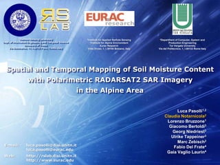
  • 1. Spatial and Temporal Mapping of Soil Moisture Content with Polarimetric RADARSAT2 SAR Imagery in the Alpine Area Luca Pasolli1,2 Claudia Notarnicola2 Lorenzo Bruzzone1 Giacomo Bertoldi3 Georg Niedriest3 Ulrike Tappeiner3 Marc Zebisch2 Fabio Del Frate4 Gaia Vaglio Laurin4 E-mail: luca.pasolli@disi.unitn.it luca.pasolli@eurac.edu Web: http://rslab.disi.unitn.it http://www.eurac.edu
  • 2. 2 Outline Introduction 1 Aim of the Work 2 Study Area and Dataset 3 Estimation System Description 4 Analysis of Results 5 Conclusion 6 IEEE International Geoscience and Remote Sensing Symposium IGARSS 2011 Vancouver, Canada – 24-29 July, 2011
  • 3.
  • 4.
  • 6.
  • 7. Estimation of vegetation biomass (forest)
  • 8. Investigation on the influence of soil and vegetation parameters in connection to natural hazard in Alpine regions.
  • 9. Estimation of soil moisture content on bare and vegetated areas (alpine meadows and pastures) IEEE International Geoscience and Remote Sensing Symposium IGARSS 2011 Vancouver, Canada – 24-29 July, 2011
  • 10.
  • 11. flood and landslide prediction
  • 12.
  • 13. sensitivityof microwave signals on different target properties (moisture content, roughness, vegetation, land use)
  • 14.
  • 15. by exploiting an advanced retrieval algorithm based on the Support Vector Regression (SVR) methodL. Pasolli, C. Notarnicola, L. Bruzzone, G. Bertoldi, S. Della Chiesa, V. Hell, G. Niedrist, U. Tappeiner, M. Zebisch, F. Del Frate, G.V. Laurin, “EstimagionofSoilMoisture in an Alpine catchmentwith RADARSAT2 images”, Applied and EnvironmentalSoil Science, in press IEEE International Geoscience and Remote Sensing Symposium IGARSS 2011 Vancouver, Canada – 24-29 July, 2011
  • 16. 5 Aimof the Work ToFurther Investigate the RetrievalofSoilMoisture from RADARSAT2 SAR Images in Alpine Areas Byexploiting the fully-polarimetriccapabilityof RADARSAT2 in combinationwith standard and advancedfeatureextraction/selectionmethods Byextending the analysisin time and spacewith the availableimages IEEE International Geoscience and Remote Sensing Symposium IGARSS 2011 Vancouver, Canada – 24-29 July, 2011
  • 17.
  • 19. Soil moisture content conditionsIEEE International Geoscience and Remote Sensing Symposium IGARSS 2011 Vancouver, Canada – 24-29 July, 2011
  • 20.
  • 22.
  • 23. NDVI map extracted from MODIS Terra images (pixel size 250 m)
  • 24. Land use map (meadows, pasture);IEEE International Geoscience and Remote Sensing Symposium IGARSS 2011 Vancouver, Canada – 24-29 July, 2011
  • 25. Estimation System 8 Polarimetric RADARSAT2 SAR image Data Pre-processing Feature Extraction & Selection Ancillary Data RetrievalAlgorithm EstimatedSoilMoistureContentMap IEEE International Geoscience and Remote Sensing Symposium IGARSS 2011 Vancouver, Canada – 24-29 July, 2011
  • 26.
  • 27. Multi-objective Model Selection ApproachPolarimetric RADARSAT2 SAR image Featuresfrom RemotelySensedImage Featuresfrom Ancillary Data Ground Truth ReferenceSamples Training Phase Data Pre-processing Validation Set Training Set K-Fold Cross Validation Performance Evaluation SVR Learning SVR Estimation Feature Extraction & Selection SVR ParametersConfig. Sub-Sample Generator Ancillary Data ModelSelection Multi-ObjectiveModelSelection RetrievalAlgorithm EstimationPerform. (MSE, R2) Estimation Operational Phase SVR Estimator Input Features (Image + Ancillary) Output SMC Value EstimatedSoilMoistureContentMap IEEE International Geoscience and Remote Sensing Symposium IGARSS 2011 Vancouver, Canada – 24-29 July, 2011
  • 28.
  • 30. Polarimetric Combinations: Span (HH+HV+2HV), Polarization Ratio (HH/VV) and Linear Depolarization Ratio (HV/VV)
  • 31. Polarimetric phase difference (PPD) and interferometric coherence
  • 35.
  • 36.
  • 38. SVR withGaussian RBF kernelfunction
  • 39. Hyper-parametersranges: 10-3 < γ < 103 , 10-3< C < 103 , 10-3 < ε < 10
  • 40. Multi-objectives model selection according to RMSE and R2 quality metrics
  • 41. Performance assessment on 17 independent test reference samples according to:
  • 42. Root Mean Squared Error (RMSE)
  • 44.
  • 45. Generation ofsoilmoisturecontentmapsassociatedwith RADARSAT 2 SAR imagestimeseriesacquiredduringsummer 2010
  • 46. Qualitative and quantitative assessmentwithpriorknowledge on the area and field station measurementsIEEE International Geoscience and Remote Sensing Symposium IGARSS 2011 Vancouver, Canada – 24-29 July, 2011
  • 47. 11 Results: Experiment 1 HH feature HH HV/VV features ICA1 ICA4 features α Afeatures IEEE International Geoscience and Remote Sensing Symposium IGARSS 2011 Vancouver, Canada – 24-29 July, 2011
  • 48. 11 Results: Experiment 2 EstimatedSoilMoistureContentMap, June 2010 IEEE International Geoscience and Remote Sensing Symposium IGARSS 2011 Vancouver, Canada – 24-29 July, 2011
  • 49. 14 Results: Experiment 2 Estimated dielectric constant Map, October 2010 Estimated dielectric constant Map, August 2010 Estimated dielectric constant map, July 2010 Estimated Dielectric constant Map, June 2010 IEEE International Geoscience and Remote Sensing Symposium IGARSS 2011 Vancouver, Canada – 24-29 July, 2011
  • 50.
  • 51.
  • 52.
  • 53. Integration of data from different sensors (e.g., L-Band SAR images)IEEE International Geoscience and Remote Sensing Symposium IGARSS 2011 Vancouver, Canada – 24-29 July, 2011
  • 54. 16 Thankyoufor the Attention!! Questions? luca.pasolli@disi.unitn.it luca.pasolli@eurac.edu IEEE International Geoscience and Remote Sensing Symposium IGARSS 2011 Vancouver, Canada – 24-29 July, 2011