GWP Central and Eastern Europe Demo Projects
•Transferir como PPT, PDF•
0 gostou•395 visualizações


Recomendados
Recomendados
Mais conteúdo relacionado
Mais procurados
Mais procurados (12)
Destaque
Destaque (9)
Semelhante a GWP Central and Eastern Europe Demo Projects
Semelhante a GWP Central and Eastern Europe Demo Projects (20)
Mais de Global Water Partnership
Mais de Global Water Partnership (20)
Último
Último (17)
GWP Central and Eastern Europe Demo Projects
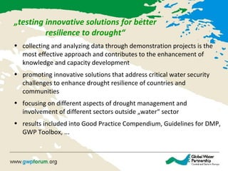
- 1. „testing innovative solutions for better resilience to drought“ • collecting and analyzing data through demonstration projects is the most effective approach and contributes to the enhancement of knowledge and capacity development • promoting innovative solutions that address critical water security challenges to enhance drought resilience of countries and communities • focusing on different aspects of drought management and involvement of different sectors outside „water“ sector • results included into Good Practice Compendium, Guidelines for DMP, GWP Toolbox, ...
- 2. Identification of agricultural drought characteristics & monitoring method through the application of remote sensing data.Hungary, Slovakia, RomaniaHungary, Slovakia, Romania Remote sensing agricultural drought monitoring methods Ukraine, MoldovaUkraine, Moldova Agricultural drought monitoring and forecasting Poland, Romania, LithuaniaPoland, Romania, Lithuania Drought Risk Management Scheme Upgrade data assessment and forecasting tools to support drought management and monitoring. Developing a framework for an integrated operational drought risk management system that can be adjusted to a given drought context.
- 3. • mitigation measure – to adjust to extreme variability in water quantities (release/use of water during dry periods) • to improve water retention potential of the landscapes • small dikes and polders, restoration of wetlands and changes in the forest and agricultural practices, etc. • Guidelines: to combine drought mitigation, flood protection and biodiversity conservation • Natural Water Retention Measures Initiative (www. nwrm.eu) Poland, Hungary, Slovakia, Slovenia Poland, Hungary, Slovakia, Slovenia Limnos; 2013 Limnos; 2013 Revitalization of the river stream Retention of the agricultural runoff
- 4. • to test the methods for improving water infiltration into the soil profile • field experiments with mixture of different „techniques“: sub-soiling, with and without tillage, composting tillage, organic fertilizers applications, ... – to improve soil structure • ¸practical examples of soil water holding capacity regultations + how to include proposals into DMP or already exsisting agro-enviromental plans Slovakia, Czech Republic, Slovenia, Poland Slovakia, Czech Republic, Slovenia, Poland Increasing soil water holding capacity Muller; Slovakia Laboratory rain simulator; CZ Mihelic; Slovenia
- 5. Bulgaria, Ukraine, Slovenia, Lithuania Bulgaria, Ukraine, Slovenia, Lithuania Drought impact on forest ecosystems • 4 GWP CEE countries with forests area 35% of total regional forests • forests have significant impact on the water regime of territories • measures for forest adaptation, mitigation of the negative effects of climate change o analysis of forest ecosystems – vulnerability zones of the forest vegetation for the present climate (61-90) and for the year 2050 and 2100 (different scenarios: realistic, optimistic, pessimistic) o measures for adaptation for differetn zones (high level of vulnerability, low level) Sakar Mountain; Bulgaria, 1999
- 6. Bulgaria, Ukraine, Slovenia, Lithuania Bulgaria, Ukraine, Slovenia, Lithuania Drought impact on forest ecosystems • 4 GWP CEE countries with forests area 35% of total regional forests • forests have significant impact on the water regime of territories • measures for forest adaptation, mitigation of the negative effects of climate change o analysis of forest ecosystems – vulnerability zones of the forest vegetation for the present climate (61-90) and for the year 2050 and 2100 (different scenarios: realistic, optimistic, pessimistic) o measures for adaptation for differetn zones (high level of vulnerability, low level) Sakar Mountain; Bulgaria, 1999
Notas do Editor
- Remote sensing: By applying the results, an early warning monitoring system can be established which can forecast the effect of drought on irreversible yield loss and/or quality degradation before symptoms occur. The monitoring system could provide the opportunity to assess possible future yield damages, which contribute to food security and facilitate drought mitigation. For water management today, remote sensing (RS) is one of most important solutions for measuring agricultural drought and its effects. The broad application of RS has few technological barriers, although the accumulated knowledge on RS is slowly being implemented into practice. This project aims to help fill the knowledge gap in this field, through spectral MODIS satellite time series datasets, in order to develop agricultural drought monitoring to facilitate decision-making in practice. While it is possible to continuously gather satellite data on plant water content, the direct interpretation of these data is not feasible for farmers. Using field reference data (i.e. data of green and brown water content) as a calibration for remote sensing data, the real drought situation of plants can be quickly and effectively mapped in both space and time on the surface. 2. Upgrading agricultural drought monitoring and forecasting: the case of Ukraine and Moldova Given the climate change conditions and increase of extreme weather events such as droughts, monitoring and forecasting instruments play a key role in the development of the agricultural sector. This is especially true in countries with limited water resources such as Ukraine and Moldova, where the agricultural sector is key to national economic development. - modern agro-climatic trends will be analyzed, based on meteorological observation data and experimental studies of soil water-holding capacity in Ukraine and the Dniester River Basin. to review agro-climatic zoning and to develop maps of drought-prone areas for the agricultural sector of Ukraine and the Dniester River Basin. This will be done in order to improve drought monitoring systems, update methods of data assessment and develop forecast models for key crop harvest losses through drought. The new agro-climatic zoning of Ukraine and the Dniester River Basin, recommendations elaborated for improving drought monitoring, upgraded forecasting models and good practices for increasing soil moisture retention will be presented and discussed with farmers and policy/decision-makers to improve drought management at the local and national/river basin levels.
- Small retention is often considered only as a flood protection measure. This demonstration project will show how floodwater stored by small retention dikes and polders is also an important source of water for ecosystems, agriculture and forestry during drought in river basins
- Field experiments with currently available technologies for sub-soiling and other farming practices designed to improve soil structure