SlideShare a Scribd company logo
1 of 23
Download to read offline
Effective Marketing
A Key Success Factor for Enterprise GIS
          42nd Annual URISA Conference

                      Reno, Nevada
                    November 10, 2004


                             Greg Babinski, GISP
                             Finance & Marketing Manager
                             King County GIS Center
                             “Putting GIS to Work in King County”


                                                       www.metrokc.gov/gis


Geospatial Technology Competency Model
     Outputs, Roles, & Competencies
 Outputs are the products and services GIS organizations
 deliver to their customers
 GIS professionals typically perform specialized ‘roles’
 that focus on delivering a subset of GIS outputs for the
 organization
 Geospatial Technology Competency Model identifies 12
 distinct ‘roles’ required for enterprise GIS operations
 Typical roles include management, project management,
 data management, programming, training, mapping,
 marketing, etc.
 Each GIS ‘role’ requires mastery of a set of knowledge,
 skills, and abilities (KSA’s).


                                                                             1
Geospatial Technology Competency Model
     Marketing Role & Competencies
  Technical: Assess Geospatial Technologies, Technical Writing
  Business: ‘Big Picture’ Vision, Industry Understanding, Cost Benefit
  Analysis/ROI, Change Management, Buy-in/Advocacy
  Analytical: Creative Thinking, Problem Solving Skills
  Interpersonal: Leadership, Questioning, Relationship Building,
  Feedback, Communications

But what is effective enterprise GIS marketing?
Two examples:
  King County GIS Center
  Muckleshoot Indian Tribe GIS


                   King County GIS
  The King County Geographic Information System (KCGIS) is a
  consolidated and coordinated regional geographic information
  resource, organized to meet the business needs of King County,
  local agencies, and the general public.
  KCGIS is comprised of both the King County GIS Center (an internal
  service fund, responsible for core GIS resources and enterprise GIS
  services for the entire County) and business specific activity in
  various GIS programs distributed across other County agencies.
  KCGIS is managed by the Director of DNRP, supported by a
  management level GIS Oversight Committee and an operational
  level GIS Technical Committee.


                                                          www.metrokc.gov/gis


                                                                                2
KCGIS Organization
      GIS Sponsor GIS Sponsor
      Department Executive
                                                 DNRP Director
                                                 (P. Bissonnette)


                                                                                                                                                                                                                                                                                    Budget
                                                       DNRP                                                                                                   DOT                           DDES                 KCA                       DES                         KCSO                        DPH         Council
                                                                                                                                                                                                                                                                                    Office


                                                                                                                                   KCGIS
                                                                                                              DNRP TU
                                                                                                                                 Oversight
      Governance


                                                                                                             (G. Hocking)
                                                                                                                                 Committee
        KCGIS


                                                                                                                                   KCGIS
                                                                                                                                  Technical
       GIS Service Providers
       Business Direction to


                                                                                                                                 Committee


                                                                                                                                                                                                                                                                                    Budget
                                 Parks          SWD             WLRD           WTD                                                             Transit       Roads          KCIA            DDES                 KCA         EMD          RELSD          FMD           KCSO                        DPH         Council
                                                                                                                                                                                                                                                                                    Office


                                                                                                                                                             Roads                                               KCA         EMD-        Elections
                                                   KCGIS Center Management Represents                                                          Transit                                      DDES
                                         DNRP Parks & SWD on KCGIS Technical Committee                     KCGIS Center                                       GIS
                                                                                                                                                                                          IS Section
                                                                                                                                                                                                              GIS          E911 GIS         GIS
                                                                                                                                               GIS Unit
                                                                                                                                                            Program                                         Program         Program       Section
                                                                                                                                              1 GIS Mgr     1 GIS Lead                    1 GIS Lead        1 GIS Lead     1 GIS Lead    1 GIS Mgr
                                                                                                        1 GIS Center Mgr
                                                                                                        2 GIS Function Mgrs                                                                                                              3 GIS FTEs
                                                                                                                                              5 GIS FTEs    5 GIS FTEs                    3 GIS FTEs        1 Mapping
                                                                                                        1 Office Mgr                                                                                                                     2 GIS TLTs
                                                                                                                                              (6.15 net)    1 GIS TLT                     (4.33 net)        Spvr           (1.00 net)
    GIS Service
     Providers


                                                                                                                                                            (3.01 net)                                      7 Mappers                    (5.45 net)
                                                                                                                                                                                                            (8.40 net)
                                                                                                                              GIS
                                                                                                 DNRP        Enterprise
                                                                                                                             Client
                                                                                                GIS Unit     Operations
                                                                                                                            Services

                                                                                                10.5 GIS       7.5 GIS        9.0 GIS
                                                                                                  FTEs          FTEs           FTEs


                                DNRP:         DNRP:            DNRP:         DNRP:                           Outside Regional Public          DOT:          DOT:          DOT:            DDES              KCA            DES:          DES:          DES:          KCSO          Budget        DPH           Council
                                Parks         SWD              WLRD          WTD                                                              Transit       Roads         KCIA                                             EMD-E911      RELSD         FMD                         Office
      GIS End


                                                                                                             Agencies and Public Users
       Users


                                                                                                             of KCGIS Data & Services
                                                                                                                                                                                                                                                                     4 GIS Power   2 GIS Power   3 GIS Power   1 GIS
                                                                                                             (Parcel Viewer, iMap, VMC,
                                                                                                                                              GIS Users     GIS Users                     GIS Users         GIS Users      GIS Users     GIS Users                   Users         Users         Users         Power User
                                GIS Clients   GIS Clients      GIS Clients   GIS Clients
                                                                                                             CDs, Client Services, etc.)      GIS Clients   GIS Clients   GIS Clients     GIS Clients       GIS Clients    GIS Clients   GIS Clients   GIS Clients                                             (0.15 net)
                                                                                                                                                                                                                                                                     (0.6 net)     (0.60 net)    9 Casual
                                                                                                                                                                                                                                                                                                 GIS Users
                                                                                                                                                                                                                                                                     GIS Clients   GIS Clients   GIS Clients   GIS Clients


                                                                Agencies that Fund KCGIS Center O&M (entitled to a seat                          Business Reporting Relationship
                                                                on the KCGIS Technical Committee). These agencies
                                                                provide business direction to GIS service providers.                             GIS Oversight Committee Membership (lines depict business
                                                                                                                                                 units with 2004 membership) DNRP Technology Unit Manager
                                                                                                                                                 (Gary Hocking) is permanent Chair
                                                    GIS Unit    Typical KCGIS Service Provider Organization (FTE count
                                                                indicates both positions assigned GIS tasks and net FTEs                         GIS Technical Committee Membership (lines depict where
                                                                assigned to GIS, based on 2004 KCGIS O&M Plan)                                   member is drawn from each agency)
                                                   GIS Mgr
                                                   GIS FTEs                                                                                      GIS Service Delivery - via KCGIS Center Enterprise Operations
                                                                                                                                                 and/or Client Services

                                                                KCGIS Center                                                                     Direct GIS Service Delivery - via KCGIS Center Matrixed Staff
                                                                                                                                                                                                                          King County Consolidated GIS Organization
                                                                                                                                                 GIS Service Delivery - via Dedicated Department GIS Unit                                   2004
GB: November 17, 2003


                                                      How is GIS Used for King County Business?
                                                                                                                                                                      How is GIS used for County Business?
                                                                                                                                                                                 Mapping
                                                                                                                                                                                 Public information delivery
                                                                                                                                                                                 Growth management & planning
                                                                                                                                                                                 Property assessment
                                                                                                                                                                                 Land development permitting
                                                                                                                                                                                 Site selection
                                                                                                                                                                                 Simulating environmental conditions
                                                                                                                                                                                 Emergency response planning
                                                                                                                                                                                 Crime analysis
                                                                                                                                                                                 Transportation planning
                                                                                                                                                                                 Bus & van routing
                                                                                                                                                                                 Road maintenance management
                                                                                                                                                                                 Public health service delivery
                                                                                                                                                                                 E911 operations
                                                                                                                                                                                 Airport sound abatement
                                                                                                                                                                                 Boundary management (legislative
                                                                                                                                                                                 districts, voter precincts, tax unit
                                                                                                                                                                                 boundaries, etc.)
                                                                                                                                                                                 And the list goes on…..
                                                                                                                                                                                                                                                        www.metrokc.gov/gis


                                                                                                                                                                                                                                                                                                                             3
GIS Marketing Strategy Development Process

 Agency Business Drivers:
     Define Your Agency Business Goals
     Define Your Business Success Indicators
     Define Marketing Goals to Achieve Business Success

 Marketing Strategy Process:
     Define & ‘Package’ GIS Outputs (Products & Services) That Can
     Provide Business Value
     Identify Customers & Communicate the Business Value of Your
     GIS Products & Services to Appropriate Decision Makers
     Listen to Customers & Competitors to Enhance & Refine Your
     Agency Product & Service Offerings


 KCGIS Center Business & Marketing Goals

 KCGIS Center Business Goals:
     Develop, Maintain, and Distribute GIS Resources & Services that
     Meet Customer Business Needs
     Serve Customers Who are Willing to Pay for GIS Products &
     Services


 KCGIS Center Marketing Goals:
     Promote the Use of GIS Technology, Products & Services
     Ensure the Financial Viability of KCGIS Operations and the
     Products & Services Offered


                                                                       4
KCGIS Center Marketing Objectives

       Maintain our Existing Base of Customers


       Identify & Develop New Customers


       Develop ‘Business Intelligence’ to Help
       Guide the Development of Future KCGIS
       Center Capabilities


    KCGIS Center Products & Services
Enterprise Operations:
    GIS Data Warehouse Management
    GIS Systems Administration
    Enterprise GIS Data Coordination
    Core GIS User Applications

Matrix GIS Staffing Services
On-Demand GIS Client Services:
    Application Development
    Training
    Mapping & Analysis


                                                 5
KCGIS Center Target Markets

        Aligned with 3 KCGIS Center ‘Business Lines’


        Some Customers use Products or Services
        from all 3 Business Lines


        KCGIS Center Target Markets
Enterprise Operations:
    Current: 30 County agency customers
    Average annual revenue: $46K
    Potential for 40 – 60 additional customers
    (Other county agencies, local cities, utilities,
    special districts)
                                                                                             KC Assessor
                                                                                                Maintains:
                                                                                               1. Parcel Data
                                                                                           2. Parcel Annotation                                                           DDES
                                                                                                                                                                         Maintains:
                                        DES                                                                                                                          1. Comp Plan Zones
                                     Maintains:                                                                                                                       2. Land Use Zones
                                 1. Election Districts                                                                                                                 3. Hazard Zones
                                  2. Voter Precincts                                                                                                                      4. Wetlands
                                                                                                  Access all GIS

                                                                                                                        Maintained Data
                                                                                                                         Posts Newly


                                                                                                                                                        ly ta
                                                                                                                                                   ew a             ta
                                                                                                                                                  N dD
                                                         P o ta
                                                         M


                                                                                                                                                                 Da
                                                            ain


                                                                                                                                                      e
                                                            st in


                                                                                                                                             sts in
                                                              Ac


                                                               s ed


                                                                                                                                                               S
                                                                                                                                           Po inta           GI
                                                                N
                                                                 ce


                                                                                                                 Data
                                                                  ew D a
                                                                   ss


                                                                                                                                             a           all
                                                                      ly ta
                                                                       all


                                                                                                                                           M         ss
                                                                                                                                                  ce
                                                                           GI


                                                                                                                                               Ac
                                                                             S
                                                                               Da


                                                                                                                                                                                                      KCGIS Center:
                                                                                  ta


                                                                                                                                                                                          1. Manages Data mainained by other
                                                                                                                                                   Posts Newly Maintained Data
                           KCGIS Center                                                       KCGIS                                                     Access all GIS Data
                                                                                                                                                                                          Departments
                                                      Posts Newly                                                                                                                         2. Maintains Data acquired from other
                           DNRP GIS Unit
                              Maintains:             Maintained Data                           Data                                                                                       Agencies
                                                                                                                                                                                          3. QC's & Monitors all Dept. data posted to
                            1. Hydrography
                                                   Access all GIS Data
                                                                                             Warehouse                                          QC & Monitor all Public Library           KCGIS Data Warehouse
                           2. Sampling Sites                                                                                                   GIS Data for Standards & Quality
                            3. Sewer Lines                                                   (Managed by                                                                                  4. KCGIS Database Administration
                                                                                                                                                                                          5. System Administration
                           4. Parks & Trails                                                KCGIS Center)                                                                                 6. Metadata management
                                                                          ly ta                                                                                                           7. Maintains standard KCGIS data access
                                                                      ew D a          ta                                                                                                  front end-user applications
                                                                    N
                                                                   s ed            Da
                                                                                                                                          M
                                                                                                                                          Po ta ut u


                                                                st in
                                                                                                                                            ain (F
                                                                                                            a


                                                                                                                                             s ts ine r e)


                                                             P o inta           IS
                                                                                                     GIS Dat


                                                                                                                                                Ac


                                                                               G
                                                                                                                                                 Ne d D


                                                                a          all
                                                                                                                                                   ce


                                                             M
                                                                                                                                                     w at


                                                                       ss
                                                                                                                                                     ss


                                                                                                                                                      ly a


                                                                    ce
                                                                                                                                                        KC


                                                                  Ac
                                                                                                                                                           GI
                                                                                                      all


                                                                                                                                                              S
                                                                                               Access


                                                                                                                                                                Da
                                                                                                                                                                  ta


                                        DOT
                                      Maintains
                                 1. Street Centerline                                                                                                         Future Regional             KCGIS Data Warehouse
                                 2. Street Addresses                                                                                                           GIS Partners
                                                                                             Other KCGIS
                                    3. Transit data
                                                                                            Departments,                                                         Maintain:                Maintenance & Access
                                                                                           Countywide GIS                                                      1. Local zoning            Architecture
                                                                                                                                                              2. Local land use
                                                                                           End-Users, & the                                                                               Note: Only sample data
                                                                                                                                                             3. Other Local Data
                                                                                            General Public                                                                                maintenance responsibilities are
                                                                                                                                                                                          shown


                                                                                                                                                                                                                                        6
KCGIS Center Target Markets
Matrixed GIS Staffing Services:
     Current: 6 County agency customers
     Average annual revenue: $203K
     Potential for 10 - 15 additional customers
     (Other county agencies, local cities, special
     districts)


        KCGIS Center Target Markets
On-Demand GIS Client Services:
    Past Year: 160+ separate customers (County
    agencies, cities, districts, utilities, tribes,
    private firms & individuals)
    Average annual revenue per customer: $2,235
    Potential for 250 - 750 customers
    New growth areas may include non-profits,
    targeted high-potential business communities,
    and out of area customers


                                                      7
KCGIS Center Target Market Decision Makers

   Enterprise Operations & Matrixed Staffing Clients:
       Public agency environment
       Rigid procurement and/or budgeting process
       requires extensive marketing effort
       A key objective is to retain these customers
       year after year (CRM is key!)
       Decision occurs at three levels


KCGIS Center Target Market Decision Makers
  The Technician or Business End-User:
       Do the products or services being offered
       provided business value?
       Do the products or services being offered
       provided technical value?


                                                        8
KCGIS Center Target Market Decision Makers
  Agency Business Operations Management:
       Do the products or services being offered help
       me meet my business goals?
       Do the products or services being offered help
       me meet my department’s budget goals?
       Do the products or services being offered help
       me meet my goals within the expectations of
       my elected leadership/board?


KCGIS Center Target Market Decision Makers
Agency Leadership, Elected or City/Executive Manager:
    These decision makers control organizational strategy,
    procurement policy, and budget.
    Do the products or services being offered align with
    my strategy, policy, and budget?
    Is the political climate OK?
    Do the products or services help me save money while
    I retain control and credit in the eyes of my
    constituencies for GIS derived services?


                                                             9
KCGIS Center Target Market Decision Makers

On-Demand GIS Client Services Customers:
    More diverse customer base
    Short-term and low/medium cost projects push most
    decision making down to managers, business end-
    users, & technicians
    General marketing message with focused sales effort
    Repeat business pushes down overall marketing
    cost, so CRM is key


     Business Intelligence Development

Keeps Agency’s Business & Marketing Strategy Forward
  Focused:
    Everyone in the organization contributes business
    intelligence
    What is the competition up to?
    What can new technology do for customers?
    How satisfied are our customers?
    Did our services help them meet their business
    goals?
    How could we serve them better?


                                                          10
Business Intelligence Development

 Supports Development of New Products & Services:
      Based on GIS conferences, literature, educational
      programs, user groups, and professional networking
      Leads to analysis of emerging technology that could
      meet customer business needs
      Could lead to internal product/service R&D effort
      Could lead to new products or services (resulting in
      new marketing effort)


       Business Intelligence Development
Management of Business Intelligence Process:
    MS Outlook Team Folders or SharePoint used to manage
    client contacts information
    Weekly business group staff meetings net first hand client
    information
    Monthly client services business meetings analyze client
    and competitor information
    Monthly all-staff meetings ensure customer information
    exchange
    Weekly management team meetings include focus on
    refining & acting on business intelligence


                                                                 11
Other Marketing Strategy Considerations

Competition:
    Theoretical – benchmarking studies
    Outsourcing the whole enchilada
    Internal: centralized vs. decentralized services
    Outside service providers
    Business partners


    Can another provider deliver services better or
    cheaper to the target market?


 Other Marketing Strategy Considerations

Legal & Business Environment:
    Is there a legal or statutory issue? Ask you attorney
    – but ask the right question!
    Is there an internal political bias?
    Is there an external business lobby?
    What is in the best interest of your constituents?
    They are usually taxpayers.


                                                            12
Other Marketing Strategy Considerations

 Level of Effort & Cost:
      It will take time
      It will cost money – both for marketing material and
      R&D
      But - there are many ways to integrate marketing
      into what you are doing already!


KCGIS Center Marketing Strategy Components
Marketing Plan Matrix:
    Key link between strategy and implementation
    Describes individual marketing tools, materials,
    activities & events
    Identifies marketing goals each supports
    Identifies target market each addresses
    Describes who, how, when each is intended to be used


                                                             13
KCGIS Center Marketing Strategy Components

 Branding:
      Creates an image of quality and value
      Appropriate for the organization, or for specific
      services or products
      King County GIS Center – the message behind the
      name:
        The ITS Division GIS Technical Resource Center?
        King County: Origins & Core Service Area
        GIS: Our technology world of services & products
        Center: Enterprise, convenient, efficient


KCGIS Center Marketing Strategy Components
Logo’s & Product/Service Branding:
    Logo’s reinforce identity, but…
    Beware corporate standards
    Tag Lines can help reinforce the brand:
       ‘We Put GIS to Work for King County’

    Product & Service Branding:
       GIS Services Express
       Training Tag Line: ‘Visualize Your Data – Better Decisions –
       Superior Public Service’


                                                                      14
KCGIS Center Marketing Strategy Components

 GIS Staff as a Key Marketing Resource:
     Customer-service focus should be a key non-
     technical expectation:
        1x positive customer experience = 10y marketing effort
        1z negative customer experience = 100y marketing effort

     All staff should understand the marketing process:
        Look for leads
        Report back business intelligence
        Scope out the competition

     Sensitivity, imagination, & flexibility


KCGIS Center Marketing Plan Implementation

       Comprised of dozens of tools and activities


       Some target one market, some two or all three


       Some are one-time, annual, monthly, weekly, or
       ad-hoc events


       Some are appropriate for designated staff, others
       can be used by any GIS professional


                                                                  15
KCGIS Center Marketing Plan Implementation

    KCGIS Governance Meetings & Process:
      KCGIS Oversight Committee (6 Senior Managers)
      KCGIS Technical Committee (20 Lead Technicians
      or Business Users)
      Enterprise Operations focus
      Prime venue to market enterprise operations
      services


KCGIS Center Marketing Plan Implementation

KCGIS User Group Meetings:
 Monthly meetings, open to all internal & external users of
 KCGIS Center services
 Attendees (20-40) tend to be technicians or business users
 Primary focus on technical issues or project show cases
 Outside vendors (KCGIS Business Partners) participate
 Non-overt marketing message: KCGIS center is a quality
 technical resource and a reliable, responsive service
 provider


                                                              16
KCGIS Center Marketing Plan Implementation

KCGIS Center national GIS Day Event:
 All day public event in a large public conference room
 8-10 booths for KCGIS business lines & other KCGIS
 business partners
 Two small adjacent rooms used for presentations and ‘ask
 the GIS doctor’ drop in clinic
 Primary focus on showcasing business solutions
 Recent key note speakers: County Executive & Assessor
 200+ attendees represent current & future target markets
 Generate external publicity


KCGIS Center Marketing Plan Implementation
Annual King County Budget development Process:
 Narrowly Focused – But High Value Activity
 Focus by GIS Manager & Finance & Marketing Manager
 Targets business unit managers & department directors
 Focus to commit to annual GIS service & funding levels
 Extensive verbal & written communications, plus lobbying
 technicians & business users
 Other key players include department finance managers,
 budget office staff, Executive management analysts, and
 Council staff


                                                            17
KCGIS Center Marketing Plan Implementation
Cold Calls & ‘Howdy Meetings’:
 Business intelligence driven
 Finance & Marketing Manager or other GIS staff initiate
 Cold call objective is a follow-up ‘Howdy Meeting’ with
 decision makers
 ‘Howdy Meetings’ are mostly informative – what we do,
 what potential client does, how GIS might help
 We focus on free GIS resources, but try to identify follow-
 up business opportunities
 Process resulted in several new Enterprise Operations &
 Matrix GIS Staffing customers


KCGIS Center Marketing Plan Implementation
Effective Web Site:
 Web mapping showcase (1.6 million annual user sessions)
 Generates exposure to the marketing message:
    Weekly GIS news items & client project news
    Staff professional presentations & GIS Knowledge Base
    Spatial data catalog

 Client Services Section:
    Sample projects & products
    Training program
    GIS data


                                                               18
KCGIS Center Marketing Plan Implementation
Other Marketing Tools & Activities:
 Annual GIS O&M Plan, GIS Best Practices & Standards
 Targeted & mass mailings
 Customer satisfaction surveys
 Newsletter (KCGIS.Today), Posters & ‘Map-a-Month Calendar’
 SOQ’s Service Description Sheets, Staff Bio’s
 Vendor booth at state URISA Conference, frequent speakers
 at local conferences & events
 Future: Business specific conferences & advertising, more
 public-private partnership


KCGIS Center Marketing Plan Implementation
   Marketing Follow-up Activity:
     Annual report on activity:
        Number of events, contacts, activities

     Annual evaluation of marketing effectiveness:
        Number of new customers
        Customer retention ratio
        Repeat business
        Revenue growth

     Satisfaction surveys & feed back forms
     Unsolicited complaints (few) and testimonials (many!)


                                                              19
Muckleshoot Tribe GIS
 Located in Southern King County (semi-rural)

 Manages approximately 6 square miles of land, plus
 other property throughout King County

 Operates a major casino complex & a regional
 entertainment venue

 Muckleshoot Tribe GIS managed by one person with
 strong & successful marketing


                Muckleshoot Tribe GIS
Branding Program & Target Market Development:
 Standard logo for all maps, web site, & products
 Target market identified as tribe department managers &
 business operations staff:
    Educated about GIS concepts
    Developed a product of wide tribal value


                                                           20
Muckleshoot Tribe GIS
Branding Program & Target Market Development:
 Large scale aerial-imagery based “label-map’ of entire
 reservation area
    Developed with CC GIS interns
    Used throughout tribal government
    Whets appetite of market for more GIS-based products & services


                 Muckleshoot Tribe GIS
   Tribe Intranet GIS Web Site:
    Educates Tribe administrative staff about GIS concepts
    Provides showcase for Muckleshoot GIS maps & imagery
    Provides access to maps & imagery in JPG & PDF format
    Describes the Tribe’s framework GIS projects
    No web mapping capability


                                                                      21
Muckleshoot Tribe GIS
Project & Personal Branding:
 Maximum use is made of project branding with
 descriptive acronyms:
    JUMP (Joint Utility Mapping Project)
    SNARE (Survey Network Across the Reservation with Elevations)
    Facilitate understanding project concepts by Tribal decision-
    makers & enhances image of quality & reliability

 Personal Branding: GIS Certification
    GIS Manager was self motivated to pursue certification
    GISP Certificate on Manager’s door has attracted attention
    Certification has perceptibly enhanced the stature of the GIS
    program


              Muckleshoot Tribe GIS
Small Agency GIS Marketing Challenges:
 Limited resources means marketing needs to be focused
 and very efficient
 There are some inherent advantages though:
    Business intelligence processing is easy
    The marketing strategy & plan can be ‘in your head’

 Marketing has been a key factor for Muckleshoot GIS:
    6 plus years of support, growth, and success
    Continued support
    Potential for future development


                                                                    22
Conclusions & Questions
Effective marketing is a key success factor for
development and ongoing operation of enterprise GIS
Large and small agencies can benefit from effective
marketing

How does your agency market its GIS?
Questions?


               Reference
               Gaudet, C., Annulis, H., and Carr, J., 2001. Workforce Development Models for
               Geospatial Technology, Hattiesburg, MS: The University of Southern Mississippi.
               (http://www.geowdc.usm.edu/research/research.htm)

               Acknowledgement
               Mr. Tim Leach, GIS Manager,
               Muckleshoot Indian Tribe, 39015 172nd Ave SE, Auburn, WA, 98092.

                                                                       www.metrokc.gov/gis


                                                                                                 23

More Related Content

More from Greg Babinski

IMPROVING ENTERPRISE GIS OPERATIONS VIA STAFF USAGE ANALYSIS AND SURVEYS
IMPROVING ENTERPRISE GIS OPERATIONS VIA STAFF USAGE ANALYSIS AND SURVEYSIMPROVING ENTERPRISE GIS OPERATIONS VIA STAFF USAGE ANALYSIS AND SURVEYS
IMPROVING ENTERPRISE GIS OPERATIONS VIA STAFF USAGE ANALYSIS AND SURVEYSGreg Babinski
 
BURISA News Issue 192
BURISA News Issue 192BURISA News Issue 192
BURISA News Issue 192Greg Babinski
 
URISA Newsletter Issue 193
URISA Newsletter Issue 193URISA Newsletter Issue 193
URISA Newsletter Issue 193Greg Babinski
 
BURISA Newsletter Issue 194 (Final Issue)
BURISA Newsletter Issue 194 (Final Issue)BURISA Newsletter Issue 194 (Final Issue)
BURISA Newsletter Issue 194 (Final Issue)Greg Babinski
 
King County GIS Funding and Billing Procedures 2015-2016
King County GIS Funding and Billing Procedures 2015-2016King County GIS Funding and Billing Procedures 2015-2016
King County GIS Funding and Billing Procedures 2015-2016Greg Babinski
 
GIS for Equity & Social Justice Best Practices
GIS for Equity & Social Justice Best PracticesGIS for Equity & Social Justice Best Practices
GIS for Equity & Social Justice Best PracticesGreg Babinski
 
GIS v. IT - One of these things is not like the other
GIS v. IT - One of these things is not like the otherGIS v. IT - One of these things is not like the other
GIS v. IT - One of these things is not like the otherGreg Babinski
 
Babinski geography as human ecology wsu19720614
Babinski geography as human ecology wsu19720614Babinski geography as human ecology wsu19720614
Babinski geography as human ecology wsu19720614Greg Babinski
 
Examining the meaning of confederate civil war monuments
Examining the meaning of confederate civil war monumentsExamining the meaning of confederate civil war monuments
Examining the meaning of confederate civil war monumentsGreg Babinski
 
Martin Luther King, William Bunge, URISA, and GIS for Equity and Social Justi...
Martin Luther King, William Bunge, URISA, and GIS for Equity and Social Justi...Martin Luther King, William Bunge, URISA, and GIS for Equity and Social Justi...
Martin Luther King, William Bunge, URISA, and GIS for Equity and Social Justi...Greg Babinski
 
The future of urisa as an international organization
The future of urisa as an international organizationThe future of urisa as an international organization
The future of urisa as an international organizationGreg Babinski
 
URISA’s GIS Management Institute
URISA’s GIS Management InstituteURISA’s GIS Management Institute
URISA’s GIS Management InstituteGreg Babinski
 
2002 KCGIS O&M Issue Status Report #4: Status of Original GIS Capital Project...
2002 KCGIS O&M Issue Status Report #4: Status of Original GIS Capital Project...2002 KCGIS O&M Issue Status Report #4: Status of Original GIS Capital Project...
2002 KCGIS O&M Issue Status Report #4: Status of Original GIS Capital Project...Greg Babinski
 
A Day in the Life of King County GIS
A Day in the Life of King County GISA Day in the Life of King County GIS
A Day in the Life of King County GISGreg Babinski
 
URISA Geospatial Management Competency Model - Strawman Draft
URISA Geospatial Management Competency Model - Strawman DraftURISA Geospatial Management Competency Model - Strawman Draft
URISA Geospatial Management Competency Model - Strawman DraftGreg Babinski
 
Draft Municipal GIS Capability Maturity Model
Draft Municipal GIS Capability Maturity ModelDraft Municipal GIS Capability Maturity Model
Draft Municipal GIS Capability Maturity ModelGreg Babinski
 
Flight of the Malfunction: My 2013 Trip to Morotai & WWII 13th AAF Sites
Flight of the Malfunction: My 2013 Trip to Morotai & WWII 13th AAF SitesFlight of the Malfunction: My 2013 Trip to Morotai & WWII 13th AAF Sites
Flight of the Malfunction: My 2013 Trip to Morotai & WWII 13th AAF SitesGreg Babinski
 
A Survey and Analysis of GIS Web Mapping Applications in Washington State
A Survey and Analysis of GIS Web Mapping Applications in Washington StateA Survey and Analysis of GIS Web Mapping Applications in Washington State
A Survey and Analysis of GIS Web Mapping Applications in Washington StateGreg Babinski
 
No GIS is an Island How (and why) we should compare ourselves and share our s...
No GIS is an Island How (and why) we should compare ourselves and share our s...No GIS is an Island How (and why) we should compare ourselves and share our s...
No GIS is an Island How (and why) we should compare ourselves and share our s...Greg Babinski
 
Law and the Geoweb’ Panel Discussion. 2011 AAG Conference
Law and the Geoweb’ Panel Discussion. 2011 AAG ConferenceLaw and the Geoweb’ Panel Discussion. 2011 AAG Conference
Law and the Geoweb’ Panel Discussion. 2011 AAG ConferenceGreg Babinski
 

More from Greg Babinski (20)

IMPROVING ENTERPRISE GIS OPERATIONS VIA STAFF USAGE ANALYSIS AND SURVEYS
IMPROVING ENTERPRISE GIS OPERATIONS VIA STAFF USAGE ANALYSIS AND SURVEYSIMPROVING ENTERPRISE GIS OPERATIONS VIA STAFF USAGE ANALYSIS AND SURVEYS
IMPROVING ENTERPRISE GIS OPERATIONS VIA STAFF USAGE ANALYSIS AND SURVEYS
 
BURISA News Issue 192
BURISA News Issue 192BURISA News Issue 192
BURISA News Issue 192
 
URISA Newsletter Issue 193
URISA Newsletter Issue 193URISA Newsletter Issue 193
URISA Newsletter Issue 193
 
BURISA Newsletter Issue 194 (Final Issue)
BURISA Newsletter Issue 194 (Final Issue)BURISA Newsletter Issue 194 (Final Issue)
BURISA Newsletter Issue 194 (Final Issue)
 
King County GIS Funding and Billing Procedures 2015-2016
King County GIS Funding and Billing Procedures 2015-2016King County GIS Funding and Billing Procedures 2015-2016
King County GIS Funding and Billing Procedures 2015-2016
 
GIS for Equity & Social Justice Best Practices
GIS for Equity & Social Justice Best PracticesGIS for Equity & Social Justice Best Practices
GIS for Equity & Social Justice Best Practices
 
GIS v. IT - One of these things is not like the other
GIS v. IT - One of these things is not like the otherGIS v. IT - One of these things is not like the other
GIS v. IT - One of these things is not like the other
 
Babinski geography as human ecology wsu19720614
Babinski geography as human ecology wsu19720614Babinski geography as human ecology wsu19720614
Babinski geography as human ecology wsu19720614
 
Examining the meaning of confederate civil war monuments
Examining the meaning of confederate civil war monumentsExamining the meaning of confederate civil war monuments
Examining the meaning of confederate civil war monuments
 
Martin Luther King, William Bunge, URISA, and GIS for Equity and Social Justi...
Martin Luther King, William Bunge, URISA, and GIS for Equity and Social Justi...Martin Luther King, William Bunge, URISA, and GIS for Equity and Social Justi...
Martin Luther King, William Bunge, URISA, and GIS for Equity and Social Justi...
 
The future of urisa as an international organization
The future of urisa as an international organizationThe future of urisa as an international organization
The future of urisa as an international organization
 
URISA’s GIS Management Institute
URISA’s GIS Management InstituteURISA’s GIS Management Institute
URISA’s GIS Management Institute
 
2002 KCGIS O&M Issue Status Report #4: Status of Original GIS Capital Project...
2002 KCGIS O&M Issue Status Report #4: Status of Original GIS Capital Project...2002 KCGIS O&M Issue Status Report #4: Status of Original GIS Capital Project...
2002 KCGIS O&M Issue Status Report #4: Status of Original GIS Capital Project...
 
A Day in the Life of King County GIS
A Day in the Life of King County GISA Day in the Life of King County GIS
A Day in the Life of King County GIS
 
URISA Geospatial Management Competency Model - Strawman Draft
URISA Geospatial Management Competency Model - Strawman DraftURISA Geospatial Management Competency Model - Strawman Draft
URISA Geospatial Management Competency Model - Strawman Draft
 
Draft Municipal GIS Capability Maturity Model
Draft Municipal GIS Capability Maturity ModelDraft Municipal GIS Capability Maturity Model
Draft Municipal GIS Capability Maturity Model
 
Flight of the Malfunction: My 2013 Trip to Morotai & WWII 13th AAF Sites
Flight of the Malfunction: My 2013 Trip to Morotai & WWII 13th AAF SitesFlight of the Malfunction: My 2013 Trip to Morotai & WWII 13th AAF Sites
Flight of the Malfunction: My 2013 Trip to Morotai & WWII 13th AAF Sites
 
A Survey and Analysis of GIS Web Mapping Applications in Washington State
A Survey and Analysis of GIS Web Mapping Applications in Washington StateA Survey and Analysis of GIS Web Mapping Applications in Washington State
A Survey and Analysis of GIS Web Mapping Applications in Washington State
 
No GIS is an Island How (and why) we should compare ourselves and share our s...
No GIS is an Island How (and why) we should compare ourselves and share our s...No GIS is an Island How (and why) we should compare ourselves and share our s...
No GIS is an Island How (and why) we should compare ourselves and share our s...
 
Law and the Geoweb’ Panel Discussion. 2011 AAG Conference
Law and the Geoweb’ Panel Discussion. 2011 AAG ConferenceLaw and the Geoweb’ Panel Discussion. 2011 AAG Conference
Law and the Geoweb’ Panel Discussion. 2011 AAG Conference
 

Recently uploaded

Designing IA for AI - Information Architecture Conference 2024
Designing IA for AI - Information Architecture Conference 2024Designing IA for AI - Information Architecture Conference 2024
Designing IA for AI - Information Architecture Conference 2024Enterprise Knowledge
 
Commit 2024 - Secret Management made easy
Commit 2024 - Secret Management made easyCommit 2024 - Secret Management made easy
Commit 2024 - Secret Management made easyAlfredo García Lavilla
 
Human Factors of XR: Using Human Factors to Design XR Systems
Human Factors of XR: Using Human Factors to Design XR SystemsHuman Factors of XR: Using Human Factors to Design XR Systems
Human Factors of XR: Using Human Factors to Design XR SystemsMark Billinghurst
 
Dev Dives: Streamline document processing with UiPath Studio Web
Dev Dives: Streamline document processing with UiPath Studio WebDev Dives: Streamline document processing with UiPath Studio Web
Dev Dives: Streamline document processing with UiPath Studio WebUiPathCommunity
 
AI as an Interface for Commercial Buildings
AI as an Interface for Commercial BuildingsAI as an Interface for Commercial Buildings
AI as an Interface for Commercial BuildingsMemoori
 
Leverage Zilliz Serverless - Up to 50X Saving for Your Vector Storage Cost
Leverage Zilliz Serverless - Up to 50X Saving for Your Vector Storage CostLeverage Zilliz Serverless - Up to 50X Saving for Your Vector Storage Cost
Leverage Zilliz Serverless - Up to 50X Saving for Your Vector Storage CostZilliz
 
DevEX - reference for building teams, processes, and platforms
DevEX - reference for building teams, processes, and platformsDevEX - reference for building teams, processes, and platforms
DevEX - reference for building teams, processes, and platformsSergiu Bodiu
 
"Subclassing and Composition – A Pythonic Tour of Trade-Offs", Hynek Schlawack
"Subclassing and Composition – A Pythonic Tour of Trade-Offs", Hynek Schlawack"Subclassing and Composition – A Pythonic Tour of Trade-Offs", Hynek Schlawack
"Subclassing and Composition – A Pythonic Tour of Trade-Offs", Hynek SchlawackFwdays
 
Powerpoint exploring the locations used in television show Time Clash
Powerpoint exploring the locations used in television show Time ClashPowerpoint exploring the locations used in television show Time Clash
Powerpoint exploring the locations used in television show Time Clashcharlottematthew16
 
Streamlining Python Development: A Guide to a Modern Project Setup
Streamlining Python Development: A Guide to a Modern Project SetupStreamlining Python Development: A Guide to a Modern Project Setup
Streamlining Python Development: A Guide to a Modern Project SetupFlorian Wilhelm
 
Unraveling Multimodality with Large Language Models.pdf
Unraveling Multimodality with Large Language Models.pdfUnraveling Multimodality with Large Language Models.pdf
Unraveling Multimodality with Large Language Models.pdfAlex Barbosa Coqueiro
 
"Federated learning: out of reach no matter how close",Oleksandr Lapshyn
"Federated learning: out of reach no matter how close",Oleksandr Lapshyn"Federated learning: out of reach no matter how close",Oleksandr Lapshyn
"Federated learning: out of reach no matter how close",Oleksandr LapshynFwdays
 
Bun (KitWorks Team Study 노별마루 발표 2024.4.22)
Bun (KitWorks Team Study 노별마루 발표 2024.4.22)Bun (KitWorks Team Study 노별마루 발표 2024.4.22)
Bun (KitWorks Team Study 노별마루 발표 2024.4.22)Wonjun Hwang
 
New from BookNet Canada for 2024: BNC CataList - Tech Forum 2024
New from BookNet Canada for 2024: BNC CataList - Tech Forum 2024New from BookNet Canada for 2024: BNC CataList - Tech Forum 2024
New from BookNet Canada for 2024: BNC CataList - Tech Forum 2024BookNet Canada
 
Anypoint Exchange: It’s Not Just a Repo!
Anypoint Exchange: It’s Not Just a Repo!Anypoint Exchange: It’s Not Just a Repo!
Anypoint Exchange: It’s Not Just a Repo!Manik S Magar
 
CloudStudio User manual (basic edition):
CloudStudio User manual (basic edition):CloudStudio User manual (basic edition):
CloudStudio User manual (basic edition):comworks
 
Beyond Boundaries: Leveraging No-Code Solutions for Industry Innovation
Beyond Boundaries: Leveraging No-Code Solutions for Industry InnovationBeyond Boundaries: Leveraging No-Code Solutions for Industry Innovation
Beyond Boundaries: Leveraging No-Code Solutions for Industry InnovationSafe Software
 
Integration and Automation in Practice: CI/CD in Mule Integration and Automat...
Integration and Automation in Practice: CI/CD in Mule Integration and Automat...Integration and Automation in Practice: CI/CD in Mule Integration and Automat...
Integration and Automation in Practice: CI/CD in Mule Integration and Automat...Patryk Bandurski
 
Ensuring Technical Readiness For Copilot in Microsoft 365
Ensuring Technical Readiness For Copilot in Microsoft 365Ensuring Technical Readiness For Copilot in Microsoft 365
Ensuring Technical Readiness For Copilot in Microsoft 3652toLead Limited
 

Recently uploaded (20)

Designing IA for AI - Information Architecture Conference 2024
Designing IA for AI - Information Architecture Conference 2024Designing IA for AI - Information Architecture Conference 2024
Designing IA for AI - Information Architecture Conference 2024
 
Commit 2024 - Secret Management made easy
Commit 2024 - Secret Management made easyCommit 2024 - Secret Management made easy
Commit 2024 - Secret Management made easy
 
Human Factors of XR: Using Human Factors to Design XR Systems
Human Factors of XR: Using Human Factors to Design XR SystemsHuman Factors of XR: Using Human Factors to Design XR Systems
Human Factors of XR: Using Human Factors to Design XR Systems
 
Dev Dives: Streamline document processing with UiPath Studio Web
Dev Dives: Streamline document processing with UiPath Studio WebDev Dives: Streamline document processing with UiPath Studio Web
Dev Dives: Streamline document processing with UiPath Studio Web
 
AI as an Interface for Commercial Buildings
AI as an Interface for Commercial BuildingsAI as an Interface for Commercial Buildings
AI as an Interface for Commercial Buildings
 
Leverage Zilliz Serverless - Up to 50X Saving for Your Vector Storage Cost
Leverage Zilliz Serverless - Up to 50X Saving for Your Vector Storage CostLeverage Zilliz Serverless - Up to 50X Saving for Your Vector Storage Cost
Leverage Zilliz Serverless - Up to 50X Saving for Your Vector Storage Cost
 
DevEX - reference for building teams, processes, and platforms
DevEX - reference for building teams, processes, and platformsDevEX - reference for building teams, processes, and platforms
DevEX - reference for building teams, processes, and platforms
 
DMCC Future of Trade Web3 - Special Edition
DMCC Future of Trade Web3 - Special EditionDMCC Future of Trade Web3 - Special Edition
DMCC Future of Trade Web3 - Special Edition
 
"Subclassing and Composition – A Pythonic Tour of Trade-Offs", Hynek Schlawack
"Subclassing and Composition – A Pythonic Tour of Trade-Offs", Hynek Schlawack"Subclassing and Composition – A Pythonic Tour of Trade-Offs", Hynek Schlawack
"Subclassing and Composition – A Pythonic Tour of Trade-Offs", Hynek Schlawack
 
Powerpoint exploring the locations used in television show Time Clash
Powerpoint exploring the locations used in television show Time ClashPowerpoint exploring the locations used in television show Time Clash
Powerpoint exploring the locations used in television show Time Clash
 
Streamlining Python Development: A Guide to a Modern Project Setup
Streamlining Python Development: A Guide to a Modern Project SetupStreamlining Python Development: A Guide to a Modern Project Setup
Streamlining Python Development: A Guide to a Modern Project Setup
 
Unraveling Multimodality with Large Language Models.pdf
Unraveling Multimodality with Large Language Models.pdfUnraveling Multimodality with Large Language Models.pdf
Unraveling Multimodality with Large Language Models.pdf
 
"Federated learning: out of reach no matter how close",Oleksandr Lapshyn
"Federated learning: out of reach no matter how close",Oleksandr Lapshyn"Federated learning: out of reach no matter how close",Oleksandr Lapshyn
"Federated learning: out of reach no matter how close",Oleksandr Lapshyn
 
Bun (KitWorks Team Study 노별마루 발표 2024.4.22)
Bun (KitWorks Team Study 노별마루 발표 2024.4.22)Bun (KitWorks Team Study 노별마루 발표 2024.4.22)
Bun (KitWorks Team Study 노별마루 발표 2024.4.22)
 
New from BookNet Canada for 2024: BNC CataList - Tech Forum 2024
New from BookNet Canada for 2024: BNC CataList - Tech Forum 2024New from BookNet Canada for 2024: BNC CataList - Tech Forum 2024
New from BookNet Canada for 2024: BNC CataList - Tech Forum 2024
 
Anypoint Exchange: It’s Not Just a Repo!
Anypoint Exchange: It’s Not Just a Repo!Anypoint Exchange: It’s Not Just a Repo!
Anypoint Exchange: It’s Not Just a Repo!
 
CloudStudio User manual (basic edition):
CloudStudio User manual (basic edition):CloudStudio User manual (basic edition):
CloudStudio User manual (basic edition):
 
Beyond Boundaries: Leveraging No-Code Solutions for Industry Innovation
Beyond Boundaries: Leveraging No-Code Solutions for Industry InnovationBeyond Boundaries: Leveraging No-Code Solutions for Industry Innovation
Beyond Boundaries: Leveraging No-Code Solutions for Industry Innovation
 
Integration and Automation in Practice: CI/CD in Mule Integration and Automat...
Integration and Automation in Practice: CI/CD in Mule Integration and Automat...Integration and Automation in Practice: CI/CD in Mule Integration and Automat...
Integration and Automation in Practice: CI/CD in Mule Integration and Automat...
 
Ensuring Technical Readiness For Copilot in Microsoft 365
Ensuring Technical Readiness For Copilot in Microsoft 365Ensuring Technical Readiness For Copilot in Microsoft 365
Ensuring Technical Readiness For Copilot in Microsoft 365
 

Effective Marketing: King County GIS Center

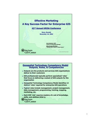
  • 1. Effective Marketing A Key Success Factor for Enterprise GIS 42nd Annual URISA Conference Reno, Nevada November 10, 2004 Greg Babinski, GISP Finance & Marketing Manager King County GIS Center “Putting GIS to Work in King County” www.metrokc.gov/gis Geospatial Technology Competency Model Outputs, Roles, & Competencies Outputs are the products and services GIS organizations deliver to their customers GIS professionals typically perform specialized ‘roles’ that focus on delivering a subset of GIS outputs for the organization Geospatial Technology Competency Model identifies 12 distinct ‘roles’ required for enterprise GIS operations Typical roles include management, project management, data management, programming, training, mapping, marketing, etc. Each GIS ‘role’ requires mastery of a set of knowledge, skills, and abilities (KSA’s). 1
  • 2. Geospatial Technology Competency Model Marketing Role & Competencies Technical: Assess Geospatial Technologies, Technical Writing Business: ‘Big Picture’ Vision, Industry Understanding, Cost Benefit Analysis/ROI, Change Management, Buy-in/Advocacy Analytical: Creative Thinking, Problem Solving Skills Interpersonal: Leadership, Questioning, Relationship Building, Feedback, Communications But what is effective enterprise GIS marketing? Two examples: King County GIS Center Muckleshoot Indian Tribe GIS King County GIS The King County Geographic Information System (KCGIS) is a consolidated and coordinated regional geographic information resource, organized to meet the business needs of King County, local agencies, and the general public. KCGIS is comprised of both the King County GIS Center (an internal service fund, responsible for core GIS resources and enterprise GIS services for the entire County) and business specific activity in various GIS programs distributed across other County agencies. KCGIS is managed by the Director of DNRP, supported by a management level GIS Oversight Committee and an operational level GIS Technical Committee. www.metrokc.gov/gis 2
  • 3. KCGIS Organization GIS Sponsor GIS Sponsor Department Executive DNRP Director (P. Bissonnette) Budget DNRP DOT DDES KCA DES KCSO DPH Council Office KCGIS DNRP TU Oversight Governance (G. Hocking) Committee KCGIS KCGIS Technical GIS Service Providers Business Direction to Committee Budget Parks SWD WLRD WTD Transit Roads KCIA DDES KCA EMD RELSD FMD KCSO DPH Council Office Roads KCA EMD- Elections KCGIS Center Management Represents Transit DDES DNRP Parks & SWD on KCGIS Technical Committee KCGIS Center GIS IS Section GIS E911 GIS GIS GIS Unit Program Program Program Section 1 GIS Mgr 1 GIS Lead 1 GIS Lead 1 GIS Lead 1 GIS Lead 1 GIS Mgr 1 GIS Center Mgr 2 GIS Function Mgrs 3 GIS FTEs 5 GIS FTEs 5 GIS FTEs 3 GIS FTEs 1 Mapping 1 Office Mgr 2 GIS TLTs (6.15 net) 1 GIS TLT (4.33 net) Spvr (1.00 net) GIS Service Providers (3.01 net) 7 Mappers (5.45 net) (8.40 net) GIS DNRP Enterprise Client GIS Unit Operations Services 10.5 GIS 7.5 GIS 9.0 GIS FTEs FTEs FTEs DNRP: DNRP: DNRP: DNRP: Outside Regional Public DOT: DOT: DOT: DDES KCA DES: DES: DES: KCSO Budget DPH Council Parks SWD WLRD WTD Transit Roads KCIA EMD-E911 RELSD FMD Office GIS End Agencies and Public Users Users of KCGIS Data & Services 4 GIS Power 2 GIS Power 3 GIS Power 1 GIS (Parcel Viewer, iMap, VMC, GIS Users GIS Users GIS Users GIS Users GIS Users GIS Users Users Users Users Power User GIS Clients GIS Clients GIS Clients GIS Clients CDs, Client Services, etc.) GIS Clients GIS Clients GIS Clients GIS Clients GIS Clients GIS Clients GIS Clients GIS Clients (0.15 net) (0.6 net) (0.60 net) 9 Casual GIS Users GIS Clients GIS Clients GIS Clients GIS Clients Agencies that Fund KCGIS Center O&M (entitled to a seat Business Reporting Relationship on the KCGIS Technical Committee). These agencies provide business direction to GIS service providers. GIS Oversight Committee Membership (lines depict business units with 2004 membership) DNRP Technology Unit Manager (Gary Hocking) is permanent Chair GIS Unit Typical KCGIS Service Provider Organization (FTE count indicates both positions assigned GIS tasks and net FTEs GIS Technical Committee Membership (lines depict where assigned to GIS, based on 2004 KCGIS O&M Plan) member is drawn from each agency) GIS Mgr GIS FTEs GIS Service Delivery - via KCGIS Center Enterprise Operations and/or Client Services KCGIS Center Direct GIS Service Delivery - via KCGIS Center Matrixed Staff King County Consolidated GIS Organization GIS Service Delivery - via Dedicated Department GIS Unit 2004 GB: November 17, 2003 How is GIS Used for King County Business? How is GIS used for County Business? Mapping Public information delivery Growth management & planning Property assessment Land development permitting Site selection Simulating environmental conditions Emergency response planning Crime analysis Transportation planning Bus & van routing Road maintenance management Public health service delivery E911 operations Airport sound abatement Boundary management (legislative districts, voter precincts, tax unit boundaries, etc.) And the list goes on….. www.metrokc.gov/gis 3
  • 4. GIS Marketing Strategy Development Process Agency Business Drivers: Define Your Agency Business Goals Define Your Business Success Indicators Define Marketing Goals to Achieve Business Success Marketing Strategy Process: Define & ‘Package’ GIS Outputs (Products & Services) That Can Provide Business Value Identify Customers & Communicate the Business Value of Your GIS Products & Services to Appropriate Decision Makers Listen to Customers & Competitors to Enhance & Refine Your Agency Product & Service Offerings KCGIS Center Business & Marketing Goals KCGIS Center Business Goals: Develop, Maintain, and Distribute GIS Resources & Services that Meet Customer Business Needs Serve Customers Who are Willing to Pay for GIS Products & Services KCGIS Center Marketing Goals: Promote the Use of GIS Technology, Products & Services Ensure the Financial Viability of KCGIS Operations and the Products & Services Offered 4
  • 5. KCGIS Center Marketing Objectives Maintain our Existing Base of Customers Identify & Develop New Customers Develop ‘Business Intelligence’ to Help Guide the Development of Future KCGIS Center Capabilities KCGIS Center Products & Services Enterprise Operations: GIS Data Warehouse Management GIS Systems Administration Enterprise GIS Data Coordination Core GIS User Applications Matrix GIS Staffing Services On-Demand GIS Client Services: Application Development Training Mapping & Analysis 5
  • 6. KCGIS Center Target Markets Aligned with 3 KCGIS Center ‘Business Lines’ Some Customers use Products or Services from all 3 Business Lines KCGIS Center Target Markets Enterprise Operations: Current: 30 County agency customers Average annual revenue: $46K Potential for 40 – 60 additional customers (Other county agencies, local cities, utilities, special districts) KC Assessor Maintains: 1. Parcel Data 2. Parcel Annotation DDES Maintains: DES 1. Comp Plan Zones Maintains: 2. Land Use Zones 1. Election Districts 3. Hazard Zones 2. Voter Precincts 4. Wetlands Access all GIS Maintained Data Posts Newly ly ta ew a ta N dD P o ta M Da ain e st in sts in Ac s ed S Po inta GI N ce Data ew D a ss a all ly ta all M ss ce GI Ac S Da KCGIS Center: ta 1. Manages Data mainained by other Posts Newly Maintained Data KCGIS Center KCGIS Access all GIS Data Departments Posts Newly 2. Maintains Data acquired from other DNRP GIS Unit Maintains: Maintained Data Data Agencies 3. QC's & Monitors all Dept. data posted to 1. Hydrography Access all GIS Data Warehouse QC & Monitor all Public Library KCGIS Data Warehouse 2. Sampling Sites GIS Data for Standards & Quality 3. Sewer Lines (Managed by 4. KCGIS Database Administration 5. System Administration 4. Parks & Trails KCGIS Center) 6. Metadata management ly ta 7. Maintains standard KCGIS data access ew D a ta front end-user applications N s ed Da M Po ta ut u st in ain (F a s ts ine r e) P o inta IS GIS Dat Ac G Ne d D a all ce M w at ss ss ly a ce KC Ac GI all S Access Da ta DOT Maintains 1. Street Centerline Future Regional KCGIS Data Warehouse 2. Street Addresses GIS Partners Other KCGIS 3. Transit data Departments, Maintain: Maintenance & Access Countywide GIS 1. Local zoning Architecture 2. Local land use End-Users, & the Note: Only sample data 3. Other Local Data General Public maintenance responsibilities are shown 6
  • 7. KCGIS Center Target Markets Matrixed GIS Staffing Services: Current: 6 County agency customers Average annual revenue: $203K Potential for 10 - 15 additional customers (Other county agencies, local cities, special districts) KCGIS Center Target Markets On-Demand GIS Client Services: Past Year: 160+ separate customers (County agencies, cities, districts, utilities, tribes, private firms & individuals) Average annual revenue per customer: $2,235 Potential for 250 - 750 customers New growth areas may include non-profits, targeted high-potential business communities, and out of area customers 7
  • 8. KCGIS Center Target Market Decision Makers Enterprise Operations & Matrixed Staffing Clients: Public agency environment Rigid procurement and/or budgeting process requires extensive marketing effort A key objective is to retain these customers year after year (CRM is key!) Decision occurs at three levels KCGIS Center Target Market Decision Makers The Technician or Business End-User: Do the products or services being offered provided business value? Do the products or services being offered provided technical value? 8
  • 9. KCGIS Center Target Market Decision Makers Agency Business Operations Management: Do the products or services being offered help me meet my business goals? Do the products or services being offered help me meet my department’s budget goals? Do the products or services being offered help me meet my goals within the expectations of my elected leadership/board? KCGIS Center Target Market Decision Makers Agency Leadership, Elected or City/Executive Manager: These decision makers control organizational strategy, procurement policy, and budget. Do the products or services being offered align with my strategy, policy, and budget? Is the political climate OK? Do the products or services help me save money while I retain control and credit in the eyes of my constituencies for GIS derived services? 9
  • 10. KCGIS Center Target Market Decision Makers On-Demand GIS Client Services Customers: More diverse customer base Short-term and low/medium cost projects push most decision making down to managers, business end- users, & technicians General marketing message with focused sales effort Repeat business pushes down overall marketing cost, so CRM is key Business Intelligence Development Keeps Agency’s Business & Marketing Strategy Forward Focused: Everyone in the organization contributes business intelligence What is the competition up to? What can new technology do for customers? How satisfied are our customers? Did our services help them meet their business goals? How could we serve them better? 10
  • 11. Business Intelligence Development Supports Development of New Products & Services: Based on GIS conferences, literature, educational programs, user groups, and professional networking Leads to analysis of emerging technology that could meet customer business needs Could lead to internal product/service R&D effort Could lead to new products or services (resulting in new marketing effort) Business Intelligence Development Management of Business Intelligence Process: MS Outlook Team Folders or SharePoint used to manage client contacts information Weekly business group staff meetings net first hand client information Monthly client services business meetings analyze client and competitor information Monthly all-staff meetings ensure customer information exchange Weekly management team meetings include focus on refining & acting on business intelligence 11
  • 12. Other Marketing Strategy Considerations Competition: Theoretical – benchmarking studies Outsourcing the whole enchilada Internal: centralized vs. decentralized services Outside service providers Business partners Can another provider deliver services better or cheaper to the target market? Other Marketing Strategy Considerations Legal & Business Environment: Is there a legal or statutory issue? Ask you attorney – but ask the right question! Is there an internal political bias? Is there an external business lobby? What is in the best interest of your constituents? They are usually taxpayers. 12
  • 13. Other Marketing Strategy Considerations Level of Effort & Cost: It will take time It will cost money – both for marketing material and R&D But - there are many ways to integrate marketing into what you are doing already! KCGIS Center Marketing Strategy Components Marketing Plan Matrix: Key link between strategy and implementation Describes individual marketing tools, materials, activities & events Identifies marketing goals each supports Identifies target market each addresses Describes who, how, when each is intended to be used 13
  • 14. KCGIS Center Marketing Strategy Components Branding: Creates an image of quality and value Appropriate for the organization, or for specific services or products King County GIS Center – the message behind the name: The ITS Division GIS Technical Resource Center? King County: Origins & Core Service Area GIS: Our technology world of services & products Center: Enterprise, convenient, efficient KCGIS Center Marketing Strategy Components Logo’s & Product/Service Branding: Logo’s reinforce identity, but… Beware corporate standards Tag Lines can help reinforce the brand: ‘We Put GIS to Work for King County’ Product & Service Branding: GIS Services Express Training Tag Line: ‘Visualize Your Data – Better Decisions – Superior Public Service’ 14
  • 15. KCGIS Center Marketing Strategy Components GIS Staff as a Key Marketing Resource: Customer-service focus should be a key non- technical expectation: 1x positive customer experience = 10y marketing effort 1z negative customer experience = 100y marketing effort All staff should understand the marketing process: Look for leads Report back business intelligence Scope out the competition Sensitivity, imagination, & flexibility KCGIS Center Marketing Plan Implementation Comprised of dozens of tools and activities Some target one market, some two or all three Some are one-time, annual, monthly, weekly, or ad-hoc events Some are appropriate for designated staff, others can be used by any GIS professional 15
  • 16. KCGIS Center Marketing Plan Implementation KCGIS Governance Meetings & Process: KCGIS Oversight Committee (6 Senior Managers) KCGIS Technical Committee (20 Lead Technicians or Business Users) Enterprise Operations focus Prime venue to market enterprise operations services KCGIS Center Marketing Plan Implementation KCGIS User Group Meetings: Monthly meetings, open to all internal & external users of KCGIS Center services Attendees (20-40) tend to be technicians or business users Primary focus on technical issues or project show cases Outside vendors (KCGIS Business Partners) participate Non-overt marketing message: KCGIS center is a quality technical resource and a reliable, responsive service provider 16
  • 17. KCGIS Center Marketing Plan Implementation KCGIS Center national GIS Day Event: All day public event in a large public conference room 8-10 booths for KCGIS business lines & other KCGIS business partners Two small adjacent rooms used for presentations and ‘ask the GIS doctor’ drop in clinic Primary focus on showcasing business solutions Recent key note speakers: County Executive & Assessor 200+ attendees represent current & future target markets Generate external publicity KCGIS Center Marketing Plan Implementation Annual King County Budget development Process: Narrowly Focused – But High Value Activity Focus by GIS Manager & Finance & Marketing Manager Targets business unit managers & department directors Focus to commit to annual GIS service & funding levels Extensive verbal & written communications, plus lobbying technicians & business users Other key players include department finance managers, budget office staff, Executive management analysts, and Council staff 17
  • 18. KCGIS Center Marketing Plan Implementation Cold Calls & ‘Howdy Meetings’: Business intelligence driven Finance & Marketing Manager or other GIS staff initiate Cold call objective is a follow-up ‘Howdy Meeting’ with decision makers ‘Howdy Meetings’ are mostly informative – what we do, what potential client does, how GIS might help We focus on free GIS resources, but try to identify follow- up business opportunities Process resulted in several new Enterprise Operations & Matrix GIS Staffing customers KCGIS Center Marketing Plan Implementation Effective Web Site: Web mapping showcase (1.6 million annual user sessions) Generates exposure to the marketing message: Weekly GIS news items & client project news Staff professional presentations & GIS Knowledge Base Spatial data catalog Client Services Section: Sample projects & products Training program GIS data 18
  • 19. KCGIS Center Marketing Plan Implementation Other Marketing Tools & Activities: Annual GIS O&M Plan, GIS Best Practices & Standards Targeted & mass mailings Customer satisfaction surveys Newsletter (KCGIS.Today), Posters & ‘Map-a-Month Calendar’ SOQ’s Service Description Sheets, Staff Bio’s Vendor booth at state URISA Conference, frequent speakers at local conferences & events Future: Business specific conferences & advertising, more public-private partnership KCGIS Center Marketing Plan Implementation Marketing Follow-up Activity: Annual report on activity: Number of events, contacts, activities Annual evaluation of marketing effectiveness: Number of new customers Customer retention ratio Repeat business Revenue growth Satisfaction surveys & feed back forms Unsolicited complaints (few) and testimonials (many!) 19
  • 20. Muckleshoot Tribe GIS Located in Southern King County (semi-rural) Manages approximately 6 square miles of land, plus other property throughout King County Operates a major casino complex & a regional entertainment venue Muckleshoot Tribe GIS managed by one person with strong & successful marketing Muckleshoot Tribe GIS Branding Program & Target Market Development: Standard logo for all maps, web site, & products Target market identified as tribe department managers & business operations staff: Educated about GIS concepts Developed a product of wide tribal value 20
  • 21. Muckleshoot Tribe GIS Branding Program & Target Market Development: Large scale aerial-imagery based “label-map’ of entire reservation area Developed with CC GIS interns Used throughout tribal government Whets appetite of market for more GIS-based products & services Muckleshoot Tribe GIS Tribe Intranet GIS Web Site: Educates Tribe administrative staff about GIS concepts Provides showcase for Muckleshoot GIS maps & imagery Provides access to maps & imagery in JPG & PDF format Describes the Tribe’s framework GIS projects No web mapping capability 21
  • 22. Muckleshoot Tribe GIS Project & Personal Branding: Maximum use is made of project branding with descriptive acronyms: JUMP (Joint Utility Mapping Project) SNARE (Survey Network Across the Reservation with Elevations) Facilitate understanding project concepts by Tribal decision- makers & enhances image of quality & reliability Personal Branding: GIS Certification GIS Manager was self motivated to pursue certification GISP Certificate on Manager’s door has attracted attention Certification has perceptibly enhanced the stature of the GIS program Muckleshoot Tribe GIS Small Agency GIS Marketing Challenges: Limited resources means marketing needs to be focused and very efficient There are some inherent advantages though: Business intelligence processing is easy The marketing strategy & plan can be ‘in your head’ Marketing has been a key factor for Muckleshoot GIS: 6 plus years of support, growth, and success Continued support Potential for future development 22
  • 23. Conclusions & Questions Effective marketing is a key success factor for development and ongoing operation of enterprise GIS Large and small agencies can benefit from effective marketing How does your agency market its GIS? Questions? Reference Gaudet, C., Annulis, H., and Carr, J., 2001. Workforce Development Models for Geospatial Technology, Hattiesburg, MS: The University of Southern Mississippi. (http://www.geowdc.usm.edu/research/research.htm) Acknowledgement Mr. Tim Leach, GIS Manager, Muckleshoot Indian Tribe, 39015 172nd Ave SE, Auburn, WA, 98092. www.metrokc.gov/gis 23