SlideShare uma empresa Scribd logo
1 de 8
Baixar para ler offline
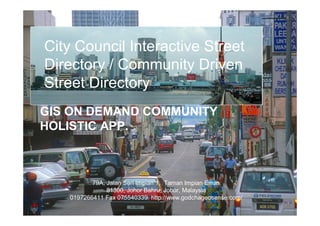
City Council Interactive Street
Directory / Community Driven
Street Directory
GIS ON DEMAND COMMUNITY
HOLISTIC APP.


          79A, Jalan Seri Impian 1, Taman Impian Emas
               81300, Johor Bahru, Johor, Malaysia
   0197266411 Fax 075540339 http://www.godchageosense.com/
Project Description
 The project is to develop a beta street directory platform that integrate existing City Council mapping
 data with highly visualize geo contents such as aerial images
 and a geo coded property facet view.                                             Interactive City Council
                                                                                  Street Directory
    Street Map            Property Map       Property/Business Data

                                                                                    Property Directory


                                                                                                         Property
                                                                                                           info

                                                                            Property photo
 The project involves                                                       link with map location
 • customizing existing mapping platform into city council
 interactive street directory,
                                                                                                         Business
 • design and integrate street view GPS log camera system                                                  Info
 for property image collection and geo coding.
 • Design and develop property listing and search engine


                                  Lat 1.48356°                                          Property &
                                  Long 103.758°                                        Service Rating


                                                                             High resolution aerial photo for
                                                                             better map visualization
Project Description (eco system)
                                                                                       Business owner
                                                                                       able to extend their
                         Interactive City Council                                      business reach via
                         Street Directory (high visualization)                         city council
                                                                                       interactive media

                         Property Directory


                                              Property
                                                data
                                                                 City Council
 Property Owner                                                  Property Database
 Access
 (ID / Password)
                                                                                        City Council able to
                                              Business                                  access up to date
                                                data                                    property, business
                                                                 City Council
                                                                                        and asset status
                                                                 Business Database
                                                                                        data.
 Open Public Search
 & View
 (Public able to view        Property &
 public rating, status      Service Rating
 events, reporting by
 geo tagging etc)
                                                         Property directory can be extended for other
                                                         city council assets and facility services such
                                                         as traffic reports, assets such as traffic light or
                                                         street light faulty, public transport, event
                                                         announcement etc.
                                                         Indexing City Status on An Interactive Platform
Value Proposition
      151 Local Councils in Malaysia, where reside                         City Council survives on
           80% of business residences
            80% of business residences                                     taxes.
           70% of total population
            70% of total population
           90% higher income group
            90% higher income group
           90% of happening events
            90% of happening events
                                                     >80%
                                                           ta is
                                                     Gov Da ically
                                                            ph
       Local Council needs to                        Geogra
             Better mange their territory             Based            Thus. City council
             Up to date asset status (respond time)
             Provide effective communication mediums
                                                                       needs location
             Provide environment for business to grow                  information platform
             Maintain & upgrade city life                              (GIS)
                                                 Unfortunately
                                                       >80% city council ran on deficit (poor)
                                                       <30% can effort to have proper GIS platform
                                                       99% of city council website are not
                                                       interactive and not participatory map based
               Proposal to provides free interactive street directory platform and
               partner with 151 city councils, charge minimum annual
               maintenance fees to Malaysia 500,000 business premises (owner).
               New income to city councils, new opportunity to existing
               businesses and providing public access to interactive city
               information. [With potential revenue for mobile access and
               premium data]
Content of The Project
High visualization with ease navigation                                  ü Property & Assets
for public and business to                                                    ü search
search, update property and city data within                                  ü rating
street mapping platform.                               Applications           ü Complains
                                                                         ü Status
The platform entice rich community contribution data                     ü Events
on top of existing geo contents


                   Concept – Utilizing images
                                                                                        Public/
                       for property profiling,                                          Property
                             public tagging &                                           owner
                              street directory           Facet premise                  update
                                                            Photo

                                                                                      Image
                                                                                      Updating
   City Wide                                               Aerial Image               services
   Collaboration platform


                                          Map Data

                                                                                     Geo Sense Sdn. Bhd.
                                                                                     www.geosense.com.my
Technology Platform /
                                         Architecture and Plan


            Utilizing Cloud Computing

                                           Future multiple access

Customizing eMap / GODCHA existing and
Proven interactive street directory
to cater for city council needs
Project Plan - Timeline / Milestone / Expenditure /
Deliverables                                               What
                                                           Industry
                                                           gets


                                                           New IP


                                                           Contents

                                                           System


     Funding Requirement (RM)   46,000   28,000   24,000
Street Image Capturing System
          Camera sys
          4 units
                                                      Location
          & 4 unit
                                                      Of the images
          CMOS video
          camera
                                      Lat 1.48356°
                                      Long 103.758°

                                GPS


              CPU

Mais conteúdo relacionado

Mais procurados

Urban Systems Collaborative Seminar | John Reinhardt, City Forward and other ...
Urban Systems Collaborative Seminar | John Reinhardt, City Forward and other ...Urban Systems Collaborative Seminar | John Reinhardt, City Forward and other ...
Urban Systems Collaborative Seminar | John Reinhardt, City Forward and other ...urbansystemssymposium
 
Memoria Smartcity 2011
Memoria Smartcity 2011Memoria Smartcity 2011
Memoria Smartcity 2011Luis Fernandez
 
GIS for National Mapping and Charting
GIS for National Mapping and ChartingGIS for National Mapping and Charting
GIS for National Mapping and ChartingEsri
 
An ANT exploration of mParticipation in the city of Cape Town
An ANT exploration of mParticipation in the city of Cape TownAn ANT exploration of mParticipation in the city of Cape Town
An ANT exploration of mParticipation in the city of Cape TownLaban Bagui
 
Information Society SA, Public Sector ICT CeBIT 2013 presentation
Information Society SA, Public Sector ICT CeBIT 2013 presentationInformation Society SA, Public Sector ICT CeBIT 2013 presentation
Information Society SA, Public Sector ICT CeBIT 2013 presentationInformation Society SA
 
Gis for Electric Distribution
Gis for Electric DistributionGis for Electric Distribution
Gis for Electric DistributionEsri
 
Esri GIS Trends for Transportation
Esri GIS Trends for TransportationEsri GIS Trends for Transportation
Esri GIS Trends for TransportationEsri
 
Club of Amsterdam - Future of services
Club of Amsterdam - Future of servicesClub of Amsterdam - Future of services
Club of Amsterdam - Future of servicesIskander Smit
 
A Quick Guide to Building a GIS for Your Public Safety Agency
A Quick Guide to Building a GIS for Your Public Safety AgencyA Quick Guide to Building a GIS for Your Public Safety Agency
A Quick Guide to Building a GIS for Your Public Safety AgencyEsri
 
MEAUC Nov 2011 Presentation
MEAUC Nov 2011 PresentationMEAUC Nov 2011 Presentation
MEAUC Nov 2011 PresentationNishant Arora
 
Benoit Felten - The Universal Connectivity Revolution
Benoit Felten - The Universal Connectivity RevolutionBenoit Felten - The Universal Connectivity Revolution
Benoit Felten - The Universal Connectivity Revolutionimec.archive
 
Trend One (Web Expansion) Grape Online Strategies 2009 by Nick Sohnemann
Trend One (Web Expansion) Grape Online Strategies 2009 by Nick SohnemannTrend One (Web Expansion) Grape Online Strategies 2009 by Nick Sohnemann
Trend One (Web Expansion) Grape Online Strategies 2009 by Nick SohnemannHUNGRY BOYS Creative agency
 

Mais procurados (20)

Urban Systems Collaborative Seminar | John Reinhardt, City Forward and other ...
Urban Systems Collaborative Seminar | John Reinhardt, City Forward and other ...Urban Systems Collaborative Seminar | John Reinhardt, City Forward and other ...
Urban Systems Collaborative Seminar | John Reinhardt, City Forward and other ...
 
Enterprise GIS Planning and Framework
Enterprise GIS Planning and FrameworkEnterprise GIS Planning and Framework
Enterprise GIS Planning and Framework
 
Memoria Smartcity 2011
Memoria Smartcity 2011Memoria Smartcity 2011
Memoria Smartcity 2011
 
GIS for National Mapping and Charting
GIS for National Mapping and ChartingGIS for National Mapping and Charting
GIS for National Mapping and Charting
 
An ANT exploration of mParticipation in the city of Cape Town
An ANT exploration of mParticipation in the city of Cape TownAn ANT exploration of mParticipation in the city of Cape Town
An ANT exploration of mParticipation in the city of Cape Town
 
Hawaii Pacific GIS Conference 2012: Esri ArcGIS 10.1 - What's Coming in ArcGI...
Hawaii Pacific GIS Conference 2012: Esri ArcGIS 10.1 - What's Coming in ArcGI...Hawaii Pacific GIS Conference 2012: Esri ArcGIS 10.1 - What's Coming in ArcGI...
Hawaii Pacific GIS Conference 2012: Esri ArcGIS 10.1 - What's Coming in ArcGI...
 
Information Society SA, Public Sector ICT CeBIT 2013 presentation
Information Society SA, Public Sector ICT CeBIT 2013 presentationInformation Society SA, Public Sector ICT CeBIT 2013 presentation
Information Society SA, Public Sector ICT CeBIT 2013 presentation
 
The Transit Hub
The Transit HubThe Transit Hub
The Transit Hub
 
Hans schaffers smartcities
Hans schaffers smartcitiesHans schaffers smartcities
Hans schaffers smartcities
 
Gis for Electric Distribution
Gis for Electric DistributionGis for Electric Distribution
Gis for Electric Distribution
 
Esri GIS Trends for Transportation
Esri GIS Trends for TransportationEsri GIS Trends for Transportation
Esri GIS Trends for Transportation
 
Club of Amsterdam - Future of services
Club of Amsterdam - Future of servicesClub of Amsterdam - Future of services
Club of Amsterdam - Future of services
 
A Quick Guide to Building a GIS for Your Public Safety Agency
A Quick Guide to Building a GIS for Your Public Safety AgencyA Quick Guide to Building a GIS for Your Public Safety Agency
A Quick Guide to Building a GIS for Your Public Safety Agency
 
MEAUC Nov 2011 Presentation
MEAUC Nov 2011 PresentationMEAUC Nov 2011 Presentation
MEAUC Nov 2011 Presentation
 
Governalia
GovernaliaGovernalia
Governalia
 
Benoit Felten - The Universal Connectivity Revolution
Benoit Felten - The Universal Connectivity RevolutionBenoit Felten - The Universal Connectivity Revolution
Benoit Felten - The Universal Connectivity Revolution
 
SIIA Previews: REonomy
SIIA Previews: REonomySIIA Previews: REonomy
SIIA Previews: REonomy
 
Gábor András: PERIPHÉRIA Project
Gábor András: PERIPHÉRIA ProjectGábor András: PERIPHÉRIA Project
Gábor András: PERIPHÉRIA Project
 
Trend One (Web Expansion) Grape Online Strategies 2009 by Nick Sohnemann
Trend One (Web Expansion) Grape Online Strategies 2009 by Nick SohnemannTrend One (Web Expansion) Grape Online Strategies 2009 by Nick Sohnemann
Trend One (Web Expansion) Grape Online Strategies 2009 by Nick Sohnemann
 
The Web Expansion
The Web ExpansionThe Web Expansion
The Web Expansion
 

Destaque

Blogging In The Math Classroom
Blogging In The Math ClassroomBlogging In The Math Classroom
Blogging In The Math Classroomtmeade
 
Cvitas Visual Essay Small
Cvitas Visual Essay SmallCvitas Visual Essay Small
Cvitas Visual Essay Smallguest4f68c1
 
AirSense - Neogeography
AirSense - NeogeographyAirSense - Neogeography
AirSense - NeogeographyIsmail Ibrahim
 
Blogging In The Math Classroom
Blogging In The Math ClassroomBlogging In The Math Classroom
Blogging In The Math Classroomtmeade
 

Destaque (8)

Blogging In The Math Classroom
Blogging In The Math ClassroomBlogging In The Math Classroom
Blogging In The Math Classroom
 
police
policepolice
police
 
Cvitas Visual Essay Small
Cvitas Visual Essay SmallCvitas Visual Essay Small
Cvitas Visual Essay Small
 
Reversing diabetes
Reversing diabetesReversing diabetes
Reversing diabetes
 
AirSense - Neogeography
AirSense - NeogeographyAirSense - Neogeography
AirSense - Neogeography
 
project
projectproject
project
 
Blogging In The Math Classroom
Blogging In The Math ClassroomBlogging In The Math Classroom
Blogging In The Math Classroom
 
Sederpalooza.2016
Sederpalooza.2016Sederpalooza.2016
Sederpalooza.2016
 

Semelhante a Godcha forward

Integrating GIS to financial data
Integrating GIS to financial dataIntegrating GIS to financial data
Integrating GIS to financial dataeventspat
 
nsgic 2012 - your plumbing is done!
nsgic 2012 - your plumbing is done!nsgic 2012 - your plumbing is done!
nsgic 2012 - your plumbing is done!Marten Hogeweg
 
Thames Tunnel: the Many Forms of Web GIS Reporting
Thames Tunnel: the Many Forms of Web GIS ReportingThames Tunnel: the Many Forms of Web GIS Reporting
Thames Tunnel: the Many Forms of Web GIS ReportingEsri
 
J.D. Stanley - PTA and Informed Mobility
J.D. Stanley - PTA and Informed MobilityJ.D. Stanley - PTA and Informed Mobility
J.D. Stanley - PTA and Informed MobilityShane Mitchell
 
On Future Research Areas for ICT-enabled Governance
On Future Research Areas for ICT-enabled GovernanceOn Future Research Areas for ICT-enabled Governance
On Future Research Areas for ICT-enabled GovernanceYannis Charalabidis
 
GIS Needs Assessment & Planning for Community & Human Services
GIS Needs Assessment & Planning for Community & Human ServicesGIS Needs Assessment & Planning for Community & Human Services
GIS Needs Assessment & Planning for Community & Human ServicesGreg Babinski
 
Connecting UP Australia 2011 - Unlocking the Front Counter
Connecting UP Australia 2011 - Unlocking the Front CounterConnecting UP Australia 2011 - Unlocking the Front Counter
Connecting UP Australia 2011 - Unlocking the Front CounterGary Maguire
 
Jong Guen Kim - Seoul u-Work Center
Jong Guen Kim - Seoul u-Work CenterJong Guen Kim - Seoul u-Work Center
Jong Guen Kim - Seoul u-Work CenterShane Mitchell
 
Smart City November 2003
Smart City November 2003Smart City November 2003
Smart City November 2003Nirvesh Sooful
 
OSi Local Gov User Group Presentation
OSi Local Gov User Group PresentationOSi Local Gov User Group Presentation
OSi Local Gov User Group PresentationIMGS
 
GIS enabled eGovernance
GIS enabled eGovernanceGIS enabled eGovernance
GIS enabled eGovernanceEsri India
 
Boi, Dell'Orto, Raffaldi & Trombetti - input2012
Boi, Dell'Orto, Raffaldi & Trombetti - input2012Boi, Dell'Orto, Raffaldi & Trombetti - input2012
Boi, Dell'Orto, Raffaldi & Trombetti - input2012INPUT 2012
 
Customer Experience Lifecycle
Customer Experience LifecycleCustomer Experience Lifecycle
Customer Experience LifecycleAmaury de Buchet
 
IMGS OSI Ministerial Briefing - World GIS Day
IMGS OSI Ministerial Briefing - World GIS DayIMGS OSI Ministerial Briefing - World GIS Day
IMGS OSI Ministerial Briefing - World GIS DayIMGS
 
Hadoop's Opportunity to Power Next-Generation Architectures
Hadoop's Opportunity to Power Next-Generation ArchitecturesHadoop's Opportunity to Power Next-Generation Architectures
Hadoop's Opportunity to Power Next-Generation ArchitecturesDataWorks Summit
 
Digital Inclusion Brazil - Africa - IdeaValley - Bilbao - Spain- by Sergio Ca...
Digital Inclusion Brazil - Africa - IdeaValley - Bilbao - Spain- by Sergio Ca...Digital Inclusion Brazil - Africa - IdeaValley - Bilbao - Spain- by Sergio Ca...
Digital Inclusion Brazil - Africa - IdeaValley - Bilbao - Spain- by Sergio Ca...IdeaValley Sergio Cabral Cavalcanti
 

Semelhante a Godcha forward (20)

Integrating GIS to financial data
Integrating GIS to financial dataIntegrating GIS to financial data
Integrating GIS to financial data
 
nsgic 2012 - your plumbing is done!
nsgic 2012 - your plumbing is done!nsgic 2012 - your plumbing is done!
nsgic 2012 - your plumbing is done!
 
Thames Tunnel: the Many Forms of Web GIS Reporting
Thames Tunnel: the Many Forms of Web GIS ReportingThames Tunnel: the Many Forms of Web GIS Reporting
Thames Tunnel: the Many Forms of Web GIS Reporting
 
J.D. Stanley - PTA and Informed Mobility
J.D. Stanley - PTA and Informed MobilityJ.D. Stanley - PTA and Informed Mobility
J.D. Stanley - PTA and Informed Mobility
 
On Future Research Areas for ICT-enabled Governance
On Future Research Areas for ICT-enabled GovernanceOn Future Research Areas for ICT-enabled Governance
On Future Research Areas for ICT-enabled Governance
 
2011-EuroGI
2011-EuroGI2011-EuroGI
2011-EuroGI
 
GIS Needs Assessment & Planning for Community & Human Services
GIS Needs Assessment & Planning for Community & Human ServicesGIS Needs Assessment & Planning for Community & Human Services
GIS Needs Assessment & Planning for Community & Human Services
 
Connecting UP Australia 2011 - Unlocking the Front Counter
Connecting UP Australia 2011 - Unlocking the Front CounterConnecting UP Australia 2011 - Unlocking the Front Counter
Connecting UP Australia 2011 - Unlocking the Front Counter
 
Jong Guen Kim - Seoul u-Work Center
Jong Guen Kim - Seoul u-Work CenterJong Guen Kim - Seoul u-Work Center
Jong Guen Kim - Seoul u-Work Center
 
Smart City November 2003
Smart City November 2003Smart City November 2003
Smart City November 2003
 
Ozri08 Key Note
Ozri08   Key NoteOzri08   Key Note
Ozri08 Key Note
 
OSi Local Gov User Group Presentation
OSi Local Gov User Group PresentationOSi Local Gov User Group Presentation
OSi Local Gov User Group Presentation
 
GIS enabled eGovernance
GIS enabled eGovernanceGIS enabled eGovernance
GIS enabled eGovernance
 
Boi, Dell'Orto, Raffaldi & Trombetti - input2012
Boi, Dell'Orto, Raffaldi & Trombetti - input2012Boi, Dell'Orto, Raffaldi & Trombetti - input2012
Boi, Dell'Orto, Raffaldi & Trombetti - input2012
 
Customer Experience Lifecycle
Customer Experience LifecycleCustomer Experience Lifecycle
Customer Experience Lifecycle
 
Igcon 2011
Igcon 2011Igcon 2011
Igcon 2011
 
IMGS OSI Ministerial Briefing - World GIS Day
IMGS OSI Ministerial Briefing - World GIS DayIMGS OSI Ministerial Briefing - World GIS Day
IMGS OSI Ministerial Briefing - World GIS Day
 
Hadoop's Opportunity to Power Next-Generation Architectures
Hadoop's Opportunity to Power Next-Generation ArchitecturesHadoop's Opportunity to Power Next-Generation Architectures
Hadoop's Opportunity to Power Next-Generation Architectures
 
Discovering Honolulu Data
Discovering Honolulu DataDiscovering Honolulu Data
Discovering Honolulu Data
 
Digital Inclusion Brazil - Africa - IdeaValley - Bilbao - Spain- by Sergio Ca...
Digital Inclusion Brazil - Africa - IdeaValley - Bilbao - Spain- by Sergio Ca...Digital Inclusion Brazil - Africa - IdeaValley - Bilbao - Spain- by Sergio Ca...
Digital Inclusion Brazil - Africa - IdeaValley - Bilbao - Spain- by Sergio Ca...
 

Mais de Ismail Ibrahim

Geo sense drone mapping solution
Geo sense drone mapping solutionGeo sense drone mapping solution
Geo sense drone mapping solutionIsmail Ibrahim
 
Swiftlet bird nest sg kapal proposal
Swiftlet bird nest sg kapal proposalSwiftlet bird nest sg kapal proposal
Swiftlet bird nest sg kapal proposalIsmail Ibrahim
 
Geo Sense Unmanned Aerial Mapping Services
Geo Sense Unmanned Aerial Mapping ServicesGeo Sense Unmanned Aerial Mapping Services
Geo Sense Unmanned Aerial Mapping ServicesIsmail Ibrahim
 
Geo Sense - UAV service, unmanned remote sensing
Geo Sense - UAV service, unmanned remote sensingGeo Sense - UAV service, unmanned remote sensing
Geo Sense - UAV service, unmanned remote sensingIsmail Ibrahim
 
Baby Car Rf Id Solution 2
Baby Car Rf Id Solution 2Baby Car Rf Id Solution 2
Baby Car Rf Id Solution 2Ismail Ibrahim
 
High Resolution Aerial Images Services
High Resolution Aerial Images ServicesHigh Resolution Aerial Images Services
High Resolution Aerial Images ServicesIsmail Ibrahim
 

Mais de Ismail Ibrahim (10)

Geo sense drone mapping solution
Geo sense drone mapping solutionGeo sense drone mapping solution
Geo sense drone mapping solution
 
Maskom v2
Maskom v2Maskom v2
Maskom v2
 
Swiftlet bird nest sg kapal proposal
Swiftlet bird nest sg kapal proposalSwiftlet bird nest sg kapal proposal
Swiftlet bird nest sg kapal proposal
 
Geo Sense Unmanned Aerial Mapping Services
Geo Sense Unmanned Aerial Mapping ServicesGeo Sense Unmanned Aerial Mapping Services
Geo Sense Unmanned Aerial Mapping Services
 
Geo Sense UAV service
Geo Sense UAV serviceGeo Sense UAV service
Geo Sense UAV service
 
Geo Sense - UAV service, unmanned remote sensing
Geo Sense - UAV service, unmanned remote sensingGeo Sense - UAV service, unmanned remote sensing
Geo Sense - UAV service, unmanned remote sensing
 
Baby Car Rf Id Solution 2
Baby Car Rf Id Solution 2Baby Car Rf Id Solution 2
Baby Car Rf Id Solution 2
 
High Resolution Aerial Images Services
High Resolution Aerial Images ServicesHigh Resolution Aerial Images Services
High Resolution Aerial Images Services
 
Geosense Uav
Geosense UavGeosense Uav
Geosense Uav
 
Geosense 12
Geosense 12Geosense 12
Geosense 12
 

Godcha forward

  • 1. City Council Interactive Street Directory / Community Driven Street Directory GIS ON DEMAND COMMUNITY HOLISTIC APP. 79A, Jalan Seri Impian 1, Taman Impian Emas 81300, Johor Bahru, Johor, Malaysia 0197266411 Fax 075540339 http://www.godchageosense.com/
  • 2. Project Description The project is to develop a beta street directory platform that integrate existing City Council mapping data with highly visualize geo contents such as aerial images and a geo coded property facet view. Interactive City Council Street Directory Street Map Property Map Property/Business Data Property Directory Property info Property photo The project involves link with map location • customizing existing mapping platform into city council interactive street directory, Business • design and integrate street view GPS log camera system Info for property image collection and geo coding. • Design and develop property listing and search engine Lat 1.48356° Property & Long 103.758° Service Rating High resolution aerial photo for better map visualization
  • 3. Project Description (eco system) Business owner able to extend their Interactive City Council business reach via Street Directory (high visualization) city council interactive media Property Directory Property data City Council Property Owner Property Database Access (ID / Password) City Council able to Business access up to date data property, business City Council and asset status Business Database data. Open Public Search & View (Public able to view Property & public rating, status Service Rating events, reporting by geo tagging etc) Property directory can be extended for other city council assets and facility services such as traffic reports, assets such as traffic light or street light faulty, public transport, event announcement etc. Indexing City Status on An Interactive Platform
  • 4. Value Proposition 151 Local Councils in Malaysia, where reside City Council survives on 80% of business residences 80% of business residences taxes. 70% of total population 70% of total population 90% higher income group 90% higher income group 90% of happening events 90% of happening events >80% ta is Gov Da ically ph Local Council needs to Geogra Better mange their territory Based Thus. City council Up to date asset status (respond time) Provide effective communication mediums needs location Provide environment for business to grow information platform Maintain & upgrade city life (GIS) Unfortunately >80% city council ran on deficit (poor) <30% can effort to have proper GIS platform 99% of city council website are not interactive and not participatory map based Proposal to provides free interactive street directory platform and partner with 151 city councils, charge minimum annual maintenance fees to Malaysia 500,000 business premises (owner). New income to city councils, new opportunity to existing businesses and providing public access to interactive city information. [With potential revenue for mobile access and premium data]
  • 5. Content of The Project High visualization with ease navigation ü Property & Assets for public and business to ü search search, update property and city data within ü rating street mapping platform. Applications ü Complains ü Status The platform entice rich community contribution data ü Events on top of existing geo contents Concept – Utilizing images Public/ for property profiling, Property public tagging & owner street directory Facet premise update Photo Image Updating City Wide Aerial Image services Collaboration platform Map Data Geo Sense Sdn. Bhd. www.geosense.com.my
  • 6. Technology Platform / Architecture and Plan Utilizing Cloud Computing Future multiple access Customizing eMap / GODCHA existing and Proven interactive street directory to cater for city council needs
  • 7. Project Plan - Timeline / Milestone / Expenditure / Deliverables What Industry gets New IP Contents System Funding Requirement (RM) 46,000 28,000 24,000
  • 8. Street Image Capturing System Camera sys 4 units Location & 4 unit Of the images CMOS video camera Lat 1.48356° Long 103.758° GPS CPU