1. Urban Design for Students without a Design Background
RECOGNISING URBAN FABRICS
GETTING STARTED IN DESIGNING PARTS OF CITIES
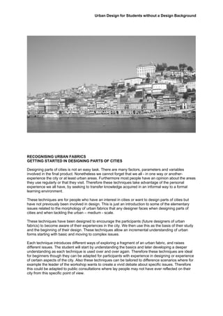
Designing parts of cities is not an easy task. There are many factors, parameters and variables
involved in the final product. Nonetheless we cannot forget that we all - in one way or another-
experience the city or at least urban areas. Furthermore most people have an opinion about the areas
they use regularly or that they visit. Therefore these techniques take advantage of the personal
experience we all have, by seeking to transfer knowledge acquired in an informal way to a formal
learning environment.
These techniques are for people who have an interest in cities or want to design parts of cities but
have not previously been involved in design. This is just an introduction to some of the elementary
issues related to the morphology of urban fabrics that any designer faces when designing parts of
cities and when tackling the urban – medium - scale.
These techniques have been designed to encourage the participants (future designers of urban
fabrics) to become aware of their experiences in the city. We then use this as the basis of their study
and the beginning of their design. These techniques allow an incremental understanding of urban
forms starting with basic and moving to complex issues.
Each technique introduces different ways of exploring a fragment of an urban fabric, and raises
different issues. The student will start by understanding the basics and later developing a deeper
understanding as each technique is used over and over again. Therefore these techniques are ideal
for beginners though they can be adapted for participants with experience in designing or experience
of certain aspects of the city. Also these techniques can be tailored to difference scenarios where for
example the leader of the workshop wants to create a vivid debate about specific issues. Therefore
this could be adapted to public consultations where lay people may not have ever reflected on their
city from this specific point of view.
2. Urban Design for Students without a Design Background
Workshop 1
Experiencing and learning from the urban environment
MENTAL MAP
TASK
You are going to draw two maps to tell a friend how to go from one place to another. Therefore the
maps need to be informative but they do not need to be pretty or a piece of art. Use symbols and key
words when appropriate.
Map 1: You are asked to draw a map of Sheffield showing the train station, the venue for this event
and the main High Street and the restaurant where you went out for supper yesterday evening.
Map 2: Your route from home to work if you walk or cycle. If you use a different transport mode to go
to work you will draw a map from your house to the local High Street.
Participants will have 15 minutes to draw the maps.
After everybody has finalised the maps these will be laid out on the floor for comparison and a debate
between participants will be guided by the leader. The role of the leader at this point is very important
making sure that the relevant topics are discussed and the leader will introduce new terms like mental
map, legibility, parts and the whole of a city, elements forming the urban fabric, experiencing the city
moving through versus reading a map, the memory of a place… The discussion will start by
comparing how different people may have represented similar elements or how some elements are
repeated in all the maps.
AIMS
• Identify the specifics within an urban fabric based on a personal experience;
• Illustrate a part of a city with a degree of abstraction helpful to understand the role of diagrams;
• Reflect on and evaluate how the context of the city influences the experience of the city.
OUTCOMES
• The ability to grasp the concept of legibility and imageability;
• The ability to identify basic urban elements;
• Awareness that the city is experienced by moving through it.
MATERIAL PROVIDED
• A4 and A3 paper
• Pens and pencils
TRANSFERABILITY
1. This task can be introduced in a site visit or field trip. Once the group has been walking from one
destination point to another the leader would ask the students to draw the route. After the maps
are finalised the students will leave their sketch book on the floor and a constructive debate will
take place. The students may have read already the book by Kevin Lynch and Gordon Cullen or
they will be referred to at this point, encouraging participants to read them.
Throughout a course about Urban Design you can repeat this exercise at different points
changing the aims in relation to the students’ understanding of urban forms and its relation with its
inhabitation.
2. This technique can be used as an ice-breaker when doing consultation with lay people who work
or live in the same area. This time, the participants will be asked to draw a map showing the
characteristic elements of their neighbourhood. This will encourage people to talk about their
choices and be intrigued with other’s maps and choices, thereby enabling a conversation and
interaction.
3. Urban Design for Students without a Design Background
Workshop 2
Learning by comparing existing urban fabrics
OVERLAPPING OS-MAPS on GOOGLE EARTH and viceversa
TASK
This task will or can be done at the very beginning of any project - even before the site visit. As part of
this exercise, you have been introduced to a new project and given a copy of the site plan and a few
pictures.
You are going to take the OS map of the site given to you at scale and you are going to find
precedents to conduct a first and quick assessment of the site. Specifically you will be asked to find
precedents under two categories: A part of a city that you are familiar with and other precedents that
you consider suitable for the site because of the size of the site, good practice or a common feature.
Once you decided which precedents to use you will find Google-Earth images at scale of the chosen
precedents. The precedents and the OS site map should be at the same scale. You will print out the
OS site map on paper and the precedents on tracing paper and overlay them one by one.
You first will overlay the familiar place on the site. The aim of overlaying an area that you know on the
site is quickly get a sense of scale. You always can relate to the time it takes you to move from A to B
and how many “things” happen along that journey. This will be a good reference for you when
designing, making sure that your proposed layout is neither too intense nor too boring either.
You will do the same with the other precedents which prompts questions: What is the capacity of this
site? Is there a minimum, optimum or maximum density? How many accesses does the site need?
How many open spaces does the site needs? How big a block structure can be related to the
surrounding area?...
For the purpose of this exercise we will give you the OS map and Google-Eath precedents printed out
at the right scale and type of paper. This exercise could be done all on the computer and this is the
way most students prefer.
4. Urban Design for Students without a Design Background
AIMS
• Develop a basis knowledge of urban form;
• Become familiar with a selection of attributes/aspects/elements relevant to tissue analysis;
• Develop skills in working in multidisciplinary teams;
• Apply critical thinking.
OUTCOMES
• Produce and use mapping, diagramming and sketching to get to know a site and present data of
a precedents;
• Evaluate the capacity of a site;
• Grasp some the basic terminology related to tissue analysis.
MATERIAL PROVIDED
• Os map of a site on tracing paper and at scale
• Google Earth images of precedents on paper and at scale
• Key images explaining the nature of the precedents
• Table of densities
TRANSFERABILITY
This exercise can be used to assess an initial site as presented here and furthermore it can help to
develop a feasibility study.
1. It can be used at different stages of the design process.
a. It is used to decide and assess how big an open space should be. In this case the
technique is used in a very similar way though it applies to a different scale.
b. It also can be used to avoid the panic that many students feel when facing the blank
sheet of empty white paper. When designing at the neighbourhood scale, students are
asked to copy and paste onto their site a block that they think is appropriate. The second
stage is to adapt the precedent to fit the physical and the cultural conditions of the study
area considering also social and political, economic aspects. Therefore the precedent
goes through a series of mutations from beginning to completion of the design affected by
contextual factors.
c. Students can overlay any precedent that helps them with their design. This way the
student is forced to be specific about what is important about the chosen precedent for
their design and to find a way how to use it.
2. This technique can be part of a much larger exercise where students are asked to assess the
precedent by producing qualitative and quantitative data. This becomes a tissues analysis
exercise and the student deepens his/her understanding of the morphologies of places.
3. The fact of using different precedents allows for a comparative study and in a natural way
students need to become selective - identifying criteria in relation to their knowledge against
urban fabrics. This helps students become critical thinkers.
4. When the overlay of places is used in a simple way, using very well known parts of cities, it can
help lay people easily understand the size; “bigness” or “smallness” of a site.
5. Urban Design for Students without a Design Background
Workshop3
Creating the environment
CASUAL THREE DIMENSIONAL MODEL
TASK
The students will be asked to work in groups of 3 to 5 members. Each group is going to be given an
OS map of an existing street at 1/200 and blocks representing building types at 1/200. This task has
two parts:
Firstly, all of the students will build a model of the street using the OS map as a base and the blocks
provided. The leader will help the students to identify the different blocks and will introduce the basic
differences between building types.
Secondly, once stage one is finalised, the leader is going to modify the model by changing the use of
a building and therefore its size. The students will need to modify the street however they think is
appropriate, whilst acknowledging the changes made.
6. Urban Design for Students without a Design Background
The idea is that the building heights can change in relation to the existing plan, thereby changing the
section of the street. This will help students realise that the design cannot be developed just in plan
that the section is very important (the relationship between width and height). Students will also start
to know the dimensions of building and how relevant it is to learn about building types. Introducing a
new use in the street will compel students to think about the influences of land uses besides the
immediate surrounding, as well as the needs for the building and the activities that it creates.
A further step will be to draw a sketch of the plan and a typical section of the new street. Students will
need to get a good understanding of the measurements of buildings, car lanes, car parking bays and
so on. This will help accurately test the proposal for the street, leading students to make new
iterations of the initial proposals.
Students will be encouraged to take pictures of the different possible options as a way of recording
the process and this will also allow them to assess the different options later on.
AIMS
• To introduce the concept of urban form related to density;
• To introduce basic measurements of the urban form and elements in it: From buildings to street,
open spaces, trees, a person, cars… ;
• To introduce the relevance of scales, size and the capacity of a site.
OUTCOMES
• To grasp some of the basic terminology related to tissue analysis;
• To understand and be able to differentiate between urban forms;
• Ability to identify building types.
MATERIAL PROVIDED
OS map of a street at 1/200
Blocks of different sizes at 1/200
TRANSFERABILITY
This is a first contact with a three dimensional tool and it is very rudimentary. Nevertheless, students
very soon move on to do the same exercise using Sketch Up. When presented as part of a student
project, this exercise often forms part of the previous exercise “Learning by Comparing”. Students will
take a precedent and model it in Sketch Up, and will then paste it in a location on the site. The uses,
heights, housing types, overall size of the block or so on have to be modified mutating the initial
precedents and forcing the student to consider a series of issues gradually.
This can be used as an interactive tool used by lay people as part of workshops in consultations.
Measurements are implicit and they do not become an issue.
Games can be designed to explore basic urban form as well as the relationship between mass-void
and densities. The most common and straightforward urban forms to explore will be perimeter blocks,
lineal blocks, tower blocks and an urban form created with a combination of these building types.