Colin broderick my_experience_with_open_data (1)
•Transferir como PPT, PDF•
0 gostou•483 visualizações


Recomendados
Recomendados
Mais conteúdo relacionado
Semelhante a Colin broderick my_experience_with_open_data (1)
Semelhante a Colin broderick my_experience_with_open_data (1) (20)
Mais de Dublinked .
Mais de Dublinked . (20)
Último
Último (20)
Colin broderick my_experience_with_open_data (1)
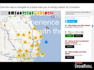
- 1. UrbanRural My Experience of working with the Data Colin Broderick
- 2. Introduction Who am I? UrbanRural? Consuming the NaPTAN Export (challenging!). The Challenges and Joys of working with Open DATA
- 3. Who am I? Spatial Planner, Map Nerd and Open DATA dabbler
- 4. UrbanRural - what is it? An app to help you find your local heritage.
- 5. UrbanRural - what’s the problem? Who here has ever had to look through a development plan? Protected Structures and Built Heritage are buried in the maps and in a table in the appendix
- 6. UrbanRural - what’s the problem? RPS, Dublin City Development Plan 2011 - 2017
- 7. UrbanRural - what’s the problem? Swords Map, Fingal County Development Plan 2011 - 2017
- 8. UrbanRural - what’s the problem? Interactive Mapping - South Dublin County Development Plan 2011 - 2017
- 9. So you find the building - what next? The End
- 10. UrbanRural - let’s solve this! Educate people about their local built heritage. Help promote the built heritage of Ireland (Fingal). Help improve peoples understanding of protected structures.
- 11. UrbanRural - The DATA Fingal Protected structure list (csv) Fingal NIAH Survey Google Maps (api) Google Places (api)
- 12. UrbanRural - What’s it look like?
- 13. UrbanRural - What’s it look like?
- 14. Map & Searc h
- 15. RPS Detail s
- 16. NIAH Detail s
- 17. And it works on your phone
- 18. RPS DATA - The Problems Even within DubLinked no one is releasing the same data. Formats are Different - Fingal does csv’s with extra information. The rest of the counties are shapefiles with no extra data appended
- 19. NaPTAN What is NaPTAN I hear you say? It’s “a database system for uniquely identifying all the points of access to public transport in the UK” (DTF, UK) It stands for the National Public Transport Access Nodes It sets the standards of how the information should be exchanged (xml & csv) Its main use is in making Journey Planners
- 20. Why was I interested in this?
- 21. What does it look like?
- 22. Mean a whole lot to you? So what’s the best thing to do? Map it!
- 23. Final Product
- 24. Not all plain sailing Not all of co-ordinates are using the same projection so its looks a bit like this. I don’t have access to MS Access or ArcGIS QGIS to the rescue on my dads laptop, able to extract the data in the proper format and made a bunch of csv files.
- 25. The world covered in measles
- 26. Suggestions That the NTA release this data in the other release format of a suite of csv files. Maybe DubLinked could take the lead in defining the standards for data sharing in terms of file formats information
- 27. Hope this was interesting for you! Thank you! Thank you! Thank you! @rusty1052