In mountain bike sull'altopiano
•
0 gefällt mir•637 views

In mountain bike sull'altopiano: tutti i percorsi da fare in bicicletta / mountain bike sull'Altopiano Dolomiti Paganella in Trentino

Empfohlen
Empfohlen
Weitere ähnliche Inhalte
Mehr von ApT Dolomiti Paganella
Mehr von ApT Dolomiti Paganella (20)
In mountain bike sull'altopiano
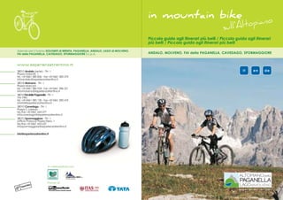
- 1. in mountain bike no pia sull’Alto Piccola guida agli itinerari più belli / Piccola guida agli itinerari più belli / Piccola guida agli itinerari più belli Azienda per il Turismo DOLOMITI di BRENTA, PAGANELLA, ANDALO, LAGO di MOLVENO, FAI della PAGANELLA, CAVEDAGO, SPORMAGGIORE S.c.p.A. ANDALO, MOLVENO, FAI della PAGANELLA, CAVEDAGO, SPORMAGGIORE www.esperienzatrentino.it 38010 Andalo (sede) - TN - I it en de Piazza Dolomiti, 1 tel. +39 0461 585 836 - fax +39 0461 585 570 infoandalo@esperienzatrentino.it 38018 Molveno - TN - I Piazza Marconi tel. +39 0461 586 924 - fax +39 0461 586 221 infomolveno@esperienzatrentino.it 38010 Fai della Paganella - TN - I Via Villa tel. +39 0461 583 130 - fax +39 0461 583 410 infofai@esperienzatrentino.it 38010 Cavedago - TN - I Piazza S. Lorenzo tel./fax +39 0461 654 277 infocavedago@esperienzatrentino.it 38010 Spormaggiore - TN - I (Ufficio Proloco) Piazza Fiera, 1 tel./fax +39 0461 653 637 infospormaggiore@esperienzatrentino.it info@esperienzatrentino.it In collaborazione con:
- 2. » In mountain bike sull’Altopiano della Paganella L’Altopiano della Paganella, con la sua natura dell’Altopiano, i cui abitanti nei vari centri protetta nel Parco Naturale Adamello Brenta accolgono l’ospite con piacere e cordialità, e con la maestosa bellezza dei paesaggi, con chiedendogli in cambio il pieno rispetto di gli intrecci di sentieri e mulattiere, è il luogo questi luoghi, dei prati, dei boschi, della ideale per la pratica del mountain bike. In splendida natura. Scoprite questo territorio questa guida vengono indicati alcuni tra gli rispettando la flora e la fauna, in serena itinerari più belli che è possibile percorrere convivenza con gli escursionisti. Sui sentieri sull’Altopiano, ma la fitta rete di sentieri e alpini, quelli stretti e ripidi realizzati a passo carrarecce che lo caratterizzano consente d’uomo, è bene andare a piedi o percorrerli infinite varianti e possibilità di ammirare in bike solo se è presente l’apposito segnale incantevoli panorami delle Dolomiti di Brenta. che ne indica il permesso. Nelle vostre escursioni fermatevi ogni tanto ad Pedalare in mountain bike sull’Altopiano della osservare gli scorci suggestivi, ad ascoltare i Paganella è uno dei modi migliori per vivere lo rumori del bosco... questo è puro benessere! sport, fondendo armoniosamente movimento L’orgoglio per la propria terra e per le proprie e natura in una sensazione unica. montagne anima la calda ospitalità » By mountain bike on the Altopiano della Paganella » NORMATIVA MOUNTAINBIKE IN TRENTINO The Altopiano della Paganella, with its protected the warm hospitality of the people of the Il Trentino ha regolato con la L.P. 8/1993 e necessitano di una notevole manutenzione. Natural environment in the Parco Naturale Plateau, where the inhabitants of all the towns successiva deliberazione G.P. n°2083 del 30 Scopri la montagna rispettando flora e fauna, Adamello Brenta and the majestic beauty of welcome guests with pleasure and cordiality, settembre 2005 l’accesso delle mountain bike in serena convivenza con gli escursionisti. Sui its scenery, and with its many paths and mule expecting in exchange an attitude of respect ai sentieri. sentieri alpini, quelli stretti e ripidi realizzati a tracks, is the ideal place for mountain biking. for these places, the meadows, the woods, L’obiettivo principale è quello di favorire una passo d’uomo, è bene andare a piedi o This guide describes some of the most attractive and their splendid natural features. corretta fruizione della montagna e di percorrerli in bike solo se è presente l’apposito itineraries on the Altopiano, but the network of Explore the territory and observe the flora and confermare i principi e i valori ben noti da segnale. paths and dirt tracks it features offers great fauna respectfully, sharing happily with hikers sempre a chi la frequenta con passione, in Una scelta di tranquillità e di qualità che ti variety and many opportunities to admire the and bikers. If you want to use the narrow steep modo da tutelare gli escursionisti, gli stessi bikers preghiamo di rispettare. enchanting panoramas of the Dolomiti di alpine trails, remember to walk or bike only e i sentieri, che soprattutto in alta quota Brenta. if you can see a sign allowing access. Remember to stop every now and then during Pedalling your mountain bike on the Altopiano » MOUNTAINBIKING RULES IN TRENTINO your excursions to observe the evocative views, della Paganella is one of the best ways to listen to the sounds of silence in the woods... experience sport in a harmonious combination Trentino has regulated access to mountain bike trails. Adopt a respectful attitude when you this is pure wellbeing! of movement and nature; a unique sensation. trails with Legislative Provision No. 8/1993 and explore the mountains and their flora and Pride for their land and mountains animates later Provincial Government resolution No. 2083 fauna, sharing them happily with hikers. of 30 September 2005. If you want to use the narrow steep alpine The main objective is to ensure proper use of trails, proceed at snail’s pace and walk or the mountains and confirm the principles and bike only where you can see a sign allowing » Mit dem Mountainbike auf dem Hochplateau der Paganella values well-known to those who frequent them access. Das Hochplateau der Paganella ist ein ideales Aus der liebenswürdigen Gastlichkeit des regularly, so that hikers, bikers and the trails It makes sense to observe a choice of Gelände für Mountainbike Touren – ein Geflecht Hochplateaus spricht der Stolz der Bewohner they use are protected and maintenance work serenity and quality. von Wegen und Saumpfaden zieht sich durch auf ihre Berge und auf die wunderbare is carried out, especially on the high altitude den Naturpark Adamello Brenta und durch die Landschaft. Sie empfangen die Gäste mit eindrucksvolle Landschaft, die von den majestätischen Gipfeln der Brenta Gruppe Freude und Herzlichkeit; von den Besuchern erwarten sie sich dafür Achtung gegenüber der » MOUNTAINBIKE IM TRENTINO - Landesgesetz geprägt ist. Dieser Führer stellt einige der Umwelt. Entdecken Sie dieses Gebiet mit Mit Landesgesetz 8/1993 und Beschluss G.P. vor allem in großer Höhe einer intensiven schönsten Routen der Hochebene vor, doch respektvollem Verhalten gegenüber Flora und n°2083 vom 30/09/2005 regelt die Provinz Trient Wartung bedürfen. bietet das dichte Netz von Pfaden und Fauna. Auf den schmalen und steilen das Benutzen der Pfade und Wege auf den Entdecken Sie dieses Gebiet mit respektvollem Forstwegen unzählige Varianten, um die Bergpfaden gehen Sie besser zu Fuß und bleiben Mountainbikes. Verhalten gegenüßber Flora und Fauna. Auf Landschaft der Brenta Dolomiten zu genießen. nur dort im Sattel, wo es ausdrücklich erlaubt Mittels dieser Bestimmungen wird ein korrektes den schmalen und steilen Bergpfaden gehen Steigen Sie zwischendurch einen Augenblick ist. Verhalten der Besucher gegenüber der Sie besser zu Fuß und bleiben nur dort im Sattel, vom Rad und lassen Sie sich bezaubern von Im Mountainbike auf dem Hochplateau der Berglandschaft angestrebt und Grundsätze wo es ausdrüßcklich erlaubt ist. Wir haben den herrlichen Panoramen und lauschen Sie Paganella – die beste Art, diesen Sport zu leben; und Werte vermittelt, die für den Liebhaber der Lebensqualitäßt vorangesetzt – wir bitten Sie, den Geräuschen des Waldes - es ist das reinste Bewegung im Einklang mit der Natur– eine Berge selbstverständlich sind – zum Schutz der dies zu respektieren. Wohlbefinden! einmalige Erfahrung. Wanderer, der Biker selbst und der Pfade, die
- 3. Geeignete Ausrüstung mitnehmen. Für den Ausflug geeignete Kleidung tragen und gegebenenfalls ausreichend Nahrungsmittel und Getränke mitführen. 06 Usare sempre il casco. Indossate il casco allacciandolo bene: può salvarvi la vita. Always wear a helmet. Keep your helmet on and properly fastened at all times: it could save your life. Immer einen Helm benutzen. Einen Helm benutzen und gut festmachen: der Helm kann Ihnen das Leben retten. 07 Utilizzare solo biciclette in perfette condizioni di funzionamento. Eseguite regolarmente » MOUNTAIN BIKE controlli e manutenzione del mezzo. Portate con voi un kit di riparazione per la vostra MTB. Only use bikes in perfect working condition. Perform checks and maintenance on your bike regularly. Carry a repair kit for your MTB. Nur perfekt funktionstüchtige Fahrräder benutzen. Das Fahrrad regelmäßig kontrollieren und warten. Einen Reparatursatz für Ihr MTB mitführen. 08 Non sopravvalutare le proprie capacità. Valutate l’itinerario a seconda dei vostri limiti: Decalogo per un uso corretto e rispettoso della mountain bike evitate itinerari superiori alle vostre capacità. Prestate la massima attenzione alle condizioni Ten simple rules for using your mountain bike considerately and conscientiously meteorologiche che in montagna possono variare con estrema rapidità. Do not overestimate your abilities. Choose an itinerary according to your limitations: avoid Zehn Faustregeln für korrektes und rücksichtsvolles Fahren mit dem Mountainbike itineraries above your experience level. Always watch what weather is doing, as it can change very quickly in the mountains. Die eigenen Fähigkeiten niemals üfberschätzen. Die Strecke nach Ihren eigenen Fähigkeiten 01 Dare la precedenza ai pedoni. Evitare percorsi molto frequentati da escursionisti o pedoni. und Möglichkeiten beurteilen: Strecken, die Ihr Können übersteigen, sind zu vermeiden. Die Rallentare e passate con cautela quanti possono venire a trovarsi sul vostro percorso. Wetterlage genau beobachten: Im Gebirge kann das Wetter nämlich sehr schnell umschlagen. Give way to pedestrians. Avoid paths frequented by large number of hikers and pedestrians. 09 Slow down and ride with caution whenever you encounter a pedestrian. Comunicare la destinazione e il programma di viaggio. Non viaggiate da soli in zone isolate e se avete in mente di coprire lunghe distanze. Fußgänger haben Vorrang. Von Wanderern oder Fußgängern stark besuchte Strecken sind zu vermeiden. Abbremsen und eventuelle Fußgänger auf der Strecke vorsichtig überholen. Inform someone of your destination and itinerary before setting off. Never travel alone in isolated areas or if you intend to cover long distances. 02 Usare sempre la massima prudenza. Moderate la velocità, commisurandola al tipo di terreno, Ziel und Reiseplan bekannt geben. In abgelegenen Gebiet und auf langen Strecken niemals alla vostra esperienza di guida e allo stato del mezzo. Ricordatevi che la vostra sicurezza alleine reisen. dipende solo da voi, dalla scelta del tracciato e dalla prudenza adottata. 10 Rispettate la filosofia del cicloescursionismo. Lasciate le minori tracce possibili del vostro Always ride with the utmost caution. Moderate your speed in accordance to the terrain, your experience and the state of your bike. Remember you are responsible for your own passaggio. Limitatevi a scattare fotografie, portando con voi solamente bei ricordi. safety. Be careful and do not overestimate yourself. Respect the credo of the cyclist-excursionist. Leave as little evidence as possible of your Stets maximale Vorsicht walten lassen. Die Geschwindigkeit drosseln und dem Gelände, der passage. Take only photos and good memories away with you. Fahrerfahrung und dem Zustand des Fahrrads anpassen. Denken Sie daran, dass Ihre Die Philosophie für MTB-Trekking beachten. So wenig Spuren wie möglich hinterlassen. Sicherheit ganz allein von Ihnen abhängt, von der Auswahl der Strecke und von Ihrer Vorsicht. Beschränken Sie sich auf Fotografien und nehmen Sie nur schöne Erinnerungen mit. 03 Rispettare la natura. In presenza di animali al pascolo, rallentate la velocità ed evitate di spaventare il bestiame. Rimanete sui percorsi già tracciati per non recare danni alla vegetazione e al terreno. Evitate inutili frenate o derapate che sono causa di erosione e aumentano i rischi. Respect nature. Slow down near grazing animals and take care not to frighten them. Stay on marked paths to prevent causing damage to the plants and soil. Do not skid or slide deliberately, as this may be dangerous to yourself and to others. Die Natur schützen. Bei frei weidendem Vieh abbremsen und die Tiere nicht erschrecken. Immer auf den ausgeschilderten Wegen bleiben, um der Vegetation und dem Boden keine Schäden zuzufügen. Unnötiges und ruckartiges Bremsen vermeiden: diese Manöver sind Ursache für Erosionen und erhöhen die Unfallgefahr. 04 Rispettare le regole stradali e i divieti. Rispettate il codice stradale anche sulle strade forestali, osservando le indicazioni e i divieti della segnaletica. Evitare di percorrere itinerari nonsegnalati o non consentiti alle MTB. Respect the highway code and obey restrictions. Respect the highway code, even on the forest roads, and obey the indications and restrictions given by road signs. Keep off unmarked paths and paths where MTBs are not permitted. Die Straßenverkehrsregeln und Verbote beachten. Die Straßenverkehrsordnung auch auf Forststraßen beachten und die Hinweis-und Verbotsschielder befolgen. Nicht ausgeschilderte und nicht für MTB zugelassen Wege sind zu vermeiden. 05 Dotarsi di un adeguato equipaggiamento. Indossate abbigliamento adeguato all’escursione e valutate la necessità di alimenti e bevande. Equip yourself with suitable gear. Wear clothing suitable for your excursion. Always take something to drink and, if necessary, food.
- 4. » Legenda / Legend / Zeichenerklärung » Percorsi / Trails / Routen Partenza / Departure / Abfahrt / quota s.l.m. / m a.s.l. / Meereshöhe » ANDALO 14 CAVEDAGO - MASO TOMAS - BIVIO MASO TOSCANA - LAVEZOL - PRIORI- -S. 01 GIRO DEI MASI E LAGO DI ANDALO TOMMASO Difficoltà / Difficulty / Schwierigkeitsgrad ANDALO - MASO TOSCANA - LAVEZOL - 02 PRIORI - CENTRO » SPORMAGGIORE facile / easy / einfach media / medium / mittel 15 SPORMAGGIORE - PONT - PIAN DEL BENON 03 ANDALO - PRIORI - MALGA DAGNOLA - - SPORMAGGIORE difficile / difficult / schwierig ANDALO 16 SPORMAGGIORE - MAURINA - MEANO - Lunghezza / Length / Länge 04 ANDALO - VALBIOLE - MOLVENO - ANDALO SPORMAGGIORE 17 SPORMAGGIORE - PONT - SELVAPIANA - Dislivello / Gradient / Höhenunterschied » MOLVENO SPORMAGGIORE 05 GIRO DEI LAGHI DI MOLVENO E NEMBIA 18 BELFORT - SANTEL - MONTE FAUSIOR - Quota massima / Maximum height / Maximale Höhe MALGA VAL DEI BRENZI - BELFORT 06 MOLVENO - NEMBIA - DEGGIA MOLINE - SAN LORENZO IN BANALE - MOLVENO Tempo di percorrenza / Time / Dauer » IMPIANTI di RISALITA 07 MOLVENO - NEMBIA - RANZO - MOLVENO CABLE CAR Tipologia fondo tracciato / Type of trail / Streckentyp SEILBAHN 08 MOLVENO - CICLAMINO - PONTE ROMANO - LIDO DI MOLVENO - SENTIERO RE DEI BELGI 19 DOSS PELÀ - PIAN DEL DOSSON - ANDALO asfalto / tarmac / asphaltiert » FAI della PAGANELLA 20 DOSS PELÀ - MALGA COVELO - PASSO S.GIOVANNI - MALGA CIAGO - GAGGIA - sterrato / dirt / nicht asphaltiert ANDALO 09 FAI - SCAVI ARCHEOLOGICI - SERAIA- FAI sentiero / path / Pfad 21 DOSS PELÀ - MALGA COVELO - BOCCA S. 10 GIRO DEL MONTE FAUSIOR GIOVANNI - PASSO S. GIOVANNI - MALGA GAZZA - MARGONE - RANZO - BAEL - Punti di appoggio / Refreshments / Raststationen NEMBIA - MOLVENO - ANDALO 11 FAI - DOSSON - LA ROCCA - FAI 12 CIAMINADA DI FAI 22 DOSS PELÀ - MALGA TERLAGO - CIMA PAGANELLA - DOSSO LARICI - MALGA » Altimetrie del percorso / altimetry / Höhenprofil ZAMBANA - DOSS PELÀ - PIAN DEL DOSSON - ANDALO asfalto sentiero sterrato » CAVEDAGO tarmac path dirt asphaltiert Pfad nicht asphaltiert 13 CAVEDAGO - MASO SASS - CROCIFISSO - SPORMAGGIORE - CAVEDAGO
- 5. km 6,2 m 196 m 1098 01 » Giro dei masi - Lago di Andalo 1h + Andalo » m 1.040 diversi bar e ristoranti nell’abitato di Andalo. bars and restaurants at Andalo. Bars und Restaurants in der Ortschaft Andalo. Il paese di Andalo si è sviluppato nel corso dei discesa incrociamo la strada provinciale e RUNDE HÖFE UND ANDALO SEE kreuzen wir die Landstraße und weiter abwärts secoli attorno a 14 masi. Sono gruppi di case scendendo verso Andalo, al primo incrocio Das Dorf Andalo hat sich im Laufe der immer in Richtung Andalo biegen wir an der cresciuti in corrispondenza dei vari appezzamenti giriamo a destra lungo Via San Rocco. Giunti Jahrhunderte um 14 Bauernhöfe herum ersten Kreuzung rechts in die Via San Rocco ein. di terreno. Ancora oggi è possibile ammirare all’altezza dell’edificio scolastico svoltiamo a entwickelt und den Grundstücken entsprechend Beim Schulgebäude wenden wir uns wieder alcune delle costruzioni originarie seguendo il destra seguendo Via Fovo (Maso) per innestaci bildeten sich die Häusergruppen. Heute noch rechts und folgen der Via Fovo (Hof), fahren tracciato che di seguito illustriamo che conduce poi su Via Tenaglia e scendere fino ad incrociare sind entlang der Strecke, auf der wir Sie durch entlang der Via Tenaglia hinab bis zur neuen a fare il giro di tutto il paese. All’uscita di Piazza la nuova caserma dei Carabinieri, dove das Dorf führen, einige der ursprünglichen Carabinierikaserne, wo wir rechts einbiegen. Dolomiti giriamo a sinistra e saliamo per Via Perli gireremo a destra. Con prudenza affrontiamo Gebäude zu sehen. Etwas Vorsicht auf der abfallenden Strecke, (Maso), fino alla cima del colle. Scolliniamo e il tratto in discesa per poi risalire verso il Maso Am Ausgang von Piazza Dolomiti biegen wir links dann geht es wieder aufwärts Richtung Maso giriamo a sinistra fino alla strada provinciale. Ghezzi. Giunti all’incrocio giriamo a sinistra per ein und folgen der Via Perli (Hof) hinauf bis zur Ghezzi. Auf der Kreuzung geht es links weiter auf Proseguiamo verso destra salendo fino ad la strada che sale verso il Pradel fino ad Höhe des Hügels. Hier biegen wir links ab bis zur der Straße, die nach Pradel hinauf führt, bis wir incontrare un negozio di elettrodomestici, dove incontrare la segnaletica che ci indica di piegare Landstraße. das Hinweisschild erreichen, das rechts den giriamo a destra per Via Clamer (Maso). Giunti a destra per un sentiero che ci condurrà al Rechts geht es weiter nach oben bis zu einem Pfad Richtung Maso Cadin anzeigt. quasi in cima del tratto in salita, proseguiamo Maso Cadin. All’incrocio giriamo a sinistra per Geschäft für Elektrohaushaltsgeräte; dort biegen Auf der nächsten Kreuzung biegen wir links ab per un sentiero che si diparte a destra e scende la strada che sale al Maso Pegorar. Superato il wir rechts ab auf die Via Clamer (Hof). und fahren hinauf bis zum Maso Pegorar. fino ad incontrare un crocifisso in legno. maso imbocchiamo a destra il sentiero che Kurz vor Anstiegsende folgen wir rechts einem Nach dem Hof nehmen wir den Pfad rechts, der Proseguiamo lungo la strada pianeggiante che scende in mezzo ai prati e ci porterà in prossimità absteigenden Pfad bis zu einem Holzkreuz. abwärts durch die Felder Richtung Manege attraversa i prati della località Lava. Alla nostra del centro equitazione. Attraversiamo il parco Auf der ebenen Straße geht es weiter durch die führt. sinistra in cima al colle scorgeremo il Maso e imbocchiamo il percorso che si snoda attorno Felder der Fraktion Lava. Wir durchqueren den Park und folgend dem Monego. Giunti in prossimità di un capitello dopo al laghetto. Links von uns liegt auf der Anhöhe Maso Monego. Pfad rund um den See. aver superato dei caratteristici fabbricati in legno Nach den auffälligen Holzgebäuden unweit des pieghiamo a sinistra e attraversiamo il Maso Bildstocks halten wir uns links und überqueren Toscana. Proseguendo oltre dopo una breve Maso Toscana. Nach einem kurzen Abstieg TRAILS ROUND THE FARMS AND LAKE OF ANDALO building turn right along Via Fovo to take Via The town of Andalo developed over the Tenaglia and go down as far as the new centuries around 14 shepherd’s huts, which were Carabinieri barracks, where you turn right. Take grouped around different plots of land. Even care on the downhill stretch, which then climbs 1100 M.Toscana today some of the original constructions can be up to Maso Ghezzi. M.Monego 1098 admired along the trail described below, which At the crossroads turn left onto the road that 1090 1090 makes a tour around the town. goes up to Pradel; go on until you see a signpost From Piazza Dolomiti turn left and go up Via Perli pointing to a path on the right that takes you to 1080 to the top of the hill. Down the hill turn left to Maso Cadin. At the crossroads turn left onto the 1070 take the provincial road. Continue to the right, road that goes up to Maso Pegorar. and at a household appliance shop turn right Beyond the hut take the path on the right that 1060 along Via Clamer. Just before the top of the goes down through the meadows and takes M.Pegorar climb take a path that forks right and go down you to the horse-riding centre. 1049 1050 to a wooden crucifix. Continue along the flat Go through the park and take the route around road across the meadows of Lava. To the left, the lake. 1040 Andalo at the top of the hill, stands Maso Monego. 1040 When you reach a roadside chapel, after passing 1030 M.Cadin some characteristic wooden buildings, take the 1032 m left and go past Maso Toscana. After a short 1020 downhill stretch, cross the provincial road and go down towards Andalo; take the first turning 1010 C.S. Andalo right and go along Via San Rocco. At the school 1007 1000 km 1,5 2,8 3,8 0 1 2 3 4 5 6 6,2 7
- 6. km 5,7 » Andalo - Maso Toscana - Lavezol - Priori - m 40 m 1098 02 Centro Sportivo 45 min / 1h + Andalo » m 1.040 diversi nell’abitato di Andalo, Tana dell’Ermellino at Andalo and Tana dell’Ermellino in der Ortschaft Andalo, Tana dell’Ermellino. All’uscita di Piazza Dolomiti giriamo a destra e forestale. Al primo bivio mantenere la destra e Am Ausgang von Piazza Dolomiti schlagen wir saliamo per Via Paganella lungo la strada con breve e poco impegnativo saliscendi ci rechts in die Via Paganella ein und fahren der provinciale che conduce a Fai della Paganella. inoltriamo nel bosco; incontriamo un secondo Provinzstraße entlang, die nach Fai della Superato Maso Toscana e dopo la curva bivio dove piegheremo a sinistra e arriveremo Paganella führt. Nach dem Maso Toscana und proseguiamo per circa 200 m. e deviamo a poi in prossimità di loc. Priori e del suo centro nach der Kurve biegen wir nach ungefähr 200 sinistra lungo una strada forestale sterrata che sportivo. Giriamo a sinistra e percorrendo la m links in einen nicht asphaltierten Forstweg ein, si snoda fra i prati mantenendo sempre la sinistra. pianeggiante strada forestale giungiamo in der durch die Felder führt, wobei wir uns immer Con una breve ma impegnativa discesa breve al Centro Sportivo di Andalo. links halten. arriviamo ad incrociare la strada statale che Nach einem kurzen aber anstrengenden Abstieg attraversiamo e imbocchiamo una nuova strada überqueren wir die Staatsstraße und biegen wiederum in einen Forstweg ein. An der ersten Abzweigung halten wir uns rechts; der Weg führt From Piazza Dolomiti turn right and go up Via easy up and down hill track takes you into the einige Male auf- und abwärts und schließlich Paganella along the provincial road that leads woods; you find a second junction where you durch den Wald. to Fai della Paganella. turn left to reach the vicinity of Priori and its sports An der zweiten Abzweigung biegen wir links ab After Maso Toscana and a bend, continue for centre. und kommen in die unmittelbare Nähe der about 200 m, keep left along a Forestry Turn left and go along the flat Forestry Fraktion Priori und des Sportzentrums. Commission dirt track across the meadows. After Commission road for the short stretch to the Wir biegen links ab und erreichen auf einem a short steep descent cross the main road to Andalo sports centre. ebenen Forstweg in Kürze das Sportzentrum von take another Forestry Commission road. Andalo. At the first junction, keep to the right; a short M.Toscana 1100 1098 1090 1080 1070 1060 1050 1040 Andalo 1040 1030 Priori 1018 m 1020 C.S. Andalo 1010 1007 1000 km 1,5 3,3 0 1 2 3 4 5 6
- 7. km 13,0 m 517 m 1542 03 » Andalo - Priori - Malga Dagnola - Andalo 2h 15 min + Andalo » m 1.040 Tana dell’Ermellino Da Piazza Dolomiti ci dirigiamo verso il centro attenzione imboccheremo una stradina che ci of which there is an iron barrier with a keep out that goes through Pian della Lipa to an old sportivo e imbocchiamo la strada sterrata porterà ad un piccolo piazzale in fondo al quale sign. Forestry Commission nursery. lasciando alla nostra destra il maneggio. Con incontreremo una sbarra di ferro con un cartello Go beyond this and continue along the almost Proceed downhill to reach the town of Andalo. comode pedalate costeggiamo il lago di di divieto. flat path through the woods. After about 700 m Andalo (periodico) e giungiamo in breve in loc. Superiamo l’ostacolo e proseguiamo per la of pleasant pedalling, get onto the bigger track Priori di Cavedago. Proseguiamo ignorando le stradina che con andamento quasi diramazioni e iniziata la salita incontreremo una pianeggiante taglia a mezzacosta il bosco. biforcazione con evidenti cartelli che ci Dopo circa 700 m. di piacevole tragitto, ci Am Piazza Dolomiti geht es Richtung biegen aber nach 2 km – Vorsicht bei der indicheranno Malga Dagnola. La salita si fa immetteremo su una strada di maggiori Sportzentrum; wir nehmen den Schotterweg, Abzweigung! – in einen schmalen Weg ein, der subito impegnativa e proseguirà per circa 3 km; dimensioni che attraversando la località Pian wobei sich rechts von uns die Manege befindet. uns zu einem Platz führt, an dessen Ende sich la strada immersa nel bosco ci condurrà al della Lipa ci condurrà all’ex vivaio forestale. Si Auf einem gemütlichen Pfad dem See von eine Schranke befindet. Ungeachtet des Verbots pascolo di malga Dagnola, ora non più utilizzata. prosegue ora in discesa raggiungendo di li a Andalo entlang erreichen wir in Kürze die Fraktion folgen wir dem Weg, der auf halber Höhe den Per il ritorno affronteremo con prudenza la stessa poco l’abitato di Andalo. Priori di Cavedago. Vorbei an allen möglichen Wald durchquert. strada in discesa per circa 2 km dove con molta Abzweigungen kommen wir zu Beginn des Nach einer angenehmen Strecke von ungefähr Anstiegs an eine Weggabelung, an der uns 700 m kommen wir auf eine breitere Straße, die Hinweisschilder die Richtung nach Malga uns durch die Fraktion Pian della Lipa zur From Piazza Dolomiti go towards the sports fork with clear signs to Malga Dagnola. The Dagnola anzeigen. Der ungefähr 3 km lange ehemaligen Forstbaumschule bringt. Es geht centre, where you take a dirt road, leaving the climb is quite steep and goes on for about 3 km; und sehr anspruchsvolle Anstieg führt durch den weiter abwärts bis wir kurz danach die Ortschaft horse-riding centre to your right. Easy pedalling the road through the woods leads to the Wald und bringt uns schließlich zu den Almwiesen von Andalo erreichen. takes you round Andalo Lake (periodic) to reach abandoned malga Dagnola. On the return der Malga Dagnola, die heute nicht mehr in Priori di Cavedago. journey pedal carefully down the same road for Betrieb ist. Go straight on, ignoring the various side roads, about 2 km where, with great care, you take a Der Abstieg erfolgt auf dem gleichen Weg, at the beginning of the uphill stretch there is a track that leads to a small clearing at the end 1600 M.Dagnola 1542 1500 1400 Vivaio Forestale 1300 1194 1200 1100 1000 1090 1080 1070 1060 Andalo Andalo 1050 1040 1040 1040 Priori m 1030 1018 1020 1010 1000 km 2,6 6,5 11,2 0 1 2 3 4 5 6 7 8 9 10 11 12 13
- 8. km 6,8 m 410 m 1183 04 » Andalo - Valbiole - Molveno - Andalo 1h 20 min + Andalo » m 1.040 Casina Bruniol meadow. Go carefully downhill and at the At the end of the large clearing on the left there bottom observe the village of Molveno from is a path into the woods. above. At the junction with Via Belvedere turn Go beyond the iron barrier and proceed to the left for another pleasant view of the lake. Rio Lambin stream. At the main road junction turn right and after Cross the stream, turn left and follow the path some metres downhill, carefully cross the road to Andalo. to take the way down to the left to Genzianella. Ab Piazza Dolomiti nehmen wir die Staatsstraße mit Via Belvedere drehen wir nach links; vom Richtung Sportzentrum; nach 100m biegen wir Weg aus ist immer noch der Molvenosee zu am Park Hotel Sport links in die Via Crosare ein. sehen. Am Supermarkt biegen wir wiederum links in die An der Kreuzung mit der Staatsstraße biegen wir Straße ein, die hinauf zu Pradel führt. rechts auf eine abwärts führende Strecke; nach Nach der Handwerkerzone geht die Straße in nur wenigen Metern überqueren wir die Straße einen unasphaltierten Weg über; der Anstieg ist –Vorsicht! – und nehmen links den Abstieg zur teilweise sehr anspruchsvoll. Fraktion Genzianella. Am Parkplatz von Valbiole weisen uns die Links am hinteren Ende des Platzes führt ein Weg Schilder links zum Abstieg nach Molveno; nach durch den Wald. Wir lassen die Schranke hinter ca. 200 m erreichen wir den Ort Piof, wo am uns und erreichen kurz danach den Rio Lambin. Straßenrand eine kleine Kapelle steht. Vorsicht Wir überqueren den Bach, biegen nach links ab beim Abstieg, an dessen Ende wir eine herrliche und folgenden dem Pfad bis nach Andalo. Aussicht auf Molveno haben. Auf der Kreuzung Da Piazza Dolomiti percorriamo la strada statale potremmo osservare dall’alto il paese di in direzione del centro sportivo per circa 100 m. Molveno. All’incrocio con Via Belvedere giriamo fino al Park Hotel Sport piegando poi a sinistra a sinistra, la strada ci offre ancora una piacevole per Via Crosare. All’altezza del supermercato vista sul lago. Giunti all’incrocio con la strada giriamo nuovamente a sinistra imboccando la statale giriamo a destra e dopo qualche decina 1200 Valbiole 1183 strada che sale al Pradel. Superata l’area di metri di discesa, facendo molta attenzione artigianale il fondo stradale diventa sterrato e attraversiamo la strada per immetterci sulla via Chiesetta Alpini compatto. In qualche tratto la salita si fa che scende a sinistra per località Genzianella. 1150 1183 impegnativa. Sopraggiunti al parcheggio di In fondo al grande piazzale sul lato sinistro si Valbiole, aiutati anche dalle indicazioni, giriamo diparte una stradina che si inoltra nel bosco. a sinistra per la stradina che scende verso Superiamo la sbarra di ferro e proseguiamo 1100 Molveno, raggiungendo dopo 200 m. circa la raggiungendo di lì a poco il rio Lambin. Dopo Andalo località Piof dove ai bordi di un prato sorge una aver attraversato il rio, giriamo a sinistra e 1040 piccola chiesetta alpina. Con prudenza seguendo il sentiero raggiungiamo Andalo. 1050 affrontiamo la discesa, al termine della quale Andalo 1040 Molveno 1000 V.Belvedere From Piazza Dolomiti go about 100 m along the a compact dirt track and in some parts is very 974 main road in the direction of the sports centre; steep. When you reach the Valbiole car park, m when you reach the Park Hotel Sport turn left follow the signs and turn left along the track that 950 Genzianella along Via Crosare. At the supermarket turn left goes downhill to Molveno. 963 again and take the road that climbs to Pradel. After about 200 m you reach Piof where there After the light industrial area the road becomes is a small alpine church on the edge of a 900 km 2,5 2,7 3,5 6,8 0 1 2 3 4 5 6 7
- 9. km 12,8 m 90 m 925 05 » Giro dei Laghi di Molveno e Nembia 1h 45 min + Molveno » m 864 Baita Fortini di Napoleone, bar ristorante Nembia Baita Fortini di Napoleone, Nembia bar and restaurant Baita Fortini di Napoleone, Bar Restaurant Nembia. Il percorso interessa i laghi di Molveno e Nembia. TRAILS ROUND MOLVENO AND NEMBIA LAKES Dal lido di Molveno si prosegue oltre il The route touches Molveno and Nembia lakes. campeggio lungo Via Marocchi e giriamo a From Molveno lido go past the Via Marocchi sinistra per il Ponte Romano. Si affronta una breve camp site and turn left for the Roman bridge. salita fino al “Doss Corno” per scendere sulla There is a short climb to “Doss Corno” then a sponda destra del lago fino alla cascata. downhill stretch on the right-hand shore of the Lasciamo alle nostre spalle il lago e all’incrocio lake to the waterfall. Turn your back on the lake con una stradina asfaltata giriamo verso destra and at the junction with a paved path turn right, oltrepassando la centrale Enel per proseguire going past the Enel power station and continuing su sterrato, fino al laghetto di Nembia. Dopo la on a dirt track to lake Nembia. After the first prima casa (ex segheria) che incontriamo house (former sawmill) turn left along a grassy giriamo a sinistra lunga una stradina erbosa che track that climbs gently to the wonderful Nembia sale leggermente fino a raggiungere la valley, where there are inviting stopping places. RUNDE MOLVENO SEE UND NEMBIA SEE unasphaltiertem Weg bis zum Nembia See. meravigliosa conca di Nembia, dove alcune Go on to cross the paved road again, turn right Die Route führt zu den Seen von Molveno und Nach dem ersten Haus – ein altes Sägewerk - aree attrezzate invitano alla sosta. Si riprende twice and continue to the main road. Nembia. Vom Lido di Molveno geht es am kommen wir links auf einen leicht ansteigenden fino ad incrociare nuovamente la strada At this point go to the left and admire the lake Campingplatz vorbei entlang der Via Marocchi grasbewachsenen Pfad, der zur wunderschönen asfaltata dove, piegando verso destra per due and Brenta Dolomites on the way to Molveno. links zur Ponte Romano. Ein kurzer Anstieg führt Mulde von Nembia hinauf führt, wo volte, proseguiremo fino alla strada statale. hinauf zum “Doss Corno”, danach geht’s hinunter Picknickplätze zum Verschnaufen einladen. Raggiunta quest’ ultima, si proseguirà verso zum rechten Seeufer bis hin zum Wasserfall. Weiter geht’s bis wir erneut die Asphaltstraße sinistra, ammirando il lago e le Dolomiti di Brenta Wir lassen den See hinter uns und auf einer kreuzen, dann fahren wir zweimal rechts und fino a Molveno. Kreuzung mit einem schmalen asphaltierten Weg weiter zur Staatsstraße, wo wir links einbiegen biegen wir rechts ab vorbei an einem Richtung Molveno. Vor uns liegen See und Elektrizitätswerk, weiter geht’s auf Brentadolomiten. 940 Fortini 925 920 900 880 Molveno 864 860 840 Ponte Romano 820 840 Nembia m 800 Molveno 781 781 780 760 km 1,2 1,8 5,8 12,8 0 1 2 3 4 5 6 7 8 9 10 11 12 13
- 10. km 22,5 m 325 m 864 » Molveno - Nembia - Deggia Moline - San 06 Lorenzo in Banale - Molveno 2h 45 min + Baita Fortini di Napoleone, bar ristorante Nembia, bar e ristoranti nell’abitato di San Lorenzo in Banale. Molveno » m 864 Baita Fortini di Napoleone, Nembia bar and restaurant, bars and restaurants at San Lorenzo in Banale. Baita Fortini di Napoleone, Bar Restaurant Nembia, Bars und Restaurants im Ort San Lorenzo in Banale. Partendo dal lido di Molveno si segue la sponda Vom Lido di Molveno geht es am rechten Seeufer destra del lago fino a raggiungere il laghetto di entlang bis zum Nembia See. An der Kreuzung Nembia. All’incrocio con la statale incontreremo mit der Staatsstraße sehen wir rechts Bar sulla destra il bar ristorante Nembia. Si prosegue Restaurant Nembia. Wir fahren weiter Richtung verso San Lorenzo in Banale per una ventina di San Lorenzo in Banale, biegen nach ungefähr metri girando poi a sinistra seguendo 20 Meter links ab Richtung Santuario di Deggia. l’indicazione per il Santuario di Deggia. Con Abstieg – Vorsicht! – bis zur Brücke Moline. prudenza scendiamo fino al ponte delle Moline Bis zum Santuario ist der Weg asphaltiert, danach con fondo in asfalto fino in prossimità del gepflastert. Nach der Brücke über den Bondai Santuario e poi in selciato. Oltrepassato il ponte Bach beginnt der Anstieg bis hinauf zum sul torrente Bondai, inizia la salita che ci Sportplatz der Fraktion Promeghin. Dann folgt accompagnerà fino al campo sportivo (loc. eine kurze ebene Strecke und ein kurzer Anstieg Promeghin). Un breve tratto pianeggiante, poi von 50 Metern, dann geht es wieder eben dahin ancora 50 metri di salita poi nuovamente bis zum Beohotel. Dort biegen wir rechts in eine pianeggiante fino al Beohotel, dove piegando schmale Gasse ein, die hinauf führt zur Fraktion verso destra, si imbocca una stretta viuzza che Glolo, danach wenden wir nach links und sale alla frazione Glolo e svoltando poi a sinistra erreichen in einer Kehre die Staatsstraße. si raggiunge la statale ad un tornante. Si Wir folgen rechts noch einem kurzen Anstieg prosegue verso destra ancora per una breve und lassen die Ortschaft San Lorenzo hinter uns. salita abbandonando l’abitato di San Lorenzo. Es geht gerade weiter durch Tunnel, aber Non resta che proseguire diritti ammirando zwischendurch ist uns ein Blick auf die Landschaft all’uscita di ogni galleria il panorama alla nostra rechts gegönnt. destra. From Molveno lido follow the right-hand shore of the lake to reach lake Nembia. At the junction with the main road there is the Nembia bar and Molveno restaurant. Continue towards San Lorenzo in 880 Molveno 864 864 Banale for about 20 metres, then turn left and 860 follow the signs for the Santuario di Deggia. 840 Pedal carefully downhill to the “delle Moline” 820 Nembia bridge on a tarmac, then cobbled, road to the 800 781 S.Lorenzo Santuario. 780 in Banale Over the bridge over the Bondai torrent, start 758 760 climbing up to the sportsground (Promeghin). There is a short flat stretch, then 50 metres uphill 740 followed by another flat stretch to the Beohotel. 720 Here go right onto a narrow path that leads to 700 Glolo, then go left and proceed to a bend in 680 the main road. 660 Deggia Take the right again for a short climb, leaving 640 619 San Lorenzo. 620 m Go straight on and admire the panorama on 600 the right when coming out of the tunnels. 580 560 Moline 557 540 km 5,8 7,4 8,1 11,1 22,5 0 2 4 6 8 10 12 14 16 18 20 22 24
- 11. v. km 27 (v.km 58) » Molveno - Nembia - Ranzo -Molveno (variante Ranzo - Margone - Malga Ranzo - Passo S. m 196 (v.1.213) m 864 (v.m 1.944) Giovanni - Malga di Covelo - Passo S.Giacomo - 07 Passo S.Antonio - Malga Terlago - Andalo) 3h 15 min (v.7h) + Molveno » m 864 bar ristorante Nembia. V.: Malga di Ranzo, Malga di Covelo, Malga di Terlago. Nembia bar and restaurant. V.: Malga di Ranzo, Malga di Covelo, Malga di Terlago. Bar Restaurant Nembia. V.: Malga di Ranzo, Malga di Covelo, Malga di Terlago. Partendo dal lido di Molveno si segue la sponda riempire d’acqua la nostra borraccia. Superati Ab Lido di Molveno folgen wir dem rechten Der Rückweg ist derselbe. destra del lago fino a raggiungere il laghetto di gli ultimi fienili, la strada si immerge nel bosco Seeufer bis zum Nembiasee. An der Kreuzung VARIANTE: Wer einen anspruchsvolleren Nembia. All’incrocio con la statale incontreremo fino ad un traliccio della linea elettrica dove, mit der Staatsstraße sehen wir rechts Bar Rückweg antreten will, kann den in Route Nr. 21 sulla destra il bar ristorante Nembia. Si prosegue proseguendo verso destra, si affronterà una Restaurant Nembia. beschriebenen Rückweg folgen. verso San Lorenzo in Banale per una ventina di discesa che ci immetterà su una strada di Wir fahren weiter Richtung San Lorenzo in Banale, metri girando poi a sinistra seguendo maggiori dimensioni. Qui il panorama ci offre biegen nach ungefähr 20 Meter links ab l’indicazione per il Santuario di Deggia. Arrivati delle vedute sulla valle del Sarca. Si prosegue Richtung Santuario di Deggia. An einer ad un bivio si prosegue verso sinistra, affrontando ancora in discesa affrontando la strada che Abzweigung biegen wir links auf einen kurzen una breve ma impegnativa salita che termina presenta a tratti il fondo sconnesso. Il tratto finale aber anspruchsvollen Anstieg, an dessen Ende con il cambio di pavimentazione da asfalto a in asfalto ci condurrà all’abitato di Ranzo. Per il die asphaltierte Straße aufhört. sterrato. La via prosegue con andamento ritorno si seguirà lo stesso percorso dell’andata. Der Schotterweg geht auf und ab und führt ondulato caratterizzata dalla presenza a lato VARIANTE: Chi invece volesse affrontare un vorbei an alten Holzhäusern mitten in den della strada di rustici immersi in un’ oasi di verdi percorso più impegnativo può proseguire Bergwiesen. Entlang der Strecke begegnen wir prati. Di tanto in tanto lungo il percorso si seguendo a ritroso le indicazioni dell’itinerario immer wieder Brunnen, an denen wir unsere incontrano delle fontane dove è possibile n. 21. Wasserflasche auffüllen können. Nach den letzten Scheunen führt der Weg in den Wald bis zu einem Elektrizitätsmasten, wo rechts ein Abstieg beginnt, der uns zu einer breiteren Straße bringt, von wo aus wir eine herrliche Aussicht auf das Sarcatal haben. Es geht weiter abwärts, wo der Weg allerdings sehr holprig wird. Das letzte Stück ist asphaltiert und führt zum Ort Ranzo. 878 Baeli 870 Molveno 878 864 860 850 840 830 820 From Molveno lido follow the right-hand shore Occasionally there are wayside fountains where 810 of the lake to reach lake Nembia. you can fill your water bottles. Beyond the last At the junction with the main road on the right barns, the road enters the woods as far as an 800 Nembia is the Nembia bar and restaurant. Continue electricity pylon, where it goes on to the right to 790 781 towards San Lorenzo in Banale for 20 metres, descend to a wider road. Here there are 780 then take the left and follow the signs for the panoramic views of the Sarca valley. Santuario di Deggia. Continue downhill along a rather bumpy road. 770 Go left at the crossing and keep left up a short The last stretch is tarmac and leads to the village 760 m Ranzo steep climb that ends with the tarmac road, of Ranzo. 750 739 which becomes a dirt track. The track continues Use the same route for the return trip. a little bumpily and features rustic buildings in VARIATION: For a more demanding route, follow 740 the meadows along the way. the directions for itinerary No. 21, in reverse order. 730 km 5,8 9,8 13,4 0 1 2 3 4 5 6 7 8 9 10 11 12 13 14
- 12. km 8,5 » Molveno - Ciclamino - Ponte Romano - m 95 m 926 08 Lido di Molveno - Sentiero Re dei Belgi 1h + Molveno » m 864 Baita Ciclamino, bar in zona lido Molveno. Baita Ciclamino, bar in Molveno lido area. Baita Ciclamino, Bars am Lido di Molveno. Vom Zentrum von Molveno geht es auf die Via Pier und der Brücke über den Rio Massò biegen Dolomiti, Anfahrt für die Schutzhütten der Brenta wir rechts ab und folgen dem Pfad entlang des Gruppe. Unmittelbar am Ende der asphaltierten Ufers bis zur Brücke über den Laghetto di Bior. Straße sehen wir an der linken Seite einen Auf einem Asphaltweg geht es weiter Richtung Bildstock, der der Heiligen Maria geweiht ist. Auf San Lorenzo di Banale; nach 500 m finden wir einem Schotterweg geht es weiter bis zur Baita auf der rechten Seite den Pfad Re dei Belgi, Ciclamino, wo wir links das Gebäude umfahren dem wir bis zum Molveno Grand Hotel folgen. und mit Vorsicht den Abstieg beginnen. An der Kreuzung mit der Staatsstraße biegen wir Am Bildstock des Heiligen Antonius biegen wir links zum Ausgangspunkt Molveno ab. rechts ab und folgen dem Pfad entlang des Waals zum Sägewerk Veneziana. An der Kreuzung mit der asphaltierten Straße biegen wir rechts ab, wo wir nach ungefähr 100 Metern auf einen unasphaltierten Weg gelangen; hier blicken wir auf das Dorf Molveno am gleichnamigen See. Nach der ersten Brücke wenden wir nach einigen Dal centro di Molveno raggiungiamo Via sinistra per transitare sul Ponte Romano e Metern nach links zur Ponte Romano, nach der Dolomiti, strada di accesso ai rifugi del Gruppo seguendo il sentiero sulla sponda del lago si Brücke dem Pfad am Seeufer entlang bis zum di Brenta. In prossimità del tratto finale in asfalto raggiunge il campeggio. Si prosegue per Via Campingplatz. Weiter auf der Via Lungolago bis incontreremo sul lato sinistro della strada un Lungolago fino al parcheggio a fianco della zum Parkplatz am Schwimmbad. altare dedicato alla Madonna. Si prosegue su piscina che attraversiamo per raggiungere la Wir überqueren den Platz und erreichen den sterrato fino alla Baita Ciclamino dove girando spiaggia. Giunti sulla spiaggia si prosegue verso Strand. Hier halten wir uns links und nach dem a sinistra attorno all’edificio si inizia la discesa, sinistra superando il molo e il ponte sul Rio Massò che andrà affrontata con prudenza. All’altezza deviamo a destra per raggiungere il sentiero del capitello dedicato a S. Antonio, si gira a lungo la riva fino al ponte sul laghetto di Bior. destra seguendo il sentiero a fianco del canale Da qui si procede su asfalto verso San Lorenzo di adduzione d’acqua alla segheria Veneziana. in Banale per circa 500 m. fino ad incontrare Giunti all’incrocio con la strada asfaltata si svolta alla nostra destra il sentiero denominato Re dei Ciclamino 930 926 a destra per proseguire su sterrato dopo un Belgi che percorreremo fino al Molveno Grand centinaio di metri, dove potremmo ammirare il Hotel. All’incrocio con la strada statale si gira a 920 lago e il paese di Molveno. Superato il primo sinistra per ritornare a Molveno. ponte, dopo qualche decina di metri, si gira a 910 From Molveno town centre reach Via Dolomiti, onto the Roman bridge and follow the path on 900 the access road for the mountain huts in the the lakeside to the camp site. Go along Via Brenta Mountains. Close to the final part of the Lungolago to the swimming pool car park, which 890 tarmac road, on the left, there is an altar you cross to reach the beach. 880 dedicated to Our Lady. Continue along the dirt At the beach go left, pass the quay and the Molveno road to Baita Ciclamino, then turn left around bridge on the Rio Massò, then turn right onto the 870 864 the building and start the descent with great lakeside path to the bridge on lake Bior. care. At the wayside chapel dedicated to St. From here continue on tarmac in the direction Molveno 860 864 Incrocio SS Anthony, turn right and follow the path along of San Lorenzo in Banale for about 500 m until Lido di Sentiero Re 847 the side of the water canal for the Veneziana you find a path on your right called Re dei Belgi m 850 Molveno dei Belgi sawmill. At the junction with the tarmac road, which takes you to the Molveno Grand Hotel. 840 840 840 P. Romano turn right to continue on a dirt track from which At the junction with the main road, turn left to 840 you can admire the lake and Molveno. return to Molveno. About 10 metres over the first bridge turn left 830 km 0 1 1,3 2 3 3,8 4 5 5,3 6 6,7 7 7,2 8 8,5 9