VANZI Virtual Worlds for Infrastructure Planning
•
0 gostou•627 visualizações

VANZI is a virtual world platform for infrastructure planning. It aims to improve on traditional approaches by allowing for more stakeholder engagement, reuse of data and models, and testing of "what if" scenarios. Current roadblocks include difficulties accessing and combining GIS data, a lack of tools for creating interactive 3D models, and government/utility conservatism. VANZI seeks to address these by developing standards, tools, and an open-source platform to tie existing resources together and support ongoing projects visualizing city infrastructure and freight transport systems.

Recomendados
Recomendados
Mais conteúdo relacionado
Mais procurados
Mais procurados (15)
Destaque
Destaque (7)
Semelhante a VANZI Virtual Worlds for Infrastructure Planning
Semelhante a VANZI Virtual Worlds for Infrastructure Planning (20)
Mais de Cybera Inc.
Mais de Cybera Inc. (20)
Último
Último (20)
VANZI Virtual Worlds for Infrastructure Planning
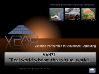
- 1. VANZI – “Real world wisdom thru virtual worlds” VANZI Presentation @ Cybera Summit - Oct 2011
- 2. Outline • Who is VPAC – and our role in Cyberinfrastucture • Traditional infrastructure planning – White papers, consultants, and “one off studies” • VANZI – virtual worlds for infrastructure planning – Hypothetical case studies – VANZI 2020 • Roadblocks to the VANZI Vision – Removing those roadblocks – Projects in the pipeline • Summary VANZI Presentation @ Cybera Summit - Oct 2011
- 3. VPAC • VPAC and Cybera are “sibling” organizations – State-based “Cyberinfrastructure”, “not for profit” – But significant differences … • VPAC – Founded in 2000 – Employs over 40 technical staff • Sys administration, software development, engineers, … – Revenue from contracts and services • Not “grant-based” anymore • Major commercial clients including GM – Partner with many companies and organizations incl. IBM and DDN VANZI Presentation @ Cybera Summit - Oct 2011
- 4. Traditional Infrastructure Planning • Infrastructure planning for “large projects” (e.g., major provincial/state $), has not advanced much for decades – Managed by “white papers”, consultancies, “one-off” studies and models/simulation … followed by a “competitive bid” process • What is wrong with this approach? – Stakeholder engagement is often limited – Each project is a “silo” – little or no reuse of data or models – Limited ability to manage risk or manage infrastructure life-cycle • By running “what if” scenarios, long-term planning for infrastructure VANZI Presentation @ Cybera Summit - Oct 2011
- 5. VANZI 2020 • Case Study #1 – I want to dig a hole in my front yard… – Right now, call “dial before you dig” – They lookup utility data, come out a few days later and spray paint where the pipes and lines are – If your discover its wrong… good luck getting the data corrected • In VANZI 2020…. – You open up the iDigIt.com.ca HTML6 website on your phone – Authenticate, and see a 3D utility map overlaid on the scene as you walk around – Find anything else interesting, upload the image, it is analyzed via the utilities software agent and utility databases are updated VANZI Presentation @ Cybera Summit - Oct 2011
- 6. VANZI 2020 (continued) • Case Study #2 – the City of Melbourne plans to build a new city rail station, called “Southlands” – Right now, an internal study by DoT then a tender is issued – A determined citizen can get the 1,000+ page plan by FoI – Maybe there is a movie created that shows what it might look like • In VANZI 2020…. – A 3D interactive public model of the planned station is created • In the cloud… data, compute, visualization – Authorized users can do specialized studies and modify the model • E.g., arborists; or law enforcement looking at crime prevention; traffic flow impact analysis feed data from population growth models VANZI Presentation @ Cybera Summit - Oct 2011
- 7. Roadblocks to VANZI 2020 • 99% of the IT technology to do VANZI 2020 exists now! – But state of the art is typically non-interactive “movies” and custom 2D overlays using google maps • So what limits achieving VANZI 2020? 1. Difficulty of “real-time” access to GIS data sets 2. Creating 3D interactive models requires “3D game designer” expertise 3. Government and utility conservatism 4. Lack of a “platform”… each GIS project has to build its own IT infrastructure (glue to tie together what exists) VANZI Presentation @ Cybera Summit - Oct 2011
- 8. Removing Roadblocks to VANZI 2020 1. Difficulty of access to GIS data sets – And combining them • Solution – National and provincial projects such as the “spatial marketplace” in Australia http://crcsi.com.au • Web services and infrastructure for data access – Government regulation requiring utility providers to provide curated data access – Emerging open standards and peak bodies for 3D infrastructure data e.g., http://www.ucinet.info/ http://www.dspec.com.au/ – Emerging 3D GIS databases VANZI Presentation @ Cybera Summit - Oct 2011
- 9. Removing Roadblocks to VANZI 2020 (cont.) 2. Creating 3D interactive models requires “3D game designer” expertise • Solution – Engage the game development community – Develop better tools and libraries for GIS data import – Leverage and collaborate with existing companies with 3D modeling expertise VANZI Presentation @ Cybera Summit - Oct 2011
- 10. Removing Roadblocks to VANZI 2020 3. Government and utility conservatism • Solution – VANZI models are an “adjunct” to traditional approaches to infrastructure design and planning, not a replacement – VANZI as a way of “minimizing risk” and “community engagement” – Agile software development and project management for VANZI projects – Leverage off early “eager adopters” and case studies VANZI Presentation @ Cybera Summit - Oct 2011
- 11. Removing Roadblocks to VANZI 2020 4. Lack of a “platform”… each GIS project has to build its own IT infrastructure (glue to tie together what exists) • Solution – A concerted long-term open-source project to build and evolve the VANZI platform – One project at a time… but with a long-term vision and architecture VANZI Presentation @ Cybera Summit - Oct 2011
- 12. Logistics Government operator Policy Analyst User Interface Layer Website with ability to run MIS model set model parameters interactively, export data from model, etc. MIS Model/Simulation Layer network Port Inland Road Rail Port network network Object Layer -‐ Data Aggregation/Transformation Shipping Truck Ship Train Container Data Access Layer API’s for import/export of data from Stakeholder’s DB’s, population data, etc. External DB’s Population Freight Road Rail Data distribution network network data VANZI Presentation @ Cybera Summit - Oct 2011
- 13. The VANZ Initiative • Achieving the VANZ vision requires a strong consortia • Solution, form a new “not for profit” entity • Members of VANZI national consortia – CRCSi – the national spatial data consortia, 70+ companies – NiCTA – National ICT Australia (R&D) – MAV – Municipal Association of Victoria – VPAC • A strong VANZI Board track record of government engagement VANZI Presentation @ Cybera Summit - Oct 2011
- 14. VANZI Projects • VANZI was only formed about 3 months ago – So it is “early days”, our website will not be up for a week or so – For now, contact bill@vpac.org • Two key large infrastructure projects we are engaging – City of Melbourne 3D Modeling • Multiyear project to create an evolving 4D data model of the city and its infrastructure /buildings; for urban planning, tourism, … – Melbourne Intermodal System (MIS) • A freight transport and port plan for the city for infrastructure development going forward VANZI Presentation @ Cybera Summit - Oct 2011
- 15. The MIS Project & VANZI VANZI Presentation @ Cybera Summit - Oct 2011
- 16. Questions VANZI Presentation @ Cybera Summit - Oct 2011