
Recomendados
Recomendados
Mais conteúdo relacionado
Mais de commons
Mais de commons (17)
Último
Último (20)
Portalegre - presentation ro
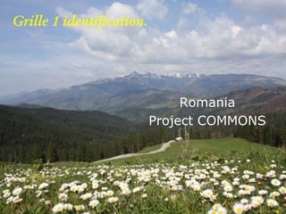
- 1. Grille 1 identification. Romania Project COMMONS
- 2. Grille 1 identification. LOCALIZATION Romania Republic Surface: 273.500 km2 Habitants: 23.400.000 Capitale: Bucharest Romania Project COMMONS
- 3. INTERREG IVC - COMMONS Cluj County Romania Project COMMONS
- 4. Grille 1 identification. IDENTIFICATION OF EXPERIMENTAL SITE Vladeasa Massif is situated in the sector named Bihor-Vladeasa Mountains, respectively the central compartment of Apuseni Mountains, as mountainous branch which belongs to the Western Carpathians, situated between the parallels 46º47'59" and 46º37'22" Northern latitude and the meridians 22º51'38" and 22º33'11" Eastern longitude Romania Project COMMONS
- 5. Grille 1 identification. IDENTIFICATION OF EXPERIMENTAL SITE Explanation Total Out of which Sacuieu Sancraiu Margau Poieni Surface out of which: 42841,889 12104,5 1275,4 15481,5 13980,5 Agricultural land, 14696,727 3818,7 127,4 4837,8 5912,9 out of which: Land in crop 6766,550 2289,7 5,2 1481,0 2990,1 Pastures 7542,200 1448,6 122,2 3356,7 2618,7 Hay field 384,472 80,330 - - 304,1 Woods out of which: 27722.258 8204,8 1148,0 10643,7 7725,7 Deciduous 5843,929 1390,0 893,4 1148,7 2411,8 Coniferous 14206,026 5852,5 100,0 5635,9 1071,3 Composite woods 4002,382 223,1 29,2 2678,8 1071,3 Vegetation of 3601,062 726,9 125,4 1180,7 1568,4 transition Alpine area 68,859 12,4 - - 56,4 Discontinuous 188,476 61,3 - - 127,2 building areas Lakes 188,601 19,7 - - 168,9 Quarries 45,827 - - - 45,8 Romania Project COMMONS
- 6. Grille 1 identification. IDENTIFICATION OF EXPERIMENTAL SITE The real estate fund of Vladeasa Massif is presented as follows: Agricultural lands – arable (46%); pastures (51%); hays (3%) Real estate fund – coniferous trees (52); deciduous trees (21%); mixed (14%); transition (13%) and alpine gap (0%) Romania Project COMMONS
- 7. Grille 1 identification. IDENTIFICATION OF EXPERIMENTAL SITE Romania Project COMMONS
- 8. Grille 1 identification. IDENTIFICATION OF EXPERIMENTAL SITE Romania Project COMMONS
- 9. Grille 1 identification. VLADEASA MASSIF Although it seems a region which is easy to analyze from the point of view of the landscape, the Vladeasa Massif presents a relatively complex and varied, due to the geographical, geomorphological, hydrological and pedological complexity which occurred in time. The Vladeasa Massive is made up as a geomorphological unit which is very different from the neighbouring large morphological units Romania Project COMMONS
- 10. Grille 1 identification. VLADEASA MASSIF The magmatites (dacites, rhyolites and granodiorites) from Vladeasa Massif are fitted in the relief through heavy, massive shapes framed by deep valleys the same reflex in relief have the crystallofillian rocks, which, through their structure, imposed the presence of steep banks of cuesta type and of structural surfaces (or the so-called levelling surfaces) Jurassic limestones from the Rameti rift valley determined the existence of an endocarstic relief extremely important in the caves from the basin of the Iada valley, some of them being declared as monuments of nature Romania Project COMMONS
- 11. Grille 1 identification. VLADEASA MASSIF Romania Project COMMONS
- 12. Grille 1 identification. Hydrology and hydrogeology the hydrographical basin of Crisul Repede and, in a reduced part, to the Somesul Cald basin, situated at the Southern limit of the territory In the Crisul Repede basin during 1955-2000 a lot of high floods were registered, most often 1-2 high floods per year, having only one maximum peak (monoundical high floods) or with several peaks (poliundical high floods). Romania Project COMMONS
- 13. Grille 1 identification. BIODIVERSITY From the point of view of the phytogeographical region, the Vladeasa Massif territory is classified in the Central-European region, East- Carpathian region, Apuseni Mountains sub-province The vegetation on altitude is represented through the following units and subunits: 1) the nemoral floor (of deciduous tree forests) with the subfloor of common oak forests, the subfloor of beech forests and the subfloor of mixture forests (beech with resinaceous); 2) the boreal floor (of common spruce and other species of resinaceous) 3) the subalpine and alpine floors which do not include species of trees but on an Romania isolated basis Project COMMONS
- 14. Grille 1 identification. BIODIVERSITY Romania Project COMMONS
- 15. Grille 1 identification. BIODIVERSITY Romania Project COMMONS
- 16. Grille 1 identification. BIODIVERSITY Romania Project COMMONS
- 17. Grille 1 identification. THE STATUS OF NATURAL HABITATS We identified 21 protected areas of national importance and a Natural Park Natural monuments: The Varfurasu Cave, 2002- Natura 2000 11 areas of national importance Romania Project COMMONS
- 18. Grille 1 identification. THE STATUS OF NATURAL HABITATS Romania Project COMMONS
- 19. Grille 1 identification. THE STATUS OF NATURAL HABITATS Romania Project COMMONS
- 20. Grille 1 identification. REGULATORY STATUE ALTITUDE: 700-1836 m Land situation Area: 42842 ha Common runs: 64% Private owner: 36% 36% Common land Privat e owner 64% Romania Project COMMONS
- 21. Grille 1 identification. REGULATORY STATUE Situation of Forest: 31% state forest 33% Public ownership of territorial administrative units 25% Private forest ownership of legal persons 7% Forests owned by individuals 4% Forests belonging to units of education and worship Romania Project COMMONS
- 22. Grille 1 identification. HISTORY 1879 Austrian law for common forest 1881 Forest Code (inspired by France code 1897)which precise that forests can be deforested only after there was made an arrangement, approved by regal decree 1897 Austrian law for composesorate forest Romanian Forest Code 1910,1962,1996 Restoration of property right – 18 law/1991 and 1 law/2000 Romania Project COMMONS
- 23. Grille 1 identification. HYSTORY Subsistence agriculture Exploitation and wood processing Livestock Romania Project COMMONS
- 24. Grille 1 identification. HYSTORY Romania Project COMMONS
- 25. Grille 1 identification. HYSTORY Romania Project COMMONS
- 26. Grille 1 identification. HYSTORY Romania Project COMMONS
- 27. Grille 1 identification. STAKES AND THREATS Vladeasa Massif is affected by major tectonic movements such as earthquakes, weather phenomena Risks: erosion sliding and fall of land risks caused by floods Romania Project COMMONS
- 28. Grille 1 identification. STAKES AND THREATS Romania Project COMMONS
- 29. Grille 1 identification. STAKES AND THREATS Romania Project COMMONS
- 30. Grille 1 identification. STAKES AND THREATS Soil and water pollution by: inappropriate use of agricultural land illegal deforestation lack of landfill arranged Romania Project COMMONS
- 31. Grille 1 identification. STAKES AND THREATS Romania Project COMMONS
- 32. Grille 1 identification. STAKES AND THREATS Romania Project COMMONS
- 33. Grille 1 identification. STAKES AND THREATS Traditional activities are diminished The people who lives there are aged Young people migrate to the cities Romania Project COMMONS
- 34. Grille 1 identification. STAKES AND THREATS Romania Project COMMONS
- 35. Grille 1 identification. STAKES AND THREATS Romania Project COMMONS
- 36. Grille 1 identification. STAKES AND THREATS Romania Project COMMONS
- 37. Grille 1 identification. STAKES AND THREATS Romania Project COMMONS
- 38. Grille 1 identification. OBJECTIVES offering solutions regarding the administration of natural resources through the correlation of environmental factors with the biological and technological factors, their improvement through the working of soil represents a prioritz in the conditions of practicing a long lasting agriculture and of reconstruction of the agro-sylvical fund; familiarization with the impact that some improvement measures have on: momentary humidity, water reserve accumulated in the soil, soil permeability for water, soil’s content in chemical elements; Romania Project COMMONS
- 39. Grille 1 identification. OBJECTIVES development of a conceptual analysis of natural factors, but especially of the ecological regimes in which the agro-sylvical pastoral production process is unfolded; identification and quantification of pedogenetical processes which led to the spatial differentiation of soils from this region Romania Project COMMONS
- 40. Grille 1 identification. OBJECTIVES Romania Project COMMONS
- 41. Grille 1 identification. OBJECTIVES the establishment of preservation possibilities of soil resources, as well as the water ones through practising adequate measurements and study on the hay production, wood material and agricultural products; Measures to decrease pollution Romania Project COMMONS
- 42. Grille 1 identification. OBJECTIVES Romania Project COMMONS
- 43. Grille 1 identification. Thank You! Romania Project COMMONS