CNUNE Summit Norman Garrick
•
0 gostou•417 visualizações

![The Demise of City Life in Connecticut ,[object Object],[object Object],[object Object],[object Object],[object Object],[object Object],[object Object]](data:image/gif;base64,R0lGODlhAQABAIAAAAAAAP///yH5BAEAAAAALAAAAAABAAEAAAIBRAA7)
Recomendados
Recomendados
Mais conteúdo relacionado
Mais procurados
Mais procurados (20)
Semelhante a CNUNE Summit Norman Garrick
Semelhante a CNUNE Summit Norman Garrick (20)
Mais de New England Chapter of the Congress for the New Urbanism
Mais de New England Chapter of the Congress for the New Urbanism (20)
Último
Último (20)
CNUNE Summit Norman Garrick
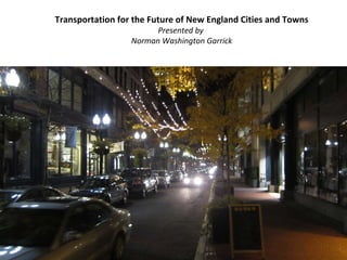
- 1. Transportation for the Future of New England Cities and Towns Presented by Norman Washington Garrick
- 3. What is Transportation For? Lewis Mumford (The Highway and the City, 1964)
- 4. Pharmacies in Washington, DC ½ Mile
- 5. Pharmacies in Hartford ½ Mile
- 6. Vehicle Miles Traveled Ref for Vehicle Data ---- http://www1.eere.energy.gov/vehiclesandfuels/facts/2007_fcvt_fotw474.html Ref for VMT ---- http://www.fhwa.dot.gov/policyinformation/statistics/2007/vmt421.cfm 1908 The Model T 1930s The Depression 1940-45 World War II 1956 Highway Bill 1973 First Oil Crisis 1979 Second Oil Crisis 2004 ??? 1949 Housing Act
- 7. Vehicle Miles Traveled Ref for Vehicle Data ---- http://www1.eere.energy.gov/vehiclesandfuels/facts/2007_fcvt_fotw474.html Ref for VMT ---- http://www.fhwa.dot.gov/policyinformation/statistics/2007/vmt421.cfm US Canada Germany Japan
- 8. Vehicle Miles Traveled Ref for Vehicle Data ---- http://www1.eere.energy.gov/vehiclesandfuels/facts/2007_fcvt_fotw474.html Ref for VMT ---- http://www.fhwa.dot.gov/policyinformation/statistics/2007/vmt421.cfm
- 10. Cities will be part of the country; I shall live 30 miles from my office in one direction, under a pine tree; my secretary will live 30 miles away from it too, in the other direction, under another pine tree. We shall both have our own car. We shall use up tires, wear out road surfaces and gears, consume oil and gasoline. All of which will necessitate a great deal of work … enough for all. Le Corbusier, 1935
- 16. Hartford 1930s
- 17. Hartford 1960s
- 20. Conventional Transportation Planning More Highways More Parking Prediction of More Driving Less Walking/Transit Plans for Development Conventional transportation planning assumes the following linear relationship This approach to planning is often referred to as ‘predict and provide’ There are a number of flaws in this model - including the assumption of a linear relationship
- 21. Conventional Transportation Planning and the Spiral of Decay More Highways More Parking More Driving Less Walking/Transit Fewer Jobs Fewer Residents = New Urbanists and others have long argued that conventional transportation planning behaves more like the model shown below Recently we started a research project which is investigating this model
- 24. The Fate of Hartford 1960 to 2000 More Highways More Parking More Driving Less Walking/Transit Fewer Jobs Fewer Residents = The evidence so far from our study seems to strongly support this ‘spiral of decay’ model
- 25. Spiral of Decay in Hartford 1960 to 2000 More Highways More Parking More Driving Less Walking/Transit Fewer Jobs Fewer Residents = Driving Up 39 % Parking Up 180 % Transit Down 45 % Walking Down 56 % Jobs Down 7 % Residents Down 25 %
- 26. Cambridge versus Hartford 1960 to 2000 Hartford Cambridge Driving No Change Parking Up 104 % Transit Down 20 % Walking Up 32 % Jobs Up 73 % Residents Down 7 % Driving Up 39 % Parking Up 180 % Transit Down 45 % Walking Down 56 % Jobs Down 7 % Residents Down 25 %
- 27. Why the Spiral of Decay? Rate of Driving Parking per Activity Cities with high driving rates require up to 5 to 6 times more parking for each new job or resident Very costly, uses lots of land and creates a horrible walking environment Hartford Cambridge
- 28. Why the Spiral of Decay? Cities with more parking end up accommodating many fewer jobs and residents per square mile Parking per Activity Activities per Sq. Mile Hartford Cambridge
- 29. City Friendly Transportation Planning What is the vision for the city? Create a transportation system that supports this vision
- 30. City Friendly Transportation Planning Creating a transportation system for the city we want Parking Caps No highways No street widening No street retirement Freeway removal Road Diet Eliminate one-way streets Restore on-street parking
- 31. Los Angeles, California Tuesday March 15 1800 Hours
- 32. Los Angeles, California Wednesday March 16 0730 Hours
- 33. Excessive Street Capacity is Everywhere Not Just in the Heart of America’s 2 nd City at Rush Hour
- 35. Remember, Zürich was not built in a day!