

Recomendados
Recomendados
Mais conteúdo relacionado
Mais procurados
Mais procurados (20)
Destaque
Semelhante a Final EIS Part 1
Semelhante a Final EIS Part 1 (20)
Mais de Honolulu Civil Beat
Mais de Honolulu Civil Beat (20)
Final EIS Part 1
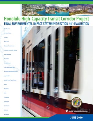
- 1. Honolulu High-Capacity Transit Corridor Project FINAL ENVIRONMENTAL IMPACT STATEMENT/SECTION 4(f) EVALUATION East Kapolei UH West O’ahu Ho’opili West Loch Waipahu Transit Center Leeward Community College Pearl Highlands Pearlridge Aloha Stadium Pearl Harbor Naval Base Honolulu International Airport Lagoon Drive Middle Street Transit Center Kalihi Kapālama Iwilei Chinatown Downtown Civic Center Kaka’ako Ala Moana JUNE 2010
- 7. Abstract is Final Environmental Impact Statement/Section 4(f) Evaluation is a joint National Environmental Policy Act (NEPA) and Hawai‘i Revised Statutes Chapter 343 document. It is intended to provide decision makers and the public with information on the Project’s environmental impacts and bene ts. It also serves as a summary documentation of the consultation conducted in compliance with Section 106 of the National Historic Preservation Act of 1966, as amended, and the Section 4(f) evaluation prepared pursuant to Section 4(f) of the U.S. Department of Transportation Act of 1966. is document identi es the current and future need to address mobility and travel reliability issues, to support transportation and land use planning policies, and to improve transportation equity in the study corridor on the Island of O‘ahu in the State of Hawai‘i. In compliance with NEPA, this document considers a No Build and a Build Alternative that will provide high-capacity transit service in the corridor between East Kapolei and Ala Moana Center and serving Hono- lulu International Airport. is Final EIS identi es the Preferred Alternative, which consists of a 20-mile elevated guideway that includes transit stations, park-and-ride facilities, a maintenance and storage facility, and other ancil- lary facilities to support the transit system. is Final EIS addresses agency and public comments on the Dra EIS and documents the transportation e ects and potential consequences on the natural and human environment, including e ects on land use and economic activity; communities and neigh- borhoods; visual and aesthetic conditions; air quality and energy; noise and vibration; hazardous materials; natural resources; water quality; and archaeo- logical, cultural, and historic resources. It also includes documentation of measures to avoid and minimize e ects to the natural and built environments and includes mitigation and other commitments. Financial implications of construction and operation of the transit system are also evaluated. Comments concerning re nement of the design of the Airport Alternative sub- sequent to the Dra EIS may be addressed to Mr. Matley and Mr. Yoshioka at the addresses above during the 30 days following the Federal Register Notice of Availability. Substantive new comments received during the 30-day period will be addressed in the Record of Decision. A DVD of the Final EIS is available at no cost. e document is available on the project website at honolulutransit.org and may be reviewed at the following locations: • City Municipal Library • All State public libraries • City and County of Honolulu Department of Transportation Services, 650 South King Street, 3rd oor Printed copies of the document are available for purchase.
- 11. Preface Purpose of the Final Environmental e NEPA Preferred Alternative, referred to in Impact Statement this Final EIS as the Project, is evaluated in more e purpose of this Final Environmental Impact detail and is a 20-mile portion of the Locally Statement (EIS) is to provide the City and County Preferred Alternative (LPA) for which FTA may of Honolulu Department of Transportation Ser- provide Federal funding. FTA and the City identi- vices (DTS), the Federal Transit Administration ed this alternative as preferred for meeting the (FTA), and the public and interested parties with Purpose and Need over other alternatives, includ- the information necessary to make an informed ing the No Build Alternative. e Project includes decision about the Project based on a full and the construction and operation of a xed guideway open analysis of costs, bene ts, and environmental rail system. It is a portion of the LPA that begins at impacts of alternatives considered. Approval of this the University of Hawai‘i at West O‘ahu (near the EIS is not an Administrative Action (as de ned future Kroc Center), and proceeds via Farrington by 23 CFR 771.107) and does not commit FTA to Highway and Kamehameha Highway (adjacent to approve any future grant request to fund the Project. Pearl Harbor), to Aolele Street serving the Airport, to Dillingham Boulevard, to Nimitz Highway, e Honolulu High-Capacity Transit Corridor to Halekauwila Street, and ending at Ala Moana Project is the project name used for FTA planning Center. If FTA publishes a Record of Decision on and project development for New Starts projects. this Preferred Alternative, then the City would continue pursuing funding for the Project by e Locally Preferred Alternative as identi ed by submitting an application to enter the Final Design the City Council at the conclusion of the Alterna- stage of the New Starts Program. tives Analysis process is a step required for FTA’s discretionary New Starts Program. It represents the City’s long-range plan for the rail system, including the Project (as de ned below) and the potential extensions. June 2010 Honolulu High-Capacity Transit Corridor Project Environmental Impact Statement i
- 12. Purpose of the Final Environmental risks of harm to the environment against the ben- Impact Statement for the Federal Aviation e ts to be derived from the Project, and to make a Administration reasoned choice between alternatives. It also serves e Federal Aviation Administration (FAA) is as documentation of the coordination conducted a cooperating agency on this EIS, in accordance in compliance with Section 106 of the National with 40 CFR Part 1501.6(a)(1), since it has special Historic Preservation Act of 1966, as amended, and expertise and jurisdiction by law to approve the Section 4(f) evaluation prepared pursuant to proposed development at Honolulu International Section 4(f) of the U.S. Department of Transporta- Airport. e FAA is assigned responsibilities tion Act of 1966. pursuant to 49 USC 40101 et seq., for civil aviation and regulation of air commerce in the interests e HRS Chapter 343 EIS preparation notice was of aviation safety and e ciency. As a cooperating issued for this Project on December 8, 2005. e agency on this EIS, FAA will use the EIS documen- Notice of Intent to prepare an EIS was published tation to comply with its own requirements under in the Federal Register on March 15, 2007, which the National Environmental Policy Act (NEPA) for began the NEPA scoping period. e March 15, Federal actions. e FAA will also use the EIS to 2007, notice superseded the December 7, 2005, support subsequent decisions and Federal actions, Notice of Intent to prepare an Alternatives Analy- including unconditional approval of the portion of sis and Dra EIS. e Dra EIS was distributed for the Airport Layout Plan that depicts the Project, public and agency review beginning in November determination of eligibility for Federal assistance 2008 with the Notice of Availability published in under the Federal grant in-aid program, approval the Federal Register on November 21, 2008, and of an application to use Passenger Facility Charges, in the State of Hawai‘i Environmental Notice on and approval to grant right-of-way at the airport to November 23, 2008. Public hearings were held to carry out the Project. receive comments from the public and agencies, and comments were accepted until February 6, Overview of the Final Environmental Impact 2009. e Notice of Availability of this Final EIS Statement will be published in the Federal Register. is document builds on the ndings of the Alternatives Analysis Report (DTS 2006b) and HRS Section 343-5(f) and Hawai‘i Administra- the Honolulu High-Capacity Transit Corridor tive Rules (HAR) Section 11-200-25(b) both Project Dra Environmental Impact Statement/ require State and Local agencies to cooperate Section 4(f) Evaluation (RTD 2008u), follows FTA with Federal agencies to the fullest extent pos- planning and guidance, provides information on sible to reduce duplication between Federal and the preferred Fixed Guideway Transit Alternative State requirements. is includes preparing joint via the Airport (Airport Alternative) and the No environmental impact statements with concur- Build Alternative, and addresses agency and public rent public review and processing. e governor comments on the Dra EIS. has nal authority to accept the EIS. At the time of submission to the governor, Hawai‘i’s EIS rules is document is a joint NEPA and Hawai‘i also require that the Final EIS be distributed to Revised Statutes (HRS) Chapter 343 Final EIS. It persons and agencies with jurisdiction or exper- has been compiled in good faith and sets forth suf- tise in certain areas relevant to various actions cient information to enable the decision-maker to and to Dra EIS commenters that request the consider fully the environmental factors involved, Final EIS. e Final EIS will be submitted to the to make a reasoned decision a er balancing the governor and distributed to the FTA. e FTA ii Preface
- 13. will issue a Notice of Availability of the Final EIS Chapter 1 discusses the background, describes the pursuant to its NEPA regulations. study corridor from Kapolei to UH Mānoa and Waikīkī, and explains the Purpose and Need for No sooner than 30 days a er publication of this the xed guideway transit system. Final EIS, the FTA will sign a Record of Deci- sion. e Record of Decision will summarize Chapter 2 details the alternatives and technologies the alternatives considered, factors that support considered during the screening and selection selection of the recommended alternative, and process and summarizes the alternatives consid- commitments to measures that mitigate substan- ered during the Alternatives Analysis and environ- tial environmental impacts. mental impact analysis processes. It includes the basis for selection of the Preferred Alternative and e LPA includes the majority of housing and a description of the project design elements and employment on O‘ahu. e east-west length of the operating parameters. corridor is approximately 23 miles. e north- south width is at most 4 miles because much of Chapter 3 describes existing and future transpor- the corridor is constrained by the Ko‘olau and tation conditions in the study corridor, presents Wai‘anae Mountain Ranges to the north and the consequences of the Project and compares them to Paci c Ocean to the south. is document pro- the No Build Alternative, and discusses mitigation vides environmental analysis and documentation for potential transportation impacts. for the 20-mile Project as described in Section 2.5 between East Kapolei and Ala Moana Center. Chapter 4 describes existing and future envi- ronmental conditions, presents consequences of Future planned extensions from East Kapolei to the Project and compares them to the No Build West Kapolei, following Salt Lake Boulevard, and Alternative, and discusses mitigation for potential from Ala Moana Center to UH Mānoa and to environmental impacts. Waikīkī are included in the LPA and are addressed as cumulative e ects in Sections 3.6.2 and 4.19.3 Chapter 5 discusses the Project’s e ects on public of this Final EIS. ese planned extensions parks, recreational areas, and historic properties would be evaluated through a separate NEPA to support determinations required to comply and HRS Chapter 343 process and designed and with the provisions of the U.S. Department of constructed once additional funding is secured. Transportation Act of 1966 [commonly referred to as Section 4(f)]. Organization of the Final Environmental Impact Statement Chapter 6 presents the various funding sources is document is divided into two volumes. is and estimated capital and operating costs. volume contains the Final EIS for the Project, which includes a summary of changes between the Dra Chapter 7 summarizes the evaluation of the and Final EIS, explanation and analysis of design Project based on the information in Chapters 3 re nements to the Airport Alternative since the through 6. Dra EIS, and responses to comments on the Dra EIS. It consists of the following eight chapters: Chapter 8 discusses the overall public outreach and agency coordination components and sum- June 2010 Honolulu High-Capacity Transit Corridor Project Environmental Impact Statement iii
- 14. marizes comments received on the Dra EIS and the responses to those comments. Volume II consists of electronic les for the appendices referenced in the Final EIS, including comments received regarding the Dra EIS and the responses to those comments. e CD is located at the end of Volume I. Technical reports support- ing the analysis presented in this Final EIS are available for review at the o ces of the City and County of Honolulu Department of Transportation Services Rapid Transit Division and on the project website at www.honolulutransit.org. iv Preface
- 15. Table of Contents Acronyms and Abbreviations xxiii Executive Summary S-1 Chapter 01 Background, Purpose and Need 1-1 1.1 History of the Honolulu High-Capacity Transit Corridor Project 1-1 1.1.1 Conditions Leading to the Project 1-1 1.1.2 Progress of the Honolulu High-Capacity Transit Corridor Project 1-4 1.1.3 Developments since the Draft Environmental Impact Statement 1-5 1.2 Description of the Corridor 1-5 1.3 Existing Travel Patterns in the Corridor 1-12 1.3.1 Person-trip Patterns 1-12 1.3.2 Transit Travel Patterns 1-13 1.4 Existing Transportation Facilities and Services in the Corridor 1-15 1.4.1 Street and Highway System 1-15 1.4.2 Public Transit System 1-16 1.4.3 Parking 1-16 1.4.4 Pedestrian and Bicycle Systems 1-16 1.5 Performance of the Existing Transportation System 1-16 1.5.1 Highway Tra c Volumes 1-16 1.5.2 Highway Tra c Operating Conditions 1-17 1.5.3 Transit Operating Conditions 1-19 June 2010 Honolulu High-Capacity Transit Corridor Project Environmental Impact Statement v
- 16. 1.6 Potential Transit Markets 1-20 1.7 Purpose of the Project 1-21 1.8 Need for Transit Improvements 1-21 1.8.1 Improve Corridor Mobility 1-21 1.8.2 Improve Corridor Travel Reliability 1-22 1.8.3 Improve Access to Planned Development to Support City Policy to Develop a Second Urban Center 1-22 1.8.4 Improve Transportation Equity 1-22 1.9 Goals of the Project 1-23 Chapter 02 Alternatives Considered 2-1 2.1 Changes to this Chapter since the Draft Environmental Impact Statement 2-2 2.2 Alternatives Screening and Selection Process 2-4 2.2.1 Screening of a Broad Range of Alternatives 2-5 2.2.2 Alternatives Considered in the Alternatives Analysis 2-7 2.2.3 Alternatives Consideration Process after the Alternatives Analysis 2-14 2.3 Alternatives Considered in the Draft Environmental Impact Statement 2-16 2.3.1 No Build Alternative 2-16 2.3.2 Salt Lake Alternative 2-18 2.3.3 Airport Alternative 2-18 2.3.4 Airport & Salt Lake Alternative 2-18 2.4 Preferred Alternative Identi cation Process 2-22 2.4.1 Re nement of Preferred Alternative 2-23 2.5 The Project: Fixed Guideway Alternative from East Kapolei to Ala Moana Center via the Airport 2-23 2.5.1 Operating Parameters 2-29 2.5.2 Transit Technology 2-30 2.5.3 Station Characteristics 2-31 2.5.4 Safety and Security Measures 2-31 2.5.5 Pedestrian and Bicycle Access 2-43 2.5.6 Bus System 2-43 2.5.7 Park-and-Ride Facilities 2-44 2.5.8 Vehicle Maintenance and Storage Facility 2-44 2.5.9 Traction Power Substations 2-45 2.5.10 Project Phasing 2-46 vi Table of Contents
- 17. Chapter 03 Transportation 3-1 3.1 Changes to this Chapter since the Draft Environmental Impact Statement 3-3 3.2 Methodology 3-5 3.2.1 Analytical Tools and Data Sources 3-5 3.2.2 Approach to Estimating Transportation E ects 3-6 3.3 Existing Conditions and Performance 3-8 3.3.1 Existing Travel Patterns 3-8 3.3.2 Existing Transit Conditions and Performance 3-10 3.3.3 Existing Streets and Highways Conditions and Performance 3-17 3.3.4 Existing Parking Conditions and Performance 3-25 3.3.5 Existing Bicycle and Pedestrian Network Conditions and Performance 3-26 3.3.6 Existing Airport Facilities 3-26 3.4 Transportation Consequences and Mitigation 3-27 3.4.1 Future Travel Patterns 3-28 3.4.2 E ects on Transit 3-31 3.4.3 E ects on Streets and Highways 3-47 3.4.4 E ects on Parking 3-54 3.4.5 E ects on Bicycle and Pedestrian Facilities 3-59 3.4.6 E ects to Airport Facilities 3-60 3.4.7 Mitigation of Long-term Transportation E ects 3-61 3.5 Construction-related E ects on Transportation 3-64 3.5.1 Construction Staging Plans 3-64 3.5.2 Construction-related E ects on Transit Service 3-64 3.5.3 Construction-related E ects on Tra c 3-67 3.5.4 Construction-related E ects on Parking 3-69 3.5.5 Construction-related E ects on Bicycle and Pedestrian Facilities 3-70 3.5.6 Construction-related E ects on Airport Facilities 3-70 3.5.7 Mitigation of Construction-related E ects 3-71 3.6 Indirect and Cumulative Transportation System E ects 3-74 3.6.1 Indirect E ects 3-74 3.6.2 Cumulative E ects 3-74 Chapter 04 Environmental Analysis, Consequences, and Mitigation 4-1 4.1 Changes to this Chapter since the Draft Environmental Impact Statement 4-3 4.2 Land Use 4-11 4.2.1 Background and Methodology 4-11 4.2.2 A ected Environment 4-11 4.2.3 Environmental Consequences and Mitigation 4-21 June 2010 Honolulu High-Capacity Transit Corridor Project Environmental Impact Statement vii
- 18. 4.3 Economic Activity 4-24 4.3.1 Background and Methodology 4-25 4.3.2 A ected Environment 4-25 4.3.3 Environmental Consequences and Mitigation 4-26 4.4 Acquisitions, Displacements, and Relocations 4-26 4.4.1 Background and Methodology 4-26 4.4.2 A ected Environment 4-27 4.4.3 Environmental Consequences and Mitigation 4-27 4.5 Community Services and Facilities 4-28 4.5.1 Background and Methodology 4-29 4.5.2 A ected Environment 4-29 4.5.3 Environmental Consequences and Mitigation 4-38 4.6 Neighborhoods 4-42 4.6.1 Background and Methodology 4-42 4.6.2 A ected Environment 4-42 4.6.3 Environmental Consequences and Mitigation 4-45 4.7 Environmental Justice 4-49 4.7.1 Background and Methodology 4-49 4.7.2 A ected Environment 4-51 4.7.3 Environmental Consequences 4-54 4.7.4 Environmental Justice Determination 4-58 4.8 Visual and Aesthetic Conditions 4-60 4.8.1 Background and Methodology 4-60 4.8.2 A ected Environment 4-62 4.8.3 Environmental Consequences and Mitigation 4-67 4.9 Air Quality 4-110 4.9.1 Background and Methodology 4-110 4.9.2 A ected Environment 4-111 4.9.3 Environmental Consequences and Mitigation 4-112 4.10 Noise and Vibration 4-113 4.10.1 Background and Methodology 4-113 4.10.2 A ected Environment 4-116 4.10.3 Environmental Consequences and Mitigation 4-116 4.11 Energy and Electric and Magnetic Fields 4-123 4.11.1 Background and Methodology 4-124 4.11.2 A ected Environment 4-124 4.11.3 Environmental Consequences and Mitigation 4-124 4.12 Hazardous Waste and Materials 4-125 4.12.1 Background and Methodology 4-126 4.12.2 A ected Environment 4-126 viii Table of Contents
- 19. 4.12.3 Environmental Consequences and Mitigation 4-130 4.13 Ecosystems 4-132 4.13.1 Background and Methodology 4-132 4.13.2 A ected Environment 4-135 4.13.3 Environmental Consequences and Mitigation 4-140 4.14 Water 4-141 4.14.1 Background and Methodology 4-142 4.14.2 A ected Environment 4-146 4.14.3 Environmental Consequences and Mitigation 4-157 4.14.4 404(b)(1) Analysis 4-171 4.15 Street Trees 4-172 4.15.1 Background and Methodology 4-172 4.15.2 A ected Environment 4-174 4.15.3 Environmental Consequences and Mitigation 4-174 4.16 Archaeological, Cultural, and Historic Resources 4-176 4.16.1 Background and Methodology 4-176 4.16.2 A ected Environment 4-183 4.16.3 Environmental Consequences and Mitigation 4-185 4.17 Maintenance and Storage Facility 4-196 4.17.1 No Build Alternative 4-197 4.17.2 The Project 4-197 4.18 Construction Phase E ects 4-199 4.18.1 Land Use and Economic Activity 4-201 4.18.2 Communities and Neighborhoods 4-202 4.18.3 Visual and Aesthetic Conditions 4-203 4.18.4 Air Quality 4-204 4.18.5 Noise and Vibration 4-204 4.18.6 Construction Energy Consumption 4-206 4.18.7 Contaminated Media and Solid Waste 4-206 4.18.8 Natural Resources 4-208 4.18.9 Invasive Species 4-209 4.18.10 Water Resources 4-209 4.18.11 Archaeological, Cultural, and Historic Resources 4-212 4.18.12 Relationship between Short-term Uses of the Environment and Long-term Productivity 4-213 4.19 Indirect and Cumulative E ects 4-214 4.19.1 Background and Methodology 4-214 4.19.2 Indirect E ects 4-215 4.19.3 Cumulative E ects 4-219 4.19.4 E ects of No Build Alternative on Growth 4-232 June 2010 Honolulu High-Capacity Transit Corridor Project Environmental Impact Statement ix
- 20. 4.20 Irreversible and Irretrievable Commitments of Resources 4-233 4.21 Anticipated Permits, Approvals, and Agreements 4-233 Chapter 05 Section 4(f) Evaluation 5-1 5.1 Changes to this Chapter since the Draft Environmental Impact Statement 5-1 5.2 Introduction 5-3 5.2.1 Section 4(f) Determinations 5-3 5.2.2 De minimis Impact Determinations 5-4 5.2.3 Section 4(f) “Use” De nitions 5-4 5.3 Alternatives Evaluation and Description of the Project 5-5 5.3.1 Alternatives Evaluation 5-5 5.3.2 Description of the Project 5-6 5.4 Description of Section 4(f) Properties 5-6 5.5 Direct Use of Section 4(f) Properties 5-14 5.5.1 Park and Recreational Properties 5-14 5.5.2 Historic Sites 5-23 5.6 Evaluation of Constructive Use of Section 4(f) Properties 5-49 5.6.1 Parks and Recreational Properties 5-50 5.6.2 Historic Section 4(f) Properties 5-54 5.6.3 Summary of Evaluation of Constructive Use of Section 4(f) Properties 5-68 5.7 Temporary Occupancy of Section 4(f) Properties 5-69 5.8 Least Overall Harm 5-70 5.8.1 Least Overall Harm Evaluation of the Airport and Salt Lake Alternative Alignments 5-70 5.8.2 Di erences in Environmental Impacts between Airport and Salt Lake Alternatives 5-72 5.8.3 Purpose and Need 5-72 5.9 Determination of Section 4(f) Use 5-73 Chapter 06 Cost and Financial Analysis 6-1 6.1 Changes to this Chapter since the Draft Environmental Impact Statement 6-1 6.2 Cost Estimate Methodology 6-2 6.2.1 Capital Cost Methodology 6-2 6.2.2 Operating and Maintenance Cost Methodology 6-3 6.3 Capital Plan 6-3 6.3.1 Capital Costs 6-3 6.3.2 Proposed Capital Funding Sources for the Project 6-3 6.3.3 Funding Sources for Ongoing Capital Expenditures 6-5 x Table of Contents
- 21. 6.4 Operating and Maintenance Plan 6-7 6.4.1 Operating and Maintenance Costs 6-7 6.4.2 Operating and Maintenance Funding Sources 6-7 6.5 Cash Flow Analysis 6-9 6.5.1 Financing Assumptions for the Project 6-9 6.5.2 Ongoing Capital Expenditure Cash Flow 6-10 6.5.3 Operating and Maintenance Expenditure Cash Flow 6-10 6.6 Risks and Uncertainties 6-10 6.6.1 Project Cost Risks 6-11 6.6.2 Economic and Financial Risks 6-11 6.6.3 Capital Revenues 6-12 6.6.4 Operating Revenues 6-13 6.6.5 Operating Costs 6-14 Chapter 07 Evaluation of the Project 7-1 7.1 Changes to this Chapter since the Draft Environmental Impact Statement 7-1 7.2 E ectiveness in Meeting Project Purpose and Need 7-2 7.2.1 Improve Corridor Mobility 7-2 7.2.2 Improve Corridor Travel Reliability 7-3 7.2.3 Improve Access to Planned Development to Support City Policy to Develop a Second Urban Center 7-4 7.2.4 Improve Transportation Equity 7-4 7.3 Transportation and Environmental Consequences 7-6 7.3.1 Transportation 7-6 7.3.2 Environmental Consequences 7-6 7.4 Cost-e ectiveness 7-7 7.5 Financial Feasibility 7-7 7.5.1 Measure of Capital Financial Feasibility 7-7 7.5.2 Measure of City Financial Contribution for Operating and Maintenance 7-8 7.5.3 Comparison of Alternatives 7-8 7.6 New Starts Program 7-8 7.6.1 Background 7-8 7.6.2 Ratings for the Project 7-9 7.7 Important Trade-o s 7-10 7.8 Unresolved Issues 7-10 June 2010 Honolulu High-Capacity Transit Corridor Project Environmental Impact Statement xi
- 22. Chapter 08 Comments and Coordination 8-1 8.1 Changes to this Chapter since the Draft Environmental Impact Statement 8-2 8.2 Public and Community Outreach 8-2 8.2.1 Public Outreach Techniques 8-2 8.2.2 Government and Other Agency Coordination 8-2 8.2.3 Section 106 and Consulting Party Coordination 8-4 8.2.4 HRS Chapter 343 Coordination 8-6 8.2.5 NEPA Coordination 8-6 8.3 Community Outreach during the Alternatives Analysis Phase 8-6 8.4 Community Outreach during the Project’s Preliminary Engineering/EIS Phase 8-7 8.4.1 Community Station Design Workshops 8-8 8.4.2 Agency Coordination 8-8 8.5 Public Hearings 8-9 8.6 Draft EIS Comments 8-10 8.6.1 Alternatives Considered 8-10 8.6.2 Planned Extensions 8-12 8.6.3 Ridership/Travel Forecasting 8-12 8.6.4 Parking 8-13 8.6.5 Tra c Analysis 8-14 8.6.6 Visual 8-15 8.6.7 Noise 8-17 8.6.8 Project Cost and Financing 8-17 8.6.9 Construction Phasing 8-18 8.6.10 Construction 8-18 8.6.11 Acquisitions and Relocations 8-19 8.6.12 Managed Lane Alternative 8-19 8.6.13 At-grade Alternatives 8-23 8.7 Continuing Public Involvement through Construction 8-25 8.8 Accommodations for Minority, Low-income, and Persons with Disabilities 8-25 References List of Preparers List of EIS Recipients Index List of Appendices (on enclosed compact disk) Appendix A Comments Received on the Draft Environmental Impact Statement and Responses Appendix B Preliminary Alignment Plans and Pro les xii Table of Contents
- 23. Appendix C Preliminary Right-of-Way Plans Appendix D Bus Transit Routes Appendix E Construction Approach Appendix F Record of Agency Correspondence and Coordination Appendix G Record of Public and Stakeholder Correspondence and Coordination Appendix H Section 106 of the National Historic Preservation Act Draft Programmatic Agreement Appendix I Mitigation and Commitments Appendix J Relationship to Land Use Plans, Policies, and Controls Appendix K Airport Layout Plan and Drawings Figures Figure 1-1 Honolulu High-Capacity Transit Corridor Project Vicinity 1-2 Figure 1-2 Population, Vehicle Ownership, and Vehicle Miles Traveled Trends for O`ahu 1-2 Figure 1-3 Areas and Districts in the Study Corridor 1-7 Figure 1-4 Major Activity Centers in the Study Corridor 1-8 Figure 1-5 Population Distribution for O`ahu 1-10 Figure 1-6 Employment Distribution for O`ahu 1-11 Figure 1-7 Current (2007) Daily Person-trip Patterns on O`ahu 1-12 Figure 1-8 Daily 2007 Transit Trips between Transportation Analysis Areas 1-14 Figure 1-9 Concentrations of Transit-dependent Households (2000) 1-15 Figure 1-10 Existing A.M. Peak-Period Wai`anae to Downtown Travel Time Distribution (Highway Drive Time Only) 1-18 Figure 1-11 Selected Bus Trip Times for Selected Routes 1-19 Figure 1-12 Route Maps for Sampled Routes 1-20 Figure 2-1 Planning and Project Development Process 2-3 Figure 2-2 Alternatives Screening Process 2-5 Figure 2-3 Managed Lane Alternative Evaluated in the Alternatives Analysis 2-11 Figure 2-4 Fixed Guideway Alternative Evaluated in the Alternatives Analysis 2-13 Figure 2-5 Salt Lake Alternative 2-19 Figure 2-6 Airport Alternative 2-20 Figure 2-7 Airport & Salt Lake Alternative 2-21 Figure 2-8 Fixed Guideway Transit Alternative Features (East Kapolei to Fort Weaver Road) 2-25 Figure 2-9 Fixed Guideway Transit Alternative Features (Fort Weaver Road to Aloha Stadium) 2-26 Figure 2-10 Fixed Guideway Transit Alternative Features (Aloha Stadium to Kalihi) 2-27 Figure 2-11 Fixed Guideway Transit Alternative Features (Kalihi to Ala Moana Center) 2-28 Figure 2-12 Example Vehicle on Elevated Guideway (Cross-section) 2-30 Figure 2-13 Typical Side-platform Station Con guration without a Concourse 2-32 Figure 2-14 Typical Side-platform Station Con guration with a Concourse 2-33 Figure 2-15 Typical Center-platform Station Con guration with a Concourse 2-34 Figure 2-16 Legend for Figures 2-17 to 2-39 2-35 June 2010 Honolulu High-Capacity Transit Corridor Project Environmental Impact Statement xiii
- 24. Figure 2-17 East Kapolei Station 2-35 Figure 2-18 UH West O`ahu Station 2-36 Figure 2-19 Ho`opili Station 2-36 Figure 2-20 West Loch Station 2-36 Figure 2-21 Waipahu Transit Center Station 2-37 Figure 2-22 Leeward Community College Station 2-37 Figure 2-23 Pearl Highlands Station 2-37 Figure 2-24 Pearlridge Station 2-38 Figure 2-25 Aloha Stadium Station 2-38 Figure 2-26 Pearl Harbor Naval Base Station 2-39 Figure 2-27 Honolulu International Airport Station 2-39 Figure 2-28 Lagoon Drive Station 2-39 Figure 2-29 Middle Street Transit Center Station 2-39 Figure 2-30 Kalihi Station 2-40 Figure 2-31 Kapālama Station 2-40 Figure 2-32 Iwilei Station 2-40 Figure 2-33 Chinatown Station 2-40 Figure 2-34 Downtown Station 2-41 Figure 2-35 Civic Center Station 2-41 Figure 2-36 Kaka`ako Station 2-41 Figure 2-37 Ala Moana Center Station 2-42 Figure 2-38 Leeward Community College Maintenance and Storage Facility Location and Conceptual Layout 2-44 Figure 2-39 Maintenance and Storage Facility in Ho`opili Location and Conceptual Layout 2-45 Figure 2-40 Example of a Traction Power Substation 2-45 Figure 2-41 Project Construction Phases 2-46 Figure 2-42 Project Schedule 2-48 Figure 2-43 Planned Extensions 2-48 Figure 3-1 TheBus Annual Average Operating Speed in Miles per Hour—1984–2009 3-13 Figure 3-2 TheBus Systemwide Schedule Adherence (Percent of Weekday Systemwide Arrivals more than Five Minutes Late) 3-16 Figure 3-3 TheBus Systemwide Annual Service Incidents Involving Turnbacks 3-16 Figure 3-4 Selected Screenline Facilities Locations 3-19 Figure 3-5 Transit-dependent Households and Transit-user Bene ts—2030 Project 3-32 Figure 3-6 Transit Average Operating Speeds in Miles per Hour—No Build Alternative and the Project 3-35 Figure 3-7 A.M. Peak-Period Transit Travel Times by Travel Market—Existing Conditions, No Build Alternative, and Project 3-35 Figure 3-8 Positive User Bene ts of the Project Compared to No Build Alternative—2030 3-39 Figure 3-9 2030 A.M. Two-hour Peak Period Boardings, Alightings, and Link Volumes 3-41 xiv Table of Contents
- 25. Figure 3-10 2030 Daily Boardings, Alightings, and Link Volumes 3-42 Figure 3-11 Transit Shares of Home-based Work Trips in A.M. Two-Hour Peak Period—Existing Conditions, No Build Alternative, and Project 3-44 Figure 3-12 Pearl Highlands Station Area—2030 A.M. Peak-Hour Volumes 3-53 Figure 3-13 Pearl Highlands Station Area—2030 P.M. Peak-Hour Volumes 3-53 Figure 3-14 Airport Runway Protection Zone 3-62 Figure 4-1 Project Overview 4-4 Figure 4-2 Planning Regions and Planned Land Use 4-13 Figure 4-3 Existing Land Use (East Kapolei to Fort Weaver Road) 4-15 Figure 4-4 Existing Land Use (Fort Weaver Road to Aloha Stadium) 4-16 Figure 4-5 Existing Land Use (Aloha Stadium to Kalihi) 4-17 Figure 4-6 Existing Land Use (Kalihi to Ala Moana Center) 4-18 Figure 4-7 Designated Agricultural Lands (East Kapolei to Fort Weaver Road) 4-19 Figure 4-8 Designated Agricultural Lands (Fort Weaver Road to Aloha Stadium) 4-20 Figure 4-9 Community Resources and Facilities within One-half Mile (East Kapolei to Fort Weaver Road) 4-31 Figure 4-10 Community Resources and Facilities within One-half Mile (Fort Weaver Road to Aloha Stadium) 4-32 Figure 4-11 Community Resources and Facilities within One-half Mile (Aloha Stadium to Kalihi) 4-33 Figure 4-12 Community Resources and Facilities within One-half Mile (Kalihi to Ala Moana Center) 4-34 Figure 4-13 Corridor Neighborhoods 4-43 Figure 4-14 Environmental Justice Populations within the Study Corridor 4-52 Figure 4-15 Communities of Concern within the Study Corridor 4-53 Figure 4-16 Visually Sensitive Resources and Representative Viewpoints within the Project Corridor 4-61 Figure 4-17 Protected Views and Vistas (East Kapolei to Fort Weaver Road) 4-64 Figure 4-18 Protected Views and Vistas (Fort Weaver Road to Aloha Stadium) 4-65 Figure 4-19 Protected Views and Vistas (Kalihi to Ala Moana Center) 4-66 Figure 4-20 Viewpoint 1—Farrington Highway near Waikele Road, looking `Ewa 4-72 Figure 4-21 Viewpoint 2—Kamehameha Highway near Acacia Road, looking `Ewa 4-73 Figure 4-22 Viewpoint 3—Kamehameha Highway at Ka`ahumanu Street, looking Makai 4-74 Figure 4-23 Viewpoint 4—Kamehameha Highway at Kaonohi Street, looking Makai 4-75 Figure 4-24 Viewpoint 5—Aloha Stadium, looking `Ewa 4-76 Figure 4-25 Viewpoint 6—Kamehameha Highway near Radford Drive and the Pearl Harbor Naval Base Station Area, looking Mauka 4-77 Figure 4-26 Viewpoint 7—Ke`ehi Lagoon Beach Park, looking Mauka and `Ewa 4-78 Figure 4-27 Viewpoint 8—Ke`ehi Lagoon Beach Park, looking Mauka 4-79 Figure 4-28 Viewpoint 9— Dillingham Boulevard at Kalihi, looking Makai 4-80 Figure 4-29 Viewpoint 10—Dillingham Boulevard near Honolulu Community College and Kapālama Station Area, looking `Ewa 4-81 June 2010 Honolulu High-Capacity Transit Corridor Project Environmental Impact Statement xv
- 26. Figure 4-30 Viewpoint 11—Nimitz Highway Bridge and Chinatown Station Area, looking Makai 4-82 Figure 4-31 Viewpoint 12—Nimitz Highway, makai of Nimitz Highway/Maunakea Street Intersection, looking `Ewa and Mauka 4-83 Figure 4-32 Viewpoint 13—Maunakea Street, looking Makai 4-84 Figure 4-33 Viewpoint 14—O`ahu Market at King Street, looking Makai 4-85 Figure 4-34 Viewpoint 15—Nimitz Highway/Fort Street Intersection Mauka of Irwin Park and Aloha Tower Marketplace, looking Koko Head 4-86 Figure 4-35 Viewpoint 16—Fort Street Mall at Merchant Street, looking Makai 4-87 Figure 4-36 Viewpoint 17—Aloha Tower Drive at Irwin Park and Aloha Tower Marketplace, looking Mauka 4-88 Figure 4-37 Viewpoint 18—Halekauwila Street/Cooke Street Intersection, looking Mauka past Mother Waldron Neighborhood Park 4-89 Figure 4-38 Viewpoint 19—Mother Waldron Neighborhood Park near Halekauwila Street/Cooke Street Intersection, looking `Ewa 4-90 Figure 4-39 Visual Simulation from Waimano Home Road at Fourth Street, looking Mauka 4-95 Figure 4-40 Visual Simulation from Waimano Home Road near Pearl City Elementary School, looking Makai 4-96 Figure 4-41 Visual Simulation from Honomanu Street near Nalopaka Place, looking Makai 4-96 Figure 4-42 Visual Simulation from Arizona Memorial, looking Mauka 4-97 Figure 4-43 Visual Simulation from World War II Valor in the Paci c National Monument Visitor Center Parking Lot, looking Mauka 4-97 Figure 4-44 Visual Simulation from Bishop Street at Aloha Tower Drive, looking Mauka 4-102 Figure 4-45 Visual Simulation from Bishop Street at Queen Street, looking Makai 4-102 Figure 4-46 Visual Simulation from Cooke Street at Ilaniwai Street, looking Makai 4-104 Figure 4-47 Visual Simulation from Ward Avenue near Auahi Street, looking Mauka 4-104 Figure 4-48 Visual Simulation from Ward Avenue at Queen Street, looking Makai 4-105 Figure 4-49 Visual Simulation from Pi`ikoi Street at Ala Moana Center Entrance, looking Mauka 4-105 Figure 4-50 Visual Simulation from Pi`ikoi Street at Kapi`olani Boulevard, looking Makai 4-106 Figure 4-51 Typical Sound Levels 4-113 Figure 4-52 FTA Transit Project Noise Exposure Impact Criteria 4-115 Figure 4-53 Noise Measurement Locations and Results (East Kapolei to Fort Weaver Road) 4-117 Figure 4-54 Noise Measurement Locations and Results (Fort Weaver Road to Aloha Stadium) 4-118 Figure 4-55 Noise Measurement Locations and Results (Aloha Stadium to Kalihi) 4-119 Figure 4-56 Noise Measurement Locations and Results (Kalihi to Ala Moana Center) 4-120 Figure 4-57 Natural Resources (East Kapolei to Aloha Stadium) 4-137 Figure 4-58 Natural Resources (Aloha Stadium to Ala Moana Center) 4-138 Figure 4-59 Ko`oloa`ula 4-136 Figure 4-60 White Tern 4-140 Figure 4-61 Wetland and Waters of the U.S. Study Sites 4-148 Figure 4-62 Waiawa Stream and Springs 4-151 xvi Table of Contents
- 27. Figure 4-63 Maintenance and Storage Facility Stormwater Outfall near Leeward Community College 4-153 Figure 4-64 Waiau Springs and Wetland 4-154 Figure 4-65 Sumida Watercress Farm Wetland 4-155 Figure 4-66 `Aiea Bay State Recreation Area Wetland 4-156 Figure 4-67 Watershed and Flood Zones 4-158 Figure 4-68 Moanalua Stream 4-163 Figure 4-69 Kapālama Canal Stream 4-164 Figure 4-70 Nu`uanu Stream 4-165 Figure 4-71 Identi ed Street Trees 4-173 Figure 4-72 True Kamani Trees on Dillingham Boulevard 4-174 Figure 4-73 Potential to A ect Archaeological Resources 4-184 Figure 4-74 Historic Properties in Area of Potential E ects (East Kapolei to Fort Weaver Road) 4-187 Figure 4-75 Historic Properties in Area of Potential E ects (Fort Weaver Road to Aloha Stadium) 4-188 Figure 4-76 Historic Properties in Area of Potential E ects (Aloha Stadium to Kalihi) 4-189 Figure 4-77 Historic Properties in Area of Potential E ects (Kalihi to Ala Moana Center) 4-190 Figure 4-78 Typical Construction Equipment Noise Levels 4-205 Figure 4-79 Visual Simulation of UH Mānoa Planned Extension at Convention Center, looking Mauka 4-230 Figure 4-80 Visual Simulation of Waikīkī Planned Extension at Kālaimoku, looking Mauka 4-230 Figure 4-81 Special Management Area Figure 5-1 Historic, Park and Recreational Properties (East Kapolei to Fort Weaver Road) 5-7 Figure 5-2 Historic, Park and Recreational Properties (Fort Weaver Road to Aloha Stadium) 5-8 Figure 5-3 Historic, Park and Recreational Properties (Aloha Stadium to Kalihi) 5-9 Figure 5-4 Historic, Park and Recreational Properties (Kalihi to Ala Moana Center) 5-10 Figure 5-5 Aloha Stadium 5-14 Figure 5-6 Aloha Stadium—Project and Features 5-15 Figure 5-7 Ke`ehi Lagoon Beach Park 5-17 Figure 5-8 Ke`ehi Lagoon Beach Park 5-18 Figure 5-9 Paci c War Memorial Site (DAV Ke`ehi Lagoon Memorial) 5-21 Figure 5-10 Higa Four-plex (left) and Afuso House (right) 5-24 Figure 5-11 Teixeira House 5-25 Figure 5-12 Dillingham Boulevard Historic Properties Alternative 5-27 Figure 5-13 Lava Rock Curbs on Halekauwila Street Alternative 5-29 Figure 5-14 Boulevard Saimin 5-31 Figure 5-15 Kapālama Canal Bridge 5-32 Figure 5-16 Six Quonset Huts 5-33 Figure 5-17 True Kamani Trees on Dillingham Boulevard 5-34 Figure 5-18 O`ahu Railway & Land Company Terminal Building 5-35 Figure 5-19 O`ahu Railway & Land Company Alternative 5-36 June 2010 Honolulu High-Capacity Transit Corridor Project Environmental Impact Statement xvii
- 28. Figure 5-20 O`ahu Railway & Land Company Former Filling Station 5-38 Figure 5-21 O`ahu Railway & Land Company Basalt Paving Blocks 5-38 Figure 5-22 Chinatown Historic District 5-39 Figure 5-23 Chinatown/Downtown Area Alternatives 5-40 Figure 5-24 Downtown Area Tunnel Alternatives 5-41 Figure 5-25 Dillingham Transportation Building, looking Mauka from Nimitz Highway 5-42 Figure 5-26 Plaza at Planned Downtown Station Entrance; Dillingham Transportation Building on right 5-43 Figure 5-27 Dillingham Transportation Building, HECO Power Plant, and Leslie A. Hicks Building and Alternatives—Alakea Street Alternative Alignment 5-44 Figure 5-28 Alakea Street/Dillingham Boulevard Alternative 5-45 Figure 5-29 Entrance to Paci c Guardian Center 5-45 Figure 5-30 Parking Entrance at Harbor Square Building 5-45 Figure 5-31 Dillingham Transportation Building, HECO Power Plant, and Leslie A. Hicks Building Alternatives—Fort Street Alternative Alignment 5-47 Figure 5-32 HECO Downtown Plant and Leslie A. Hicks Building 5-48 Figure 5-33 West Loch Golf Course 5-51 Figure 5-34 Neal S. Blaisdell Park 5-51 Figure 5-35 `Aiea Bay State Recreation Area 5-52 Figure 5-36 Walker Park 5-52 Figure 5-37 Irwin Memorial Park 5-52 Figure 5-38 Nimitz Highway/Fort Street Intersection `Ewa of Irwin Memorial Park and Aloha Tower Marketplace, looking Koko Head 5-53 Figure 5-39 Halekauwila Street/Cooke Street Intersection, looking Mauka past Mother Waldron Neighborhood Park 5-53 Figure 5-40 Future Queen Street Park Site 5-54 Figure 5-41 Honouliuli Stream Bridge 5-54 Figure 5-42 Waikele Stream Bridge, Koko Head Span 5-55 Figure 5-43 Waiawa Stream Bridge 5-56 Figure 5-44 Waimalu Stream Bridge 5-56 Figure 5-45 Kalauao Springs Bridge 5-57 Figure 5-46 Kalauao Stream Bridge 5-57 Figure 5-47 U.S. Naval Base Pearl Harbor National Historic Landmark 5-58 Figure 5-48 U.S. Naval Base Pearl Harbor National Historic Landmark—Project and Features 5-59 Figure 5-49 Potential Makalapa Navy Housing Historic District 5-60 Figure 5-50 Ossipo ’s Aloha Chapel 5-61 Figure 5-51 Hawai`i Employers Council 5-62 Figure 5-52 Institute for Human Services/Tamura Building 5-63 xviii Table of Contents
- 29. Figure 5-53 Wood Tenement Buildings behind Tong Fat Co. 5-63 Figure 5-54 Nu`uanu Stream Bridge 5-64 Figure 5-55 Nimitz Highway at Maunakea Street, looking `Ewa and Makai toward Chinatown 5-64 Figure 5-56 Merchant Street Historic District 5-65 Figure 5-57 DOT Harbors Division Building 5-66 Figure 5-58 Pier 10/11 5-66 Figure 5-59 Aloha Tower 5-67 Figure 6-1 Total Agency-wide Capital Costs 6-4 Figure 6-2 Systemwide Operating and Maintenance Costs 6-7 Figure 6-3 Transit System Operating Revenues and City Subsidy 6-9 Figure 7-1 Communities of Concern and User Bene ts for the Project Compared to the No Build Alternative 7-5 Tables Table 1-1 Existing (2007) A.M. Peak-Period Travel Times (in Minutes) 1-9 Table 1- 2 Major Trip Generators and Attractors for Existing Bus Trips (2007) 1-15 Table 1-3 2007 A.M. Peak-Period Speeds and Level-of-Service on H-1 Freeway 1-18 Table 1-4 Project Goals and Objectives 1-23 Table 2-1 Alternatives and Technologies Considered but Rejected 2-6 Table 2-2 Summary of Alternatives Analysis Findings 2-8 Table 2-3 Summary of Alternatives Analysis Environmental Review 2-10 Table 2-4 Committed Congestion-relief Projects in the O`ahu Regional Transportation Plan 2030 2-17 Table 2-5 Transit Vehicle Requirements 2-18 Table 2-6 Summary of Data for Alternatives Considered in Draft Environmental Impact Statement 2-22 Table 2-7 Fixed Guideway Weekday Operating Assumptions 2-30 Table 2-8 Locations and Capacity of Park-and-Ride Facilities 2-44 Table 3-1 Summary of Transportation E ects and Mitigation 3-2 Table 3-2 Islandwide Daily Person Trips by Trip Purpose—Existing Conditions 3-8 Table 3-3 Islandwide Daily Trips by Mode—Existing Conditions 3-9 Table 3-4 Islandwide Daily Transit Trips by Trip Purpose—Existing Conditions 3-9 Table 3-5 Islandwide Vehicle Miles Traveled, Vehicle Hours Traveled, and Vehicle Hours of Delay—Existing Conditions 3-10 Table 3-6 TheBus Fare Structure—Existing Conditions 3-12 Table 3-7 Average Weekday Boardings on Selected Routes in the Study Corridor—2008 3-14 Table 3-8 Bus Passenger Vehicle Trips per Revenue Hour for Major U.S. Bus Operations—2005 3-17 Table 3-9 A.M. Peak-Hour Screenline Impacts Analysis—Existing Conditions, 2030 No Build Alternative, and 2030 Project 3-21 Table 3-10 P.M. Peak-Hour Screenline Impacts Analysis—Existing Conditions, 2030 No Build Alternative, and 2030 Project 3-23 Table 3-11 Islandwide Person Trips by Trip Purpose—2007 and 2030 3-28 June 2010 Honolulu High-Capacity Transit Corridor Project Environmental Impact Statement xix
- 30. Table 3-12 Islandwide Daily Trips by Mode—Existing Conditions, No Build Alternative, and Project 3-29 Table 3-13 Islandwide Daily Transit Trips by Trip Purpose—Existing Conditions, No Build Alternative, and Project 3-30 Table 3-14 Islandwide Daily Vehicle Miles Traveled, Vehicle Hours Traveled, and Vehicle Hours of Delay—Existing Conditions, No Build Alternative, and Project 3-31 Table 3-15 Average Transit Vehicle Speeds in Miles Per Hour—Existing Conditions, No Build Alternative, and Project 3-34 Table 3-16 Fixed Guideway Station-to-Station Travel Times—2030 3-36 Table 3-17 Estimated Transit User Bene ts Resulting from the Project—2030 3-37 Table 3-18 Islandwide Daily Transit Boardings and Trips for Existing Conditions, No Build Alternative, and Project 3-40 Table 3-19 Shares of Total Daily Boardings by Transit Service Type (Residents plus Visitors)—Existing Conditions, No Build Alternative, and Project 3-43 Table 3-20 Daily Mode of Access to Project Stations—2030 3-46 Table 3-21 Fixed Guideway Column Placement E ects on Streets and Highways—2030 3-49 Table 3-22 Daily Parking and Kiss-and-Ride Demand at Project Stations—2030 3-50 Table 3-23 E ects on Tra c near Park-and-Ride Facilities and Bus Transit Centers—Existing Conditions, No Build Alternative, and Project (without and with mitigation) 3-51 Table 3-24 E ects on Parking and Loading Zones due to Fixed Guideway Column and Station Placement—2030 3-55 Table 3-25 Summary of E ects on Bicycle and Pedestrian Systems due to Fixed Guideway Column Placement—2030 3-59 Table 3-26 Bus Routes A ected by Construction 3-65 Table 3-27 Potential Peak Period Temporary Lane Closures During Construction 3-69 Table 3-28 Potential E ect on On-Street Parking During Construction 3-70 Table 3-29 Daily Transit Ridership—2030 Planned Extensions 3-75 Table 3-30 Vehicle Miles Traveled, Vehicle Hours Traveled, and Vehicle Hours of Delay—2030 Planned Extensions 3-75 Table 4-1 Summary of Direct Environmental E ects and Mitigation Measures to Avoid, Minimize, or Reduce Impacts 4-5 Table 4-2 Existing Land Use Overview by Planning Area 4-12 Table 4-3 Forecast Employment for the Project Region and Study Corridor 4-25 Table 4-4 Acquisitions and Displacements Summary 4-28 Table 4-5 Religious Institutions Adjacent to Project Alignment 4-35 Table 4-6 A ected Community, Government, and Military Facilities 4-38 Table 4-7 Year 2000 Demographic Characteristics of Neighborhoods 4-46 Table 4-8 Demographic Characteristics of O`ahuMPO Environmental Justice Areas 4-54 Table 4-9 Visual E ects of the Project 4-70 Table 4-10 Visual E ects on Protected Views and Vistas—East Kapolei to Fort Weaver Road 4-92 xx Table of Contents
- 31. Table 4-11 Potential Visual E ects on Protected Views and Vistas—Fort Weaver Road to Aloha Stadium 4-95 Table 4-12 Potential Visual E ects on Protected Views and Vistas—Aloha Stadium to Kalihi 4-99 Table 4-13 Potential Visual E ects on Protected Views and Vistas—Kalihi to Ala Moana Center 4-101 Table 4-14 National and State Ambient Air Quality Standards 4-111 Table 4-15 2030 Mobile Source Regional Transportation Pollutant Burdens (kg/day) 4-112 Table 4-16 FTA Transit Project Noise Impact Criteria—Land Use Categories 4-114 Table 4-17 FTA Ground-borne Vibration Impact Criteria 4-116 Table 4-18 Noise Impacts 4-121 Table 4-19 Mitigated Noise Levels 4-123 Table 4-20 Location of Potential EMF Receptors within 200 Feet of the Project 4-125 Table 4-21 2030 Summary of Average Daily Transportation Energy Demand 4-125 Table 4-22 Sites of Concern near the Project that Could Be Contaminated 4-129 Table 4-23 Sites Where Hazardous Materials Are Used or Stored that Will Be Acquired 4-131 Table 4-24 Threatened, Endangered, and Protected Species Evaluated along the Study Corridor 4-134 Table 4-25 Summary of the Project’s E ects on Threatened, Endangered, and Protected Species 4-141 Table 4-26 Streams Crossed by the Project 4-147 Table 4-27 Attributes of Streams Crossed by the Project 4-149 Table 4-28 Marine Waters 4-156 Table 4-29 Streams Having FEMA Mapped Flood Zones 4-159 Table 4-30 Permanent Impacts to Waters of the U.S. (Linear Transportation Features) 4-159 Table 4-31 Permanent Impacts to Waters of the U.S. (Other Project Features) 4-159 Table 4-32 Summary of Street Tree E ects/Transplanting Mitigation 4-175 Table 4-33 Adverse E ects on Cultural Resources Related to Act 50 4-191 Table 4-34 Historic Properties within Project’s Area of Potential E ects 4-192 Table 4-35 Employment E ects during Construction 4-202 Table 4-36 Total Construction Energy Required 4-206 Table 4-37 Construction Impacts to Waters of the U.S. (Linear Transportation Features) 4-209 Table 4-38 Rail System Bene ts on Real Estate Values 4-219 Table 4-39 Planned and Foreseeable Actions in the Study Corridor 4-221 Table 4-40 List of Anticipated Permits, Approvals and Agreements 4-234 Table 5-1 Publicly Owned Park and Recreational Properties Adjacent to the Project 5-11 Table 5-2 Historic Properties Evaluated for Section 4(f) Use 5-13 Table 6-1 Capital Cost Estimate for the Project by Cost Category 6-2 Table 6-2 Overview of Transit Capital Expenditures through 2030 (excluding nance charges) 6-3 Table 6-3 2030 Operating and Maintenance Costs by Alternative 6-8 Table 6-4 Project Sources and Uses of Capital Funds (millions of YOE $) 6-10 Table 7-1 Project Goals and Objectives 7-2 Table 7-2 E ectiveness of Alternatives in Improving Corridor Mobility 7-3 Table 7-3 E ectiveness of Alternatives in Improving Corridor Travel Reliability 7-4 June 2010 Honolulu High-Capacity Transit Corridor Project Environmental Impact Statement xxi
- 32. Table 7-4 Equity Comparison of 2030 Transit Travel-time Savings for the Project Compared to the No Build Alternative 7-6 Table 7-5 2030 Cost-e ectiveness of the Project 7-7 Table 7-6 2030 Financial Feasibility 7-8 Table 7-7 Mobility Improvements (2030) 7-9 Table 7-8 Cost-e ectiveness (2030) 7-9 Table 7-9 Operating E ciencies (2030) 7-10 Table 7-10 Land Use and Economic Development (2030) 7-10 Table 7-11 Trade-o s 7-11 Table 8-1 Summary of Agency Roles and Responsibilities 8-5 Table 8-2 Common Comment Topics on the Draft EIS 8-10 xxii Table of Contents
- 33. Acronyms and Abbreviations AASHTO American Association of State Highway and Transportation O cials ACHP Federal Advisory Council on Historic Preservation ADA Americans with Disabilities Act of 1990 AIS archaeological inventory survey ALP Honolulu International Airport Layout Plan APE Area of Potential E ect (applicable to archaeological, cultural, and historic resources) ARRA American Recovery and Reinvestment Act (U.S. Public Law 111-5) AST aboveground storage tank AVO average vehicle occupancy BA biological assessment BMP best management practice(s) BRT bus rapid transit BTU British thermal unit CEQ Council on Environmental Quality CERCLA Comprehensive Environmental Response, Compensation and Liability Act of 1980 (42 USC 103) CFR Code of Federal Regulations CIA cultural impact assessments CINCPACFLT Commander-in-Chief Paci c Fleet City City and County of Honolulu CLR Cultural Landscape Report CO carbon monoxide CPI-U Consumer Price Index for all Urban Consumers CWA Clean Water Act (33 USC 1251-1387) CWB State of Hawai‘i Department of Health, Clean Water Branch CZM Coastal Zone Management CZMA Coastal Zone Management Act (16 USC 1451 et seq.) DA U.S. Department of the Army DAGS State of Hawai‘i Department of Accounting and General Services DAV Disabled American Veterans dB decibels dBA A-weighted decibels June 2010 Honolulu High-Capacity Transit Corridor Project Environmental Impact Statement xxiii
- 34. DBEDT State of Hawai‘i Department of Business, Economic Development and Tourism DBFS City and County of Honolulu Department of Budget and Fiscal Services DES City and County of Honolulu Department of Environmental Services DFM City and County of Honolulu Department of Facility Maintenance DHHL State of Hawai‘i Department of Hawaiian Home Lands DLNR State of Hawai‘i Department of Land and Natural Resources DLNR-DFW State of Hawai‘i Department of Land and Natural Resources, Division of Forestry and Wildlife DLNR-Parks State of Hawai‘i Department of Land and Natural Resources, Division of State Parks DPP City and County of Honolulu Department of Planning and Permitting DPP-LUPD City and County of Honolulu Department of Planning and Permitting, Land Use Permits Division DPR City and County of Honolulu Department of Parks and Recreation DTS City and County of Honolulu Department of Transportation Services EA environmental assessment EIS environmental impact statement EJ environmental justice EMF electric and magnetic eld EPA U.S. Environmental Protection Agency ESA environmental site assessment ‘Ewa (direction) toward the west (see also Wai‘anae) FAA Federal Aviation Administration FFGA Full Funding Grant Agreement FHWA Federal Highway Administration feet FTA Federal Transit Administration FY scal year GEO Governor’s Executive Order GET general excise and use tax GIS Geographic Information System GO General Obligation (Bond) GSP gross state product H-1 Interstate Route H-1 (H-1 Freeway) H-2 Interstate Route H-2 (H-2 Freeway) H-3 Interstate Route H-3 (H-3 Freeway) xxiv Acronyms and Abbreviations
- 35. HABS Historic American Building Survey HALS Historic American Landscape Survey HAR Hawai‘i Administrative Rules HARC Hawai‘i Agriculture Research Center HART Honolulu Area Rail Rapid Transit HBMP Hawai‘i Biodiversity and Mapping Program HCDA Hawai‘i Community Development Authority HCM Highway Capacity Manual HCP Habitat Conservation Plan HDOA State of Hawai‘i Department of Agriculture HDOH State of Hawai‘i Department of Health HDOT State of Hawai‘i Department of Transportation HEC State of Hawai‘i Environmental Council HECO Hawaiian Electric Company HHCTCP Honolulu High-Capacity Transit Corridor Project HNL Honolulu International Airport HOV high-occupancy vehicle HRS Hawai‘i Revised Statutes HRT Honolulu Rapid-Transit Development HRT&L Honolulu Rapid Transit & Land Company HSC e Supreme Court of the State of Hawai‘i HSVAP Hawai‘i Stream Visual Assessment Protocol HUD U.S. Department of Housing and Urban Development IVT in-vehicle time JD jurisdictional determination kg kilogram Koko Head (direction) toward the east kV kilovolts Ldn day/night noise level (descriptor of daily noise environment; incorporates a penalty for high noise levels at night) LEDPA least environmentally damaging practicable alternative LEED Leadership in Energy and Environmental Design Leq equivalent sound level (common environmental noise descriptor) Leq(h) hourly equivalent sound level Lmax maximum noise level during an event LONP Letter of No Prejudice June 2010 Honolulu High-Capacity Transit Corridor Project Environmental Impact Statement xxv
- 36. LOS level-of-service LOTMA Leeward O‘ahu Transportation Management Association LPA Locally Preferred Alternative LWCF Land and Water Conservation Fund makai (direction) toward the sea mauka (direction) toward the mountains MBTA Migratory Bird Treaty Act (16 USC 703-711) MBTU million British thermal units g/m3 micrograms per cubic meter MMPA Marine Mammal Protection Act (16 USC 1361-1407) MOA memorandum of agreement MOT Maintenance of Tra c (Plan) mph miles per hour MPS multiple property submissions MSAT mobile source air toxics NAAQS National Ambient Air Quality Standards NAGPRA Native American Graves Protection and Repatriation Act (25 USC 3001 et seq.) NEPA National Environmental Policy Act (42 USC 4321-4347) NHL national historic landmark NHPA National Historic Preservation Act (16 USC 470) NO2 nitrogen dioxide NOAA/NMFS National Oceanic and Atmospheric Administration National Marine Fisheries Service NOI notice of intent NOx nitrogen oxides NPDES National Pollutant Discharge Elimination System NPS National Park Service NRCS Natural Resources Conservation Service NRHP National Register of Historic Places O&M operating and maintenance O3 ozone O‘ahuMPO O‘ahu Metropolitan Planning Organization OEQC State of Hawai‘i O ce of Environmental Quality Control OHWM ordinary high-water mark OP State of Hawai‘i Department of Business, Economic Development and Tour- ism, O ce of Planning xxvi Acronyms and Abbreviations
- 37. OR&L O‘ahu Railway and Land Company ORTP O‘ahu Regional Transportation Plan 2030 OTS O‘ahu Transit Services, Inc. PA Programmatic Agreement Pb lead PE preliminary engineering PEEP Preliminary Engineering Evaluation Program PHNS Pearl Harbor Naval Station PIP Public Involvement Plan PM10 particulate matter smaller than or equal to 10 microns in size PM2.5 particulate matter smaller than or equal to 2.5 microns in size ppm parts per million Project Honolulu High-Capacity Transit Corridor Project Fixed Guideway Transit Alternative via the Airport (Airport Alternative) PUC Primary Urban Center ROD Record of Decision ROH Revised Ordinances of Honolulu RPW relatively permanent non-navigable tributaries of traditional navigable waters RTD City and County of Honolulu Department of Transportation Services Rapid Transit Division SAFETEA-LU Safe, Accountable, Flexible, E cient Transportation Equity Act: A Legacy for Users (U.S. Public Law 109-59) SCAP Stream Channel Alteration Permit Section 106 Section 106 of the National Historic Preservation Act of 1966, as amended (16 USC 470) Section 4(f) Section 4(f) of the U.S. Department of Transportation Act of 1966 [49 USC 1653(f)] SHPD State Historic Preservation Division SHPO State Historic Preservation O cer SMA special management area SO2 sulfur dioxide SSMP Safety and Security Management Plan SWMP Storm Water Management Plan TAA Transportation Analysis Area TCP traditional cultural properties TDM transportation demand management June 2010 Honolulu High-Capacity Transit Corridor Project Environmental Impact Statement xxvii
- 38. TMDL total maximum daily loads TMK Tax Map Key TMP Transit Mitigation Program TNW traditional navigable waters TOB top of bank TOD transit-oriented development TPSS traction power substation TSD transit-supportive development TSM Transportation System Management UCB urban community boundary UH University of Hawai‘i USACE U.S. Army Corps of Engineers USC U.S. Code USCG U.S. Coast Guard USDA U.S. Department of Agriculture USDOE U.S. Department of Energy USDOT U.S. Department of Transportation USFWS U.S. Fish and Wildlife Service USHHS U.S. Department of Health and Human Services UST underground storage tank V/C volume-to-capacity VdB vibration decibels (measure of vibration velocity) VHD vehicle hours of delay VHT vehicle hours traveled VMT vehicle miles traveled VOC volatile organic compounds vph vehicles per hour Wai‘anae (direction) toward the west (see also ‘Ewa) WMATA Washington Metropolitan Area Transit Authority WQC water quality certi cation YOE year of expenditure YOE $ year of expenditure dollars xxviii Acronyms and Abbreviations
- 39. Executive Summary e U.S. Department of Transportation Federal e Project includes the construction and opera- Transit Administration (FTA) and the City and tion of a xed guideway rail system. It is a portion County of Honolulu Department of Transporta- of the Locally Preferred Alternative (LPA) that tion Services (DTS) are undertaking a project begins at the University of Hawai‘i-West O‘ahu that will provide high-capacity rail service on the (near the future Kroc Center), and proceeds via Island of O‘ahu. Farrington Highway and Kamehameha Highway (adjacent to Pearl Harbor), to Aolele Street serving e study corridor for the Honolulu High-Capacity the Airport, to Dillingham Boulevard, to Nimitz Transit Corridor Project (HHCTCP) extends Highway, to Halekauwila Street, and ending at Ala from Kapolei in the west (the Wai‘anae or ‘Ewa Moana Center (Figures 2-8 to 2-11 in Chapter 2). direction) to the University of Hawai‘i at Mānoa e system will use steel-wheel-on-steel-rail tech- (UH Mānoa) and Waikīkī in the east (the Koko nology. All parts of the guideway will be elevated Head direction). It is con ned by the Wai‘anae and except near Leeward Community College, where it Ko‘olau Mountain Ranges in the mauka direction will be at-grade in exclusive right-of-way. (toward the mountains, generally to the north within the study corridor) and the Paci c Ocean Purpose of and Need for in the makai direction (toward the sea, generally to Transportation Improvements the south within the study corridor) (Figure S-1). e purpose of the Honolulu High-Capacity is corridor includes the majority of residential Transit Corridor Project is to provide high- and employment areas on O‘ahu. Its east-west capacity rapid transit in the highly congested length is approximately 23 miles, and between east-west transportation corridor between Kapolei Pearl City and ‘Aiea, its width is less than 1 mile and UH Mānoa, as speci ed in the O‘ahu Regional between Pearl Harbor and the base of the Ko‘olau Transportation Plan 2030 (ORTP) (O‘ahuMPO Mountain Range. 2007). e HHCTCP is intended to provide faster, more reliable public transportation service than June 2010 Honolulu High-Capacity Transit Corridor Project Environmental Impact Statement S-1