“Using Oblique & 3 D Imaging for Map Production & GIS Support in Bosnia - Herzegovina ”
•Download as PPT, PDF•
0 likes•585 views

Lecture in DGI 2011, London

Recommended
Recommended
More Related Content
Viewers also liked
Viewers also liked (7)
Similar to “Using Oblique & 3 D Imaging for Map Production & GIS Support in Bosnia - Herzegovina ”
Similar to “Using Oblique & 3 D Imaging for Map Production & GIS Support in Bosnia - Herzegovina ” (9)
Recently uploaded
Recently uploaded (20)
“Using Oblique & 3 D Imaging for Map Production & GIS Support in Bosnia - Herzegovina ”
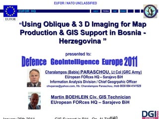
- 1. EUFOR / NATO UNCLASSIFIED VIZVIZ PRINTPRINTTERATERAEUFOR HQEUFOR HQ GEOGEO Charalampos (Babis) PARASCHOU, Lt Col (GRC Army) EUropean FORces HQ – Sarajevo BiH Information Analysis Division / Chief Geogrpahic Officer chvparas@yahoo.com, f/b: Charalampos Paraschou, mob 0030 694 4141929 ““Using Oblique & 3 D ImagingUsing Oblique & 3 D Imaging ffor Mapor Map Production & GIS SupportProduction & GIS Support iin Bosnian Bosnia -- HerzegovinaHerzegovina ”” presented to:presented to: Martin BOEHLEIN Civ. GIS Technician EUropean FORces HQ – Sarajevo BiH
- 2. EUFOR / NATO UNCLASSIFIED VIZVIZ PRINTPRINTTERATERAEUFOR HQEUFOR HQ GEOGEO AGENDAAGENDA 1)1) EUFOR HQ – Orientation – MissionEUFOR HQ – Orientation – Mission 2)2) 3D ANAGLYPH MAPS (Red-Blue glasses)3D ANAGLYPH MAPS (Red-Blue glasses) 3)3) 3D PRINTERS – A 3D MAP of BiH3D PRINTERS – A 3D MAP of BiH 4)4) 3D DIGITAL MODELs – A 3D model of BiH in a USB3D DIGITAL MODELs – A 3D model of BiH in a USB stickstick 5)5) Q&AQ&A
- 3. EUFOR / NATO UNCLASSIFIED VIZVIZ PRINTPRINTTERATERAEUFOR HQEUFOR HQ GEOGEO AGENDAAGENDA 1)1) EUFOR HQ – Orientation – MissionEUFOR HQ – Orientation – Mission 2) 3D ANAGLYPH MAPS (Red-Blue glasses)3D ANAGLYPH MAPS (Red-Blue glasses) 3) 3D PRINTERS – A 3D MAP of BiH3D PRINTERS – A 3D MAP of BiH 4)4) 3D DIGITAL MODELs – A 3D model of BiH in a USB3D DIGITAL MODELs – A 3D model of BiH in a USB stickstick 5)5) Q&AQ&A
- 4. EUFOR / NATO UNCLASSIFIED VIZVIZ PRINTPRINTTERATERAEUFOR HQEUFOR HQ GEOGEO MissionMission accomplished…accomplished… 1992 2010
- 5. EUFOR / NATO UNCLASSIFIED VIZVIZ PRINTPRINTTERATERAEUFOR HQEUFOR HQ GEOGEO Bosnia Herzegovina War March 1992 - November 1995Bosnia Herzegovina War March 1992 - November 1995 June 1992 - December 1995 UNPROFORJune 1992 - December 1995 UNPROFOR (United Nation Protection Force)(United Nation Protection Force) Geospatial support required:Geospatial support required: low scale maps and digital datalow scale maps and digital data low resolution imagerieslow resolution imageries local maps (if available)local maps (if available) compound mapscompound maps troops supporttroops support
- 6. EUFOR / NATO UNCLASSIFIED VIZVIZ PRINTPRINTTERATERAEUFOR HQEUFOR HQ GEOGEO Dayton Peace Agreement 21 November 1995Dayton Peace Agreement 21 November 1995 December 1995 - December 1996 IFORDecember 1995 - December 1996 IFOR (Implementation Force)(Implementation Force) Geospatial support required:Geospatial support required: medium scale maps and digital datamedium scale maps and digital data medium resolution imageriesmedium resolution imageries troops deploymenttroops deployment situation overviewsituation overview geodetic benchmarksgeodetic benchmarks
- 7. EUFOR / NATO UNCLASSIFIED VIZVIZ PRINTPRINTTERATERAEUFOR HQEUFOR HQ GEOGEO First Democratic elections in BiH September 1996First Democratic elections in BiH September 1996 December 1996 - December 2004 SFORDecember 1996 - December 2004 SFOR (Stabilization Forces)(Stabilization Forces) December 2004 - Current EUFORDecember 2004 - Current EUFOR (European Union Forces)(European Union Forces) Geospatial support required:Geospatial support required: high scale maps and digital datahigh scale maps and digital data high resolution imagerieshigh resolution imageries intel activitiesintel activities data acquisition (new features)data acquisition (new features) new mapsnew maps The next step for EUFOR is the transformation fromThe next step for EUFOR is the transformation from a Peacekeeping mission to a Training mission.a Peacekeeping mission to a Training mission. (helping BiH to become a member of EU and NATO)(helping BiH to become a member of EU and NATO)
- 8. EUFOR / NATO UNCLASSIFIED VIZVIZ PRINTPRINTTERATERAEUFOR HQEUFOR HQ GEOGEO AGENDAAGENDA 1) EUFOR HQ – Orientation – MissionEUFOR HQ – Orientation – Mission 2)2) 3D ANAGLYPH MAPS (Red-Blue glasses)3D ANAGLYPH MAPS (Red-Blue glasses) 3) 3D PRINTERS – A 3D MAP of BiH3D PRINTERS – A 3D MAP of BiH 4)4) 3D DIGITAL MODELs – A 3D model of BiH in a USB3D DIGITAL MODELs – A 3D model of BiH in a USB stickstick 5)5) Q&AQ&A
- 9. EUFOR / NATO UNCLASSIFIED VIZVIZ PRINTPRINTTERATERAEUFOR HQEUFOR HQ GEOGEO © ERDAS, Inc. A Hexagon Company. All Rights Reserved What is Stereo Viewing?What is Stereo Viewing? Imagine a “Real World” scene...Imagine a “Real World” scene...
- 10. EUFOR / NATO UNCLASSIFIED VIZVIZ PRINTPRINTTERATERAEUFOR HQEUFOR HQ GEOGEO © ERDAS, Inc. A Hexagon Company. All Rights Reserved What is Stereo Viewing?What is Stereo Viewing? How would a camera “see” thisHow would a camera “see” this scene?scene? 1 perspective center1 perspective center No depth perceptionNo depth perception 2D image2D image
- 11. EUFOR / NATO UNCLASSIFIED VIZVIZ PRINTPRINTTERATERAEUFOR HQEUFOR HQ GEOGEO © ERDAS, Inc. A Hexagon Company. All Rights Reserved What is Stereo Viewing?What is Stereo Viewing? How would a human “see” thisHow would a human “see” this scene?scene? 2 perspective centers2 perspective centers Human brain resolves two imagesHuman brain resolves two images into a 3D imageinto a 3D image Depth perceptionDepth perception Left Eye Right Eye
- 12. EUFOR / NATO UNCLASSIFIED VIZVIZ PRINTPRINTTERATERAEUFOR HQEUFOR HQ GEOGEO © ERDAS, Inc. A Hexagon Company. All Rights Reserved Viewing stereo pairsViewing stereo pairs Same concepts apply whenSame concepts apply when viewing a pair of images orviewing a pair of images or photographs in stereophotographs in stereo Stereo OverlapStereo Overlap In this case we provide the twoIn this case we provide the two images for our two eyesimages for our two eyes Brain “tricked” into seeing inBrain “tricked” into seeing in stereostereo
- 13. EUFOR / NATO UNCLASSIFIED VIZVIZ PRINTPRINTTERATERAEUFOR HQEUFOR HQ GEOGEO © ERDAS, Inc. A Hexagon Company. All Rights Reserved Viewing stereo pairsViewing stereo pairs The Terrain Editor allows us to place our eyes atThe Terrain Editor allows us to place our eyes at the location where the images were exposedthe location where the images were exposed Flight Line
- 14. EUFOR / NATO UNCLASSIFIED VIZVIZ PRINTPRINTTERATERAEUFOR HQEUFOR HQ GEOGEO © ERDAS, Inc. A Hexagon Company. All Rights Reserved Eye and Photo Base DistancesEye and Photo Base Distances Eye Base:Eye Base:
- 15. EUFOR / NATO UNCLASSIFIED VIZVIZ PRINTPRINTTERATERAEUFOR HQEUFOR HQ GEOGEO © ERDAS, Inc. A Hexagon Company. All Rights Reserved Eye and Photo Base DistancesEye and Photo Base Distances Eye Base:Eye Base: Distance between interpreter’s eyes
- 16. EUFOR / NATO UNCLASSIFIED VIZVIZ PRINTPRINTTERATERAEUFOR HQEUFOR HQ GEOGEO © ERDAS, Inc. A Hexagon Company. All Rights Reserved Distance between exposure stations Eye and Photo Base DistancesEye and Photo Base Distances Photo Base:Photo Base:
- 17. EUFOR / NATO UNCLASSIFIED VIZVIZ PRINTPRINTTERATERAEUFOR HQEUFOR HQ GEOGEO © ERDAS, Inc. A Hexagon Company. All Rights Reserved X-ParallaxX-Parallax ““The apparent displacement of an object caused byThe apparent displacement of an object caused by the shift in the position of observation”the shift in the position of observation” A B
- 18. EUFOR / NATO UNCLASSIFIED VIZVIZ PRINTPRINTTERATERAEUFOR HQEUFOR HQ GEOGEO © ERDAS, Inc. A Hexagon Company. All Rights Reserved X-ParallaxX-Parallax A B Change in position of rooftop termed stereoscopic parallax 1. Parallax of a point is directly related to its elevation 2. Parallax is greater for high points than low points
- 19. EUFOR / NATO UNCLASSIFIED VIZVIZ PRINTPRINTTERATERAEUFOR HQEUFOR HQ GEOGEO © ERDAS, Inc. A Hexagon Company. All Rights Reserved X-ParallaxX-Parallax Variation in parallax, caused by elevation, providesVariation in parallax, caused by elevation, provides the basis for determining elevation of points fromthe basis for determining elevation of points from photographic measurementphotographic measurement Change in position of rooftop termed stereoscopic parallax 1. Parallax of a point is directly related to its elevation 2. Parallax is greater for high points than low points
- 20. EUFOR / NATO UNCLASSIFIED VIZVIZ PRINTPRINTTERATERAEUFOR HQEUFOR HQ GEOGEO Summary of 3D viewing:Summary of 3D viewing: Viewing 3D map (red-blue glasses):) Software (Erdas Imagine in our case) Using a DEM which accuracy is direct related with the map scale Computes the parallax for every map pixel Creates a new digital map file where the red-blue layers moved from pix to pix according to the parallax
- 21. EUFOR / NATO UNCLASSIFIED VIZVIZ PRINTPRINTTERATERAEUFOR HQEUFOR HQ GEOGEO THE 3D MAPS’ PrintersTHE 3D MAPS’ Printers Traditional Uses of 3D GIS modelsTraditional Uses of 3D GIS models EducationEducation Situational AnalysisSituational Analysis DisplayDisplay CommunicationCommunication ProcessProcess Hand made, CNC, MoldedHand made, CNC, Molded Expensive (thousands of dollars)Expensive (thousands of dollars) Slow (many days, even weeks)Slow (many days, even weeks)
- 22. EUFOR / NATO UNCLASSIFIED VIZVIZ PRINTPRINTTERATERAEUFOR HQEUFOR HQ GEOGEO AGENDAAGENDA 1) EUFOR HQ – Orientation – MissionEUFOR HQ – Orientation – Mission 2) 3D ANAGLYPH MAPS (Red-Blue glasses)3D ANAGLYPH MAPS (Red-Blue glasses) 3)3) 3D PRINTERS – A 3D MAP of BiH3D PRINTERS – A 3D MAP of BiH 4)4) 3D DIGITAL MODELs – A 3D model of BiH in a USB3D DIGITAL MODELs – A 3D model of BiH in a USB stickstick 5)5) Q&AQ&A
- 23. EUFOR / NATO UNCLASSIFIED VIZVIZ PRINTPRINTTERATERAEUFOR HQEUFOR HQ GEOGEO THE 3D MAPS’ PrintersTHE 3D MAPS’ Printers Output Device for 3D SoftwareOutput Device for 3D Software
- 24. EUFOR / NATO UNCLASSIFIED VIZVIZ PRINTPRINTTERATERAEUFOR HQEUFOR HQ GEOGEO THE 3D MAPS’ Printers – future planningTHE 3D MAPS’ Printers – future planning Three-Dimensional Printing technology (3DP) originally developedThree-Dimensional Printing technology (3DP) originally developed at the Massachusetts Institute of Technology (MIT) in 1993.at the Massachusetts Institute of Technology (MIT) in 1993. 3DP technology creates 3D physical prototypes by solidifying layers3DP technology creates 3D physical prototypes by solidifying layers of deposited powder using a liquid binder.of deposited powder using a liquid binder. By definition 3DP is an extremely versatile and rapid processBy definition 3DP is an extremely versatile and rapid process accommodating geometry of varying complexity in hundreds ofaccommodating geometry of varying complexity in hundreds of different applications, and supporting many types of materials.different applications, and supporting many types of materials. 3D Printing for GIS3D Printing for GIS
- 25. EUFOR / NATO UNCLASSIFIED VIZVIZ PRINTPRINTTERATERAEUFOR HQEUFOR HQ GEOGEO Our choice - Z CorporationOur choice - Z Corporation AdvantagesAdvantages Probably the World’s Fastest 3D PrinterProbably the World’s Fastest 3D Printer Unrivaled speed delivers parts in hours versus daysUnrivaled speed delivers parts in hours versus days Only reasonable option for large GIS modelsOnly reasonable option for large GIS models Best Value in ClassBest Value in Class Most inexpensive partsMost inexpensive parts Most affordable systemMost affordable system Great PartsGreat Parts High definition parts for great detail and accuracyHigh definition parts for great detail and accuracy ColorColor Only technology that prints in full colorOnly technology that prints in full color Essential for printing realistic GIS modelsEssential for printing realistic GIS models Sample CustomersSample Customers US Army - US Army Corp of Engineers - University of Michigan etcUS Army - US Army Corp of Engineers - University of Michigan etc THE 3D MAPS’ Printers – future planningTHE 3D MAPS’ Printers – future planning
- 26. EUFOR / NATO UNCLASSIFIED VIZVIZ PRINTPRINTTERATERAEUFOR HQEUFOR HQ GEOGEO THE 3D MAPS’ Printers – future planningTHE 3D MAPS’ Printers – future planning 3D Printing-How it Works <1/4>3D Printing-How it Works <1/4> Spread a layer of powder Print a slice of the part Spread another layer of powder Parts are printed with no supports to remove
- 27. EUFOR / NATO UNCLASSIFIED VIZVIZ PRINTPRINTTERATERAEUFOR HQEUFOR HQ GEOGEO THE 3D MAPS’ Printers – future planningTHE 3D MAPS’ Printers – future planning 3D Printing-How it Works <2/4>3D Printing-How it Works <2/4> Z Corp. 3D printers use standard inkjet printing technology to createZ Corp. 3D printers use standard inkjet printing technology to create parts layer-by-layer by depositing a liquid binder onto thin layers ofparts layer-by-layer by depositing a liquid binder onto thin layers of powder.powder. Instead of feeding paper under the print heads like a 2D printer, a 3DInstead of feeding paper under the print heads like a 2D printer, a 3D printer moves the print heads over a bed of powder upon which itprinter moves the print heads over a bed of powder upon which it prints the cross-sectional data sent from the software.prints the cross-sectional data sent from the software. The Z Corp. system requires powder to be distributed accurately andThe Z Corp. system requires powder to be distributed accurately and evenly across the build platform.evenly across the build platform. 3D Printers accomplish this task by using a feed piston and platform,3D Printers accomplish this task by using a feed piston and platform, which rises incrementally for each layer.which rises incrementally for each layer. A roller mechanism spreads powder fed from the feed piston ontoA roller mechanism spreads powder fed from the feed piston onto the build platform.the build platform. The excess powder falls down an overflow chute, into a container forThe excess powder falls down an overflow chute, into a container for reuse in the next build.reuse in the next build. Spread a layer of powder
- 28. EUFOR / NATO UNCLASSIFIED VIZVIZ PRINTPRINTTERATERAEUFOR HQEUFOR HQ GEOGEO THE 3D MAPS’ Printers – future planningTHE 3D MAPS’ Printers – future planning 3D Printing-How it Works <3/4>3D Printing-How it Works <3/4> Once the layer of powder is spread, the inkjet print heads print theOnce the layer of powder is spread, the inkjet print heads print the cross-sectional area for the first, or bottom slice of the part onto thecross-sectional area for the first, or bottom slice of the part onto the smooth layer of powder, binding the powder together.smooth layer of powder, binding the powder together. A piston then lowers the build platform 0.1016mm (0.004”), and aA piston then lowers the build platform 0.1016mm (0.004”), and a new layer of powder is spread on top.new layer of powder is spread on top. The print heads apply the data for the next cross section onto theThe print heads apply the data for the next cross section onto the new layer, which binds itself to the previous layer.new layer, which binds itself to the previous layer. ZPrint repeats this process for all of the layers of the part.ZPrint repeats this process for all of the layers of the part. The 3D printing process creates an exact physical model of theThe 3D printing process creates an exact physical model of the geometry represented by 3D data.geometry represented by 3D data. Process time depends on the height of the part or parts being built.Process time depends on the height of the part or parts being built. Typically, these 3D printers build at a vertical rate of 25mm – 50mmTypically, these 3D printers build at a vertical rate of 25mm – 50mm (1” – 2”) per hour.(1” – 2”) per hour. Print cross sectionPrint cross section
- 29. EUFOR / NATO UNCLASSIFIED VIZVIZ PRINTPRINTTERATERAEUFOR HQEUFOR HQ GEOGEO THE 3D MAPS’ Printers – future planningTHE 3D MAPS’ Printers – future planning 3D Printing-How it Works <4/4>3D Printing-How it Works <4/4> When the 3D printing process completes, loose powder surroundsWhen the 3D printing process completes, loose powder surrounds and supports the part in the build chamber.and supports the part in the build chamber. Users can remove the part from the build chamber after theUsers can remove the part from the build chamber after the materials have had time to set, and return unprinted, loose powdermaterials have had time to set, and return unprinted, loose powder back to the feed platform for reuse.back to the feed platform for reuse. Users then use forced air to blow the excess powder off the printedUsers then use forced air to blow the excess powder off the printed part, a short process which takes less than 10 minutes.part, a short process which takes less than 10 minutes. Z Corp. technology does not require the use of solid or attachedZ Corp. technology does not require the use of solid or attached supports during the printing process, and all unused material issupports during the printing process, and all unused material is reusable.reusable. Print a layer of powderPrint a layer of powder
- 30. EUFOR / NATO UNCLASSIFIED VIZVIZ PRINTPRINTTERATERAEUFOR HQEUFOR HQ GEOGEO Our choice - Spectrum Z™510Our choice - Spectrum Z™510 High Definition High Fidelity Full Color Large Build Volume THE 3D MAPS’ Printers – future planningTHE 3D MAPS’ Printers – future planning
- 31. EUFOR / NATO UNCLASSIFIED VIZVIZ PRINTPRINTTERATERAEUFOR HQEUFOR HQ GEOGEO High DefinitionHigh Definition High resolution 600 X 540 DPI printing Great detail and accuracy 4 pt font! THE 3D MAPS’ Printers – future planningTHE 3D MAPS’ Printers – future planning High Color FidelityHigh Color Fidelity Full 24-bit color Large Build EnvelopeLarge Build Envelope 10”x 14”x 8” (250 x 350 x 200 mm)10”x 14”x 8” (250 x 350 x 200 mm)
- 32. EUFOR / NATO UNCLASSIFIED VIZVIZ PRINTPRINTTERATERAEUFOR HQEUFOR HQ GEOGEO Sample Applications (1/5)Sample Applications (1/5) Operations/Response Planning Communication and Review Cartographic Displays Advanced 3D Visualization THE 3D MAPS’ Printers – future planningTHE 3D MAPS’ Printers – future planning
- 33. EUFOR / NATO UNCLASSIFIED VIZVIZ PRINTPRINTTERATERAEUFOR HQEUFOR HQ GEOGEO Operations/Response Planning (2/5)Operations/Response Planning (2/5) Deploy 3D Terrain and Urban models to field units andDeploy 3D Terrain and Urban models to field units and operation centersoperation centers Replace the ‘Sand Table’ with models printed withthe ‘Sand Table’ with models printed with real-time geospatial intelligencereal-time geospatial intelligence Line of sightLine of sight Plume analysisPlume analysis Least cost pathLeast cost path THE 3D MAPS’ Printers – future planningTHE 3D MAPS’ Printers – future planning
- 34. EUFOR / NATO UNCLASSIFIED VIZVIZ PRINTPRINTTERATERAEUFOR HQEUFOR HQ GEOGEO Communication and Review (3/5)Communication and Review (3/5) Communication models for client/public review process Full color models add communication power and customer impact Easy to understand complex information THE 3D MAPS’ Printers – future planningTHE 3D MAPS’ Printers – future planning
- 35. EUFOR / NATO UNCLASSIFIED VIZVIZ PRINTPRINTTERATERAEUFOR HQEUFOR HQ GEOGEO Cartographic Display (4/5)Cartographic Display (4/5) Topography and terrain from GIS data Hydrography City Models Cartographer/Analyst map production Educational/Museum Displays THE 3D MAPS’ Printers – future planningTHE 3D MAPS’ Printers – future planning
- 36. EUFOR / NATO UNCLASSIFIED VIZVIZ PRINTPRINTTERATERAEUFOR HQEUFOR HQ GEOGEO Advanced 3D Visualization (5/5)Advanced 3D Visualization (5/5) Full Color 3D output enables:Full Color 3D output enables: Geologic researchGeologic research Site study and evaluationSite study and evaluation Subsurface visualizationSubsurface visualization Watershed AnalysisWatershed Analysis Viewshed determinationsViewshed determinations THE 3D MAPS’ Printers – future planningTHE 3D MAPS’ Printers – future planning
- 37. EUFOR / NATO UNCLASSIFIED VIZVIZ PRINTPRINTTERATERAEUFOR HQEUFOR HQ GEOGEO Printing GIS data in 3DPrinting GIS data in 3D Chose the level of detail and area you want to model Determine the size and scale of the model How will the model be displayed? Export a VRML/PLY file for 3D printing from GIS software DEM (digital elevation model) Color Image Orthorectified, registered to the DEM. Satellite, Aerial, Annotation, Chloropleth Print 3D model of VRML file on 3D Printer using simple Z Corp software THE 3D MAPS’ Printers – future planningTHE 3D MAPS’ Printers – future planning
- 38. EUFOR / NATO UNCLASSIFIED VIZVIZ PRINTPRINTTERATERAEUFOR HQEUFOR HQ GEOGEO Summary of AdvantagesSummary of Advantages Rapidly produce sophisticated cartography at very low cost Hours instead of days/weeks Tens or hundreds of dollars instead of thousands Full-color models Fundamentally change the way you use GIS data to communicate Raise exposure & visibility of GIS data Communicate clearly with clients, co-workers or public Perform analysis on critical elements with quick, inexpensive, easily reproducible models THE 3D MAPS’ Printers – future planningTHE 3D MAPS’ Printers – future planning
- 39. EUFOR / NATO UNCLASSIFIED VIZVIZ PRINTPRINTTERATERAEUFOR HQEUFOR HQ GEOGEO AGENDAAGENDA 1) EUFOR HQ – Orientation – MissionEUFOR HQ – Orientation – Mission 2) 3D ANAGLYPH MAPS (Red-Blue glasses)3D ANAGLYPH MAPS (Red-Blue glasses) 3) 3D PRINTERS – A 3D MAP of BiH3D PRINTERS – A 3D MAP of BiH 4)4) 3D DIGITAL MODELs – A 3D model of BiH in a USB3D DIGITAL MODELs – A 3D model of BiH in a USB stick (3slides-1hide)stick (3slides-1hide) 5)5) Q&AQ&A
- 40. EUFOR / NATO UNCLASSIFIED VIZVIZ PRINTPRINTTERATERAEUFOR HQEUFOR HQ GEOGEO AGENDAAGENDA 1) EUFOR HQ – Orientation – MissionEUFOR HQ – Orientation – Mission 2) 3D ANAGLYPH MAPS (Red-Blue glasses)3D ANAGLYPH MAPS (Red-Blue glasses) 3) 3D PRINTERS – A 3D MAP of BiH3D PRINTERS – A 3D MAP of BiH 4)4) 3D DIGITAL MODELs – A 3D model of BiH in a USB3D DIGITAL MODELs – A 3D model of BiH in a USB stickstick 5)5) Q&AQ&A (maybe)(maybe) Thank you for your attention, I am pending your questions..??Thank you for your attention, I am pending your questions..??
Editor's Notes
- Ladies and gentlemen, I’m Lieutenant Colonel of the Greek Army, PARASHOU is my surname, Haralampos is my name and it means “hara” plus “lampos” in greek: you are shining from joy ness. My family and friends call me Babis and I think it is easier for you also. I serve in NATO Deployable Corps in Greece and you can see on the screen my contact details via e-mail, facebook, office phone or cell phone. Next slide pls
- This is the agenda of my presentation. First, a small introduction about NDC-GR HQ; Then I will present you the need for printing maps into the field that traditional offset printing technique is not adequate. In the end a few words about our next planned step – printing 3D maps into the field. PS: hide slides there iot describe in full detail some complicated methods and of course to give a reason to buy the cd with presentation Next slide pls
- This is the agenda of my presentation. First, a small introduction about NDC-GR HQ; Then I will present you the need for printing maps into the field that traditional offset printing technique is not adequate. In the end a few words about our next planned step – printing 3D maps into the field. PS: hide slides there iot describe in full detail some complicated methods and of course to give a reason to buy the cd with presentation Next slide pls
- NATO in this case can say
- This is the agenda of my presentation. First, a small introduction about NDC-GR HQ; Then I will present you the need for printing maps into the field that traditional offset printing technique is not adequate. In the end a few words about our next planned step – printing 3D maps into the field. PS: hide slides there iot describe in full detail some complicated methods and of course to give a reason to buy the cd with presentation Next slide pls
- This is the agenda of my presentation. First, a small introduction about NDC-GR HQ; Then I will present you the need for printing maps into the field that traditional offset printing technique is not adequate. In the end a few words about our next planned step – printing 3D maps into the field. PS: hide slides there iot describe in full detail some complicated methods and of course to give a reason to buy the cd with presentation Next slide pls
- Here we can see the output device, the printer and the final result.
- Also, after a market research a greek company PV Engineers.. After a market research in Greece, the Company PV.. fullfilled the criteria we put and the Z™ -series p rinters is, in our opinion, the most appropriate machine…
- For the reasons that I am showing you in the next slide we chose this printer
- An example of
- The principal uses for 3D printed architecture models are design study, customer communication and creation of elements for presentation models. Pictured here is a model of a large sports stadium bowl developed by a leading architecture firm in the US Next pls
- In early design exploration, many architects will use the printer to study a particular design element, rather than the complete finished design. In this case, the bowl of the stadium and the points of entry to the stadium are critical design elements. Next pls
- The parts have impact with customers. Often these parts are used to get customer buy-in on key design elements. Full color parts also add an extra dimension in communication, and can be integrated with other elements to make a presentation model. The model pictured below is a proposed concept for an apartment group in Italy. Next pls
- These models can be used with the traditional model making process to add value, including: Accurate terrain maps to form the base of a model Realistic secondary buildings in a cityscape. [Today the secondary buildings are often represented in simple block form only.] Any element that can be produced quickly and then finished by the model maker to the desired level. This allows the model maker to focus on higher value added tasks. Next pls
- Z Corporation has pioneered the use of full color printing for GIS [Geographic Information Systems] data. These accurate, repeatable 3D terrain models can be used for a variety of research and planning functions. Next pls
- We chose the level of detail and area we want to model, then we determine the size and scale of the model But how will the model be displayed? First exporting a VRML/PLY file for 3D printing from GIS software which includes: DEM (digital elevation model) Color Image Orthorectified, registered to the DEM. Satellite, Aerial, Annotation, Chloropleth We print 3D model of VRML file on 3D Printer using simple Z Corp software
- Using quick, inexpensive models makes it possible to use 3D models frequently in customer communication and get better feedback These models can quickly create base geometry that can be further enhanced by a skilled model maker and used as a final presentation model The models are true to the digital data and reproducible. If a series of iterations are considered, each iteration is correct and not subject to differences in model making technique. Next pls
- This is the agenda of my presentation. First, a small introduction about NDC-GR HQ; Then I will present you the need for printing maps into the field that traditional offset printing technique is not adequate. In the end a few words about our next planned step – printing 3D maps into the field. PS: hide slides there iot describe in full detail some complicated methods and of course to give a reason to buy the cd with presentation Next slide pls
- This is the agenda of my presentation. First, a small introduction about NDC-GR HQ; Then I will present you the need for printing maps into the field that traditional offset printing technique is not adequate. In the end a few words about our next planned step – printing 3D maps into the field. PS: hide slides there iot describe in full detail some complicated methods and of course to give a reason to buy the cd with presentation Next slide pls