

Recomendados
Mais conteúdo relacionado
Destaque
Destaque (19)
Último
Último (20)
4th+yr+portfolio
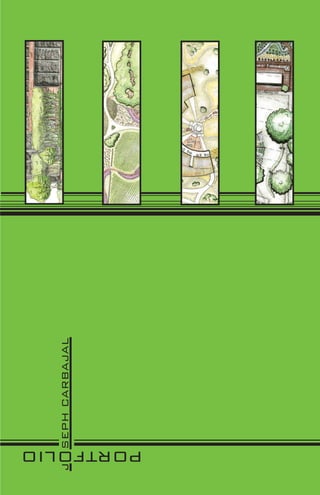
- 1. J SEPH CARBAJAL PORTFOLIO
- 3. “Design it well, because tomorrow you may be the one cutting the grass on it .” Eric Broussard, Landscape Architect
- 4. Joseph Carbajal Resume 1655 Harrodsburg Rd. Lawrenceburg, KY 40342 (859) 684-9678 jhcarb2@gmail.com Education Anderson County High School, lawrenceburg, KY 2006 University of Kentucky, Lexington, KY Landscape Architecture, College of Agriculture current Work Experience Carbajal’s landscapeing and Nursury, Lawrenceburg, KY Seasonal foreman 2005-2010 Century Bank, Lawrenceburg, KY teller 2006-2007 Big Ass Fans, Lexington, KY Control Panel Programmer + Tester 2008-present Walt Disney Company, Walt Disney World Resort, Lake buena Vista, FL Internship: Disney College Program, Merchandise Fall 2007 Seasonal Cast Member, Merchandise 2008-present Awards + Recognition Dean’s List, University of Kentucky 2006-2007 The National Endowment for the Arts, YOUR TOWN, The Citizens Institute on Rural Design, Harrodsburg, KY Student Assistant 2011 SKills + Leadership Proficient in: Adobe Creative Suite Proficient in Autocad + Google Sketchup Bi-lingual: fluent in spanish and english Trainer on production line for Big Ass Fans References Carey Smith Ned Crankshaw Dr. Martha Greenwood CEO, Big Ass Fans LA Department Chair Pediatric Hematologist/ Lexington, KY University of Kentucky Oncologist Lexington, KY Lexington, KY csmith@bigassfans.com ned.crankshaw@uky.edy (859) 323-5481
- 6. COLDSTREAM MONTESSORI SCHOOL LEXINGTON, KY future apartment bldgs high point high point v views bad Montess ri Montessori School sori Layout Layout u ut noise n :s Gym/cafeteria/library I-75: noise + bad restrooms e uitabl classrooms building s not citation blvd: sound + bad views outdoor classroom storage/maintenance offices opp rtunities/constraints/ opportunities/constraints/ evation elevation bluegrass-maury silt loam MONTESSORI O Very Close Close somewhat close Maury sil t loam not close does not matter hu n mcafee s loa tingt ilty m on ty sil loam cl a y e sil t m cafe am lo SCHO cl ay proximity matrix 1 soils
- 7. coldstream montessori school This design meets the requirements of the builder and client while addressing the environmental problems due to the human altered landscape. The building helps eliminate stormwater run-off. To soccer enhance a more sustainable design the field building uses natural sunlight and wind direction. The surro . The su ro e surrounding lan ng landscape is ndsca ape left as little altered as possible t tt redd po including preserving riparian zones and gp ria an swales. Available outdoor natural swa sw va ai eo laboratories and cla rie and classrooms are e es n oooms are ar available to students and teachers. preserved meadowland cor to cit t to citation blv blvd n entrance to underground cor parking under school n trail system + buffer for meadow preserved rv preserved swale cane run creek + playground riparian zone connection to coldstream research park
- 8. HOWARDS LANDING WINERY + BISTRO CLARK COUNTY, KY located on a bluff overlooking the kentucky river valley this site has provided a great location for the design of the howards landing winery + bistro. Inventory and analysis were very impor- tant for this design since the vines can only grow on certain slopes and in certain soils as well as needing a steady flow of wind to dry the leaves. The inventory and analysis provided below shows how the site was designed to suit these needs as well as those of the business owner. invento inventory analysis V Vine building Suitability HOW RDS HOW RDS HOWARDSS soil map located in blue and located c bl the colored zones t olored yellow zones are yellow l represent prime land for soils in purple, red, and easy slopes that could vines with yellow being yellow were most suitable be used for buildings AND N ANDIN for growing grapes since they proivded the most nutrients best suited, blue good, and red bad slope percent recreational views + opportunity base map levatio elevation o on >840’ 760’-840’ W WINER WINER blue zones: 0-3% locations within the blue arrows are gooo yellow zones: 3-5% purple margins are best views with forest red zones: 5+% suited for recreation with obstructing view on east <760’ a heightened focus on red side of property and road on west. 3
- 9. PLAN production HOWARDS CREEK WINERY facility Howards Creek Winery + Bistro is a bluegrass charm where the ancient art of preserved wine-making meets the majestic bluffs overlooking the Kentucky River historic valley. With walking paths as well as an amphitheater. The rock wall winery can be enjoyed by all. Schematic Drawings boo ne vineyards eyar ya ar sbo r owners oug h living quarters HOWARDS roa d vineyards LWinery entrance from main road forest walk Concept Drawings council welcome center center en ring + bistr bistro t outdoor WINE NE E amphitheater welcome center + bistro section
- 10. S.H. Firm mill street South Hill, Lexington, KY South hill is an historic district in the heart of the city of lexington with a blighted surface parking lot that is underutilized. S.H. Firm is looking to change the face of the site and help create a positive infill project for the historic district. This design utilizes This northern side of the building is viewed when driving state of the art energy conservation along maxwell street at the mill street intersection. as techniques and maximizes the use of the site. you can see lots of natural light is allowed with ground plane plan Natural elements located on the ground windows as well as a large use of natural softscape plane as well as the rooftop elements gardens provide an oasis for employees and clients of the firm. clients will experience first hand the opportunities that can be had with work done by S.H. Firm and its associates. maxwell street this is the southern end of the building opposite of the prior view of the northside. here we see what will be viewed on lawrence street looking north at the solar panel topped corner tower. 5 lawrence street
- 11. roof garden plan WESTERN ROOF GARDEN THE WESTERN ROOF GARDEN IS USED AS A BREAK AREA FOR EMPLOYEES. THIS GARDEN IS PRIVATE AND ONLY ACCESSIBLE BY EM- PLOYEES THROUGH THE ROOFTOP CONFERENCE ROOM. West EAST SECTION LOOKING WEST LOOK NG east maxwe maxwe maxwell street IR BIOSWALE OSW RAINGARDEN DECK MAXWELL ST. EASTERN ROOF GARDEN THE EASTERN ROOF GARDEN IS USED AS A SHOWCASE ROOF GARDEN THAT IS OPEN TO THE PUBLIC AND ACTS AS AN ESCAPE FOR EMPLOYEES OF THE DESIGN FIRM. RAISED WOODPLANCK DECK ACTS AS THE WALKWAYS.
- 12. live green kentucky university of kentucky, lexington, KY context map designed as a collaborative between the university of kentucky college of engineering and now Wall er Aven being utilized as a living working laboratory for the college of agriculture the UK solar house, ue known as sky.blue, is located next to the site of the cooper house on nicholasville road. as a Cop pe UK r Dri ve living learning laboratory the solar hosue site will be a dwelling for two researchers who are r hopoing to promote sustainable living in the city limits. the house i ng itself is a zero energy house Fore so the landscape around it will be as well. elements include permaeble hardscape and edible ha s t Park Road gardens for cooking and food. elevated burms reduce rainwater runoff into the streets and vated in also imitate the rolling hills of the bluegrass. a raingarden and bioswale elminiate any excess Road water from running off site and creating further flooding problems. native plants are used in a Site sville live way that is sustainable and very appealing to the senses. Nich ola Far m Ro ad UK inventory + Analysis green 8 0 10 20 30 40 50 kentucky 0 10 20 30 40 50 0 10 20 30 40 50 8 11 7
- 13. earth berms for seating and plan stormwater control pul 1 l in rev ers 2 e pa rkin g SE OP OU ER CO H walking path through welcome council ring 2 bioswale + edible 4 raingarden garden plot perspectives HO 3 back deck of solar house SOLAR H USE gr bus drop-off 4 STONE D 1 A FENCE RO 3 M NIC R HO 4 FA LAS VIL LE eRO AD earth burms walking path past berms
- 14. Louisville’s Urban Research Park Louisville Urban Research Park (LURP) The Louisville Urban Research Park is a redeveloped industrial superfund site that is geared to attract high end research companies. Along with Blackleaf Superfund Site, Louisville, KY participating with the University of Louisville departments of research, the research park will be a usable and inspiring district of modern buildings. a fomer industrial site now a superfund site. the blackleaf site in the Park Hill neighborhood The open buildings will be incorporated into the Park Hill Corridor that is slated for redevelopment over the course of the next years with the help in Louisville, KY has stood vacant for many years and new redevelopment has been suited for of the Louisville-Metro Government. It will be part of the Louisville-Lexington Economic development plan that is looking to bring more industrial jobs the following design greenspaces and a space forfor the blighted site intended to bring life back to it. to the Bluegrass. Along with new is the altrnative small commercial business along Wilson Avenue, this new district seeks attract further growth and development to the area.further growth in this the possibilities for development are broad and diverse. Louisville’s the community and enhance With over 60 acres of site available area of louisville. Urban Research Park looks to the future while working with the past to bring Louisville and the University of Louisville to the limelight of todays economy. Concept Plan 0 L 00 100 200 3 300 300 4 400 400 Wilson Av nue Ave e Scale 1”=100’ Parking Lot Parking Lot Parking Lot Parking Lot Parking Garage ayw iH High Dixie 2/20/2012 Main Building Parking Garage r Parking Garage Dr. Ryan Hargrove Preliminary Perspectives Preliminary Perspect Perspectives Preliminary Perspectives Perspecti e ar p k LA 842 Research Boulevardlookingeast at the the intersection of Dixie Highway. research blvd. looking east at intersection of Dixie Highway. Street trees one of the many squares that dot the dot the park to encourage outdoor activity One of the many squares that research research park to encourage looking south at the main building over the great lawn. the m 9 building south at the meeting spaces and great lawn. The Main Building pro- Looking provides Main Building over the other common spaces for line the raod creating a buffroad creating a buffer for the pedestrians Street trees line the er from the pedestrians along with parallel parking outdoorcreating gathering spaces to furthergathering spaces tobetween as well as activity as well as creating incorporate socializing further availablewith parallel parking availablethe underground and above ground along for those who do not wish to park in for those who do not wish incorporate socializing is view is looking North West towards Dixie This researchers and collegues. Th between researchers and collegues. all companies and and other common spaces for all the researchbusiness vides meeting spaces businesses that are using companies and park to park in the view is looking northwest towards dixie highway. whenare usingis not available in their buildings. that space the research park when space is not available in their buildings. Joey Carbajal parking garages underground and above ground parking garages. Highway.
- 15. The current design for the Urban Research Park calls for a more integrated design concept with a complete remediation of the LURP site to eliminate the possibility of further contamination.. Existing axis’ that flow directly into the site are kept through the site as well as the elimination of the diagonal pedestrian corridors that disected the site. The pedestrian corridors are Plan replaced with green corridors lines with plant material and trees that create a haven for the employees of the site as well as patrons to the commercial sector. Along Wilson Avenue is commercial that will be convenient for the neighborhood residents. The shotgun houses opposite of the smaller commercial buildings along Wilson Avenue with later be sought for development as professional offices while keeping the historic architectural integrity of the houses. Industrial building types are placed closer to the neighboring industrial districts and the adjacent railroad. These buildings are applicable for use by many diverse companies that seek to find a prime site near the University of Louisville as well as within clear sight of the everchanging downtown of Louisville. Wilson Ave nue ridor y way Covered Covered Community Park ridor hwa Parking Parking Louisvil ou ille il lle Looking southwest towards the Main Building and Green Cor ridor plaza from neighboring Wilson Avenue. The community hig park can be enjoyed by those of the Park Hill and Round-a- Covered Green Cor ridor Discovery D bout Parking California neighborhoods and will be maintained by rive Round-a- funds generated by research partnering companies. xie Main Plaza bout Covered et Green Cor Parking di Green Cor Covered overed v d g Parking ark Cove d Covered vered din B uil Disco Parking Park n Pa king on very D mm rive Co 15th Stre Covered r a Parking One of the four green corridors for pedestrians with plaza spaces located at the southern end of the corridors. Since the research park is dense with structures these green corridors act as an escape sttructures esc escap invironment from the streets and the busy working invironmen from inviro inside the research buildings. in nside research p esearch park a Wilson Avenue is transformed into a walkable pleasant environment with street trees put in place as well as the conversion of the shotgun houses into future offices for professionals. Wilson Avenue also hosts small commercial retail for the surrounding community including a grocery store.
- 16. Gosselin Residence This sustainable design incorporates a contemporary design for a modern home. Living green roofs and permeable pavers in walkways reduces the affect of run-off as well as absorbing energy from the sun. Two social areas are created keeping in mind the downward sloping front yard of the house. Lining the walkway with trees and creating turns makes the experience one that is more interesting and intimate for the owners and visitors walking to the main entrance to the house. Greenroof allows for this modernhouse to reduce its carbon footprint. The entire roof will reduce water run-off to a minimum. 5 12 Front of house is vegetated to help reduce the cost of heating and cooling since 2 the front of the house is in 12 facing south and gets direct sunlight most days out of the year. Stairs are installed for access to front lawn and acts as a location a s to site and look over landscape. o r Two social areas are placed in front of house al ho for outdoor eating and enjoying the lands ou door landscape. Two different levels are available for use different e use. 1 12 es 4 12 e 3 12 A pedestrian bridge allows for easy access over creek. 11
- 17. details Perspectives Aluminum light post at 4 inches 1 Pedestrian Bridge thick Flagstone rock 12 covers retaining Rigid conduit as walls for planters recommended by 10” manufacturer slope Light pole anchored 2” Slate pavers on Plant Bed to seat wall by four bridge 10x450mm (3/8”x18”) G.S. Anchor Bolts with nuts and washer 18” of concrete Flagstone used to base for cover concrete walls 4” concrete for base outdoor at a thickness of 2” reinforced as required lighting extending from concrete 1/2 1/2” Expansion joint 2 Walkway Lighting Posts 12 3 e Walking Path Staircase 12 6” riser with slate pavers In this perspective we see the front entrance walkway as it meanders through s 12”Slate pavers for f st steps planters that are located on t ters the front side of the house. Flagstone is used as an slope alternative for the walls on the planters. Native plants are aesthetically pleasing alterna 1/2” Expansion joint /2” used making them more drought resistant in this type of environment. (Google Sketchup) Go Gos Gos Gosselin 4” Concrete base Prepared aggregate Planting Bed Flagstone covered retaining wall with concrete base concret Flagstone paver pieces (2” thick) thic 8 8” Concrete w/ rebar as required ncrete Concrete footing reinforced Flagstone pavers (2”) paver as required Spacing filled w/ topsoil acing R s Reside (2”) ) (4”) Aggregate Base (2”) Spacing filled with topsoil (2”) Flag stone pavers (4”) Aggregate Base Prepared Subgrade In this bird’s eye view of the proposed Gossman residence we see the overall plan and its depth. Different levels on the site and the meandering of the walkway paths Prepared subgrade create an enticing environment that is pleasant and plays off of the modern design of the house. Earthy tones and materials enhance the feeling of nature surrouding the 4 Planter Retaining Wall 5 Walking Path Pavers house. 12 12 (Google Sketchup)
- 18. photoshop Illustrator before after satellite aerial street grid system Grading + Drainage autocad 13
- 22. LAJABRAC HPES J OILOFTROP