

Recomendados
Mais conteúdo relacionado
Mais procurados
Mais procurados (20)
Destaque
Destaque (20)
Semelhante a Automatic vehicle location
Semelhante a Automatic vehicle location (20)
Mais de Seminar Links
Mais de Seminar Links (20)
Automatic vehicle location
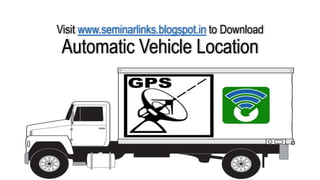
- 1. Visit www.seminarlinks.blogspot.in to Download Automatic Vehicle Location
- 2. Introduction • Automatic vehicle location (AVL) is a means for determining the geographic location of a vehicle and transmitting this information to a point where it can be stored and used with certain software and database applications. • Automatic Vehicle Location (AVL) Systems provide real-time vehicle tracking by integrating GPS, wireless communications, and GIS mapping software. • AVL systems utilize wireless communications technologies to send GPS, mobile data and other vehicle status information to your dispatch where you can view your fleet’s location on GIS-based AVL software.
- 3. GPS and GIS • The Global Positioning System (GPS) is a space-based satellite navigation system that provides location and time information in all weather conditions, anywhere on or near the Earth where there is an unobstructed line of sight to four or more GPS satellites. • A geographic information system (GIS) is a system designed to capture, store, manipulate, analyze, manage, and present all types of geographical data
- 4. Vehicle Tracking & Mobile Data Systems • Most commonly, the location is determined using GPS, and the transmission mechanism is SMS, GPRS, a satellite or terrestrial radio from the vehicle to a radio receiver. • GSM and EVDO are the most common services applied, because of the low data rate needed for AVL, and the low cost and omnipresent nature of these public networks.
- 5. How AVL Works • The vehicle tracking device fitted in the vehicle receives the information from a minimum of 3 GPS satellites and uses triangulation to calculate it's exact location - latitude, longitude and movement. • It also fetches vehicle information such as ignition status, vehicle moving or parked among other information and prepares all these into a data packet to be sent.
- 6. • The Tracking device then sends this data over the GPRS network of the GSM service provider to their Internet gateway and further over the Internet to the Application Server. • The Application Server monitors the vehicles with tracking system communicating constantly with each device independently, sending commands, receiving regular data and alerts, and storing all of this on the server.
- 7. • The Web Application is user-friendly interface that can be accessed on any PC using an Internet browser. • The web application shows you real-time vehicle tracking, re-plays of past vehicle movements, the account and the vehicle information, and a score of reports and alert systems. • When a PC or the Internet is not close by, one can use the Mobile Application to get all of this information on their mobile phones.
- 9. GIS Map
- 10. Sensor-augmented AVL • The main purpose of using AVL is not only to locate the vehicles, but also to obtain information about engine data, fuel consumption, driver data and sensor data from i.e. doors, freezer room on trucks or air pressure. • Such data can be obtained via the CAN-bus and via direct connections to AVL systems that both sends and receives data via SMS or GPRS in pure ASCII text format. • CAN bus (for controller area network) is a vehicle bus standard designed to allow microcontrollers and devices to communicate with each other within a vehicle without a host computer.
- 11. Active & Passive Tracking • Several types of vehicle tracking devices exist. Typically they are classified as "passive" and "active“. • "Passive" devices store GPS location, speed, heading and sometimes a trigger event such as key on/off, door open/closed. • Once the vehicle returns to a predetermined point, the device is removed and the data downloaded to a computer for evaluation.
- 12. • "Active" devices also collect the same information but usually transmit the data in near-real-time via cellular or satellite networks to a computer or data center for evaluation. • Many modern vehicle tracking devices combine both active and passive tracking abilities. • When a cellular network is available and a tracking device is connected it transmits data to a server; when a network is not available the device stores data in internal memory and will transmit stored data to the server later when the network becomes available again.
- 13. Other options For determining actual location in environments where GPS illumination is poor, the alternate options are • Dead reckoning • Active RFID systems
- 14. Dead reckoning It is the process of calculating one's current position by using a previously determined position, or fix, and advancing that position based upon known or estimated speeds over elapsed time and course. The navigator plots his 9am position, indicated by the triangle, and, using his course and speed, estimates his position at 9:30am and 10am
- 15. Active RFID systems Radio-frequency identification (RFID) is the wireless non-contact use of radio-frequency electromagnetic fields to transfer data, for the purposes of automatically identifying and tracking tags attached to objects.
- 16. Common uses • In Urban Transit forMonitoring schedule adherence of buses in service Triggering changes of buses destination sign displays at the end of the line (or other set location along a bus route). Triggering pre-recorded announcements for passengers. • Vehicle Tracking — Designed for customers requiring vehicle movement and usage in their control. • Asset Tracking — Track and monitor mobile assets such as cargo containers, trailers, earth moving equipment, construction equipment, etc. • Personal Tracking — Real-time tracking and protection for children, the elderly or even your pets! • Workforce Tracking — Improve staff productivity and customer service through realtime tracking of your sales-force, field workers, delivery workers, etc. • Stolen vehicle recovery • Distance Calculation
- 17. Benefits of this System • Improve utilization of the fleet • Increase employee productivity • Enhance customer service • Capitalize on accurate fleet data • Increase safety & driver responsibility • Detect side jobs • Stop unauthorized vehicle use • Prevent fraudulent claims • Eliminate paper logs • Reduce risk of asset theft / abandonment
- 19. Conclusion • The AVL system combines a positioning hardware, a communication platform that can be used to monitor and track a commuter transport in real time. • This enables the transport management centers to observe, collect, and analyze location information about a commuter vehicle in real time. • This data will give an agency the ability to make better and more informed decisions while also providing quicker response to emergencies. • The benefits to the passengers mean better on time performance and less waiting time at bus stops.
- 20. Thank You