
Recomendados
Recomendados
Mais conteúdo relacionado
Semelhante a Final land-mapping-guide by Anyona Simon Gichuru - 2015
Semelhante a Final land-mapping-guide by Anyona Simon Gichuru - 2015 (20)
Mais de anyonasimon
Mais de anyonasimon (13)
Último
Último (20)
Final land-mapping-guide by Anyona Simon Gichuru - 2015
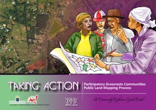
- 1. 1A Community Reference Guide Book Community-led Participatory Public Land Mapping Process Participatory Grassroots Communities Public Land Mapping Process This project is funded by the the Embassy of Sweden and ACT! A Community Reference Guide Book
- 2. Community-led Participatory Public Land Mapping Process Taking Action Participatory Grassroots Communities Public Land Mapping Process A Community Reference Guide Book © GROOTS Kenya First published in September 2013 in the Republic of Kenya ISBN: 978-9966-1755-0-2 This publication has been produced by GROOTS Kenya with the assistance of the Embassy of Sweden and ACT! The contents of this publication are the sole responsibility of GROOTS Kenya and can in no way be taken to reflect the views of the partners/donors. Rights and permissions This publication may be produced or translated in any form or by any means including photocopying or electronic provided that GROOTS Kenya is acknowledged. No permission is required in order to use, translate, reproduce or transmit any part of this publication. Under no circumstance is this publication to be sold or used commercially.
- 3. 2 A Community Reference Guide Book Community-led Participatory Public Land Mapping Process Table of Contents Abbreviations................................................................................. 3 Glossary of Terms........................................................................... 4 Foreword........................................................................................ 5 Acknowledgements........................................................................ 7 Executive Summary........................................................................ 8 1.0 INTRODUCTION AND BACKGROUND.........................10 1.1 Private and Public Land - The National Context.................... 10 1.2 Background of the Community Reference Guidebook.......... 12 1.2.1 Objectives of the guidebook....................................... 12 1.2.2 Who can use this guide? ........................................... 12 1.3 Background of GROOTS Kenya.............................................. 13 1.4 Involvement of GROOTS Kenya with Land (Private and Public)............................................................... 13 1.4.1 GROOTS Kenya’s involvement with private land......... 13 1.4.2 GROOTS Kenya’s involvement with public land........... 14 2.0 GRASSROOTS COMMUNITIES PARTICIPATORY PUBLIC LAND MAPPING PROCESS.....................................18 2.1 Why public land mapping?.................................................... 18 2.2 Overview of the process....................................................... 19 2.3 Actual Mapping Process........................................................ 21 3.0 MAPPING PROCESS OUTCOMES..................................31 3.1 Enhanced capacities of grassroots women and communities.................................................................. 31 3.2 Public land inventory and map.............................................. 32 3.2.1 Sample public lands inventory .................................. 33 3.2.2 Sample public lands GIS map..................................... 34 3.3 Surrender of public lands ..................................................... 35
- 4. 3A Community Reference Guide Book Community-led Participatory Public Land Mapping ProcessParticipatory Grassroots Communities Public Land Mapping Process Abbreviations ACC Assistant County Commissioner CBO Community Based Organization CDF Constituency Development Fund DCC Deputy County Commissioner CODIT Community and Organizational Development Institute GROOTS Grassroots Organizations Operating Together in Sisterhood GIS Geographical Information Systems GPS Global Positioning System KENVO Kijabe Environment volunteers NGC National Government Co-ordinators NLP National Land Policy NGOs Non-governmental Organizations RC Regional Co-ordinator SPSS Statistical Package for Social Sciences WDG Watch Dog Groups UN United Nations
- 5. 4 A Community Reference Guide Book Community-led Participatory Public Land Mapping Process Glossary of Terms Term/Phrase: Description: Categories of land in Kenya (NLP, 2009) Public land All land that is not private land or community land, set aside for public good and which is declared to be public by an Act of Parliament and the constitution Private land All land lawfully held,managedand usedbyanindividual orotherentityunderstatutory tenure. Private land is derived from the former Government Lands Act (Cap 280); Community land All land lawfully held, managed and used by a given community as defined by the constitution Deputy County Commissioner Representatives of the National Government at the Sub County level (formerly District Commissioners)1 ; Assistant County Commissioner Representatives of the National Government at the Sub-County level (formerly District Officers)2 Chiefs and Assistant Chiefs Representatives of the National Government at the location and sub-location level. Water point A specific point along a river or water body that has since been declared public to facilitate access to the water body for grazing or other domestic purposes. Road reserve The distance between the edges of a road to the nearest development e.g. temporary or permanent structure. It differs depending on the classification of the road: - Class A= (At least 9m on each side) - Class B= (At least 6m on each side) - Access road = (at least 3m on each side) Riparian strip The strip of land extending from 6 meters upto 30 meters on either side of a river which separates the river from other activities. This area is also considered public land. Dumpsite This refers to an area earmarked for refuse disposal. 1. As provided for in the National Government Coordination Act 2013 2. As provided for in the National Government Coordination Act 2013
- 6. 5A Community Reference Guide Book Community-led Participatory Public Land Mapping Process Foreword ‘’Inafewdecades,therelationshipbetweentheenvironment, resources and conflict may seem almost as obvious as the connection we see today between human rights, democracy and peace’’, Prof. Wangari Muta Maathai (1940 – 2011) T he preamble to the Constitution of Kenya, honours those ‘who historically struggled to bring freedom and justice to our land’ and respects the ‘environment, which is our heritage not only for the present but also for the benefit of future generations’. That is why land and people are the fundamental foundations of any nation or state anywhere in the world. That is why the Constitution of Kenya speaks of the Republic of Kenya in Article 5 as ‘the territory and territorial waters comprising Kenya’ and in Article 1 that ‘all sovereign power belongs to the people of Kenya’. These two elements are critical and interdependent. Private, community and public land in Kenya have been a bone of contention for many years. This is because land has been the subject of corruption, conflict, illegal acquisition and grabbing for private or political gains and interests. Hence, the people of Kenya must at all times “respect, uphold and defend the Constitution’ which under Article 3 (1) provides the critical mechanism and protection for land ownership, use, acquisition and transfer be it public, community and private land under Chapter 5. Womenandchildrenhavebornethebiggestbruntduring inheritance disputes and the land clashes in Kenya, and therefore have the biggest stake in ensuring that proper land identification, documentation and management system is critical to promoting life and livelihoods in the country’s development agenda. The inclusion of Chapter 5 on Land and Environment in the Constitution of Kenya coupled with the ‘principles of land policy’, the new Land Act No 2 of 2012, Land Registration Act No. 6 of 2012 and the establishment of the National Land Commission Act No. 5 of 2012 confirms the importance of land.
- 7. 6 A Community Reference Guide Book Community-led Participatory Public Land Mapping Process This reference and guide book therefore provides a radical shift from previous efforts in land protection through whistle blowing, demonstrations, petitions, litigation or agitation to practical, deliberate and scientific development of a Public Lands Inventory and Mapping. This process is grassroots-led, community-led and women-led through deliberate partnership with various stakeholders, including state and non- state agencies to identify, inquire, document and digitally map out public land in their respect wards, constituencies and counties. The process builds understanding, skills, ownership and public participation in a very sensitive, emotive and historically elusive issue – LAND! The common heritage we all have is public land. It is everyone’s responsibility to protect and defend under Article 62 of the Constitution. The proper management of public land is critical to any community and society to ensure sustainable development, access to public services, facilities and infrastructure. The development of Ward and County Public Lands Inventories and Maps will transform grassroots communities, accelerate development and hold public officers and institutions in those particular areas accountable. This Community Reference Guide Book therefore, provides the first steps towards community transformation in the management of public land in Kenya. On behalf of the entire GROOTS Kenya Movement, we appreciate the leadership of the people of Lari Constituency, Kiambu County for leading the way towards this important journey in the transformation of our country, Kenya. This is our contribution. As the late Prof. Wangari Maathai stated, ‘’It’s the little things citizens do. That’s what will make the difference. My little thing is planting trees”. What is your little thing? God bless you all. Jedidah Wakonyo Waruhiu Board Chair, GROOTS Kenya
- 8. 7A Community Reference Guide Book Community-led Participatory Public Land Mapping Process Acknowledgements The Reference Guide Book on participatory development of public land inventory that is led by grassroots people is informed by a two-year project implemented in Lari Constituency,KiambuCountybyGROOTSKenya. GROOTS Kenya is indebted to all those that participated in the project as well as in writing this guide. We appreciate the invaluable input by the government and community leaders from Kiambu County, in particular Bernard Kinyua (Deputy County Commissioner Lari Sub-County), Joseph K. Gatungu (Chief, Magina Location), Teresia Muthoni Kimani, John Chege Kinyanjui, Joan Wangechi Kinyanjui, Rose Wairimu Njenga and all the grassroots community women leaders. Their courage, leadership and determination has reinforced the understanding and drive to protect public land among the people of Lari Constituency. GROOTS Kenya is also extremely grateful to the technical team that contributed to the development and revision ofthisguidebook,amongthemAnyonaS.Gichuru(CODIT Institute), GROOTS Kenya staff and Board members in particular Titus Kuria Mbugua (staff in charge of day- to-day project activities) and the land expert team who participated in reviewing the model and the content. Special thanks also go out to our sister organization Kijabe Environment Volunteers (KENVO) especially Nelly Wangari and David Kuria (Executive Director) for the unwavering support throughout the process. Thanks to Peter Wambu for design and insightful input to this process. And to all who participated in one way or the other during the entire process, we say thank you and may God bless you abundantly. GROOTS Kenya greatly appreciates the Embassy of Sweden in Kenya and Act Change and Transform (ACT!) for providing the financial support for the process. Esther Mwaura-Muiru Founder and National Co-ordinator , GROOTS Kenya
- 9. 8 A Community Reference Guide Book Community-led Participatory Public Land Mapping Process Executive Summary This reference and guidebook is designed to support grassroots communities through women’s leadership towardsinitiating,supportingandexecutingparticipatory public land identification and mapping processes. The reference guidebook is based on a generic model developed by GROOTS Kenya and effectively tested in Lari Constituency, Kiambu County in the Republic of Kenya between 2011 and 2012. Objectives of the guidebook This guidebook aims to: 1. Sensitize community members on the significance of public land and their role in safeguarding all public land in their community; 2. Inform grassroots community members on the process of identifying, mapping and storing information relating to public land; 3. Showcase the structure, content and outputs of a participatory grassroots community-led public land mapping process; and, 4. Support possible replication of this community led land mapping model. Who can use this guide? This guidebook was developed for use by communities who appreciate the importance of taking a lead role in identifying, documenting and safeguarding public land within their area. As a result, the guide embraces a multi- stakeholder approach, which includes among others non-governmental organizations (NGOs), administration officials (National and County Government), men, youth as well as private sector actors.
- 10. Community-led Participatory Public Land Mapping Process Women are empowered and effective leaders, and agents of change in community development work
- 11. 10 A Community Reference Guide Book Community-led Participatory Public Land Mapping Process 1.0 INTRODUCTION AND BACKGROUND 1.1 Private and Public Land - The National Context Land, both public and private is an emotive issue in Kenya. Private land is the principal source of livelihoods, mate- rial wealth and is of great social, economic and cultural significance for the majority of Kenyan’s. On the other hand, public land is the basis on which communities collectively access adequate and quality basic and essential services such as education, health, recreation and administration. Over the years, the management of public land has been faced with a myriad of malpractices which include among others, corruption, illegal acquisition (grabbing) and irregular allocations. These malpractices were fueled by the fact that the country has not had a consolidated and comprehensive database of public lands since independence. This has led to low levels of knowledge of such land on the part of most community members. This in many ways facilitated irregular transactions by corrupt County authority officials (mostly former Councillors) in the former Municipal and County Council offices with the assistance of Ministry of Land officials. Public land Public Schools Health centres Recreation Parks Administrative offices
- 12. 11A Community Reference Guide Book Community-led Participatory Public Land Mapping Process Section 60 of the National Land Policy acknowledges the lack of a comprehensive inventory of public land: “There is currently no system for registering public institutional land. To safeguard such land, a practice emerged under whichtheywereregisteredinthenameofthePermanent Secretary in the Ministry of Finance.” Another Illegal occurrence was by community members who encroached on public land that they perceived to Grabbing of public land by private developers. Such land benefits the whole community for development of public facilities that enable the community to access basic and quality public services and facilities To address this, the policy in Section 61(b) provided for the participatory development of a Public Lands Inventory which should be deposited with the National Land Commission for posterity. be un-utilised sometimes eventually settling on it. Some of the public land parcels are still intact but most of them have been adversely affected by the aforementioned issues. This has resulted in the reduction of available public land thus putting a strain on the space
- 13. 12 A Community Reference Guide Book Community-led Participatory Public Land Mapping Process 1.2 Background of the Community Reference Guidebook This reference and guidebook is designed to support grassroots communities through women’s leadership towards initiating, supporting and executing participatory public land identification and mapping processes. The guidebook is based on a generic model developed by GROOTS Kenya and effectively tested in Lari Constituency, Kiambu County in the Republic of Kenya between 2011 and 2012. 1.2.1 Objectives of the guidebook This guidebook aims to: 1. Sensitize community members on the significance of public land and their role in safeguarding all public land in their community; 2. Inform grassroots community members on the process of identifying, mapping and storing information relating to public land; 3. Showcase the structure, content and outputs of a participatory grassroots community led public land mapping process; and, 4. Support possible replication of this community led land mapping model. 1.2.2 Who can use this guide? This guidebook was developed for use by women in grassroots communities who appreciate the importance of taking a lead role in identifying, documenting and safeguarding public land within their community. As a result,theguideembracesamulti-stakeholderapproach, which includes among others non-governmental organizations (NGOs), administration officials (National and County Government), men, youth as well as private sector actors.
- 14. 13A Community Reference Guide Book Community-led Participatory Public Land Mapping Process 1.3 Background of GROOTS Kenya GROOTS Kenya is an association of organized community-based groups that are led by women. Our theory of change is to shift grassroots women perceived role of vulnerable, victim and passive participants in development to empowered and effective leaders and agents of change in community development work. Founded in 1995 after the fourth UN Conference on Women in Beijing, China, GROOTS Kenya began as a response to the lack of visibility of grassroots women in development processes and decision-making forums that affect them and their communities. Today, it is a force of over 2,000 community-based organizations and self-help groups with the shared vision of ensuring that grassroots women are at the forefront of community change. The efforts of GROOTS Kenya have resulted in the recognition of many grassroots women as change agents at the local, national, regional and international levels winning the confidence of various partners and key stakeholders. The organization has remained committed to the bottom-up and human rights based approach to development. GROOTS Kenya works closely with communities and the administrative authorities to directly influence development processes at the county, national, regional and international levels. 1.4 Involvement of GROOTS Kenya in Land (Private and Public) 1.4.1 GROOTS Kenya’s involvement with private land Since 2004, GROOTS Kenya has been working with grassroots women in various communities to enhance their capacities in curbing asset stripping and disinheritance with specific emphasis on matrimonial property. GROOTS has been organizing communities to reverse this long standing injustice to widows and orphans. For most low income households, matrimonial land is not only the main source of livelihood but it also
- 15. 14 A Community Reference Guide Book Community-led Participatory Public Land Mapping Process provides the invaluable sense of security and identity. Yet, some retrogressive social and cultural practices such as asset stripping and disinheritance often deny them access to and use of matrimonial land thus subjecting them to abject poverty and destitution after the death of their husbands in the hands of male relatives. GROOTS Kenya’s interventions have achieved great suc- cess where some communities established locally con- stituted oversight groups commonly known as Watch Dog Groups (WDGs). WDGs have halted or greatly con- tributed to reducing retrogressive injustices to women such as disinheritance, asset stripping and other forms of domestic violence. These efforts were successful due to the involvement of men and local leadership in the respective communities in safeguarding, protecting and facilitating the restoration of the essential matrimonial assets to the disadvantaged people who are largely grassroots women and orphans. 1.4.2 GROOTS Kenya’s involvement with public land Through her extensive involvement in the formulation of the National Land Policy, GROOTS Kenya realized a precarious connection between public land and the social, economic and integral wellbeing of the rural grassroots women. In this, GROOTS Kenya, appreciated that the community in poor households primarily depend on public land to access basic essential services such as education, health, recreation and administration (including security). Absence of or interference with public land, negatively and extensively affect the grassroots communities’ ability to development and to access adequate and quality public services and facilities. However, an even greater realization was the gender implications; the fact that low income, grassroots women suffer disproportionately more compared to men when these basic essential services are not available.
- 16. 15A Community Reference Guide Book Community-led Participatory Public Land Mapping Process For instance, grassroots women walk longer distances to take their children to school or worry excessively over their children’s safety and wellbeing when they cannot access public schools, health and/or other services in their vicinity. Again, women and girls suffer substantially when communities cannot access effective and efficient administrative/security services as they are usually vic- tims of violence. While public land is critically important to all community members, its value and significance to the social, economic and integral wellbeing and devel- Distant health centres Distant schools opment of community members is more pronounced to the grassroots women than other community members in the society. Unfortunately, grassroots women have remained ignorant of and are in most cases not involved in the administration and management of public land. The process was therefore inspired by this realization and the imminent need to support active participation of local community members led by grassroots women on the significance of public land to their livelihoods as
- 17. 16 A Community Reference Guide Book Community-led Participatory Public Land Mapping Process well as to place them at the forefront in safeguarding and in the administration of public land. These efforts are anchored on the Constitution of Kenya, Chapter 4 (The Bill of Rights). Article 19(2) recognizes the importance of protecting and recognising human rights and fundamental freedoms, in order to preserve the dignity of individuals and communities and to promote social justice and the realization of the potential of all human beings. Encroachment of cemetries by private developers Distant administrative offices In addition to this, the National Land Policy Section 60(f) provides for the participatory and accountable mecha- nisms for the allocation, development and disposal of public lands in Kenya. Further, Section 197(n) of the National Land Policy also provides for increased involve- ment of vulnerable groups within communities in deci- sion making over public land and related resources, and to protect their rights from unjust and illegal utilization.
- 18. Community-led Participatory Public Land Mapping Process Grassroots women are positioned to lead the public land mapping process because they spearhead many community initiatives, and are therefore likely to have more commitment in the process
- 19. 18 A Community Reference Guide Book Community-led Participatory Public Land Mapping Process 2.0 GRASSROOTS COMMUNITIES PARTICIPATORY PUBLIC LAND MAPPING PROCESS 2.1 Why public land mapping? Theparticipatoryapproachinidentificationandmapping of public land is a critical exercise for any community as it carries out five important functions: a) It enhances the knowledge and awareness of community members on the location, use, historical transitions of the available public land in their locality; b) It helps to document useful details of the public land for current and future reference ; c) The mapping process product is an inventory of all public land which is stored in various formats to safeguard the institutional memory for future generations; d) It is a stepping stone to reclaiming illegally or irregularlyacquiredpubliclandfromtheperpetrators (in some instances the perpetrators voluntarily surrender public land back to the public); and, e) The inventory guides in decision making for developmentprojectsensuringthattheirknowledge of available free land as a fundamental resource, and that other resources are then channelled to the right use reducing duplication and wastage.
- 20. 19A Community Reference Guide Book Community-led Participatory Public Land Mapping Process 2.2 Overview of the process collaboration with men, youth and other stakeholders. Grassroots women are positioned to lead the process because they spearhead many community initiatives, and are therefore likely to have more commitment in the process than other members of society. In addition, although women have more to lose when public land is unavailable, they lag behind in knowledge skills and participation on issues related to land especially public land. This process intends to reverse this. Community members are therefore the primary stakeholders to this process. Strong relations and partnerships are cultivated early with as many stakeholders as possible. The success of this process depends on the goodwill and support provide by all. Further, cordial and harmonious relations with majority of the stakeholders enhance the efficiency and effectiveness of the process. This process is based on a generic model developed by GROOTS Kenya and which was successfully piloted in Lari Constituency in Kiambu County, Republic of Kenya, in 2012. The process is entirely participatory and includes all stakeholders in society. It thrives and leverages on linkages and partnerships established with various stakeholders within a defined location who include among others; a) Grassroots community members (women, men and youth); b) Community-based Organizations (CBOs) c) Non-governmental organizations (NGOs); d) Government institutions (Ministries, National and County Government, Administration, etc); and, e) Private sector actors (researchers and professionals in various fields). Whereas the model is participatory in nature, grassroots womenarepositionedtotakeleadershipbutworkinclose
- 21. 20 A Community Reference Guide Book Community-led Participatory Public Land Mapping Process Mapping preliminaries The mapping preliminaries are considerations that ought to be factored in and addressed before the actual grassroots women-led mapping process starts. These considerations establish a firm foundation for the mapping process to facilitate the process to a successful completion. Considerations Justification 1. Who is the process initiator? < The process can be initiated by two categories of actors; (1), the grassroots community members and (2), an institutional actor. An institutional actor can be an NGO, government agency or other entity whether public or private. < The process initiator is responsible for carrying out step 2. 2. Identifying resources required and possible sources; < The mapping process requires a range of resources that are both financial and non-financial in nature. < Financial resources constitute money to facilitate mobility, hire technical persons, meetings and other costs such as stationery, communication etc. < Non-financial resources include among others human resource skills (people & institutions), partners as well as underlying elements such as goodwill, spirit of volunteerism and support. < The main responsibility of the institutional actor is to support the process and provide mainly the financial resources and expertise required to facilitate the process. The actor in some instances becomes the underlying identity of the process. 3. Defining the scope of the mapping process: < The scope of the mapping process is primarily determined by available resources and should be described in general terms for example Km2 , geographical span, number and nature of units involved (Wards, Constituencies, Sub-Counties, County, etc.). Resource requirements increase as the span of the mapping process expands. < Effective resource allocation ensures that the process does not stall midway due to under-allocation of resources while at the same time reduce waste and redundancy resulting from over-allocation of resources. < Defining the scope is also a critical exercise as it gives an indication of the various actors that ought to be involved and provides guidelines on the perceived roles and responsibilities of each actor.
- 22. 21A Community Reference Guide Book Community-led Participatory Public Land Mapping Process 2.3 Actual Mapping Process Step 1: Identification and rallying of key stakeholders Identifying key stakeholders to support the process, initiating discussions and establishing working relationships is a key entry point to the area targeted for mapping. The critical stakeholders’ at this level would generally include: i) National and County Government representatives (may include among others, the Governor and County Commissioner (if available), Deputy County Commissioner, Assistant County Commissioner, Regional Co-ordinators,Chiefs and Assistant Chiefs); ii) Local Community-based Organizations (CBOs); iii) Government Ministries (Land, Education, Health and others); and iv) Technical personnel (Land and legal experts to facilitate training, GPS mapping experts among others). Involvement of these stakeholders early in the mapping process is invaluable in three ways; (1), it provides a platformtoinformtheadministrationabouttheprevailing task, goals and objectives as well as to get them on board (notasafield-basedstakeholderbutasaleadactorinthe process), (2), it provides a platform to share expectations and discuss the roles and responsibilities of all actors involved; and (3), the stakeholders provide support and credibility to the process once they are on board. Rallying stakeholders
- 23. 22 A Community Reference Guide Book Community-led Participatory Public Land Mapping Process Step 2: Sensitization of community interest groups This involves the general sensitization of representatives of certain (if not all) interest groups within the target area who may include, among others, institutional stakeholders, opinion leaders, village elders, security agencies (national and administrative police) and religious institutions. This is usually carried out in a series of meetings in the target area where the various stakeholders are sensitized on various issues relating to public land, which include; i) Historical and current contexts of public land; ii) Importance of public land to their social, economic and integral wellbeing; iii) Challenges that have riddled public land; iv) The role of the grassroots community members (especially women) in identifying and safeguarding public land; v) Clarifythattheaimofthetaskistocreateawareness, protect and formulate a detailed inventory of public landinthetargetarea(nottorepossess/reclaim)and, vi) Defining the process of identifying, mapping and safeguarding public land among others. In the sensitization meetings, the key stakeholders identified in step 1 ought to play a major role in organization and co-ordination in collaboration with the institutional actor/lead. In addition to being sensitized, participants in these meetings are also tasked with informing the members of the wider community of the impending task well in advance and as such they constitute a critical point of entry and buy in of the various community stakeholders.
- 24. 23A Community Reference Guide Book Community-led Participatory Public Land Mapping Process Step 3: Selection of grassroots community team members The process of identifying, documenting and mapping of public lands in the target area is essentially carried out by the grassroots women with the help of the men and youth. The team works under the facilitative support of a research expert. In selecting the team, the recommended approach is to task the administrative actors mainly the Regional Co-ordinators (RCs) and National Government Co-ordinators (NGCs) to assist in the identification and selection of a team of community members to carry out the exercise. This enhances the ownership and legitimacy of the process. The administrative officers have a lot of information and profiles of community members that may be considered to be part of the lead data collection team. Their involvement adds great value in selecting a well spread and balanced team of community members with emphasis on ensuring that every area target zone is adequately represented. To make the process easier, the lead organization can shareordevelopaselectioncriteria/minimumthreshold that the administration officials can use in recruiting the lead team. Some of the attributes that may be included in the selection criteria/minimum threshold may include among others: i) Have at least basic education (secondary school); ii) Be of high moral standing character in society; iii) Have a passion for community development and welfare; iv) Committed to community work; v) Ready to volunteer; vi) MORE THAN 75% OF THE TEAM SHOULD COMPRISE GRASSROOTS WOMEN. The number of grassroots community members to be involved in the process can be determined following
- 25. 24 A Community Reference Guide Book Community-led Participatory Public Land Mapping Process discussions between the lead organization and the local administration. When the ideal number of grassroots community members to be involved is identified, the administration should focus on recruiting double the number for initial sensitization and training then selecting half of these for the actual data collection exercise. Step 4: Sensitization and training on public land After identification and selection, grassroots community members are taken through sensitization and training on issues revolving around land and public land. The training is general in nature but also covers some technical aspects which may include; i) Provisions of the law on land and public land; ii) Existing institutional frameworks (The Kenyan Constitution, Land Act, Land Registration Act, Local Authorities Act and other relevant Acts of Parliament); iii) Public land mapping process model and research (ethics, professionalism etc.); and iv) GIS mapping (general overview, process, importance and use). In most instances, the training is also used as a short listing platform to select grassroots community members who will be involved in the data collection and mapping phases. It is important to note that only approximately half of the trained grassroots community members will be actively included in the data collection and processing stage.
- 26. 25A Community Reference Guide Book Community-led Participatory Public Land Mapping Process Step 5: Public Lands Identification and Documentation This step involves the core activities; (1) designing of the data collection tools; (2) sampling respondents; (3) assigning data collection team members to the specific target zones to administer the tools and collect data, and (4) compilation, entry, cleaning and processing of the raw data into a draft inventory. Core activity: Details: 1. Design of the data collection tools; This ensures that data is collected within an organized context and within well defined parameters. It is more effective when the technical expert spearheads this process and where grassroots community members are involved in the formulation and design of the data collection tools as this enhances their understanding and familiarity with the tools. The data collection tools would mainly include: < Questionnaires (for key informant interviews); < Checklists /template that adequately capture the required detail i.e.; Nature/type of the public utility; Name/reference (official reference & common/local name); Geographical location (area /physical reference point); Physical size and further classification (where applicable1 ); Official registration reference (Land Reference No (LR. No, Town plot number, GPS reference (co-ordinates); Initial intended purpose, current utilization and status; Details (mostly explaining deviations between the original intended purpose and current utilization); < Already existing maps; < Other important information or comments from the community members. It is important to test the tool with a few sample people to ensure that it is easy to use and is able to capture the required information.
- 27. 26 A Community Reference Guide Book Community-led Participatory Public Land Mapping Process 2. Sampling of respondents Adequate sampling is essential in any objective research /data collection exercise. The sampling should take into consideration all interest groups that may be of assistance to the study as well as have adequate numbers of respondents to bring out balanced findings. The main elements for consideration during sampling include: < Number of respondents based on the size of the local population; < Distribution (age, gender, area of residence); < Opinion leaders and village elders; < Diversity in range of stakeholders including retired officers; < Persons known to have irregularly obtained or are in possession of public lands) among others. 3. Assigning data collection team to specific zones and administering tools The data collection team members should be assigned to their domicile areas or to areas close to them. This is because the reality of this task is such that community members shall contribute the bulk of the information to be processed and they are known to be more open and candid to people who are either known or familiar to them2 . It adds value when the lead expert accompanies the data collection team to the field especially to the initial meetings and those that involve technical persons such as institutions and other key informants into the process. 4. Data compilation and processing In processing the data collected, the lead expert is encouraged to use statistical software such as SPSS, STATA and XLStat among others. From this, the lead expert should formulate a draft inventory to be shared first with the data collection team for cleaning which will then be subjected to validation. 1. For example land parcels can be measure in acreage but roads may only be classified and where possible measures in terms of length/distance. Rivers may not have any other form of reference to indicate size 2. Also noting that land issues are sensitive in most communities
- 28. 27A Community Reference Guide Book Community-led Participatory Public Land Mapping Process Step 6: Validation of Draft Public Lands Inventory Validation involves sharing the draft inventory with various authoritative actors within the target areas. These actors may include among others Ministry of Lands, County Authority Offices, Institute of Surveyors of Kenya and other relevant offices. This process should be conducted by the data collection team under close supervision of the lead expert. Validation essentially comes in handy to: i) Share and compare data collected with the information on existing maps and other registered publications; ii) Put the analysed data in the right context (some of the data may be strange and glaringly peculiar); iii) Identify other public land that may have been left out in the course of data collection; and iv) Present the draft inventory to all community members. The most significant part of the validation process is presenting the draft inventory and findings of the process to a meeting where community members and relevant stakeholders are invited to attend and give their input. The meeting is presided over by the grassroots community members (mostly the women) who were involved in the data collection process. These meetings servethreeprimarypurposes;(1)aforumtodisseminate the information collected; (2) community members get to provide input (often revising information that may be presented wrongly as well as putting things in the right context) and (3) a data collection forum where the grassroots community members share additional information on other public land that may have been left out. Once the wider range of community members and other stakeholders have given their input to the team, the inventory is finalized and produced both digitally and in printed form.
- 29. 28 A Community Reference Guide Book Community-led Participatory Public Land Mapping Process Step 7: GIS Mapping and Storage of the Inventory The output of the final public lands inventory is then used by the grassroots community members in formulating a GIS map of the target area which should display all the public lands identified complete with the GPS co-ordinates and markings. This is done under the supervision of a GIS specialist and the lead research expert. The data collection team may be taken through a refresher course on GIS mapping (having undergone the initial detailed training) to refresh their knowledge and skills and to facilitate the actual mapping. The process of documenting the inventory and formulating a GIS map constitute the first steps towards storing the information on the public land in ways that can be retrieved. Ideally, the outputs, that is, the inventory and GIS maps should be stored in two forms; (i) In physical form (printed for distribution); and, (ii) Uploaded onto a public internet domain for reference and as a means of storage and dissemination Thesetwostepsconstitutethestorageanddissemination functions of the process.
- 30. 29A Community Reference Guide Book Community-led Participatory Public Land Mapping Process Step 8: High level stakeholders forum After mapping and storage, the outputs of this process should be presented to high level and key stakeholders who may include among others, senior national and county government officials, private sector stakeholders and individual and institutional experts in various related fields. The aim of this meeting is to seek expertise input to ensure the community process is of quality and done within the law. This also becomes the opportunity to communicate what has been happening, highlight the challenges experienced and initiate dialogue aimed at influencing the formulation or enforcement of public policy and other related action that may be relevant to the restoration, protection and documentation of public land.
- 31. Community-led Participatory Public Land Mapping Process In addition to the basic and essential skills acquired for those that attend the sensitization meetings and trainings, the community members become more informed and aware of the status of public land in their area.
- 32. 31A Community Reference Guide Book Community-led Participatory Public Land Mapping Process 3.0 MAPPING PROCESS OUTCOMES Asuccessfulmappingprocessbringsforthseveralpositive outcomes for the participating communities which include (1) enhanced capacities of grassroots women and communities; (2) formulation of a comprehensive public land inventory and map; (3) the process prompts voluntary surrender of public lands by individuals; (4) the process promotes public awareness and protection of public land. 3.1 Enhanced capacities of grassroots women and communities The process engages a learning-by-doing approach to building capacities and skills of the communities. This ensures that knowledge and skills are passed to the grassroots community members throughout the entire process. In addition to the basic and essential skills acquired for those that attend the sensitization meeting and trainings, the community members become more informed and aware of the status of public land in their area. With the information contained in the public land inventory and maps, grassroots community members and development actors are better placed to make more informed decision on the channelling of development funds and projects and reclaiming public land. As a result, development projects cost much less and funds that would have otherwise been wasted are channelled to more productive uses e.g. CDF committee allocating funds to purchase land from an individual to establish a water project while there are many public land parcels that remain unoccupied.
- 33. 32 A Community Reference Guide Book Community-led Participatory Public Land Mapping Process 3.2 Public land inventory and map Generally information about public lands is usually with different stakeholders, in different forms and sometimes contradicting information. The participatory processes of data collection, validation and formulation of the public lands inventory ensures that the information obtained is effectively analyzed and crosschecked with the relevant stakeholders before it is entered into the public lands inventory and map. The inventory and maps therefore provide credible, harmonised, comprehensive and authoritative references for the public lands in the target area thereby enhancing transparency and accountability amongst the grassroots communities and other stakeholders. The inventory usually has all public lands and resources classified into at least nine categories which comprise: i) Public learning institutions; ii) Water bodies; iii) Roads and road reserves; iv) Market centres; v) Health facilities; vi) Parking areas; vii) Club areas (recreational facilities); viii) Forests; and ix) Cemeteries. Additional public lands and related resources may be identified in different areas depending on the available resources. The categories list above is therefore not comprehensive and may be expanded where additional resources are identified. In addition, an online inventory is available on www.publicland-kenya.org
- 34. 33A Community Reference Guide Book Community-led Participatory Public Land Mapping Process 3.2.1 Sample public lands inventory Public Land/Facility: Land/Plot Ref. No: Acreage: Original Intended Purpose: Current Utilization: Karenge Primary School T. 3372 0.405 acres Primary school Primary school Kariguini Secondary School T. 3057/ 3058/3059 0.18/ 0.207/ 0.207 acres Secondary school Secondary school Iria-ini Secondary School T. 1750 0.91ha Secondary school Secondary school Karenge water project T. No. 3526 0.25 acres Water plot Construction of a water reservoir/ borehole Ngenya water project T. 3202 0.25 acres Water plot Construction of Ngenya water project. Chief’s office constructed using CDF kitty T.410 0.5 acres Occupied by Nyanduma chiefs office Construction of chiefs office 40 acres initially intended for a tea research centre T.580 40 acres Tea research plot & nursery school Cultivation of tea by individual members, Abandoned nursery school building
- 35. 34 A Community Reference Guide Book Community-led Participatory Public Land Mapping Process 3.2.2 Sample public lands GIS map No. FACILITY NAme ACReAGe CHIEF CAMP 0, nyanduma_chief_office, 0.5 1, gatamaiyu_chiefs_office 2, Kagwe_chief_office rEsErvEd CEMETErY 7, kihara_cattledip, 0.25 8, mbariki_cattle_dip, 1 9, wandemi_cattle_dip, 0.25 10 kamunyuini_cattle_dip 0.25 HEAlTH FACIlITIEs 0, nduriri_dispensary, WATEr POINTs 0, athomi_water_point 1, ahadi_waterpoint 0.25 2, hamithia_waterpoint 0.25 3, karenge_water_point 0.25 4, karenge_water_project 5, muchenga_water_point 0.25 2, 3, 4, 5 6, 7, 0, 1, 2, 3, 4, 5 0, 1, 2, 3, 4, 5, 6, 7, 8, 9, 10 11, 12, 13, 14, 15, 16, 17 18 19, 21, 22, 23 24 25 0, 0, 0, No. FACILITY NAme ACReAGe No. FACILITY NAme ACReAGe No. PuBlIClANdANdOTHErNATurAlrEsOurCEsINNYANduMAWArd-lArICONsTITuENC sCAlE rATIO sCAlE KAMBuru WArd, lArI CONsTITuENCY GITHuNGurI CONsTITuENCY GATuNdu sOuTH CONsTITuENCY disclaimer: GROOT S Kenya and Lari Constituency Community members within the given circumstances and available resources did their best to produce this map. We are NOT liable for any Omission or Commission herein. Gachoire location Nyanduma location Gatamaiyu location T Copyright © GrOOTs KENYA Email: grootsk@grootskenya.org www.publicland-kenya.org Blamwa Media Consultants, http://blamwamedia.kbo.co.ke Created: 15th July 2013 Public land and other natural resources in Nyanduma Ward, Lari Constituency, Kiambu County
- 36. 35A Community Reference Guide Book Community-led Participatory Public Land Mapping Process 3.3 Surrender of public lands An interesting outcome of the process is where grassroots community members occupying public lands irregularly express an interest to voluntarily surrender the public land to the communities. This is also triggered by the fact that the current inhabitants of public land are in most cases not the core architects for the irregular allocation and in most instances grabbing of public lands. Many of them are victims of the lucrative schemes of corrupt Council and Ministry officials. Case study: In Nyanduma ward, a community member who participated in a community feedback meeting found out that one of the roads (Mugumoini - Gakunu road) had been identified as a public easement road. Together with the community members they determined that a family had en- croached on the road and completely blocked community members from accessing a local river. As a result, the community member invited the area Assistant Chief and the grassroots women who were in the lead team during the data vali- dation to discuss a process for the family to sur- render the easement road for public use.
- 37. Community-led Participatory Public Land Mapping Process Design:pewambu@yahoo.com Beverly Court, Marcus Garvey Road Off Argwings Kodhek Road P.O. Box 10320 -00100 Nairobi, Kenya Cellphone 1: +254 - 720898222 Cellphone 2: +254 - 734365566 Email: grootsk@grootskenya.org ISBN: 978-9966-1755-0-2