Where2.0+Gov2.0 - Gov2.0 Summit
•
14 gostaram•6,225 visualizações

This document discusses using location data and geospatial technologies to enable greater transparency, participation, and collaboration between government agencies and citizens. It provides examples of applications that leverage open geographic information, like crisis response systems and tools for monitoring elections. The document argues that open data in open formats without restrictive licensing, combined with user-centric interfaces, can encourage exploration and collaboration. Integrating geospatial data and services with conventional data can significantly improve decision-making across all levels of government.

Recomendados
Recomendados
Mais conteúdo relacionado
Mais procurados
Mais procurados (20)
Destaque
Semelhante a Where2.0+Gov2.0 - Gov2.0 Summit
Semelhante a Where2.0+Gov2.0 - Gov2.0 Summit (20)
Mais de Andrew Turner
Mais de Andrew Turner (20)
Último
Último (20)
Where2.0+Gov2.0 - Gov2.0 Summit
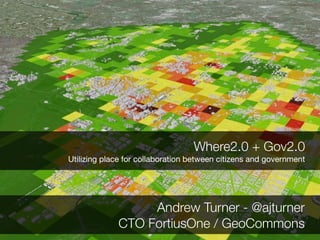
- 1. Where2.0 + Gov2.0 Utilizing place for collaboration between citizens and government Andrew Turner - @ajturner CTO FortiusOne / GeoCommons
- 2. Open Government Initiative http://www.whitehouse.gov/open/
- 3. Transparency Participation Collaboration Open Government Initiative http://www.whitehouse.gov/open/
- 4. Transparency Participation Collaboration ? Open Government Initiative http://www.whitehouse.gov/open/
- 5. People live and interact with Place flickr: qwertyuiop
- 6. Geography is a Common Pivot Point
- 7. 74% Federal Enterprise Business Reference Model Architecture
- 8. 74% of “Services for Citizens” FEA Lines of Business Federal Enterprise Business Reference Model Architecture
- 9. 74% of “Services for Citizens” FEA Lines of Business are primarily Geospatial Federal Enterprise Business Reference Model Architecture
- 10. U.S. Census Navstar GPS TIGER/Line Government is a Platform
- 11. GIS is moving from being only for experts...
- 12. flickr:thomashawk flickr:ayula ...to engaging with stakeholders and citizens
- 13. Agency Agency Agency Transparency
- 14. Agency Agency Agency Transparency
- 15. Agency Agency Agency Citizen Transparency
- 16. Agency Agency Agency Citizen
- 17. Agency Agency Citizen Agency
- 18. Agency Agency Citizen Agency
- 19. Agency Agency Citizen Agency
- 20. Agency Agency Citizen Agency Participation
- 21. Agency Community Agency Citizen Agency Participation
- 22. Agency Community Agency Citizen Agency Participation
- 23. Agency Community Agency Citizen Agency Collaboration
- 24. Agency Community Agency Citizen Agency Collaboration
- 25. Agency Community Agency Citizen Agency Collaboration
- 26. Agency Community Agency Citizen Agency Collaboration
- 28. Ride the City
- 30. Daytime Crime
- 31. Nighttime Crime
- 33. AreYouSafe
- 34. Election Monitoring - TwitterVoteReport http://twittervotereport.com
- 35. Election Monitoring - TwitterVoteReport
- 36. Election Monitoring - Afghanistan 2009
- 37. Crisis Response: San Diego Wildfires
- 38. Crisis Response: San Diego Wildfires
- 39. Crisis Response: San Diego Wildfires
- 40. GeoCommons
- 41. Education Environment Population Health Cross-Agency-Citizen Collaboration
- 42. Education Environment Population Health Cross-Agency-Citizen Collaboration
- 45. Open Data
- 46. Epidemiology
- 50. Where2.0 + Gov2.0 Open Data in Open Formats, free of restrictive licensing
- 51. Where2.0 + Gov2.0 Open Data in Open Formats, free of restrictive licensing User-Centric, Domain- Centric, Easy to use interfaces
- 52. Where2.0 + Gov2.0 Open Data in Open Formats, free of restrictive licensing User-Centric, Domain- Centric, Easy to use interfaces Encourage Exploration and Collaboration
- 53. “The coupling of geospatial data, services and technologies with conventional data, services and technologies can be one of the most significant enablers of improved decision making within business operations. It increases performance of key mission ” requirements across all levels of governments. FGDC FEA Geospatial Profile
- 54. Thank you for Collaborating Andrew Turner e: andrew@fortiusone.com b: http://highearthorbit.com t: @ajturner http://delicious.com/tags/gov2summit