SlideShare uma empresa Scribd logo
1 de 35
Baixar para ler offline
Challenges to Accurate Measurement
   of Greenhouse Gas Emissions


                    Allan C. Eustis
    National Institute of Standards & Technology
              AMS Broadcast Conference
                  Miami Beach, Fla.
                   June 27, 2010
“To measure is to know.”
                                   Lord Kelvin


Metrology & Meteorology

Quantification of Gas Properties

Greenhouse Gas Measurement Research
Activities
Early NIST:
Founded 1901 as the National Bureau of Standards
U.S. Becomes a Signatory to the Treaty of
the Metre 1879
Nascent electrical industry needed
standards
American measuring instruments sent
abroad for calibration
Consumer products and construction
materials uneven in quality and reliability
Eight different “authoritative’ values for the
gallon


                                                   National Archives
Bureau of Standards Established by
Congress in 1901
 • Authority Given to Congress for
   Weights and Measures by the U.S.
   Constitution
Early NIST:Need for Standards
                          1904 Baltimore Fire
U.S. Becomes a Signatory to the Treaty of
the Metre 1879
Nascent electrical industry needed
standards
American measuring instruments sent
abroad for calibration
Consumer products and construction
materials uneven in quality and reliability
Eight different “authoritative’ values for the
gallon
Bureau of Standards Established by
Congress in 1901
 • Authority Given to Congress for
                                                 Enoch Free Library


   Weights and Measures by the U.S.
   Constitution
Early NIST:Need for Standards
       1904 Baltimore Fire
    600 Different Fire Hydrant couplings
    Across the US


                                           Enoch Free Library
NIST Today:
Mission:
To promote U.S. innovation and industrial competitiveness by
  advancing measurement science, standards, and technology in
  ways that enhance economic security and improve our quality of
  life


Major Assets                                 Major Programs
•   ~ 2,900 staff members                    •   NIST Laboratories
•   ~ 2600 associates and facilities users   •   Baldrige National Quality Program
•   ~ 1,600 field staff in partner org.      •   Manufacturing Extension Partnership
•   ~ 400 NIST staff serving on              •   Technology Innovation Program
      1,000 national and international
       standards committees
The NIST Laboratories
Metrology: “Roads and Bridges” of
          Science and Trade
Groundbreaking research tools
that foster progress in new fields
– quantum information,
nanotechnology, bioscience

Better measurement methods to
ensure the quality of products
and satisfy regulatory needs
– Smart Grid

Performance measures to ensure
accurate technology
comparisons


                                      © MOSCHENShutterstock
Standards and reference
materials to ensure fairness and
safety in international trade
NIST GHG & Climate Change
Measurements & Standards Activities
• Climate change is a major issue for the U.S. and the World and
  greenhouse gas emissions a major driver.
• Measurement results of undisputable quality and scientific
  integrity are needed to inform effective mitigation strategies both
  nationally and internationally.
• Determination of greenhouse gas amounts emitted to and removed
  from the atmosphere is needed at improved levels of accuracy.
• Climate change observations require
  improved calibration capabilities
• NIST measurement science research
  seeks to improve measurements
  and standards for greenhouse gas           Ssun
  emissions and offset determination
  using surface and satellite-based
  methods                                         UV & Visible Radiation

                                                    Thermal Radiation
The Quantitative GHG Emissions Monitoring,
Reporting, and Validation Challenge

                            Bottom – Up                                                              Top – Down

                                                                                 Estuaries &
                                                                                Coastal Ocean


                                 Agriculture
                                                            Landfills
     • Electricity Gen.
     • General Industrial
       Energy Generation
                                        Transport Fueling
                                                                 Forests & Woodlands
 Stationary Sources                    Distributed or Area Sources and Sinks                            Regional            International
  0.005 – 0.05 km                                    0.5 – 5 km                                       10 – 100 km            100 – 1000 km


                          Size or Extent (Source or Measurement Approach)
Continuous Emissions          Single Point Measurements           Remote Measurements              Atmospheric Monitoring
 Monitoring Technology                                                                             • Satellite Observations
                              • Optical Reference Data            • Optical Spectral Ref. Data
                                                                                                       • Radiometry
• Gas Concentration.          • Chemical Meas. Standards          • Advanced Measurement Tools &
  Standards                                                         Methodologies                      • Optical Spectral Reference Data
• Stack Gas Velocity                                                                               • Surface-based Networks
  Measurement                                                                                         • Gas Conc. Standards
                                                                                                      • Wind Velocity Standards


                       Measurement Tools, Standards Technologies & Methodologies
Size and Scope of Climate Change Measurements
        Impacts on Monitoring, Reporting, and Verification


                      Bottom – Up                                                   Top – Down

                                                                     Estuaries &
                                                                    Coastal Ocean


                           Agriculture               Landfills


                      +                                                             =
• Electricity Gen.
• Industrial Energy
  Generation
                            Transport Fueling
                                                    Forests & Woodlands                   Regional      International

                                         Distributed or Area Sources
0.005 – 0.05 km                                                                         10 – 100 km   100 – 1,000 km
                                                  0.5 – 5 km


                                                Size or Extent


                      Measurement Tools, Standards, Technologies & Methods
A Primary Technical Measurement Challenge
                  GHG Inventory Determination and Acceptance
                                Internationally
• Quantification of GHG Mass Transfers To & From the Atmosphere
 – Always require:
   • Determination of GHG concentration at a point source or across an area
   • GHG transport rate – Directional
           – Emissions – to the atmosphere
           – Removals – from the atmosphere


            GHG Mass Flowrate = Total Gas Mass Flowrate * GHG Concentration


 Mass Flowrate                                        GHG Concentration
 • Confined flows in stacks                           • Confined flows in stacks
       •   Gas impact velocity and ultrasonic               •   Point sampling
           methods are predominant                          •   NIST for the Acid Rain Program
 • Quantification over geographical                   • Quantification over geographical
   areas                                                areas
   •       Wind field characterization – 3D problem     •       Dispersed, gradients, and variable
   •       Directional and periodic                     •       Dimensions up to several square kilometers
The Earth’s Radiative Balance
& The NIST Climate Program
                                                                            UV & Visible Radiation
                                                                              Thermal Radiation


         Satellite
     Calibrations &
      Standards


                                 SSun

                                        ρEarth
• Lamp Irradiance Standards
• Aperture Area Measurements                                               εAtm; TAtm
• Absolute Detector Standards
                                                 • Infrared & Microwave Standards
                                                 • Greenhouse Gas Measurements
            •   Reflective Aerosols Data             Point and Area Sources
            •   Black Carbon Aerosols Data           Regional reconciliation of inventories
                                                     with atmospheric measurements
            •   Reflectance Standards            •   Gas Concentration Standards
            •   Ocean Color Standards            •   Spectroscopy and Kinetic Data
                                                 •   Temperature Standards
                                                 •   Humidity and Pressure Standards
NIST/NASA Collaboration:
  The Orbiting Carbon Observatory
  Improved CO2 Determination
  in the Atm. Column

CO2 observations from orbit
 at the <0.5% (2 ppm) level
    requires world class
  spectroscopic reference
      data for CO2 and
       the O2 A-band.

  Diatomic oxygen (O2) provides
   atmospheric path lengths in
 remote sensing measurements.


 In the past two years NIST has completed six projects in support of NASA’s
   OCO. This work has produced the lowest uncertainty spectroscopic line
           parameter measurements in the world on the O2 A-band.
NIST Program Components
•   Point Source Metrology                        • Advanced, Field-Deployable Detection
     –   Continuous Emission Mon. Test Bed          Technologies
•   Distributed Source Metrology                      – Frequency Comb IR Sources
     –   Flux Measurement Tools                       – Fieldable Atmospheric Monitoring Tech.
     –   Emission Dispersion Analysis             • Satellite Calibration
     –   Field Reference Site                         – Optical Reflectance and Transmittance
•   GHG Measurements, Standards,                        Standards
    Ref. Data, and Tools                              – Microwave Standards
     –   Gas Concentration Standards                  – Thermal Infrared Standards
     –   Atmospheric Lifetime References              – Scene Generation
     –   Spectroscopic Reference Data             •   Aerosol Measurement Science
     –   Documentary Standards &                      –   Black Carbon Morphology
         Assessment Methodologies                     –   Black Carbon Bulk Properties
•   GHG Inventory & Regional Emissions                –   Black Carbon Optical Properties
    Profile Methodologies                             –   VOC Aerosol Formation Mechanisms
     –   Region Criteria Development
                                               ARRA Research Grants
     –   Stakeholder Identification
                   • Measuring Greenhouse Gas Emissions by Inverse Methods:
     –   Demo. Project Planning and Imple.
                      A Pilot Program - Scripps & LLNL
                   • Development, Improvement, and Assessment of the Accuracy of Aircraft-Based
                     Mass Balance Measurements of the Integrated Urban Emission Fluxes of
                     Greenhouse Gases – Purdue, Univ. Colo., and Penn State Univ.
                   • Multi-wavelength LIDAR System to Characterize Atmospheric Composition &
                     Chemistry – Michigan Aerospace
Gas Concentration Standards
                                Reference Materials
                                • SRM 1720, Global Background Air (2010)
                                        • Certified for CO2, CH4, N2O, CO

                                •CFC SRM (2011)
                                        • To be certified for CFCs, SF6, VOCs


                                Methods
                                • NOAA collaboration on urban tower air sample
                                  collection
                                • Track effectiveness of mitigation efforts of
                                  major metropolitan area

Critical to:                    International Engagement
 • CEMS                         • CCQM Key Comparisons
 • Atmospheric Monitoring and       •    Atmospheric CH4 (2014)
   the Decadal Observation          •    Atmospheric CO2 (2011)

   Series Inherent to Climate
                                    •    Atmospheric CFC/HFC (2011)
                                    •    Atmospheric N2O (2013)
   Studies of the Atmosphere
                                • Biosphere indicator gases
                                    •    Requested by World Metrology Organization, Global Atmospheric
                                         Watch program
                                    •    With national metrology institutes: NPL (UK),
                                         VSL (Netherlands), and KRISS (Korea)
Standards Framework for Climate Observations
  WMO-BIPM Partnership to Facilitate Use of the SI
    Traceability in Climate Observations - 2002


World Meteorological                       International Committee for
Organization (WMO)                        Weights and Measures (CIPM)

“...have agreed to work together to ensure that data related in
particular to measurements of state and composition of atmosphere
and water resources, coming from the programmes organized under
the auspices of the WMO, are properly based on units traceable to
the SI through the procedures of the CIPM MRA and the Technical
Regulations of the WMO.”

                               Treaty of the Metre Organizations
                               •   CIPM – International Committee on Weights and Measures
                               •   BIPM – International Bureau of Weights and Measures
Workshop on Quantification of
       GHG Area Sources and Sinks:
         Summary of Priority Research Targets
Instrumentation and Technology
 – Components for High Performance Remote Sensing Systems
   • Better detector technology for λ≥1100nm; higher quantum efficiency,
     larger active areas, high bandwidths, lower NEP, extension to λ≥ 2500nm
   • Higher power, more spectrally pure, single-frequency diode lasers (DFBs
     or DBRs) to serve as seed sources for pulsed lasers/OPO or as sources
     for open-path sensors
 – Compact, cost-effective DIAL Lidar (greenhouse gases: CO2, CH4, N2O)
   • Better understanding of required application performance (sources/sinks,
     local/regional scales)
   • Targeted Lidar designs (total error budgets, key components)
 – Smaller and Cheaper Measurement Technology
   • Reduction in size, weight, power, cost, complexity of existing
     measurement techniques ( alternative spectroscopic techniques, better
     battery technology, streamlined electronics & data acquisition, ability to
     sample accurately & precisely under ambient conditions)
Workshop on Quantification of
      GHG Area Sources and Sinks:
        Summary of Priority Research Targets
Instrumentation and Technology
 – Spectroscopic Data to Support GHG Flux and Concentration
   Measurements
    • Extremely precise (0.1%) spectroscopic parameters in support of
      OCO satellite retrievals of O2 and CO2 (1.6m and 2.0m) including
      T and P dependence
    • Development of 2µ Lidar sensors, optical sensors to monitor
      isotopic ratios in real time
 – Long-term Dense Network of Continuous Fenceline
   Monitors/Anthropogenic
    • Develop accurate, cost effective fenceline monitors in parallel
 – Long-term Dense Network of GHG Mole Fraction Measurements
   • Accelerate development of low cost, robust, accurate instruments
   • Transport model improvements based on measured wind profiles,
      boundary layer height
Workshop on Quantification of
            GHG Area Sources and Sinks:
               Summary of Priority Research Targets
Modeling
•   GHG Testbed for Model Validation
     –   Capability of models to reproduce a known source; influence of weather on models;
         differences between multiple point sources vs. a true area source and how differences
         affect models; well-controlled GHG source that can simulate a variety of source types; field
         campaigns for model validation
•   Protocols for Emissions Quantification Measurements and Models
     –   Identify possible combinations of measurements and models for quantifying emissions;
         assess and develop protocols for appropriate techniques (sensors and models)
•   Optimal Sampling Strategies for Small Scale GHG Emission Measurements
     –   Explore sensitivity of sampling methods using numerical simulation; identify characteristic
         scales of temporal and spatial variability in actual sources
•   GHG Emission Simulation
     –   Compare IR emissions for simulated measurements with simulators of whole systems;
         characterize whole system error and uncertainty; simulation of complete source (µm
         environment, point sources vs. distributed/area)
           NIST Workshop – June 2 & 3, Scripps Institution of Oceanography
                GREENHOUSE GAS EMISSIONS QUANTIFICATION AND VERIFICATION
                STRATEGIES
           AWMA Symposium – Sept. 8 to 10, Washington, DC
                2nd AWMA Greenhouse Gas Measurement Symposium
NIST Program Summary
Measurements Promote:               Traceability to the SI:
•   Fairness & equity in GHG        •   Allows comparisons to be
    accounting and markets              made independent of time or
•   Efficiency in the generation        locale
    & use of GHGs                   •   Improves measurement
•   Equitable usage of GHG              accuracy
    offsets                         •   Provides confidence in the
•   The quality of greenhouse           accuracy of measurements
    gas inventories that furnish    •   Helps contractors
    the foundation for policy and       understand and meet
    regulatory decisions                agency requirements,
•   Science-based GHG                   protecting contractor and
    mitigation caps.                    customer
•   A basis for reconciliation of   •   Ensures the quality of
    determinations of GHG               climate data records that
    inventories from the top-           furnish the foundation for
    down and the bottom-up              policy and regulatory
                                        decisions
              Economic Valuation of GHGs will
              Drive Greater Accuracy Needs
C & W Music Titles You May
       Have Missed
“The Pint of No Return”
“If Love were Oil, I’d be a Quart Low”
(conversion to metric)
“If Love were Oil, I’d be a Half Liter Low”

“The Bridge Washed Out; I Can’t Swim &
My Baby’s on the Other Side”
GHG Point Source:
           Pulverized Coal Power Plant
                                 Velocities of Fluid
                                Structures in an Elbow
                              • A simple geometry can
                                create a complex velocity
                                vector field – Counter
                                rotating vortices
                              • Velocity field is not ideal
                                for flow measurement
                                applications


Flue Gas
Point Source Metrology
NIST Large Fire Facility: 1:100 scale stack model
    Heat Release              measure flow
Quantification for Many
                            properties & CO2
Materials & Structures
                          concentration in stack
Distributed GHG Emissions Sources and
Sinks (1 – 5 km Geographical Areas)
Optical Remote Sensing Technologies

  cross sectional area Acs
                                              x

                                                          z                                  Hyperspectral Imaging
                                                                                            Determines Plume Cross-
                                                                                                section & Extent
                                       y                      φ
  Emission Source


                                                                                                                      GHG Mass
                                                                                                                       Flowrate
                                                                                                                         LIDAR
                                                                                                                        Doppler
                                                                                                                      Velocimeter

                                                              Lidar – Related Implementation Technologies
                                                              • Available for ~2 decades
                                                              • Significant technological advances by telecom technology
                          GHG Concentration                     industry in optical fibers and solid state lasers and amplifiers
                    DIAL: Differential Absorption LIDAR
                                                              • Platform for development of suitcase-sized systems
Heterodyne DIAL Measurement
Greenhouse Gas Area Source & Sink Mass Flux

    CH4
                                                            • Dual beam heterodyne approach
                               CO2                          • Common mode noise rejection
                                                             • Simultaneous sideband approach
                                                N2O 
                                              (x1000)
                 H2O


 1.646               λ / μm                         1.590

                                     Cavity Lock*


                     1.58-1.65 µm
                                                                                       On/Off - 10 GHz


          P = 5 mJ (PPLN=20 mJ)
          Δν=190 MHz (transform limited)


                               LiNbO3
          3 µm
High Accuracy Spectroscopic Reference Data
    O2 A Band (~765 nm)                                                                        absorption spectrum
                                                                                     200 MHz


                          optical resonator    pzt                                                               stabilized comb of
cw probe laser                                                                                                 resonant frequencies


                                              frequency -stabilized   decay signal
                                              reference laser

                                              Frequency-stabilized cavity                          frequency
                 cavity stabilization servo     ring-down spectrometer


    NIST
    • Quantified a correction required to
      accurately describe line intensities
      in the O2 A-band

    • Accurate absorption line shape
      measurements augmented with
      high accuracy absorber number
      density determination reduced line
      intensity uncertainties from
      2% to 0.3%

                                                                                     transition index
New Measurement Technologies
              Photoacoustic Spectrometer


Self-calibrating instrument for measuring
absolute gas concentrations and aerosol
absorption coefficient.
NIST Radiometric Measurements
  and Standards Capabilities
Supporting Satellite Calibrations
              and
    Performance Evaluation
NIST Primary Optical Watt Radiometer (POWR)
Optical Measurements are Traceable to the SI through the
Electrical Watt

 • POWR provides optical
   power measurement
   capability to the          LN2
   0.01% (k = 2) level
 • Primary Standard for
   satellite radiometric     Liquid
   observing schemes         He @
                             2K


              Field or Satellite measurements required near the
               level where standards are available are often a
                        significant challenge to realize.
Measurements Require Quality and Accuracy
  High Resolution Infrared Radiation Sounder (HIRS) on the
  Polar-Orbiting Operational Environmental Satellites (POES)


          Vendor                                   Vendor
                               NIST                                          NIST


                   ΔT > 10 K                                ΔT up to 0.5 K

 optical filter center wavelength Temperature sensitivity measurement

                   Resolves ~ 10 Kelvin Atmospheric Temperature
                            Measurement Discrepancy
Can GHG Observation Networks and Inverse
       Modeling Be Applied to Verification
• Can GHG quantification and Source              Inverse modeling combined with
  ID Reach Spatial Resolutions                   weather data and atm. dispersion
  of ~1 km?                                        models regresses observed
                                                  concentrations to their source
• What additions to surface-based
  networks are needed?
   – Mesonets – Installed Observing Networks
      • Public/Private partnership opportunity
   – GHG Concentration instrumentation needs
     – Accurate – 1 ppm of ~400 ppm (CO2)
     – Robust - Fieldable
         » No calibration gases for routine operation
     – Low-cost
                                                                  Observing      Obs.
   – Inverse Modeling Resolution                                   Network      Station
       • Boundary layer turbulence-induced limits –
         velocity dispersive relationships          AGAGE – NASA Supported,
       • Accuracy of weather data                     Scripps-MIT Lead
       • Optimize number of observing points        NOAA – Tall Towers System
                                                      & CarbonTracker
Workshop on Quantification of
       GHG Area Sources and Sinks:
         Summary of Priority Research Targets

Defining the Measurement Problem
  – Definition and Clarification of Regulatory Needs and Requirements
      • Conduct one or more emissions measurement pilot programs with
        partnership among stakeholder groups
      • Design measurement networks for long-term monitoring with input
        from all stakeholder groups
  – Pilot Study: Methodological Test and Comparison of Techniques
      • Field program to quantify emission of multiple gases from a single
        large metropolitan area using multiple approaches
      • Similar activity for offsets and management
Thank You
             &
         Questions

       Allan.eustis@nist.gov
http://www.nist.gov/cstl/ghg_clim
         ate_overview.cfm

Mais conteúdo relacionado

Semelhante a June 2010 AMS Broadcasters Meeting

Monitoring measuring and verification, Gonzalo Zambrano, University of Alberta
Monitoring measuring and verification, Gonzalo Zambrano, University of AlbertaMonitoring measuring and verification, Gonzalo Zambrano, University of Alberta
Monitoring measuring and verification, Gonzalo Zambrano, University of AlbertaGlobal CCS Institute
 
Using multi-temporal benchmarking to determine optimal sensor deployment: adv...
Using multi-temporal benchmarking to determine optimal sensor deployment: adv...Using multi-temporal benchmarking to determine optimal sensor deployment: adv...
Using multi-temporal benchmarking to determine optimal sensor deployment: adv...DART Project
 
Air monitoring sensors and advanced analytics in exposure assessment
Air monitoring sensors and advanced analytics in exposure assessmentAir monitoring sensors and advanced analytics in exposure assessment
Air monitoring sensors and advanced analytics in exposure assessmentDrew Hill
 
Ian Grant_An improved satellite-based long record of Australian vegetation dy...
Ian Grant_An improved satellite-based long record of Australian vegetation dy...Ian Grant_An improved satellite-based long record of Australian vegetation dy...
Ian Grant_An improved satellite-based long record of Australian vegetation dy...TERN Australia
 
Offshore wind resource assessment
Offshore wind resource assessmentOffshore wind resource assessment
Offshore wind resource assessmentDileep V Raj
 
110414 extreme dustsmokesulfate
110414 extreme dustsmokesulfate110414 extreme dustsmokesulfate
110414 extreme dustsmokesulfateRudolf Husar
 
CCS Risk analysis, Neil Wildgust, Global CCS Institute
CCS Risk analysis, Neil Wildgust, Global CCS InstituteCCS Risk analysis, Neil Wildgust, Global CCS Institute
CCS Risk analysis, Neil Wildgust, Global CCS InstituteGlobal CCS Institute
 
HRSC Technologies: Using MiHpt for Rapid In-Situ Contaminant and Hydrostratig...
HRSC Technologies: Using MiHpt for Rapid In-Situ Contaminant and Hydrostratig...HRSC Technologies: Using MiHpt for Rapid In-Situ Contaminant and Hydrostratig...
HRSC Technologies: Using MiHpt for Rapid In-Situ Contaminant and Hydrostratig...ASC-HRSC
 
Kasper Johansen_Field and airborne data collection by AusCover: a tropical ra...
Kasper Johansen_Field and airborne data collection by AusCover: a tropical ra...Kasper Johansen_Field and airborne data collection by AusCover: a tropical ra...
Kasper Johansen_Field and airborne data collection by AusCover: a tropical ra...TERN Australia
 
Enabling the Flow of Ecosystem Services from Agriculture to Improve Puerto Ri...
Enabling the Flow of Ecosystem Services from Agriculture to Improve Puerto Ri...Enabling the Flow of Ecosystem Services from Agriculture to Improve Puerto Ri...
Enabling the Flow of Ecosystem Services from Agriculture to Improve Puerto Ri...National Institute of Food and Agriculture
 
Zebra - TRIAD-ES Joint Presentation
Zebra - TRIAD-ES Joint PresentationZebra - TRIAD-ES Joint Presentation
Zebra - TRIAD-ES Joint PresentationZEBRA Environmental
 
Aquifer Characterization Using Multilevel Samplers in Rotasonic Boreholes
Aquifer Characterization Using Multilevel Samplers in Rotasonic BoreholesAquifer Characterization Using Multilevel Samplers in Rotasonic Boreholes
Aquifer Characterization Using Multilevel Samplers in Rotasonic BoreholesJeff Steiner
 
acoustic resonance viscometery rotational viscometer with advance sensor
acoustic resonance viscometery rotational viscometer with advance sensoracoustic resonance viscometery rotational viscometer with advance sensor
acoustic resonance viscometery rotational viscometer with advance sensorAlokDadhich2
 
Cost effective tools for monitoring Soil Organic Carbon (SOC)
Cost effective tools for monitoring Soil Organic Carbon (SOC) Cost effective tools for monitoring Soil Organic Carbon (SOC)
Cost effective tools for monitoring Soil Organic Carbon (SOC) Land Health Decisions (SD4) ICRAF
 
120514 Consulting Services Linkedin
120514  Consulting Services Linkedin120514  Consulting Services Linkedin
120514 Consulting Services LinkedinAVandrea
 
Atmos - Tom hartley - Modelling Bird Behaviour to Progress Wind Farm Development
Atmos - Tom hartley - Modelling Bird Behaviour to Progress Wind Farm DevelopmentAtmos - Tom hartley - Modelling Bird Behaviour to Progress Wind Farm Development
Atmos - Tom hartley - Modelling Bird Behaviour to Progress Wind Farm DevelopmentEsri UK
 

Semelhante a June 2010 AMS Broadcasters Meeting (20)

Monitoring measuring and verification, Gonzalo Zambrano, University of Alberta
Monitoring measuring and verification, Gonzalo Zambrano, University of AlbertaMonitoring measuring and verification, Gonzalo Zambrano, University of Alberta
Monitoring measuring and verification, Gonzalo Zambrano, University of Alberta
 
Using multi-temporal benchmarking to determine optimal sensor deployment: adv...
Using multi-temporal benchmarking to determine optimal sensor deployment: adv...Using multi-temporal benchmarking to determine optimal sensor deployment: adv...
Using multi-temporal benchmarking to determine optimal sensor deployment: adv...
 
Air monitoring sensors and advanced analytics in exposure assessment
Air monitoring sensors and advanced analytics in exposure assessmentAir monitoring sensors and advanced analytics in exposure assessment
Air monitoring sensors and advanced analytics in exposure assessment
 
Combustion Associates Inc. Corporate Profile
Combustion Associates Inc. Corporate ProfileCombustion Associates Inc. Corporate Profile
Combustion Associates Inc. Corporate Profile
 
Ian Grant_An improved satellite-based long record of Australian vegetation dy...
Ian Grant_An improved satellite-based long record of Australian vegetation dy...Ian Grant_An improved satellite-based long record of Australian vegetation dy...
Ian Grant_An improved satellite-based long record of Australian vegetation dy...
 
Offshore wind resource assessment
Offshore wind resource assessmentOffshore wind resource assessment
Offshore wind resource assessment
 
110414 extreme dustsmokesulfate
110414 extreme dustsmokesulfate110414 extreme dustsmokesulfate
110414 extreme dustsmokesulfate
 
CCS Risk analysis, Neil Wildgust, Global CCS Institute
CCS Risk analysis, Neil Wildgust, Global CCS InstituteCCS Risk analysis, Neil Wildgust, Global CCS Institute
CCS Risk analysis, Neil Wildgust, Global CCS Institute
 
HRSC Technologies: Using MiHpt for Rapid In-Situ Contaminant and Hydrostratig...
HRSC Technologies: Using MiHpt for Rapid In-Situ Contaminant and Hydrostratig...HRSC Technologies: Using MiHpt for Rapid In-Situ Contaminant and Hydrostratig...
HRSC Technologies: Using MiHpt for Rapid In-Situ Contaminant and Hydrostratig...
 
HRSC Technologies: Using MiHpt for Rapid In-Situ Contaminant and Hydrostratig...
HRSC Technologies: Using MiHpt for Rapid In-Situ Contaminant and Hydrostratig...HRSC Technologies: Using MiHpt for Rapid In-Situ Contaminant and Hydrostratig...
HRSC Technologies: Using MiHpt for Rapid In-Situ Contaminant and Hydrostratig...
 
Kasper Johansen_Field and airborne data collection by AusCover: a tropical ra...
Kasper Johansen_Field and airborne data collection by AusCover: a tropical ra...Kasper Johansen_Field and airborne data collection by AusCover: a tropical ra...
Kasper Johansen_Field and airborne data collection by AusCover: a tropical ra...
 
Introduction to Metrology
Introduction to Metrology Introduction to Metrology
Introduction to Metrology
 
Enabling the Flow of Ecosystem Services from Agriculture to Improve Puerto Ri...
Enabling the Flow of Ecosystem Services from Agriculture to Improve Puerto Ri...Enabling the Flow of Ecosystem Services from Agriculture to Improve Puerto Ri...
Enabling the Flow of Ecosystem Services from Agriculture to Improve Puerto Ri...
 
Measuring Carbon in Complex Landscapes with Trees - ICRAF and ASB at UNFCCC SB32
Measuring Carbon in Complex Landscapes with Trees - ICRAF and ASB at UNFCCC SB32Measuring Carbon in Complex Landscapes with Trees - ICRAF and ASB at UNFCCC SB32
Measuring Carbon in Complex Landscapes with Trees - ICRAF and ASB at UNFCCC SB32
 
Zebra - TRIAD-ES Joint Presentation
Zebra - TRIAD-ES Joint PresentationZebra - TRIAD-ES Joint Presentation
Zebra - TRIAD-ES Joint Presentation
 
Aquifer Characterization Using Multilevel Samplers in Rotasonic Boreholes
Aquifer Characterization Using Multilevel Samplers in Rotasonic BoreholesAquifer Characterization Using Multilevel Samplers in Rotasonic Boreholes
Aquifer Characterization Using Multilevel Samplers in Rotasonic Boreholes
 
acoustic resonance viscometery rotational viscometer with advance sensor
acoustic resonance viscometery rotational viscometer with advance sensoracoustic resonance viscometery rotational viscometer with advance sensor
acoustic resonance viscometery rotational viscometer with advance sensor
 
Cost effective tools for monitoring Soil Organic Carbon (SOC)
Cost effective tools for monitoring Soil Organic Carbon (SOC) Cost effective tools for monitoring Soil Organic Carbon (SOC)
Cost effective tools for monitoring Soil Organic Carbon (SOC)
 
120514 Consulting Services Linkedin
120514  Consulting Services Linkedin120514  Consulting Services Linkedin
120514 Consulting Services Linkedin
 
Atmos - Tom hartley - Modelling Bird Behaviour to Progress Wind Farm Development
Atmos - Tom hartley - Modelling Bird Behaviour to Progress Wind Farm DevelopmentAtmos - Tom hartley - Modelling Bird Behaviour to Progress Wind Farm Development
Atmos - Tom hartley - Modelling Bird Behaviour to Progress Wind Farm Development
 

June 2010 AMS Broadcasters Meeting

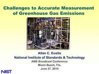
  • 1. Challenges to Accurate Measurement of Greenhouse Gas Emissions Allan C. Eustis National Institute of Standards & Technology AMS Broadcast Conference Miami Beach, Fla. June 27, 2010
  • 2. “To measure is to know.” Lord Kelvin Metrology & Meteorology Quantification of Gas Properties Greenhouse Gas Measurement Research Activities
  • 3. Early NIST: Founded 1901 as the National Bureau of Standards U.S. Becomes a Signatory to the Treaty of the Metre 1879 Nascent electrical industry needed standards American measuring instruments sent abroad for calibration Consumer products and construction materials uneven in quality and reliability Eight different “authoritative’ values for the gallon National Archives Bureau of Standards Established by Congress in 1901 • Authority Given to Congress for Weights and Measures by the U.S. Constitution
  • 4. Early NIST:Need for Standards 1904 Baltimore Fire U.S. Becomes a Signatory to the Treaty of the Metre 1879 Nascent electrical industry needed standards American measuring instruments sent abroad for calibration Consumer products and construction materials uneven in quality and reliability Eight different “authoritative’ values for the gallon Bureau of Standards Established by Congress in 1901 • Authority Given to Congress for Enoch Free Library Weights and Measures by the U.S. Constitution
  • 5. Early NIST:Need for Standards 1904 Baltimore Fire 600 Different Fire Hydrant couplings Across the US Enoch Free Library
  • 6. NIST Today: Mission: To promote U.S. innovation and industrial competitiveness by advancing measurement science, standards, and technology in ways that enhance economic security and improve our quality of life Major Assets Major Programs • ~ 2,900 staff members • NIST Laboratories • ~ 2600 associates and facilities users • Baldrige National Quality Program • ~ 1,600 field staff in partner org. • Manufacturing Extension Partnership • ~ 400 NIST staff serving on • Technology Innovation Program 1,000 national and international standards committees
  • 8. Metrology: “Roads and Bridges” of Science and Trade Groundbreaking research tools that foster progress in new fields – quantum information, nanotechnology, bioscience Better measurement methods to ensure the quality of products and satisfy regulatory needs – Smart Grid Performance measures to ensure accurate technology comparisons © MOSCHENShutterstock Standards and reference materials to ensure fairness and safety in international trade
  • 9. NIST GHG & Climate Change Measurements & Standards Activities • Climate change is a major issue for the U.S. and the World and greenhouse gas emissions a major driver. • Measurement results of undisputable quality and scientific integrity are needed to inform effective mitigation strategies both nationally and internationally. • Determination of greenhouse gas amounts emitted to and removed from the atmosphere is needed at improved levels of accuracy. • Climate change observations require improved calibration capabilities • NIST measurement science research seeks to improve measurements and standards for greenhouse gas Ssun emissions and offset determination using surface and satellite-based methods UV & Visible Radiation Thermal Radiation
  • 10. The Quantitative GHG Emissions Monitoring, Reporting, and Validation Challenge Bottom – Up Top – Down Estuaries & Coastal Ocean Agriculture Landfills • Electricity Gen. • General Industrial Energy Generation Transport Fueling Forests & Woodlands Stationary Sources Distributed or Area Sources and Sinks Regional International 0.005 – 0.05 km 0.5 – 5 km 10 – 100 km 100 – 1000 km Size or Extent (Source or Measurement Approach) Continuous Emissions Single Point Measurements Remote Measurements Atmospheric Monitoring Monitoring Technology • Satellite Observations • Optical Reference Data • Optical Spectral Ref. Data • Radiometry • Gas Concentration. • Chemical Meas. Standards • Advanced Measurement Tools & Standards Methodologies • Optical Spectral Reference Data • Stack Gas Velocity • Surface-based Networks Measurement • Gas Conc. Standards • Wind Velocity Standards Measurement Tools, Standards Technologies & Methodologies
  • 11. Size and Scope of Climate Change Measurements Impacts on Monitoring, Reporting, and Verification Bottom – Up Top – Down Estuaries & Coastal Ocean Agriculture Landfills + = • Electricity Gen. • Industrial Energy Generation Transport Fueling Forests & Woodlands Regional International Distributed or Area Sources 0.005 – 0.05 km 10 – 100 km 100 – 1,000 km 0.5 – 5 km Size or Extent Measurement Tools, Standards, Technologies & Methods
  • 12. A Primary Technical Measurement Challenge GHG Inventory Determination and Acceptance Internationally • Quantification of GHG Mass Transfers To & From the Atmosphere – Always require: • Determination of GHG concentration at a point source or across an area • GHG transport rate – Directional – Emissions – to the atmosphere – Removals – from the atmosphere GHG Mass Flowrate = Total Gas Mass Flowrate * GHG Concentration Mass Flowrate GHG Concentration • Confined flows in stacks • Confined flows in stacks • Gas impact velocity and ultrasonic • Point sampling methods are predominant • NIST for the Acid Rain Program • Quantification over geographical • Quantification over geographical areas areas • Wind field characterization – 3D problem • Dispersed, gradients, and variable • Directional and periodic • Dimensions up to several square kilometers
  • 13. The Earth’s Radiative Balance & The NIST Climate Program UV & Visible Radiation Thermal Radiation Satellite Calibrations & Standards SSun ρEarth • Lamp Irradiance Standards • Aperture Area Measurements εAtm; TAtm • Absolute Detector Standards • Infrared & Microwave Standards • Greenhouse Gas Measurements • Reflective Aerosols Data Point and Area Sources • Black Carbon Aerosols Data Regional reconciliation of inventories with atmospheric measurements • Reflectance Standards • Gas Concentration Standards • Ocean Color Standards • Spectroscopy and Kinetic Data • Temperature Standards • Humidity and Pressure Standards
  • 14. NIST/NASA Collaboration: The Orbiting Carbon Observatory Improved CO2 Determination in the Atm. Column CO2 observations from orbit at the <0.5% (2 ppm) level requires world class spectroscopic reference data for CO2 and the O2 A-band. Diatomic oxygen (O2) provides atmospheric path lengths in remote sensing measurements. In the past two years NIST has completed six projects in support of NASA’s OCO. This work has produced the lowest uncertainty spectroscopic line parameter measurements in the world on the O2 A-band.
  • 15. NIST Program Components • Point Source Metrology • Advanced, Field-Deployable Detection – Continuous Emission Mon. Test Bed Technologies • Distributed Source Metrology – Frequency Comb IR Sources – Flux Measurement Tools – Fieldable Atmospheric Monitoring Tech. – Emission Dispersion Analysis • Satellite Calibration – Field Reference Site – Optical Reflectance and Transmittance • GHG Measurements, Standards, Standards Ref. Data, and Tools – Microwave Standards – Gas Concentration Standards – Thermal Infrared Standards – Atmospheric Lifetime References – Scene Generation – Spectroscopic Reference Data • Aerosol Measurement Science – Documentary Standards & – Black Carbon Morphology Assessment Methodologies – Black Carbon Bulk Properties • GHG Inventory & Regional Emissions – Black Carbon Optical Properties Profile Methodologies – VOC Aerosol Formation Mechanisms – Region Criteria Development ARRA Research Grants – Stakeholder Identification • Measuring Greenhouse Gas Emissions by Inverse Methods: – Demo. Project Planning and Imple. A Pilot Program - Scripps & LLNL • Development, Improvement, and Assessment of the Accuracy of Aircraft-Based Mass Balance Measurements of the Integrated Urban Emission Fluxes of Greenhouse Gases – Purdue, Univ. Colo., and Penn State Univ. • Multi-wavelength LIDAR System to Characterize Atmospheric Composition & Chemistry – Michigan Aerospace
  • 16. Gas Concentration Standards Reference Materials • SRM 1720, Global Background Air (2010) • Certified for CO2, CH4, N2O, CO •CFC SRM (2011) • To be certified for CFCs, SF6, VOCs Methods • NOAA collaboration on urban tower air sample collection • Track effectiveness of mitigation efforts of major metropolitan area Critical to: International Engagement • CEMS • CCQM Key Comparisons • Atmospheric Monitoring and • Atmospheric CH4 (2014) the Decadal Observation • Atmospheric CO2 (2011) Series Inherent to Climate • Atmospheric CFC/HFC (2011) • Atmospheric N2O (2013) Studies of the Atmosphere • Biosphere indicator gases • Requested by World Metrology Organization, Global Atmospheric Watch program • With national metrology institutes: NPL (UK), VSL (Netherlands), and KRISS (Korea)
  • 17. Standards Framework for Climate Observations WMO-BIPM Partnership to Facilitate Use of the SI Traceability in Climate Observations - 2002 World Meteorological International Committee for Organization (WMO) Weights and Measures (CIPM) “...have agreed to work together to ensure that data related in particular to measurements of state and composition of atmosphere and water resources, coming from the programmes organized under the auspices of the WMO, are properly based on units traceable to the SI through the procedures of the CIPM MRA and the Technical Regulations of the WMO.” Treaty of the Metre Organizations • CIPM – International Committee on Weights and Measures • BIPM – International Bureau of Weights and Measures
  • 18. Workshop on Quantification of GHG Area Sources and Sinks: Summary of Priority Research Targets Instrumentation and Technology – Components for High Performance Remote Sensing Systems • Better detector technology for λ≥1100nm; higher quantum efficiency, larger active areas, high bandwidths, lower NEP, extension to λ≥ 2500nm • Higher power, more spectrally pure, single-frequency diode lasers (DFBs or DBRs) to serve as seed sources for pulsed lasers/OPO or as sources for open-path sensors – Compact, cost-effective DIAL Lidar (greenhouse gases: CO2, CH4, N2O) • Better understanding of required application performance (sources/sinks, local/regional scales) • Targeted Lidar designs (total error budgets, key components) – Smaller and Cheaper Measurement Technology • Reduction in size, weight, power, cost, complexity of existing measurement techniques ( alternative spectroscopic techniques, better battery technology, streamlined electronics & data acquisition, ability to sample accurately & precisely under ambient conditions)
  • 19. Workshop on Quantification of GHG Area Sources and Sinks: Summary of Priority Research Targets Instrumentation and Technology – Spectroscopic Data to Support GHG Flux and Concentration Measurements • Extremely precise (0.1%) spectroscopic parameters in support of OCO satellite retrievals of O2 and CO2 (1.6m and 2.0m) including T and P dependence • Development of 2µ Lidar sensors, optical sensors to monitor isotopic ratios in real time – Long-term Dense Network of Continuous Fenceline Monitors/Anthropogenic • Develop accurate, cost effective fenceline monitors in parallel – Long-term Dense Network of GHG Mole Fraction Measurements • Accelerate development of low cost, robust, accurate instruments • Transport model improvements based on measured wind profiles, boundary layer height
  • 20. Workshop on Quantification of GHG Area Sources and Sinks: Summary of Priority Research Targets Modeling • GHG Testbed for Model Validation – Capability of models to reproduce a known source; influence of weather on models; differences between multiple point sources vs. a true area source and how differences affect models; well-controlled GHG source that can simulate a variety of source types; field campaigns for model validation • Protocols for Emissions Quantification Measurements and Models – Identify possible combinations of measurements and models for quantifying emissions; assess and develop protocols for appropriate techniques (sensors and models) • Optimal Sampling Strategies for Small Scale GHG Emission Measurements – Explore sensitivity of sampling methods using numerical simulation; identify characteristic scales of temporal and spatial variability in actual sources • GHG Emission Simulation – Compare IR emissions for simulated measurements with simulators of whole systems; characterize whole system error and uncertainty; simulation of complete source (µm environment, point sources vs. distributed/area) NIST Workshop – June 2 & 3, Scripps Institution of Oceanography GREENHOUSE GAS EMISSIONS QUANTIFICATION AND VERIFICATION STRATEGIES AWMA Symposium – Sept. 8 to 10, Washington, DC 2nd AWMA Greenhouse Gas Measurement Symposium
  • 21. NIST Program Summary Measurements Promote: Traceability to the SI: • Fairness & equity in GHG • Allows comparisons to be accounting and markets made independent of time or • Efficiency in the generation locale & use of GHGs • Improves measurement • Equitable usage of GHG accuracy offsets • Provides confidence in the • The quality of greenhouse accuracy of measurements gas inventories that furnish • Helps contractors the foundation for policy and understand and meet regulatory decisions agency requirements, • Science-based GHG protecting contractor and mitigation caps. customer • A basis for reconciliation of • Ensures the quality of determinations of GHG climate data records that inventories from the top- furnish the foundation for down and the bottom-up policy and regulatory decisions Economic Valuation of GHGs will Drive Greater Accuracy Needs
  • 22. C & W Music Titles You May Have Missed “The Pint of No Return” “If Love were Oil, I’d be a Quart Low” (conversion to metric) “If Love were Oil, I’d be a Half Liter Low” “The Bridge Washed Out; I Can’t Swim & My Baby’s on the Other Side”
  • 23. GHG Point Source: Pulverized Coal Power Plant Velocities of Fluid Structures in an Elbow • A simple geometry can create a complex velocity vector field – Counter rotating vortices • Velocity field is not ideal for flow measurement applications Flue Gas
  • 24. Point Source Metrology NIST Large Fire Facility: 1:100 scale stack model Heat Release measure flow Quantification for Many properties & CO2 Materials & Structures concentration in stack
  • 25. Distributed GHG Emissions Sources and Sinks (1 – 5 km Geographical Areas) Optical Remote Sensing Technologies cross sectional area Acs x z Hyperspectral Imaging Determines Plume Cross- section & Extent y φ Emission Source GHG Mass Flowrate LIDAR Doppler Velocimeter Lidar – Related Implementation Technologies • Available for ~2 decades • Significant technological advances by telecom technology GHG Concentration industry in optical fibers and solid state lasers and amplifiers DIAL: Differential Absorption LIDAR • Platform for development of suitcase-sized systems
  • 26. Heterodyne DIAL Measurement Greenhouse Gas Area Source & Sink Mass Flux CH4 • Dual beam heterodyne approach CO2 • Common mode noise rejection • Simultaneous sideband approach N2O  (x1000) H2O 1.646 λ / μm 1.590 Cavity Lock* 1.58-1.65 µm On/Off - 10 GHz P = 5 mJ (PPLN=20 mJ) Δν=190 MHz (transform limited) LiNbO3 3 µm
  • 27. High Accuracy Spectroscopic Reference Data O2 A Band (~765 nm) absorption spectrum 200 MHz optical resonator pzt stabilized comb of cw probe laser resonant frequencies frequency -stabilized decay signal reference laser Frequency-stabilized cavity frequency cavity stabilization servo ring-down spectrometer NIST • Quantified a correction required to accurately describe line intensities in the O2 A-band • Accurate absorption line shape measurements augmented with high accuracy absorber number density determination reduced line intensity uncertainties from 2% to 0.3% transition index
  • 28. New Measurement Technologies Photoacoustic Spectrometer Self-calibrating instrument for measuring absolute gas concentrations and aerosol absorption coefficient.
  • 29. NIST Radiometric Measurements and Standards Capabilities Supporting Satellite Calibrations and Performance Evaluation
  • 30. NIST Primary Optical Watt Radiometer (POWR) Optical Measurements are Traceable to the SI through the Electrical Watt • POWR provides optical power measurement capability to the LN2 0.01% (k = 2) level • Primary Standard for satellite radiometric Liquid observing schemes He @ 2K Field or Satellite measurements required near the level where standards are available are often a significant challenge to realize.
  • 31. Measurements Require Quality and Accuracy High Resolution Infrared Radiation Sounder (HIRS) on the Polar-Orbiting Operational Environmental Satellites (POES) Vendor Vendor NIST NIST ΔT > 10 K ΔT up to 0.5 K optical filter center wavelength Temperature sensitivity measurement Resolves ~ 10 Kelvin Atmospheric Temperature Measurement Discrepancy
  • 32. Can GHG Observation Networks and Inverse Modeling Be Applied to Verification • Can GHG quantification and Source Inverse modeling combined with ID Reach Spatial Resolutions weather data and atm. dispersion of ~1 km? models regresses observed concentrations to their source • What additions to surface-based networks are needed? – Mesonets – Installed Observing Networks • Public/Private partnership opportunity – GHG Concentration instrumentation needs – Accurate – 1 ppm of ~400 ppm (CO2) – Robust - Fieldable » No calibration gases for routine operation – Low-cost Observing Obs. – Inverse Modeling Resolution Network Station • Boundary layer turbulence-induced limits – velocity dispersive relationships AGAGE – NASA Supported, • Accuracy of weather data Scripps-MIT Lead • Optimize number of observing points NOAA – Tall Towers System & CarbonTracker
  • 33. Workshop on Quantification of GHG Area Sources and Sinks: Summary of Priority Research Targets Defining the Measurement Problem – Definition and Clarification of Regulatory Needs and Requirements • Conduct one or more emissions measurement pilot programs with partnership among stakeholder groups • Design measurement networks for long-term monitoring with input from all stakeholder groups – Pilot Study: Methodological Test and Comparison of Techniques • Field program to quantify emission of multiple gases from a single large metropolitan area using multiple approaches • Similar activity for offsets and management
  • 34.
  • 35. Thank You & Questions Allan.eustis@nist.gov http://www.nist.gov/cstl/ghg_clim ate_overview.cfm