SlideShare uma empresa Scribd logo
1 de 13
ArcGIS Mobile – Gas leak detection
2 Introduction Delta Infra is a service provider for the Delta Network Company (DNWB), the industry and other network operators. The tasks they perform are mainly related to maintaining and inspecting these networks. For the inspection of their gas line network, walking routes are defined. Using sophisticated detection equipment they search for possible gas leaks in their network. To aid them with this task Esri Netherland and Grontmij have developed a mobile application based on ArcGIS Mobile 10.
3 Initial settings The first time the application is started, the user will have to enter the specifications of the detection equipment used for the fieldwork. This meta information is stored for later reference.
4 Full extent The application starts with the full extent of the province of Zeeland (the Netherlands).
5 Zoom in to detailed area  The user zooms in to the area (or uses the GPS position); gas pipes and house connections become visible.
6 Register observations When an observation needs to be registered the user will have the choice between a gas leak or an obstacle.
7 Location A gas leak detection location (or an obstacle) can be drawn on the map or can be defined by the GPS coordinates.
8 Specify attributes After the location has been defined all the attributes are specified. Address and pipeline data are automatically filled in based on the location.
9 Type 1 gas leak In case of a gas leak of type 1 (severe) the application sends an email containing the address and an image of the location on the map for immediate action.
10 Progress of fieldwork When the observation of (a part of) the street has been finalized, the street is registered as "checked" and the symbology is changed automatically. This provides the necessary feedback to the fieldworker with respect to the area processed.
11 Connection to Diasys The ArcGIS mobile application is connected to the Diasys application containing high detailed house connection drawings. When a detailed sketch is requested this is registered in the ArcGIS mobile application for later reference.
12 Technology ,[object Object]
 Windows Presentation FoundationFor more info on ArcGIS Mobile please visit: http://resources.arcgis.com/content/arcgis-mobile/10.0/about

Mais conteúdo relacionado

Mais procurados

2013 Vendor Track, ArcGIS GeoEvent Processor by Jayson Hagen
2013 Vendor Track, ArcGIS GeoEvent Processor by Jayson Hagen2013 Vendor Track, ArcGIS GeoEvent Processor by Jayson Hagen
2013 Vendor Track, ArcGIS GeoEvent Processor by Jayson HagenGIS in the Rockies
 
Transformer Loading. Driving Enterprise Decisions with ArcGIS Online.
Transformer Loading.  Driving Enterprise Decisions with ArcGIS Online.Transformer Loading.  Driving Enterprise Decisions with ArcGIS Online.
Transformer Loading. Driving Enterprise Decisions with ArcGIS Online.SSP Innovations
 
Dotnet sink trail a proactive data reporting protocol for wireless sensor ne...
Dotnet  sink trail a proactive data reporting protocol for wireless sensor ne...Dotnet  sink trail a proactive data reporting protocol for wireless sensor ne...
Dotnet sink trail a proactive data reporting protocol for wireless sensor ne...Ecway Technologies
 
Measuring Change with Radar Imagery_Richard Goodman - Intergraph Geospatial W...
Measuring Change with Radar Imagery_Richard Goodman - Intergraph Geospatial W...Measuring Change with Radar Imagery_Richard Goodman - Intergraph Geospatial W...
Measuring Change with Radar Imagery_Richard Goodman - Intergraph Geospatial W...IMGS
 
How to create Telemetry Corrector
How to create Telemetry Corrector How to create Telemetry Corrector
How to create Telemetry Corrector APNIC
 
Watershed development and drainage assessments
Watershed development and drainage assessmentsWatershed development and drainage assessments
Watershed development and drainage assessmentsAndrew Harrison
 
OpenWeatherMap on the Open GIS Conference 2012
OpenWeatherMap on the Open GIS Conference 2012OpenWeatherMap on the Open GIS Conference 2012
OpenWeatherMap on the Open GIS Conference 2012Dennsy
 
calculating wind speed and direction using arcgis
calculating wind speed and direction using arcgiscalculating wind speed and direction using arcgis
calculating wind speed and direction using arcgissaqibjavaid17
 
MATLAB Projects for Electronics Engineering Students Research Help
MATLAB Projects for Electronics Engineering Students Research HelpMATLAB Projects for Electronics Engineering Students Research Help
MATLAB Projects for Electronics Engineering Students Research HelpMatlab Simulation
 

Mais procurados (12)

VLSI 2014 LIST
VLSI 2014 LISTVLSI 2014 LIST
VLSI 2014 LIST
 
2013 Vendor Track, ArcGIS GeoEvent Processor by Jayson Hagen
2013 Vendor Track, ArcGIS GeoEvent Processor by Jayson Hagen2013 Vendor Track, ArcGIS GeoEvent Processor by Jayson Hagen
2013 Vendor Track, ArcGIS GeoEvent Processor by Jayson Hagen
 
Transformer Loading. Driving Enterprise Decisions with ArcGIS Online.
Transformer Loading.  Driving Enterprise Decisions with ArcGIS Online.Transformer Loading.  Driving Enterprise Decisions with ArcGIS Online.
Transformer Loading. Driving Enterprise Decisions with ArcGIS Online.
 
Dotnet sink trail a proactive data reporting protocol for wireless sensor ne...
Dotnet  sink trail a proactive data reporting protocol for wireless sensor ne...Dotnet  sink trail a proactive data reporting protocol for wireless sensor ne...
Dotnet sink trail a proactive data reporting protocol for wireless sensor ne...
 
Measuring Change with Radar Imagery_Richard Goodman - Intergraph Geospatial W...
Measuring Change with Radar Imagery_Richard Goodman - Intergraph Geospatial W...Measuring Change with Radar Imagery_Richard Goodman - Intergraph Geospatial W...
Measuring Change with Radar Imagery_Richard Goodman - Intergraph Geospatial W...
 
How to create Telemetry Corrector
How to create Telemetry Corrector How to create Telemetry Corrector
How to create Telemetry Corrector
 
Watershed development and drainage assessments
Watershed development and drainage assessmentsWatershed development and drainage assessments
Watershed development and drainage assessments
 
OpenWeatherMap on the Open GIS Conference 2012
OpenWeatherMap on the Open GIS Conference 2012OpenWeatherMap on the Open GIS Conference 2012
OpenWeatherMap on the Open GIS Conference 2012
 
GIS Applications for Tornado Damage Visualization
GIS Applications for Tornado Damage VisualizationGIS Applications for Tornado Damage Visualization
GIS Applications for Tornado Damage Visualization
 
Presentation may30th
Presentation may30thPresentation may30th
Presentation may30th
 
calculating wind speed and direction using arcgis
calculating wind speed and direction using arcgiscalculating wind speed and direction using arcgis
calculating wind speed and direction using arcgis
 
MATLAB Projects for Electronics Engineering Students Research Help
MATLAB Projects for Electronics Engineering Students Research HelpMATLAB Projects for Electronics Engineering Students Research Help
MATLAB Projects for Electronics Engineering Students Research Help
 

Destaque

Detecting Buildings in AHN2 LiDAR data with ArcGIS - Grontmij
Detecting Buildings in AHN2 LiDAR data with ArcGIS - GrontmijDetecting Buildings in AHN2 LiDAR data with ArcGIS - Grontmij
Detecting Buildings in AHN2 LiDAR data with ArcGIS - GrontmijXander Bakker
 
ArcGIS Mobile 10 - Grontmij
ArcGIS Mobile 10 - GrontmijArcGIS Mobile 10 - Grontmij
ArcGIS Mobile 10 - GrontmijXander Bakker
 
GeoWeb HTML5 Viewer Online en Offline - Grontmij
GeoWeb HTML5 Viewer Online en Offline - GrontmijGeoWeb HTML5 Viewer Online en Offline - Grontmij
GeoWeb HTML5 Viewer Online en Offline - GrontmijXander Bakker
 
Some thoughts on DevSummit 2012 including comments and links (PDF)
Some thoughts on DevSummit 2012 including comments and links (PDF)Some thoughts on DevSummit 2012 including comments and links (PDF)
Some thoughts on DevSummit 2012 including comments and links (PDF)Xander Bakker
 
Python en la Plataforma ArcGIS
Python en la Plataforma ArcGISPython en la Plataforma ArcGIS
Python en la Plataforma ArcGISXander Bakker
 
Evaluating the Height of Regional Dikes of HH Rijnland with LiDAR using ArcGI...
Evaluating the Height of Regional Dikes of HH Rijnland with LiDAR using ArcGI...Evaluating the Height of Regional Dikes of HH Rijnland with LiDAR using ArcGI...
Evaluating the Height of Regional Dikes of HH Rijnland with LiDAR using ArcGI...Xander Bakker
 

Destaque (6)

Detecting Buildings in AHN2 LiDAR data with ArcGIS - Grontmij
Detecting Buildings in AHN2 LiDAR data with ArcGIS - GrontmijDetecting Buildings in AHN2 LiDAR data with ArcGIS - Grontmij
Detecting Buildings in AHN2 LiDAR data with ArcGIS - Grontmij
 
ArcGIS Mobile 10 - Grontmij
ArcGIS Mobile 10 - GrontmijArcGIS Mobile 10 - Grontmij
ArcGIS Mobile 10 - Grontmij
 
GeoWeb HTML5 Viewer Online en Offline - Grontmij
GeoWeb HTML5 Viewer Online en Offline - GrontmijGeoWeb HTML5 Viewer Online en Offline - Grontmij
GeoWeb HTML5 Viewer Online en Offline - Grontmij
 
Some thoughts on DevSummit 2012 including comments and links (PDF)
Some thoughts on DevSummit 2012 including comments and links (PDF)Some thoughts on DevSummit 2012 including comments and links (PDF)
Some thoughts on DevSummit 2012 including comments and links (PDF)
 
Python en la Plataforma ArcGIS
Python en la Plataforma ArcGISPython en la Plataforma ArcGIS
Python en la Plataforma ArcGIS
 
Evaluating the Height of Regional Dikes of HH Rijnland with LiDAR using ArcGI...
Evaluating the Height of Regional Dikes of HH Rijnland with LiDAR using ArcGI...Evaluating the Height of Regional Dikes of HH Rijnland with LiDAR using ArcGI...
Evaluating the Height of Regional Dikes of HH Rijnland with LiDAR using ArcGI...
 

Semelhante a ArcGIS Mobile 10 Gas Leak Detection Application by Grontmij and Esri NL

20200512 the introduction of high precision positioning mason li v1.0(1)
20200512 the introduction of high precision positioning mason li v1.0(1)20200512 the introduction of high precision positioning mason li v1.0(1)
20200512 the introduction of high precision positioning mason li v1.0(1)GeoMedeelel
 
Handheld augmented reality_for_underground_infrast
Handheld augmented reality_for_underground_infrastHandheld augmented reality_for_underground_infrast
Handheld augmented reality_for_underground_infrastHelloWorld121381
 
Getting_Started_with_ArcGIS.pdf
Getting_Started_with_ArcGIS.pdfGetting_Started_with_ArcGIS.pdf
Getting_Started_with_ArcGIS.pdfAhmed Arafat
 
Infor eam v11.3 gis integratie (6 juni 2017)
Infor eam v11.3   gis integratie (6 juni 2017)Infor eam v11.3   gis integratie (6 juni 2017)
Infor eam v11.3 gis integratie (6 juni 2017)Dazler Consultancy
 
IRJET- Comparison on Measurement of a Building using Total Station, ARCGI...
IRJET-  	  Comparison on Measurement of a Building using Total Station, ARCGI...IRJET-  	  Comparison on Measurement of a Building using Total Station, ARCGI...
IRJET- Comparison on Measurement of a Building using Total Station, ARCGI...IRJET Journal
 
REAL TIME WEB BASED SYSTEM FOR OBSERVING SAG AT SUBSTATION
REAL TIME WEB BASED SYSTEM FOR OBSERVING SAG AT SUBSTATIONREAL TIME WEB BASED SYSTEM FOR OBSERVING SAG AT SUBSTATION
REAL TIME WEB BASED SYSTEM FOR OBSERVING SAG AT SUBSTATIONIJCSEA Journal
 
THE DESIGN IN MOBILE AND WEB PLATFORM OF THE LOCATION IDENTIFICATION APPLICAT...
THE DESIGN IN MOBILE AND WEB PLATFORM OF THE LOCATION IDENTIFICATION APPLICAT...THE DESIGN IN MOBILE AND WEB PLATFORM OF THE LOCATION IDENTIFICATION APPLICAT...
THE DESIGN IN MOBILE AND WEB PLATFORM OF THE LOCATION IDENTIFICATION APPLICAT...Ibrahim Özgön
 
Vehicle Tracking System for School Bus by Arduino
Vehicle Tracking System for School Bus by ArduinoVehicle Tracking System for School Bus by Arduino
Vehicle Tracking System for School Bus by ArduinoIRJET Journal
 
IRJET- A Survey on Various Location Tracking Systems
IRJET- A Survey on Various Location Tracking SystemsIRJET- A Survey on Various Location Tracking Systems
IRJET- A Survey on Various Location Tracking SystemsIRJET Journal
 
Current State of mago3D, an Open Source Based Digital Twin Platform
Current State of mago3D, an Open Source Based Digital Twin PlatformCurrent State of mago3D, an Open Source Based Digital Twin Platform
Current State of mago3D, an Open Source Based Digital Twin PlatformSANGHEE SHIN
 
FlightlineGeo_ESRI_Newsletter_winter2014
FlightlineGeo_ESRI_Newsletter_winter2014FlightlineGeo_ESRI_Newsletter_winter2014
FlightlineGeo_ESRI_Newsletter_winter2014Devon Humphrey
 
Iaetsd location-based services using autonomous gps
Iaetsd location-based services using autonomous gpsIaetsd location-based services using autonomous gps
Iaetsd location-based services using autonomous gpsIaetsd Iaetsd
 
State of mago3D, An Open Source Based Digital Twin Platform
State of mago3D, An Open Source Based Digital Twin PlatformState of mago3D, An Open Source Based Digital Twin Platform
State of mago3D, An Open Source Based Digital Twin PlatformSANGHEE SHIN
 
Mobileworxs Ec Mobile Gps Applications White Paper[1]
Mobileworxs Ec Mobile Gps Applications White Paper[1]Mobileworxs Ec Mobile Gps Applications White Paper[1]
Mobileworxs Ec Mobile Gps Applications White Paper[1]MobileWorxs
 
Pollution Sensor Based Data Communication via Android Device
Pollution Sensor Based Data Communication via Android DevicePollution Sensor Based Data Communication via Android Device
Pollution Sensor Based Data Communication via Android DeviceIOSR Journals
 
Gis 3 dfeature extraction and modeling
Gis 3 dfeature extraction and modelingGis 3 dfeature extraction and modeling
Gis 3 dfeature extraction and modelingSBL-corp
 

Semelhante a ArcGIS Mobile 10 Gas Leak Detection Application by Grontmij and Esri NL (20)

20200512 the introduction of high precision positioning mason li v1.0(1)
20200512 the introduction of high precision positioning mason li v1.0(1)20200512 the introduction of high precision positioning mason li v1.0(1)
20200512 the introduction of high precision positioning mason li v1.0(1)
 
Handheld augmented reality_for_underground_infrast
Handheld augmented reality_for_underground_infrastHandheld augmented reality_for_underground_infrast
Handheld augmented reality_for_underground_infrast
 
Getting_Started_with_ArcGIS.pdf
Getting_Started_with_ArcGIS.pdfGetting_Started_with_ArcGIS.pdf
Getting_Started_with_ArcGIS.pdf
 
Railway Presentation
Railway PresentationRailway Presentation
Railway Presentation
 
70.mobile gis
70.mobile gis70.mobile gis
70.mobile gis
 
Infor eam v11.3 gis integratie (6 juni 2017)
Infor eam v11.3   gis integratie (6 juni 2017)Infor eam v11.3   gis integratie (6 juni 2017)
Infor eam v11.3 gis integratie (6 juni 2017)
 
Curriculum_Vitae
Curriculum_VitaeCurriculum_Vitae
Curriculum_Vitae
 
IRJET- Comparison on Measurement of a Building using Total Station, ARCGI...
IRJET-  	  Comparison on Measurement of a Building using Total Station, ARCGI...IRJET-  	  Comparison on Measurement of a Building using Total Station, ARCGI...
IRJET- Comparison on Measurement of a Building using Total Station, ARCGI...
 
REAL TIME WEB BASED SYSTEM FOR OBSERVING SAG AT SUBSTATION
REAL TIME WEB BASED SYSTEM FOR OBSERVING SAG AT SUBSTATIONREAL TIME WEB BASED SYSTEM FOR OBSERVING SAG AT SUBSTATION
REAL TIME WEB BASED SYSTEM FOR OBSERVING SAG AT SUBSTATION
 
THE DESIGN IN MOBILE AND WEB PLATFORM OF THE LOCATION IDENTIFICATION APPLICAT...
THE DESIGN IN MOBILE AND WEB PLATFORM OF THE LOCATION IDENTIFICATION APPLICAT...THE DESIGN IN MOBILE AND WEB PLATFORM OF THE LOCATION IDENTIFICATION APPLICAT...
THE DESIGN IN MOBILE AND WEB PLATFORM OF THE LOCATION IDENTIFICATION APPLICAT...
 
Vehicle Tracking System for School Bus by Arduino
Vehicle Tracking System for School Bus by ArduinoVehicle Tracking System for School Bus by Arduino
Vehicle Tracking System for School Bus by Arduino
 
IRJET- A Survey on Various Location Tracking Systems
IRJET- A Survey on Various Location Tracking SystemsIRJET- A Survey on Various Location Tracking Systems
IRJET- A Survey on Various Location Tracking Systems
 
Current State of mago3D, an Open Source Based Digital Twin Platform
Current State of mago3D, an Open Source Based Digital Twin PlatformCurrent State of mago3D, an Open Source Based Digital Twin Platform
Current State of mago3D, an Open Source Based Digital Twin Platform
 
FlightlineGeo_ESRI_Newsletter_winter2014
FlightlineGeo_ESRI_Newsletter_winter2014FlightlineGeo_ESRI_Newsletter_winter2014
FlightlineGeo_ESRI_Newsletter_winter2014
 
Iaetsd location-based services using autonomous gps
Iaetsd location-based services using autonomous gpsIaetsd location-based services using autonomous gps
Iaetsd location-based services using autonomous gps
 
State of mago3D, An Open Source Based Digital Twin Platform
State of mago3D, An Open Source Based Digital Twin PlatformState of mago3D, An Open Source Based Digital Twin Platform
State of mago3D, An Open Source Based Digital Twin Platform
 
Mobileworxs Ec Mobile Gps Applications White Paper[1]
Mobileworxs Ec Mobile Gps Applications White Paper[1]Mobileworxs Ec Mobile Gps Applications White Paper[1]
Mobileworxs Ec Mobile Gps Applications White Paper[1]
 
Pollution Sensor Based Data Communication via Android Device
Pollution Sensor Based Data Communication via Android DevicePollution Sensor Based Data Communication via Android Device
Pollution Sensor Based Data Communication via Android Device
 
vishal resume (1)
vishal resume (1)vishal resume (1)
vishal resume (1)
 
Gis 3 dfeature extraction and modeling
Gis 3 dfeature extraction and modelingGis 3 dfeature extraction and modeling
Gis 3 dfeature extraction and modeling
 

Mais de Xander Bakker

Mobiel werken bij LSNed presentatie op Esri GIS conferentie 2013 - Grontmij
Mobiel werken bij LSNed presentatie op Esri GIS conferentie 2013 - GrontmijMobiel werken bij LSNed presentatie op Esri GIS conferentie 2013 - Grontmij
Mobiel werken bij LSNed presentatie op Esri GIS conferentie 2013 - GrontmijXander Bakker
 
Digital Elevation Models - WUR - Grontmij
Digital Elevation Models - WUR - GrontmijDigital Elevation Models - WUR - Grontmij
Digital Elevation Models - WUR - GrontmijXander Bakker
 
Eenvoudige Toets Brabantse Delta met AHN2 - Grontmij
Eenvoudige Toets Brabantse Delta met AHN2 - GrontmijEenvoudige Toets Brabantse Delta met AHN2 - Grontmij
Eenvoudige Toets Brabantse Delta met AHN2 - GrontmijXander Bakker
 
Bodemdaling model Provincie Utrecht - Grontmij
Bodemdaling model Provincie Utrecht - GrontmijBodemdaling model Provincie Utrecht - Grontmij
Bodemdaling model Provincie Utrecht - GrontmijXander Bakker
 
Playing around with LiDAR, AHN2, Aerial Photography and LAStools in ArcGIS 10.1
Playing around with LiDAR, AHN2, Aerial Photography and LAStools in ArcGIS 10.1Playing around with LiDAR, AHN2, Aerial Photography and LAStools in ArcGIS 10.1
Playing around with LiDAR, AHN2, Aerial Photography and LAStools in ArcGIS 10.1Xander Bakker
 
Characterizing regional dikes with LiDAR using ArcGIS 10 by Grontmij
Characterizing regional dikes with LiDAR using ArcGIS 10 by GrontmijCharacterizing regional dikes with LiDAR using ArcGIS 10 by Grontmij
Characterizing regional dikes with LiDAR using ArcGIS 10 by GrontmijXander Bakker
 
Esri DevSummit 2011 - Grontmij presentation
Esri DevSummit 2011 - Grontmij presentationEsri DevSummit 2011 - Grontmij presentation
Esri DevSummit 2011 - Grontmij presentationXander Bakker
 
The 'right' choices in GIS - Grontmij
The 'right' choices in GIS - GrontmijThe 'right' choices in GIS - Grontmij
The 'right' choices in GIS - GrontmijXander Bakker
 

Mais de Xander Bakker (8)

Mobiel werken bij LSNed presentatie op Esri GIS conferentie 2013 - Grontmij
Mobiel werken bij LSNed presentatie op Esri GIS conferentie 2013 - GrontmijMobiel werken bij LSNed presentatie op Esri GIS conferentie 2013 - Grontmij
Mobiel werken bij LSNed presentatie op Esri GIS conferentie 2013 - Grontmij
 
Digital Elevation Models - WUR - Grontmij
Digital Elevation Models - WUR - GrontmijDigital Elevation Models - WUR - Grontmij
Digital Elevation Models - WUR - Grontmij
 
Eenvoudige Toets Brabantse Delta met AHN2 - Grontmij
Eenvoudige Toets Brabantse Delta met AHN2 - GrontmijEenvoudige Toets Brabantse Delta met AHN2 - Grontmij
Eenvoudige Toets Brabantse Delta met AHN2 - Grontmij
 
Bodemdaling model Provincie Utrecht - Grontmij
Bodemdaling model Provincie Utrecht - GrontmijBodemdaling model Provincie Utrecht - Grontmij
Bodemdaling model Provincie Utrecht - Grontmij
 
Playing around with LiDAR, AHN2, Aerial Photography and LAStools in ArcGIS 10.1
Playing around with LiDAR, AHN2, Aerial Photography and LAStools in ArcGIS 10.1Playing around with LiDAR, AHN2, Aerial Photography and LAStools in ArcGIS 10.1
Playing around with LiDAR, AHN2, Aerial Photography and LAStools in ArcGIS 10.1
 
Characterizing regional dikes with LiDAR using ArcGIS 10 by Grontmij
Characterizing regional dikes with LiDAR using ArcGIS 10 by GrontmijCharacterizing regional dikes with LiDAR using ArcGIS 10 by Grontmij
Characterizing regional dikes with LiDAR using ArcGIS 10 by Grontmij
 
Esri DevSummit 2011 - Grontmij presentation
Esri DevSummit 2011 - Grontmij presentationEsri DevSummit 2011 - Grontmij presentation
Esri DevSummit 2011 - Grontmij presentation
 
The 'right' choices in GIS - Grontmij
The 'right' choices in GIS - GrontmijThe 'right' choices in GIS - Grontmij
The 'right' choices in GIS - Grontmij
 

Último

SIP trunking in Janus @ Kamailio World 2024
SIP trunking in Janus @ Kamailio World 2024SIP trunking in Janus @ Kamailio World 2024
SIP trunking in Janus @ Kamailio World 2024Lorenzo Miniero
 
AI as an Interface for Commercial Buildings
AI as an Interface for Commercial BuildingsAI as an Interface for Commercial Buildings
AI as an Interface for Commercial BuildingsMemoori
 
Streamlining Python Development: A Guide to a Modern Project Setup
Streamlining Python Development: A Guide to a Modern Project SetupStreamlining Python Development: A Guide to a Modern Project Setup
Streamlining Python Development: A Guide to a Modern Project SetupFlorian Wilhelm
 
"Federated learning: out of reach no matter how close",Oleksandr Lapshyn
"Federated learning: out of reach no matter how close",Oleksandr Lapshyn"Federated learning: out of reach no matter how close",Oleksandr Lapshyn
"Federated learning: out of reach no matter how close",Oleksandr LapshynFwdays
 
My Hashitalk Indonesia April 2024 Presentation
My Hashitalk Indonesia April 2024 PresentationMy Hashitalk Indonesia April 2024 Presentation
My Hashitalk Indonesia April 2024 PresentationRidwan Fadjar
 
Story boards and shot lists for my a level piece
Story boards and shot lists for my a level pieceStory boards and shot lists for my a level piece
Story boards and shot lists for my a level piececharlottematthew16
 
Advanced Test Driven-Development @ php[tek] 2024
Advanced Test Driven-Development @ php[tek] 2024Advanced Test Driven-Development @ php[tek] 2024
Advanced Test Driven-Development @ php[tek] 2024Scott Keck-Warren
 
"LLMs for Python Engineers: Advanced Data Analysis and Semantic Kernel",Oleks...
"LLMs for Python Engineers: Advanced Data Analysis and Semantic Kernel",Oleks..."LLMs for Python Engineers: Advanced Data Analysis and Semantic Kernel",Oleks...
"LLMs for Python Engineers: Advanced Data Analysis and Semantic Kernel",Oleks...Fwdays
 
CloudStudio User manual (basic edition):
CloudStudio User manual (basic edition):CloudStudio User manual (basic edition):
CloudStudio User manual (basic edition):comworks
 
Integration and Automation in Practice: CI/CD in Mule Integration and Automat...
Integration and Automation in Practice: CI/CD in Mule Integration and Automat...Integration and Automation in Practice: CI/CD in Mule Integration and Automat...
Integration and Automation in Practice: CI/CD in Mule Integration and Automat...Patryk Bandurski
 
Ensuring Technical Readiness For Copilot in Microsoft 365
Ensuring Technical Readiness For Copilot in Microsoft 365Ensuring Technical Readiness For Copilot in Microsoft 365
Ensuring Technical Readiness For Copilot in Microsoft 3652toLead Limited
 
Powerpoint exploring the locations used in television show Time Clash
Powerpoint exploring the locations used in television show Time ClashPowerpoint exploring the locations used in television show Time Clash
Powerpoint exploring the locations used in television show Time Clashcharlottematthew16
 
Nell’iperspazio con Rocket: il Framework Web di Rust!
Nell’iperspazio con Rocket: il Framework Web di Rust!Nell’iperspazio con Rocket: il Framework Web di Rust!
Nell’iperspazio con Rocket: il Framework Web di Rust!Commit University
 
Training state-of-the-art general text embedding
Training state-of-the-art general text embeddingTraining state-of-the-art general text embedding
Training state-of-the-art general text embeddingZilliz
 
Bun (KitWorks Team Study 노별마루 발표 2024.4.22)
Bun (KitWorks Team Study 노별마루 발표 2024.4.22)Bun (KitWorks Team Study 노별마루 발표 2024.4.22)
Bun (KitWorks Team Study 노별마루 발표 2024.4.22)Wonjun Hwang
 
Search Engine Optimization SEO PDF for 2024.pdf
Search Engine Optimization SEO PDF for 2024.pdfSearch Engine Optimization SEO PDF for 2024.pdf
Search Engine Optimization SEO PDF for 2024.pdfRankYa
 
Scanning the Internet for External Cloud Exposures via SSL Certs
Scanning the Internet for External Cloud Exposures via SSL CertsScanning the Internet for External Cloud Exposures via SSL Certs
Scanning the Internet for External Cloud Exposures via SSL CertsRizwan Syed
 
Beyond Boundaries: Leveraging No-Code Solutions for Industry Innovation
Beyond Boundaries: Leveraging No-Code Solutions for Industry InnovationBeyond Boundaries: Leveraging No-Code Solutions for Industry Innovation
Beyond Boundaries: Leveraging No-Code Solutions for Industry InnovationSafe Software
 
Designing IA for AI - Information Architecture Conference 2024
Designing IA for AI - Information Architecture Conference 2024Designing IA for AI - Information Architecture Conference 2024
Designing IA for AI - Information Architecture Conference 2024Enterprise Knowledge
 

Último (20)

SIP trunking in Janus @ Kamailio World 2024
SIP trunking in Janus @ Kamailio World 2024SIP trunking in Janus @ Kamailio World 2024
SIP trunking in Janus @ Kamailio World 2024
 
AI as an Interface for Commercial Buildings
AI as an Interface for Commercial BuildingsAI as an Interface for Commercial Buildings
AI as an Interface for Commercial Buildings
 
Streamlining Python Development: A Guide to a Modern Project Setup
Streamlining Python Development: A Guide to a Modern Project SetupStreamlining Python Development: A Guide to a Modern Project Setup
Streamlining Python Development: A Guide to a Modern Project Setup
 
"Federated learning: out of reach no matter how close",Oleksandr Lapshyn
"Federated learning: out of reach no matter how close",Oleksandr Lapshyn"Federated learning: out of reach no matter how close",Oleksandr Lapshyn
"Federated learning: out of reach no matter how close",Oleksandr Lapshyn
 
My Hashitalk Indonesia April 2024 Presentation
My Hashitalk Indonesia April 2024 PresentationMy Hashitalk Indonesia April 2024 Presentation
My Hashitalk Indonesia April 2024 Presentation
 
Story boards and shot lists for my a level piece
Story boards and shot lists for my a level pieceStory boards and shot lists for my a level piece
Story boards and shot lists for my a level piece
 
Advanced Test Driven-Development @ php[tek] 2024
Advanced Test Driven-Development @ php[tek] 2024Advanced Test Driven-Development @ php[tek] 2024
Advanced Test Driven-Development @ php[tek] 2024
 
"LLMs for Python Engineers: Advanced Data Analysis and Semantic Kernel",Oleks...
"LLMs for Python Engineers: Advanced Data Analysis and Semantic Kernel",Oleks..."LLMs for Python Engineers: Advanced Data Analysis and Semantic Kernel",Oleks...
"LLMs for Python Engineers: Advanced Data Analysis and Semantic Kernel",Oleks...
 
CloudStudio User manual (basic edition):
CloudStudio User manual (basic edition):CloudStudio User manual (basic edition):
CloudStudio User manual (basic edition):
 
Integration and Automation in Practice: CI/CD in Mule Integration and Automat...
Integration and Automation in Practice: CI/CD in Mule Integration and Automat...Integration and Automation in Practice: CI/CD in Mule Integration and Automat...
Integration and Automation in Practice: CI/CD in Mule Integration and Automat...
 
Ensuring Technical Readiness For Copilot in Microsoft 365
Ensuring Technical Readiness For Copilot in Microsoft 365Ensuring Technical Readiness For Copilot in Microsoft 365
Ensuring Technical Readiness For Copilot in Microsoft 365
 
Powerpoint exploring the locations used in television show Time Clash
Powerpoint exploring the locations used in television show Time ClashPowerpoint exploring the locations used in television show Time Clash
Powerpoint exploring the locations used in television show Time Clash
 
Nell’iperspazio con Rocket: il Framework Web di Rust!
Nell’iperspazio con Rocket: il Framework Web di Rust!Nell’iperspazio con Rocket: il Framework Web di Rust!
Nell’iperspazio con Rocket: il Framework Web di Rust!
 
Training state-of-the-art general text embedding
Training state-of-the-art general text embeddingTraining state-of-the-art general text embedding
Training state-of-the-art general text embedding
 
Bun (KitWorks Team Study 노별마루 발표 2024.4.22)
Bun (KitWorks Team Study 노별마루 발표 2024.4.22)Bun (KitWorks Team Study 노별마루 발표 2024.4.22)
Bun (KitWorks Team Study 노별마루 발표 2024.4.22)
 
DMCC Future of Trade Web3 - Special Edition
DMCC Future of Trade Web3 - Special EditionDMCC Future of Trade Web3 - Special Edition
DMCC Future of Trade Web3 - Special Edition
 
Search Engine Optimization SEO PDF for 2024.pdf
Search Engine Optimization SEO PDF for 2024.pdfSearch Engine Optimization SEO PDF for 2024.pdf
Search Engine Optimization SEO PDF for 2024.pdf
 
Scanning the Internet for External Cloud Exposures via SSL Certs
Scanning the Internet for External Cloud Exposures via SSL CertsScanning the Internet for External Cloud Exposures via SSL Certs
Scanning the Internet for External Cloud Exposures via SSL Certs
 
Beyond Boundaries: Leveraging No-Code Solutions for Industry Innovation
Beyond Boundaries: Leveraging No-Code Solutions for Industry InnovationBeyond Boundaries: Leveraging No-Code Solutions for Industry Innovation
Beyond Boundaries: Leveraging No-Code Solutions for Industry Innovation
 
Designing IA for AI - Information Architecture Conference 2024
Designing IA for AI - Information Architecture Conference 2024Designing IA for AI - Information Architecture Conference 2024
Designing IA for AI - Information Architecture Conference 2024
 

ArcGIS Mobile 10 Gas Leak Detection Application by Grontmij and Esri NL

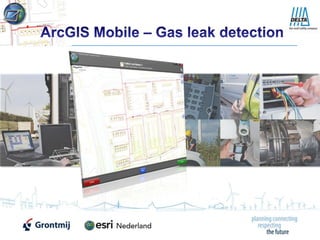
  • 1. ArcGIS Mobile – Gas leak detection
  • 2. 2 Introduction Delta Infra is a service provider for the Delta Network Company (DNWB), the industry and other network operators. The tasks they perform are mainly related to maintaining and inspecting these networks. For the inspection of their gas line network, walking routes are defined. Using sophisticated detection equipment they search for possible gas leaks in their network. To aid them with this task Esri Netherland and Grontmij have developed a mobile application based on ArcGIS Mobile 10.
  • 3. 3 Initial settings The first time the application is started, the user will have to enter the specifications of the detection equipment used for the fieldwork. This meta information is stored for later reference.
  • 4. 4 Full extent The application starts with the full extent of the province of Zeeland (the Netherlands).
  • 5. 5 Zoom in to detailed area The user zooms in to the area (or uses the GPS position); gas pipes and house connections become visible.
  • 6. 6 Register observations When an observation needs to be registered the user will have the choice between a gas leak or an obstacle.
  • 7. 7 Location A gas leak detection location (or an obstacle) can be drawn on the map or can be defined by the GPS coordinates.
  • 8. 8 Specify attributes After the location has been defined all the attributes are specified. Address and pipeline data are automatically filled in based on the location.
  • 9. 9 Type 1 gas leak In case of a gas leak of type 1 (severe) the application sends an email containing the address and an image of the location on the map for immediate action.
  • 10. 10 Progress of fieldwork When the observation of (a part of) the street has been finalized, the street is registered as "checked" and the symbology is changed automatically. This provides the necessary feedback to the fieldworker with respect to the area processed.
  • 11. 11 Connection to Diasys The ArcGIS mobile application is connected to the Diasys application containing high detailed house connection drawings. When a detailed sketch is requested this is registered in the ArcGIS mobile application for later reference.
  • 12.
  • 13. Windows Presentation FoundationFor more info on ArcGIS Mobile please visit: http://resources.arcgis.com/content/arcgis-mobile/10.0/about
  • 14. More information… This project has been a collaboration of Esri Netherlands and Grontmij for Delta Infra. Berend Veldkamp GIS Programmer (Grontmij) More information? http://software.grontmij.nl (Dutch) http://www.esri.nl (Dutch) http://www.delta.nl (Dutch) Albert van Kempen Project leader (Grontmij) Xander Bakker GIS Consultant (Grontmij)