Naturesbenefits Kenya 08 Upper Tana
•Download as PPT, PDF•
0 likes•348 views

Maps from Nature's Benefits in Kenya -- Chapter 8: The Upper Tana: Patterns of Ecosystem Services and Poverty. Examines maps of various ecosystem services and poverty patterns in a single region -- the upper watersheds of the Tana River -- to demonstrate how such maps can help to highlight the relationships among people, ecosystems, and poverty.

Recommended
More Related Content
Similar to Naturesbenefits Kenya 08 Upper Tana
Similar to Naturesbenefits Kenya 08 Upper Tana (20)
More from World Resources Institute (WRI)
More from World Resources Institute (WRI) (20)
Recently uploaded
Recently uploaded (20)
Naturesbenefits Kenya 08 Upper Tana
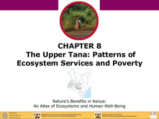
- 1. CHAPTER 8 The Upper Tana: Patterns of Ecosystem Services and Poverty Nature’s Benefits in Kenya: An Atlas of Ecosystems and Human Well-Being
- 2. Upper Tana: Landforms and Rivers
- 3. Upper Tana: Population Density, 1999
- 4. Upper Tana: Poverty Rate, 1999
- 5. Upper Tana: Poverty Density, 1999
- 6. Upper Tana: Household Reliance on Ecosystems for Drinking Water SINGLE DOMINANT DRINKING WATER SOURCES (More than 75% of households) Rely on surface water Rely on groundwater Rely on piped water MIX OF DRINKING WATER SOURCES Rely on surface and groundwater (more than 75% of households) Mix of piped, surface and ground water ( no dominant source) OTHER FEATURES Upper Tana boundary District boundaries Major roads Major national parks and reserves (over 5,000 ha) WATER BODIES AND RIVERS Permanent rivers Water bodies
- 7. Upper Tana: High Share of Piped Drinking Water and Poverty Rate AREAS WITH PIPED WATER ACCESS LESS THAN 75 PERCENT OR OTHER SOURCE
- 8. Upper Tana: Irrigation Efforts and Other Water Uses
- 9. Upper Tana: Small-Scale Irrigation Efforts and Poverty Rate AREAS WITHOUT SMALL-SCALE IRREGATION EFFORTS
- 10. Upper Tana: Small-Scale Irrigation Efforts and High Share of Piped Drinking Water
- 11. Upper Tana: Food Crops as Percentage of All Cropland
- 12. Upper Tana: High Share of Food Crops and Poverty Rate AREAS WITH LESS THAN 75 PERCENT OF FOOD SHARE
- 13. Upper Tana: Milk Production
- 14. Upper Tana: High Milk Production and Poverty Rate AREAS WITH LESS THAN 6 PERCENT WOODLOTS IN CROPLAND
- 15. Upper Tana: High Share of Food Crops and High Milk Production
- 16. Upper Tana: Average Number of Crops Grown in Cropland
- 17. Upper Tana: High Average Number of Crops Grown in Cropland and Poverty Rate AREAS WITH LESS THAN FOUR AGRICULTURAL CROPS
- 18. Upper Tana: Share of Woodlots in Cropland
- 19. Upper Tana: High Share of Woodlots in Cropland and Poverty Rate AREAS WITH LESS THAN 6 PERCENT WOODLOTS IN CROPLAND
- 20. Upper Tana: High Average Number of Crops Grown and High Share of Woodlots in Cropland
- 21. Upper Tana: Demographic and Poverty Characteristics for Areas Outlined by Selected Ecosystem Indicators
- 22. Upper Tana: Summary of Poverty Rates in Areas Outlined by Selected Ecosystem Indicators (High Share Piped Drinking Water vs. Small-Scale Irrigation Efforts) HIGH SHARE PIPED DRINKING WATER SMALL-SCALE IRRIGATION EFFORTS
- 23. Upper Tana: Summary of Poverty Rates in Areas Outlined by Selected Ecosystem Indicators (High Share Food Crops vs. High Milk Production) HIGH SHARE FOOD CROPS HIGH MILK PRODUCTION
- 24. Upper Tana: Summary of Poverty Rates in Areas Outlined by Selected Ecosystem Indicators (High Average Number of Crops vs. High Share of Woodlots in Cropland) HIGH AVERAGE NUMBER OF CROPS HIGH SHARE OF WOODLOTS IN CROPLAND
- 25. Upper Tana: Summary of Poverty Rates in Areas Outlined by Selected Ecosystem Indicators HIGH SHARE PIPED DRINKING WATER HIGH SHARE FOOD CROPS HIGH AVERAGE NUMBER OF CROPS SMALL-SCALE IRREGATION EFFORTS HIGH MILK PRODUCTION HIGH SHARE OF WOODLOTS IN CROPLAND
Editor's Notes
- What This Chapter Shows: This chapter examines maps of various ecosystem services and poverty patterns in a single region—the upper watersheds of the Tana River—to demonstrate how such maps can help to highlight the relationships among people, ecosystems, and poverty. After providing a brief overview of landforms, population distribution, and poverty patterns in the upper Tana, the spatial relationships between selected ecosystem indicators and poverty in three topic areas: water-related ecosystem services; food-related ecosystem services; and biodiversity- and wood-related ecosystem services are discussed. The chapter concludes with a detailed summary that highlights poverty for six selected ecosystem indicators and suggests possible future analyses based on the patterns observed.