SlideShare uma empresa Scribd logo
1 de 20
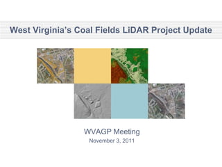
West Virginia’s Coal Fields LiDAR Project Update


                 WVAGP Meeting
                  November 3, 2011
NRAC’s Last Project Status Map for WVDEP


                                   Slide 2
Statewide LiDAR Delivered So Far
                          Frist
                          deliverable
                          has been QC
                          checked by
                          FEMA’s LiDAR
                          QC Contractor
                          Dewberry
                          successfully


                                Slide 3
LiDAR Coverage, by County


Table above lists
coal field counties
with 100%
coverage as a
result of WVDEP’s
LiDAR flights (the
exception is
Marion which flew
their own mission
but shared the
data with WVDEP
via WVU NRAC).

Table top right counties shows additional counties with zero to partial LiDAR coverage as of Autumn 2011 as
a result of WVDEP’s LiDAR work. Each county lists its corresponding percentage of total coverage.
Additional counties confirmed to have county wide LiDAR are Cabell, Jefferson, Kanawha and Raleigh with
new county-wide coverage in 2011. There may be more in the northern or eastern panhandles.


                                                                                              Slide 4
Spatial Extent  by watershed not county


                                   Slide 5
First Derived Dataset


                        Slide 6
Second Derived Dataset


                         Slide 7
Third Derived Dataset


                        Slide 8
Resolution and Change Comparison
 WVDEP 2009
    Data


  At this scale, differences in data resolution and change over time are not widely noticeable. However, upon
further analysis, significant differences in resolution and change become evident, as shown in the next slide…


WVSAMP 2003
   Data


                                                                                                Slide 9
Resolution and Change Comparison
                                                          The image above is
WVDEP 2009
   Data                                                   a portion of the most
                                                          recent LiDAR flown
                                                          by West Virginia
                                                          University (WVU) for
                                                          WV Department of
                                                          Environmental
                                                          Protection (WVDEP).
                                                          The image below is a
                                                          portion of the data
      Change in Landscape                                 provided by the West
                                                          Virginia Statewide
                                                          Addressing and
                                                          Mapping Project
                                  Change in Resolution    (WVSAMP). Both
                                                          examples are from
                                                          the same region in
                                                          Boone County, West
                                                          Virginia. Changes to
                                                          the landscape that
                                                          have occurred since
                                                          the date of data
                                                          collection by
                                                          WVSAMP versus the
                                                          date of collection
                                                          from the WVDEP
                                                          LiDAR are clearly
                                                          visible. This
                                                          comparison also
                                                          shows the
                                                          considerable
WVSAMP 2003                                               improvement in
   Data
                                                          resolution between
                                                          the two datasets.


                                                         Slide 10
Hillshade of a Mining Site, Wyoming County, WV


                                       Slide 11
5’ Contours Overlaid on Hillshade


                              Slide 12
5’ Contours of the Mining Site


                             Slide 13
LiDAR, Blair Mountain, and Viewshed Analysis


     WVDEP’s first official use of this LiDAR data
        was a viewshed analysis investigating
    existing and proposed mining permits around
                   Blair Mountain.


                                                     Slide 14
LiDAR, Blair Mountain, and Viewshed Analysis


                                      Slide 15
Data Access via ArcGIS Server
• Derived Datasets as REST geoservices …
  – DEM
  – Grid                               For
  – Hillshade
                                        All
  – Contours
  – Canopy height
                                      CAD
  – Slope                                &
  – Aspect                             GIS
  – Intensity image                  Users
  – … Possible building footprints
                                        Slide 16
Raw LAS File Distribution
• WV View  first deliverables there next
  week


                                    Slide 17
The End
Without more partners
soon, the LiDAR
capability at WVU is
headed for …


                        Slide 18
Future Data Product  Building Footprints


                                  Slide 19
Future Data Product  Intensity Image


                                 Slide 20

Mais conteúdo relacionado

Mais de WV Assocation of Geospatial Professionals

Mais de WV Assocation of Geospatial Professionals (20)

Proceedings for 2016 WV EPAN GIS Users Group Meeting
Proceedings for 2016 WV EPAN GIS Users Group MeetingProceedings for 2016 WV EPAN GIS Users Group Meeting
Proceedings for 2016 WV EPAN GIS Users Group Meeting
 
Evaluating Riparian Buffers of WV Landowners in Chesapeake Bay Drainage
Evaluating Riparian Buffers of WV Landowners in Chesapeake Bay Drainage Evaluating Riparian Buffers of WV Landowners in Chesapeake Bay Drainage
Evaluating Riparian Buffers of WV Landowners in Chesapeake Bay Drainage
 
2016 Agenda for WV EPAN Users Group Meeting
2016 Agenda for WV EPAN Users Group Meeting2016 Agenda for WV EPAN Users Group Meeting
2016 Agenda for WV EPAN Users Group Meeting
 
WV Local GIS Data Contributions to State/Federal Datasets
WV Local GIS Data Contributions to State/Federal DatasetsWV Local GIS Data Contributions to State/Federal Datasets
WV Local GIS Data Contributions to State/Federal Datasets
 
Agenda EPAN 2015
Agenda EPAN 2015Agenda EPAN 2015
Agenda EPAN 2015
 
Transitioning Applications to the Web App Builder
Transitioning Applications to the Web App BuilderTransitioning Applications to the Web App Builder
Transitioning Applications to the Web App Builder
 
Stormwater and GIS
Stormwater and GISStormwater and GIS
Stormwater and GIS
 
Pictometry Imagery for West Virginia
Pictometry Imagery for West VirginiaPictometry Imagery for West Virginia
Pictometry Imagery for West Virginia
 
Device Locational Accuracy
Device Locational AccuracyDevice Locational Accuracy
Device Locational Accuracy
 
WV Statewide Addressing and Mapping Update (SAMS-II)
WV Statewide Addressing and Mapping Update (SAMS-II)WV Statewide Addressing and Mapping Update (SAMS-II)
WV Statewide Addressing and Mapping Update (SAMS-II)
 
Agenda for WVAGP 2015 Annual Meeting
Agenda for WVAGP 2015 Annual MeetingAgenda for WVAGP 2015 Annual Meeting
Agenda for WVAGP 2015 Annual Meeting
 
WV 3D Elevation Program (3DEP) / BAA Overview
WV 3D Elevation Program (3DEP) / BAA OverviewWV 3D Elevation Program (3DEP) / BAA Overview
WV 3D Elevation Program (3DEP) / BAA Overview
 
WV National Hydrography Dataset (NHD) Update
WV National Hydrography Dataset (NHD) UpdateWV National Hydrography Dataset (NHD) Update
WV National Hydrography Dataset (NHD) Update
 
Three Rivers Quest (WV Water Research Institute)
Three Rivers Quest (WV Water Research Institute)Three Rivers Quest (WV Water Research Institute)
Three Rivers Quest (WV Water Research Institute)
 
Geospatial Initiatives: A National Perspective
 Geospatial Initiatives: A National Perspective Geospatial Initiatives: A National Perspective
Geospatial Initiatives: A National Perspective
 
2013 WV Epan GIS Users Group Meeting Agenda
2013 WV Epan GIS Users Group Meeting Agenda2013 WV Epan GIS Users Group Meeting Agenda
2013 WV Epan GIS Users Group Meeting Agenda
 
Python and ArcGIS 10.1
Python and ArcGIS 10.1Python and ArcGIS 10.1
Python and ArcGIS 10.1
 
Predicting Future Growth from Unbuilt Lots
Predicting Future Growth from Unbuilt LotsPredicting Future Growth from Unbuilt Lots
Predicting Future Growth from Unbuilt Lots
 
Mobile Options for ArcGIS – Selecting Your Solution
Mobile Options for ArcGIS – Selecting Your SolutionMobile Options for ArcGIS – Selecting Your Solution
Mobile Options for ArcGIS – Selecting Your Solution
 
Martinsburg Urban Tree Inventory
Martinsburg Urban Tree InventoryMartinsburg Urban Tree Inventory
Martinsburg Urban Tree Inventory
 

Último

Unit-V; Pricing (Pharma Marketing Management).pptx
Unit-V; Pricing (Pharma Marketing Management).pptxUnit-V; Pricing (Pharma Marketing Management).pptx
Unit-V; Pricing (Pharma Marketing Management).pptxVishalSingh1417
 
Unit-IV- Pharma. Marketing Channels.pptx
Unit-IV- Pharma. Marketing Channels.pptxUnit-IV- Pharma. Marketing Channels.pptx
Unit-IV- Pharma. Marketing Channels.pptxVishalSingh1417
 
Mixin Classes in Odoo 17 How to Extend Models Using Mixin Classes
Mixin Classes in Odoo 17  How to Extend Models Using Mixin ClassesMixin Classes in Odoo 17  How to Extend Models Using Mixin Classes
Mixin Classes in Odoo 17 How to Extend Models Using Mixin ClassesCeline George
 
Third Battle of Panipat detailed notes.pptx
Third Battle of Panipat detailed notes.pptxThird Battle of Panipat detailed notes.pptx
Third Battle of Panipat detailed notes.pptxAmita Gupta
 
The basics of sentences session 3pptx.pptx
The basics of sentences session 3pptx.pptxThe basics of sentences session 3pptx.pptx
The basics of sentences session 3pptx.pptxheathfieldcps1
 
ICT role in 21st century education and it's challenges.
ICT role in 21st century education and it's challenges.ICT role in 21st century education and it's challenges.
ICT role in 21st century education and it's challenges.MaryamAhmad92
 
Basic Civil Engineering first year Notes- Chapter 4 Building.pptx
Basic Civil Engineering first year Notes- Chapter 4 Building.pptxBasic Civil Engineering first year Notes- Chapter 4 Building.pptx
Basic Civil Engineering first year Notes- Chapter 4 Building.pptxDenish Jangid
 
How to Give a Domain for a Field in Odoo 17
How to Give a Domain for a Field in Odoo 17How to Give a Domain for a Field in Odoo 17
How to Give a Domain for a Field in Odoo 17Celine George
 
SKILL OF INTRODUCING THE LESSON MICRO SKILLS.pptx
SKILL OF INTRODUCING THE LESSON MICRO SKILLS.pptxSKILL OF INTRODUCING THE LESSON MICRO SKILLS.pptx
SKILL OF INTRODUCING THE LESSON MICRO SKILLS.pptxAmanpreet Kaur
 
Application orientated numerical on hev.ppt
Application orientated numerical on hev.pptApplication orientated numerical on hev.ppt
Application orientated numerical on hev.pptRamjanShidvankar
 
On National Teacher Day, meet the 2024-25 Kenan Fellows
On National Teacher Day, meet the 2024-25 Kenan FellowsOn National Teacher Day, meet the 2024-25 Kenan Fellows
On National Teacher Day, meet the 2024-25 Kenan FellowsMebane Rash
 
How to Create and Manage Wizard in Odoo 17
How to Create and Manage Wizard in Odoo 17How to Create and Manage Wizard in Odoo 17
How to Create and Manage Wizard in Odoo 17Celine George
 
psychiatric nursing HISTORY COLLECTION .docx
psychiatric  nursing HISTORY  COLLECTION  .docxpsychiatric  nursing HISTORY  COLLECTION  .docx
psychiatric nursing HISTORY COLLECTION .docxPoojaSen20
 
Kodo Millet PPT made by Ghanshyam bairwa college of Agriculture kumher bhara...
Kodo Millet  PPT made by Ghanshyam bairwa college of Agriculture kumher bhara...Kodo Millet  PPT made by Ghanshyam bairwa college of Agriculture kumher bhara...
Kodo Millet PPT made by Ghanshyam bairwa college of Agriculture kumher bhara...pradhanghanshyam7136
 
General Principles of Intellectual Property: Concepts of Intellectual Proper...
General Principles of Intellectual Property: Concepts of Intellectual  Proper...General Principles of Intellectual Property: Concepts of Intellectual  Proper...
General Principles of Intellectual Property: Concepts of Intellectual Proper...Poonam Aher Patil
 
Grant Readiness 101 TechSoup and Remy Consulting
Grant Readiness 101 TechSoup and Remy ConsultingGrant Readiness 101 TechSoup and Remy Consulting
Grant Readiness 101 TechSoup and Remy ConsultingTechSoup
 
Russian Escort Service in Delhi 11k Hotel Foreigner Russian Call Girls in Delhi
Russian Escort Service in Delhi 11k Hotel Foreigner Russian Call Girls in DelhiRussian Escort Service in Delhi 11k Hotel Foreigner Russian Call Girls in Delhi
Russian Escort Service in Delhi 11k Hotel Foreigner Russian Call Girls in Delhikauryashika82
 
Dyslexia AI Workshop for Slideshare.pptx
Dyslexia AI Workshop for Slideshare.pptxDyslexia AI Workshop for Slideshare.pptx
Dyslexia AI Workshop for Slideshare.pptxcallscotland1987
 

Último (20)

Unit-V; Pricing (Pharma Marketing Management).pptx
Unit-V; Pricing (Pharma Marketing Management).pptxUnit-V; Pricing (Pharma Marketing Management).pptx
Unit-V; Pricing (Pharma Marketing Management).pptx
 
Mehran University Newsletter Vol-X, Issue-I, 2024
Mehran University Newsletter Vol-X, Issue-I, 2024Mehran University Newsletter Vol-X, Issue-I, 2024
Mehran University Newsletter Vol-X, Issue-I, 2024
 
Unit-IV- Pharma. Marketing Channels.pptx
Unit-IV- Pharma. Marketing Channels.pptxUnit-IV- Pharma. Marketing Channels.pptx
Unit-IV- Pharma. Marketing Channels.pptx
 
Mixin Classes in Odoo 17 How to Extend Models Using Mixin Classes
Mixin Classes in Odoo 17  How to Extend Models Using Mixin ClassesMixin Classes in Odoo 17  How to Extend Models Using Mixin Classes
Mixin Classes in Odoo 17 How to Extend Models Using Mixin Classes
 
Third Battle of Panipat detailed notes.pptx
Third Battle of Panipat detailed notes.pptxThird Battle of Panipat detailed notes.pptx
Third Battle of Panipat detailed notes.pptx
 
The basics of sentences session 3pptx.pptx
The basics of sentences session 3pptx.pptxThe basics of sentences session 3pptx.pptx
The basics of sentences session 3pptx.pptx
 
ICT role in 21st century education and it's challenges.
ICT role in 21st century education and it's challenges.ICT role in 21st century education and it's challenges.
ICT role in 21st century education and it's challenges.
 
Basic Civil Engineering first year Notes- Chapter 4 Building.pptx
Basic Civil Engineering first year Notes- Chapter 4 Building.pptxBasic Civil Engineering first year Notes- Chapter 4 Building.pptx
Basic Civil Engineering first year Notes- Chapter 4 Building.pptx
 
How to Give a Domain for a Field in Odoo 17
How to Give a Domain for a Field in Odoo 17How to Give a Domain for a Field in Odoo 17
How to Give a Domain for a Field in Odoo 17
 
SKILL OF INTRODUCING THE LESSON MICRO SKILLS.pptx
SKILL OF INTRODUCING THE LESSON MICRO SKILLS.pptxSKILL OF INTRODUCING THE LESSON MICRO SKILLS.pptx
SKILL OF INTRODUCING THE LESSON MICRO SKILLS.pptx
 
Application orientated numerical on hev.ppt
Application orientated numerical on hev.pptApplication orientated numerical on hev.ppt
Application orientated numerical on hev.ppt
 
On National Teacher Day, meet the 2024-25 Kenan Fellows
On National Teacher Day, meet the 2024-25 Kenan FellowsOn National Teacher Day, meet the 2024-25 Kenan Fellows
On National Teacher Day, meet the 2024-25 Kenan Fellows
 
How to Create and Manage Wizard in Odoo 17
How to Create and Manage Wizard in Odoo 17How to Create and Manage Wizard in Odoo 17
How to Create and Manage Wizard in Odoo 17
 
psychiatric nursing HISTORY COLLECTION .docx
psychiatric  nursing HISTORY  COLLECTION  .docxpsychiatric  nursing HISTORY  COLLECTION  .docx
psychiatric nursing HISTORY COLLECTION .docx
 
Kodo Millet PPT made by Ghanshyam bairwa college of Agriculture kumher bhara...
Kodo Millet  PPT made by Ghanshyam bairwa college of Agriculture kumher bhara...Kodo Millet  PPT made by Ghanshyam bairwa college of Agriculture kumher bhara...
Kodo Millet PPT made by Ghanshyam bairwa college of Agriculture kumher bhara...
 
General Principles of Intellectual Property: Concepts of Intellectual Proper...
General Principles of Intellectual Property: Concepts of Intellectual  Proper...General Principles of Intellectual Property: Concepts of Intellectual  Proper...
General Principles of Intellectual Property: Concepts of Intellectual Proper...
 
Grant Readiness 101 TechSoup and Remy Consulting
Grant Readiness 101 TechSoup and Remy ConsultingGrant Readiness 101 TechSoup and Remy Consulting
Grant Readiness 101 TechSoup and Remy Consulting
 
Spatium Project Simulation student brief
Spatium Project Simulation student briefSpatium Project Simulation student brief
Spatium Project Simulation student brief
 
Russian Escort Service in Delhi 11k Hotel Foreigner Russian Call Girls in Delhi
Russian Escort Service in Delhi 11k Hotel Foreigner Russian Call Girls in DelhiRussian Escort Service in Delhi 11k Hotel Foreigner Russian Call Girls in Delhi
Russian Escort Service in Delhi 11k Hotel Foreigner Russian Call Girls in Delhi
 
Dyslexia AI Workshop for Slideshare.pptx
Dyslexia AI Workshop for Slideshare.pptxDyslexia AI Workshop for Slideshare.pptx
Dyslexia AI Workshop for Slideshare.pptx
 

WV DEP Coal LIDAR Project Update (3 Nov 2011)

  • 1. West Virginia’s Coal Fields LiDAR Project Update WVAGP Meeting November 3, 2011
  • 2. NRAC’s Last Project Status Map for WVDEP Slide 2
  • 3. Statewide LiDAR Delivered So Far Frist deliverable has been QC checked by FEMA’s LiDAR QC Contractor Dewberry successfully Slide 3
  • 4. LiDAR Coverage, by County Table above lists coal field counties with 100% coverage as a result of WVDEP’s LiDAR flights (the exception is Marion which flew their own mission but shared the data with WVDEP via WVU NRAC). Table top right counties shows additional counties with zero to partial LiDAR coverage as of Autumn 2011 as a result of WVDEP’s LiDAR work. Each county lists its corresponding percentage of total coverage. Additional counties confirmed to have county wide LiDAR are Cabell, Jefferson, Kanawha and Raleigh with new county-wide coverage in 2011. There may be more in the northern or eastern panhandles. Slide 4
  • 5. Spatial Extent  by watershed not county Slide 5
  • 9. Resolution and Change Comparison WVDEP 2009 Data At this scale, differences in data resolution and change over time are not widely noticeable. However, upon further analysis, significant differences in resolution and change become evident, as shown in the next slide… WVSAMP 2003 Data Slide 9
  • 10. Resolution and Change Comparison The image above is WVDEP 2009 Data a portion of the most recent LiDAR flown by West Virginia University (WVU) for WV Department of Environmental Protection (WVDEP). The image below is a portion of the data Change in Landscape provided by the West Virginia Statewide Addressing and Mapping Project Change in Resolution (WVSAMP). Both examples are from the same region in Boone County, West Virginia. Changes to the landscape that have occurred since the date of data collection by WVSAMP versus the date of collection from the WVDEP LiDAR are clearly visible. This comparison also shows the considerable WVSAMP 2003 improvement in Data resolution between the two datasets. Slide 10
  • 11. Hillshade of a Mining Site, Wyoming County, WV Slide 11
  • 12. 5’ Contours Overlaid on Hillshade Slide 12
  • 13. 5’ Contours of the Mining Site Slide 13
  • 14. LiDAR, Blair Mountain, and Viewshed Analysis WVDEP’s first official use of this LiDAR data was a viewshed analysis investigating existing and proposed mining permits around Blair Mountain. Slide 14
  • 15. LiDAR, Blair Mountain, and Viewshed Analysis Slide 15
  • 16. Data Access via ArcGIS Server • Derived Datasets as REST geoservices … – DEM – Grid For – Hillshade All – Contours – Canopy height CAD – Slope & – Aspect GIS – Intensity image Users – … Possible building footprints Slide 16
  • 17. Raw LAS File Distribution • WV View  first deliverables there next week Slide 17
  • 18. The End Without more partners soon, the LiDAR capability at WVU is headed for … Slide 18
  • 19. Future Data Product  Building Footprints Slide 19
  • 20. Future Data Product  Intensity Image Slide 20