SlideShare uma empresa Scribd logo
1 de 28
Office of Coast Survey
Providing Navigation SupportProviding Navigation Support
for Growth in the Arctic Maritime Economyfor Growth in the Arctic Maritime Economy
Crescent Moegling
Northwest Navigation Manager, Office of Coast Survey
National Oceanic and Atmospheric Administration
Office of Coast Survey
Coast Survey is the nation’s
nautical chart maker
Traditional paper charts
Electronic navigational charts
Office of Coast Survey
NOAA charts cover U.S. coastal waters
U.S. marine transportation system:
95,000 miles of coastline
25,000 miles of navigable channels
U.S. EEZ is 3.4 million square nautical miles
Office of Coast Survey
NOAA charts are the source of all U.S.
nautical charts
Commercial vessels called on
U.S. ports 63,000 times in 2010.
Every vessel is required to
carry nautical charts.
10 million U.S. residents sailed on a
cruise in 2010.
Every cruise ship must use
nautical charts.
Office of Coast Survey
Mariners have trusted Coast
Survey for over two centuries
• First science agency of the U.S., formed in 1807
• Surveys 3.4 million square nautical miles
• Creates and updates over 1,000 nautical charts
• Speeds re-opening of ports after hurricanes and
other disasters
• Develops hydrodynamic models for coastal
management
• Provides global hydrographic leadership
Office of Coast Survey
Advanced technologies to acquire
hydrographic data
Rainier
Newport, OR
1968, MRP 2010-11
Fairweather
Ketchikan, AK
1968, 2010
Thomas Jefferson
Norfolk, VA
1992
Bay Hydro II
Silver Spring, MD
2008
Hassler
New Hampshire
2012
King Air
2009
Six Navigation
Response
Teams
Office of Coast Survey
“Seeing” the seafloor
• Deals with the
measurement and
description of the
physical features of
oceans, seas, coastal
areas, lakes and rivers.
Hydrography is the branch of applied sciences that:
Office of Coast Survey
National Policy guides NOAA in the Arctic
• Presidential Executive Order (July 2010)
– “Address environmental stewardship needs in the Arctic
Ocean and adjacent coastal areas in the face of climate-
induced and other environmental changes.”
– “Implement comprehensive integrated ecosystem-based
coastal and marine spatial planning in the United States.”
• NOAA Arctic Vision and Strategy (February 2011)
– Enhance international & national partnerships. Share data
and observational platforms.
– Advance resilient and healthy Arctic communities and
economies. Improve safe navigation, oil spill response
readiness, geospatial infrastructure, and climate change
adaption strategies.
Office of Coast Survey
Alaska accounts for 63% of U.S.
“navigationally significant waters”
In square nautical miles
Office of Coast Survey
Comparison of Alaska and the contiguous states
shows the extent of historical survey coverage
Office of Coast Survey
Preparing for new Arctic routes
Office of Coast Survey
NOAA recently updated Arctic charting priorities
• 14 new charts planned
• Seeking views of
maritime interests
http://www.nauticalcharts.noaa.gov/mcd/docs/Arctic_Nautical_Charting_Plan.pdf
Office of Coast Survey
Marine traffic drives
new chart coverage
Office of Coast Survey
Example of harbor scale charts
Office of Coast Survey
Chart 16161:
Kotzebue Harbor and Approaches
• Based on a
large survey
conducted by
NOAA Ship
Fairweather,
summer, 2011
• Published in
April 2012 –
1:50,000 scale
• Previously, the
largest scale
chart available
was 1:700,000
Office of Coast Survey
New charts
are planned
as data
becomes
available
Office of Coast Survey
Recon surveys in 2012
• Fairweather checked
sparse soundings
acquired by early U.S.
Coast and Geodetic
Survey field parties and
by other agencies.
• The vessel traveled along
a 1,500 nautical mile
coastal corridor from
Dutch Harbor, Alaska, to
the Canadian border.
Office of Coast Survey
Crew saw the beauty
of the Arctic
Office of Coast Survey
An example of Fata Morgana
– an Artic mirage
Office of Coast Survey
A “ghost ship”??
Office of Coast Survey
Navigation response in the Arctic?
Office of Coast Survey
NOAA navigation products are used in
response to oil spills
Office of Coast Survey
Could we respond to a major event in
the Arctic?
• Improving geospatial infrastructure
• Correcting meters-level positioning errors
• Increasing tide, current, and water-level coverage
• Updating shoreline and hydrographic data
• Producing new nautical charts
NOAA must tackle substantial hydrographic,
cartographic, and geospatial tasks in Alaska.
These tasks include:
Office of Coast Survey
www.nauticalcharts.noaa.gov
Twitter @nauticalcharts
Blogging at noaacoastsurvey.wordpress.com

Mais conteúdo relacionado

Mais procurados

ppt pres coastalt 2011.ppt
ppt pres coastalt 2011.pptppt pres coastalt 2011.ppt
ppt pres coastalt 2011.ppt
grssieee
 
ALERT: AMEC Load Estimation and Reduction Tracking
ALERT: AMEC Load Estimation and Reduction TrackingALERT: AMEC Load Estimation and Reduction Tracking
ALERT: AMEC Load Estimation and Reduction Tracking
Thomas Williams
 
TGS East Russian Arctic- Geology and Hydrocarbon Systems
TGS East Russian Arctic- Geology and Hydrocarbon Systems TGS East Russian Arctic- Geology and Hydrocarbon Systems
TGS East Russian Arctic- Geology and Hydrocarbon Systems
TGS
 
6_SF2C_JieLiu
6_SF2C_JieLiu6_SF2C_JieLiu
6_SF2C_JieLiu
Jie Liu
 
Graphical presentation and classification for assessment of Ground water Qual...
Graphical presentation and classification for assessment of Ground water Qual...Graphical presentation and classification for assessment of Ground water Qual...
Graphical presentation and classification for assessment of Ground water Qual...
Indian School of Mines, Dhanbad, India
 

Mais procurados (20)

NOAA National Water Model, Gregory Waller
NOAA National Water Model, Gregory WallerNOAA National Water Model, Gregory Waller
NOAA National Water Model, Gregory Waller
 
U.S. Army Corps of Engineers Update, Mark Mazzanti SES
U.S. Army Corps of Engineers Update, Mark Mazzanti SESU.S. Army Corps of Engineers Update, Mark Mazzanti SES
U.S. Army Corps of Engineers Update, Mark Mazzanti SES
 
ppt pres coastalt 2011.ppt
ppt pres coastalt 2011.pptppt pres coastalt 2011.ppt
ppt pres coastalt 2011.ppt
 
DSD-INT 2018 Tidal propagation and salt intrusion in the multi-channel estuar...
DSD-INT 2018 Tidal propagation and salt intrusion in the multi-channel estuar...DSD-INT 2018 Tidal propagation and salt intrusion in the multi-channel estuar...
DSD-INT 2018 Tidal propagation and salt intrusion in the multi-channel estuar...
 
Kansas rivermodel
Kansas rivermodelKansas rivermodel
Kansas rivermodel
 
ALERT: AMEC Load Estimation and Reduction Tracking
ALERT: AMEC Load Estimation and Reduction TrackingALERT: AMEC Load Estimation and Reduction Tracking
ALERT: AMEC Load Estimation and Reduction Tracking
 
1992 Report of the North Carolina Environmental Sciences Review Panel to the ...
1992 Report of the North Carolina Environmental Sciences Review Panel to the ...1992 Report of the North Carolina Environmental Sciences Review Panel to the ...
1992 Report of the North Carolina Environmental Sciences Review Panel to the ...
 
The Effect of Declination on The Tide Pattern in Hydroghraphic Surveying
The Effect of Declination on The Tide Pattern in Hydroghraphic SurveyingThe Effect of Declination on The Tide Pattern in Hydroghraphic Surveying
The Effect of Declination on The Tide Pattern in Hydroghraphic Surveying
 
TGS East Russian Arctic- Geology and Hydrocarbon Systems
TGS East Russian Arctic- Geology and Hydrocarbon Systems TGS East Russian Arctic- Geology and Hydrocarbon Systems
TGS East Russian Arctic- Geology and Hydrocarbon Systems
 
Hydrography
Hydrography Hydrography
Hydrography
 
Hydrographic surveys
Hydrographic surveysHydrographic surveys
Hydrographic surveys
 
3.2 IUKWC Workshop Freshwater EO - Mark Cutler - Jun17
3.2 IUKWC Workshop Freshwater EO - Mark Cutler - Jun173.2 IUKWC Workshop Freshwater EO - Mark Cutler - Jun17
3.2 IUKWC Workshop Freshwater EO - Mark Cutler - Jun17
 
Hydro2016
Hydro2016Hydro2016
Hydro2016
 
Hydrographicsurveying
HydrographicsurveyingHydrographicsurveying
Hydrographicsurveying
 
6_SF2C_JieLiu
6_SF2C_JieLiu6_SF2C_JieLiu
6_SF2C_JieLiu
 
Circulation of the North Atlantic Ocean During the 1990's as Determine by Lag...
Circulation of the North Atlantic Ocean During the 1990's as Determine by Lag...Circulation of the North Atlantic Ocean During the 1990's as Determine by Lag...
Circulation of the North Atlantic Ocean During the 1990's as Determine by Lag...
 
Graphical presentation and classification for assessment of Ground water Qual...
Graphical presentation and classification for assessment of Ground water Qual...Graphical presentation and classification for assessment of Ground water Qual...
Graphical presentation and classification for assessment of Ground water Qual...
 
4. WFD Application update - Brendan Ward
4. WFD Application update - Brendan Ward4. WFD Application update - Brendan Ward
4. WFD Application update - Brendan Ward
 
10. Preperation of the Flood Risk Management Plans - Mark Adamson
10. Preperation of the Flood Risk Management Plans - Mark Adamson10. Preperation of the Flood Risk Management Plans - Mark Adamson
10. Preperation of the Flood Risk Management Plans - Mark Adamson
 
Estimating the Atlantic overturning at 26N using satellite altimetry [IUGG]
Estimating the Atlantic overturning at 26N using satellite altimetry [IUGG]Estimating the Atlantic overturning at 26N using satellite altimetry [IUGG]
Estimating the Atlantic overturning at 26N using satellite altimetry [IUGG]
 

Semelhante a Charting the Arctic

Eco Dive Club 2012-02-07
Eco Dive Club 2012-02-07Eco Dive Club 2012-02-07
Eco Dive Club 2012-02-07
Kim Anthony
 
Meteorology presentation.pptx lates
Meteorology presentation.pptx latesMeteorology presentation.pptx lates
Meteorology presentation.pptx lates
jabbar2002pk200
 
Diehl_Research_poster(2) (1)
Diehl_Research_poster(2) (1)Diehl_Research_poster(2) (1)
Diehl_Research_poster(2) (1)
Brett Diehl
 
2016 Geo Field Tech C.V. PDF
2016 Geo Field Tech C.V. PDF2016 Geo Field Tech C.V. PDF
2016 Geo Field Tech C.V. PDF
Jeremiah Brower
 

Semelhante a Charting the Arctic (20)

Definition of Oceanography
Definition of OceanographyDefinition of Oceanography
Definition of Oceanography
 
The Bay Way Plan 2009
The Bay Way Plan 2009The Bay Way Plan 2009
The Bay Way Plan 2009
 
Coastal Resource Management
Coastal Resource ManagementCoastal Resource Management
Coastal Resource Management
 
Pacific Resources on Digital Coast
Pacific Resources on Digital CoastPacific Resources on Digital Coast
Pacific Resources on Digital Coast
 
2007 Historic Overview Sea Disposal of Chemical Warfare Materiel
2007 Historic Overview Sea Disposal of Chemical Warfare Materiel2007 Historic Overview Sea Disposal of Chemical Warfare Materiel
2007 Historic Overview Sea Disposal of Chemical Warfare Materiel
 
Http _www.swfwmd.state.fl
Http  _www.swfwmd.state.flHttp  _www.swfwmd.state.fl
Http _www.swfwmd.state.fl
 
Web based Data and Tools for Coastal Management
Web based Data and Tools for Coastal ManagementWeb based Data and Tools for Coastal Management
Web based Data and Tools for Coastal Management
 
Eco Dive Club 2012-02-07
Eco Dive Club 2012-02-07Eco Dive Club 2012-02-07
Eco Dive Club 2012-02-07
 
Scenic Hudson Sea Level Rise Mapper - Part 1
Scenic Hudson Sea Level Rise Mapper - Part 1Scenic Hudson Sea Level Rise Mapper - Part 1
Scenic Hudson Sea Level Rise Mapper - Part 1
 
Meteorology presentation.pptx lates
Meteorology presentation.pptx latesMeteorology presentation.pptx lates
Meteorology presentation.pptx lates
 
Alaska Arctic Policy Commission: Implementation Plan & Bering Sea Communities
Alaska Arctic Policy Commission: Implementation Plan & Bering Sea CommunitiesAlaska Arctic Policy Commission: Implementation Plan & Bering Sea Communities
Alaska Arctic Policy Commission: Implementation Plan & Bering Sea Communities
 
Northeast Ocean Data Portal
Northeast Ocean Data PortalNortheast Ocean Data Portal
Northeast Ocean Data Portal
 
DSD-INT 2015 - unique delft3 d applications in the usa- edwin elias
DSD-INT 2015 - unique delft3 d applications in the usa- edwin eliasDSD-INT 2015 - unique delft3 d applications in the usa- edwin elias
DSD-INT 2015 - unique delft3 d applications in the usa- edwin elias
 
SCA conference2014
SCA conference2014SCA conference2014
SCA conference2014
 
Rob Thieler, Changing Climate, Changing Coasts
Rob Thieler, Changing Climate, Changing CoastsRob Thieler, Changing Climate, Changing Coasts
Rob Thieler, Changing Climate, Changing Coasts
 
A lec 1 an introduction to oceanography
A  lec 1 an introduction to oceanographyA  lec 1 an introduction to oceanography
A lec 1 an introduction to oceanography
 
Diehl_Research_poster(2) (1)
Diehl_Research_poster(2) (1)Diehl_Research_poster(2) (1)
Diehl_Research_poster(2) (1)
 
NOAAsept2004
NOAAsept2004NOAAsept2004
NOAAsept2004
 
2016 Geo Field Tech C.V. PDF
2016 Geo Field Tech C.V. PDF2016 Geo Field Tech C.V. PDF
2016 Geo Field Tech C.V. PDF
 
Groundwater Resources Program (Dennehy)
Groundwater Resources Program (Dennehy)Groundwater Resources Program (Dennehy)
Groundwater Resources Program (Dennehy)
 

Último

Call Girls Kengeri Satellite Town Just Call 👗 7737669865 👗 Top Class Call Gir...
Call Girls Kengeri Satellite Town Just Call 👗 7737669865 👗 Top Class Call Gir...Call Girls Kengeri Satellite Town Just Call 👗 7737669865 👗 Top Class Call Gir...
Call Girls Kengeri Satellite Town Just Call 👗 7737669865 👗 Top Class Call Gir...
amitlee9823
 
FULL ENJOY Call Girls In Majnu Ka Tilla, Delhi Contact Us 8377877756
FULL ENJOY Call Girls In Majnu Ka Tilla, Delhi Contact Us 8377877756FULL ENJOY Call Girls In Majnu Ka Tilla, Delhi Contact Us 8377877756
FULL ENJOY Call Girls In Majnu Ka Tilla, Delhi Contact Us 8377877756
dollysharma2066
 
Insurers' journeys to build a mastery in the IoT usage
Insurers' journeys to build a mastery in the IoT usageInsurers' journeys to build a mastery in the IoT usage
Insurers' journeys to build a mastery in the IoT usage
Matteo Carbone
 
Quick Doctor In Kuwait +2773`7758`557 Kuwait Doha Qatar Dubai Abu Dhabi Sharj...
Quick Doctor In Kuwait +2773`7758`557 Kuwait Doha Qatar Dubai Abu Dhabi Sharj...Quick Doctor In Kuwait +2773`7758`557 Kuwait Doha Qatar Dubai Abu Dhabi Sharj...
Quick Doctor In Kuwait +2773`7758`557 Kuwait Doha Qatar Dubai Abu Dhabi Sharj...
daisycvs
 
Call Girls Jp Nagar Just Call 👗 7737669865 👗 Top Class Call Girl Service Bang...
Call Girls Jp Nagar Just Call 👗 7737669865 👗 Top Class Call Girl Service Bang...Call Girls Jp Nagar Just Call 👗 7737669865 👗 Top Class Call Girl Service Bang...
Call Girls Jp Nagar Just Call 👗 7737669865 👗 Top Class Call Girl Service Bang...
amitlee9823
 
Call Girls In Noida 959961⊹3876 Independent Escort Service Noida
Call Girls In Noida 959961⊹3876 Independent Escort Service NoidaCall Girls In Noida 959961⊹3876 Independent Escort Service Noida
Call Girls In Noida 959961⊹3876 Independent Escort Service Noida
dlhescort
 
Russian Call Girls In Gurgaon ❤️8448577510 ⊹Best Escorts Service In 24/7 Delh...
Russian Call Girls In Gurgaon ❤️8448577510 ⊹Best Escorts Service In 24/7 Delh...Russian Call Girls In Gurgaon ❤️8448577510 ⊹Best Escorts Service In 24/7 Delh...
Russian Call Girls In Gurgaon ❤️8448577510 ⊹Best Escorts Service In 24/7 Delh...
lizamodels9
 
Nelamangala Call Girls: 🍓 7737669865 🍓 High Profile Model Escorts | Bangalore...
Nelamangala Call Girls: 🍓 7737669865 🍓 High Profile Model Escorts | Bangalore...Nelamangala Call Girls: 🍓 7737669865 🍓 High Profile Model Escorts | Bangalore...
Nelamangala Call Girls: 🍓 7737669865 🍓 High Profile Model Escorts | Bangalore...
amitlee9823
 

Último (20)

Call Girls Zirakpur👧 Book Now📱7837612180 📞👉Call Girl Service In Zirakpur No A...
Call Girls Zirakpur👧 Book Now📱7837612180 📞👉Call Girl Service In Zirakpur No A...Call Girls Zirakpur👧 Book Now📱7837612180 📞👉Call Girl Service In Zirakpur No A...
Call Girls Zirakpur👧 Book Now📱7837612180 📞👉Call Girl Service In Zirakpur No A...
 
Call Girls Kengeri Satellite Town Just Call 👗 7737669865 👗 Top Class Call Gir...
Call Girls Kengeri Satellite Town Just Call 👗 7737669865 👗 Top Class Call Gir...Call Girls Kengeri Satellite Town Just Call 👗 7737669865 👗 Top Class Call Gir...
Call Girls Kengeri Satellite Town Just Call 👗 7737669865 👗 Top Class Call Gir...
 
Falcon's Invoice Discounting: Your Path to Prosperity
Falcon's Invoice Discounting: Your Path to ProsperityFalcon's Invoice Discounting: Your Path to Prosperity
Falcon's Invoice Discounting: Your Path to Prosperity
 
FULL ENJOY Call Girls In Majnu Ka Tilla, Delhi Contact Us 8377877756
FULL ENJOY Call Girls In Majnu Ka Tilla, Delhi Contact Us 8377877756FULL ENJOY Call Girls In Majnu Ka Tilla, Delhi Contact Us 8377877756
FULL ENJOY Call Girls In Majnu Ka Tilla, Delhi Contact Us 8377877756
 
RSA Conference Exhibitor List 2024 - Exhibitors Data
RSA Conference Exhibitor List 2024 - Exhibitors DataRSA Conference Exhibitor List 2024 - Exhibitors Data
RSA Conference Exhibitor List 2024 - Exhibitors Data
 
Call Girls In Panjim North Goa 9971646499 Genuine Service
Call Girls In Panjim North Goa 9971646499 Genuine ServiceCall Girls In Panjim North Goa 9971646499 Genuine Service
Call Girls In Panjim North Goa 9971646499 Genuine Service
 
Uneak White's Personal Brand Exploration Presentation
Uneak White's Personal Brand Exploration PresentationUneak White's Personal Brand Exploration Presentation
Uneak White's Personal Brand Exploration Presentation
 
Insurers' journeys to build a mastery in the IoT usage
Insurers' journeys to build a mastery in the IoT usageInsurers' journeys to build a mastery in the IoT usage
Insurers' journeys to build a mastery in the IoT usage
 
It will be International Nurses' Day on 12 May
It will be International Nurses' Day on 12 MayIt will be International Nurses' Day on 12 May
It will be International Nurses' Day on 12 May
 
Quick Doctor In Kuwait +2773`7758`557 Kuwait Doha Qatar Dubai Abu Dhabi Sharj...
Quick Doctor In Kuwait +2773`7758`557 Kuwait Doha Qatar Dubai Abu Dhabi Sharj...Quick Doctor In Kuwait +2773`7758`557 Kuwait Doha Qatar Dubai Abu Dhabi Sharj...
Quick Doctor In Kuwait +2773`7758`557 Kuwait Doha Qatar Dubai Abu Dhabi Sharj...
 
MONA 98765-12871 CALL GIRLS IN LUDHIANA LUDHIANA CALL GIRL
MONA 98765-12871 CALL GIRLS IN LUDHIANA LUDHIANA CALL GIRLMONA 98765-12871 CALL GIRLS IN LUDHIANA LUDHIANA CALL GIRL
MONA 98765-12871 CALL GIRLS IN LUDHIANA LUDHIANA CALL GIRL
 
Call Girls Jp Nagar Just Call 👗 7737669865 👗 Top Class Call Girl Service Bang...
Call Girls Jp Nagar Just Call 👗 7737669865 👗 Top Class Call Girl Service Bang...Call Girls Jp Nagar Just Call 👗 7737669865 👗 Top Class Call Girl Service Bang...
Call Girls Jp Nagar Just Call 👗 7737669865 👗 Top Class Call Girl Service Bang...
 
Call Girls In Noida 959961⊹3876 Independent Escort Service Noida
Call Girls In Noida 959961⊹3876 Independent Escort Service NoidaCall Girls In Noida 959961⊹3876 Independent Escort Service Noida
Call Girls In Noida 959961⊹3876 Independent Escort Service Noida
 
A DAY IN THE LIFE OF A SALESMAN / WOMAN
A DAY IN THE LIFE OF A  SALESMAN / WOMANA DAY IN THE LIFE OF A  SALESMAN / WOMAN
A DAY IN THE LIFE OF A SALESMAN / WOMAN
 
Organizational Transformation Lead with Culture
Organizational Transformation Lead with CultureOrganizational Transformation Lead with Culture
Organizational Transformation Lead with Culture
 
Russian Call Girls In Gurgaon ❤️8448577510 ⊹Best Escorts Service In 24/7 Delh...
Russian Call Girls In Gurgaon ❤️8448577510 ⊹Best Escorts Service In 24/7 Delh...Russian Call Girls In Gurgaon ❤️8448577510 ⊹Best Escorts Service In 24/7 Delh...
Russian Call Girls In Gurgaon ❤️8448577510 ⊹Best Escorts Service In 24/7 Delh...
 
Nelamangala Call Girls: 🍓 7737669865 🍓 High Profile Model Escorts | Bangalore...
Nelamangala Call Girls: 🍓 7737669865 🍓 High Profile Model Escorts | Bangalore...Nelamangala Call Girls: 🍓 7737669865 🍓 High Profile Model Escorts | Bangalore...
Nelamangala Call Girls: 🍓 7737669865 🍓 High Profile Model Escorts | Bangalore...
 
Famous Olympic Siblings from the 21st Century
Famous Olympic Siblings from the 21st CenturyFamous Olympic Siblings from the 21st Century
Famous Olympic Siblings from the 21st Century
 
B.COM Unit – 4 ( CORPORATE SOCIAL RESPONSIBILITY ( CSR ).pptx
B.COM Unit – 4 ( CORPORATE SOCIAL RESPONSIBILITY ( CSR ).pptxB.COM Unit – 4 ( CORPORATE SOCIAL RESPONSIBILITY ( CSR ).pptx
B.COM Unit – 4 ( CORPORATE SOCIAL RESPONSIBILITY ( CSR ).pptx
 
Cracking the Cultural Competence Code.pptx
Cracking the Cultural Competence Code.pptxCracking the Cultural Competence Code.pptx
Cracking the Cultural Competence Code.pptx
 

Charting the Arctic

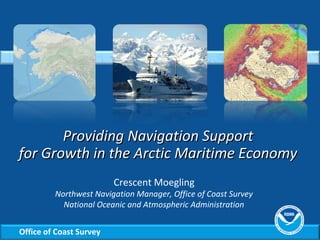
  • 1. Office of Coast Survey Providing Navigation SupportProviding Navigation Support for Growth in the Arctic Maritime Economyfor Growth in the Arctic Maritime Economy Crescent Moegling Northwest Navigation Manager, Office of Coast Survey National Oceanic and Atmospheric Administration
  • 2. Office of Coast Survey Coast Survey is the nation’s nautical chart maker Traditional paper charts Electronic navigational charts
  • 3. Office of Coast Survey NOAA charts cover U.S. coastal waters U.S. marine transportation system: 95,000 miles of coastline 25,000 miles of navigable channels U.S. EEZ is 3.4 million square nautical miles
  • 4. Office of Coast Survey NOAA charts are the source of all U.S. nautical charts Commercial vessels called on U.S. ports 63,000 times in 2010. Every vessel is required to carry nautical charts. 10 million U.S. residents sailed on a cruise in 2010. Every cruise ship must use nautical charts.
  • 5. Office of Coast Survey Mariners have trusted Coast Survey for over two centuries • First science agency of the U.S., formed in 1807 • Surveys 3.4 million square nautical miles • Creates and updates over 1,000 nautical charts • Speeds re-opening of ports after hurricanes and other disasters • Develops hydrodynamic models for coastal management • Provides global hydrographic leadership
  • 6. Office of Coast Survey Advanced technologies to acquire hydrographic data Rainier Newport, OR 1968, MRP 2010-11 Fairweather Ketchikan, AK 1968, 2010 Thomas Jefferson Norfolk, VA 1992 Bay Hydro II Silver Spring, MD 2008 Hassler New Hampshire 2012 King Air 2009 Six Navigation Response Teams
  • 7. Office of Coast Survey “Seeing” the seafloor • Deals with the measurement and description of the physical features of oceans, seas, coastal areas, lakes and rivers. Hydrography is the branch of applied sciences that:
  • 8. Office of Coast Survey National Policy guides NOAA in the Arctic • Presidential Executive Order (July 2010) – “Address environmental stewardship needs in the Arctic Ocean and adjacent coastal areas in the face of climate- induced and other environmental changes.” – “Implement comprehensive integrated ecosystem-based coastal and marine spatial planning in the United States.” • NOAA Arctic Vision and Strategy (February 2011) – Enhance international & national partnerships. Share data and observational platforms. – Advance resilient and healthy Arctic communities and economies. Improve safe navigation, oil spill response readiness, geospatial infrastructure, and climate change adaption strategies.
  • 10. Office of Coast Survey Alaska accounts for 63% of U.S. “navigationally significant waters” In square nautical miles
  • 11. Office of Coast Survey Comparison of Alaska and the contiguous states shows the extent of historical survey coverage
  • 12. Office of Coast Survey Preparing for new Arctic routes
  • 13. Office of Coast Survey NOAA recently updated Arctic charting priorities • 14 new charts planned • Seeking views of maritime interests http://www.nauticalcharts.noaa.gov/mcd/docs/Arctic_Nautical_Charting_Plan.pdf
  • 14. Office of Coast Survey Marine traffic drives new chart coverage
  • 15. Office of Coast Survey Example of harbor scale charts
  • 16. Office of Coast Survey Chart 16161: Kotzebue Harbor and Approaches • Based on a large survey conducted by NOAA Ship Fairweather, summer, 2011 • Published in April 2012 – 1:50,000 scale • Previously, the largest scale chart available was 1:700,000
  • 17. Office of Coast Survey New charts are planned as data becomes available
  • 18. Office of Coast Survey Recon surveys in 2012 • Fairweather checked sparse soundings acquired by early U.S. Coast and Geodetic Survey field parties and by other agencies. • The vessel traveled along a 1,500 nautical mile coastal corridor from Dutch Harbor, Alaska, to the Canadian border.
  • 19. Office of Coast Survey Crew saw the beauty of the Arctic
  • 20. Office of Coast Survey
  • 21. Office of Coast Survey
  • 22. Office of Coast Survey An example of Fata Morgana – an Artic mirage
  • 23. Office of Coast Survey A “ghost ship”??
  • 24. Office of Coast Survey
  • 25. Office of Coast Survey Navigation response in the Arctic?
  • 26. Office of Coast Survey NOAA navigation products are used in response to oil spills
  • 27. Office of Coast Survey Could we respond to a major event in the Arctic? • Improving geospatial infrastructure • Correcting meters-level positioning errors • Increasing tide, current, and water-level coverage • Updating shoreline and hydrographic data • Producing new nautical charts NOAA must tackle substantial hydrographic, cartographic, and geospatial tasks in Alaska. These tasks include:
  • 28. Office of Coast Survey www.nauticalcharts.noaa.gov Twitter @nauticalcharts Blogging at noaacoastsurvey.wordpress.com

Notas do Editor

  1. 4 NOAA survey vessels: FA, RA, FH, & TJ CLICK - 6 navigation response teams CLICK - Bay Hydro II CLICK- LiDAR Contracted hydrographic surveys and services: $22 million/year
  2. Briefly describe multibeam and side scan.
  3. NOAA Arctic Vision Goals: Goal 4: Enhance international & national partnerships. Share data and observational platforms Goal 6: Advance resilient and healthy Arctic communities and economies. Improve geospatial infrastructure, safe navigation, oil spill response readiness, and climate change adaption strategies. I’LL BE TALKING TODAY ABOUT TWO PRONGS TO THE NOAA STRATEGY CLICK - SAFE NAVIGATION CLICK – OIL SPILL RESPONSE READINESS
  4. The U.S. Arctic Research and Policy Act of 1984 defines the U.S. Arctic as the area north of the Arctic Circle, Yukon River, and Aleutian Islands through the Bering Strait and Chukchi & Beaufort Seas.
  5. As ice diminishment opens up new routes, maritime traffic begins to pick up. The region currently has virtually no geospatial infrastructure for accurate positioning and elevations; It has sparse tide, current and water level prediction coverage; It has obsolete shoreline and hydrographic data in most areas; And it has poor nautical charts. We need to survey more, and update charts. In the summer of 2012, NOAA Ship Fairweather undertook a reconnaissance survey of the Arctic, to the northernmost tip of the Alaska’s Arctic coast. Fairweather checked check soundings along a 1,500 nautical mile coastal corridor from Dutch Harbor, Alaska, to the Canadian border. The sounding samples acquired by Fairweather throughout the reconnaissance will provide critical information needed to prioritize NOAA’s future survey projects in the Arctic.
  6. In June 2011, Coast Survey issued the Arctic Nautical Charting Plan after consultations with maritime interests and the public, as well as with other federal, state, and local governments. On February 15, we issued the 2 nd draft, which is outlining the 14 planned charts, and includes a new map showing vessel traffic patterns. The new edition also provides information that will make it easier for mariners and other chart users to provide comments on the plan.
  7. The AIS information has been extremely helpful as we have planned a series of surveys over the next several years to begin addressing the “emerging critical” areas.
  8. The ports in western and northern Alaska with significant vessel traffic concentrations will get new large scale charts – harbor scales range from 1:5,000 to 1:50,000. This is the Delong Mountain Terminal in northwest Alaska, servicing Red Dog Mine – the world’s largest producer of zinc concentrate.
  9. The crew experienced some of the beauty – including wildlife – of the Arctic
  10. “ There was a hurried call on the radio from the bridge to survey, requesting that they pull in their MVP (moving vessel sound speed profiler) “fish” being towed behind the Fairweather – we were approaching a large field of ice and needed to be prepared to maneuver. However, the ice never got any closer. It turned out to be an example of Fata Morgana – an Arctic mirage, caused by the refraction of light rays due to the cold and dense polar air.”
  11. “ Viewed through binoculars, our very own “ghost ship.” This ship was actually 23 miles away at the time – over the visible horizon.”
  12. “ When NOAA Ship Fairweather started her Arctic reconnaissance survey, on August 1, there was some question about whether she would be able to complete the entire trackline. The icepack from Barrow to the Canadian border had not yet receded. “ Thanks to satellite imagery and ice forecasts, we can see open water up to Barter Island, and then thin ice to Demarcation Point. Cmdr. Jim Crocker is now able to follow a nearshore route.” They surveyed closer to shore than the planned transit route – and acquired very useful hydrographic data.
  13. In late December, 2012, Shell Drilling Vessel KULLUK went adrift in the Gulf of Alaska. During the event, NOAA's navigation manager worked closely with the National Weather Service AK Region and the scientific support coordinator for NOAA ORR. We provided updated bathymetry data and expertise for consideration in choosing areas for safe anchorage. When the KULLUK grounded on New Year's Eve, the navigation manager provided Incident Command with graphics of survey vintage and bathy data. On Sunday, the KULLUK was re-floated and transported to a port of refuge in Kiliuda Bay for further assessment. Fortunately, the worse scenario – a major spill – did not occur. How will we help when the worst scenario does happen?
  14. BP Deepwater Horizon Oil Spill – Commerce was not interrupted Coast Survey used 1990 ocean mapping surveys to create a digital terrain model of spill site. (Shown here.) Coast Survey recovered multibeam survey data collected during NOAA’s ocean mapping program of the 1990s. The data and the terrain model can be used to improve ocean circulation models and assist in discussions about current spill volume calculations. During the spill, vessels that passed through oil were required to undergo decontamination before entering ports, which could slow down shipping and produce traffic bottlenecks. NOAA produced a range of charts that displayed the oil spill trajectory based on model estimates. We organized a survey for a new ship anchorage site at the mouth of the Mississippi River in the Gulf of Mexico for ships to undergo inspection and oil decontamination before entering ports. NOAA’s response and assessment of the Deepwater Horizon spill included our ships on the water, planes in the air, and oceanographic equipment in the water.  Although many of these platforms weren’t designed to conduct oil spill-specific research, they were quickly re-configured and mobilized to collect a wide variety of data to inform scientific efforts and the recovery and restoration of the Gulf.