
Recomendados
Mais conteúdo relacionado
Mais procurados
Mais procurados (20)
Destaque
Destaque (20)
Semelhante a Satellite Imagery: Acquisition and Presentation
Semelhante a Satellite Imagery: Acquisition and Presentation (20)
Último
Último (20)
Satellite Imagery: Acquisition and Presentation
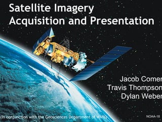
- 1. (In conjunction with the Geosciences Department of WMU) Satellite Imagery Acquisition and Presentation Jacob Comer Travis Thompson Dylan Weber NOAA-18
- 2. Introduction and Background Dylan Design and Implementation Travis Frontend, Testing, and Summary Jake Introduction
- 3. Background • Client • History of satellite receiver • Problems • Solutions
- 4. Design and Implementation • NOAA Satellites • Recieving Station • Application and Database Server
- 5. Testing and Summary • Frontend Design • Testing Image Accuracy & Aquisition • Testing Image Database Insertion • Testing Web Frontend • Testing Robustness of Backend • Summary
- 7. Client • Primary Stakeholder Dr. Mohamed Sultan - Chair, Dept. Of Geosciences Western Michigan University • Primary Contact Kyle Chouinard - Systems Administrator, Dept. Of Geosciences Western Michigan University
- 8. Satellite Receiver • Installed on Everett Tower 2004. • Uses Terascan Software on Receiver in Rood Hall • Provides information for hydrolic, oceanographic, and meteorological studies • Inoperational since 2008.
- 9. Satellites • Noaa 15 - 19 • Advanced Very High Resolution Radiometer (AVHRR) • Advanced Microwave Sounding Unit-A (AMSU-A) • Microwave Humidity Sounder (MHS)
- 10. Terascan • Proprietary Seaspace Software • Used for downloading raw data from polar orbiting satellites. • Converts raw data to various image formats.
- 11. Problems • Reciever wasn't communicating with satellites • Outdated software and hardware • Poor documentation • Licensing Problems
- 12. Outdated Hardware and Software • Updated to Terascan 4.0 • Upgraded hardware • Installed CentOS
- 13. Poor Documentation/Licensing • Contacted Seaspace • Renewed License
- 14. Design & Implementation Travis Thompson
- 17. NOAA Satellites • Polar Orbiting • High Resolution Picture Transmission (HRPT) • Transmition on L-Band (1670 - 1720 MHz) • Advanced Very High Resolution Radiometer (AVHRR) Satellite Frequency NOAA-15 1702.5 MHz NOAA-16 1702.5 MHz NOAA-17 1698.0 MHz NOAA-18 1707.0 MHz NOAA-19 1698.0 MHz
- 18. NOAA Satellites Cont. Name Launch date Period (min) NOAA 19 February 6, 2009 102 NOAA 18 May 20, 2005 102 NOAA 17 June 24, 2002 101.1 NOAA 16 September 21, 2000 101.9 NOAA 15 May 13, 1998 101.1
- 20. NOAA-15 Passes
- 22. Antenna • 1.5m Dish inside a 1.8m Radome • Integrated Tracking System • L-Band (1670 - 1720 MHz) • 3 Axis Positioner
- 23. Receiving Station • CentOS 5.7 x64 • TeraScan 4.0.1 • Image Reception Scheduler
- 27. Application & Database Server Overview HRPT NOAA-[15-19] Coax Receiving Station Samba Database Server Application Server Socket Client HTTP Antenna
- 28. Application & Database Server • Windows Server 2008 R2 • ArcGIS 10 • PostgreSQL 8.3 • Apache / Tomcat
- 29. Image Insertion Automation Scan Watch Directory Find Raster Dataset Insert into Catalog Move into Processed Directory
- 30. • ArcPy Python Library • Connection to ArcGIS SDE Database Server • Insert Raster Dataset into the Database import arcpy from arcpy import env Image Insertion Automation Cont. sdeDB = "E:/TeraScan/automation/Localhost.sde" env.workspace = sdeDB arcpy.RasterToGeodatabase_conversion(filename, sdeDB)
- 31. ArcCatalog
- 32. Frontend, Testing, & Summary Jacob Comer
- 34. Frontend Technologies Flow Application Server Database Server Client Side Socket
- 35. Frontend Design
- 37. Turning on a Layer
- 38. Multiple Layers
- 41. Graphs
- 42. Graphs Cont.
- 43. Testing Image Accuracy & Aquisition • View images as they are aquired • Verify images against images that are known to be accurate • Set up a log that logs when images are being downloaded
- 44. Testing Image Database Insertion • Automate encoding into GEOTIFF format • Verify images visually • Log automated transfer of encoded images to database drive • Log automated insertion into database • Log removal of images on original box to keep clutter down
- 45. Automated Transfer of Files
- 46. Automated Insertion Into Database
- 47. Testing Web Frontend • Group testing of features o Attempt to break Everything we have implemented • Client testing of features o Make sure they don't break anything accidentally • Ensuring security of database connection
- 48. Testing Robustness of Backend • Multiple connections • Query for non-existing image • Attempt to access restricted information on the server
- 49. Summary • Automates image aquisition, processing, and insertion into database • The backend will automatically make database images accessible from the web frontend • The web frontend will overlay the images on a (google) map and allow meta-data to be viewed