
Recomendados
Recomendados
Mais conteúdo relacionado
Mais procurados
Mais procurados (13)
Destaque
Semelhante a Buzzi Hercules Hydrogeology
Semelhante a Buzzi Hercules Hydrogeology (8)
Buzzi Hercules Hydrogeology
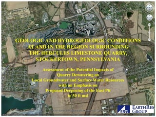
- 1. GEOLOGIC AND HYDROGEOLOGIC CONDITIONS AT AND IN THE REGION SURROUNDING THE HERCULES LIMESTONE QUARRY, STOCKERTOWN, PENNSYLVANIA Assessment of the Potential Impacts of Quarry Dewatering on Local Groundwater and Surface Water Resources with an Emphasis on Proposed Deepening of the East Pit to 50 ft msl
- 2. Pumping from quarry was ~ 54 Million Gallons per day or ~ 84 cfs WQIZ Stream losses were determined to be ~30 million gallons per day or ~ 46 cfs A recirculation cell was hypothesized
- 3. The U.S.G.S. speculated that there could be a “Hypothesized Fracture Zone with Large Hydraulic Conductivity.” Risser, 2006
- 4. MW-1 MW-4 PADEP-06 MW-2 West quarry MW-8 inflow zone PADEP-03 PADEP-04 MW-6R MW-3 PADEP-05 PADEP-01 PADEP-02
- 5. Grout Curtain WQIZ Nazareth In an attempt to eliminate the hypothetical recirculation, a grout curtain was installed in 2008. ESSROC Quarry
- 6. Data generated during and since the installation of the grout curtain provided for an expanded understanding of hydrogeologic conditions
- 7. The previous conceptualization was of a single, unconfined aquifer as the source of the quarry inflow. The boundaries were assigned based on a combination of the observed limits of stream flow losses in the Bushkill and Schoeneck Creeks and water balance, assuming a uniform, standard recharge rate.
- 8. Data from the post-grouting period supports a conclusion that there are two distinct groundwater systems: a shallow unconfined system which occurs in the epikarst zone and a deep confined system. The currently proposed quarry deepening would occur wholly within the unconfined aquifer zone. .
- 9. Buzzi Cement Stockertown Plant WQIZ The grout curtain failed to Nazareth eliminate WQIZ inflows, but achieved a maximum reduction of Tatamy flow of approximately 10% Various investigators hypothesized that the conduit flow bypassed the curtain in the subsurface by ESSROC Quarry flowing around the ends.
- 10. The questions which had to be answered were: Does extraction from the WQIZ derive water from the Bushkill Corridor? Is there a conduit of large conductivity? Are the two groundwater zones distinct hydraulically? Will extending the depth to 50 ft msl adversely impact local or regional water resources?
- 11. The answers to those questions required a re-assessment of both the geology and hydrogeology of the quarry and the surrounding area.
- 12. Beginning of influent Explanation stream conditions Geology Prominent Karst Feature Ojb Ojb Surface Expression of Karst trend Fold West quarry axis inflow zone Fault Trace Fault Inferred Location Bushkill Ob Ob Creek Ob Geologic Contact Outcrop of Jacksonburg Fm Ob Beekmantown Group Ojb Groundwater Flow D U
- 13. Beginning of influent Explanation stream conditions Geology Prominent Karst Feature Ojb Ojb Surface Expression of Karst trend Fold West quarry axis inflow zone Fault Trace Fault Inferred Location Bushkill Ob Ob Creek Ob Geologic Contact . Outcrop of Jacksonburg Fm Ob Beekmantown Group Ojb There is a pervasive SW-to-NE trend of all Groundwater Flow structural features D U
- 14. Geology Karst solution features follow the same general SW-NE trend and also plunge toward the NE.
- 15. Beginning of influent Explanation stream conditions Geology Prominent Karst Feature Ojb Ojb Surface Expression of Karst trend Fold West quarry axis inflow zone Fault Trace Fault Inferred Location Bushkill Ob Ob Creek Ob Geologic Contact The hypothetical conduit of Risser Outcrop of Jacksonburg Fm would be off trend and would, of Beekmantown Ob necessity, have to plunge SW. Group Ojb Groundwater Flow D U
- 16. Beginning of influent Explanation stream conditions Geology Prominent Karst Feature Ojb Ojb Surface Expression of Karst trend Fold West quarry axis inflow zone Fault Trace Fault Inferred Location Bushkill Ob Ob Creek Ob Geologic Contact In fact, both the trend and Outcrop of plunge of the hypothetical feature Jacksonburg Fm Ob Beekmantown are not plausible: the trend Group Ojb would be inconsistent with the Groundwater Flow entire tectonic setting and the D U plunge, if present, would have to be eastward.
- 17. Hydrogeology
- 18. The quarry is in the outcrop area of the Jacksonburg Formation near the contacts with the Martinsburg Fm (up section) and Epler Fm (down section). Within the outcrop area of the pelitic Martinsburg Formation the stream is effluent. The reach of stream over the paleokarst Jacksonburg Formation is perched above an aquifer which is in the epikarst zone. The reach of stream from the contact of the Epler Formation with the Jacksonburg Formation is a classic, influent karst stream characterized by few tributaries, surface drains, predominant subsurface drainage, closed depressions, sinking streams, in- stream ponors…
- 19. Hydrogeology Indications of Two Groundwater Systems It was necessary to pressure grout the curtain which could only be accomplished by reducing aquifer pressures through a series of relief wells.
- 20. Hydrogeology Indications of Two Groundwater Systems “When the pressure relief wells were opened to provide for grout injection, there was an immediate response in wells MW-3 and MW-6.”
- 22. Hydrogeology Indications of Two There is an upwelling zone in Groundwater the standing water of the WQIZ; Systems Water jets out of seams/cracks in the standpipes of capped wells in the WQIZ with 15-ft high standpipes; Water rose to a height 48 ft above the quarry floor during grouting Grout and rock fragments were ejected from pressure relief wells
- 23. Indications of Two Unconfined zone wells did MW-1 not respond to the operation Groundwater of pressure relief wells Systems PADEP-06 MW-4 MW-2 West quarry MW-8 inflow zone PADEP-03 PADEP-04 MW-6R MW-3 PADEP-05 PADEP-01 PADEP-02
- 24. Indications of Two Hydrogeology MW-1 Groundwater Systems PADEP-06 MW-4 MW-2 West quarry MW-8 inflow zone PADEP-03 PADEP-04 MW-6R Unconfined zone wells responded to precipitation MW-3 and stream flow. PADEP-05 PADEP-01 PADEP-02
- 26. Indications of Two Hydrogeology Groundwater Systems Temperatures of unconfined zone groundwater followed stream water temperatures through the fall-winter months. Confined zone groundwater remained nearly constant.
- 28. Indications of Two Hydrogeology Groundwater Systems Unconfined groundwater has remained unaffected over a period of time during which the volume of quarry extraction increased.
- 30. Indications of Two Hydrogeology Groundwater Systems Buzzi does not pump groundwater. The water in the WQIZ flows freely upward into the stilling basins and it is pumped from those ponds to the Bushkill
- 31. Indications of Two Hydrogeology Groundwater Systems In other words, there is no active hydraulic influence pulling water against the prevailing hydraulic gradient.
- 32. Indications of Two Hydrogeology Groundwater Systems After 19 years of artesian flow into the WQIZ under significant hydraulic pressure, there has been no adverse effect on aquifer performance.
- 33. Indications of Two Hydrogeology Groundwater Systems The flows into the WQIZ do not exert a hydraulic influence on either unconfined groundwater or the Bushkill Creek.
- 34. Hydrogeology Absence of responses in unconfined groundwater to confined zone stresses – especially in interposed wells
- 36. Beginning of influent Explanation Hydrogeology stream conditions Prominent Karst Feature Ojb Ojb Surface Expression of Karst trend Fold West quarry axis inflow zone Fault Trace Fault Inferred Location Bushkill Ob Ob Creek Ob Geologic Contact Outcrop of Jacksonburg Fm The geology imparts a significant Ob Beekmantown directional anisotropy to the Group Ojb groundwater system. Groundwater Flow D U
- 37. Hydrogeology MW-1 East Sump (drained) PADEP-06 MW-2 ‘V’ Sump MW-4 South Sump West quarry MW-8 inflow zone PADEP-03 PADEP-04 MW-6R MW-3 PADEP-05 PADEP-01 PADEP-02
- 38. Quarry Deepening Currently approved for deepening to 0 ft msl from current floor at 100 ft msl. October 3, 2011 report addressed Special Condition 22 for hydrogeology and highwall integrity. Concern regarding hydrology is that further deepening could have impact on local hydrogeology. Conducted a hydraulic test in June 2011 using south sump.
- 39. Quarry Deepening West Quarry Inflow Zone Proposed mine deepening area
- 40. MW-1 Quarry Deepening Sump MW-4 MW-2 MW-8 Quarry Deepening MW-3 MW-6R The sump was dewatered at a rate of 1,800 gpm in July, 2011 – local effects were monitored in perimeter wells.
- 41. MW-1 Quarry Deepening Sump MW-4 MW-2 MW-8 Quarry Deepening MW-3 MW-6R The drawdown of unconfined water within the sump was ~ 12 ft. The volume of water extracted was approximately 4 X 106 ft3 (30 million gallons). At a porosity of 4% (high) and an aquifer thickness of 100 ft, that is equivalent to the storage over an area of ~ 24 acres.
- 43. MW-1 Quarry Deepening Sump MW-4 MW-2 MW-8 MW-3 Quarry Deepening MW-6R Sump rebound was at a rate of 0.15 ft hr-1. Total rebound was 11.5 ft over a 7-day recovery period. The calculated Darcian hydraulic conductivity is 2 ft day-1 to 4 ft day-1.
- 44. MW-1 Quarry Deepening Sump MW-4 MW-2 MW-8 Quarry Deepening MW-6R There were NO responses in any well to MW-3 either the dewatering at 1,800 gpm or to the post-extraction recovery… Except MW-3 which is along-strike of the sump.
- 45. MW-1 Quarry Deepening Sump MW-4 MW-2 MW-8 MW-6R MW-3
- 46. MW-1 Quarry Deepening MW-4 MW-2 MW-8 MW-3 The structural geology imparts are MW-6R pronounced, along-strike directional anisotropy along a generally SW-NW direction. .
- 47. MW-1 Quarry Deepening MW-4 MW-2 MW-8 The structural geology imparts a cross- MW-6R strike barrier to flow and even to MW-3 hydraulic communication. . .
- 49. The directional anisotropy is also the condition within the confined aquifer
- 50. MW-1 Quarry Deepening MW-4 MW-2 MW-8 MW-3 As a result of the directional MW-6R anisotropy, drawdown of the unconfined aquifer to accommodate mining to 50 ft msl will be in an along- strike direction and will be bound by the north and south boundary faults. . The Bushkill in the along-strike direction is a perched stream unconnected to groundwater and is already lined
- 51. MW-1 Quarry Deepening MW-4 MW-2 MW-8 MW-3 MW-6R With a footprint area of ~ 50 acres and a depth of 50 ft, the dewatering can be maintained with an extraction rate of ~2,600 gpm for a total daily volume of ~ 2.6 MGD. .
- 53. Quarry Deepening Two Distinct Structural Trends
- 54. Quarry Deepening
- 55. Quarry Deepening
- 57. Quarry Deepening
- 60. Quarry Deepening The Markland Analysis revealed that there are areas along the southern highwall where instabilities could occur, but that the potentially causal structural features do not extend vertically beyond one bench or only marginally into the next highest bench. Routine mitigation measures are adequate to stabilize the potentially unstable zones
- 61. Conclusions There are two hydraulically distinct aquifers: • a shallow unconfined zone which occurs predominantly in the epikarst zone; • a deep confined aquifer which is the principal source of WQIZ inflow water
- 62. Conclusions The pattern of unconfined aquifer dewatering is controlled by geologic structure. The cone of depression appears to be elongate in a SW-NE ellipse, constrained between faults which create no-flow boundaries to cross-strike flow.
- 63. Conclusions Mining to el. 50 ft msl will have little impact on local or regional water resources. Using data from sump dewatering test, the east pit dewatering will require ~ 2,000 gpm, or an additional 2.5 MGD…. … an increase of 4% to 5% above current discharge.
- 64. Beginning of influent Explanation Conclusions stream conditions Prominent Karst Feature Ojb Ojb Surface Expression of Karst trend Fold West quarry axis inflow zone Fault Trace Fault Inferred Location Bushkill Ob Ob Creek Ob Geologic Contact The speculation that there could be Outcrop of Jacksonburg Fm a “conduit of large conductivity” is Ob Beekmantown Group inconsistent with all data and Ojb Groundwater Flow observations. D U
- 65. Conclusions MW-4 MW-2 MW-8 The source of WQIZ water is MW-3 not the Bushkill Creek MW-6R In 2009 the loss of water from the Bushkill increased from 30 MGD to ~38 MGD with no change to the rate or volume of WQIZ inflows. . It is not possible that a portion of water lost to swallow holes could travel in the unconfined aquifer away from the quarry while the remainder flows toward the quarry.
- 66. Conclusions MW-4 MW-2 MW-8 The source of WQIZ water is MW-3 MW-6R not the Bushkill Creek Groundwater elevations in the two aquifers within the Bushkill Corridor are similar – at some locations, are under a negative pressure gradient at some locations, and at some locations there is a positive pressure . gradient.