SlideShare uma empresa Scribd logo
1 de 24
Baixar para ler offline
Modeling the Blanco Watershed
Joanna C. Curran
Basin Planning with Computer Models
Models can integrate available data, help clarify and help
quantify primary watershed processes, and guide further
data collection
Models can be used to help predict the effect of changing
management practices by simulating the essential
watershed processes
Model = simplification of reality
Model results = hypotheses
Best interpreted in terms of relative changes, not
absolute amounts
SWAT: Soil and Water Assessment Tool
• A watershed scale model intended to model the effects of land
management practices on large complex watersheds
• Uses basin-specific physical data to predict the impacts of
topography, soils, land use, management decisions, and weather
on water, sediment, nutrient, and agricultural chemical yields for
large ungaged watersheds
• Operates on a daily time step and is able to provide a continuous
temporal simulation of physical watershed processes
• Able to simulate hundreds of years, thereby predicting the long-
term impacts of management decisions.
• A long term yield model that is not designed to
model single event flood routing
SWAT Components
– Canopy storage
– Infiltration
– Redistribution
– Evapotranspiration
– Lateral subsurface
flow
– Surface flow
– Tributary channels
– Return flow
– Plant Growth
• Climate
– daily precipitation, air
temperature, solar
radiation, wind speed
and relative humidity are
input from records of
observed data or
simulated
Watershed Delineation from Digital
Elevation Models at 30-meter resolution
Blanco River flows southeast for 140 km
Blanco Watershed area is 1365 km2
USGS seamless data website
Subbasins are defined according to drainage
USGS National Hydrography Dataset
By partitioning the
watershed into subbasins,
different areas of the
watershed can be
referenced to one another
spatially
STATSGO Soil Layers, USDA-NRCS)
Records were obtained from the National
Climatic Data Center
The precipitation gage stations used for
the Blanco River basin model were:
Blanco, San Marcos, Fischer Store, and
Wimberley 1 NW
Solar radiation, wind speed, and relative
humidity were simulated by the model
using the WEXGEN weather generator
model and monthly climate statistics
calculated from long-term measured data
to simulate weather data
Precipitation and Temperature
Land use and soil data combine to define HRUs
Together, HRUs and the stream network data are used to model the
watershed
HRUs cross sub-basin boundaries, instead following combinations of
land use and soil type.
Precipitation and flows are calculated first for each HRU, and then for
each sub-basin based on the results from the HRUs
Discharge from each HRU are summarized in each subbasin and then
routed through the stream network to the watershed outlet
Water balance is the governing equation for the model
Hydrological Response Units (HRUs)
• Surface runoff is predicted through a modification of the SCS curve
number with daily rainfall records
• Volume of the runoff from a given precipitation event is calculated
using the Green-Ampt equation
• Flow is routed through the tributaries and main channel using the
Muskingham method. Gains and losses are accounted for due to
soil water content, surface runoff, evapotranspiration, precipitation,
water lost by seepage into the soil, and the amount of return flow.
The amount of flow moving through the sub-basins is calculated
using a daily time step.
• Potential evapotranspiration is calculated by the Priestly-Taylor
method using temperature, solar radiation, and relative humidity
data
• Measured air temperature data are used to compute a daily water
temperature for a well mixed stream
Modeling Hydrologic Processes
Modeling Scenarios
1. 1990-2006 Precipitation with current land use
2. 1945-1960 Precipitation with current land use
3. 1990-2006 Precipitation with approximately 13%
urbanization
4. 1945-1960 Precipitation with approximately 13%
urbanization
5. 1990-2006 Precipitation with approximately 78%
urbanization
6. 1945-1960 Precipitation with approximately 78%
urbanization
Current Land Use
~2% urbanized
~13% urbanized
~80% urbanized
(From GIRAS, USGS)
0
15
30
45
60
75
90
105
120
135
150
0% 10% 20% 30% 40% 50% 60% 70% 80% 90% 100%
%time flow exceeded
Q,cfs
Model results
are analyzed
through
hydrographs
and flow
duration curves
Flow expected
half the time
Q50 = 20 cfs
Flow exceeded
10% of time
Q10 = 45 cfs
Flow exceeded
75% of time
Q10 = 12 cfs
0
20
40
60
80
100
120
140
Jan-92 Sep-94 Jun-97 Mar-00 Dec-02 Sep-05
Q,cfs
• Flow profiles illustrate how flow rates change in the Blanco River
when traveling from the headwaters to the confluence with the San
Marcos River. The trends in all of the simulation results show
increasing flow rates in the downstream direction. This is to be
expected as the main stem receives input from overland flow,
tributaries, and possibly groundwater.
• Separate profiles are presented for each modeling scenario and for
each of the 50%, 75%, and 90% flows, so for each scenario there
are three profiles
• It is the difference in the flow profile trajectories that illustrate the
effects of land use management and climate scenarios
• Flow within the tributaries is analyzed separately. The majority of the
inputs are minor, making the inputs from Cypress Creek, the Little
Blanco River, and Sink Creek easily discerned.
• The major tributaries to the Blanco River are the Little Blanco River,
Cypress Creek, and the Sink Creek. They are located at 60 km, 92
km, and 142 km downstream respectively.
Longitudinal Flow Profiles
0
20
40
60
80
100
120
140
0 20 40 60 80 100 120 140 160
Distance Downstream (km)
Q,cfs
0
50
100
150
200
250
300
350
0 20 40 60 80 100 120 140 160
Distance Downstream (km)
Q,cfs
0
500
1000
1500
2000
2500
0 20 40 60 80 100 120 140 160
Distance Downstream (km)
Q,cfs
Q75
2% urban; 13% urban; 78% urban
Blanco River: Rainfall
from 1990-2006
Q50
Q10
Under all scenarios, the flows are similar for
the first 60 km
Flows separate at 60 km and 100 km
downstream, corresponding to inputs from
the Little Blanco River and Cypress Creek.
Flows are consistently low at 13% urban
area
Tributaries have more influence at low or
high amounts of urban land use
Flows are consistent between the tributaries
under all urbanization scenarios
Downstream of 60 km, the trajectory of the
fully urbanized scenario increases
dramatically
0
1
2
3
4
5
6
7
8
9
10
0 20 40 60 80 100 120 140 160
Distance Downstream (km)
Q,cfs
0
5
10
15
20
25
30
35
40
0 20 40 60 80 100 120 140 160
Distance Downstream (km)
Q,cfs
0
20
40
60
80
100
120
140
0 20 40 60 80 100 120 140 160
Distance Downstream (km)
Q,cfs
Tributaries: Rainfall
from 1990-2006
Q75
2% urban; 13% urban; 78% urban
Q50
Q10
Little Blanco River has a dramatic effect
under the 78% urbanization, increasing
main channel flow by approximately 50%
When the urbanization of the watershed is
13%, the Little Blanco input has little effect
on the flow in the main channel.
Cypress Creek inputs cause a noticeable
increase in Blanco River flow only under
78% urban and only during flood flows
Some tributaries are predicted to be dry
under both today’s land use condition and
when 13% of the watershed is urban
Those tributaries not predicted to be dry
contribute 3 cfs or less to the Blanco during
at low flows
Tributaries cannot be relied upon to keep
the Blanco River flowing
0
500
1000
1500
2000
2500
0 20 40 60 80 100 120 140 160
distance downstream (km)
Q(cfs)
0
50
100
150
200
250
300
350
0 20 40 60 80 100 120 140 160
distance downstream (km)
Q(cfs)
0
20
40
60
80
100
120
0 20 40 60 80 100 120 140 160
distance downstream (km)
Q(cfs)
Blanco River: Rainfall
from 1945-1960Q75
2% urban; 13% urban; 78% urban
Q50
Q10
Predicted flow regimes are almost all lower
than those predicted under 1990’s rainfall
The difference is most dramatic at the
lowest flows, when the 78% urbanized
scenarios predicts the least flow
78% urban area leads to the lowest
predicted flows, with the River almost dry at
many locations
Increasing urban area from 2% to 13% does
not distinctly alter the lowest flows
The flow expected half of the time for the
Blanco River is consistently higher when
impervious cover is increased to 78%
Increasing the urban area of the watershed
to 13% deceases river flows by ~ 10 cfs
from what is predicted under current land
use conditions. High flows are predicted to
be similar regardless of the rainfall scenario
modeled
0
10
20
30
40
50
60
70
80
90
0 20 40 60 80 100 120
Distance Downstream (km)
Q,cfs
0
5
10
15
20
25
0 20 40 60 80 100 120
Distance Downstream (km)
Q,cfs
0
1
2
3
4
5
6
7
8
9
0 20 40 60 80 100 120
Distance Downstream (km)
Q,cfs
Q75 Tributaries: Rainfall
from 1945-1960
2% urban; 13% urban; 78% urban
Q50
Q10
Tributary influence under drought
conditions is similar to that under
normal precipitation, and the majority
are minor contributors to the main stem
At the lowest flows, all of the tributaries
have predicted flow rates of less than
10 cfs
The exceptions occur at 78% urban
land cover, when flow rates in both the
Little Blanco River and Cypress Creek
exceed 10 cfs. The Little Blanco River
is predicted to contribute over 20 cfs,
although this is a small fraction of the
main stem flow.
At the highest predicted flows,
contributions from the Little Blanco and
Cypress Creek are noticeable under all
urbanization scenarios
• 13% urbanized watershed predicts the lowest flows
• 78% urbanized watershed has consistently the highest flows
• Current land use condition of 2% urban area falls in the mid-range flows
• The only exception to this trend is the predicted lowest flows under
drought conditions
• The consistency of this trend provides a strong indication of expected
changes to stream flow as urbanization progresses
• As the watershed area grows in population and infrastructure, the
amount of flow reaching the river will decrease.
• As watershed urbanization continues, the amount of impervious cover
and hardened land surface will reach a point where the majority of the
precipitation becomes run-off and direct recharge to the Blanco River.
Common Features to the Modeled Scenarios
• A total of six different scenarios were modeled using the SWAT model with the
BASINS interface and ArcView3.1. The scenarios modeled flows under current
land use, 13% urban land use, and 78% urban land use against rainfall patterns
from 1990-2006 and 1945-1960 in 38 38 separate sub-basins within the larger
Blanco watershed.
• Model runs predict an initial decrease in flows as the watershed population
grows and the urban area approaches 13% of the total land use. Under low,
mid, and high flow rates, an expansion of urban area first decreases river flows.
• As the amount of impervious cover due to the infrastructure that accompanies
urbanization increases to cover the majority of the watershed area, the flows in
the river increase dramatically.
• When drought conditions are simulated, there occurs an expected drop in
predicted flows for all but the most infrequent events. During a drought, the
Blanco River is predicted to maintain only limited flow with almost negligible
contribution from tributaries.
• Under drought, low flows continue until the confluence of the Blanco with the
Little Blanco River which adds significant flow only during extremely high flow
event. Under normal climate conditions, the contribution of the Little Blanco
River is significant to both the mid and high flow regimes. In all scenarios, the
only tributaries of significance are the Little Blanco and Cypress Creek.
Summary of Modeling Results
The case of 78% urbanization of the watershed area
represents an extreme, but distant possibility.
In contrast, the watershed is well on its way to becoming
13% urbanized.
This research indicates flows in the Blanco River and its
tributaries will decrease consistently as urbanization
progresses, and some of the tributaries will have
negligible flow rates.
The lowest flows are expected over the first 60 km of the
river, before the addition tributary flow. This corresponds
to the region of the headwaters and spring systems.
Summary of Modeling Results
Acknowledgements
Texas River Systems Institute and the Texas Nature
Conservancy for providing the funding to make this
project possible
Dept. of Biology for their participation and partnership
Nathanael Banda for his help with building the model
0
10
20
30
40
50
60
70
80
90
100
BearCreekatFM
1826
SlaughterCreekat
FM1826
BartonCreekat71
BartonCreekatLost
Creek
BullCreekat360
BartonCreekat360
WilliamsonCreekat
OakHill
WalnutCreekat
Webberville
ShoarCreekat12
WallerCreekat23
WallerCreekat38
BoggyCreekat183
Percentage
% Impervious Cover
% Runoff
% Infiltration
Example of the effects of impervious cover on both rainfall runoff
and infiltration – data monitoring sites are from Austin, 1996

Mais conteúdo relacionado

Mais de Earth Institute of Columbia University

Mais de Earth Institute of Columbia University (20)

2019 Vaquita Survey Report
2019 Vaquita Survey Report2019 Vaquita Survey Report
2019 Vaquita Survey Report
 
Climate Change as News - 2007 Revkin book chapter
Climate Change as News - 2007 Revkin book chapterClimate Change as News - 2007 Revkin book chapter
Climate Change as News - 2007 Revkin book chapter
 
A 1974 CIA Study of Climate Disruption Saw Cooling, Omitted CO2
A 1974 CIA Study of Climate Disruption Saw Cooling, Omitted CO2 A 1974 CIA Study of Climate Disruption Saw Cooling, Omitted CO2
A 1974 CIA Study of Climate Disruption Saw Cooling, Omitted CO2
 
New National Strategy Narrative
New National Strategy NarrativeNew National Strategy Narrative
New National Strategy Narrative
 
Supercomputers, Science and Spies - A. Revkin in Tech Review 8/86
Supercomputers, Science and Spies - A. Revkin in Tech Review 8/86Supercomputers, Science and Spies - A. Revkin in Tech Review 8/86
Supercomputers, Science and Spies - A. Revkin in Tech Review 8/86
 
Emails of Trump Adviser Aiming to Challenge Global Warming Worries
Emails of Trump Adviser Aiming to Challenge Global Warming WorriesEmails of Trump Adviser Aiming to Challenge Global Warming Worries
Emails of Trump Adviser Aiming to Challenge Global Warming Worries
 
The Plan for a Trump Committee on Climate and Security
The Plan for a Trump Committee on Climate and SecurityThe Plan for a Trump Committee on Climate and Security
The Plan for a Trump Committee on Climate and Security
 
Scenes and Impressions at the Trial of the Killers of Amazon Defender Chico M...
Scenes and Impressions at the Trial of the Killers of Amazon Defender Chico M...Scenes and Impressions at the Trial of the Killers of Amazon Defender Chico M...
Scenes and Impressions at the Trial of the Killers of Amazon Defender Chico M...
 
A Polynesian Paradise, and Family, in Flux
A Polynesian Paradise, and Family, in FluxA Polynesian Paradise, and Family, in Flux
A Polynesian Paradise, and Family, in Flux
 
When Global Warming Became News: 1988
When Global Warming Became News: 1988When Global Warming Became News: 1988
When Global Warming Became News: 1988
 
Testing a Method to Encourage LPG Adoption for Cooking
Testing a Method to Encourage LPG Adoption for CookingTesting a Method to Encourage LPG Adoption for Cooking
Testing a Method to Encourage LPG Adoption for Cooking
 
A Boy's Holocaust - Horror, Hope and Endurance
A Boy's Holocaust - Horror, Hope and EnduranceA Boy's Holocaust - Horror, Hope and Endurance
A Boy's Holocaust - Horror, Hope and Endurance
 
Shell's 1997-8 Public Relations Strategy for Nigeria Troubles
Shell's 1997-8 Public Relations Strategy for Nigeria TroublesShell's 1997-8 Public Relations Strategy for Nigeria Troubles
Shell's 1997-8 Public Relations Strategy for Nigeria Troubles
 
Climate Certainty, Uncertainty & Options
Climate Certainty, Uncertainty & OptionsClimate Certainty, Uncertainty & Options
Climate Certainty, Uncertainty & Options
 
"Anthropocene" is Too Modest to Describe Human Earth Impact
"Anthropocene" is Too Modest to Describe Human Earth Impact"Anthropocene" is Too Modest to Describe Human Earth Impact
"Anthropocene" is Too Modest to Describe Human Earth Impact
 
Plutonium in Paradise (France's South Pacific Nuclear Legacy
Plutonium in Paradise (France's South Pacific Nuclear LegacyPlutonium in Paradise (France's South Pacific Nuclear Legacy
Plutonium in Paradise (France's South Pacific Nuclear Legacy
 
Humanity's Role in Creating a "Post-Holocene" Chapter of Earth History
Humanity's Role in Creating a "Post-Holocene" Chapter of Earth HistoryHumanity's Role in Creating a "Post-Holocene" Chapter of Earth History
Humanity's Role in Creating a "Post-Holocene" Chapter of Earth History
 
Help of the Helpless
Help of the HelplessHelp of the Helpless
Help of the Helpless
 
No Red/Blue Divide on CO2 Rules & Renewables Innovation
No Red/Blue Divide on CO2 Rules & Renewables Innovation No Red/Blue Divide on CO2 Rules & Renewables Innovation
No Red/Blue Divide on CO2 Rules & Renewables Innovation
 
Conflict Builds as Gators & People Thrive in Florida
Conflict Builds as Gators & People Thrive in FloridaConflict Builds as Gators & People Thrive in Florida
Conflict Builds as Gators & People Thrive in Florida
 

Último

Pests of cotton_Borer_Pests_Binomics_Dr.UPR.pdf
Pests of cotton_Borer_Pests_Binomics_Dr.UPR.pdfPests of cotton_Borer_Pests_Binomics_Dr.UPR.pdf
Pests of cotton_Borer_Pests_Binomics_Dr.UPR.pdf
PirithiRaju
 
Pests of cotton_Sucking_Pests_Dr.UPR.pdf
Pests of cotton_Sucking_Pests_Dr.UPR.pdfPests of cotton_Sucking_Pests_Dr.UPR.pdf
Pests of cotton_Sucking_Pests_Dr.UPR.pdf
PirithiRaju
 
dkNET Webinar "Texera: A Scalable Cloud Computing Platform for Sharing Data a...
dkNET Webinar "Texera: A Scalable Cloud Computing Platform for Sharing Data a...dkNET Webinar "Texera: A Scalable Cloud Computing Platform for Sharing Data a...
dkNET Webinar "Texera: A Scalable Cloud Computing Platform for Sharing Data a...
dkNET
 
Conjugation, transduction and transformation
Conjugation, transduction and transformationConjugation, transduction and transformation
Conjugation, transduction and transformation
Areesha Ahmad
 

Último (20)

Pests of cotton_Borer_Pests_Binomics_Dr.UPR.pdf
Pests of cotton_Borer_Pests_Binomics_Dr.UPR.pdfPests of cotton_Borer_Pests_Binomics_Dr.UPR.pdf
Pests of cotton_Borer_Pests_Binomics_Dr.UPR.pdf
 
FAIRSpectra - Enabling the FAIRification of Spectroscopy and Spectrometry
FAIRSpectra - Enabling the FAIRification of Spectroscopy and SpectrometryFAIRSpectra - Enabling the FAIRification of Spectroscopy and Spectrometry
FAIRSpectra - Enabling the FAIRification of Spectroscopy and Spectrometry
 
Dopamine neurotransmitter determination using graphite sheet- graphene nano-s...
Dopamine neurotransmitter determination using graphite sheet- graphene nano-s...Dopamine neurotransmitter determination using graphite sheet- graphene nano-s...
Dopamine neurotransmitter determination using graphite sheet- graphene nano-s...
 
Factory Acceptance Test( FAT).pptx .
Factory Acceptance Test( FAT).pptx       .Factory Acceptance Test( FAT).pptx       .
Factory Acceptance Test( FAT).pptx .
 
9654467111 Call Girls In Raj Nagar Delhi Short 1500 Night 6000
9654467111 Call Girls In Raj Nagar Delhi Short 1500 Night 60009654467111 Call Girls In Raj Nagar Delhi Short 1500 Night 6000
9654467111 Call Girls In Raj Nagar Delhi Short 1500 Night 6000
 
GBSN - Microbiology (Unit 2)
GBSN - Microbiology (Unit 2)GBSN - Microbiology (Unit 2)
GBSN - Microbiology (Unit 2)
 
GBSN - Microbiology (Unit 3)
GBSN - Microbiology (Unit 3)GBSN - Microbiology (Unit 3)
GBSN - Microbiology (Unit 3)
 
IDENTIFICATION OF THE LIVING- forensic medicine
IDENTIFICATION OF THE LIVING- forensic medicineIDENTIFICATION OF THE LIVING- forensic medicine
IDENTIFICATION OF THE LIVING- forensic medicine
 
Proteomics: types, protein profiling steps etc.
Proteomics: types, protein profiling steps etc.Proteomics: types, protein profiling steps etc.
Proteomics: types, protein profiling steps etc.
 
module for grade 9 for distance learning
module for grade 9 for distance learningmodule for grade 9 for distance learning
module for grade 9 for distance learning
 
GBSN - Microbiology (Unit 1)
GBSN - Microbiology (Unit 1)GBSN - Microbiology (Unit 1)
GBSN - Microbiology (Unit 1)
 
Locating and isolating a gene, FISH, GISH, Chromosome walking and jumping, te...
Locating and isolating a gene, FISH, GISH, Chromosome walking and jumping, te...Locating and isolating a gene, FISH, GISH, Chromosome walking and jumping, te...
Locating and isolating a gene, FISH, GISH, Chromosome walking and jumping, te...
 
High Profile 🔝 8250077686 📞 Call Girls Service in GTB Nagar🍑
High Profile 🔝 8250077686 📞 Call Girls Service in GTB Nagar🍑High Profile 🔝 8250077686 📞 Call Girls Service in GTB Nagar🍑
High Profile 🔝 8250077686 📞 Call Girls Service in GTB Nagar🍑
 
COMPUTING ANTI-DERIVATIVES (Integration by SUBSTITUTION)
COMPUTING ANTI-DERIVATIVES(Integration by SUBSTITUTION)COMPUTING ANTI-DERIVATIVES(Integration by SUBSTITUTION)
COMPUTING ANTI-DERIVATIVES (Integration by SUBSTITUTION)
 
Pests of cotton_Sucking_Pests_Dr.UPR.pdf
Pests of cotton_Sucking_Pests_Dr.UPR.pdfPests of cotton_Sucking_Pests_Dr.UPR.pdf
Pests of cotton_Sucking_Pests_Dr.UPR.pdf
 
Connaught Place, Delhi Call girls :8448380779 Model Escorts | 100% verified
Connaught Place, Delhi Call girls :8448380779 Model Escorts | 100% verifiedConnaught Place, Delhi Call girls :8448380779 Model Escorts | 100% verified
Connaught Place, Delhi Call girls :8448380779 Model Escorts | 100% verified
 
GBSN - Biochemistry (Unit 1)
GBSN - Biochemistry (Unit 1)GBSN - Biochemistry (Unit 1)
GBSN - Biochemistry (Unit 1)
 
dkNET Webinar "Texera: A Scalable Cloud Computing Platform for Sharing Data a...
dkNET Webinar "Texera: A Scalable Cloud Computing Platform for Sharing Data a...dkNET Webinar "Texera: A Scalable Cloud Computing Platform for Sharing Data a...
dkNET Webinar "Texera: A Scalable Cloud Computing Platform for Sharing Data a...
 
Conjugation, transduction and transformation
Conjugation, transduction and transformationConjugation, transduction and transformation
Conjugation, transduction and transformation
 
Feature-aligned N-BEATS with Sinkhorn divergence (ICLR '24)
Feature-aligned N-BEATS with Sinkhorn divergence (ICLR '24)Feature-aligned N-BEATS with Sinkhorn divergence (ICLR '24)
Feature-aligned N-BEATS with Sinkhorn divergence (ICLR '24)
 

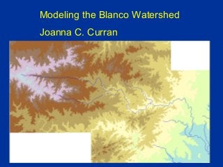
A 2007 Model of Growth Impacts on the Flow of Texas's Blanco River

  • 1. Modeling the Blanco Watershed Joanna C. Curran
  • 2. Basin Planning with Computer Models Models can integrate available data, help clarify and help quantify primary watershed processes, and guide further data collection Models can be used to help predict the effect of changing management practices by simulating the essential watershed processes Model = simplification of reality Model results = hypotheses Best interpreted in terms of relative changes, not absolute amounts
  • 3. SWAT: Soil and Water Assessment Tool • A watershed scale model intended to model the effects of land management practices on large complex watersheds • Uses basin-specific physical data to predict the impacts of topography, soils, land use, management decisions, and weather on water, sediment, nutrient, and agricultural chemical yields for large ungaged watersheds • Operates on a daily time step and is able to provide a continuous temporal simulation of physical watershed processes • Able to simulate hundreds of years, thereby predicting the long- term impacts of management decisions. • A long term yield model that is not designed to model single event flood routing
  • 4.
  • 5. SWAT Components – Canopy storage – Infiltration – Redistribution – Evapotranspiration – Lateral subsurface flow – Surface flow – Tributary channels – Return flow – Plant Growth • Climate – daily precipitation, air temperature, solar radiation, wind speed and relative humidity are input from records of observed data or simulated
  • 6. Watershed Delineation from Digital Elevation Models at 30-meter resolution Blanco River flows southeast for 140 km Blanco Watershed area is 1365 km2 USGS seamless data website
  • 7. Subbasins are defined according to drainage USGS National Hydrography Dataset By partitioning the watershed into subbasins, different areas of the watershed can be referenced to one another spatially
  • 8. STATSGO Soil Layers, USDA-NRCS)
  • 9. Records were obtained from the National Climatic Data Center The precipitation gage stations used for the Blanco River basin model were: Blanco, San Marcos, Fischer Store, and Wimberley 1 NW Solar radiation, wind speed, and relative humidity were simulated by the model using the WEXGEN weather generator model and monthly climate statistics calculated from long-term measured data to simulate weather data Precipitation and Temperature
  • 10. Land use and soil data combine to define HRUs Together, HRUs and the stream network data are used to model the watershed HRUs cross sub-basin boundaries, instead following combinations of land use and soil type. Precipitation and flows are calculated first for each HRU, and then for each sub-basin based on the results from the HRUs Discharge from each HRU are summarized in each subbasin and then routed through the stream network to the watershed outlet Water balance is the governing equation for the model Hydrological Response Units (HRUs)
  • 11. • Surface runoff is predicted through a modification of the SCS curve number with daily rainfall records • Volume of the runoff from a given precipitation event is calculated using the Green-Ampt equation • Flow is routed through the tributaries and main channel using the Muskingham method. Gains and losses are accounted for due to soil water content, surface runoff, evapotranspiration, precipitation, water lost by seepage into the soil, and the amount of return flow. The amount of flow moving through the sub-basins is calculated using a daily time step. • Potential evapotranspiration is calculated by the Priestly-Taylor method using temperature, solar radiation, and relative humidity data • Measured air temperature data are used to compute a daily water temperature for a well mixed stream Modeling Hydrologic Processes
  • 12. Modeling Scenarios 1. 1990-2006 Precipitation with current land use 2. 1945-1960 Precipitation with current land use 3. 1990-2006 Precipitation with approximately 13% urbanization 4. 1945-1960 Precipitation with approximately 13% urbanization 5. 1990-2006 Precipitation with approximately 78% urbanization 6. 1945-1960 Precipitation with approximately 78% urbanization
  • 13. Current Land Use ~2% urbanized ~13% urbanized ~80% urbanized (From GIRAS, USGS)
  • 14. 0 15 30 45 60 75 90 105 120 135 150 0% 10% 20% 30% 40% 50% 60% 70% 80% 90% 100% %time flow exceeded Q,cfs Model results are analyzed through hydrographs and flow duration curves Flow expected half the time Q50 = 20 cfs Flow exceeded 10% of time Q10 = 45 cfs Flow exceeded 75% of time Q10 = 12 cfs 0 20 40 60 80 100 120 140 Jan-92 Sep-94 Jun-97 Mar-00 Dec-02 Sep-05 Q,cfs
  • 15. • Flow profiles illustrate how flow rates change in the Blanco River when traveling from the headwaters to the confluence with the San Marcos River. The trends in all of the simulation results show increasing flow rates in the downstream direction. This is to be expected as the main stem receives input from overland flow, tributaries, and possibly groundwater. • Separate profiles are presented for each modeling scenario and for each of the 50%, 75%, and 90% flows, so for each scenario there are three profiles • It is the difference in the flow profile trajectories that illustrate the effects of land use management and climate scenarios • Flow within the tributaries is analyzed separately. The majority of the inputs are minor, making the inputs from Cypress Creek, the Little Blanco River, and Sink Creek easily discerned. • The major tributaries to the Blanco River are the Little Blanco River, Cypress Creek, and the Sink Creek. They are located at 60 km, 92 km, and 142 km downstream respectively. Longitudinal Flow Profiles
  • 16. 0 20 40 60 80 100 120 140 0 20 40 60 80 100 120 140 160 Distance Downstream (km) Q,cfs 0 50 100 150 200 250 300 350 0 20 40 60 80 100 120 140 160 Distance Downstream (km) Q,cfs 0 500 1000 1500 2000 2500 0 20 40 60 80 100 120 140 160 Distance Downstream (km) Q,cfs Q75 2% urban; 13% urban; 78% urban Blanco River: Rainfall from 1990-2006 Q50 Q10 Under all scenarios, the flows are similar for the first 60 km Flows separate at 60 km and 100 km downstream, corresponding to inputs from the Little Blanco River and Cypress Creek. Flows are consistently low at 13% urban area Tributaries have more influence at low or high amounts of urban land use Flows are consistent between the tributaries under all urbanization scenarios Downstream of 60 km, the trajectory of the fully urbanized scenario increases dramatically
  • 17. 0 1 2 3 4 5 6 7 8 9 10 0 20 40 60 80 100 120 140 160 Distance Downstream (km) Q,cfs 0 5 10 15 20 25 30 35 40 0 20 40 60 80 100 120 140 160 Distance Downstream (km) Q,cfs 0 20 40 60 80 100 120 140 0 20 40 60 80 100 120 140 160 Distance Downstream (km) Q,cfs Tributaries: Rainfall from 1990-2006 Q75 2% urban; 13% urban; 78% urban Q50 Q10 Little Blanco River has a dramatic effect under the 78% urbanization, increasing main channel flow by approximately 50% When the urbanization of the watershed is 13%, the Little Blanco input has little effect on the flow in the main channel. Cypress Creek inputs cause a noticeable increase in Blanco River flow only under 78% urban and only during flood flows Some tributaries are predicted to be dry under both today’s land use condition and when 13% of the watershed is urban Those tributaries not predicted to be dry contribute 3 cfs or less to the Blanco during at low flows Tributaries cannot be relied upon to keep the Blanco River flowing
  • 18. 0 500 1000 1500 2000 2500 0 20 40 60 80 100 120 140 160 distance downstream (km) Q(cfs) 0 50 100 150 200 250 300 350 0 20 40 60 80 100 120 140 160 distance downstream (km) Q(cfs) 0 20 40 60 80 100 120 0 20 40 60 80 100 120 140 160 distance downstream (km) Q(cfs) Blanco River: Rainfall from 1945-1960Q75 2% urban; 13% urban; 78% urban Q50 Q10 Predicted flow regimes are almost all lower than those predicted under 1990’s rainfall The difference is most dramatic at the lowest flows, when the 78% urbanized scenarios predicts the least flow 78% urban area leads to the lowest predicted flows, with the River almost dry at many locations Increasing urban area from 2% to 13% does not distinctly alter the lowest flows The flow expected half of the time for the Blanco River is consistently higher when impervious cover is increased to 78% Increasing the urban area of the watershed to 13% deceases river flows by ~ 10 cfs from what is predicted under current land use conditions. High flows are predicted to be similar regardless of the rainfall scenario modeled
  • 19. 0 10 20 30 40 50 60 70 80 90 0 20 40 60 80 100 120 Distance Downstream (km) Q,cfs 0 5 10 15 20 25 0 20 40 60 80 100 120 Distance Downstream (km) Q,cfs 0 1 2 3 4 5 6 7 8 9 0 20 40 60 80 100 120 Distance Downstream (km) Q,cfs Q75 Tributaries: Rainfall from 1945-1960 2% urban; 13% urban; 78% urban Q50 Q10 Tributary influence under drought conditions is similar to that under normal precipitation, and the majority are minor contributors to the main stem At the lowest flows, all of the tributaries have predicted flow rates of less than 10 cfs The exceptions occur at 78% urban land cover, when flow rates in both the Little Blanco River and Cypress Creek exceed 10 cfs. The Little Blanco River is predicted to contribute over 20 cfs, although this is a small fraction of the main stem flow. At the highest predicted flows, contributions from the Little Blanco and Cypress Creek are noticeable under all urbanization scenarios
  • 20. • 13% urbanized watershed predicts the lowest flows • 78% urbanized watershed has consistently the highest flows • Current land use condition of 2% urban area falls in the mid-range flows • The only exception to this trend is the predicted lowest flows under drought conditions • The consistency of this trend provides a strong indication of expected changes to stream flow as urbanization progresses • As the watershed area grows in population and infrastructure, the amount of flow reaching the river will decrease. • As watershed urbanization continues, the amount of impervious cover and hardened land surface will reach a point where the majority of the precipitation becomes run-off and direct recharge to the Blanco River. Common Features to the Modeled Scenarios
  • 21. • A total of six different scenarios were modeled using the SWAT model with the BASINS interface and ArcView3.1. The scenarios modeled flows under current land use, 13% urban land use, and 78% urban land use against rainfall patterns from 1990-2006 and 1945-1960 in 38 38 separate sub-basins within the larger Blanco watershed. • Model runs predict an initial decrease in flows as the watershed population grows and the urban area approaches 13% of the total land use. Under low, mid, and high flow rates, an expansion of urban area first decreases river flows. • As the amount of impervious cover due to the infrastructure that accompanies urbanization increases to cover the majority of the watershed area, the flows in the river increase dramatically. • When drought conditions are simulated, there occurs an expected drop in predicted flows for all but the most infrequent events. During a drought, the Blanco River is predicted to maintain only limited flow with almost negligible contribution from tributaries. • Under drought, low flows continue until the confluence of the Blanco with the Little Blanco River which adds significant flow only during extremely high flow event. Under normal climate conditions, the contribution of the Little Blanco River is significant to both the mid and high flow regimes. In all scenarios, the only tributaries of significance are the Little Blanco and Cypress Creek. Summary of Modeling Results
  • 22. The case of 78% urbanization of the watershed area represents an extreme, but distant possibility. In contrast, the watershed is well on its way to becoming 13% urbanized. This research indicates flows in the Blanco River and its tributaries will decrease consistently as urbanization progresses, and some of the tributaries will have negligible flow rates. The lowest flows are expected over the first 60 km of the river, before the addition tributary flow. This corresponds to the region of the headwaters and spring systems. Summary of Modeling Results
  • 23. Acknowledgements Texas River Systems Institute and the Texas Nature Conservancy for providing the funding to make this project possible Dept. of Biology for their participation and partnership Nathanael Banda for his help with building the model