Journey Through the Ice Age - Photo Journey down the Tatshenshini / Alsek River
•Transferir como PPTX, PDF•
1 gostou•596 visualizações

This document provides an overview of rafting trips down the Tatshenshini/Alsek River corridor through the Canadian wilderness led by Canadian Rafting Adventures. It describes the immense, pristine landscape containing the largest continuous block of protected land on Earth, home to wildlife like grizzly bears and bald eagles. The document highlights the logistics of the rafting trips, including providing all necessary gear, tents, sleeping bags, and gourmet meals prepared in their expedition kitchen.

Recomendados
Mais conteúdo relacionado
Semelhante a Journey Through the Ice Age - Photo Journey down the Tatshenshini / Alsek River
Semelhante a Journey Through the Ice Age - Photo Journey down the Tatshenshini / Alsek River (20)
Último
Último (20)
Journey Through the Ice Age - Photo Journey down the Tatshenshini / Alsek River
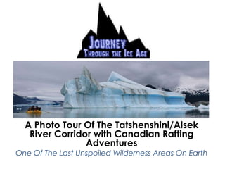
- 1. A Photo Tour Of The Tatshenshini/Alsek River Corridor with Canadian Rafting Adventures One Of The Last Unspoiled Wilderness Areas On Earth
- 2. Dave Pearson: Owner/Raft Guide Ben Thackeray: Owner/Raft Guide
- 3. “Picture a steel-gray, mile-wide river running past mountains that tower 15,000 feet above. Imagine a journey into the Ice Age history of our planet, where glaciers descend to the waters edge: a frozen wall of sapphire- blue, 150 feet high, ten miles wide, calving enormous pinnacles into the river amid thunder and waves.”(Ric Careless, 1993)
- 10. Rigging up and getting ready for the white water below Dalton Post
- 12. Stillwater Canyon, a great place to spot Bald and Golden Eagles
- 18. Juvenile Bald Eagle Golden Eagle
- 19. Sediments Creek
- 26. According to the World Wildlife Fund the area required to sustain a minimum viable population of Grizzly Bears 19,650 square miles. (Tatshenshini River Wild, 1993)
- 29. Glacier Bear
- 33. “The Tatshenshini/Alsek is one of the most magnificent river systems on earth, flowing through one of the worlds most pristine wilderness areas.” (Al Gore, 1993)
- 34. “Of all the changes that will come to Canada in the next generation, we must prevent any of a sort that will diminish the essential beauty of this country. For if that beauty is lost, or if that wilderness escapes, the very nature and character of this land will have passed beyond our grasp.” (Pierre Elliott Trudeau, 1993)
- 35. The O'Connor River: From Interior To Coastal
- 37. “There is such and incessant display of scenic wild grandeur that it becomes tiresome, we can no longer appreciate it; its awe inspiring influence no longer appeals to our hardened senses.” (E.J. Glave, 1890)
- 38. Confluence of the Tatshenshini and Alsek Rivers
- 43. Walker Glacier
- 62. Camp Life
- 63. We Provide High End River Gear Including: Life jacket, splash top, Helly Hansen rubber rain gear, rubber boots For The Whitewater Day: Helmet, wetsuit, neoprene boots For Your Stuff: One large 115 liter dry bag, on small 20 liter dry bag
- 64. Where Will We Sleep? We provide top of the line Mountain Hardware Hammer Head 4 season tents 3 person tents for 2 campers, 2 person tent for single camper We also have a selection of North Face and Mountain Hardware sleeping bags that will keep you warm on the coldest nights.
- 65. We also provide the most comfortable inflatable camp mat that money can buy!
- 66. We carry a state of the art expedition kitchen allowing us to prepare outstanding gourmet meals in this wilderness setting!
- 67. What Will We Eat?
- 68. Relax near the fire while meals are prepared for you!
- 69. We Never Forget Dessert!
Notas do Editor
- Located in the St. Elias Mountains, south of Mt. Logan, the tallest mountain in Canada. The Tat/Alsek flows through the largest continuous block of protected land on earth Including: Wrangell-St. Elias national park, Kluane National Park, Tatshenshini/Alsek Provincial Park, and Glacier Bay National Park Totals 8.5 million Hectares Truly the Last fully protected and undisturbed river-system in the world
- The Tatshenshini/Alsek watershed is 27 thousand sq km Making it one of the largest drainages on the west of North and South America It picks up a huge amount of water in a relatively short distance It can flow at over 3000 CMS at the outlet (bow river in Calgary is sever hundred depending on the season) This is due to 16-20 % of the watershed being glacier covered making the area the world’s largest non polar ice field
- The nature of the river is changing every day Unlike most rivers that flow form a clod alpine environment to warmer lowlands the Tatshenshini/Alsek flows from the warmer sunny forested hills of the Yukon to the colder environment of glaciers and icebergs at the coast.
- History of exploration Original explorers where the Natives that used the corridor as a trade route. Costal Tlingit traded with the Southern Tutchone, part of the interior Athabascans who had several villages near the start of the Tatshenshini River. Klukshu was the main native village and still exists today. The interior Athathabascans in this area were some of the wealthiest due to the abundant Salmon and the available trade with the Costal Tliget. The costal Tlingit form Dry Bay, where the Alsek river meets the Gulf of Alaska, would travel up the Alsek and tatshenshini rivers while they were frozen in the winter and return via dugout Canoes made from Aspens.
- The first white Explorers were E.J. Glave and Jack Dalton who first navigated the river in 1890 In 1906 A.J. Barbazon lead a Canadian Survey Expedition to chart the US/Canadian Boarder Many trappers and hunters frequented the area from the time of the gold rush Commercial rafting expeditions started in the 1970’s
- Two Southern Tutchone settlements existed on either side of Dalton post. Nesketaheen was just downstream and Klukshu still exists just upstream. Nesketaheen was the site of an annual trade fair between the coastal and interior natives. The Tlingits would bring costal goods that eventually included Blankets, guns, beads, and tools acquired from trade with white men. They would trade these for copper, furs, snowshoes and leather goods from the interior. Jack Dalton eventual set up a trading post in this area while establishing the Dalton trail which ran from Haines Alaska to the Yukon River. The Southern Tutchone became aware of Daltson’s presence when sawdust form construction floated by there Nesketaheen settlement. As we move down River form Dalton Post we very shortly enter a deep Canyon with numerous class three rapids that were unrunable by canoe. Daltons decent of the tatshenshini in 1890 involved a 5 day portage of the canyon
- As mentioned previously the start of the trip is in a dry interior environment with Quaking Aspen and white spruce the dominant trees.
- Silver Creek to Sediments Creek Great Day for photos, The river is slow with numerous ox-bows Great opportunity to view moose, trumpeter swans , and bald eagles Moose are the only member of the deer family that exist in the area Still water canyon is a contrast to the canyons from the day before Look for cliff swallows and bald eagle nests on the cliffs above Golden eagles also exist in the upper section of the Tatshenshini, they are often mistake for Juvenile Bald eagles who’s heads haven’t yet turned white
- The winding ox-bows will periodically offer the first view of the Alsek range that divides the two river valleys
- The are over 180 species of birds that frequent the river valley during the spring and summer. The most prominent and most impressive are the bald eagle
- You will see hundreds of bald eagles throughout the trip Occasionally you will see clusters of half a dozen or more sitting in the limbs of trees
- Bald eagles nests are usually within 200 meters of the river in large old growth trees, they like to have a clear flight path of the river to ensure hunting success. Bald eagles continually add to there nests and have been found to weigh up to a metric tone and measure up to 8 feet wide.
- Sediments creek At the start of the trip the tributaries are fed by snowmelt and rain, once we get to sediments creek they become glacial fed although the glaciers are so far up the creeks they are not visible from the river, a few days down the river and the glaciers will be right at the rivers edge. This name sediments creek is very appropriate, the receding glacier grinds the rocks it rests on and produces sediment and gravel which get transported down the creek to the river forming a large delta at the mouth, and adding cloudy water in to the Tatshenshini.
- Sediments creek offers fantastic hiking through aspen forests where there is often evidence of bears. There is also excellent wild flow viewing, the type of flowers and the intensity can vary due to the weather and time of year.
- Chocolate lily
- Northern Ground Cone
- Fireweed is seen throughout the trip Common Fireweed is found in open patches on hillsides Dwarf Fireweed or River beauty is found sprawling along the riverbanks Bear root is commonly mistaken for fireweed; it exists mostly on gravel bars and is a source of food for Bears early in the season. Indian paint brush is also seen through out the trip, in the bow valley this is also common and is usually red. However we will see a large variety of colors including several multi colour paintbrush on this trip.
- The Tatshenshini lies in a protected block of 32818 square miles making it a perfect habitat for Grizzlies and other bears. For context Banff is 8,290 sq miles
- Bears that are seen in areas like Banff are habituated. They have had contact with humans and this has changed there behavior. Bears that become to habituated are commonly relocated or killed. The bears that we encounter on the Tatshenshini are the most un habituated that you can find. Humans are foreign things to them, so they behave accordingly and often run when they become aware of you. However a bears vision is not fantastic and if you are down wind and quiet you can often view them undiscovered.
- The Bear habitat is so fantastic that it is the only place in the world to see the “Glacier Bear” The Glacier bear is a very rare and unique variation of the Black Bear The tatshenshini is the only place in Canada where this bear has been see.
- Bear evidence is almost everywhere, every time you step of the rafts you can find evidence of bears
- Windy Craggy Mine This proposed mine would have given access to one of the largest copper deposits in world This would have been a massive open pit mine with a large toxic tailings pond. The tailings pond would have been held back by a man made dam. The Tatshenshini area is one of the most seismically active in North America making it very likely that this dam would break spilling toxic waste into this highly sensitive ecosystem The minors were so optimistic they also proposed a never before tried idea of disposing of toxic waste high up on a glacier (some real forward thinking!) Trucks would have crossed the tatshenshini on their way to the Haines Hwy about every 8 minutes. The proposed site of the bridge was where a restriction in the river creates a rapid called “monkey wrench rapid” the rapid got its name when surveyors trying to plan out the road were constantly delayed by a mysterious person interfering or “monkey wrenching” with their efforts.
- Protection The silver lining to the threat of mining was that is spurred a massive protection effort lead by international environmental groups and concerned locals Many journalists and politicians were brought down the Tatshenshini to help push ahead the efforts to protect the area. In 1993 Mike Harcourt, then the Premier of BC helped the Tatshenshini/ Alsek become a Class A Provincial Park In 1994 the area was give UNESCO word Heritage site status completing the worlds largest continuous protected area with 8.5 million Hectares
- O’Connor River The silt from the tributaries makes the Tatshenshini so silty this point you can actually hear it, sounds like the boat is leaking. This is the point where the environment changes from interior to costal. The glaciers are no longer far up a creek, they are right at the river
- This is where “scenic overdose syndrome” kicks in. This was a term first coned by some of the first commercial guides on the river. It refers to the fact that there is so much stunning scenery that you can’t actually take it all in, some things that would normally take your breath away get lost amongst everything else.
- Confluence This was the site of a native village called Kaskawulsh. Around 1852 the Lowell Glacier surged and blocked the Alsek River causing it to rise 200m creating a large lake about 50 miles long. The ice dam broke causing water equal to 6 times that off the Amazon River to come crashing down washing the village away. Only one man survived the flood returning to the coast to tell the others of the “wall of water”. The forests and soil up the valley were scoured away leave in a flood line still visible today. For obvious reasons no new village was ever established there. This is the ultimate example of how dynamic this area is as it emerges from the ice age. Similar glacial surges have happened since in 1997 and 2010, but they did not completely block the river and therefore did not have as dramatic an effect. There is a theory that the Tweedsmuir Glacier, closer to the confluence than the Lowell Glacier, at one point blocked the Alsek River and created a massive lake that stretched all the way to Haines Junction allowing travelling natives to paddle along the lake providing an even easier trade rout.
- Petroglyph Island, the only remaining evidence of the old native village
- Camp at Reynolds glacier, site of a previous Jokulhlaup, 11 glaciers can be seen form camp Jokulhlaup: Icelandic word meaning: Glacial Outburst Massive lakes form on top of and below glaciers, warm weather can cause big changes in glaciers and sometimes these lakes erupt causing massive amounts of water and round chunks of ice to come crashing down. Refer to Graph
- Displays two likely Jokulhlaup events in 1997
- Walker Glacier: Welcome to the USA “Kodak Corner” Big left turn reveals even greater scenery as we approach walker glacier Not the official name, it was giver simply because it is easy to access and many people “walk” on it.
- Heavy bear traffic makes it a great place to see tracks.
- Cracking and shifting on the glacier can be heard regularly reminding us once again how dynamic the area is.
- Walker Glacier in 2004
- Walker Glacier 2012, look how the lake is being formed
- After Walker Glacier Mt. Fairweather comes into view, at 15,300 ft or 4,660m it is the 8th tallest peak and fourth tallest mtn. in Canada. Fairweather is very prominent as it stands 5000ft taller than the surrounding peaks.
- Alsek Lake The scenery has been building the whole trip, Alsek Lake is the Grand finale. Like walker Glacier, the Alsek and the Grand Plateau Glaciers formed a large lake as they receded. Massive chunks of ice fall of the face of the Glaciers forming hundreds of icebergs that float in the Lake. These bergs can be some of the largest in the whole Glacier Bay area. Because they are in fresh water they don’t deteriorate as fast as those in salt water.
- Again we are reminded of the dynamic nature of the area. All day and night you can hear the rumble of glaciers calving and creating icebergs and also icebergs rolling in the water If you hear a thunderous boom it is likely a iceberg being born. When a glacier calves they create a tsunami type wave that will eventually make its way to shore, sometimes these can be quite large carrying large icebergs up onto the beach. A continuous dull roar is likely from a chunk falling off an iceberg causing a shift in weight which can sometimes make the whole iceberg roll constantly until it eventually settles.
- The Lake is often blocked with a wall of icebergs. When the relatively shallow river enters the deep lake there is a strong undertow as the water drops to the bottom of the lake. This creates a current that pulls the bergs towards the entrance. Explain entrance options Before the glaciers had receded enough to create Alsek Lake there are native accounts of walking over a glacier to go up the river and traveling under the glacier on the way back down. Our options may have risks but nothing like paddling under a glacier!
- The end!
- Explain gear
- Explain lunch spread