
Recomendados
Recomendados
Mais conteúdo relacionado
Mais procurados
Mais procurados (20)
Semelhante a Shoreline Change Maps and Projected Shoreline Change for the RI Shoreline_RIFMA2016
Semelhante a Shoreline Change Maps and Projected Shoreline Change for the RI Shoreline_RIFMA2016 (20)
Mais de RI_FMA
Mais de RI_FMA (12)
Último
Último (20)
Shoreline Change Maps and Projected Shoreline Change for the RI Shoreline_RIFMA2016
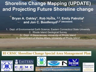
- 1. Shoreline Change Mapping (UPDATE) and Projecting Future Shoreline change Bryan A. Oakley1, Rob Hollis, 2,3, Emily Patrolia4 and Jon C. Boothroyd2,3* (deceased) 1. Dept. of Environmental Earth Science, Eastern Connecticut State University 2. Rhode Island Geological Survey 3. Dept. of Geosciences, University of Rhode Island 4. Department of Marine Affairs, University of Rhode Island
- 2. SHORELINE CHANGE SAMP: ON-GOING PROJECTS • Update (to include 2014) Shoreline Change Maps for Washington County (HUD and RIBRWCT Funded) • Project future shoreline change for the South Shore (NOAA PSM Funding)
- 3. Updated 1939 – 2014 Shoreline Change Maps
- 4. Shoreline Change Maps Understand Risk www.BeachSAMP.org http://www.crmc.ri.gov/maps.html
- 5. SCE m Seaward Shoreline year − Landward Shoreline year Net Shoreline Movement vs. Shoreline Change Envelope Boothroyd et al., 2016 Boothroyd and Hehre, 2007 NSM (m Years between oldest and youngest shoreline
- 6. Net Shoreline Movement (NSM) 1939 Shoreline 1951 Shoreline 2014 Shoreline Shoreline Change Envelope (SCE) 1939 Shoreline 1951 Shoreline 2014 Shoreline -37.5 m 63 m EPR Rate = Net Shoreline Movement Number of years between oldest and youngest shorelines EPR Rate = -37.5 m 75 years EPR Rate = -0.5 m yr-1 SCE Rate = 63 m -63 years SCE Rate = -1.0 m yr-1 SCE Rate = Distance between most landward and seaward shorelines Landward year - seaward year Net Shoreline Movement vs. Shoreline Change Envelope
- 9. Fill placed at Quonset Point
- 10. Shoreline Type Average Shoreline Change Distance (m) Average Shoreline Change Rate (m yr-1) Shoreline Type % Glacial Stratified -49.27 -0.76 6% Barrier/ Beach -35.89 -0.57 63% Glacial Till -18.41 -0.31 31% Barrier/ Beach -15.50 -0.21 15% Glacial Till -13.65 -0.20 11% Glacial Stratified -8.71 -0.12 22% Napatree Point to Point Judith Point Judith to Potowomut River
- 11. 2016 Mapping vs. 2006 Mapping
- 12. Bousquet and Son – Aerial Views Quonochontaug Barrier Pre/Post Sandy: Barrier Spit Migration
- 13. PROJECTED FUTURE SHORELINE POSITIONS Matunuck Headland in 2050? 1951 2014
- 14. PROJECTING FUTURE SHORELINE CHANGE i.e. Making a prediction on future shoreline position in the future • ‘Statistical based’ – take historic rates of shoreline change and multiply them forward by the desired number of years • ‘Process based’ – incorporate the historical observations, coupled with physical conditions (grain size, wave characteristics etc.) and models of beach evolution to predict shoreline change
- 15. PROJECTING FUTURE SHORELINE CHANGE • Increasing rates of shoreline change with increasing rates of sea-level rise remain a complicated and controversial topic… • Significant debate still exists about whether storms (Fenster et al., 2001; Morton, 2008; Morton and Sallenger, 2003) or sea-level rise (Leatherman et al., 2000; Zhang, 2002; Moore, 2006) drives shoreline change.
- 16. PROJECTING FUTURE SHORELINE CHANGE • Occam's razor suggests that while shoreline change is driven by storms, higher rates of sea level rise WILL produce higher rates of shoreline change as storms are allowed to act higher on the shoreline. ???
- 17. PROJECTING FUTURE SHORELINE CHANGE • Our approach; present three scenarios at 2040, 2065 and 2100: • Historic rate of change + uncertainty in shoreline position (Ea) • Exponential rate of Shoreline Change + uncertainty in shoreline position (Ea) • “Low” Scenario – rate of shoreline change doubles by 2100 • “High” Scenario – rate of shoreline change increases by 2.5X by 2065 (1 m of SLR) (Moore et al., 2007; Anderson et al., 2015)
- 18. Historic Rate Exponential Low (Double by 2100) Exponential High (2.5X by 2065) Historical vs. Exponential Shoreline Change
- 19. Shoreline Position - 1939 Shoreline Position - 2014 Uncertainty Annualized Rate: -1 m yr-1 Projecting Future Shorelines Based on Historical Shoreline change Shoreline Position - 2065 54 m (51 m + Uncertainty)) 75 m 1939 – 2014
- 20. Shoreline Position - 1939 Shoreline Position - 2014 Uncertainty Annualized Rate: -1 m yr-1 Projecting Future Shorelines Using Exponential Shoreline change Shoreline Position - 2065 86 m (Exponential High) 65 m (Exponential Low) 54 m (Historic)
- 21. Shoreline Position - 1939 Shoreline Position - 2014 Uncertainty Annualized Rate: -1 m yr-1 Projecting Future Shorelines Using Exponential Shoreline change Shoreline Position - 2065 Coastal Setback- 2065
- 22. Misquamicut Barrier – 2100 – Historical Rate of Shoreline Change Shoreline Position Controlling Coastal Feature Setback
- 23. Misquamicut Barrier – 2100 – Exp. High Rate of Shoreline Change Shoreline Position Controlling Coastal Feature Setback
- 24. Undoubtedly, our understanding of the dynamics of shoreline change in the face of accelerated sea level rise will improve in coming years. The goal of these projections is to inform stakeholders and guide sustainable development choices in the coming decade(s) “Qualitative Modelling” Exponential High…?
- 26. (Former) Boardwalk at SK-TB Oct 2005 S. Kingstown Town Beach – October 2005 Extra-tropical storm Bluff Edge
- 27. Glacial Bluff at SK-TB Post Sandy RIDOT Boardwalk Pilings
- 28. South Kingstown Town Beach Bluff Retreat 29 meters (95 feet) of retreat in 26 years
- 29. Matunuck Headland circa 1950 CRMC Archives
- 30. Matunuck, 1991 – CRMC Archives, J. Freedman
- 32. North Carolina: 125,000 yBP Sea Level + 6 m (20 ft) Riggs et al., 2011 i.e. This was all Underwater…
- 34. North Carolina: A few decades and a major storm or two…. Riggs et al., 2011 East Beach, RI…….
- 35. North Carolina: 100-300 years in the future…? Riggs et al., 2011
- 36. End of presentation OakleyB (at) easternct.edu http://www1.easternct.edu/oakleyb http://www.beachsamp.org Funders/Partners