Legal Office BIM Model
•
0 likes•1,359 views

The document outlines the design of a new office building for legal firms. It includes a schedule of accommodation and constraints of the site location. Laser scanning was used to capture data of the site and surrounding buildings to help model the context in Revit. An architectural model of the building was created with walls, floors, doors and windows. A structural model was also developed including the steel frame, concrete floors and pile foundations. The next steps will be to complete the structural and MEP models and then clash detect them in Navisworks to identify and resolve any issues.

Recommended
More Related Content
What's hot
What's hot (20)
Viewers also liked
Similar to Legal Office BIM Model
Similar to Legal Office BIM Model (20)
More from Campus
More from Campus (12)
Recently uploaded
Recently uploaded (20)
Legal Office BIM Model
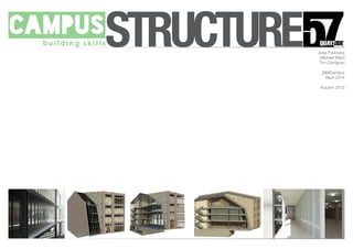
- 1. STRUCTURE Jurijs Pavlovics Michael Ward Tim Corrighan _BIMCampus Revit 2014 Autumn 2013
- 2. Introduction Brief Our team has been appointed to design a new office specifically tailored to legal firms and legal training. The building must incorporate space for multiple companies. Schedule of Accommodation: Office spaces (both open plan and cellular) Meeting/board rooms (varying sizes for specific uses, eg. 1 to 1, groups, etc.) Achieve storage room General storage rooms Moot court (legal training court) Break-out spaces throughout the building Kitchenette/coffee points Toilets (male,female, accessible WC’s, shower room, etc.) Accessible lift Cleaners store Central reception with guest waiting area STRUCTURE
- 3. Site Proposed Site The proposed site is located on the North bank of the River Tyne, Newcastle upon Tyne. 57 Quayside Newcastle upon Tyne NE1 2BJ Currently housing a ‘Pocket Park’, an initiative promoted by NE1 STRUCTURE
- 4. Site Constraints Site Boundaries The site is restricted on two sides by neighbouring buildings: Flynn’s Bar Law Building To the front, the site is restricted by the street front and public footpath To the rear, the site is slight more open with room for car parking All buildings are limited to roughly the same height and number of levels Observations Busy street to the South Access needed to property along the East boundary Access to car park from Broad Chare to the North East STRUCTURE
- 5. Inspiration Presidents Stone + Brick Facades Quayside History Glass with hard materials Infill Architecture Modern Architecture sitting with Classical STRUCTURE
- 6. Using the 3D City Model City Model Throughout this project and the last we have used a 3D city model of Newcastle to create the context for our Revit model. Used to better understand the site boundaries. We have used the 3D city model to create more professional external renders. The 3D model was used to align the point cloud data to one of the neighbouring buildings so a Revit model for these buildings could be modelled in place. STRUCTURE
- 7. Data Acquisition Laser Scanning Tutorial in laser scanning with Paul from Leica Geosystems. Scanned the full site from several different locations We headed straight back to the computer suit to load the point cloud into Revit STRUCTURE
- 8. Laser Scanning and Modelling from the Point Cloud Data Modelling from Point Cloud Data The point cloud data was opened in a new revit project and was used to begin building a model of the adjoining buildings to the site. Using walls, extrusions and windows we created the facades of the buildings. We created custom texture to apply to these surfaces. We then added roofs and further details to complete the context models. We worked individually on each of the buildings and the models were linked together before being imported and aligned to the site model. STRUCTURE
- 9. DN By Department Legend Lift Offices Private Public WC Drawn Dwg. No. Scale at A1 Project No. Drawing Project Status Rev. Date this drawing is copyright - check all dimensions on site - inform architect / so of any discrepancies - work to figured dimensions only - do not scale Rev. Amendment Date Checked1 : 100 1234 A(00)GAP900 MW Departmental Plans 1234 - BCT2 - 57 Quayside Preliminary 09/11/13Checker 1 : 100 Departmental Level 00 1 1 : 100 Departmental Level 0 2 1 : 100 Departmental Level 1 3 1 : 100 Departmental Level 2 4 1 : 100 Departmental Level 3 5 The Design STRUCTURE
- 10. Architectural Model Modelling in Revit We all began modelling the architecture model to create a com- prehensive mass made up of architectural elements: Walls (with materials) Floors Doors Windows and other glazing This is the base for the BIM STRUCTURE
- 11. Structural Model Structural Grid 8x5 grid Horizontal Spacing - 3000/2000/4200/2000/3000 Vertical Spacing - 4000/2000/2000/6000/6000/5000/2500 Base of steel frame Primary Structure Steel Frame In-situe cast concrete floor Concrete pile foundations STRUCTURE
- 12. What is Next? Structural Model The next stage now for us is to complete the structural model, creating a fully comprehensive Level 2 BIM. MEP Model We will then create a mechanical and electrical model concentrating on one floor. This will give us three co-ordiated models which we can then process in Navisworks. Navisworks We will then import a central model into Autodesk’s Navisworks. Here we will run a series of clash detections between the architectural and structural models, architecture and MEP and structure with MEP. In Navisworks we will also create a series of construction animations and renders using the cloud. We welcome any questions? STRUCTURE