SlideShare uma empresa Scribd logo
1 de 45
Baixar para ler offline
How do we root an infrastructure detached from place?PADRAIG CONNOLLY
10103082
ACKNOWLEDGEMENTS To all my lecturers at SAUL foryour support and guidance throughout theyears, in particular
the 4th and 5th year teams. Special thanks also to Fran and Noel for all their assistance.
To Jenny and Rafal, for your help to get me over the end line, I am so grateful.
To Mam, Dad and Hugh, for everything over the last few years.Thanks for all your assistance
in model making, proof reading and drawing. Without your help this would have been
impossible and I am truly grateful for that.
To my class, who have made the years in SAUL such an enjoyable experience, from first to
fifth year, it has been an enjoyable time because of you all. I hope it continues long after this.
TABLE OF CONTENTS Part 1
Introduction
INFRASTRUCTURE AND MOBILITY
FROM PLACE TO NON-PLACE
ARCHITECTURE AND MOBILITY
FROM NON-PLACE TO PLACE
Part2
SITE
PROGRAM
FINAL DESIGN PROJECT
Bibliography
Part 1
Tim Engolds diagram of the hub-spoke model of place compared to the knot of entangled lifelines on the right. The left showing the planning of place, as a
circulating out structure versus the right, the series of movement representing everyday life.
The evolving nature of our landscape
has seen many changes in recent times,
both above and below its original formed
ground. We have created large-scale
connections between our urban cores and
have developed infrastructures within,
to move our cities’ people. However, this
need for ultimate connectivity has led to
disconnection with former places along
routes. This disconnect has made these
places almost non- places, struggling in
trying to find their identity in more than a
subway sign or motorway exit.
The thesis looks to explore the possibility
of changing what one understands as
inhabitable space, by looking actively at
the junctions presented by the motorway
as important points of transition both
physically and socially. This will hopefully
look to remove the isolated state of the
infrastructure and move to developing
a stronger relationship to place and
infrastructure. The thesis will also look
to how architecture considers mobility in
its make up, looking at how architecture
can engage with movement and program
together rather than fragmenting them.
It looks to re-imagine how this functional
infrastructure could work as a new
generator of social interactions, removing
its isolated state and enabling a dialogue
with the places it connects. The thesis will
also speculate on the future use of the
structures being introduced, considering
the changing and evolving state of the
motorway.
Introduction
The Road.
One can consider the road a piece of
infrastructure, a tool to get you from one
place to another with little obstacles. The
reality though, is the road has also become
a social condition in its own right. The road
has always had a social element. Going to
and from places by foot would have always
led to chance encounters.
“Which came first, the house or the road
leading to the house?”1
This question
has led to much debate, however, its
answer depends on individual opinion; a
house represents a shelter and physical
ownership, while the road represents a
journey? The road has evolved over time
but has always kept a sense of its origins,
summed up when one considers the road
as a metaphor; Life is a road, long and
unpredictable, and full of danger, that each
of us must travel. The road has always
brought with it a sense of freedom, never
confined by a boundary or owned by some
one. The road was an enabler to many to be
free of a place. The road, physically, socially
and metaphorically has been pivotal in how
1	 Jackson J.B, A Sense of Place, a Sense of Time (Bing-
hamton, New York, The Maple-Vail Book Manufacturing Group,
1994) 189
places develop, but equally pivotal in giving
freedom to explore.
The current day road has shown its most
significant evolution when one considers
the motorway. The road has shifted in its
social capacity, as speed and time have
omitted this need. The relationship, both
socially and physically, once capable on
the road are no longer possible with the
increase in speed and volume of traffic
using this infrastructure. It is an abstracted
tool in its own right, trying to establish
itself as an infrastructural devise, rather
than any social generator or condition. If
it has lost this important social capacity,
have we isolated human contact to a salute
from behind a steering wheel?
INFRASTRUCTURE AND
MOBILITY
Motorway Network of Ireland
Isolated Existence.
Currently the motorway has positioned
itself in an isolated position in the
landscape, with a large spacing between
the former node and the physical
infrastructure. This space in-between has
led to an abstraction of the motorway,
which has detached the infrastructure
from the nodes it is supposed to serve.
By that, the placement has led to a large
in between space developing between the
motorway and former nodal point, where
linear opportunism is at play on the newly
placed access roads.
The motorway was first realized in Italy in
1925, between Milan and Varese. Coined
by Edward M. Bassett, who denoted
the freeway as a piece of public land
designated for movement, the motorway
would become a part of modern day
society internationally. In its planning
the motorway is considered nationally, in
Ireland’s case to connect smaller urban
cores to Dublin. By that the over arching
goal is to connect urban cores as efficiently
as possible. However, this placement has
lead to a shift in the geography of the
former node points along a route. Former
nodes operate as the centre of social
infrastructure in these areas, however,
the large in-between space developing
between the motorway and node has led to
a decline in the existing towns and villages.
The motorway is the new road. It offers
potential in speed and efficiency that
enables daily life to function better.
The question now, though, is how we
understand this change from road to
motorway. No longer are buildings
together in a linear situation stitched
together, rather individual buildings with
vast distances between exist, that in there
own way have become destinations. So
how does the motorway engage socially as
the road did in the past?
JB Jackson in his essay Roads belong to the
landscape asks the important question for
today’s roads; “Which do we value more, a
senseofplaceorasenseoffreedom?”2
The
motorway brings with it a new condition,
however, the necessity of the road as
a social enabler has come to change.
Advances in technology and social media
consume far more of our social life than
physical interaction do today, so should the
2	 Jackson J.B, A Sense of Place, a Sense of Time (Bing-
hamton, New York, The Maple-Vail Book Manufacturing Group,
1994) 190
Nodal isolation between existing village and motorway,
Birdhill, Tipperary
road go back to being a source of freedom
and in fact isolated for the over connected
world. One could consider the motorway
the last isolated existence one can achieve.
The advances in technology by Google and
others in relation to driver-less cars adds
another changing quality to these roads,
as they start to act as driver-less motion
machines, so how should we understand
the motorway moving forward?
This mobility infrastructure creates a
different way of viewing the landscape, and
anewspatialexperience,sotheimportance
in its evolution only seems right. How do
we approach a fragmented infrastructure
in the landscape? “If landscape is defined
as culturally configured nature, then
infrastructure may be considered the single
most important factor generating it” 3
.
If we fail to understand the importance
this infrastructure has in the landscape,
it further becomes isolated and detached
from its surroundings. How do we root this
infrastructure? How do we enable a social
interaction yet re-asserting the road as a
place of freedom?
	
3	 Hvattum Mari and Janikie Kampevold Larsen, Routes,
Roads and Landscapes (Surrey, Ashgate Publishing Limited, 2011) 2
Current relationship between the motorway(orange) and existing nodes
The nature of place as we know it is
constantly changing. The reality of
what we understand to be our place
has been removed by the increase in
the technology and the evolution of the
worldwide economy, meaning large-scale
international movement for both work and
leisure. However, it is in this context we
find ourselves still wanting a route, a place,
a home. The need to connect one self to a
place will always be inherent to us, even in
today’s small world.
As our urban centres continue to grow at
large rates, we must ask how do we want
the socio geographic to develop? The mass
movement to large cores comes with
inflation, sprawl and a certain degree of
panic as one tries to edge their way into
an already dense fabric. The value of place
seems somewhat lost in the sensation to
be part of a certain urban condition.
Marc Auge in Non-places introduces one to
the idea of place and non-place;
“If a place can be defined as relational,
historical and concerned with identity, then a
space which cannot be defined as relational,
or historical, or concerned with identity will
be a non-place”.
Non-places according to Auge are
concerned with the modern world1
- The
idea of being born in a clinic and dying in a
hospital. They have developed throughout
our society. In particular he considers the
motorway a non-place. He talks about
the language we are presented with on
the motorway, and other non-places such
as the supermarket and the airport. We
are governed by words and names rather
than places, signs and signals that only
suggest exits and lane allocation. The hint
of what might be beyond the current route
is sometimes mentioned in a sign, but in
a sense, this further removes the need to
disengage from the specific journey. It gives
enough of a glimpse to derail curiosity
and allows only a brief glitch on the trip.
We continue ignorant to our surrounding
beyond an aesthetic view, appearing and
disappearing at high speed.
Counter arguments can be made to Auge
arguments of Non Place. Peter Merriman in
Routes, Roads and Landscapes argues Auge
has a simplistic reading of the motorway
currently as a monotonous non-place. He
argues that the motorway unfolds at speed
showing landscape features, which can be
1	 Auge Marc, Non Places: An introduction to Supermo-
dernity (London: Verso, 2008) 63
FROM PLACE TO
NON-PLACE
Shopping centre development along the motorway.
consumed quickly. The argument that the
motorway is a place in its own right brings
a new definition to the word “place”. Auge’s
definition is based on identity and historical
basis, whereas, in this context, I think place
could be described as a series of unfolding
events happening at speed, both spatial
and aesthetic. The landscape changes
before your very eyes, as you duck under a
farmer’s overpass, where he crosses with
his livestock.
In my opinion, it would appear that
Merriman and Auge are talking about
separate things. The interest spatially one
might have is not the same as the isolation
of the non-place that Auge refers to. A
non-place is a detached, isolated place
that doesn’t seem to connect to anything,
it is treated in isolation and even though it
may be an interesting experience, the issue
of isolation and disorientation continues.
You are on a journey, an experience that is
of today with nothing present of yesterday
and no idea of the future. It isolates for the
purpose of that one function.
So within this context I argue, if it is
possible to navigate between these two
interpretations of “place”. Is it possible
for the motorway to become a place, it
already controls a spatial sequence that
is enjoyable, however, it fails to negotiate
from a junction stop to existing nodes.
Could there be a connection between
former nodes and the motorway? Could
it be that the nodes plug into this large
infrastructure, both in urban and rural
conditions? The possibility of an existing
formed place and non-place making a new
condition?
Alison and Peter Smithson, ‘AS in DS: An Eye on the Road’
To put down a road, as the Smithsons state,
is a serious task as it becomes a “fix” in the
landscape which development circulates
out from. So by this, the nature of roads,
railway lines, tram lines and canals all hold
an important part in the development
of places they serve. Architecture has
concerned itself with mobility for many
years. The future planning of cities and
towns is often first developed through
connectivity of the place. Architects
such as Louis Kahn and Alison and Peter
Smithson have written extensively about
new possibilities in how architecture could
re-imagine a new order in relation to
mobility, sparked mainly by the increased
presence of the motor car in the world,
leading to segregation between vehicles
and pedestrians for safety.
Louis Kahn, in his plan for Philadelphia,
considered movement as the important
change in how one looks at civic spaces.
He criticized the Piazza and the square
as associating with an older pedestrian
society. With this, he planned a linear city
plan for Philadelphia in 1930, with civic
spaces and buildings in ten-block axis that
accommodatedautomotivetransportation
atthestreetlevel,andpedestrianwalkways
one storey above. He proposed cutaways at
the pedestrian level to allow light down to
the vehicle level. This, Kahn believed, would
“extend the area” of the village green of
old. The separation of different types of
movement would allow for a functional
arrangement leading to a better street life.1
Kahn’s plan for Philadelphia came as new
expressways opened, framing the area
with “Traffic Rivers” as he described them.
This freed the streets of through traffic,
allowing for a new order of movement. In
the plan, Kahn imagined a series of iconic
structures to help monumentalize the civic
area. “Only buildings of overwhelming
monumentality, he contended, could serve
asbastionsprotectingagainstthemoneyed
interests that were destroying the dignity
of the urban centre”. He devised parking
docks to “provide a model for defence
against the privatizing tendencies of the
automobile”. These were imagined similar
to old medieval walls protecting the urban
core.
Kahn’s view on mobility, taken somewhat
from Le Corbusier writing, was one of the
first suggestions of a new urban layout
that accommodated multiple scales of
1	 Goldhangen Sarah Williams, Louis Kahn’s situated
modernism (New Haven ; London: Yale University Press 2001) 115
Louis I. Kahn. Traffic Study, Philadelphia 1930
ARCHITECTURE AND
MOBILITY
movement. Architecture is not just a
physical thing but often an experience,
which Kahn understands in his separation
of traffic and pedestrian life as the two are
not the same. While driving on roads or
motorways, our contact with objects and
building is finite, and has to respond to
this condition. By that, Kahn’s use of iconic
forms suggests an understanding of this,
yet these same forms also hold an impact
for the pedestrian level above, articulating
the space from afar and rooting the place
in a civic threshold.
“Mobility has become the characteristic of
our period. Social and physical mobility, the
feeling of a certain sort of freedom, is one of
the things that keeps our society together,
and the symbol of this freedom is the
individually owned motor car.” 2
Alison and Peter Smithson paid particular
attention to the future working of cities. In
particular they thought the new networks
of roads would act as identifying devices
for the city similar to Amsterdam’s canals
in the 17th century. They believed that the
road would become the most “permanent
urban structure” which the city could form
2	 Smithson Alison and Peter, Ordinariness and Light
(Cambridge: The M.I.T. Press) 144
around. Shown in their plans for Berlin and
London the Smithsons believed future road
systems would influence urban and social
identities in the most profound way . 3
The Smithsons developed their plan for
London in 1959. New Ways for London
was a follow on from Kahn’s plan for
Philadelphia, which they stated to be “the
most important single contribution in the
twentieth century to changing the nature
of the relationship between architecture
and urban planning”. The plan addressed
concerns at the time of London’s intensity
in certain areas, while considering how to
distribute intensity equally around the
city allowing “things become themselves
without so much artifice and struggle”.
Roads, they believed, could be used as a
way of controlling intensity of use and that
through them, one could loosen up the
texture of the city.
The Smithsons concern with “the poetry of
movement, for a sense of connectivity”was
associated with the failure or rather lack of
coming to terms with new technologies.
The plan, in particular, was concerned with
the street and road, and how the two have
3	 Heuvel Dirk van den, Team 10: 1953-81, in search of a
utopia of the present (Rotterdam : NAi 2005) 102
Kahn’s Parking Dock, Philadelphia 1930
New Ways for London Plan, 1959
changed with the motorization of cities.
This new technology, they deemed, would
demand a new road network that would
allow an ease of access to the motorway
network, thus relieving congestion and
intensity and also re-imagining the street
as a series of levels each designated for
different types of movement.
The proposed plan was founded on two
basic tenets, the first from Hounsfield, that
flow from every point to every other point
is best served by a net; the second that the
urban motorway is the only thing capable
of providing structure for a scattered city.
The proposed road network differed from
Hounsfield-type solution, as they felt that a
four-way junction had many disadvantages
as too many decisions had to made by
the motorist. Instead, they adapted the
triangular system that allowed for a single
decision without needing to reduce speed.
This, they believed, created central spaces
around identifying fixes, places where a
relationship to the city structure can be
observed, for example, the route along the
South Bank provides fixes on Westminster
and the City. In the street context, the
Smithsons followed a similar approach
to Kahn in the dual level approach for the
street. The existing streets are reorganized
into “shop streets” and “go streets”. Shop
streets function for the purpose of that
street, allowing bus routes and two-way
traffic. Go streets are considered routes,
going somewhere and allowing access to
larger routes.
In their Berlin Hauptstadt Plan in 1957, the
Smithsons devised a new version of the
street. The predominant idea behind this
was the equal rights of freedom to both the
car and pedestrian.This was devised using a
dual level systemwith differing geometries.
Pedestrians walk on free-moving, non-
parallel narrowing and widening routes
while vehicles travel below on low speed
straight streets with light controlled
right angle intersections4
. Where the two
systems meet, continuously running public
escalators connect them, thus allowing
freedom between the ten-meter height
difference.
Architecture’s relationship to mobility is of
course constant. The need for one to move
from one place to another has always been
a challenge allowing for the spaces that
we move in to become important, social
interactions that help our towns and cities
4	 Smithson Alison and Peter, The Charged Void (New
York: The Monacelli Press, 2005) 45
New Ways for London; triangulated junction, 1959
function. Their relationship to the wider
is an important one. How our places work
is fundamentally rooted on this ability
to move freely at different speeds and
directions. Both Kahn and the Smithsons
understood how this relationship would
influence and shape our cities moving
forward. The space we move through from
place to place, from building to building
and room to room holds with it a sense of
the in-between and allows one to become
ready for a new set of conditions. This in-
between space that we move through,
holds an important point of exchange in
how we prepare ourselves for a new or
differing set of conditions.
Architecture continues to evolve and adapt
to the different types of mobility. The sense
to adapt rather than fundamentally look
at how architecture addresses movement
mustbeconsidered.Theforwardthinkingof
Kahn and the Smithsons shows us how the
city could have adapted to the motorcar.
We must consider how architecture
should address infrastructure as a tool
for social interactions. Can architecture
look to ensure an integrated, coherent
togetherness for mobility infrastructures,
to permit our places to work better?
Berlin Haupstadt Plan: typical escalator connection
between levels, 1958
FROM NON-PLACE
TO PLACE
The importance of the spaces we move
in is a significant contributor to our daily
lives going well or not. Infrastructure that
works leads to an easy transition from
one place to another. Infrastructure that
works badly leads to disruption and often
chaos in our daily plans. The functionality
of this infrastructure is crucial to our
towns and cities working, as they should.
This often large-scale infrastructure that
moves us, is of course functional but has
brought with it a change in the social order
that lay before it. The motorway is the
evolution of the road in its most advanced
state, yet, this change in state has led to an
infrastructure detached and abstracted in
its finished state. Imagined as a functional
devise,themotorwayhasalsoslicedthrough
the landscape both in a rural and urban
sense, dividing and displacing communities
in its construction. The motorway, even as
an enjoyable spatial sequence to drive, is
a non-place and needs to be addressed in
relation to places it serves. The reality of
this isolated non-place is best expressed
in JG Ballard’s novel, Concrete Island, which
explains the isolation of a motorway
“island” through the eyes of an architect
after he crashes. This left over uninhabited
space, where the architect crashes, is
overgrown which leads his crashed car to
be unnoticed for multiple days. The novel
shows the juxtaposition between the
heavily used traffic intersection and the
abandoned left over space of the “island”1
.
Onecanarguethatmotorwayholdsasense
of freedom that is liberating in today’s over
connectedworld.ItholdswithitJBJackson’s
sense of freedom that allows us to explore
ourselves. So should we really consider
rooting this isolated freedom? The scale
of the motorway comes to consideration
then,howcouldonerootthisvastnetwork?
The only engagement the motorway holds
with the places it serves is the junction.
The junction has been designed to allow
one to disengage from the motorway, as
one decelerates into a different driving
condition. This disengagement, on one
side, also marks the entrance to another,
and holds a very important relationship in
the working of the motorway. The ability
for us to enjoy the freedom and efficiency
of the motorway is controlled at this very
important point. The junction, in its current
state, is designed purely for function
but could this be understood as a social
exchange, where one understands the
1	 Ballard, J. G, Concrete Island (London: Jonathan Cape,
1974) 13
Slussen, in Sodermalm, Stockholm. Interchange opening 1935
interchange of people going somewhere
and coming from somewhere else.
Slussen, Stockholm opened in 1935 as
an infrastructural node, that contained
several types of mobility including boat
traffic using the lock, cars using the road
interchange,trainsconnectingtothemetro
station and pedestrians connecting from
one side to the other and also to a high
level walkway. The complex interchange
needed a complicated arrangement to
facilitate such a diverse range of mobility.
The project, praised by Le Corbusier as “the
modern era’s first large project”, works
for the area but also clearly worked for
the people as a place. The assembly of
people for this great opening shows the
node as a spectacle, but also as a place of
gathering. The junction/node works as an
inhabitable space that links the mobility
infrastructure to the places its serves.
By this, one could consider this point of
intersection, as a social generator, a point
of exchange both physically and socially.
As the built fabric becomes more and more
intense,architecturemustlooktoinhabiting
previouslyleftoverareas.Assemblesfollyin
Hackney Wick in London suggests a current
use of existing infrastructures to create
new urban space. The project intended
to represent a resident who refused to
leave where the infrastructure was built
anyway shows the possibility of left over,
in-between space becoming usable space
in our dense city fabrics. The folly built
by local groups allowed for a community
involvement with over 40000 people using
the space over nine weeks. The folly shows
the possibility of infrastructure acting as a
backdrop to public spaces, so could these
large scale infrastructures act as a means
of place making, allowing the physical
condition to become a social mechanism?
Advances in technology bring with them
great possibilities in terms of mobility. As
the world embarks on a new era of electric
and driverless technology, it brings with it
new possibilities for movement. However,
it also will bring about changes into the
existing infrastructures such as charge
points and other infrastructures, which
are becoming apparent on our roads and
motorways currently. Speculating into the
future allows one to think about these
ever changing pieces of infrastructure that
find themselves at an important change
in their use. They are changing, evolving
functional structures that have affected
and changed the places and landscapes
Assemble’s folly in Hackney Wick in London, 2011
Slussen, in Sodermalm, Stockholm. Interchange opening 1935
they sit. We must consider the important
role these structures play in our lives
and look to actively engage with them
as inhabited spaces, no longer disengage
from their design and placement but
consider what has been, what is and what
will be their impact on the surrounding
fabrics. The junction must evolve to
understand its importance in daily life.
These important points along routes that
have and will become a common daily
meeting point, are places architecture
must address with an understanding
of the conditions of movement.
The junction needs to reimagine itself, not
just as a tool for entering and exiting the
motorway but an entry and exit to the
adjoining places. The junction must evolve
tobecomeanexchangeofpeople,transport
and interactions. This point, used by people
coming and going different places, brings
knowledge to a place, which is being
missed by the junction’s failure to interact
with them. By that, the junction must turn
the abstracted accessible point on the
motorway into a new point of importance
for existing nodes that relates to the
existing area. It allows former connections,
which the motorway dissolved to be re-
connected.Itallowspeopletogoandcome,
in a point of exchange that empowers
dialogue between people and place.
Part 2
Semester 1 research work
Semester 2 structural tests
M50 Motorway Dublin, from junction 6-11
The thesis bases itself around the M50
motorway in Dublin. The motorway
acts similar to medieval walls of the
past, keeping the city enclosed in a semi
circle connecting from north to south
in direction. The motorway contains
seventeen junctions connecting the rest of
the country to Dublin. The main junctions
are, junction 7 interchange with the west
connecting Dublin to Galway and Sligo,
junction 9 connecting to Limerick, Cork
and Waterford and junction 1 connecting
north to Northern Ireland and Belfast.
The thesis will focus on the 5 junctions
from junction 6 to junction 11. There is
no junction 8. The junctions mark an
important transition, from urban to rural
in motorway context. This change also
signals the arrival into the city of Dublin
and holds with it a point of immense
intensity and movement.
The motorway today has seen many
changes since its formation in 1983. The
most significant is the increase in intensity
changing from a 2 -3 lane motorway in
2010. The motorway is currently in full use,
with speculation that as many as 120,000
journeys are being made each day on the
motorway. The motorway is significant in
the working of the city of Dublin to keep
the city moving.
SITE The main site will be the Red Cow
interchange, junction 9. This is Ireland’s
busiest interchange and has seen many
changes or upgrades moving, from a
round-about style junction to a free
flowing interchange. The site holds access
to public transport, an important point
when considering the future use of placing
any program on site. The LUAS, Dublin’s
Tram Network, has a park and ride facility
to the south west of the junction.
The junction nationally is seen almost
as a right of passage, dreaded by some
and enjoyed by others. It is the most
unlikely place to consider placing a
large public building, however it is this
move that hopes to really question the
larger question of how do we root this
infrastructure today?
Night-time view of Red Cow intersection approach from N7
Ariel view of Dublin showing the M50 highlighted
Site Photos:
PROGRAMME When deciding on programme for the
site, originally 4 programmes were
tested, a theatre, a restaurant, a drive
in cinema and a stadium. From this,
the main focus was reduced to the 3
junctions circulating out from the Red
Cow junction, junctions 7-10. The primary
consideration, when considering program
was based on the need to allow for social
interactions to occur. The idea of mobility
and accessibility was also tied into their
design and placement, allowing for an
ease of access from the motorway to
each programme, considering parking
and mobility from car to programme.
The main focus on the red cow site, was
primarily to allow time to pursue the
functionality of the building but also to
allow speculation on the building life span.
Considering possible changes in state over
its time, not only the physical building but
the motorway in general, as driver-less
technology comes into use internationally.
The project on the red cow changed
gradually over the design period finishing
with a theatre in the round, with parking
and other services housed in the circular
plan. The idea of the drama and theatricals
of the theatre became paramount in
considering the architecture of such a
space. Also the need to consider how
the car would access and move freely
while still accommodating a pedestrian
movement was all considered to allow
a functional building, while producing a
social building to root itself in the most
unlikely place.
Initial Program Tests:
Junction 10 intervention Junction 7 intervention
FINAL DESIGN PROJECT
Network drawing M50
Exploded axonometric of project
Interior perspective of outside circulation space
Interior perspective of foyer space
Exterior perspective from flyover showing interaction between mobility and function
Exterior night time perspective of project
1:50 Structural Model showing pillars and hanging structure
1:100 Sectional Perspective showing now and speculative future
1:500 Context model, junction 9, M50
Auge Marc, Non Places: An introduction to
Supermodernity (London: Verso, 2008)
Ballard, J. G, “Concentration City” in The
complete stories of J.G. Ballard, ed. John D.
Kelly (New York: W.W. Norton & Co, 2009)
Ballard, J. G, Concrete Island (London:
Jonathan Cape, 1974)
Castello Lineu, Rethinking the meaning
of place: conceiving place in architecture-
urbanism (Farnham: Ashgate, 2010)
Friedman Yona, Pro domo (Barcelona:
Actar, 2006)
Goldhangen Sarah Williams, Louis Kahn’s
situated modernism (New Haven; London:
Yale University Press 2001)
Halprin Lawrence, Freeways, (1966)

Heuvel Dirk van den, Team 10: 1953-
81, in search of a utopia of the present
(Rotterdam : NAi 2005)
Hvattum Mari and Janikie Kampevold
Larsen, Routes, Roads and Landscapes
(Surrey, Ashgate Publishing Limited, 2011)
Ingold Tim, Lines: A brief history (New
York: Routledge, 2008)
Jackson J.B, A Sense of Place, a Sense of
Time (Bing- hamton, New York, The Maple-
Vail Book Manufacturing Group, 1994)
Kerouac Jack, On the Road (Penguin Books,
1955)
Schwarzer Mitchell, Zoomscape
(New York; [Great Britain] : Princeton
Architectural Press, 2004)
Smithson Alison, Team 10 Primer,
(London:Studio Vista)
Smithson Alison and Peter, Ordinariness
and Light (Cambridge: The M.I.T. Press)
Smithson Alison and Peter, The Charged
Void (New York: The Monacelli Press, 2005)
Bibliography
The class of 2016 At my final presentation 20.05.16

Mais conteúdo relacionado

Mais procurados

Public Spaces, Plaemaking, and Citizen-led Planning
Public Spaces, Plaemaking, and Citizen-led PlanningPublic Spaces, Plaemaking, and Citizen-led Planning
Public Spaces, Plaemaking, and Citizen-led PlanningEnP Ragene Andrea Palma
 
Project for Public Spaces - Streets as Places
Project for Public Spaces - Streets as PlacesProject for Public Spaces - Streets as Places
Project for Public Spaces - Streets as Placesmetroplanning
 
ARC 211: American Diversity and Design: Arman Sami Khan
ARC 211: American Diversity and Design: Arman Sami KhanARC 211: American Diversity and Design: Arman Sami Khan
ARC 211: American Diversity and Design: Arman Sami KhanArman Khan
 

Mais procurados (6)

Human Space for Human Cities
Human Space for Human CitiesHuman Space for Human Cities
Human Space for Human Cities
 
Public Spaces, Plaemaking, and Citizen-led Planning
Public Spaces, Plaemaking, and Citizen-led PlanningPublic Spaces, Plaemaking, and Citizen-led Planning
Public Spaces, Plaemaking, and Citizen-led Planning
 
Project for Public Spaces - Streets as Places
Project for Public Spaces - Streets as PlacesProject for Public Spaces - Streets as Places
Project for Public Spaces - Streets as Places
 
Urban Design - temporal dimension
Urban Design - temporal  dimensionUrban Design - temporal  dimension
Urban Design - temporal dimension
 
ARC 211: American Diversity and Design: Arman Sami Khan
ARC 211: American Diversity and Design: Arman Sami KhanARC 211: American Diversity and Design: Arman Sami Khan
ARC 211: American Diversity and Design: Arman Sami Khan
 
YANG Yundong_Portfolio
YANG Yundong_PortfolioYANG Yundong_Portfolio
YANG Yundong_Portfolio
 

Destaque

Smart school initiatives
Smart school initiativesSmart school initiatives
Smart school initiativesfarhana25
 
JamiesHomeCookingSkills_RecipeLayout
JamiesHomeCookingSkills_RecipeLayoutJamiesHomeCookingSkills_RecipeLayout
JamiesHomeCookingSkills_RecipeLayoutAndi Davis
 
Teren przemysłowy "Fibris"
Teren przemysłowy "Fibris"Teren przemysłowy "Fibris"
Teren przemysłowy "Fibris"coirzeszow
 
Adam fox preliminary task and planning & research marked
Adam fox   preliminary task and planning & research marked Adam fox   preliminary task and planning & research marked
Adam fox preliminary task and planning & research marked adamfox2052
 
Preliminary task and planning & research
Preliminary task and planning & research   Preliminary task and planning & research
Preliminary task and planning & research adamfox2052
 
Power vault md32xxi deployment guide for v mware esx4.1 r2
Power vault md32xxi deployment guide for v mware esx4.1 r2Power vault md32xxi deployment guide for v mware esx4.1 r2
Power vault md32xxi deployment guide for v mware esx4.1 r2laurentgras
 
Printing discount stickers
Printing discount stickersPrinting discount stickers
Printing discount stickersClive12
 
Innovation og teknologi
Innovation og teknologiInnovation og teknologi
Innovation og teknologiPhilip Jæger
 

Destaque (14)

Smart school initiatives
Smart school initiativesSmart school initiatives
Smart school initiatives
 
Poster mind map
Poster mind mapPoster mind map
Poster mind map
 
JamiesHomeCookingSkills_RecipeLayout
JamiesHomeCookingSkills_RecipeLayoutJamiesHomeCookingSkills_RecipeLayout
JamiesHomeCookingSkills_RecipeLayout
 
Teren przemysłowy "Fibris"
Teren przemysłowy "Fibris"Teren przemysłowy "Fibris"
Teren przemysłowy "Fibris"
 
Moragues joan casas
Moragues joan casasMoragues joan casas
Moragues joan casas
 
Adam fox preliminary task and planning & research marked
Adam fox   preliminary task and planning & research marked Adam fox   preliminary task and planning & research marked
Adam fox preliminary task and planning & research marked
 
Preliminary task and planning & research
Preliminary task and planning & research   Preliminary task and planning & research
Preliminary task and planning & research
 
Production plan
Production planProduction plan
Production plan
 
Power vault md32xxi deployment guide for v mware esx4.1 r2
Power vault md32xxi deployment guide for v mware esx4.1 r2Power vault md32xxi deployment guide for v mware esx4.1 r2
Power vault md32xxi deployment guide for v mware esx4.1 r2
 
Printing discount stickers
Printing discount stickersPrinting discount stickers
Printing discount stickers
 
Lección # 27 - ECF - Etapa 1 - Ampliada
Lección # 27 - ECF - Etapa 1 - AmpliadaLección # 27 - ECF - Etapa 1 - Ampliada
Lección # 27 - ECF - Etapa 1 - Ampliada
 
Scenario Planning
Scenario PlanningScenario Planning
Scenario Planning
 
Innovation og teknologi
Innovation og teknologiInnovation og teknologi
Innovation og teknologi
 
Akash new
Akash newAkash new
Akash new
 

Semelhante a Padraig Connolly

Highways to Boulevards Charrette handout 9.3.2013
Highways to Boulevards Charrette handout 9.3.2013Highways to Boulevards Charrette handout 9.3.2013
Highways to Boulevards Charrette handout 9.3.2013Kim Mitchell
 
ARC 211: American Diversity and Design: Cristian Copete
ARC 211: American Diversity and Design: Cristian CopeteARC 211: American Diversity and Design: Cristian Copete
ARC 211: American Diversity and Design: Cristian CopeteCristian Copete
 
How do you envision the city of the future
How do you envision the city of the futureHow do you envision the city of the future
How do you envision the city of the futureSL_Belgrade
 
Arc 211: American Diversity and Design: Lovepreet Kaur
Arc 211: American Diversity and Design: Lovepreet KaurArc 211: American Diversity and Design: Lovepreet Kaur
Arc 211: American Diversity and Design: Lovepreet KaurLovepreet Kaur
 
Arc 211: American diversity and design: Amanda Werner
Arc 211: American diversity and design: Amanda WernerArc 211: American diversity and design: Amanda Werner
Arc 211: American diversity and design: Amanda WernerAmanda Werner
 
Turning Urban Streets from Infrastructures into Living PlacesEarly Research O...
Turning Urban Streets from Infrastructures into Living PlacesEarly Research O...Turning Urban Streets from Infrastructures into Living PlacesEarly Research O...
Turning Urban Streets from Infrastructures into Living PlacesEarly Research O...IEREK Press
 
Arc 211 american and diversity design mei xian zhu
Arc 211 american and diversity design mei xian zhuArc 211 american and diversity design mei xian zhu
Arc 211 american and diversity design mei xian zhuAngel Mei Xian Zhu
 
CONVIVIALITY.pdf
CONVIVIALITY.pdfCONVIVIALITY.pdf
CONVIVIALITY.pdfDaisyChami1
 
Ten ways to improve your city
Ten ways to improve your cityTen ways to improve your city
Ten ways to improve your cityAnupama Krishnan
 
Urban Design basic rules
Urban Design basic rulesUrban Design basic rules
Urban Design basic rulesTonmoy Barua
 
Fp part a - report template
Fp   part a - report templateFp   part a - report template
Fp part a - report templateTay Jit Ying
 
Public Spaces for All
Public Spaces for AllPublic Spaces for All
Public Spaces for AllIEI GSC
 
ARC 211: American Diversity and Design: Matthew Tarnowski
ARC 211: American Diversity and Design: Matthew TarnowskiARC 211: American Diversity and Design: Matthew Tarnowski
ARC 211: American Diversity and Design: Matthew TarnowskiMatthew Tarnowski
 
Doxiadis : Ekistics the science of human settlement
Doxiadis : Ekistics the science of human settlementDoxiadis : Ekistics the science of human settlement
Doxiadis : Ekistics the science of human settlementHemant Mishra
 

Semelhante a Padraig Connolly (20)

Under the Elevated
Under the ElevatedUnder the Elevated
Under the Elevated
 
Stick Sidewalks
Stick SidewalksStick Sidewalks
Stick Sidewalks
 
Highways to Boulevards Charrette handout 9.3.2013
Highways to Boulevards Charrette handout 9.3.2013Highways to Boulevards Charrette handout 9.3.2013
Highways to Boulevards Charrette handout 9.3.2013
 
ARC 211: American Diversity and Design: Cristian Copete
ARC 211: American Diversity and Design: Cristian CopeteARC 211: American Diversity and Design: Cristian Copete
ARC 211: American Diversity and Design: Cristian Copete
 
IArch4162dtolast
IArch4162dtolastIArch4162dtolast
IArch4162dtolast
 
How do you envision the city of the future
How do you envision the city of the futureHow do you envision the city of the future
How do you envision the city of the future
 
Arc 211: American Diversity and Design: Lovepreet Kaur
Arc 211: American Diversity and Design: Lovepreet KaurArc 211: American Diversity and Design: Lovepreet Kaur
Arc 211: American Diversity and Design: Lovepreet Kaur
 
Arc 211: American diversity and design: Amanda Werner
Arc 211: American diversity and design: Amanda WernerArc 211: American diversity and design: Amanda Werner
Arc 211: American diversity and design: Amanda Werner
 
Turning Urban Streets from Infrastructures into Living PlacesEarly Research O...
Turning Urban Streets from Infrastructures into Living PlacesEarly Research O...Turning Urban Streets from Infrastructures into Living PlacesEarly Research O...
Turning Urban Streets from Infrastructures into Living PlacesEarly Research O...
 
Arc 211 american and diversity design mei xian zhu
Arc 211 american and diversity design mei xian zhuArc 211 american and diversity design mei xian zhu
Arc 211 american and diversity design mei xian zhu
 
CONVIVIALITY.pdf
CONVIVIALITY.pdfCONVIVIALITY.pdf
CONVIVIALITY.pdf
 
Planning Theory and Ideas
Planning Theory and IdeasPlanning Theory and Ideas
Planning Theory and Ideas
 
Ten ways to improve your city
Ten ways to improve your cityTen ways to improve your city
Ten ways to improve your city
 
Sidewalk In My Life
Sidewalk In My LifeSidewalk In My Life
Sidewalk In My Life
 
Urban Design basic rules
Urban Design basic rulesUrban Design basic rules
Urban Design basic rules
 
Fp part a - report template
Fp   part a - report templateFp   part a - report template
Fp part a - report template
 
Internet and the city
Internet and the cityInternet and the city
Internet and the city
 
Public Spaces for All
Public Spaces for AllPublic Spaces for All
Public Spaces for All
 
ARC 211: American Diversity and Design: Matthew Tarnowski
ARC 211: American Diversity and Design: Matthew TarnowskiARC 211: American Diversity and Design: Matthew Tarnowski
ARC 211: American Diversity and Design: Matthew Tarnowski
 
Doxiadis : Ekistics the science of human settlement
Doxiadis : Ekistics the science of human settlementDoxiadis : Ekistics the science of human settlement
Doxiadis : Ekistics the science of human settlement
 

Padraig Connolly

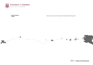
  • 1. How do we root an infrastructure detached from place?PADRAIG CONNOLLY 10103082
  • 2. ACKNOWLEDGEMENTS To all my lecturers at SAUL foryour support and guidance throughout theyears, in particular the 4th and 5th year teams. Special thanks also to Fran and Noel for all their assistance. To Jenny and Rafal, for your help to get me over the end line, I am so grateful. To Mam, Dad and Hugh, for everything over the last few years.Thanks for all your assistance in model making, proof reading and drawing. Without your help this would have been impossible and I am truly grateful for that. To my class, who have made the years in SAUL such an enjoyable experience, from first to fifth year, it has been an enjoyable time because of you all. I hope it continues long after this.
  • 3. TABLE OF CONTENTS Part 1 Introduction INFRASTRUCTURE AND MOBILITY FROM PLACE TO NON-PLACE ARCHITECTURE AND MOBILITY FROM NON-PLACE TO PLACE Part2 SITE PROGRAM FINAL DESIGN PROJECT Bibliography
  • 4. Part 1 Tim Engolds diagram of the hub-spoke model of place compared to the knot of entangled lifelines on the right. The left showing the planning of place, as a circulating out structure versus the right, the series of movement representing everyday life.
  • 5. The evolving nature of our landscape has seen many changes in recent times, both above and below its original formed ground. We have created large-scale connections between our urban cores and have developed infrastructures within, to move our cities’ people. However, this need for ultimate connectivity has led to disconnection with former places along routes. This disconnect has made these places almost non- places, struggling in trying to find their identity in more than a subway sign or motorway exit. The thesis looks to explore the possibility of changing what one understands as inhabitable space, by looking actively at the junctions presented by the motorway as important points of transition both physically and socially. This will hopefully look to remove the isolated state of the infrastructure and move to developing a stronger relationship to place and infrastructure. The thesis will also look to how architecture considers mobility in its make up, looking at how architecture can engage with movement and program together rather than fragmenting them. It looks to re-imagine how this functional infrastructure could work as a new generator of social interactions, removing its isolated state and enabling a dialogue with the places it connects. The thesis will also speculate on the future use of the structures being introduced, considering the changing and evolving state of the motorway. Introduction
  • 6. The Road. One can consider the road a piece of infrastructure, a tool to get you from one place to another with little obstacles. The reality though, is the road has also become a social condition in its own right. The road has always had a social element. Going to and from places by foot would have always led to chance encounters. “Which came first, the house or the road leading to the house?”1 This question has led to much debate, however, its answer depends on individual opinion; a house represents a shelter and physical ownership, while the road represents a journey? The road has evolved over time but has always kept a sense of its origins, summed up when one considers the road as a metaphor; Life is a road, long and unpredictable, and full of danger, that each of us must travel. The road has always brought with it a sense of freedom, never confined by a boundary or owned by some one. The road was an enabler to many to be free of a place. The road, physically, socially and metaphorically has been pivotal in how 1 Jackson J.B, A Sense of Place, a Sense of Time (Bing- hamton, New York, The Maple-Vail Book Manufacturing Group, 1994) 189 places develop, but equally pivotal in giving freedom to explore. The current day road has shown its most significant evolution when one considers the motorway. The road has shifted in its social capacity, as speed and time have omitted this need. The relationship, both socially and physically, once capable on the road are no longer possible with the increase in speed and volume of traffic using this infrastructure. It is an abstracted tool in its own right, trying to establish itself as an infrastructural devise, rather than any social generator or condition. If it has lost this important social capacity, have we isolated human contact to a salute from behind a steering wheel? INFRASTRUCTURE AND MOBILITY Motorway Network of Ireland
  • 7. Isolated Existence. Currently the motorway has positioned itself in an isolated position in the landscape, with a large spacing between the former node and the physical infrastructure. This space in-between has led to an abstraction of the motorway, which has detached the infrastructure from the nodes it is supposed to serve. By that, the placement has led to a large in between space developing between the motorway and former nodal point, where linear opportunism is at play on the newly placed access roads. The motorway was first realized in Italy in 1925, between Milan and Varese. Coined by Edward M. Bassett, who denoted the freeway as a piece of public land designated for movement, the motorway would become a part of modern day society internationally. In its planning the motorway is considered nationally, in Ireland’s case to connect smaller urban cores to Dublin. By that the over arching goal is to connect urban cores as efficiently as possible. However, this placement has lead to a shift in the geography of the former node points along a route. Former nodes operate as the centre of social infrastructure in these areas, however, the large in-between space developing between the motorway and node has led to a decline in the existing towns and villages. The motorway is the new road. It offers potential in speed and efficiency that enables daily life to function better. The question now, though, is how we understand this change from road to motorway. No longer are buildings together in a linear situation stitched together, rather individual buildings with vast distances between exist, that in there own way have become destinations. So how does the motorway engage socially as the road did in the past? JB Jackson in his essay Roads belong to the landscape asks the important question for today’s roads; “Which do we value more, a senseofplaceorasenseoffreedom?”2 The motorway brings with it a new condition, however, the necessity of the road as a social enabler has come to change. Advances in technology and social media consume far more of our social life than physical interaction do today, so should the 2 Jackson J.B, A Sense of Place, a Sense of Time (Bing- hamton, New York, The Maple-Vail Book Manufacturing Group, 1994) 190 Nodal isolation between existing village and motorway, Birdhill, Tipperary
  • 8. road go back to being a source of freedom and in fact isolated for the over connected world. One could consider the motorway the last isolated existence one can achieve. The advances in technology by Google and others in relation to driver-less cars adds another changing quality to these roads, as they start to act as driver-less motion machines, so how should we understand the motorway moving forward? This mobility infrastructure creates a different way of viewing the landscape, and anewspatialexperience,sotheimportance in its evolution only seems right. How do we approach a fragmented infrastructure in the landscape? “If landscape is defined as culturally configured nature, then infrastructure may be considered the single most important factor generating it” 3 . If we fail to understand the importance this infrastructure has in the landscape, it further becomes isolated and detached from its surroundings. How do we root this infrastructure? How do we enable a social interaction yet re-asserting the road as a place of freedom? 3 Hvattum Mari and Janikie Kampevold Larsen, Routes, Roads and Landscapes (Surrey, Ashgate Publishing Limited, 2011) 2 Current relationship between the motorway(orange) and existing nodes
  • 9. The nature of place as we know it is constantly changing. The reality of what we understand to be our place has been removed by the increase in the technology and the evolution of the worldwide economy, meaning large-scale international movement for both work and leisure. However, it is in this context we find ourselves still wanting a route, a place, a home. The need to connect one self to a place will always be inherent to us, even in today’s small world. As our urban centres continue to grow at large rates, we must ask how do we want the socio geographic to develop? The mass movement to large cores comes with inflation, sprawl and a certain degree of panic as one tries to edge their way into an already dense fabric. The value of place seems somewhat lost in the sensation to be part of a certain urban condition. Marc Auge in Non-places introduces one to the idea of place and non-place; “If a place can be defined as relational, historical and concerned with identity, then a space which cannot be defined as relational, or historical, or concerned with identity will be a non-place”. Non-places according to Auge are concerned with the modern world1 - The idea of being born in a clinic and dying in a hospital. They have developed throughout our society. In particular he considers the motorway a non-place. He talks about the language we are presented with on the motorway, and other non-places such as the supermarket and the airport. We are governed by words and names rather than places, signs and signals that only suggest exits and lane allocation. The hint of what might be beyond the current route is sometimes mentioned in a sign, but in a sense, this further removes the need to disengage from the specific journey. It gives enough of a glimpse to derail curiosity and allows only a brief glitch on the trip. We continue ignorant to our surrounding beyond an aesthetic view, appearing and disappearing at high speed. Counter arguments can be made to Auge arguments of Non Place. Peter Merriman in Routes, Roads and Landscapes argues Auge has a simplistic reading of the motorway currently as a monotonous non-place. He argues that the motorway unfolds at speed showing landscape features, which can be 1 Auge Marc, Non Places: An introduction to Supermo- dernity (London: Verso, 2008) 63 FROM PLACE TO NON-PLACE Shopping centre development along the motorway.
  • 10. consumed quickly. The argument that the motorway is a place in its own right brings a new definition to the word “place”. Auge’s definition is based on identity and historical basis, whereas, in this context, I think place could be described as a series of unfolding events happening at speed, both spatial and aesthetic. The landscape changes before your very eyes, as you duck under a farmer’s overpass, where he crosses with his livestock. In my opinion, it would appear that Merriman and Auge are talking about separate things. The interest spatially one might have is not the same as the isolation of the non-place that Auge refers to. A non-place is a detached, isolated place that doesn’t seem to connect to anything, it is treated in isolation and even though it may be an interesting experience, the issue of isolation and disorientation continues. You are on a journey, an experience that is of today with nothing present of yesterday and no idea of the future. It isolates for the purpose of that one function. So within this context I argue, if it is possible to navigate between these two interpretations of “place”. Is it possible for the motorway to become a place, it already controls a spatial sequence that is enjoyable, however, it fails to negotiate from a junction stop to existing nodes. Could there be a connection between former nodes and the motorway? Could it be that the nodes plug into this large infrastructure, both in urban and rural conditions? The possibility of an existing formed place and non-place making a new condition? Alison and Peter Smithson, ‘AS in DS: An Eye on the Road’
  • 11. To put down a road, as the Smithsons state, is a serious task as it becomes a “fix” in the landscape which development circulates out from. So by this, the nature of roads, railway lines, tram lines and canals all hold an important part in the development of places they serve. Architecture has concerned itself with mobility for many years. The future planning of cities and towns is often first developed through connectivity of the place. Architects such as Louis Kahn and Alison and Peter Smithson have written extensively about new possibilities in how architecture could re-imagine a new order in relation to mobility, sparked mainly by the increased presence of the motor car in the world, leading to segregation between vehicles and pedestrians for safety. Louis Kahn, in his plan for Philadelphia, considered movement as the important change in how one looks at civic spaces. He criticized the Piazza and the square as associating with an older pedestrian society. With this, he planned a linear city plan for Philadelphia in 1930, with civic spaces and buildings in ten-block axis that accommodatedautomotivetransportation atthestreetlevel,andpedestrianwalkways one storey above. He proposed cutaways at the pedestrian level to allow light down to the vehicle level. This, Kahn believed, would “extend the area” of the village green of old. The separation of different types of movement would allow for a functional arrangement leading to a better street life.1 Kahn’s plan for Philadelphia came as new expressways opened, framing the area with “Traffic Rivers” as he described them. This freed the streets of through traffic, allowing for a new order of movement. In the plan, Kahn imagined a series of iconic structures to help monumentalize the civic area. “Only buildings of overwhelming monumentality, he contended, could serve asbastionsprotectingagainstthemoneyed interests that were destroying the dignity of the urban centre”. He devised parking docks to “provide a model for defence against the privatizing tendencies of the automobile”. These were imagined similar to old medieval walls protecting the urban core. Kahn’s view on mobility, taken somewhat from Le Corbusier writing, was one of the first suggestions of a new urban layout that accommodated multiple scales of 1 Goldhangen Sarah Williams, Louis Kahn’s situated modernism (New Haven ; London: Yale University Press 2001) 115 Louis I. Kahn. Traffic Study, Philadelphia 1930 ARCHITECTURE AND MOBILITY
  • 12. movement. Architecture is not just a physical thing but often an experience, which Kahn understands in his separation of traffic and pedestrian life as the two are not the same. While driving on roads or motorways, our contact with objects and building is finite, and has to respond to this condition. By that, Kahn’s use of iconic forms suggests an understanding of this, yet these same forms also hold an impact for the pedestrian level above, articulating the space from afar and rooting the place in a civic threshold. “Mobility has become the characteristic of our period. Social and physical mobility, the feeling of a certain sort of freedom, is one of the things that keeps our society together, and the symbol of this freedom is the individually owned motor car.” 2 Alison and Peter Smithson paid particular attention to the future working of cities. In particular they thought the new networks of roads would act as identifying devices for the city similar to Amsterdam’s canals in the 17th century. They believed that the road would become the most “permanent urban structure” which the city could form 2 Smithson Alison and Peter, Ordinariness and Light (Cambridge: The M.I.T. Press) 144 around. Shown in their plans for Berlin and London the Smithsons believed future road systems would influence urban and social identities in the most profound way . 3 The Smithsons developed their plan for London in 1959. New Ways for London was a follow on from Kahn’s plan for Philadelphia, which they stated to be “the most important single contribution in the twentieth century to changing the nature of the relationship between architecture and urban planning”. The plan addressed concerns at the time of London’s intensity in certain areas, while considering how to distribute intensity equally around the city allowing “things become themselves without so much artifice and struggle”. Roads, they believed, could be used as a way of controlling intensity of use and that through them, one could loosen up the texture of the city. The Smithsons concern with “the poetry of movement, for a sense of connectivity”was associated with the failure or rather lack of coming to terms with new technologies. The plan, in particular, was concerned with the street and road, and how the two have 3 Heuvel Dirk van den, Team 10: 1953-81, in search of a utopia of the present (Rotterdam : NAi 2005) 102 Kahn’s Parking Dock, Philadelphia 1930 New Ways for London Plan, 1959
  • 13. changed with the motorization of cities. This new technology, they deemed, would demand a new road network that would allow an ease of access to the motorway network, thus relieving congestion and intensity and also re-imagining the street as a series of levels each designated for different types of movement. The proposed plan was founded on two basic tenets, the first from Hounsfield, that flow from every point to every other point is best served by a net; the second that the urban motorway is the only thing capable of providing structure for a scattered city. The proposed road network differed from Hounsfield-type solution, as they felt that a four-way junction had many disadvantages as too many decisions had to made by the motorist. Instead, they adapted the triangular system that allowed for a single decision without needing to reduce speed. This, they believed, created central spaces around identifying fixes, places where a relationship to the city structure can be observed, for example, the route along the South Bank provides fixes on Westminster and the City. In the street context, the Smithsons followed a similar approach to Kahn in the dual level approach for the street. The existing streets are reorganized into “shop streets” and “go streets”. Shop streets function for the purpose of that street, allowing bus routes and two-way traffic. Go streets are considered routes, going somewhere and allowing access to larger routes. In their Berlin Hauptstadt Plan in 1957, the Smithsons devised a new version of the street. The predominant idea behind this was the equal rights of freedom to both the car and pedestrian.This was devised using a dual level systemwith differing geometries. Pedestrians walk on free-moving, non- parallel narrowing and widening routes while vehicles travel below on low speed straight streets with light controlled right angle intersections4 . Where the two systems meet, continuously running public escalators connect them, thus allowing freedom between the ten-meter height difference. Architecture’s relationship to mobility is of course constant. The need for one to move from one place to another has always been a challenge allowing for the spaces that we move in to become important, social interactions that help our towns and cities 4 Smithson Alison and Peter, The Charged Void (New York: The Monacelli Press, 2005) 45 New Ways for London; triangulated junction, 1959
  • 14. function. Their relationship to the wider is an important one. How our places work is fundamentally rooted on this ability to move freely at different speeds and directions. Both Kahn and the Smithsons understood how this relationship would influence and shape our cities moving forward. The space we move through from place to place, from building to building and room to room holds with it a sense of the in-between and allows one to become ready for a new set of conditions. This in- between space that we move through, holds an important point of exchange in how we prepare ourselves for a new or differing set of conditions. Architecture continues to evolve and adapt to the different types of mobility. The sense to adapt rather than fundamentally look at how architecture addresses movement mustbeconsidered.Theforwardthinkingof Kahn and the Smithsons shows us how the city could have adapted to the motorcar. We must consider how architecture should address infrastructure as a tool for social interactions. Can architecture look to ensure an integrated, coherent togetherness for mobility infrastructures, to permit our places to work better? Berlin Haupstadt Plan: typical escalator connection between levels, 1958
  • 15. FROM NON-PLACE TO PLACE The importance of the spaces we move in is a significant contributor to our daily lives going well or not. Infrastructure that works leads to an easy transition from one place to another. Infrastructure that works badly leads to disruption and often chaos in our daily plans. The functionality of this infrastructure is crucial to our towns and cities working, as they should. This often large-scale infrastructure that moves us, is of course functional but has brought with it a change in the social order that lay before it. The motorway is the evolution of the road in its most advanced state, yet, this change in state has led to an infrastructure detached and abstracted in its finished state. Imagined as a functional devise,themotorwayhasalsoslicedthrough the landscape both in a rural and urban sense, dividing and displacing communities in its construction. The motorway, even as an enjoyable spatial sequence to drive, is a non-place and needs to be addressed in relation to places it serves. The reality of this isolated non-place is best expressed in JG Ballard’s novel, Concrete Island, which explains the isolation of a motorway “island” through the eyes of an architect after he crashes. This left over uninhabited space, where the architect crashes, is overgrown which leads his crashed car to be unnoticed for multiple days. The novel shows the juxtaposition between the heavily used traffic intersection and the abandoned left over space of the “island”1 . Onecanarguethatmotorwayholdsasense of freedom that is liberating in today’s over connectedworld.ItholdswithitJBJackson’s sense of freedom that allows us to explore ourselves. So should we really consider rooting this isolated freedom? The scale of the motorway comes to consideration then,howcouldonerootthisvastnetwork? The only engagement the motorway holds with the places it serves is the junction. The junction has been designed to allow one to disengage from the motorway, as one decelerates into a different driving condition. This disengagement, on one side, also marks the entrance to another, and holds a very important relationship in the working of the motorway. The ability for us to enjoy the freedom and efficiency of the motorway is controlled at this very important point. The junction, in its current state, is designed purely for function but could this be understood as a social exchange, where one understands the 1 Ballard, J. G, Concrete Island (London: Jonathan Cape, 1974) 13
  • 16. Slussen, in Sodermalm, Stockholm. Interchange opening 1935
  • 17. interchange of people going somewhere and coming from somewhere else. Slussen, Stockholm opened in 1935 as an infrastructural node, that contained several types of mobility including boat traffic using the lock, cars using the road interchange,trainsconnectingtothemetro station and pedestrians connecting from one side to the other and also to a high level walkway. The complex interchange needed a complicated arrangement to facilitate such a diverse range of mobility. The project, praised by Le Corbusier as “the modern era’s first large project”, works for the area but also clearly worked for the people as a place. The assembly of people for this great opening shows the node as a spectacle, but also as a place of gathering. The junction/node works as an inhabitable space that links the mobility infrastructure to the places its serves. By this, one could consider this point of intersection, as a social generator, a point of exchange both physically and socially. As the built fabric becomes more and more intense,architecturemustlooktoinhabiting previouslyleftoverareas.Assemblesfollyin Hackney Wick in London suggests a current use of existing infrastructures to create new urban space. The project intended to represent a resident who refused to leave where the infrastructure was built anyway shows the possibility of left over, in-between space becoming usable space in our dense city fabrics. The folly built by local groups allowed for a community involvement with over 40000 people using the space over nine weeks. The folly shows the possibility of infrastructure acting as a backdrop to public spaces, so could these large scale infrastructures act as a means of place making, allowing the physical condition to become a social mechanism? Advances in technology bring with them great possibilities in terms of mobility. As the world embarks on a new era of electric and driverless technology, it brings with it new possibilities for movement. However, it also will bring about changes into the existing infrastructures such as charge points and other infrastructures, which are becoming apparent on our roads and motorways currently. Speculating into the future allows one to think about these ever changing pieces of infrastructure that find themselves at an important change in their use. They are changing, evolving functional structures that have affected and changed the places and landscapes Assemble’s folly in Hackney Wick in London, 2011 Slussen, in Sodermalm, Stockholm. Interchange opening 1935
  • 18. they sit. We must consider the important role these structures play in our lives and look to actively engage with them as inhabited spaces, no longer disengage from their design and placement but consider what has been, what is and what will be their impact on the surrounding fabrics. The junction must evolve to understand its importance in daily life. These important points along routes that have and will become a common daily meeting point, are places architecture must address with an understanding of the conditions of movement. The junction needs to reimagine itself, not just as a tool for entering and exiting the motorway but an entry and exit to the adjoining places. The junction must evolve tobecomeanexchangeofpeople,transport and interactions. This point, used by people coming and going different places, brings knowledge to a place, which is being missed by the junction’s failure to interact with them. By that, the junction must turn the abstracted accessible point on the motorway into a new point of importance for existing nodes that relates to the existing area. It allows former connections, which the motorway dissolved to be re- connected.Itallowspeopletogoandcome, in a point of exchange that empowers dialogue between people and place.
  • 19.
  • 20. Part 2 Semester 1 research work
  • 22. M50 Motorway Dublin, from junction 6-11
  • 23. The thesis bases itself around the M50 motorway in Dublin. The motorway acts similar to medieval walls of the past, keeping the city enclosed in a semi circle connecting from north to south in direction. The motorway contains seventeen junctions connecting the rest of the country to Dublin. The main junctions are, junction 7 interchange with the west connecting Dublin to Galway and Sligo, junction 9 connecting to Limerick, Cork and Waterford and junction 1 connecting north to Northern Ireland and Belfast. The thesis will focus on the 5 junctions from junction 6 to junction 11. There is no junction 8. The junctions mark an important transition, from urban to rural in motorway context. This change also signals the arrival into the city of Dublin and holds with it a point of immense intensity and movement. The motorway today has seen many changes since its formation in 1983. The most significant is the increase in intensity changing from a 2 -3 lane motorway in 2010. The motorway is currently in full use, with speculation that as many as 120,000 journeys are being made each day on the motorway. The motorway is significant in the working of the city of Dublin to keep the city moving. SITE The main site will be the Red Cow interchange, junction 9. This is Ireland’s busiest interchange and has seen many changes or upgrades moving, from a round-about style junction to a free flowing interchange. The site holds access to public transport, an important point when considering the future use of placing any program on site. The LUAS, Dublin’s Tram Network, has a park and ride facility to the south west of the junction. The junction nationally is seen almost as a right of passage, dreaded by some and enjoyed by others. It is the most unlikely place to consider placing a large public building, however it is this move that hopes to really question the larger question of how do we root this infrastructure today? Night-time view of Red Cow intersection approach from N7
  • 24. Ariel view of Dublin showing the M50 highlighted
  • 26.
  • 27. PROGRAMME When deciding on programme for the site, originally 4 programmes were tested, a theatre, a restaurant, a drive in cinema and a stadium. From this, the main focus was reduced to the 3 junctions circulating out from the Red Cow junction, junctions 7-10. The primary consideration, when considering program was based on the need to allow for social interactions to occur. The idea of mobility and accessibility was also tied into their design and placement, allowing for an ease of access from the motorway to each programme, considering parking and mobility from car to programme. The main focus on the red cow site, was primarily to allow time to pursue the functionality of the building but also to allow speculation on the building life span. Considering possible changes in state over its time, not only the physical building but the motorway in general, as driver-less technology comes into use internationally. The project on the red cow changed gradually over the design period finishing with a theatre in the round, with parking and other services housed in the circular plan. The idea of the drama and theatricals of the theatre became paramount in considering the architecture of such a space. Also the need to consider how the car would access and move freely while still accommodating a pedestrian movement was all considered to allow a functional building, while producing a social building to root itself in the most unlikely place.
  • 29. Junction 10 intervention Junction 7 intervention
  • 31.
  • 33. Interior perspective of outside circulation space
  • 34. Interior perspective of foyer space
  • 35. Exterior perspective from flyover showing interaction between mobility and function
  • 36. Exterior night time perspective of project
  • 37. 1:50 Structural Model showing pillars and hanging structure
  • 38.
  • 39.
  • 40. 1:100 Sectional Perspective showing now and speculative future
  • 41.
  • 42. 1:500 Context model, junction 9, M50
  • 43.
  • 44. Auge Marc, Non Places: An introduction to Supermodernity (London: Verso, 2008) Ballard, J. G, “Concentration City” in The complete stories of J.G. Ballard, ed. John D. Kelly (New York: W.W. Norton & Co, 2009) Ballard, J. G, Concrete Island (London: Jonathan Cape, 1974) Castello Lineu, Rethinking the meaning of place: conceiving place in architecture- urbanism (Farnham: Ashgate, 2010) Friedman Yona, Pro domo (Barcelona: Actar, 2006) Goldhangen Sarah Williams, Louis Kahn’s situated modernism (New Haven; London: Yale University Press 2001) Halprin Lawrence, Freeways, (1966)
 Heuvel Dirk van den, Team 10: 1953- 81, in search of a utopia of the present (Rotterdam : NAi 2005) Hvattum Mari and Janikie Kampevold Larsen, Routes, Roads and Landscapes (Surrey, Ashgate Publishing Limited, 2011) Ingold Tim, Lines: A brief history (New York: Routledge, 2008) Jackson J.B, A Sense of Place, a Sense of Time (Bing- hamton, New York, The Maple- Vail Book Manufacturing Group, 1994) Kerouac Jack, On the Road (Penguin Books, 1955) Schwarzer Mitchell, Zoomscape (New York; [Great Britain] : Princeton Architectural Press, 2004) Smithson Alison, Team 10 Primer, (London:Studio Vista) Smithson Alison and Peter, Ordinariness and Light (Cambridge: The M.I.T. Press) Smithson Alison and Peter, The Charged Void (New York: The Monacelli Press, 2005) Bibliography
  • 45. The class of 2016 At my final presentation 20.05.16