PDC+++ Module 2 Class 2 Maps
•Transferir como PPT, PDF•
1 gostou•1,627 visualizações

The document discusses different types of maps and graphical representations that are useful for permaculture designers, including conceptual maps, resource maps, calendars, and zone and sector maps. It provides examples of each type of map, such as concept maps about organization, water system maps, soil quality maps, and planting calendars. The document emphasizes that maps are useful for communicating ideas, questioning assumptions, and re-imagining systems. Learning to make different kinds of maps is a key design skill.

Recomendados
Mais conteúdo relacionado
Mais procurados
Mais procurados (16)
Semelhante a PDC+++ Module 2 Class 2 Maps
Semelhante a PDC+++ Module 2 Class 2 Maps (20)
Mais de Academia de Permacultura Integral
Mais de Academia de Permacultura Integral (20)
Último
Último (20)
PDC+++ Module 2 Class 2 Maps
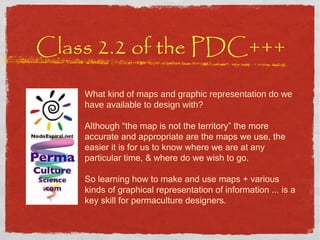
- 1. Class 2.2 of the PDC+++ What kind of maps and graphic representation do we have available to design with? Although “the map is not the territory” the more accurate and appropriate are the maps we use, the easier it is for us to know where we are at any particular time, & where do we wish to go. So learning how to make and use maps + various kinds of graphical representation of information ... is a key skill for permaculture designers.
- 2. Class2.2 PDC +++ What kind of maps and graphic representation do we have available to design with? Introduction Conceptual Maps Resource Maps Calendars Mapping Tools A Practice with Zones & Sectors
- 3. Class2.2 PDC +++ What kind of maps and graphic representation do we have available to design with? Introduction Conceptual Maps Resource Maps Calendars Mapping Tools A Practice with Zones & Sectors
- 4. Maps “ the map is not the territory” (it's a model with few dimensions ) to map .. a visual process for comunicating physical & / or social information particularly useful when spacial information is needed Maps or sketches made by clients give lots of additional information develop diagrams with personal symbols & materials
- 5. Different perspectives … BUT all information is correct & relevant THE CHILDREN THE WOMEN THE MEN Maps of a Village Client Interview
- 7. Map of China Administration Map
- 8. Only urban areas & roads
- 14. Flood Maps
- 15. Map of Climates
- 16. Class2.2 PDC +++ What kind of maps and graphic representation do we have available to design with? Introduction Conceptual Maps Resource Maps Calendars Mapping Tools A Practice with Zones & Sectors
- 17. Visual representations can change the way we see the world help us see things from another point of view question our assumptions take another look to see things we hadn't seen before
- 18. Conceptual Maps Important for communicating ideas Help to re-map (change mental models) Possibly the most important ones Use your imagination
- 20. Map of Humanity
- 21. Permaculture Design - the science of best relative placement of components (in space, in time, in the ocean of mental models of our culture .. in ALL dimensions, all types of elements) maps of flows we design SYSTEMS not PLACES (include techniques, strategies & all dimentions)
- 22. Example of Concept: “Internal Organization” Group Learning Process Work COORDINATION GROUP COMMON VISION Construction Agriculture Admin Temporary Commission
- 23. Think, debate, reflect… about our ideal vision of Chozas Share experiences in order to arrive to feel what we want FROM INSIDE > OUT FROM OUTSIDE > IN
- 26. Can help to change paradigms! Eg. Old ways of Thinking & of Designing Organizations
- 27. New Ways of Thinking & of Designing Organizations ©2000, The Chaordic Alliance Transition to Systemic Thinking (leader-full)
- 28. TWO natural successions pseudo community forming chaos storming emptyness norming real community performing professional / functional group ?
- 29. Youth Project Projects & Process - the Story of Green Adventure (London) Forest Garden LETS scheme Bicycle Transport Brockwell Greenhouses Community Centre Hour Bank Forest Garden Café Vegetable Box Scheme
- 30. ways of thinking & communicating
- 31. A PermaCulture Course Sustainability Training Training for EcoBusiness Fount of Inspiration Support Group Door into an International Community Support to Projects Base for follow-on ActionLearning Diploma, etc. Personal Life Changes Improve Site / Weave Network Multifunction principle (&’stacking’) ¡10!
- 33. Nodo Espiral: KEY CONCEPTS
- 34. the MODULES ARE
- 36. hundreds of ways of representing information graphically Venn Diagrams
- 37. Class2.2 PDC +++ What kind of maps and graphic representation do we have available to design with? Introduction Conceptual Maps Resource Maps Calendars Mapping Tools A Practice with Zones & Sectors
- 39. 39 Watering System Map
- 40. Transect Map
- 41. Shadow Maps Data Layering David's Maps: the Vesta Garden This technique shows clearly where there is less & more sun exposure during the day (then it is much easier to know where to plan lettuces & where tomatoes, etc. .. ) Techniques of Observation & Organizing Information
- 43. Congo ethnic group areas
- 44. Class2.2 PDC +++ What kind of maps and graphic representation do we have available to design with? Introduction Conceptual Maps Resource Maps Calendars Mapping Tools A Practice with Zones & Sectors
- 45. Calendars • Plantation > crops (balancing peaks & troughs) • Annual events • Chrondala • Mapping time ... use your imagination!
- 48. 13 moons calendar www.tortuga.com
- 49. EXAMPLE OF SCHEDULE Mar Apr May Jun Jul Aug Sep Oct Nov Dec Hut Bárbara's house Toilets Shower+compostoilet unfinished'house agriculture Doors and windows water trees Buying of land learning Conflict resolution Oven's house Prepare old kitchen
- 51. T&L: Your Design ¨ map your design process
- 52. Time Map This 1981 map looks at time, distance and transport. It illustrates how a section of the globe would look if London was at the centre and towns and cities were drawn in proximity to London relative to the time it takes to get there using the fastest mode of transport. it's very interesting to make graphical representations of time .. and other 'abstract' components
- 53. Class2.2 PDC +++ What kind of maps and graphic representation do we have available to design with? Introduction Conceptual Maps Resource Maps Calendars Mapping Tools A Practice with Zones & Sectors
- 54. Sketches play! And loose ...
- 55. Discharge Group INGREDIENTS: total acceptance, love, contradiction, reality, playfulness! TOPIC: doodle your home, neighborhood and city ... in 5 mins
- 57. HOW TO CREATE A BASE MAP? 0) decide for what it's, for whom, what use, etc. 1) SKETCH - of the imagination ('free map'): yours and others, not to scale, approximate, 'intuitive' 2) SCALE - created by you (by triangulation) or copied from existing map (scale as needed) APPROP I ATE TO FUNCT I ON
- 58. Finca Luna Nueva www.finca-luna.com How we created this map
- 59. Google Earth Google Earth
- 61. Management Map + chicken tractor rotation JUE VIE SÁB DOM LUN MAR MIE
- 62. be clear about the functions of your maps > Criteria Nelson Avelar in Portugal To visualize and test out options to present (communicate) - who to? to gather and organize information (observation)
- 63. - to meet their needs - & use their products DESIGN IS ... Placing elements - where they best connect
- 64. Design Techniques (Technical Drawing)
- 65. Top View or Plan Perspective Elevation View Side View Graphic Communication
- 68. Perspective
- 69. Elevation
- 70. Plan
- 72. Discharge Group INGREDIENTS: total acceptance, love, contradiction, reality, playfulness! TOPIC: perspective, plan and elevation of your location
- 73. Inkscape Vectorial graphics For plans free download x windows, mac and linux easy to use
- 74. Sketch-up Free download easy to use can rotate everything in 3D x windows and mac (no linux) Finca-luna's hen house-composting hut version 1.0
- 75. Class2.2 PDC +++ What kind of maps and graphic representation do we have available to design with? Introduction Conceptual Maps Resource Maps Calendars Mapping Tools A Practice with Zones & Sectors
- 76. Proposal: map zones and sectors in your community
- 78. Class 2.2 of the PDC+++ What kind of maps and graphic representation do we have available to design with? Although “the map is not the territory” the more accurate and appropriate are the maps we use, the easier it is for us to know where we are at any particular time, & where do we wish to go. So learning how to make and use maps + various kinds of graphical representation of information ... is a key skill for permaculture designers.
Notas do Editor
- Mapping is a visual process in which people are given the chance to related physical and/or social information in a simple and easily understood format . It is especially useful where spatial information is required . Even people who have had access to formal education often cannot read professionally drawn plans, but most people can understand simple diagrams. And more so, if they develop the diagram using symbols and materials that have meaning relevance for them. Often this means the map will be drawn in the ground using sticks to make the lines and locally available materials as symbols (leaves, nuts, peddles..). To maintain a record of the information the facilitator needs to redraw the map on paper as accurately a possible - always show your version to the participants for checking and approval - remember the information is THIERS - the original stays with them - with their permission you can make a copy.
- Layout Maps - basic layout/plan of area, village, project (In this example it is interesting to note that the map drawn by the men, is different to that drawn by the women, which again different to that of the children - different perspectives/interests awareness BUT all the information IS correct and relevant)
- Although most commonly used to depict geography, maps may represent any space , real or imagined, without regard to conte xt or s ca le ; e.g. Brain mappin g , DN A mapping, an d ex t r aterrestr ial mapping.
- http://www.uiweb.uidaho.edu/mining_school/zli/cn_map.htm 1-Beijing 6-Jilin 11-Fujian 16-Heilongjiang 21-Hainan 26-Shaanxi 31-Taiwan 2-Tianjin 7-Shanghai 12-Jiangxi 17-Hubei 22-Sichuan 27-Gansu 32-Chongqing 3-Hebei 8-Jiangsu 13-Shandong 18-Hunan 23-Guizhou 28-Qinghai 33-Hong Kong 4-Shanxi 9-Zhejing 14-Henan 19-Guangdong 24-Yunnan 29-Ningxia 34-Macau 5-Liaoning 10-Anhui 15-Inner Mongolia 20-Guangxi 25-Tibet 30-Xinjing Back
- estas son muuchas mapas - en solapación, solapadas?
- There is a great deal of information which is relate to time, and which is best and easiest presented as calendars. Again, these drawings will often be effected on the ground, with sticks, and possibly with locally found materials to represent aspects of the chart. For example to map planting calendars, the actual grain from the various crops could be used to show the time span of that crop, from planting to harvesting. Again, the information is by and for and of the people, so it should be drawn in terms that they use and that make sense to them, it is not necessary to map a whole year and to divide that year into 12 months of roughly the same time span - use the local system of time, and local names for periods and epochs. Possible uses of calendars includes crop rotations nutritional problems money availability/scarcity labor availability/scarcity religious holidays/celebrations
- Attention cartography geeks! NPR’s Robert Krulwich takes a looks at websites that let you superimpose maps on top of each other to compare the relative size of various things. For example, what would the dimensions of the gulf oil spill look like if it were superimposed on the US east coast? Or how many big countries could you fit into all of Africa? What I really like about this post is that I’ve tried to do map overlays manually in the past and it wasn’t very easy to do. Back in the ‘06 Israel-Lebanon war, I took a Google Map image of the war zone and superimposed it over New England . (Ha ifa to Beirut is about the same dista nce as Providence, RI to Lowell, MA, in case you’re wondering.) But it was really tough to do, especially given my limited tech skills. So if you’re a map nerd like I am, I hope you enjoy Robert’s post as much as I did. - @acarvin http://npr.tumblr.com/post /2133410550/m aps-on-maps
- http://2.bp.blogspot.com/_p2KqxkFzn6A/S_unWzqdawI/AAAAAAAAAI8/3GactgT1oXQ/s1600/map_of_humanity.jpg
- Estas éticas son muy idealistas, pero las ponemos en práctica a través de unas pautas de diseño de comprobado éxito, desde las más antiguas hasta las más modernas, muy bien definidas, y en continuo desarrollo. Se basan en una forma particular de pensar en la energía y los recursos de un sistema, y unas técnicas de diseño consciente que se aplican en cada fase y faceta del proceso de diseño en forma de aprendizaje acción. Es un proceso integrado, funcional y consciente. Es la ciencia de la mejor ubicación relativa de componentes en un plan o patrón cuya función principal es la de aumentar recursos, conservar energía y reducir o eliminar la polución y/o el desperdicio.
- Mapa de organización interna x una eco-aldea en formación
- un aparente ‘conflicto’ entre las personas que si tienen ideas claras de como lo quieren ... y otros que no, y que no se entusiasman nada en intentar forzar ese ‘compartir de visiones’
- Prof. Lietar - sistema de ‘deberes’ en Brazil - fomentando la auto-gestión de la educación
- ? se puede hacer algo ‘intermedio’? o sale un ‘ni carne ni pescado? Observo que la gente que NO tiene sus necesidades de ‘comunidad verdadera’ intenta crear una de cualquier grupo ... pero no siempre es apropiado. Rol del Facilitador: tener las ideas claras sobre QUE es realista en cada situación (que por no poder alcanzar una ‘comunidad verdadera’ tampoco llegamos trabajar en grupo de forma eficaz
- Respeto para los pueblos nativos ... patrones parecidos en todo el planeta: adaptados a su lugar, observación, cultura local JUGAR! Re-aprender a usar el aprendizaje en acción, nuestra forma natural de evolucionar: tiene que ser práctico, aplicada si no no se aprende nada ... acompañar a nuestro niño interior, re-discubrir el gozo y diviertimiento de ser científicos
- Es una de las 3 bases éticas de la PermaCultura ... pero ¿cómo llevarla a la práctica? Las personas somos, además del contexto, el aspecto sin duda más difícil a la hora de conseguir proyectos verdaderamente sostenibles. En este módulo exploramos de forma teórica y muy práctica también, las diferentes facetas de este contexto más amplio: la naturaleza de las personas, de los grupos y las relaciones; los modelos de investigación, el aprendizaje, la historia y el significado de la sostenibilidad .
- And finally, a map of how London’s Underground system would look if it was geographically correct, rather than stylistically simplified . This map was designed by Simon Clarke.
- English: Sources of dietary energy-consumption (%) following data of the Food and Agricultural Organisation of the United Nations ( FAO ) fo r th e years 2001 to 2003. The graph differentiates between developed and developing countries. Following the copyrig ht poli cy of the FAO the use is free for any non-commercial and educational purposes. Español: Fuentes de consumo de energía diaria entre 2001 y 2003 según la FAO, comparando entre países desarrollados y países en vías de desarrollo. La fuente principal es http://faostat.fao.org/ Portals/_Faostat/docume nts/pdf/sources_of_dietary_energy_consumption.pdf. Según la propia págin a de la FAO ( http://www.fao.org/copyright_en.htm ), el uso de sus datos e stá totalmente permitid o para uso educativo y/o no comercia l, algo que en ambos casos cumple W ikimedia.
- Resource Maps - maps can be drawn/developed which identify a specific feature, resource or use pattern. This map below right shows an existing irrigation system. While that below shows land-usage pattern Resource Maps may also be in the form of Venn diagrams, such as this example showing the sources of forest based products for a part of China Wealth Mapping - often it is important to identify wealth and influence in the village. (Note that the concept of wealth will vary according to culture - use a raking method to let the people determine their idea of wealth before mapping the story of the village.
- Transect Map - its actually a cross-section of a part of the landscape. It does not have to be in a straight line. It is useful as a way of getting to know the area, especially if an elder/knowledgeable person is asked to lead it.
- Transect Map - its actually a cross-section of a part of the landscape. It does not have to be in a straight line. It is useful as a way of getting to know the area, especially if an elder/knowledgeable person is asked to lead it.
- D. R. Congo, ethnic groups' areas
- There is a great deal of information which is relate to time, and which is best and easiest presented as calendars. Again, these drawings will often be effected on the ground, with sticks, and possibly with locally found materials to represent aspects of the chart. For example to map planting calendars, the actual grain from the various crops could be used to show the time span of that crop, from planting to harvesting. Again, the information is by and for and of the people, so it should be drawn in terms that they use and that make sense to them, it is not necessary to map a whole year and to divide that year into 12 months of roughly the same time span - use the local system of time, and local names for periods and epochs. Possible uses of calendars includes crop rotations nutritional problems money availability/scarcity labor availability/scarcity religious holidays/celebrations
- y luego las cosas más convencionales también ... son formas muy útiles de poner información compleja de forma fácil y visual
- This 1981 map looks at time, distance and transport. It illustrates how a section of the globe would look if London was at the centre and towns and cities were drawn in proximity to London relative to the time it takes to get there using the fastest mode of transport. We assume that this map takes Concorde into account, a mode of transport no longer in use.
- English: Sources of dietary energy-consumption (%) following data of the Food and Agricultural Organisation of the United Nations ( FAO ) fo r th e years 2001 to 2003. The graph differentiates between developed and developing countries. Following the copyrig ht poli cy of the FAO the use is free for any non-commercial and educational purposes. Español: Fuentes de consumo de energía diaria entre 2001 y 2003 según la FAO, comparando entre países desarrollados y países en vías de desarrollo. La fuente principal es http://faostat.fao.org/ Portals/_Faostat/docume nts/pdf/sources_of_dietary_energy_consumption.pdf. Según la propia págin a de la FAO ( http://www.fao.org/copyright_en.htm ), el uso de sus datos está totalmente permitido para uso educativo y/o no comercial, algo que en ambos casos cumple Wikimedia.
- + mapa del cuerpo energético / espiritual de la Tierra + conector a otras dimensiones (calendario 13 lunas)