
Recomendados
Mais conteúdo relacionado
Mais procurados
Mais procurados (20)
Destaque
Destaque (17)
Semelhante a Fieldwork and research cuckmere haven
Semelhante a Fieldwork and research cuckmere haven (20)
Mais de MrOH
Mais de MrOH (20)
Último
Último (20)
Fieldwork and research cuckmere haven
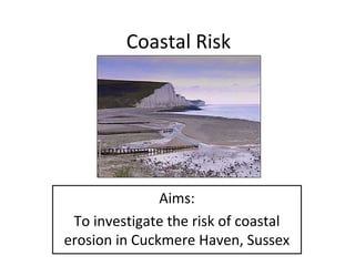
- 1. Coastal Risk Aims: To investigate the risk of coastal erosion in Cuckmere Haven, Sussex
- 2. 1 – Designing fieldwork and research to examine the risk of coastal erosion in Cuckmere Haven The Seven Sisters Country Park offers some of the finest coastal downland views in the whole of the UK. It also contains a wide range of habitats with a fantastic array of associated wildlife. Seaford Cuckmere Haven Beachy Head Cuckmere Haven lies on the coast at the point where the South Downs meet the sea. Its dramatic chalk landscape with a characteristic cliff coastline is constantly changing. The cliffs are being eroded at a rate of 30-40 cm’s every year. Cuckmere's quiet beach is located within the Seven Sisters Country Park. The location of Cuckmere Haven was chosen due to it’s proximity to school (i.e. fieldwork could be carried out in a day), accessibility (the beach can be reached with little risk), it is an area where erosion is / has taken place (therefore we will be able to investigate the risk)
- 3. 1 – Describing and justifying methods and techniques used to collect fieldwork and research data 2 – Describing and justifying the techniques used to present and analyse findings 3 – Commenting on the data and conclusions found in Cuckmere Haven, as well as evaluating limitations 4 – How could secondary data improve our study
- 4. 2 – Describing and justifying methods and techniques used to collect fieldwork and research data • • • • • • Fieldwork Field sketch – This gave evidence of undercutting of the chalk cliffs and therefore erosion Annotated photo’s – This gave evidence of erosion of cliffs (i.e. fences and walls ending on cliffs due to erosion, comparing last years photos) and effectiveness of groynes Transects – These can be done systematic / stratified, they show changes in the gradient of the beach profile and pebble size / roundness Wave measurement – Showed the frequency and size of waves Groynes – Measuring the sides of groynes tells us how effective they are. Museum – Gave us information on previous rates of erosion and rock types. It did this through information boards and selections of old photographs and maps Research • Old photo’s – Give us an idea of how the coastline looked at a certain time. We can therefore see the change. • Old maps – We can see how the shape of the coastline has changed and therefore the rate of erosion. • Newspapers – Could give us information about past events – cliff falls etc
- 5. Methodology Table Data Collected Why it was collected How it was collected Annotated photos and field sketches To record evidence of erosion By finding a suitable location and an area showing evidence of erosion Beach profiles To see key characteristics -Systematic of beach profile -Stratified Equipment Used Limitations Justifications Digital camera Often only a limited Provides a visual reminder view of the of what the coastline coastline as a whole looked like, can also be annotated to point out key features Ranging poles Clinometer Depend on sampling method Depend on sampling method To see changes in pebble 10 pebbles – long characteristics axis measured / estimate angularity Wave frequency and To see the types of Timing the number height waves hitting the coast in 1 min, estimate height Groyne To see the effectiveness Measure either measurement of the groynes side of the groynes Calliper Angularity chart Estimation of angularity 10 – to have average Stop watch Estimate for the height Timing done 3 times average Meter stick Annotated photos were used in these locations to supplement results Bi-polar survey and management tally sheet Bi-polar Management tally sheet Often uneven, but we could only measure at one point on the groynes Opinion based for the bi-polar Pebble size and shape To see the Bi-polar environmental quality of Management tally the area and whether it sheet changed depending on where you were. Also to see what was being done to manage the area and therefore its success Bi-polar scores all taken for the same categories
- 6. 3 – Describing and justifying the techniques used to present and analyse findings • Transects – Can be made into beach profiles to show changes in more than one variable along the beach (e.g. gradient and pebble size, shape) • Photo’s and sketches – Can be annotated to show key / important features • GIS / Maps – Can be annotated with findings to locate changes and find overall patterns – e.g. if the transects change along the length of the beach due to longshore drift or wave refraction / shelter or groynes) • Flow diagrams / Mind maps – Could be used to show effectiveness of coastal defences (i.e. with dates / timeline)
- 7. Beach profiles – combining data Data Presentation GIS – combining data Annotated photos and sketches
- 8. 4 – Commenting on the data and conclusions found in Cuckmere Haven, as well as evaluating limitations • • • • • • Transects – • Beach profile to have a ‘storm beach’ (steep ridge). These are formed by strong, destructive waves indicating high risk from erosion. • Pebbles were unsorted in size and angularity, there was also much driftwood / material on the beach. This indicates strong wave energy had left us with little pattern to show longshore drift / sorting. • Waves were frequent and strong indicating high risk from erosion Annotated photos / sketches – showed erosion was taking place and gave evidence for high risk, especially at the base of the cliffs. Groynes – Measuring on either side of the groynes showed that they were trapping large amounts of sediment from longshore drift. They are therefore effective as well as being required. They have had an impact reducing the risk (along with the sea wall in front of the houses) Old photos / Maps – Gave evidence that erosion has taken place on this stretch of coast. Geology – Chalk cliffs (which could be seen in the lighter sea colour around them) are at risk from erosion Management of coast – It has beach replenishment / groynes / rip rap in Seaford and groynes / sea wall in Cuckmere Haven. These seem effective in reducing rates of erosion although only in the areas they are located. E.g. cost / benefit – around housing / towns http://www.sdcg.org.uk/ • SMP - • Limitations – Wider stretch of coast to examine would have given a better overall picture of erosion and the impact of management strategies. Dates of old photos, newspapers and maps at more regular intervals would have helped us understand the change more easily
- 9. Conclusions for impacts on an ecologically important area • Bi-polar survey showed that area within the Seven Sisters Country Park (Cuckmere Haven) has a much higher quality than areas outside it (Seaford) • Management strategies tally sheet shows that this is because it is very well managed with a large number and variety of strategies • However – we did not visit in peak season which would almost certainly have influenced our results • Research (http://www.sevensisters.org.uk/) shows the area is well managed and very bio-diverse
- 10. The use of technology • Digital cameras – for annotated photos • Video cameras – for filming techniques in the field or something taking place. E.g. wave action • GIS – can be used to plan field trips and also present data sets on maps • GPS – to locate sites / features • Internet – researching fieldwork