What is the river discharge and what factors
•Transferir como PPTX, PDF•
4 gostaram•28,331 visualizações

The document discusses factors that affect river discharge. It explains that river discharge is calculated based on the cross-sectional area of the river channel and flow velocity. Physical factors like rock type, drainage basin size and relief, and vegetation can impact discharge by affecting runoff and flow speed. Human activities such as urbanization and deforestation can also impact discharge by increasing runoff. Flood hydrographs illustrate how discharge changes during rain events, with peak discharge occurring after a lag time determined by drainage basin characteristics. Case studies can show how changes in discharge impact the drainage basin over time.

Recomendados
Mais conteúdo relacionado
Mais procurados
Mais procurados (20)
Semelhante a What is the river discharge and what factors
Semelhante a What is the river discharge and what factors (20)
Último
Último (20)
What is the river discharge and what factors
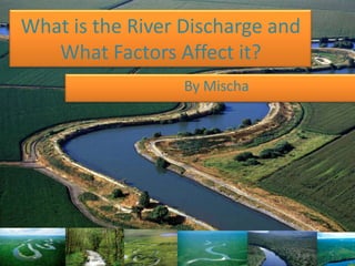
- 1. What is the River Discharge and What Factors Affect it? By Mischa
- 2. The Hydrological Cycle This describes the process whereby water in its various forms is continually cycled between the land, sea and atmosphere. It also makes its way into the biosphere to influence animal and plant ecosystems around the globe. It consist of transfers, stores, and inputs of water, it is a closed system as no gains or losses from outside are added to the system.
- 4. -It explains the distribution of water as it moves as either a liquid, solid or vapour between the ocean, the atmosphere and the land. It's a CLOSED cycle, no water added or lost. -The hydrological cycle is powered by solar energy. The sun heats the water from the ocean, lakes, rivers and the Earth's surface. The water then evaporates into the atmosphere. Additional water is drawn from the soil by plants, and it's evaporated into the atmosphere from the leaves and stems= TRANSPIRATION -The air rises & the temp. drops, the moist air condenses and form clouds (eventually results in precipitation in the form of rain, hail, sleet or snow). Water seeps into the soil (infiltration) some into the rock (percolation). -Water makes its way back to the ocean via surface runoff, through flow and ground water flow.
- 5. Within the hydrological cycle, four main processes operate: Interception • This is when plants prevent some rainfall from directly reaching the ground, for example, water on leaves or foliage. It may later reach the floor via stem flow (water flows down the stem to the ground) or through-fall, where water drips to the ground. Secondary interception occurs at ground level where water hits undergrowth. Some water returns to the atmosphere via evapotranspiration.
- 6. Evapotranspiration • Water lost from vegetation via both evaporation and transpiration. Evaporation: A physical process where moisture is lost directly to the atmosphere from the soil and water surfaces due to the suns heat Transpiration: A biological process where water is lost from the stomata pores in plant leaves
- 7. Infiltration • Where water slowly soaks into the soil from the ground. The maximum rate at which this can occur is known as infiltration capacity (mm/hour) and it is dependent on the amount of water already present in soil structure and vegetation.
- 8. Precipitation • The most important input into the system forms includes snow, hail, rain, and fog.
- 9. • Percolation: • Water in the soil does not remain there but moves down slowly into the lower layers of soil and rock. It creates groundwater storage found in rocks and this may later be moved sideways through the rock via groundwater flow.
- 10. Water flows through the hydrological cycle in various ways: • Throughflow: where water moves downwards through layers of soil. • Channel flow: downhill movement of water in rivers. • Groundwater flow: Lateral movement of water from the water table.
- 12. The hydrologic cycle can be thought of as a series of reservoirs, or storage areas, and a set of processes that cause water to move between those reservoirs. The largest reservoir by far is the oceans, which hold about 97% of the earth’s water. The remaining 3% is the freshwater so important to our survival, but about 78% of that is stored in ice in Antarctica and Greenland. About 21% of freshwater on the earth is groundwater, stored in sediments and rocks below the surface of the earth. The freshwater that we see in rivers, streams, lakes, and rain is less than 1% of the freshwater on the earth and less than 0.1% of all the water on the earth.
- 14. Drainage Basin This is the area of land drained by a river system (a river and its tributaries).
- 15. The drainage basin system is said to be open as both inputs and outputs of energy and material occur. All rivers receive a water from it. The boundaries of the basin are known as the watershed and will usually be marked by areas of higher land. Drainage basins have many different characteristics that influence how quickly or slowly the main river within them responds to a period of intense rainfall, these are outlined in more detail in the section relating to storm hydrographs.
- 17. The North East of England has 3 major drainage basins, the Tyne, Tees and Wear, and several other smaller drainage basins. These are tiny compared to the worlds largest drainage basins, such as the Nile, Amazon and Mississippi, which covers 3,225,000km2
- 19. River Discharge The discharge of a river is the volume of water which flows through it in a given time. It is usually measured in cubic meters per second.
- 20. Calculation: Cross-sectional area of channel (m2) X Velocity of the river / water (m/s) *This gives discharge as the volume (m3/s) or cumecs.
- 21. How is river discharge affected by physical factors? • Impermeable Rock (e.g. granite) – Water is unable to infiltrate through, resulting in more surface runoff, increasing volume of the channel and its speed. • Permeable Rock – More infiltration, resulting in less surface runoff and less volume in the river • Size of drainage basin – Small Water will enter the river quicker and faster • Relief of drainage basin – If the slope of the basin is more steep, water in the river is likely to move down faster, increasing its speed • Percipitation – heavy rain can cause saturation in the soil and hence cause more water to reach the river (runoff). This also means that the speed of the river increases. • Vegetation – allows more infiltration and interception, causing less surface-runoff and slowing down the speed of the river
- 22. How is river discharge affected by human factors? • Impermeable man-made surfaces – Concrete and tarmac can cause rivers in urban drainage basins to have a higher discharge due to higher amounts of surface runoff. Speed is also increased due to drainage systems and ground. • Destruction of vegetation (deforestation) – Less infiltration + interception causes more surface run off and increases speed of the water. • River Management – Presence of dams allow river flow to be controlled, which may cause more discharge (before the dam) , or less (below the dam).
- 23. Hydrographs Graphs which shows how the river discharge in a drainage basin responds to a period of rain.
- 24. Base flow – the normal day to day discharge of a river The rising limb – the rapid increase of discharge resulting from a rainfall. Peak flow – when the river reaches the maximum capacity that it can hold. The recession limb – when the discharge starts to decrease and river levels fall. Basin lag time – the time difference between the peak of the rain event to the peak flow.
- 25. What factors affect the shape of flood hydrographs? Drainage basin - Type of rock (impermeable or permeable) – Impermeable rock will not allow water to seep in, thus causing larger amounts of surface runoff and a shorter lag time. - The gradient of the drainage basin – Steep gradients will cause greater overland flow and a shorter lag time. - Size of drainage basin – larger basins will take longer to reach the river, hence a longer lag time - Present conditions of the drainage basin – soil either saturated, very dry or even frozen
- 26. Type and amount of Precipitation - Rapid rain – soil will saturate at a very rapid rate, excess water quickly transfers by surface runoff thus causing a short lag time
- 27. Land Use and Human Impact - Impermeable man-made surfaces – e.g. concrete and tarmac roads, shorter lag times - Vegetation area –infiltrates more and intercepts water, a longer lag time, reducing discharge - Area of deforestation – short lag time, increases discharge
- 28. Time/season of the year - Summer – evapotranspiration rates are higher, reducing surface run off, longer lag time - Temperatures
- 29. Water Use - Dams and reservoirs near area – slow down the rate of discharge, a much longer lag time, and may also cause a reduced amount of discharge
- 32. How do flood hydrographs change as river discharge changes?
- 33. • When it starts to precipitate, the level of discharge starts fairly low at base flow level (1). • As the rain starts to get heavy, the soil may be saturated, thus there is an increase in surface run off. This causes water to start flowing into the river channel, causing the level of discharge to increase, making the line go up positively. • A very steep rising limb (2) would indicate a fast increasing discharge rate meaning water flowing into the river channel is a faster rate, and thus a heavier rainfall. • (3) When the amount of water in the river is at its maximum level (peak discharge), the curve will reach its highest point on the graph. • As river discharge starts to decrease (4), the curve will start to slop gradually (gradient is normally less steep compared to the lag time).
- 34. Case study changes in the river discharge an the impact upon the drainage basin?
- 35. AFON GLASLYN, NORTH WALES.
- 36. • Afon Glaslyn= rises near the center of the Snowdon massif and flows in a southerly direction towards Tremadog bay. •