SlideShare uma empresa Scribd logo
1 de 12
Google Earth Integrating ICT Google Earth in your classroom Created by Miriam Tanti
Create a tour ,[object Object]
 Upload tour to your school LMS
 Using Google Earth and your IWB can add a tactile dimension* Creating a tour ensures that students are able to explore the places  identified. Use the yellow pin to create several placeholders in your tour. With your tour you can …
Take students on a virtual tour … a great way to familiarise students with the sights before an excursion
Literary tour #1 – get students to explore the places within the tour and use landmarks, cars, properties to write a creative writing piece
Literary tour #2 – use the path tool to document the literary journey and then audio software (e.g. voicethread) to narrate the story
Transport unit – students are to view tour, assess the terrain, research the best form of transport to get from point A to point B, use online databases to compare costs and time and then propose and justify the most feasible form of transport for the tour.
Computing – students are to explore the tour, assess the terrain, landscape and develop a suitable communication system
 Use the time slider to view imagery of a location at different instances of time
Antarctica unit –Time slider #2Compare Antarctica 1963 to Antarctica 2010. Use the line tool to measure parts of Antarctica that are no longer snow covered – explain why this has occurred and then use line tool to predict the area of the snow covered region of Antarctica 2030. Explain why this loss has occurred and strategies to prevent it.
Design unit – Locate address or coordinates for vacant block of land. Students are to research architecture, building codes, etc of local area. Use Google sketch-up to design building for land.

Mais conteúdo relacionado

Destaque

Social Networking in Higher Education
Social Networking in Higher EducationSocial Networking in Higher Education
Social Networking in Higher EducationMiriam Tanti
 
Personal Learning Network
Personal Learning NetworkPersonal Learning Network
Personal Learning NetworkMiriam Tanti
 
Que es un formato de archivo
Que es un formato de archivoQue es un formato de archivo
Que es un formato de archivoTEELLEEZ
 
Website Proposal
Website ProposalWebsite Proposal
Website ProposalDierdre D.
 
AXIS 網路攝影機安全應用 -大眾運輸產業 車廂篇-
AXIS 網路攝影機安全應用 -大眾運輸產業 車廂篇- AXIS 網路攝影機安全應用 -大眾運輸產業 車廂篇-
AXIS 網路攝影機安全應用 -大眾運輸產業 車廂篇- Eric Chiu
 

Destaque (8)

E commerce en la web
E commerce en la webE commerce en la web
E commerce en la web
 
Social Networking in Higher Education
Social Networking in Higher EducationSocial Networking in Higher Education
Social Networking in Higher Education
 
Pavasaris
PavasarisPavasaris
Pavasaris
 
Personal Learning Network
Personal Learning NetworkPersonal Learning Network
Personal Learning Network
 
Que es un formato de archivo
Que es un formato de archivoQue es un formato de archivo
Que es un formato de archivo
 
Website Proposal
Website ProposalWebsite Proposal
Website Proposal
 
AXIS 網路攝影機安全應用 -大眾運輸產業 車廂篇-
AXIS 網路攝影機安全應用 -大眾運輸產業 車廂篇- AXIS 網路攝影機安全應用 -大眾運輸產業 車廂篇-
AXIS 網路攝影機安全應用 -大眾運輸產業 車廂篇-
 
Age assessment
Age assessmentAge assessment
Age assessment
 

Semelhante a Google Earth in the classroom

Travel agency project
Travel agency projectTravel agency project
Travel agency projectjuanpilar745
 
25 interesting ways_and_tips_to_use_google_ear
25 interesting ways_and_tips_to_use_google_ear25 interesting ways_and_tips_to_use_google_ear
25 interesting ways_and_tips_to_use_google_earJen Hudson
 
GPS for Museum Educators
GPS for Museum EducatorsGPS for Museum Educators
GPS for Museum EducatorsJenny Barrett
 
Google literature trips
Google literature tripsGoogle literature trips
Google literature tripsKevin Amboe
 
Deeper understanding through Google Earth
Deeper understanding through Google EarthDeeper understanding through Google Earth
Deeper understanding through Google EarthKevin Amboe
 
South America Tour
South America TourSouth America Tour
South America Tourvioletmartin
 
Create a Georeferred Guide with Your Students
Create a Georeferred Guide with Your StudentsCreate a Georeferred Guide with Your Students
Create a Georeferred Guide with Your StudentsMaria Ranieri
 
Italy planning grid 1st_year_myidealtown
Italy planning grid 1st_year_myidealtownItaly planning grid 1st_year_myidealtown
Italy planning grid 1st_year_myidealtownDan NNN
 
IET Technology Coffee Morning - Location-based learning: education in the Wild
IET Technology Coffee Morning - Location-based learning: education in the WildIET Technology Coffee Morning - Location-based learning: education in the Wild
IET Technology Coffee Morning - Location-based learning: education in the WildLiz FitzGerald
 
PDW eTwinning - Google Mapping Tools - Warsaw
PDW eTwinning - Google Mapping Tools - WarsawPDW eTwinning - Google Mapping Tools - Warsaw
PDW eTwinning - Google Mapping Tools - WarsawMarco Neves
 
Science IST tools Warsaw October 2018
Science IST tools Warsaw October 2018Science IST tools Warsaw October 2018
Science IST tools Warsaw October 2018Gosia Garkowska
 
Esriuk_track7_king edward vi _garry simmons
Esriuk_track7_king edward vi _garry simmonsEsriuk_track7_king edward vi _garry simmons
Esriuk_track7_king edward vi _garry simmonsEsri UK
 
Speaking project 3 rd eso 'a travel agency'
Speaking project 3 rd eso 'a travel agency'Speaking project 3 rd eso 'a travel agency'
Speaking project 3 rd eso 'a travel agency'juanpilar745
 
Speaking project 3 rd eso 'a travel agency'
Speaking project 3 rd eso 'a travel agency'Speaking project 3 rd eso 'a travel agency'
Speaking project 3 rd eso 'a travel agency'juanpilar745
 
Travelling_educational_scenario.docx
Travelling_educational_scenario.docxTravelling_educational_scenario.docx
Travelling_educational_scenario.docxerasmusplusproject20
 
Google Earth Social Studies
Google Earth Social StudiesGoogle Earth Social Studies
Google Earth Social Studiesdamopsu
 

Semelhante a Google Earth in the classroom (20)

Travel agency
Travel agencyTravel agency
Travel agency
 
Travel agency project
Travel agency projectTravel agency project
Travel agency project
 
25 interesting ways_and_tips_to_use_google_ear
25 interesting ways_and_tips_to_use_google_ear25 interesting ways_and_tips_to_use_google_ear
25 interesting ways_and_tips_to_use_google_ear
 
GPS for Museum Educators
GPS for Museum EducatorsGPS for Museum Educators
GPS for Museum Educators
 
Group Powerpoint
Group PowerpointGroup Powerpoint
Group Powerpoint
 
Google literature trips
Google literature tripsGoogle literature trips
Google literature trips
 
Deeper understanding through Google Earth
Deeper understanding through Google EarthDeeper understanding through Google Earth
Deeper understanding through Google Earth
 
IMW2014 Tools Scan
IMW2014 Tools ScanIMW2014 Tools Scan
IMW2014 Tools Scan
 
South America Tour
South America TourSouth America Tour
South America Tour
 
Create a Georeferred Guide with Your Students
Create a Georeferred Guide with Your StudentsCreate a Georeferred Guide with Your Students
Create a Georeferred Guide with Your Students
 
Italy planning grid 1st_year_myidealtown
Italy planning grid 1st_year_myidealtownItaly planning grid 1st_year_myidealtown
Italy planning grid 1st_year_myidealtown
 
IET Technology Coffee Morning - Location-based learning: education in the Wild
IET Technology Coffee Morning - Location-based learning: education in the WildIET Technology Coffee Morning - Location-based learning: education in the Wild
IET Technology Coffee Morning - Location-based learning: education in the Wild
 
PDW eTwinning - Google Mapping Tools - Warsaw
PDW eTwinning - Google Mapping Tools - WarsawPDW eTwinning - Google Mapping Tools - Warsaw
PDW eTwinning - Google Mapping Tools - Warsaw
 
Science IST tools Warsaw October 2018
Science IST tools Warsaw October 2018Science IST tools Warsaw October 2018
Science IST tools Warsaw October 2018
 
Esriuk_track7_king edward vi _garry simmons
Esriuk_track7_king edward vi _garry simmonsEsriuk_track7_king edward vi _garry simmons
Esriuk_track7_king edward vi _garry simmons
 
Speaking project 3 rd eso 'a travel agency'
Speaking project 3 rd eso 'a travel agency'Speaking project 3 rd eso 'a travel agency'
Speaking project 3 rd eso 'a travel agency'
 
Speaking project 3 rd eso 'a travel agency'
Speaking project 3 rd eso 'a travel agency'Speaking project 3 rd eso 'a travel agency'
Speaking project 3 rd eso 'a travel agency'
 
Travelling_educational_scenario.docx
Travelling_educational_scenario.docxTravelling_educational_scenario.docx
Travelling_educational_scenario.docx
 
Google Earth
Google EarthGoogle Earth
Google Earth
 
Google Earth Social Studies
Google Earth Social StudiesGoogle Earth Social Studies
Google Earth Social Studies
 

Google Earth in the classroom

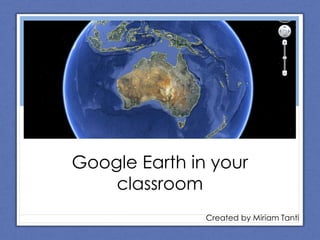
  • 1. Google Earth Integrating ICT Google Earth in your classroom Created by Miriam Tanti
  • 2.
  • 3. Upload tour to your school LMS
  • 4. Using Google Earth and your IWB can add a tactile dimension* Creating a tour ensures that students are able to explore the places identified. Use the yellow pin to create several placeholders in your tour. With your tour you can …
  • 5. Take students on a virtual tour … a great way to familiarise students with the sights before an excursion
  • 6. Literary tour #1 – get students to explore the places within the tour and use landmarks, cars, properties to write a creative writing piece
  • 7. Literary tour #2 – use the path tool to document the literary journey and then audio software (e.g. voicethread) to narrate the story
  • 8. Transport unit – students are to view tour, assess the terrain, research the best form of transport to get from point A to point B, use online databases to compare costs and time and then propose and justify the most feasible form of transport for the tour.
  • 9. Computing – students are to explore the tour, assess the terrain, landscape and develop a suitable communication system
  • 10. Use the time slider to view imagery of a location at different instances of time
  • 11. Antarctica unit –Time slider #2Compare Antarctica 1963 to Antarctica 2010. Use the line tool to measure parts of Antarctica that are no longer snow covered – explain why this has occurred and then use line tool to predict the area of the snow covered region of Antarctica 2030. Explain why this loss has occurred and strategies to prevent it.
  • 12. Design unit – Locate address or coordinates for vacant block of land. Students are to research architecture, building codes, etc of local area. Use Google sketch-up to design building for land.
  • 13. Add-ins (.kmz files)- Wild Sanctuary : archive of natural sounds- Google Lit Trips : literary tours- Ocean plug-in : explore underwater terrain
  • 14. Ideas This is a work in progress – please feel free to post a comment or email me with other Google Earth in education ideas.